Actopan, Hidalgo facts for kids
Quick facts for kids
Actopan
|
|
|---|---|
|
City
|
|
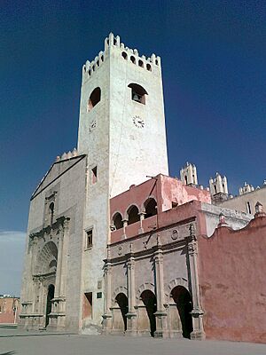
Church and Convent of San Nicolás de Tolentino
|
|
| Country | Mexico |
| State | Hidalgo |
| Municipality | Actopan |
| Time zone | UTC-6 (Central) |
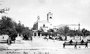
Actopan is a city in the state of Hidalgo, Mexico. Its name comes from the Nahuatl language, meaning 'thick, humid, and fertile land'. Actopan is famous for its delicious food, especially ximbo and barbacoa. It is also known for the beautiful Church and ex-convent of San Nicolás de Tolentino.
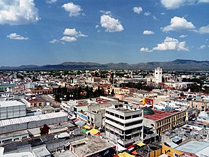
The city is about 120 kilometers (75 miles) north of Mexico City. It is only 37 kilometers (23 miles) from Pachuca, the capital of Hidalgo. Actopan is located in a region called the Mezquital Valley. In 2020, about 32,276 people lived in Actopan. This was more than half of the total population of the Actopan municipality.
Actopan was first a home for the Otomi people. Later, in 1117, Chichimeca groups took control. In 1120, it became part of Acolhuacan. The Tepanecs of Azcapotzalco conquered it in the late 1300s. Then, the Mexica took over in 1427. After the Spanish conquered Mexico, a system called encomienda was set up in Actopan. This meant Spanish settlers were given control over local people and their land.
The city of Actopan was officially founded on July 16, 1546. However, its founding anniversary is celebrated on July 8. In 1575, Actopan became a village. It was made an Alcaldía Mayor (a larger administrative area) in 1568. Actopan was the main town, and the areas around it were called República de Indios (Republics of Indigenous People). Later, it became a smaller administrative unit called a Subdelegation. On August 6, 1824, it became a City Hall. On April 26, 1847, Actopan was officially named a town.
On October 15, 1861, Actopan became a district of the State of Mexico. To fight against the French invasion, it became part of a military district in 1862. Actopan was briefly the capital of this district, but it was moved to Pachuca. In 1869, when the state of Hidalgo was created, Actopan remained a district head. In 1946, Actopan was given the title of "city."
Contents
What's in a Name?
Some people think the name Actopan comes from the Otomi language. However, many experts say it comes from Nahuatl. For example, the INAFED says it's Otomi for Actopan, Hidalgo, but Nahuatl for Actopan, Veracruz.
The word Actopan comes from Nahuatl. It combines atoctli, meaning 'thick, humid, or fertile land', and pan, meaning 'in' or 'on'. So, it means "on thick, humid, and fertile land." Another idea is that it means "on buried water."
Before the Spanish arrived, the Hñähñu people called the area Ma'ñuts'i, Mañutzi, or Mañutshí. This might mean "my little road" or "place of lighting or incensing."
City Symbols
Actopan's Glyph
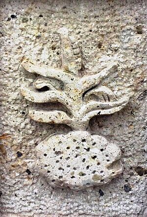
The glyph is a special symbol that represents Actopan. It shows a corn cane with corn silk and elotes (corn on the cob). These are on a clod of earth shaped like a disk, with dots inside. This symbol is often used as the city's coat of arms.
City Names
The official name is Actopan. But it's also called Ciudad del Convento (City of the Convent) or Ciudad del Convento y la Barbacoa (City of the Convent and Barbacoa). This is because of the important Church and ex-convent of San Nicolás de Tolentino and the famous local dish, barbacoa. In 1861, it was named Actopan de Hidalgo to honor Miguel Hidalgo y Costilla. But this longer name was later dropped.
City Motto
In 2017, pumas were seen in the northern part of the area. Because of this, in 2019, the Actopan City Hall registered the phrase "Territorio Puma" (Puma Territory) as a brand. It helps identify areas where these big cats live.
Actopan's Story
Ancient Times
The Otomi people founded a village here a long time ago. Around 644 AD, the Toltecs arrived. This split the town into two parts: Tetitlan and Actopan. In 1117, Chichimeca groups took over Actopan. It then became part of Acolhuacan in 1120.
Later, the Tepanecs from Azcapotzalco conquered Actopan and Ixcuinquitlapilco. This happened in the late 1300s. In 1427, the Mexica conquered the area. Actopan and Ixcuinquitlapilco were mostly Otomi communities.
Historians believe the Spanish first visited Actopan in late 1519 or early 1520. In 1521, local people fought against the Spanish conquerors. But on August 13, 1521, Tenochtitlan (the Aztec capital) fell. By 1524, the Spanish controlled most of the Mexica empire, including Actopan.
Spanish Colonial Period
The first Spanish settlers who controlled Actopan were Hernando Alonso and Juan González Ponce de León. In 1531, Ixcuinquitlapilco became a corregimiento (a Spanish administrative area), and Actopan was under its control.
Later, the encomienda (system of control over indigenous people) was given to Rodrigo Gómez de Ávila. He passed it to his son-in-law, Juan Martínez Guerrero. The encomienda of Actopan then belonged to Juan Guerrero.
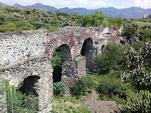
Getting enough water was a big problem for the town. So, in 1546, they started building an aqueduct. Also in 1546, the Church of Actopan was founded. The Augustinian friars decided to move the main town to Actopan because of the land. The first baptism recorded in the Church of Actopan was on July 8, 1546. This date is now celebrated as the town's founding day. The Convent of San Nicolás de Tolentino was built between 1550 and 1560. Fray Andrés de Mata is said to have overseen this work.
In 1560, Actopan became part of Pachuca. But it was separated and became an Alcaldía mayor (a larger administrative area) in 1568. Actopan was the main town, and the areas around it were called República de Indios (Republics of Indigenous People). The convent was a border between these indigenous republics. In 1575, Actopan was given the title of village. In 1576, the leader of the convent, Fray Melchor de Vargas, printed the first catechism in the Otomi language. By the 1570s, the convent complex was finished. It had three main buildings: an open chapel, the church, and the convent.
In 1580, Actopan sent 90 indigenous people to work in the mines of Pachuca. Between the 1500s and mid-1600s, the number of indigenous people in Actopan dropped a lot. In 1571, there were 7,500 people who paid taxes. By 1688, there were only 1,509.
In 1677, there was a protest in Ixmiquilpan where indigenous people refused to work in the mines. When an official came to Actopan to get workers, the local people also protested. In 1681, it was advised that the indigenous people of Actopan should not be forced to work in the mines. But forced labor in the mines started again in Actopan in 1722. On January 9, 1722, local leaders began to organize groups of workers. The indigenous people of Actopan protested to stop this system. On January 11, the militia (local army) arrived from Pachuca. There were no fights, but groups of indigenous people stayed at the town exits.
On January 16, 1722, a group from the viceroy (Spanish ruler) arrived. They ordered that the protests be stopped and that forced labor continue. On January 22, only two people involved in the protests were arrested. The indigenous people of Actopan had to accept the work system, except for the town of Santiago Tlachichilco. Forced labor continued until 1724. On January 10, 1724, some indigenous people protested again. But not many joined, and the local army stopped them. On September 2, 1724, the viceroy approved stopping forced labor for all towns in Actopan's area.
In the 1740s, José Antonio Villaseñor y Sánchez wrote that Actopan had 13 towns under its control. It had about 50 Spanish families, 20 mixed-race families, and 2,750 indigenous families. On November 16, 1750, the Convent of Actopan became part of the Archdiocese of Mexico.
On April 19, 1757, there was a new request for workers for the Pachuca mines. The next day, the mayor of Actopan received the order. Both local governments agreed but said they could only provide fewer workers. On April 27, some workers escaped, and the protests began again. Some protesters tried to take the town, but the Spanish militia fought them. On April 30, 1757, the protesters asked for peace.
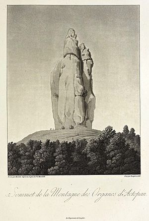
On May 15, 1803, Alexander von Humboldt, a famous explorer, visited Pachuca. He then traveled through the Actopan Valley on May 23 and 24. During his visit, Humboldt drew and studied the Organs of Actopan, also known as Los Frailes. These are rock formations located 17 kilometers (11 miles) southeast of Actopan.
Independence and Early Mexico
During the Mexican War of Independence, a royalist (someone loyal to Spain) named Domingo Claverino arrived in Actopan in February 1812. Between 1824 and 1825, many people died from measles in the city.
In 1847, Actopan was given the title of town. During the French invasion of Mexico, President Benito Juárez divided the State of Mexico into military districts. On June 7, 1862, Actopan was chosen as the capital of the second military district. However, it lacked the buildings needed for the government, so the capital was moved to Pachuca.
On October 11, 1863, General D. Tomás Mejía took control of the city. In May 1864, the leaders of Actopan recognized the Second Mexican Empire. After the state of Hidalgo was created, Actopan was considered as a possible capital. But it was rejected because it did not have the necessary buildings.
In July 1869, Julio Chávez López, who led a revolution against the government, was defeated when he tried to take Actopan. On September 16, 1875, the telegraph line between Pachuca and Actopan was opened. During the Tuxtepec Revolution in 1876, there were fights in Actopan.
Late 1800s and Mexican Revolution
In 1898, the City Hall declared July 8 a municipal holiday. On May 17, 1898, lightning struck the Church of Actopan, damaging its front and an altar. In 1900, sewage canals from Mexico City reached Actopan.
In 1910, a group called the Club Antirreleccionista was founded by local young people. During the Mexican Revolution, on December 1, 1910, the Actopan Municipal Assembly supported President Porfirio Díaz. The city's role in the revolution was small.
On May 22, 1911, Vicente Azpeitia Pardiñas took control of Actopan, supporting the Maderista revolution. On July 5, 1914, Roberto Martínez y Martínez expelled the Huertista Army from the city. On July 16, 1914, General Nicolás Flores occupied Actopan. In November 1914, Higinio Olivo was defeated by the Villistas in Actopan. On August 17, 1915, there was a battle near the town between Carrancistas and Villistas, with the Villistas being defeated.
In February 1919, Villistas forces held the city but left days later. On July 2, 1922, the Actopan army, led by Salvador Mayorga, rebelled. During the Delahuertista rebellion in 1924, Nicolás Flores declared himself governor of Hidalgo in Actopan. There were also battles between federal and rebel forces in the area.
20th Century Actopan
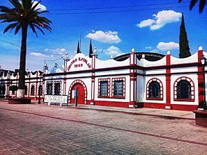
In 1928, a teacher training school was set up in the convent. It stayed there until 1932. On February 2, 1933, the Church and Convent of San Nicolás de Tolentino was declared a National Historic and Artistic Monument. On April 10, 1939, the first stone for the "Escuela Primaria Centro Escolar 1940" was laid. This school opened on October 8, 1940, and is one of the oldest primary schools in the region. In 1946, Actopan was officially named a city. The small clock tower of the convent was removed in the mid-1950s.
On March 12, 1951, a local sports club asked to use the abandoned jagüey (water reservoir) as a court. They promised to clean and care for it. Since May 18, 1954, it has been used for sports.
In 1965, the July 8 Market was built. In 1966, the Mexican government gave part of the convent property to the state of Hidalgo to build a sports field. This area was the "Jagüey." On January 27, 1987, a small earthquake of 4.1 on the Richter scale was reported. After the 1990 census, the towns of Cañada Chica Aviación and Pozo Grande were officially joined with Actopan.
Actopan in the 21st Century
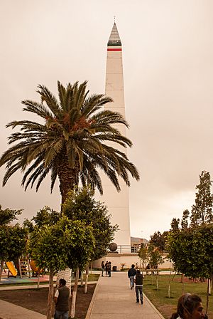
On February 28, 2001, the Zapatista Army of National Liberation held a meeting in the city. On July 8, 2001, Plaza Juárez was reopened after being remodeled. Between 2005 and 2006, the Terminal de Autotransportes de Actopan (bus station) was built. In 2008, part of the Old Municipal Palace was taken down to build new City Hall offices and Plaza Constitución. The Actopan Obelisk was also built in 2008 in Reforma Park.
The Actopan overpass was finished in March 2009. From May 17 to 21, 2010, there were 22 small earthquakes in the region. On June 25, 2012, a small chapel caught fire. Between 2013 and 2015, the July 8 Market was remodeled. In 2016, the north wall of the old municipal palace was taken down.
On December 30, 2016, about 500 merchants protested against rising gasoline prices. On January 4, 2017, after more protests, the Mexico-Laredo highway was closed. Some stores were broken into, and two gas stations were also affected.
The September 7 earthquake in Chiapas and the September 19 earthquake in Puebla were felt in Actopan, but there was no serious damage. On March 20, 2018, the strongest earthquake in Hidalgo that year happened in Actopan, measuring 3.9 on the Richter scale. On May 30, 2018, a fire burned about 15 hectares (37 acres) in the Buenos Aires neighborhood.
On May 18, 2018, a construction company was robbed. A chase followed, ending in a crash with two deaths and seven arrests. On September 7, 2019, a shooting happened on the highway. On March 30, 2020, two people were attacked with guns near the Actopan Obelisk.
On March 19, 2020, public places were closed because of the COVID-19 pandemic. The Wednesday tianguis (market) was suspended on April 20. The first COVID-19 case in Actopan was announced on April 26. Access to the city center was restricted, and a health checkpoint was set up. The Wednesday and Sunday tianguis were temporarily suspended. On May 11, 2020, the COVID-19 Actopan Immediate Response Hospital was opened. The first death in Actopan was reported on May 14.
On June 14, the Sunday tianguis was reopened, and on June 17, the Wednesday tianguis returned to the city center. The Barbacoa Fair and the San Nicolás de Tolentino festival were canceled in 2020. On September 25, 2020, vehicles could circulate in downtown Actopan again.
Due to more COVID-19 cases, on February 1, 2021, the Actopan City Hall again restricted vehicle access to the city center. They also closed the Municipal Presidency and suspended the tianguis. By March 2021, the city center was reopened. Plaza Juarez reopened in mid-July, and Parque La Reforma reopened on March 13, 2022.
Actopan's Geography
Where is Actopan?
Actopan is located at 20° 16' 05" north latitude and 98° 56' 39" west longitude. It is north of Mexico City, about 125 kilometers (78 miles) away. It is also 37 kilometers (23 miles) northwest of Pachuca.
The city is surrounded by other towns and areas. It is in the geographic region of the state of Hidalgo known as the Mezquital Valley. Actopan is in the eastern part of Mexico, in the center of Hidalgo state.
Land and Water
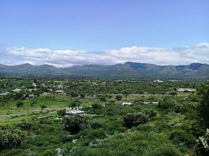
Actopan is about 2,001 meters (6,565 feet) above sea level. The land is mostly flat. It is located in the Trans-Mexican Volcanic Belt. To the north and northeast, about 2 kilometers (1.2 miles) from La Estancia, is the border between the Volcanic Belt and the Sierra Madre Oriental. This means there are faults (cracks in the earth) in the region, which can cause earthquakes.
The soil is mainly phaeozem and alluvial (made of sediment from rivers). The rocks are volcanic, like andesite. The city is in the Pánuco region, in the basin of the Moctezuma River. It is also located over the Actopan-Santiago de Anaya aquifer (underground water source).
Weather
Actopan has a semi-dry temperate climate. The average monthly temperature is about 13°C (55°F) in December and January (the coldest months). It reaches 20°C (68°F) in May (the hottest month). The average yearly temperature is about 16.4°C (61.5°F). The average rainfall is around 400 millimeters (15.7 inches). June and September have the most rain, while February and December have the least.
Plants and Animals
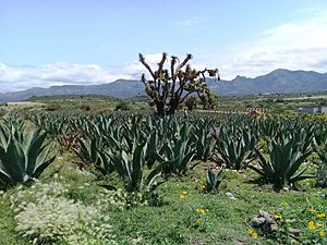
Actopan is in the Sierra Madre Oriental region. Most of its plants are scrublands with thorny bushes. You can find maguey, nances, opuntia stricta, mesquites, acacias, bilberry cacti, pitayas, chollas, and echinocactus.
Animals in this area include rabbits, squirrels, opossums, scorpions, lizards, spiders, centipedes, crickets, grasshoppers, ants, and pinacate beetles.
About 14 kilometers (8.7 miles) from the city is the Actopan Wildlife Corridor. This area covers 9,267.38 hectares (22,899 acres). It was declared a state wildlife corridor in 2020. In 2017, the presence of pumas was confirmed here after people reported attacks on farm animals and sightings of the big cats.
People of Actopan
Population Information
In 2020, Actopan had 32,276 people. This means 52.91% of the municipality's population lives in the city. Of these, 15,262 (47.29%) were men and 17,014 (52.71%) were women. Actopan is the seventh largest town in Hidalgo.
The main indigenous people in the city are the Otomí. In 2020, 653 people spoke an indigenous language. Most of them spoke the Otomí language, especially the Otomí variant of the Mezquital Valley. This language is also called hñähñú by its speakers. There were also 298 people who identified as Afro-Mexicans or Afro-descendants.
The main religion is Catholicism. In 2020, about 25,544 people said they were Catholic. The city belongs to the Archdiocese of Tulancingo. The patron saint is Nicolás de Tolentino. About 3,426 people said they were Protestant or Evangelical Christians. This includes The Church of Jesus Christ of Latter-day Saints, La Luz del Mundo Church, and Jehovah's Witnesses. About 3,188 people said they were atheists, agnostics, or had no religion.
| Vertical bar chart demographics of Actopan, Hidalgo between 1900 and 2020 |
|
EasyTimeline 1.90
|
| Population from the censuses and counts of the National Institute of Statistics and Geography (INEGI) from 1900 to 2020. |
Homes and City Planning
Actopan has many neighborhoods, such as Aviación, Benito Juárez, Chapultepec, and Centro Norte. Some areas like Cañada Chica, Cañada Aviación, and Pozo Grande are also considered part of the city.
In 2020, the city had 10,946 homes. About 8,687 of these were lived in. The average home had 3.71 people. Most houses in Actopan are built with blocks, brick, or prefabricated materials. Their roofs are often concrete. Some homes even have marble or other decorations. However, some houses are still made of adobe with brick walls and sheet metal roofs.
Access to Services
In 2010, Actopan had a very low level of social exclusion. This means most people had access to basic services. In 2015, Actopan ranked 21st out of 84 municipalities in Hidalgo for social progress. Only a small number of homes (3.50%) had dirt floors. Very few homes lacked basic services like drainage (0.81%), electricity (0.73%), or piped water (2.09%).
Actopan's Culture
Buildings and Art
Important Buildings
The city center has the oldest and most important buildings. It includes four main plazas and parks: Plaza Juárez, Plaza de la Constitución, Parque Reforma, and Parque del Salto.
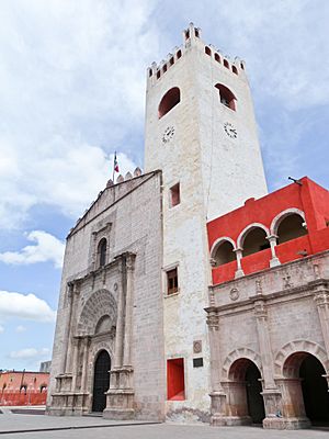
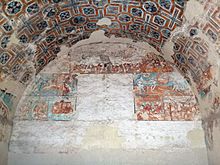
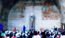
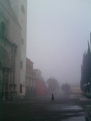
The Church and ex-convent of San Nicolás de Tolentino is a great example of 16th-century art from New Spain (colonial Mexico). It mixes different styles like Plateresque, Mudejar, Gothic, Romanesque, and Renaissance. It has a special open chapel that is 17.5 meters (57 feet) wide and 12 meters (39 feet) high. This chapel is completely covered with fresco murals.
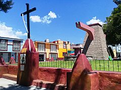
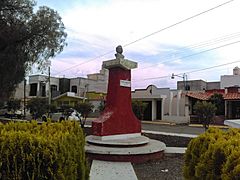
The Actopan Obelisk is in Reforma Park. It was built around 2008 and opened in 2009. It is a tall, square column that narrows at the top, ending in a pyramid shape. It is 57 meters (187 feet) tall. Inside, there is a staircase that leads to the top, offering a great view.
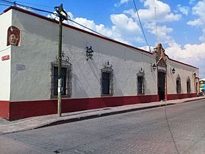
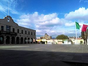
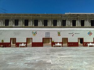
The Actopan Municipal Palace is a two-story building with a neoclassical style. It has an arched walkway with horseshoe arches and columns. This building was constructed in 2008. The Old Municipal Palace is a one-story building. Part of it was taken down in 2008 and 2016. The inner courtyard is called Plaza de las Artes.
Monuments and Statues
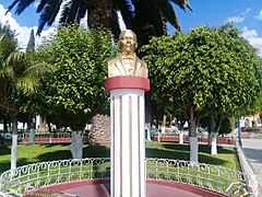
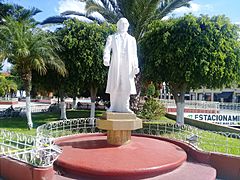
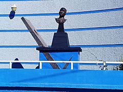
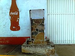
There are two monuments in Plaza Juarez. One is a statue of Miguel Hidalgo, a hero of Mexican Independence. The other is a bust (head and shoulders statue) of Benito Juárez, a former president. This one was placed in 1977. Another monument honors Efrén Rebolledo, a poet and writer. There is also a monument to Jesús Luz Meneses, built in the 1990s.
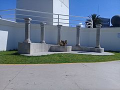
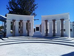
Parts of the city's old aqueduct are also monuments, like the "Fuente de Mendoza" and "Fuente El Salto." The "Fuente El Salto" is in the Nicolás Romero Garden. On September 13, 2004, the Monument to the Niños Héroes (Child Heroes) was opened. It has a curved wall with six columns, representing six Mexican cadets.
On June 21, 2019, the Monument to the Teacher was opened. It has five columns and a sculpture of two hands holding books. In Colonia Guzmán Mayer, there is a monument to Genaro Guzmán Mayer.
- Actopan monuments
Plazas and Parks
Actopan has several green areas like Plaza Juárez, Parque Reforma, Jardín Nicolás Romero, and Parque Recreativo "La Eroca." There are also parks in other neighborhoods with playgrounds for children. Plaza Juárez and Parque Reforma have shoe-shine stands.
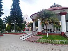
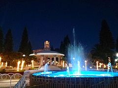
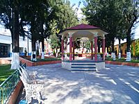
Plaza Juárez is a park with trees and a kiosk (bandstand) in the center. You can enter the atrium of the Convent of San Nicolás de Tolentino through an arched walkway. In 2014, a subway parking garage was built under Plaza Juarez.
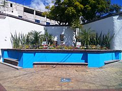
Parque Reforma is where the Actopan Obelisk is located. It also has playgrounds and exercise equipment. The Nicolás Romero Garden, or "El Salto", has an old aqueduct cistern that was turned into a fountain in 2014. The Recreational Park "La Eroca" has green areas, sports facilities, playgrounds, and a swimming pool. Plaza de la Constitución was built in 2008 in front of the Municipal Palace.
Paintings and Murals
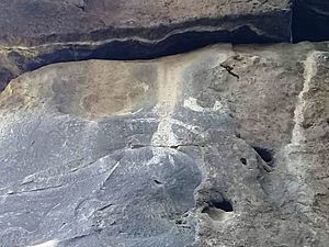
Outside the city, on the main arches of the Actopan Aqueduct ("Los Arcos"), there are white cave paintings. You can see a human figure, a sun, a half moon, and a hand. There is also an inverted "U" with seven dots, possibly showing a celestial sky.
Inside the Convent of Actopan, there are many complex murals and frescoes. These paintings combine Renaissance style with elements of mural painting from Mesoamerica. This mix is called tequitqui or Indo-Christian art. The murals in the profundis room, the stairway, and the open chapel are especially notable.
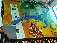
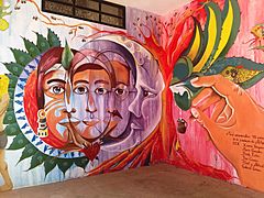
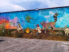
Many murals have been painted in the city. Inside the Actopan Obelisk, there are murals showing Actopan's culture, history, and identity. In 2015, 23 murals were created at the Actopan High School as part of an international festival. These murals focused on "Social Justice."
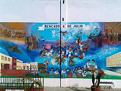
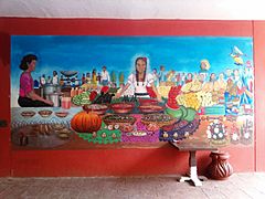
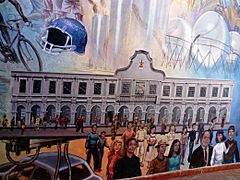
After the July 8 Market was remodeled in 2015, two murals were painted there, showing Actopan's customs. In 2016, a mural called "Actopan es.... Arte, cultura y tradición" was painted on the stairs of the Municipal Palace. It shows the Convent of Actopan and Efren Rebolledo. In 2017, a mural was opened to celebrate Actopan's 471st founding anniversary.
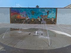
In November 2019, students created a mural about social issues like violence against women and gender equality. On September 4, 2020, the "Actopan Pueblo con sabor" mural was opened in Plaza Constitución. It shows the municipality's cultural heritage.
Museums and Cultural Places
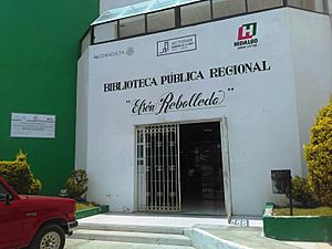
The city has a public library called the Efrén Rebolledo Municipal Public Library. It has 3,000 books and magazines. It also offers courses for children during holidays.
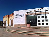
Actopan has a House of Culture, founded in 1991. It offers courses in singing, ceramics, dance, painting, and theater. There is also the Manuel Ángel Núñez Soto Theater, which can seat 820 people.
The Museum of Religious Art opened on January 1, 2011. It is inside the Church and ex-convent of San Nicolás de Tolentino. It has four rooms with art from the colonial period and the 1700s. You can see carved wooden furniture, religious oil paintings, and sculptures.
The Bicentennial Museum and Cultural Center opened on December 20, 2010. It was designed for art courses and exhibitions. However, in 2021, the Actopan City Hall announced that the building was damaged and might need to be taken down.
The Los Frailes Sports Museum, also called the "Sports Gallery," opened on January 13, 2012. It is dedicated to famous Actopan athletes. These include Velia Flores Guerrero (Paralympic athlete) and cyclists Rubén Lugo Caballero and Gabriel Cuéllar Valdez (Olympic athlete).
City Celebrations
All Mexican national holidays are celebrated in Actopan. In early March, there is a parade for spring with preschool students. On September 13, there is a ceremony for the Niños Héroes (Child Heroes). On September 15, the Anniversary of the Independence of Mexico is celebrated with a reenactment of the Cry of Dolores, Mexican food, fireworks, and dancing. On September 16, there is a parade with elementary schools. On November 20, a parade celebrates the Anniversary of the Mexican Revolution. Since 2010, a Huapango (traditional dance) contest is also held.
Religious Festivals
Important religious festivals include Día de la Candelaria (Candlemas) on February 2. On this day, people dress up figures and eat tamales. The celebration of the Cruz de Mayo (May Cross) is on May 3. A mass is held annually at the "El Salto" garden.
The main patron saint's day is for San Nicolás de Tolentino, the city's patron saint. It takes place in early September at the atrium of the Church and ex-convent of San Nicolás de Tolentino. People from different towns gather for religious ceremonies. The main day is September 10.
Throughout the year, other patron saint festivals are held in different neighborhoods. For example, in Los Olivos, there is a small fair for St. Jude Thaddeus on October 28. In Guadalupe, there is a fair for the Virgin of Guadalupe on December 12.
Easter Celebrations
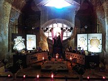
On Friday of Sorrows, an Altar of Sorrows is set up inside the Church and ex-convent of San Nicolás de Tolentino. This tradition dates back to the 1600s. The altar has a sculpture of the Our Lady of Sorrows, candles, and decorations made of sawdust and flower petals.
During Easter, there is a procession and mass on Palm Sunday. On Holy Thursday, there is a mass and a reenactment of the Last Supper. On Good Friday, a procession called the Way of the Cross takes place through the city streets. There is also a Procession of Silence in honor of the Our Lady of Solitude. On Holy Saturday, an Easter Vigil mass is held.
Masses and processions also happen in other churches in the city. In the Pozo Grande neighborhood, a reenactment of the Passion, Death, and Resurrection of Jesus of Nazareth has been held since 2006.
Day of the Dead
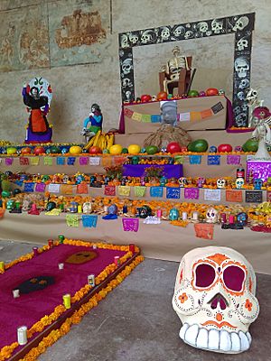
The Day of the Dead is another important tradition. Some people set up an Ofrenda (altar) in their homes with fruit, local foods, and marigold flowers. They also take flowers to the cemetery on November 1 and 2. During this time, a tianguis (market) sells calavera de alfeñique (sugar skulls), pan de muerto (bread of the dead), and other items. There are also cultural events and altar exhibitions.
The Otomi people of the Mezquital Valley create offerings with a dirt floor and walls made of reeds and maguey stalks. They also use tables covered with tablecloths. On these, they place fruits, flowers, food, candles, and incense.
Christmas Holidays
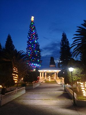
In December, the Fiestas Decembrinas (Christmas Holidays) are celebrated. The city's Christmas tree, about 12 meters (39 feet) high, is lit. This tradition started in 2009. The lighting ceremony includes fireworks, music, and Christmas stories. On December 12, there are celebrations for Our Lady of Guadalupe with pilgrimages and fireworks. Las Posadas (December 16-24), Christmas, New Year's Eve, and New Year are also celebrated.
On January 5, a toy tianguis is set up in downtown streets. Since 2012, there has been a Cavalcade of Magi (parade of the Three Wise Men) in January. This parade has fireworks and floats. The Guadalupe-Reyes Marathon is a Mexican tradition that refers to the festive period from December 12 to January 6.
Actopan Fair
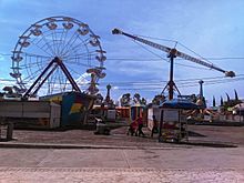
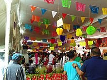
The Actopan Fair, also called Feria de la Barbacoa, happens every year in early July. The official holiday is July 8, marking the city's founding in 1546. The fair is held at the Municipal Sports Unit and in the city center. It attracts about 130,000 to 150,000 visitors.
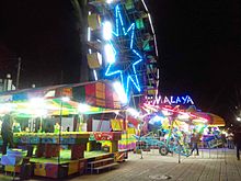
The fair includes sports and cultural events, dances, charreadas (Mexican rodeo), and a parade. There are also plays, music, painting exhibitions, antique car shows, and circus performances. Mechanical games and fireworks are also part of the fun. The food festival is a highlight, with many food displays and sales. The barbacoa contest has been held since 1971, and the Ximbó Festival since 2017.
Handicrafts and Traditional Clothes
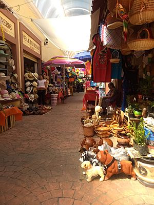
In Actopan, people make embroidery on fabric using techniques like cross stitch. They also create baskets, hats, and backpacks from palm. Other crafts include saddlery, ceramics, and pottery.
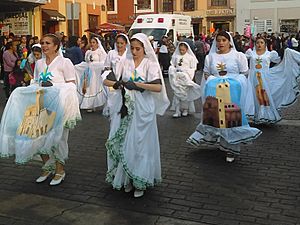
The traditional costume for the "Actopan Ciudad de Cara Bonita" folk dance is mostly white. For women, the skirt has an image of the ex-convent of Actopan. The white blouse has the Actopan glyph. Men wear white shirts and pants with Otomí embroidery.
The folk costume of the Mezquital Valley is from the Otomí people. Men used to wear blanket breeches and shirts with embroidery, a palm hat, and huaraches (sandals). Women wore a blanket blouse, an embroidered ribbon, a rebozo (shawl), and a colored or white blanket skirt.
Local Food
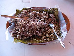
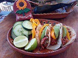
The most famous traditional dish is barbacoa. It is made with lamb or goat meat (originally with other animals). The meat is wrapped in maguey stalks and cooked in an underground oven.
Another main dish is ximbo, also called "chicken on a stalk." This dish became popular in the 1990s. It has rooster or hen meat wrapped in maguey stalks and cooked in an underground oven. It can also include nopales (cactus pads), pork skin, or pork ribs.
From the Mezquital Valley also come tunas (prickly pear fruit) and xoconostle (sour prickly pear) for dessert. Other local foods include escamoles (ant larvae) and chinicuiles (maguey worms) cooked with cactus flowers. The typical drink is pulque, a fermented drink from the maguey plant. Other popular dishes are chalupas, pambazos, tacos, mixiotes, mole, tlacoyos, sopes, quesadillas, and gorditas.
City Services
Getting Around
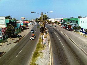
Federal Highway 85 (Mexico-Laredo) is the main road in Actopan. It helps with trade and travel. It connects to the Actopan-Tula highway, which is important for the state. The city also has the Bulevar Oriente (East Boulevard), a bypass that helps traffic move faster.
The city has a bus terminal called the Terminal de Autotransportes de Actopan (TAAC). You can travel to cities like Mexico City, Monterrey, Santiago de Querétaro, and Guadalajara. Within Hidalgo, you can go to Pachuca, Ixmiquilpan, and Tulancingo.
Media and Communication
Actopan has Internet, telephone, and mobile telephony services. You can watch TV through cable and free signals like Televisa and TV Azteca. The state channel, Channel 3 Hidalgo, is also available.
The city has a radio station, Radio UAEH Actopan (XHPECW-FM), which started in 2019. There was also Radio Actopan (XHACT-FM) from 2010 to 2022.
Actopan has a Postal Administration office and a Digital Community Center. The postal code is 42500, and the telephone prefix is 772.
Education
About 4.07% of the population cannot read or write. About 30.16% of people have not finished basic education. For the 2018–2019 school year, Actopan had 12 kindergartens, 23 preschools, 24 primary schools, and 11 secondary schools.
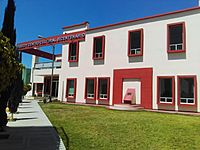
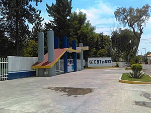
In higher secondary education, the Actopan High School is notable. It is part of the UAEH and opened in 2014. The Centro de Bachillerato Tecnológico Industrial y de Servicios No. 83 also offers technical high school programs.
For higher education, there is the Centro de Estudios Universitarios Moyocoyani, Plantel Actopan. The Actopan High School of the UAEH also offers university degrees. Its campus opened in 2000 and is located outside the city.
Healthcare
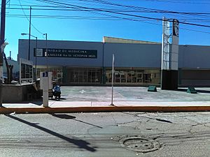
In Actopan, 42.06% of the people do not have health insurance. The city has a Family Medicine Unit (UMF) from the Mexican Social Security Institute and another from the Institute for Social Security and Services for State Workers. There is also a clinic from the Mexican Red Cross. Two health centers are run by the Secretaría de Salud de Hidalgo.
The Actopan General Hospital opened in 2000. It has areas for outpatient care, emergencies, and gynecology. It also has 30 beds for patients.
Public Services
Basic public services include potable water, drainage, and electricity. These services are sometimes limited. Water and drainage services are provided by CAASA (Comisión de Agua y Alcantarillado Sistema Actopan). The city has eight water wells that supply 14 million liters (3.7 million gallons) of water per day. Each resident uses about 205 liters (54 gallons) of water daily.
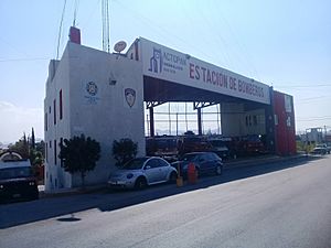
The Comisión Federal de Electricidad (CFE) provides electricity and public lighting. The city has a fire station. For public safety, there is a Public Prosecutor's Office with ten agents. Actopan also has a social rehabilitation center (Cereso).
The Actopan landfill is a Type C landfill, meaning it receives 18 to 23 tons of waste daily. It is an open-air landfill that started in 2017 and is expected to reach full capacity by 2021. The city has 10 garbage trucks that cover 14 routes in 25 neighborhoods.
Actopan's Economy
In 2015, Actopan had a Human Development Index of 0.776, which is considered high. This means people generally have good living standards. The city has nine bank branches, including Banamex, BBVA Bancomer, and HSBC. There are small manufacturing companies that make huaraches, bricks, and clothing.
Farming and raising animals happen in the neighborhoods outside the city. These activities are small-scale. Farmers grow corn and alfalfa. For livestock, they mainly raise poultry (chickens).
The city has a slaughterhouse that opened in 2015. It covers 3,500 square meters (37,674 square feet) and can process many animals.
Shopping and Markets
Stores and Markets
Shopping is mostly in the city center. You can find clothes, shoes, fruits, and vegetables. There are also chain stores like Farmacias Guadalajara, Coppel, and OXXO. Larger stores include Mi Bodega Aurrerá and Mercado Soriana. The city has two Diconsa stores and two Liconsa dairies.
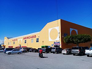
Actopan has two main markets: the 8 de Julio Market and the Jamaiquitas Market. The 8 de Julio Market is the main one. It has two levels for shops and an underground parking lot. It was built in 1965 and reopened in 2015 after remodeling. The Jamaiquitas Market was built in 2008 and has about 30 stores.
Tianguis (Open-Air Markets)
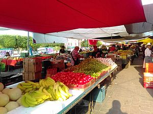
Tianguis (open-air markets) are held in Actopan on Wednesdays and Sundays. The Wednesday tianguis is one of the most important in the Mezquital Valley. It covers about 45,414 square meters (488,830 square feet) across 22 streets in the city center. You can find fruits, vegetables, legumes, herbs, kitchen tools, clothes, and food.
No one knows exactly when this tianguis started, but sales have happened in the area since 1550. Many vendors came from Santiago de Anaya. This market is famous for its food stalls, maguey syrup, and pulque. You can also hear mariachi and other traditional music. About 29,000 people visit this tianguis every Wednesday. On Sundays, there is a smaller tianguis in the downtown area, mainly around Reforma Park.
Food Market
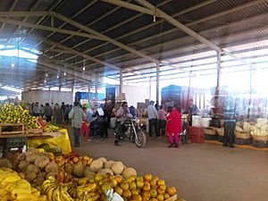
The Central de Abastos (Central Supply Market) in Actopan has been open since 2005. It operates on Wednesdays and Saturdays. It is the largest market in the region and one of the most important in Hidalgo. On Saturdays, it has fewer merchants and sells seasonal fruits, vegetables, and legumes.
On Wednesdays, it becomes an extension of the downtown tianguis. It hosts about 5,000 merchants from different municipalities of Hidalgo across 17 hectares (42 acres).
The market has areas for selling animal feed, livestock (cattle, pigs, sheep, goats), and poultry. You can also buy groceries, fruits, and vegetables (wholesale and retail). There's an area for electronics, tools, toys, handicrafts, and used items. A Gastronomic Pavilion has 39 stores selling local food. It also has the largest used car market in the state, with over 500 vehicles.
Tourism
Actopan has nine hotels (four- and three-star) with 258 rooms. It also has 16 restaurants, three cafeterias, two nightclubs, and nine bars. The city is part of the Corredor Turístico de los Balnearios (Tourist Corridor of Spas). This corridor includes Actopan and other municipalities like Santiago de Anaya and Ixmiquilpan.
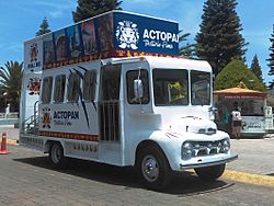
Since 2011, the city has a tourist transport bus. It has two levels, with the top level open-air. This bus travels through the main streets and attractions. It shows houses where famous people from Actopan lived, like María del Carmen González (doctor), Efrén Rebolledo (poet), and Genaro Guzmán Mayer (author of the Hymn to the State of Hidalgo). This bus usually runs on local holidays.
Sports in Actopan
The most popular sport in Actopan is soccer. Other popular sports include football, basketball, baseball, volleyball, cycling, and athletics.
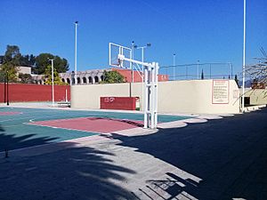
For sports facilities, there is a football field at Ozesnos Actopan. There's also a basketball court in the Aviación neighborhood and a lucha libre (wrestling) arena. The city has a bullring that is also used as a lienzo charro (rodeo arena).
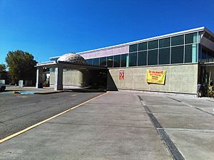
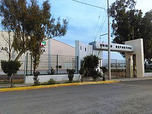
The Centro de Convenciones or Polideportivo "Mañutzi" is a covered lienzo charro with space for 3,000 people. The "Jesús Luz Meneses" Municipal Sports Complex has a gym with volleyball and basketball courts, a baseball field, and a fronton court.
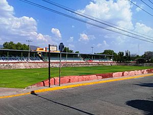
The Los Frailes Sports Complex, known as "El Jagüey", is used as a soccer stadium. It is 105 meters (344 feet) long and 57.5 meters (189 feet) wide. The "Las Canchitas" Sports Complex, also called "Jesús Luz Meneses," has areas for indoor soccer, volleyball, and basketball.
See Also
 In Spanish: Actopan (Hidalgo) para niños


