London Borough of Tower Hamlets facts for kids
Quick facts for kids
Tower Hamlets
|
|||
|---|---|---|---|
|
|||
|
|||
| Motto(s):
From Great Things to Greater
|
|||
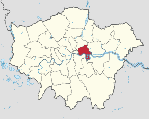
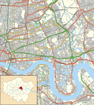
Tower Hamlets shown within Greater London
|
|||
| Sovereign state | United Kingdom | ||
| Constituent country | England | ||
| Region | London | ||
| Ceremonial county | Greater London | ||
| Created | 1 April 1965 | ||
| Admin HQ | 160 Whitechapel Rd, London E1 1BJ | ||
| Government | |||
| • Type | London borough council | ||
| • Body | Tower Hamlets London Borough Council | ||
| Area | |||
| • Total | 7.63 sq mi (19.77 km2) | ||
| Area rank | 320th (of 326) | ||
| Population
(2020)
|
|||
| • Total | 324,745 | ||
| • Rank | 33rd (of 326) | ||
| • Density | 42,544/sq mi (16,426/km2) | ||
| Time zone | UTC (GMT) | ||
| • Summer (DST) | UTC+1 (BST) | ||
| Postcodes |
E, EC
|
||
| ISO 3166 code | GB-TWH | ||
| ONS code | 00BG | ||
| GSS code | E09000030 | ||
| Police | Metropolitan Police | ||
The London Borough of Tower Hamlets is a special area in London, England. It sits on the north side of the River Thames, just east of the City of London. This borough covers a big part of the historic East End of London and also includes much of the modern London Docklands area. In 2019, about 324,745 people lived here.
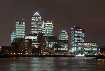
Some of London's tallest buildings are in Canary Wharf, which is a huge financial area in the south of Tower Hamlets. A part of the Queen Elizabeth Olympic Park is also located here. The borough was created in 1965. It was formed by joining three older areas: Stepney, Poplar, and Bethnal Green. The name 'Tower Hamlets' used to refer to an older area that had to provide soldiers for the Tower of London.
The local government for the area is called Tower Hamlets London Borough Council. In 2017, a study showed that Tower Hamlets had some challenges with poverty and unemployment compared to other London boroughs. However, it also had the smallest difference in school results at the secondary level.
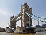
Tower Hamlets was the first London borough to build skyscrapers. Since 2014, it has completed 71 skyscrapers, more than any other place in the UK.
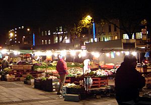
Many people from Bangladesh live in Tower Hamlets. They make up the largest single ethnic group in the borough, at 32%. The 2011 census showed that Tower Hamlets had the highest number of Muslims compared to other areas in England. It was also the only place where Muslims outnumbered Christians. The borough has over 40 mosques, Islamic centres, and schools called madrasahs. This includes the East London Mosque, which is one of Britain's largest. The restaurants, markets, and shops in Whitechapel and Brick Lane offer the biggest selection of Bangladeshi food, crafts, and clothes in Europe. Brick Lane is also a popular spot for hipster culture.
Contents
- Exploring the History of Tower Hamlets
- Understanding Tower Hamlets' Geography
- How Tower Hamlets is Governed
- Tower Hamlets' Climate
- Population and Diversity in Tower Hamlets
- Religion and Places of Worship
- Tower Hamlets' Economy
- Local Media in Tower Hamlets
- Education in Tower Hamlets
- Sports and Recreation in Tower Hamlets
- Leisure and Green Spaces
- Getting Around Tower Hamlets: Transport
- The Tower Hamlets Coat of Arms
- Freedom of the Borough Awards
- See also
Exploring the History of Tower Hamlets
The name "Tower Hamlets" was first used in the 1500s. Back then, the leader of the Tower of London commanded a local army called the Tower Hamlet Militia. These Hamlets (small settlements) paid taxes to support this army.
The London Borough of Tower Hamlets is the heart of the East End. It is located east of the old walled City of London and north of the River Thames. People started using the term "East End" to describe this area in the late 1800s. This was because London's population grew a lot, leading to crowded conditions. Many poor people and immigrants moved into these areas.
These problems got worse when new docks and railway stations were built. This forced many people from older, poorer areas to move into the East End. Over about 100 years, the East End became known for poverty, overcrowding, and other challenges.
The East End grew very quickly in the 1800s. It started as small villages near the City walls or along main roads. Farmland surrounded these villages. Along the river, there were small communities that helped with shipping and the Royal Navy. Before official docks, ships had to unload goods in the Pool of London. Industries like shipbuilding and ship repair grew in the area from Tudor times.
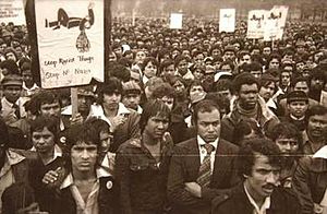
Many people from the countryside came here looking for jobs. Over time, different groups of immigrants arrived. Huguenot refugees came in the 1600s and started a new suburb in Spitalfields. Later, Irish weavers, Ashkenazi Jews, and in the 1900s, Bangladeshis moved in. Many of these immigrants worked in the clothing industry.
Because there were so many workers, wages were low and conditions were poor. This led to social reformers trying to help in the mid-1800s. It also led to the creation of unions and worker groups. The strong desire for change in the East End helped form the Labour Party. It also helped push for women's right to vote.
The London County Council began trying to fix the crowded housing in the early 1900s. World War II caused a lot of damage to the East End. Its docks, railways, and factories were often targets. This caused many people to move to new suburbs. New homes were built in the 1950s. During the war, 2,221 civilians were killed in the areas that make up Tower Hamlets. Also, 46,482 houses were destroyed.
The last docks in the Port of London closed in 1980. This created new challenges. It led to efforts to rebuild the area, like the creation of the London Docklands Development Corporation. Today, the Canary Wharf development, better transport, and the Queen Elizabeth Olympic Park are changing the East End even more. However, some parts of the borough still face significant poverty.
Understanding Tower Hamlets' Geography
Physical Features of the Borough
Tower Hamlets is located east of the City of London and north of the River Thames in East London. The London Borough of Hackney is to the north. The River Lea forms the border with the London Borough of Newham in the east. Across the Thames, you'll find the London Borough of Southwark to the southwest. The London Borough of Lewisham is to the south, and the Royal Borough of Greenwich is to the southeast. The River Lea also marks the old boundary between London areas that were historically in Middlesex and those in Essex.
The Isle of Dogs is an area formed by the old lock entrances to the West India Docks. It's also shaped by the largest bend in the River Thames. The southern part of the borough is on the historic flood plain of the River Thames. Without the Thames Barrier and other flood defenses, it would be at risk of flooding.
The Regent's Canal enters the borough from Hackney. It meets the River Thames at Limehouse Basin. A part of the Hertford Union Canal connects the Regent's Canal to the River Lea at Old Ford. Another canal, Limehouse Cut, is London's oldest. It runs from locks at Bromley-by-Bow to Limehouse Basin. Most of the paths along the canals are open for walking and cycling.
Victoria Park was created by law. It has been managed by different London councils over the years. Now, Tower Hamlets manages this large park. A part of the borough is within the Thames Gateway development area.
Key Areas within the Borough
Here are some of the areas you can find in Tower Hamlets:
- Aldgate (partly in the City of London)
- Bethnal Green
- Blackwall
- Bow
- Bow Common
- Bromley-by-Bow
- Cambridge Heath
- Canary Wharf
- Docklands
- East Smithfield
- Fish Island
- Globe Town
- Hackney Wick (partly in the London Borough of Hackney)
- Isle of Dogs
- Cubitt Town
- Millwall
- Leamouth
- Limehouse
- Mile End
- Old Ford
- Poplar
- Ratcliff
- Shadwell
- Spitalfields
- Stepney
- Wapping
- Whitechapel
How Tower Hamlets is Governed
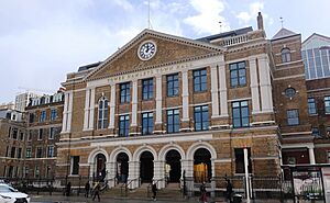
The local government is the Tower Hamlets Council. Its main office is at Tower Hamlets Town Hall on Whitechapel Road. Since 2010, the council has been led by a directly elected Mayor of Tower Hamlets.
Representation in Greater London
Since 2000, Tower Hamlets is part of the City and East area. This is one of 14 areas that make up the London Assembly. It is currently represented by Unmesh Desai from the Labour Party.
UK Parliament Representation
For the 2019 general election, the borough was divided into two areas for Parliament members:
- Bethnal Green & Bow, represented by Rushanara Ali (Labour)
- Poplar & Limehouse, represented by Apsana Begum (Labour)
After a review in 2023, Tower Hamlets will elect MPs in three areas for the next general election. These are:
- Stratford and Bow (partly in Newham and Tower Hamlets)
- Bethnal Green and Stepney
- Poplar and Limehouse (with new borders)
Tower Hamlets' Climate
The weather information below was collected between 1971 and 2000. It comes from the weather station in Greenwich, which is about 1 mile (1.6 km) south of the town hall:
| Climate data for London (Greenwich) | |||||||||||||
|---|---|---|---|---|---|---|---|---|---|---|---|---|---|
| Month | Jan | Feb | Mar | Apr | May | Jun | Jul | Aug | Sep | Oct | Nov | Dec | Year |
| Record high °C (°F) | 14.0 (57.2) |
19.7 (67.5) |
21.0 (69.8) |
26.9 (80.4) |
31.0 (87.8) |
35.0 (95.0) |
35.5 (95.9) |
37.5 (99.5) |
30.0 (86.0) |
28.8 (83.8) |
19.9 (67.8) |
15.0 (59.0) |
37.5 (99.5) |
| Mean daily maximum °C (°F) | 8.3 (46.9) |
8.5 (47.3) |
11.4 (52.5) |
14.2 (57.6) |
17.7 (63.9) |
20.7 (69.3) |
23.2 (73.8) |
22.9 (73.2) |
20.1 (68.2) |
15.6 (60.1) |
11.4 (52.5) |
8.6 (47.5) |
15.2 (59.4) |
| Mean daily minimum °C (°F) | 2.6 (36.7) |
2.4 (36.3) |
4.1 (39.4) |
5.4 (41.7) |
8.4 (47.1) |
11.5 (52.7) |
13.9 (57.0) |
13.7 (56.7) |
11.2 (52.2) |
8.3 (46.9) |
5.1 (41.2) |
2.8 (37.0) |
7.5 (45.5) |
| Record low °C (°F) | −10.0 (14.0) |
−9.0 (15.8) |
−8.0 (17.6) |
−2.0 (28.4) |
−1.0 (30.2) |
5.0 (41.0) |
7.0 (44.6) |
6.0 (42.8) |
3.0 (37.4) |
−4.0 (24.8) |
−5.0 (23.0) |
−7.0 (19.4) |
−10.0 (14.0) |
| Average precipitation mm (inches) | 51.6 (2.03) |
38.2 (1.50) |
40.5 (1.59) |
45.0 (1.77) |
46.5 (1.83) |
47.3 (1.86) |
41.1 (1.62) |
51.6 (2.03) |
50.4 (1.98) |
68.8 (2.71) |
58.0 (2.28) |
53.0 (2.09) |
591.8 (23.30) |
| Average rainy days (≥ 1.0 mm) | 10.8 | 8.5 | 9.6 | 9.4 | 9.0 | 8.3 | 8.0 | 7.6 | 8.5 | 10.7 | 10.1 | 9.9 | 110.4 |
| Average snowy days | 4 | 4 | 3 | 1 | 0 | 0 | 0 | 0 | 0 | 0 | 1 | 3 | 16 |
| Average relative humidity (%) | 81.0 | 76.0 | 69.0 | 64.0 | 62.0 | 60.0 | 60.0 | 62.0 | 67.0 | 73.0 | 78.0 | 82.0 | 69.5 |
| Mean monthly sunshine hours | 49.9 | 71.4 | 107.1 | 159.8 | 181.2 | 181.0 | 192.1 | 195.1 | 138.9 | 108.1 | 58.5 | 37.4 | 1,480.5 |
| Source 1: Record highs and lows from BBC Weather, except August and February maximum from Met Office | |||||||||||||
| Source 2: All other data from Met Office, except for humidity and snow data which are from NOAA | |||||||||||||
| Climate data for London (Heathrow airport 1981−2010) | |||||||||||||
|---|---|---|---|---|---|---|---|---|---|---|---|---|---|
| Month | Jan | Feb | Mar | Apr | May | Jun | Jul | Aug | Sep | Oct | Nov | Dec | Year |
| Mean daily maximum °C (°F) | 8.1 (46.6) |
8.4 (47.1) |
11.3 (52.3) |
14.2 (57.6) |
17.9 (64.2) |
21.0 (69.8) |
23.5 (74.3) |
23.2 (73.8) |
19.9 (67.8) |
15.5 (59.9) |
11.1 (52.0) |
8.3 (46.9) |
15.2 (59.4) |
| Mean daily minimum °C (°F) | 2.3 (36.1) |
2.1 (35.8) |
3.9 (39.0) |
5.5 (41.9) |
8.7 (47.7) |
11.7 (53.1) |
13.9 (57.0) |
13.7 (56.7) |
11.4 (52.5) |
8.4 (47.1) |
4.9 (40.8) |
2.7 (36.9) |
7.4 (45.4) |
| Average precipitation mm (inches) | 55.2 (2.17) |
40.9 (1.61) |
41.6 (1.64) |
43.7 (1.72) |
49.4 (1.94) |
45.1 (1.78) |
44.5 (1.75) |
49.5 (1.95) |
49.1 (1.93) |
68.5 (2.70) |
59.0 (2.32) |
55.2 (2.17) |
601.7 (23.68) |
| Average rainy days (≥ 1.0 mm) | 11.1 | 8.5 | 9.3 | 9.1 | 8.8 | 8.2 | 7.7 | 7.5 | 8.1 | 10.8 | 10.3 | 10.2 | 109.6 |
| Mean monthly sunshine hours | 61.5 | 77.9 | 114.6 | 168.7 | 198.5 | 204.3 | 212.0 | 204.7 | 149.3 | 116.5 | 72.6 | 52.0 | 1,632.6 |
| Source: Met Office | |||||||||||||
Population and Diversity in Tower Hamlets
| Population census | ||
|---|---|---|
| Year | Pop. | ±% |
| 1801 | 130,871 | — |
| 1811 | 160,718 | +22.8% |
| 1821 | 195,941 | +21.9% |
| 1831 | 231,534 | +18.2% |
| 1841 | 275,250 | +18.9% |
| 1851 | 330,548 | +20.1% |
| 1861 | 410,101 | +24.1% |
| 1871 | 489,653 | +19.4% |
| 1881 | 569,205 | +16.2% |
| 1891 | 584,936 | +2.8% |
| 1901 | 578,143 | −1.2% |
| 1911 | 571,438 | −1.2% |
| 1921 | 529,114 | −7.4% |
| 1931 | 489,956 | −7.4% |
| 1941 | 337,774 | −31.1% |
| 1951 | 232,860 | −31.1% |
| 1961 | 195,883 | −15.9% |
| 1971 | 164,699 | −15.9% |
| 1981 | 139,989 | −15.0% |
| 1991 | 167,985 | +20.0% |
| 2001 | 196,121 | +16.7% |
| 2011 | 254,096 | +29.6% |
| 2021 | 310,300 | +22.1% |
| Note: | ||
By 1891, Tower Hamlets was already one of the most populated areas in London. Throughout the 1800s, the local population grew by about 20% every ten years. Building the docks meant more land was used for homes and factories. In the north, people worked in weaving and small home industries. In the south, jobs were in the docks and related businesses.
By the mid-1800s, Tower Hamlets was known for being crowded and poor. The building of railways caused more people to move into the area. A large number of Eastern European Jews also arrived in the late 1800s, adding to the population growth. This growth slowed down in the 1900s as people moved to newer suburbs. The population fell from nearly 600,000 around 1900 to less than 140,000 by the early 1980s.
The areas that make up Tower Hamlets were badly damaged during World War II. Many houses were destroyed or damaged by heavy bombing. This happened at the same time as jobs in the docks declined. The Abercrombie Plan for London (1944) encouraged people to move out of London to new towns.
This decline started to change when the London Docklands Development Corporation was created. It brought new industries and homes to the old dock areas. New immigration from Asia starting in the 1970s also helped. In 2001, the population was about 196,106. By 2010, it was estimated to be 237,900.
Tower Hamlets has one of the smallest populations of White British people in the UK. No single ethnic group forms a majority here. About 45% of residents are white, with most of them being White British. 32% of residents are Bangladeshi, making them the largest ethnic minority. Asians as a whole make up 41% of the population. A smaller number of people are of Black African and Caribbean descent (7%). Somalis are the second-largest minority ethnic group. People of mixed ethnic backgrounds make up 4%, and other ethnic groups are 2%. The White British population was 31.2% in 2011, down from 42.9% in 2001.
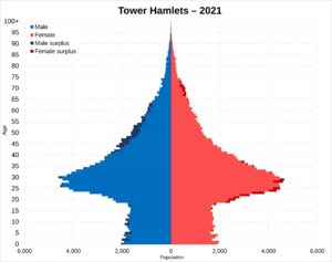
In 2018, Tower Hamlets had the lowest life expectancy and the highest rate of heart disease among all London boroughs. This was similar to Newham. The 2021 census found that Tower Hamlets has one of the lowest proportions of people over 65 years old in England and Wales, at 5.6%.
Ethnic Diversity in Tower Hamlets
| Ethnic Group | 2001 | 2011 | ||
|---|---|---|---|---|
| Number | % | Number | % | |
| White: British | 84,151 | 43% | 79,231 | 31% |
| White: Irish | 3,823 | 2% | 3,863 | 2% |
| White: Gypsy or Irish Traveller | 175 | 0% | ||
| White: Other | 12,825 | 7% | 31,550 | 12% |
| White: Total | 100,799 | 51% | 114,819 | 45% |
| Asian or Asian British: Indian | 3,001 | 2% | 6,787 | 3% |
| Asian or Asian British: Pakistani | 1,486 | 1% | 2,442 | 1% |
| Asian or Asian British: Bangladeshi | 65,553 | 33% | 81,377 | 32% |
| Asian or Asian British: Chinese | 3,573 | 2% | 8,109 | 3% |
| Asian or Asian British: Other Asian | 1,767 | 1% | 5,786 | 2% |
| Asian or Asian British: Total | 75,380 | 38% | 104,501 | 41% |
| Black or Black British: African | 6,596 | 3% | 9,495 | 4% |
| Black or Black British: Caribbean | 5,225 | 3% | 5,341 | 2% |
| Black or Black British: Other Black | 921 | 0% | 3,793 | 1% |
| Black or Black British: Total | 12,742 | 6% | 18,629 | 7% |
| Mixed: White and Black Caribbean | 1,568 | 1% | 2,837 | 1% |
| Mixed: White and Black African | 789 | 0% | 1,509 | 1% |
| Mixed: White and Asian | 1,348 | 1% | 2,961 | 1% |
| Mixed: Other Mixed | 1,168 | 1% | 3,053 | 1% |
| Mixed: Total | 4,873 | 2% | 10,360 | 4% |
| Other: Arab | 2,573 | 1% | ||
| Other: Any other ethnic group | 2,312 | 1% | 3,214 | 1% |
| Other: Total | 2,312 | 1% | 5,787 | 3% |
| Black, Asian, and minority ethnic: Total | 95,307 | 49% | 139,277 | 55% |
| Total | 196,106 | 100.00% | 254,096 | 100.00% |
Religion and Places of Worship
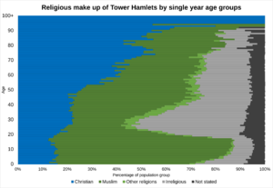
Tower Hamlets is a borough with many different religions and places of worship. According to the 2021 census:
- 39.9% of the population was Muslim.
- 22.3% was Christian.
- 2.0% was Hindu.
- 1.0% was Buddhist.
- 0.4% was Jewish.
- 0.3% was Sikh.
- 0.5% followed some other religion.
- 26.6% did not have a religion.
- 6.9% did not state their religious views.
The table below shows the religious identity of people living in Tower Hamlets. This data comes from the 2001, 2011, and 2021 censuses.
| Religion | 1995 estimates | 2001 census | 2011 census | 2021 census | ||||
|---|---|---|---|---|---|---|---|---|
| Number | % | Number | % | Number | % | Number | % | |
| Holds religious beliefs | – | – | 153,692 | 78.4 | 166,359 | 65.5 | 206,347 | 66.5 |
| Muslim | – | – | 71,389 | 36.4 | 87,696 | 34.5 | 123,912 | 39.9 |
| Christian | – | – | 75,783 | 38.6 | 68,808 | 27.1 | 69,223 | 22.3 |
| Hindu | – | – | 1,544 | 0.8 | 4,200 | 1.7 | 6,298 | 2.0 |
| Buddhist | – | – | 1,938 | 1.0 | 2,726 | 1.1 | 2,961 | 1.0 |
| Jewish | 6,000 | 3.7% | 1,831 | 0.9 | 1,283 | 0.5 | 1,341 | 0.4 |
| Sikh | – | – | 682 | 0.3 | 821 | 0.3 | 966 | 0.3 |
| Other religion | – | – | 525 | 0.3 | 825 | 0.3 | 1,652 | 0.5 |
| No religion | – | – | 27,823 | 14.2 | 48,648 | 19.1 | 82,635 | 26.6 |
| Religion not stated | – | – | 14,591 | 7.4 | 39,089 | 15.4 | 21,318 | 6.9 |
| Total population | – | 100% | 196,106 | 100.0 | 254,096 | 100.0 | 310,300 | 100.0 |
Important Religious Sites
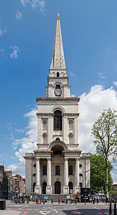
There are 21 active churches in Tower Hamlets that belong to the Church of England. These include Christ Church of Spitalfields, St Paul's Church of Shadwell, and St Dunstan's of Stepney. You can also find churches from many other Christian groups.
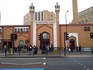
Tower Hamlets has more than 40 mosques and Islamic centres. The most famous is the East London Mosque. It was one of the first mosques in Britain allowed to broadcast the adhan (call to prayer). It is also one of the biggest Islamic centres in Europe. The Maryam Centre, which is part of the mosque, is the largest Islamic centre for women in Europe. It opened in 2013 and has a main prayer hall, funeral services, education facilities, a fitness centre, and support services. Many important people have visited the East London Mosque. These include Prince Charles, Boris Johnson, foreign government officials, and famous Muslim scholars. Other important mosques include Brick Lane Mosque, Darul Ummah Masjid, Esha Atul Islam Mosque, Markazi Masjid, Stepney Shahjalal Mosque, and Poplar Central Mosque.
Other notable religious buildings are the Fieldgate Street Great Synagogue, the Congregation of Jacob Synagogue, the London Buddhist Centre, the Hindu Pragati Sangha Temple, and the Gurdwara Sikh Sangat. The Great Synagogue of London was destroyed during World War II. It was located just outside the borough, in the City.
Tower Hamlets' Economy
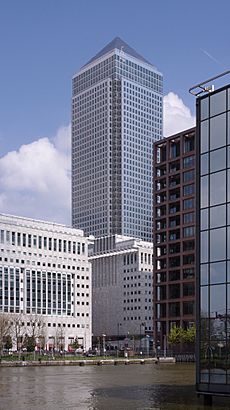
The borough is home to the main offices of many global financial companies. These companies employ some of the highest-paid workers in London. However, Tower Hamlets also has high rates of long-term illness and early death. It also has the second-highest unemployment rate in London.
Canary Wharf is where many world and European headquarters of major banks and businesses are located. These include Barclays, Citigroup, HSBC, J.P. Morgan, and Morgan Stanley. Savills, a high-end real estate company, suggests that very luxurious homes can be found in areas like Canary Riverside and Pan Peninsula. Tower Hamlets was the first borough to build skyscrapers. Since 2014, over seventy skyscrapers have been completed here. This is more than anywhere else in the UK.
The End Child Poverty coalition reported that Tower Hamlets has the highest percentage of children living in poverty in the UK, at 49%. In some areas, like Bethnal Green South, this figure is as high as 54.5%.
Surveys by the Child Poverty Action group for the council found that the Universal Credit system was not popular with low-income families. Most people who used the system found it hard to understand. They also often had problems with payments.
Local Media in Tower Hamlets
The East London Advertiser and Social Streets provide local news. You can find their news in print and online. There are also several newspapers published in the Bengali language in the borough. These are available in print and online.
Education in Tower Hamlets
The London Borough of Tower Hamlets is responsible for state schools in the area. In January 2008, there were 19,890 primary school students and 15,262 secondary school students in state schools. Only 2.4% of schoolchildren in the borough attend private schools. In 2010, 51.8% of students achieved 5 A*–C grades in their GCSEs, including Maths and English. This was the best result in the borough's history. The national average was 53.4%. Seventy-four percent achieved 5 A*–C GCSEs for all subjects. This was the same as the English average. In 1997, this figure was only 26%. The percentage of students who receive free school meals in the borough is the highest in England and Wales. In 2007, the council did not approve plans to build a Goldman Sachs-sponsored school called an academy.
Schools in the borough have different groups of students. The Times reported in 2006 that 47% of secondary schools had only non-white students. Also, 33% had a majority of white students. About 60% of students starting primary and secondary school are Bangladeshi. 78% of primary school students speak English as a second language.
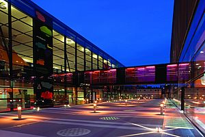
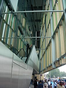
The council runs several Idea Stores in the borough. These places combine traditional library and computer services with other resources. They are designed to attract more people. The main Whitechapel store was designed by David Adjaye. It cost £16 million to build.
Universities in Tower Hamlets
- Queen Mary University of London, which is part of the University of London. It includes Barts and The London, Queen Mary's School of Medicine and Dentistry.
- London Metropolitan University
- UCL School of Management, located in One Canada Square in Canary Wharf.
- The London Interdisciplinary School, located on Whitechapel Road.
- Northeastern University - London, located in St. Katherines Docks.
Further Education Colleges
- Tower Hamlets College. In 2017, it joined with Hackney Community College and Redbridge College to form New City College. This is the second largest college in London, with over 20,000 students.
Schools and Sixth Form Colleges
- Bishop Challoner Catholic School
- Bow School
- Central Foundation Girls' School
- George Green's School
- Ibrahim College
- Jamiatul Ummah School and Sixth Form
- Langdon Park School
- Lansbury Lawrence School
- London East Academy (East London Mosque)
- London Enterprise Academy
- Mazahirul uloom London
- Morpeth School
- Mulberry Academy Shoreditch
- Mulberry School for Girls
- Oaklands School
- St Paul's Way Trust School
- Stepney All Saints School
- Stepney Green Maths, Computing & Science College
- Swanlea School, Business and Enterprise College
- Wapping High School
Volunteering Opportunities
- Volunteer Centre Tower Hamlets helps residents find volunteer work. It also supports organizations that involve student volunteers.
Sports and Recreation in Tower Hamlets
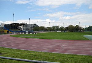
Mile End Stadium is located within Mile End Park. It has an athletics stadium and facilities for football and basketball. Two football clubs, Tower Hamlets F.C. and Sporting Bengal United F.C., play there. They are part of the Essex Senior Football League.
John Orwell Sports Centre in Wapping is the home of Wapping Hockey Club. In 2014, the club received over £300,000 to make the centre a top place for hockey.
A leisure centre with a swimming pool at Mile End Stadium was finished in 2006. Other pools are in St Georges, Limehouse, and York Hall in Bethnal Green. York Hall also often hosts boxing matches. In May 2007, a public spa opened in the building's renovated Victorian-style Turkish baths.
KO Muay Thai Gym and Apolaki Krav Maga & Dirty Boxing Academy in Bethnal Green are key places for martial arts training in the area.
The unique Green Bridge, opened in 2000, connects parts of Mile End Park. These parts would otherwise be separated by Mile End Road. The bridge has gardens, water features, and trees along the path.
Tower Hamlets and the Queen Elizabeth Olympic Park
Tower Hamlets was one of five boroughs that hosted the 2012 Summer Olympics. The Queen Elizabeth Olympic Park was built in the Lea Valley. Here's how Tower Hamlets was involved:
- A small part of the Olympic Park is in Bow, which is a district of the borough. This made Tower Hamlets a host borough.
- The energy centre for the Olympic Park (King's Yard Energy Centre) is in Tower Hamlets. It provides energy to all the Olympic venues, even though none of them are directly in Tower Hamlets.
- The world square and the London 2012 mega-store were also in the borough. The world square was for spectators to buy food and drinks. The world's biggest McDonald's was located there.
- The London 2012 mega-store sold official gifts and souvenirs. High Street, the main road to the Olympic park from west and central London, includes Whitechapel Road, Mile End Road, and Bow Road.
- Victoria Park, in Tower Hamlets, was important for the Olympics. Spectators without tickets could watch the games on big screens there. This park is less than a mile from the Olympic park. The main cycle parking for spectators was in Victoria Park. One of the entrances to the Olympic park, called the Victoria gate, is also in Tower Hamlets.
- Some schools in Tower Hamlets took part in the opening and closing ceremonies of the Olympic and Paralympic games. This was true for all the host boroughs. The part of the Olympic Park in Tower Hamlets will be called "Sweetwater." It will be one of five new neighborhoods after the games. Sweetwater will cover Tower Hamlets' part of the Olympic Park near Old Ford.
- The Olympic marathon was planned to run through the borough. However, it later ran through the City and Westminster. But the turning point for the marathon was in the borough, near The Tower of London.
- Danny Boyle, the artistic director of the London 2012 opening ceremony, lives in Mile End.
- Many Tower Hamlets residents became Olympic volunteers. Tower Hamlets ranked second, after its neighbor Newham, for the number of volunteers from the borough.
Leisure and Green Spaces
Parks in Tower Hamlets
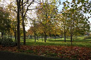
Tower Hamlets has over one hundred parks and open spaces. They range from the large Victoria Park to many small gardens and squares. The second largest park is Mile End Park. It is separated from Victoria Park by a canal. It includes The Green Bridge, which carries the park over the busy Mile End Road. One of the smallest parks is the 1.19-hectare Grove Hall Park off Fairfield Road, Bow. It used to be the site of a mental hospital. Other parks include Altab Ali Park and Mudchute Park.
Museums to Visit
- Island History Trust
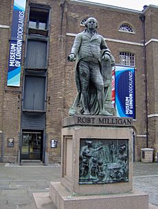
- Museum of London Docklands
- Ragged School Museum
- V&A Museum of Childhood
- Whitechapel Art Gallery
Getting Around Tower Hamlets: Transport
Road Network
Like most of the transport in Tower Hamlets, several roads spread out from the City of London. Roads that go from east to west include:
- The A11. It runs from Aldgate to the A12 near Stratford. It passes through Whitechapel, Mile End, and Bow.
- The A13 (Commercial Road/East India Dock Road). It runs from Aldgate to Poplar. East of Poplar, it continues towards Barking, Tilbury, and Southend.
- The A1203 (The Highway). It runs from Tower Hill, through Wapping, to Limehouse and Canary Wharf.
There are also several roads that go from north to south in the Borough, including:
- The A12. It starts at the A13 in Poplar and runs along the eastern edge of the Borough. This road carries traffic towards the M11 (for Stansted Airport
 ), Romford, and places in Essex. It eventually goes to Lowestoft in Suffolk.
 - The London Inner Ring Road, which goes from Old Street to Tower Bridge.
There are three road crossings over the River Thames in the Borough. From west to east, these are:
- Tower Bridge (connecting Tower Hill to Southwark and Bermondsey)
- Rotherhithe Tunnel (connecting the A13 at Limehouse to Canada Water)
- Blackwall Tunnel (connecting the A12 and A13 at Poplar to Greenwich)
Train Services
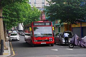
The main train services start in the City at Fenchurch Street, with one stop at Limehouse. Another main station is Liverpool Street, with stops at Bethnal Green and Cambridge Heath. The East London Line goes from north to south through Tower Hamlets. It has stations at Whitechapel, Shadwell, and Wapping. One entrance to Shoreditch High Street station is inside the Borough. The North London Line passes through the very north of Tower Hamlets. One entrance to Hackney Wick is inside the Borough. Since 2022, the Elizabeth line has two stops: Whitechapel and Canary Wharf.
Metro and Light Rail
The Docklands Light Railway (DLR) was built to serve the docklands areas. It has main starting points at Bank and Tower Gateway. At Poplar, you can change trains to go north to Stratford, south via Canary Wharf towards Lewisham, or east via the London City Airport to Woolwich Arsenal or via ExCeL London to Beckton.
Three London Underground lines cross the district, serving 8 stations in total:
- The District and Hammersmith and City lines share tracks between Aldgate East and Barking.
- The Central line has stations at Bethnal Green and Mile End. At Mile End, you can change to the District line.
- The Jubilee line has one stop at Canary Wharf.
List of Stations in Tower Hamlets
- Aldgate East station
- All Saints DLR station
- Bethnal Green railway station
- Bethnal Green tube station
- Blackwall DLR station
- Bow Church station
- Bow Road station
- Bromley-by-Bow station
- Cambridge Heath railway station
- Canary Wharf DLR station
- Canary Wharf railway station
- Canary Wharf tube station
- Crossharbour DLR station
- Devons Road DLR station
- East India DLR station
- Hackney Wick railway station
- Heron Quays DLR station
- Island Gardens DLR station
- Langdon Park DLR station
- Limehouse station (Rail and DLR)
- Mile End station
- Mudchute DLR station
- Poplar DLR station
- Shadwell railway station
- Shadwell DLR station
- Shoreditch High Street railway station
- South Quay DLR station
- Stepney Green tube station
- Tower Gateway DLR station
- Tower Hill tube station
- Wapping railway station
- West India Quay DLR station
- Westferry DLR station
- Whitechapel station
In March 2011, the most common ways residents traveled to work were:
- Underground or light rail: 24.0%
- On foot: 7.5%
- Bus, minibus, or coach: 7.5%
- Driving a car or van: 6.9%
- Bicycle: 4.1%
- Train: 3.8%
- Working mainly at or from home: 2.3%
Tower Hamlets Borough Council runs a "walking bus" service for school pupils. This service follows agreed routes. Some run every school day, while others run once or twice a week. This depends on how many adult volunteers are involved.
The Tower Hamlets Coat of Arms
The coat of arms for the Borough of Tower Hamlets was given in 1965. It features symbols that represent the area's history and its connection to the sea. It also shows strong links to the old manor and parish of Stepney. This includes St Dunstan's church in Stepney, known as the Church of the High Seas. The older Stepney area didn't have a coat of arms. However, the smaller Metropolitan Borough of Stepney did. Parts of that old design are now in the current coat of arms.
The shield on the coat of arms shows:
- A ship, which stands for the sea trades.
- A sprig of mulberry and a weaver's shuttle. These represent the silk and other weaving activities that were once very important here. The mulberry also honors the Huguenot refugees. They first brought silk weaving to Tower Hamlets and England. Many council staff wear mulberry-colored (claret/maroon) uniforms.
- Blacksmith's fire tongs, which are the symbol of St Dunstan. He is the patron saint of Stepney and had strong ties to the area. Dunstan is famous for grabbing the devil by the nose with his tongs when the devil tried to tempt him.
The top part of the coat of arms (the crest) shows:
- A silver picture of the White Tower of the Tower of London. The original Tower Hamlets area was closely linked to this tower.
- Two crossed gold anchors. These again represent the area's importance in the Port of London.
The supporters (figures on the sides) are:
- A seahorse, representing the sea trades.
- A talbot dog, representing the Isle of Dogs.
The motto is: From great things to greater. This is an English version of the Latin motto from the old Metropolitan Borough of Stepney.
The council also uses a logo instead of the coat of arms. It shows a simpler White Tower above a wavy line that looks like the Thames. This logo developed from an older one that showed the White Tower in mulberry color. That older logo showed the tower as if seen from certain angles, hiding one corner. It also had a map-accurate picture of the local part of the Thames. This older version can still be seen on many street signs.
Freedom of the Borough Awards
The following people and military groups have received the Freedom of the Borough of Tower Hamlets. This is a special honor given by the borough.
Individuals Honored
- Commander John Ludgate: Awarded on May 25, 2018.
Military Units Honored
- HMS Crane, RN: Awarded in 1942.
- 114 (1st London) Army Engineer Regiment (TA): Awarded on April 27, 1961.
See also
 In Spanish: Tower Hamlets para niños


