
National Register of Historic Places listings in Nebraska facts for kids
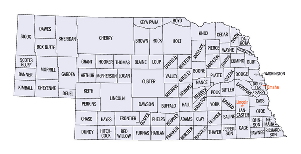
This is a list of over 1,100 special places and areas in Nebraska that are on the National Register of Historic Places. Think of it like a Hall of Fame for buildings, sites, and districts that are important to history. Out of these, 20 are even more special, called National Historic Landmarks. You can find these historic spots in 90 of Nebraska's 93 counties.
Contents
- Discover Nebraska's Historic Counties
- Historic Places in Arthur County
- Historic Places in Banner County
- Blaine County: No Historic Listings
- Historic Places in Boone County
- Historic Places in Box Butte County
- Historic Places in Boyd County
- Historic Places in Brown County
- Historic Places in Cuming County
- Historic Places in Dakota County
- Historic Places in Deuel County
- Historic Places in Dixon County
- Historic Places in Dundy County
- Historic Places in Frontier County
- Historic Places in Furnas County
- Historic Places in Garden County
- Historic Places in Garfield County
- Historic Places in Gosper County
- Historic Places in Grant County
- Historic Places in Greeley County
- Historic Places in Hamilton County
- Historic Places in Harlan County
- Historic Places in Hayes County
- Historic Places in Hitchcock County
- Historic Places in Hooker County
- Historic Places in Howard County
- Historic Places in Johnson County
- Historic Places in Keya Paha County
- Historic Places in Kimball County
- Logan County: No Historic Listings
- Historic Places in Loup County
- McPherson County: No Historic Listings
- Historic Places in Perkins County
- Historic Places in Phelps County
- Historic Places in Pierce County
- Historic Places in Polk County
- Historic Places in Rock County
- Historic Places in Sherman County
- Stanton County: No Historic Listings
- Historic Places in Thayer County
- Historic Places in Thomas County
- Historic Places in Thurston County
- Historic Places in Wayne County
- Historic Places in Wheeler County
- Historic Places in York County
Discover Nebraska's Historic Counties

The historic Meridian Highway Bridge in Cedar County.

Chimney Rock National Historic Site in Morrill County, a famous landmark.

The school at Homestead National Monument of America in Gage County.
| County | Number of Sites | |
|---|---|---|
| 1 | Adams | 19 |
| 2 | Antelope | 10 |
| 3 | Arthur | 2 |
| 4 | Banner | 1 |
| 5 | Blaine | 0 |
| 6 | Boone | 5 |
| 7 | Box Butte | 4 |
| 8 | Boyd | 6 |
| 9 | Brown | 1 |
| 10 | Buffalo | 20 |
| 11 | Burt | 11 |
| 12 | Butler | 13 |
| 13 | Cass | 27 |
| 14 | Cedar | 12 |
| 15 | Chase | 7 |
| 16 | Cherry | 13 |
| 17 | Cheyenne | 11 |
| 18 | Clay | 7 |
| 19 | Colfax | 12 |
| 20 | Cuming | 3 |
| 21 | Custer | 15 |
| 22 | Dakota | 5 |
| 23 | Dawes | 15 |
| 24 | Dawson | 8 |
| 25 | Deuel | 5 |
| 26 | Dixon | 5 |
| 27 | Dodge | 22 |
| 28 | Douglas | 175 |
| 29 | Dundy | 1 |
| 30 | Fillmore | 19 |
| 31 | Franklin | 5 |
| 32 | Frontier | 2 |
| 33 | Furnas | 2 |
| 34 | Gage | 31 |
| 35 | Garden | 6 |
| 36 | Garfield | 4 |
| 37 | Gosper | 1 |
| 38 | Grant | 1 |
| 39 | Greeley | 6 |
| 40 | Hall | 24 |
| 41 | Hamilton | 6 |
| 43 | Harlan | 4 |
| 43 | Hayes | 3 |
| 44 | Hitchcock | 4 |
| 45 | Holt | 8 |
| 46 | Hooker | 3 |
| 47 | Howard | 6 |
| 48 | Jefferson | 14 |
| 49 | Johnson | 5 |
| 50 | Kearney | 8 |
| 51 | Keith | 13 |
| 52 | Keya Paha | 3 |
| 53 | Kimball | 4 |
| 54 | Knox | 15 |
| 55 | Lancaster | 102 |
| 56 | Lincoln | 9 |
| 57 | Logan | 0 |
| 58 | Loup | 2 |
| 59 | Madison | 10 |
| 60 | McPherson | 0 |
| 61 | Merrick | 8 |
| 62 | Morrill | 8 |
| 63 | Nance | 11 |
| 64 | Nemaha | 13 |
| 65 | Nuckolls | 7 |
| 66 | Otoe | 27 |
| 67 | Pawnee | 14 |
| 68 | Perkins | 3 |
| 69 | Phelps | 5 |
| 70 | Pierce | 5 |
| 71 | Platte | 22 |
| 72 | Polk | 6 |
| 73 | Red Willow | 8 |
| 74 | Richardson | 13 |
| 75 | Rock | 3 |
| 76 | Saline | 20 |
| 77 | Sarpy | 20 |
| 79 | Saunders | 21 |
| 79 | Scotts Bluff | 21 |
| 80 | Seward | 9 |
| 81 | Sheridan | 10 |
| 82 | Sherman | 5 |
| 83 | Sioux | 7 |
| 84 | Stanton | 0 |
| 85 | Thayer | 3 |
| 86 | Thomas | 1 |
| 87 | Thurston | 6 |
| 88 | Valley | 7 |
| 89 | Washington | 15 |
| 90 | Wayne | 5 |
| 91 | Webster | 36 |
| 92 | Wheeler | 2 |
| 93 | York | 5 |
| (duplicates) | (9) | |
| TOTAL | 1,092 | |
Historic Places in Arthur County
| Name on the Register | Image | Date listed | Location | City or town | Description | |
|---|---|---|---|---|---|---|
| 1 | First Arthur County Courthouse and Jail |
 |
(#89002241) |
Marshall St. between Fir and Elm Sts. 41°34′12″N 101°41′25″W / 41.57°N 101.690278°W |
Arthur | These simple wooden buildings were the very first government offices in Arthur County. The courthouse was built in 1914, and the jail in 1915. |
| 2 | Pilgrim Holiness Church |
 |
(#79001434) |
Off Nebraska Highway 61 41°34′15″N 101°41′18″W / 41.570833°N 101.688333°W |
Arthur | This church was built in 1928 using bales of hay! Hay was a common building material in the Sandhills because wood and sod were hard to find. |
Historic Places in Banner County
| Name on the Register | Image | Date listed | Location | City or town | Description | |
|---|---|---|---|---|---|---|
| 1 | C.C. Hampton Homestead |
 |
(#84000501) |
2170 County Road 40 41°40′14″N 103°51′24″W / 41.670447°N 103.856675°W |
Harrisburg | This homestead belonged to C.C. Hampton from 1887 to 1902. He was a farmer who helped people learn about saving water and using windmills. This helped the area grow beyond just ranching. It is also known as "Warner Ranch". |
Blaine County: No Historic Listings
There are no properties listed on the National Register of Historic Places in Blaine County.
Historic Places in Boone County
| Name on the Register | Image | Date listed | Location | City or town | Description | |
|---|---|---|---|---|---|---|
| 1 | Cedar Rapids City Hall and Library |
 |
(#94000654) |
423 W. Main St. 41°33′35″N 98°08′56″W / 41.559764°N 98.148862°W |
Cedar Rapids | This building from 1913 served as both the city hall and library. It shows off the Italian Renaissance Revival architecture style. |
| 2 | Petersburg Jail |
 |
(#05000154) |
Main St. and 2nd St. 41°51′15″N 98°04′47″W / 41.854139°N 98.079821°W |
Petersburg | Built in 1902, this brick jail was the first stand-alone public building in Petersburg. It shows how important public safety was back then. |
| 3 | St. Anthony's Church and School |
 |
(#00000172) |
514 W. Main St. and 103 N 6th St. 41°33′37″N 98°09′05″W / 41.560374°N 98.151276°W |
Cedar Rapids | This site includes a Catholic school from 1911 in the Georgian Revival style and a church from 1918 in the Romanesque Revival style. |
| 4 | St. Bonaventure Church Complex |
_from_SW_2.JPG) |
(#82000598) |
Off Nebraska Highway 14 41°53′44″N 98°03′06″W / 41.895556°N 98.051667°W |
Raeville | This is a group of buildings used by a German-Catholic community. It has a three-story school from 1910, a church from 1917, a rectory (priest's house) from 1920, a parish hall, a cemetery, and an orchard. |
| 5 | US Post Office-Albion |
 |
(#92000475) |
310 W. Church St. 41°41′32″N 98°00′01″W / 41.69212°N 98.000205°W |
Albion | This is one of 12 post offices in Nebraska that has a special mural. The mural, called "Nebraska in Winter" (1939), was painted by Jenne Magafan. |
Historic Places in Box Butte County
| Name on the Register | Image | Date listed | Location | City or town | Description | |
|---|---|---|---|---|---|---|
| 1 | Alliance Commercial Historic District |
 |
(#07000180) |
Roughly along Box Butte Ave. 42°05′53″N 102°52′15″W / 42.098191°N 102.870736°W |
Alliance | This area has 44 important buildings that show what the town's business district looked like. Some buildings date back to 1893. |
| 2 | Box Butte County Courthouse |
 |
(#89002212) |
Box Butte Ave. between E. 5th and 6th Sts. 42°05′59″N 102°52′13″W / 42.099675°N 102.870156°W |
Alliance | This courthouse was built in 1913. It is made of brick and designed in the Beaux-Arts style. It is also part of the Alliance Commercial Historic District. |
| 3 | City of Alliance Central Park Fountain |
 |
(#90001772) |
Junction of 10th St. and Niobrara Ave. 42°06′18″N 102°52′09″W / 42.104945°N 102.869056°W |
Alliance | This fountain was built in 1935 with help from the Works Progress Administration. It was made by General Electric and had cool colored lights and timers. |
| 4 | Running Water Stage Station Site |
(#75001089) |
Address Restricted |
Marsland | This was a stop on the Sidney Black Hills Stage Road. It was used from 1874 to the mid-1880s. |
Historic Places in Boyd County
| Name on the Register | Image | Date listed | Location | City or town | Description | |
|---|---|---|---|---|---|---|
| 1 | Lynch Archeological Site |
(#74001101) |
Address Restricted |
Lynch | This is the site of a large village with earth lodges. People lived here between 1450 and 1550 CE. It's a rare find in Nebraska, as most similar sites are in South Dakota. | |
| 2 | Ponca Agency |
(#06000554) |
Address Restricted |
Niobrara | This was the site of the government office that managed the Ponca Reservation from 1859 to 1877. It's important because it shows a big change in Ponca history. | |
| 3 | Ponca Creek Bridge |
|
(#92000769) |
County road over Ponca Creek, 3 miles east of Lynch 42°49′27″N 98°24′25″W / 42.82422°N 98.406896°W |
Lynch | This bridge is no longer standing. |
| 4 | SS Peter & Paul Catholic School |
 |
(#91001751) |
Southeastern corner of the junction of 2nd and Broadway Sts. 42°54′54″N 98°51′10″W / 42.915013°N 98.852841°W |
Butte | This parochial school was built in 1909 and designed by William L. Steele. It's a great example of schools built in Catholic towns in Nebraska in the early 1900s. |
| 5 | The Tower |
 |
(#04001413) |
East of Gross, near the Missouri River 42°56′09″N 98°28′41″W / 42.935809°N 98.478058°W |
Lynch | Also known as Old Baldy, this is a 100-foot (30 m) tall hill with no plants. The Lewis and Clark Expedition first described this unique place and prairie dogs here on September 7, 1804. |
| 6 | White Horse Ranch |
 |
(#90000984) |
Southeast of Naper between the Keya Paha and Niobrara Rivers 42°52′30″N 99°03′34″W / 42.875095°N 99.059494°W |
Naper | This ranch, started in 1936, is where the American Albino color breed of horses first came from. It's now home to the American creme and white horse registry. |
Historic Places in Brown County
| Name on the Register | Image | Date listed | Location | City or town | Description | |
|---|---|---|---|---|---|---|
| 1 | Miller Hotel |
_from_NW_1.JPG) |
(#89002041) |
199 W. 3rd St. 42°32′02″N 99°42′07″W / 42.534025°N 99.701879°W |
Long Pine | This building was a house from 1895 that became a hotel in 1914. This was when Long Pine was a busy railroad stop. It's now a local history museum. |
Historic Places in Cuming County
| Name on the Register | Image | Date listed | Location | City or town | Description | |
|---|---|---|---|---|---|---|
| 1 | John G. Neihardt Study |
 |
(#70000369) |
Northwestern corner of Washington and Grove Sts. 42°00′40″N 96°34′39″W / 42.011233°N 96.577473°W |
Bancroft | This was the office of Nebraska's Poet Laureate, John Neihardt, from 1911 to 1920. It is now a state historic site. |
| 2 | Rattlesnake Creek Bridge |
 |
(#92000743) |
County road over Rattlesnake Creek, 2.8 miles northwest of Bancroft 42°02′39″N 96°36′49″W / 42.044272°N 96.613588°W |
Bancroft | This steel Pratt half-hip pony truss bridge was built in 1903. It's the oldest known example of this bridge type in eastern Nebraska. |
| 3 | West Point City Auditorium |
 |
(#09000904) |
237 N. Main St. 41°50′31″N 96°42′45″W / 41.841861°N 96.712417°W |
West Point | This auditorium from 1911 was a key place for shows and community events. Local people helped pay for it, and the city bought it in 1945. |
Historic Places in Dakota County
| Name on the Register | Image | Date listed | Location | City or town | Description | |
|---|---|---|---|---|---|---|
| 1 | Ben Bonderson Farm |
 |
(#06000993) |
1541 270th St. 42°16′45″N 96°38′30″W / 42.279167°N 96.641667°W |
Emerson | This farm is very well-preserved. It has eight buildings and two other structures that date back to 1883. |
| 2 | Emmanuel Lutheran Church |
 |
(#69000129) |
1500 Hickory St. 42°24′45″N 96°25′04″W / 42.41254°N 96.4177°W |
Dakota City | Built in 1860, this is one of Nebraska's oldest churches. It was the state's first Lutheran church and one of the few Greek Revival style churches of any kind. |
| 3 | Homer Site |
 |
(#73001058) |
Junction of U.S. Route 77 and Omaha Creek, northeast of Homer 42°19′44″N 96°28′48″W / 42.328889°N 96.480000°W |
Homer | This is the site of Ton-won-tonga, the main village of the Omaha people. It was used from 1775 to 1845 and was a key place for Native American trade on the Upper Missouri River. |
| 4 | Meisch House |
_from_SW_3.JPG) |
(#86000387) |
213 17th St. 42°28′26″N 96°24′54″W / 42.47386°N 96.415088°W |
South Sioux City | This square brick house was built in 1988. |
| 5 | Cornelius O'Connor House |
 |
(#77000826) |
F Ave. and Blyburg Rd. 42°18′40″N 96°27′45″W / 42.311224°N 96.462581°W |
Homer | This Italianate house was built around 1875 by Cornelius O'Connor, a carpenter. He did all the beautiful dark walnut woodwork inside. |
Historic Places in Deuel County
| Name on the Register | Image | Date listed | Location | City or town | Description | |
|---|---|---|---|---|---|---|
| 1 | Deuel County Courthouse |
 |
(#89002239) |
718 3rd St. 41°05′38″N 102°28′19″W / 41.093943°N 102.471907°W |
Chappell | This brick courthouse was built in 1915. It was designed by John J. Huddart in the Classical Revival style. |
| 2 | Menter Farmstead |
|
(#11000886) |
1270 North Fork Rd. 41°05′00″N 102°05′40″W / 41.0833°N 102.0944°W |
South of Big Springs | This farm was built between 1919 and 1928. This was a time when farming grew a lot because of the demand for winter wheat during World War I. It shows how farming became more modern with its grain elevator and concrete buildings. |
| 3 | Phelps Hotel |
_from_NW.jpg) |
(#70000370) |
Northeastern corner of 2nd and Pine Sts. 41°03′47″N 102°04′28″W / 41.063114°N 102.074372°W |
Big Springs | This wooden hotel from 1885 is the most important 19th-century building in Deuel County. |
| 4 | Fred and Minnie Meyer Sudman House |
 |
(#90001770) |
490 Vincent Ave. 41°05′44″N 102°28′19″W / 41.095467°N 102.472009°W |
Chappell | This wooden house from 1911 has a unique style. It mixes simple local building methods with fancy Renaissance design. |
| 5 | Wallace W. Waterman Sod House |
 |
(#95000096) |
Day Rd., 9 miles north of Big Springs 41°11′22″N 102°04′25″W / 41.189444°N 102.073611°W |
Big Springs | This is a historic sod house, a type of home built from blocks of sod (earth held together by grass roots) that was common on the treeless plains. |
Historic Places in Dixon County
| Name on the Register | Image | Date listed | Location | City or town | Description | |
|---|---|---|---|---|---|---|
| 1 | Cook Blacksmith Shop |
 |
(#74001106) |
204 3rd St. 42°33′45″N 96°42′27″W / 42.5625°N 96.7075°W |
Ponca | This old blacksmith shop shows what life was like in the past. Blacksmiths were very important for making and fixing metal tools. |
| 2 | Dixon County Courthouse |
|
(#89002247) |
3rd and Iowa Sts. 42°33′46″N 96°42′32″W / 42.562778°N 96.708889°W |
Ponca | This courthouse is a key building in Dixon County. It represents the local government and history of the area. |
| 3 | Indian Hill Archeological District |
(#84002460) |
Address Restricted |
New Castle | This is an important archaeological site. It helps us learn about the people who lived here long ago. | |
| 4 | Ponca Historic District |
 |
(#79001438) |
Roughly bounded by East, Court, 2nd, and 3rd Sts. 42°33′51″N 96°42′27″W / 42.564167°N 96.7075°W |
Ponca | This historic area in Ponca includes several old buildings and streets. They show how the town grew and changed over time. |
| 5 | Swedish Evangelical Lutheran Salem Church |
_from_W.JPG) |
(#83001088) |
Off Nebraska Highway 35 42°16′02″N 96°51′46″W / 42.267222°N 96.862778°W |
Wakefield | This church was built by Swedish immigrants. It is an important part of the community's religious and cultural history. |
Historic Places in Dundy County
| Name on the Register | Image | Date listed | Location | City or town | Description | |
|---|---|---|---|---|---|---|
| 1 | Dundy County Courthouse |
 |
(#89002237) |
W. 7th Ave. and Chief St. 40°03′02″N 101°31′59″W / 40.050556°N 101.533056°W |
Benkelman | This courthouse is a significant building in Dundy County. It has served as the center of local government for many years. |
Historic Places in Frontier County
| Name on the Register | Image | Date listed | Location | City or town | Description | |
|---|---|---|---|---|---|---|
| 1 | Mowry Bluff Archeological Site |
 |
(#74001115) |
Western side of Medicine Creek, immediately east of the center of Section 25, Township 5 North, Range 26 West 40°22′19″N 100°13′26″W / 40.371859°N 100.223927°W |
Cambridge | This archaeological site provides clues about ancient cultures that lived in the area. |
| 2 | Red Smoke Archeological Site |
(#74001116) |
Along Lime Creek immediately southeast of the center of Section 15, Township 5 North, Range 26 West 40°23′58″N 100°15′35″W / 40.399444°N 100.259722°W |
Stockville | This site is another important archaeological discovery. It helps scientists understand early human activity in Nebraska. |
Historic Places in Furnas County
| Name on the Register | Image | Date listed | Location | City or town | Description | |
|---|---|---|---|---|---|---|
| 1 | Cambridge State Aid Bridge |
 |
(#92000763) |
Nebraska Highway 47 over the Republican River, 0.6 miles south of Cambridge 40°16′25″N 100°09′56″W / 40.273611°N 100.165556°W |
Cambridge | This bridge crosses the Republican River. It's a key part of the local transportation history. |
| 2 | W. H. Faling House |
_from_SE_1.JPG) |
(#99001388) |
606 Parker St. 40°16′57″N 100°10′07″W / 40.2825°N 100.168611°W |
Cambridge | This house is a historic home in Cambridge. It shows the style of homes built in the area long ago. |
Historic Places in Garden County
| Name on the Register | Image | Date listed | Location | City or town | Description | |
|---|---|---|---|---|---|---|
| 1 | Ash Hollow Cave |
 |
(#66000445) |
Address Restricted |
Lewellen | Ash Hollow Cave is a very important archaeological site. It has evidence of human life dating back thousands of years. |
| 2 | Ash Hollow Historic District |
_monuments_1.JPG) |
(#75001093) |
Southwest of Lewellen along U.S. Route 26 41°16′53″N 102°06′27″W / 41.281389°N 102.1075°W |
Lewellen | This historic area includes important landmarks from the Oregon Trail and other pioneer routes. It tells the story of westward expansion. |
| 3 | Garden County Courthouse |
|
(#89002231) |
F and Main Sts. 41°24′30″N 102°20′37″W / 41.408333°N 102.343611°W |
Oshkosh | The Garden County Courthouse is a significant building in Oshkosh. It has been the center of local government for many years. |
| 4 | Lewellen State Aid Bridge |
|
(#92000756) |
County road over the North Platte River, 1 mile south of Lewellen 41°19′03″N 102°08′34″W / 41.3175°N 102.142778°W |
Lewellen | This bridge crosses the North Platte River near Lewellen. It's an important part of the area's transportation history. |
| 5 | Lisco State Aid Bridge |
|
(#92000757) |
County road over the North Platte River, 0.6 miles south of Lisco 41°29′22″N 102°37′30″W / 41.489444°N 102.625°W |
Lisco | This bridge crosses the North Platte River near Lisco. It's another example of the historic bridges in the county. |
| 6 | Rackett Grange Hall No. 318 |
 |
(#01000713) |
9250 Road 193 41°39′53″N 102°12′16″W / 41.664722°N 102.204444°W |
Lewellen | This Grange Hall was a meeting place for farmers. It shows the importance of community and agriculture in the area's past. |
Historic Places in Garfield County
| Name on the Register | Image | Date listed | Location | City or town | Description | |
|---|---|---|---|---|---|---|
| 1 | Burwell Bridge |
|
(#92000715) |
Nebraska Highway 11 over the North Loup River 41°46′04″N 99°07′31″W / 41.767778°N 99.125278°W |
Burwell | This bridge crosses the North Loup River. It's an important part of the local road network and history. |
| 2 | Burwell Carnegie Library |
 |
(#06000557) |
110 S. 7th Ave. 41°46′55″N 99°07′58″W / 41.781944°N 99.132778°W |
Burwell | This library was built with money from Andrew Carnegie. Carnegie libraries were built all over the country to help communities learn and grow. |
| 3 | Garfield County Frontier Fairgrounds |
 |
(#85001005) |
Off Nebraska Highway 91 41°46′31″N 99°07′23″W / 41.775278°N 99.123056°W |
Burwell | These fairgrounds have been home to the Garfield County Frontier Fair for many years. Fairs are a big part of rural community life. |
| 4 | Hub Building |
 |
(#06000558) |
180 Grand Ave. 42°35′07″N 99°32′16″W / 42.585278°N 99.537778°W |
Burwell | The Hub Building is a historic structure in Burwell. It likely played a role in the town's business or social life. |
Historic Places in Gosper County
| Name on the Register | Image | Date listed | Location | City or town | Description | |
|---|---|---|---|---|---|---|
| 1 | Gosper County Courthouse |
 |
(#90000961) |
507 Smith Ave. 40°35′16″N 99°51′38″W / 40.587778°N 99.860556°W |
Elwood | This courthouse is the center of government for Gosper County. It's a historic building that has seen many important decisions made. |
Historic Places in Grant County
| Name on the Register | Image | Date listed | Location | City or town | Description | |
|---|---|---|---|---|---|---|
| 1 | Hotel DeFair |
 |
(#76001132) |
Nebraska Highway 2 and Main St. 42°00′03″N 101°45′43″W / 42.000833°N 101.761944°W |
Hyannis | The Hotel DeFair is a historic hotel in Hyannis. It likely served as a stopping point for travelers and a social hub for the community. |
Historic Places in Greeley County
| Name on the Register | Image | Date listed | Location | City or town | Description | |
|---|---|---|---|---|---|---|
| 1 | Church of the Visitation of the Blessed Virgin Mary |
_church_from_S.JPG) |
(#84002472) |
Off Nebraska Highway 56 41°30′41″N 98°28′16″W / 41.511389°N 98.471111°W |
O'Connor | This church is a historic religious building in O'Connor. It has been a place of worship for the community for many years. |
| 2 | First Presbyterian Church |
 |
(#04000292) |
260 S. Pine St. 41°41′13″N 98°21′31″W / 41.686944°N 98.358611°W |
Spalding | This church is a historic place of worship in Spalding. It shows the religious heritage of the town. |
| 3 | Greeley County Courthouse |
_W_entrance_detail.JPG) |
(#89002228) |
Kildare St. 41°32′53″N 98°31′47″W / 41.548056°N 98.529722°W |
Greeley Center | The Greeley County Courthouse is the main government building for the county. It's a historic landmark in Greeley Center. |
| 4 | Scotia Chalk Building |
 |
(#79003686) |
Off Nebraska Highway 22 41°27′54″N 98°42′09″W / 41.465°N 98.7025°W |
Scotia | This building is made of chalk, which is unusual. It's a unique part of Scotia's history and architecture. |
| 5 | Spalding Power Plant and Dam |
 |
(#98001569) |
10 County Rd. 41°40′54″N 98°21′37″W / 41.681667°N 98.360278°W |
Spalding | This power plant and dam helped bring electricity to Spalding. It shows how technology changed life in the area. |
| 6 | St. Michael's Catholic Church Complex |
 |
(#83003990) |
Northeast of Greeley Center 41°41′25″N 98°21′46″W / 41.690278°N 98.362778°W |
Spalding | This group of buildings includes St. Michael's Catholic Church. It's an important religious and community center for the area. |
Historic Places in Hamilton County
| Name on the Register | Image | Date listed | Location | City or town | Description | |
|---|---|---|---|---|---|---|
| 1 | Hamilton County Courthouse |
 |
(#85001665) |
Courthouse Sq. 40°52′04″N 98°00′06″W / 40.867778°N 98.001667°W |
Aurora | This courthouse is a central part of Aurora and Hamilton County's history. It's where many important county decisions have been made. |
| 2 | IOOF Opera House |
 |
(#88000952) |
N. 3rd and B Sts. 40°52′46″N 97°53′09″W / 40.879444°N 97.885833°W |
Hampton | This opera house was a place for entertainment and community events in Hampton. It shows the cultural life of the town in the past. |
| 3 | St. Johannes Danske Lutherske Kirke |
_from_SW_1.JPG) |
(#92001570) |
2170 N. T Rd. 41°00′00″N 97°56′21″W / 41.0°N 97.939167°W |
Marquette | This Danish Lutheran church is a historic site. It represents the Danish heritage and religious life in the Marquette area. |
| 4 | Streeter-Peterson House |
 |
(#91001754) |
1121 9th St. 40°52′05″N 98°00′24″W / 40.868056°N 98.006667°W |
Aurora | The Streeter-Peterson House is a historic home in Aurora. It gives us a look into the lives of people who lived there long ago. |
| 5 | Temple Craft Building |
_from_ENE_1.JPG) |
(#14000916) |
1127-1131 12th St. 40°52′06″N 98°00′12″W / 40.868248°N 98.003423°W |
Aurora | The Temple Craft Building is a historic commercial building in Aurora. It shows the business and architectural styles of its time. |
| 6 | United Brethren Church |
_2.JPG) |
(#08001133) |
1103 K St. 40°51′58″N 98°00′15″W / 40.86617°N 98.0041°W |
Aurora | This church is a historic religious site in Aurora. It has been a place of worship for the United Brethren community. |
Former Listings in Hamilton County
| Name on the Register | Image | Date listed | Date removed | Location | City or town | Summary | |
|---|---|---|---|---|---|---|---|
| 1 | Kathleen Hearn Building |
(#84002480) |
|
10th and O Sts. 40°52′13″N 98°00′22″W / 40.8703°N 98.0061°W |
Aurora | This building was once listed but is no longer on the Register. | |
| 2 | Royal Highlanders Building |
 |
(#85002144) |
|
1235 M St. 40°52′08″N 98°00′04″W / 40.8689°N 98.0011°W |
Aurora | This building was damaged by fire in 2008 and later torn down. |
Historic Places in Harlan County
| Name on the Register | Image | Date listed | Location | City or town | Description | |
|---|---|---|---|---|---|---|
| 1 | Alma City Auditorium and Sale Barn |
 |
(#14000395) |
800 block West Main Street 40°05′50″N 99°21′50″W / 40.097156°N 99.363989°W |
Alma | This building served as both an auditorium for events and a sale barn for livestock. It shows the mix of community and agriculture in Alma. |
| 2 | Prairie Dog Creek Bridge |
 |
(#92000712) |
Township road over Prairie Dog Creek, 8.5 miles south and 1 mile west of Orleans 40°00′16″N 99°28′48″W / 40.004444°N 99.48°W |
Orleans | This bridge crosses Prairie Dog Creek. It's an example of the older bridges that helped connect communities in the county. |
| 3 | Sappa Creek Bridge |
 |
(#92000713) |
County road over Sappa Creek, 2 miles east of Stamford 40°07′53″N 99°33′17″W / 40.131389°N 99.554722°W |
Stamford | This bridge crosses Sappa Creek. It's another historic bridge that played a role in local travel. |
| 4 | Turkey Creek Bridge |
|
(#92000711) |
County road over Turkey Creek, 2 miles west and 1 mile south of Ragan 40°17′33″N 99°19′57″W / 40.2925°N 99.3325°W |
Ragan | This bridge crosses Turkey Creek. It's part of the historic transportation network in Harlan County. |
Historic Places in Hayes County
| Name on the Register | Image | Date listed | Location | City or town | Description | |
|---|---|---|---|---|---|---|
| 1 | J.M. Daniel House |
 |
(#85001169) |
Address Restricted |
Hamlet | The J.M. Daniel House is a historic home in Hamlet. It gives us a glimpse into the past lives of residents in the area. |
| 2 | J.M. Daniel School-District No. 3 |
 |
(#85001170) |
Address Restricted |
Hamlet | This school building served District No. 3. It's a historic reminder of how education was provided in rural areas long ago. |
| 3 | St. John's Evangelical Lutheran German Church and Cemetery |
_from_SE_3.JPG) |
(#85001069) |
Northeast of Hayes Center 40°34′10″N 100°50′23″W / 40.5694°N 100.8397°W |
Hayes Center | This church and cemetery are historic sites. They show the German heritage and religious life of the community near Hayes Center. |
Historic Places in Hitchcock County
| Name on the Register | Image | Date listed | Location | City or town | Description | |
|---|---|---|---|---|---|---|
| 1 | Bridge |
 |
(#92000714) |
County road over an intermittent stream, 2 miles east of Stratton 40°09′07″N 101°11′29″W / 40.151944°N 101.191389°W |
Stratton | This bridge crosses a small stream near Stratton. It's an example of the bridges built in the area to help with travel. |
| 2 | Massacre Canyon Battlefield |
 |
(#74001118) |
Address Restricted |
Trenton | This site marks the location of the last major battle between the Pawnee and Sioux tribes in 1873. It's a place of historical importance for Native American history. |
| 3 | St. Paul's Methodist Protestant Church |
_from_SW_2.JPG) |
(#79001446) |
South of Culbertson on Nebraska Highway 17 40°06′52″N 100°48′55″W / 40.114444°N 100.815278°W |
Culbertson | This church is a historic religious building near Culbertson. It shows the religious life of the community in the past. |
| 4 | Weyl Service Station |
 |
(#02000768) |
124 E. D St. 40°10′32″N 101°00′41″W / 40.175556°N 101.011389°W |
Trenton | This old service station is a historic example of early gas stations. It shows how cars and travel changed over time. |
Historic Places in Hooker County
| Name on the Register | Image | Date listed | Location | City or town | Description | |
|---|---|---|---|---|---|---|
| 1 | Hooker County Courthouse |
|
(#89002218) |
Cleveland Ave. between Railroad and 1st Sts. 42°02′33″N 101°02′43″W / 42.042500°N 101.045278°W |
Mullen | This courthouse is the main government building for Hooker County. It's a historic landmark in Mullen. |
| 2 | Humphrey Archeological Site |
(#74001122) |
South bank of the Middle Loup River, 5 miles (8.0 km) east of Mullen 42°03′07″N 100°56′58″W / 42.051944°N 100.949444°W |
Mullen | This archaeological site on the Middle Loup River helps us learn about ancient cultures in the area. | |
| 3 | Kelso Site |
(#74001123) |
Address Restricted |
Mullen | The Kelso Site is another important archaeological location. It provides clues about the history of human settlement in this region. |
Historic Places in Howard County
| Name on the Register | Image | Date listed | Location | City or town | Description | |
|---|---|---|---|---|---|---|
| 1 | Columbia Hall |
_from_E_2.JPG) |
(#05000724) |
Junction of Nebraska Highway 58 and W. Roger Wetsch Ave. 41°07′06″N 98°32′50″W / 41.118333°N 98.547222°W |
Dannebrog | Columbia Hall is a historic building in Dannebrog. It likely served as a community gathering place for events and meetings. |
| 2 | Coufal Site |
(#66000446) |
Address Restricted |
Cotesfield | The Coufal Site is a National Historic Landmark. It's an important archaeological site that tells us about early human history. | |
| 3 | Dannevirke Danish Lutheran Church and Community Hall |
 |
(#99000750) |
Dannervirke Rd. and Wausa 41°19′19″N 98°42′29″W / 41.321944°N 98.708056°W |
Elba | This church and community hall represent the Danish heritage in the Elba area. They were important centers for the Danish Lutheran community. |
| 4 | Howard County Courthouse |
 |
(#89002233) |
Indian St. between 6th and 7th Sts. 41°12′54″N 98°27′26″W / 41.215°N 98.457222°W |
St. Paul | The Howard County Courthouse is the main government building in St. Paul. It's a historic landmark for the county. |
| 5 | Palmer Site |
|
(#66000447) |
Address Restricted |
Palmer | The Palmer Site is a National Historic Landmark. It's an archaeological site that extends into Merrick County. |
| 6 | St. Peder's Dansk Evangelical Lutheran Kirke |
_from_SE_2.JPG) |
(#07000177) |
1796 7th Ave. 41°08′05″N 98°36′48″W / 41.134722°N 98.613333°W |
Nysted | This Danish Evangelical Lutheran church is a historic site in Nysted. It reflects the Danish heritage and religious life of the community. |
Historic Places in Johnson County
| Name on the Register | Image | Date listed | Location | City or town | Description | |
|---|---|---|---|---|---|---|
| 1 | Johnson County Courthouse |
 |
(#89002246) |
Courthouse Sq. 40°22′02″N 96°11′41″W / 40.367222°N 96.194722°W |
Tecumseh | This courthouse is the main government building for Johnson County. It's a historic landmark in Tecumseh. |
| 2 | Keim Stone Arch Bridge |
 |
(#92000710) |
County road 624 Av over an unnamed stream just south of 729 Rd, 3 miles east and 1 mile north of Tecumseh 40°23′32″N 96°07′22″W / 40.392222°N 96.122778°W |
Tecumseh | This stone arch bridge is a historic example of early bridge building. It helped people travel across streams in the area. |
| 3 | Tecumseh Historic District |
 |
(#75001095) |
Irregular pattern roughly bounded by Atchison and Nebraska railroad tracks, 9th and Washington Sts., and U.S. Route 136 40°22′16″N 96°11′33″W / 40.371111°N 96.1925°W |
Tecumseh | This historic area in Tecumseh includes several old buildings and streets. They show how the town grew and changed over time. |
| 4 | Tecumseh Opera House |
 |
(#88000929) |
123 S. 3rd 40°22′04″N 96°11′46″W / 40.36768°N 96.19607°W |
Tecumseh | The Tecumseh Opera House was a place for entertainment and community events. It reflects the cultural life of the town in the past. |
| 5 | George Townsend House |
 |
(#06000996) |
61872 U.S. Highway 136 40°22′03″N 96°13′25″W / 40.36756°N 96.2235°W |
Tecumseh | The George Townsend House is a historic home near Tecumseh. It gives us a glimpse into the lives of people who lived there long ago. |
Historic Places in Keya Paha County
| Name on the Register | Image | Date listed | Location | City or town | Description | |
|---|---|---|---|---|---|---|
| 1 | Carns State Aid Bridge |
 |
(#92000722) |
County road over the Niobrara River, 10.8 miles northeast of Bassett 42°44′01″N 99°28′52″W / 42.733611°N 99.481111°W |
Bassett | This bridge crosses the Niobrara River. It also extends into Rock County. |
| 2 | Keya Paha County High School |
|
(#86003377) |
Off Nebraska Highway 12 42°49′32″N 99°44′48″W / 42.825556°N 99.746667°W |
Springview | This old high school building is now the Keya Paha County Historical Museum. It tells the story of education and life in the county. |
| 3 | Lewis Bridge |
 |
(#92000774) |
County road over the Keya Paha River, 13.6 miles northeast of Springview 42°59′53″N 99°38′08″W / 42.998056°N 99.635556°W |
Springview | This bridge crosses the Keya Paha River. It also extends into Tripp County, South Dakota. |
Historic Places in Kimball County
| Name on the Register | Image | Date listed | Location | City or town | Description | |
|---|---|---|---|---|---|---|
| 1 | Fraternal Hall |
_from_SE_1.JPG) |
(#83001096) |
2nd and Chestnut Sts. 41°14′13″N 103°39′46″W / 41.236944°N 103.662778°W |
Kimball | This Fraternal Hall was a meeting place for community groups in Kimball. It shows the social life of the town in the past. |
| 2 | Gridley-Howe-Faden-Atkins Farmstead |
|
(#97000727) |
1 mile north of the junction of Nebraska Highway 71 and State St. 41°14′48″N 103°39′48″W / 41.246667°N 103.663333°W |
Kimball | This farmstead is a historic example of farming life in Kimball County. It shows how families lived and worked on the land. |
| 3 | Maginnis Irrigation Aqueduct |
 |
(#94001231) |
South of U.S. Highway 30, 5 miles west of Kimball 41°13′45″N 103°46′40″W / 41.229167°N 103.777778°W |
Kimball | This aqueduct was part of an irrigation system. It helped bring water to farms, which was very important for growing crops in the area. |
| 4 | Wheat Growers Hotel |
 |
(#02000769) |
102 S. Oak St. 41°14′18″N 103°39′36″W / 41.238333°N 103.66°W |
Kimball | The Wheat Growers Hotel is a historic hotel in Kimball. It likely served travelers and people involved in the wheat farming industry. |
Former Listings in Kimball County
| Name on the Register | Image | Date listed | Date removed | Location | City or town | Summary | |
|---|---|---|---|---|---|---|---|
| 1 | Stone Building |
|
(#83001097) |
|
126 S. Chestnut St. 41°14′15″N 103°39′46″W / 41.2375°N 103.6628°W |
Kimball | This building was destroyed by fire on January 2, 2010. |
Logan County: No Historic Listings
There are no properties listed on the National Register of Historic Places in Logan County.
Historic Places in Loup County
| Name on the Register | Image | Date listed | Location | City or town | Description | |
|---|---|---|---|---|---|---|
| 1 | Pavillion Hotel |
_from_SE.JPG) |
(#89002039) |
Main St. Square 41°46′17″N 99°22′46″W / 41.771446°N 99.379515°W |
Taylor | The Pavillion Hotel is a historic hotel in Taylor. It was likely a central place for visitors and locals in the town. |
| 2 | Thomas and Mary Williams Homestead |
_from_SW_1.JPG) |
(#98001565) |
Approximately 0.5 miles east of Taylor, off a gravel road 41°45′53″N 99°22′22″W / 41.7647°N 99.3728°W |
Taylor | This homestead belonged to Thomas and Mary Williams. It's a historic example of early farming and settlement in Loup County. |
McPherson County: No Historic Listings
There are no properties listed on the National Register of Historic Places in McPherson County.
Former Listing in McPherson County
| Name on the Register | Image | Date listed | Date removed | Location | City or town | Summary | |
|---|---|---|---|---|---|---|---|
| 1 | McPherson County Courthouse |
(#90000970) |
|
Jct. of 6th and Anderson Sts. |
Tryon | This courthouse was damaged by a tornado in 2003 and later torn down. |
Historic Places in Perkins County
| Name on the Register | Image | Date listed | Location | City or town | Description | |
|---|---|---|---|---|---|---|
| 1 | Grant City Park |
 |
(#96000066) |
Bounded by Central Ave., 9th St., an alley line, and 8th St. 40°50′52″N 101°43′25″W / 40.847778°N 101.723611°W |
Grant | Grant City Park is a historic park in Grant. It has a bandshell, which was a place for music and performances for the community. |
| 2 | Grant Commercial Historic District |
|
(#96000025) |
Roughly Central Ave. from 1st St. to 4th St. 40°50′28″N 101°43′29″W / 40.841111°N 101.724722°W |
Grant | This historic area in Grant includes several old business buildings. They show how the town's main street looked and functioned in the past. |
| 3 | Perkins County Courthouse |
 |
(#90000969) |
Lincoln St. between 2nd and 3rd Sts. 40°50′29″N 101°43′37″W / 40.841389°N 101.726944°W |
Grant | The Perkins County Courthouse is the main government building in Grant. It's a historic landmark for the county. |
Historic Places in Phelps County
| Name on the Register | Image | Date listed | Location | City or town | Description | |
|---|---|---|---|---|---|---|
| 1 | Brenstrom Farmstead |
|
(#11000104) |
10417 Westside Rd. 40°39′53″N 99°33′51″W / 40.66469°N 99.56406°W |
South of Overton | The Brenstrom Farmstead is a historic farm. It shows how farming was done in the area long ago. |
| 2 | CB&Q Holdrege Depot |
|
(#97000131) |
700 Ironhorse St. 40°26′09″N 99°22′14″W / 40.435833°N 99.370556°W |
Holdrege | This train depot was part of the Chicago, Burlington and Quincy Railroad. It was a busy place for people and goods traveling by train. |
| 3 | Farmers State Bank |
 |
(#13001022) |
307 Commercial St. 40°28′40″N 99°30′27″W / 40.477672°N 99.507382°W |
Loomis | The Farmers State Bank is a historic bank building in Loomis. It shows the financial history and architecture of the town. |
| 4 | Kinner House |
 |
(#04000294) |
515 Tibbals 40°26′23″N 99°22′56″W / 40.439722°N 99.382222°W |
Holdrege | The Kinner House is a historic home in Holdrege. It gives us a look into the lives of people who lived there long ago. |
| 5 | Phelps County Courthouse |
 |
(#89002242) |
5th Ave. between East and West Aves. 40°26′22″N 99°22′12″W / 40.439444°N 99.37°W |
Holdrege | The Phelps County Courthouse is the main government building in Holdrege. It's a historic landmark for the county. |
Historic Places in Pierce County
| Name on the Register | Image | Date listed | Location | City or town | Description | |
|---|---|---|---|---|---|---|
| 1 | Athletic Park Band Shell |
 |
(#92001573) |
Northwestern corner of the junction of Harper and Main Sts. 42°21′15″N 97°47′34″W / 42.354167°N 97.792778°W |
Plainview | This band shell in Athletic Park was a place for music and performances. It shows the cultural life of Plainview in the past. |
| 2 | Fremont, Elkhorn and Missouri Valley Railroad Depot |
|
(#05001291) |
304 S. Main St. 42°20′53″N 97°47′36″W / 42.348056°N 97.793333°W |
Plainview | This train depot was part of the Fremont, Elkhorn and Missouri Valley Railroad. It was important for transportation in Plainview. |
| 3 | Meridian Highway |
 |
(#01001273) |
4.5 miles along county roads, following 552 Ave., 853 Rd., and 551 Ave. 42°10′43″N 97°29′28″W / 42.178611°N 97.491111°W |
Pierce | This section of the Meridian Highway is a historic road. It was an important route for early car travel. |
| 4 | Plainview Carnegie Library |
 |
(#93000056) |
102 S. Main St. 42°21′02″N 97°47′36″W / 42.350556°N 97.793333°W |
Plainview | This library was built with money from Andrew Carnegie. It's a historic place for learning in Plainview. |
| 5 | Willow Creek Bridge |
|
(#92000706) |
County road over Willow Creek, 6.5 miles south of Foster 42°10′38″N 97°40′01″W / 42.177222°N 97.666944°W |
Foster | This bridge was moved to Gilman Park in Pierce, Nebraska in 1994. It's a historic example of bridge construction. |
Historic Places in Polk County
| Name on the Register | Image | Date listed | Location | City or town | Description | |
|---|---|---|---|---|---|---|
| 1 | Clarks Site |
_pan_9_of_9.JPG) |
(#73001071) |
Southwestern portion of Section 17, Township 14 North, Range 4 West Coordinates missing |
Osceola | The Clarks Site is an archaeological site. It helps us learn about the ancient history of the area near Osceola. |
| 2 | Gov. John Hopwood Mickey House |
 |
(#77000835) |
State St. 41°10′12″N 97°32′52″W / 41.17°N 97.547778°W |
Osceola | This was the home of Governor John Hopwood Mickey. He was an important political figure in Nebraska's history. |
| 3 | Charles H. Morrill Homestead |
 |
(#73001072) |
0.5 miles southeast of Stromsburg on U.S. Route 81 41°06′23″N 97°35′35″W / 41.106389°N 97.593056°W |
Stromsburg | This homestead belonged to Charles H. Morrill. It's a historic example of early farming and settlement in the area. |
| 4 | Polk County Courthouse |
_1.jpg) |
(#89002238) |
Courthouse Sq. 41°10′49″N 97°32′48″W / 41.180278°N 97.546667°W |
Osceola | The Polk County Courthouse is the main government building in Osceola. It's a historic landmark for the county. |
| 5 | Strickland Site |
(#96000683) |
Address Restricted |
Silver Creek | The Strickland Site is an archaeological site. It helps us learn about the ancient history of the area near Silver Creek. | |
| 6 | Victor E. Wilson House |
 |
(#88000915) |
518 Main St. 41°06′57″N 97°35′54″W / 41.115833°N 97.598333°W |
Stromsburg | The Victor E. Wilson House is a historic home in Stromsburg. It gives us a look into the lives of people who lived there long ago. |
Historic Places in Rock County
| Name on the Register | Image | Date listed | Location | City or town | Description | |
|---|---|---|---|---|---|---|
| 1 | Bassett Lodge and Range Cafe |
 |
(#06000640) |
205 Clark 42°35′07″N 99°32′16″W / 42.585278°N 99.537778°W |
Bassett | The Bassett Lodge and Range Cafe is a historic place in Bassett. It likely served as a stopping point for travelers and a community gathering spot. |
| 2 | Carns State Aid Bridge |
 |
(#92000722) |
County road over the Niobrara River, 10.8 miles northeast of Bassett 42°44′01″N 99°28′52″W / 42.733611°N 99.481111°W |
Bassett | This bridge crosses the Niobrara River. It also extends into Keya Paha County. |
| 3 | Rock County Courthouse |
 |
(#90000968) |
State St. between Caroline and Bertha Sts. 42°34′58″N 99°32′07″W / 42.582778°N 99.535278°W |
Bassett | The Rock County Courthouse is the main government building in Bassett. It's a historic landmark for the county. |
Historic Places in Sherman County
| Name on the Register | Image | Date listed | Location | City or town | Description | |
|---|---|---|---|---|---|---|
| 1 | Archeological Site 25SM20 |
(#01001276) |
Address Restricted |
Loup City | This archaeological site helps us learn about the ancient history of the area near Loup City. | |
| 2 | Frederick Hotel |
 |
(#02000770) |
810 O St. 41°16′30″N 98°58′07″W / 41.275°N 98.968611°W |
Loup City | The Frederick Hotel is a historic hotel in Loup City. It likely served as a stopping point for travelers and a social hub for the community. |
| 3 | Loup City Township Carnegie Library |
 |
(#07001326) |
652 N St. 41°16′34″N 98°58′00″W / 41.276111°N 98.966667°W |
Loup City | This library was built with money from Andrew Carnegie. It's a historic place for learning in Loup City. |
| 4 | Sherman County Courthouse |
_from_SE_2.JPG) |
(#89002225) |
630 O St. 41°16′31″N 98°57′58″W / 41.275278°N 98.966111°W |
Loup City | The Sherman County Courthouse is the main government building in Loup City. It's a historic landmark for the county. |
| 5 | Sweetwater Archeological Site |
_(3).JPG) |
(#74001141) |
SW 1/4, section 35, township 13N, range 15W 41°02′53″N 99°00′58″W / 41.04804°N 99.0161°W |
Sweetwater | The Sweetwater Archeological Site is an important archaeological location. It provides clues about the history of human settlement in this region. |
Stanton County: No Historic Listings
There are no properties listed on the National Register of Historic Places in Stanton County.
Historic Places in Thayer County
| Name on the Register | Image | Date listed | Location | City or town | Description | |
|---|---|---|---|---|---|---|
| 1 | Richard E. Dill House |
|
(#73001077) |
Southwest corner, 6th and Mercy Streets 40°14′53″N 97°23′19″W / 40.24805°N 97.38856°W |
Alexandria | The Richard E. Dill House is a historic home in Alexandria. It gives us a glimpse into the lives of people who lived there long ago. |
| 2 | Site No. JF00-072 |
 |
(#87001000) |
Junction of Thayer, Jefferson, Washington, and Republic county lines 40°00′07″N 97°22′09″W / 40.00198°N 97.3692°W |
Hubbell Precinct | This site marks an important survey point where four county lines meet. It's a unique historical marker. |
| 3 | US Post Office-Hebron |
|
(#92000473) |
145 N. 5th St. 40°10′03″N 97°35′21″W / 40.167467°N 97.58914°W |
Hebron | This is one of 12 post offices in Nebraska that has a special mural. The mural, called "Stampeding Buffalo Stopping a Train" (1939), was painted by Eldora Lorenzini. |
Historic Places in Thomas County
| Name on the Register | Image | Date listed | Location | City or town | Description | |
|---|---|---|---|---|---|---|
| 1 | Bessey Nursery |
 |
(#78001715) |
West of Halsey off Nebraska Highway 2 41°54′02″N 100°18′26″W / 41.900556°N 100.307222°W |
Halsey | The Bessey Nursery is a historic tree nursery. It played a big role in planting trees in the Nebraska National Forest. |
Former Listing in Thomas County
| Name on the Register | Image | Date listed | Date removed | Location | City or town | Summary | |
|---|---|---|---|---|---|---|---|
| 1 | Thomas County Courthouse |
(#90000971) |
|
503 Main Street |
Thedford | This courthouse is no longer listed on the Register. |
Historic Places in Thurston County
| Name on the Register | Image | Date listed | Location | City or town | Description | |
|---|---|---|---|---|---|---|
| 1 | Blackbird Hill |
 |
(#79001456) |
Off U.S. Route 75 southeast of Macy 42°04′48″N 96°17′55″W / 42.08°N 96.2986°W |
Anderson Township | Blackbird Hill is a traditional burial site for leaders of the Omaha tribe, including Chief Blackbird. It's a very important place for Native American history. |
| 2 | First Thurston County Courthouse |
 |
(#89002210) |
400-412 Main St. 42°06′51″N 96°42′26″W / 42.114167°N 96.707222°W |
Pender | This building was the very first courthouse for Thurston County. It's a historic reminder of the county's early government. |
| 3 | North Omaha Creek Bridge |
 |
(#92000727) |
Township road over the North Omaha Creek, 3 miles southwest of Winnebago 42°11′38″N 96°31′50″W / 42.193889°N 96.530556°W |
Winnebago | This bridge is no longer standing. |
| 4 | Dr. Susan Picotte Memorial Hospital |
 |
(#88002762) |
505 Matthewson St. 42°09′06″N 96°29′41″W / 42.151667°N 96.494722°W |
Walthill | This hospital was named after Dr. Susan LaFlesche Picotte, the first Native American female doctor. It's a very important historic site for health care and Native American history. |
| 5 | Susan La Flesche Picotte House |
 |
(#09000905) |
100 S. Taft St. 42°08′49″N 96°29′33″W / 42.146936°N 96.492478°W |
Walthill | This was the home of Dr. Susan La Flesche Picotte. It's a historic place that tells the story of her life and work. |
| 6 | Thurston County Courthouse |
 |
(#89002209) |
Main St. between 5th and 6th Sts. 42°06′49″N 96°42′32″W / 42.113611°N 96.708889°W |
Pender | This courthouse is the main government building in Pender. It's a historic landmark for Thurston County. |
Historic Places in Wayne County
| Name on the Register | Image | Date listed | Location | City or town | Description | |
|---|---|---|---|---|---|---|
| 1 | Wayne Commercial Historic District |
 |
(#09001071) |
S. Main, N. Main, and 2nd St. 42°13′49″N 97°01′04″W / 42.230278°N 97.017783°W |
Wayne | This historic area in Wayne includes several old business buildings. They show how the town's main streets looked and functioned in the past. |
| 2 | Wayne County Courthouse |
_from_SE_1.JPG) |
(#79001458) |
510 Pearl St. 42°14′03″N 97°01′11″W / 42.234167°N 97.019722°W |
Wayne | The Wayne County Courthouse is the main government building in Wayne. It's a historic landmark for the county. |
| 3 | Wayne Municipal Auditorium |
 |
(#02000273) |
222 N. Pearl St. 42°13′52″N 97°01′10″W / 42.231111°N 97.019444°W |
Wayne | The Wayne Municipal Auditorium was a place for entertainment and community events. It reflects the cultural life of the town. |
| 4 | Wayne United States Post Office |
|
(#07001325) |
120 Pearl St. 42°13′48″N 97°01′09″W / 42.23°N 97.019167°W |
Wayne | This post office is a historic building in Wayne. It has served the community's postal needs for many years. |
| 5 | Dr. W.C. Wightman House |
_from_SE_1.JPG) |
(#78001717) |
702 Lincoln St. 42°14′09″N 97°01′15″W / 42.235833°N 97.020833°W |
Wayne | This was the home of Dr. W.C. Wightman. It's a historic house that gives us a look into the lives of important people in Wayne's past. |
Historic Places in Wheeler County
| Name on the Register | Image | Date listed | Location | City or town | Description | |
|---|---|---|---|---|---|---|
| 1 | A.T. Ranch Headquarters |
_from_SE_2.JPG) |
(#90000565) |
Star Route 1 41°56′52″N 98°29′58″W / 41.94781°N 98.49944°W |
Bartlett | The A.T. Ranch Headquarters is a historic ranch. It shows the importance of ranching in the history of Wheeler County. |
| 2 | Former Wheeler County Courthouse |
_from_NW_2.JPG) |
(#89002215) |
Main St. between 2nd and 3rd Sts. 41°53′03″N 98°33′06″W / 41.884167°N 98.551667°W |
Bartlett | This building was once the courthouse for Wheeler County. It's a historic reminder of the county's early government. |
Historic Places in York County
| Name on the Register | Image | Date listed | Location | City or town | Description | |
|---|---|---|---|---|---|---|
| 1 | Bradshaw Town Hall |
 |
(#84002499) |
Off U.S. Route 34 40°53′01″N 97°44′48″W / 40.883611°N 97.746667°W |
Bradshaw | The Bradshaw Town Hall is a historic building. It served as a central place for town meetings and community events. |
| 2 | Clem's Opera House |
 |
(#88000949) |
Main and Post Sts. 41°01′41″N 97°24′07″W / 41.028056°N 97.401944°W |
Gresham | Clem's Opera House was a place for entertainment and community events in Gresham. It shows the cultural life of the town in the past. |
| 3 | W.S. Jeffery Farmstead |
 |
(#82003208) |
West of Benedict 40°59′57″N 97°41′26″W / 40.999167°N 97.690556°W |
Benedict | The W.S. Jeffery Farmstead is a historic farm. It shows how farming was done in the area long ago. |
| 4 | York Public Library |
 |
(#90001765) |
306 E. 7th St. 40°52′04″N 97°35′24″W / 40.867778°N 97.59°W |
York | The York Public Library is a historic place for learning in York. It has served the community for many years. |
| 5 | York Subway |
 |
(#92000772) |
14th and 15th Sts. and BNSF tracks over U.S. Route 81 40°52′27″N 97°35′34″W / 40.874167°N 97.592778°W |
York | The York Subway is a historic underpass. It allowed roads to go under the train tracks, which was important for transportation. |
Former Listings in York County
| Name on the Register | Image | Date listed | Date removed | Location | City or town | Summary | |
|---|---|---|---|---|---|---|---|
| 1 | York County Courthouse |
(#75001103) |
|
5th St. and Lincoln Ave. |
York | This courthouse is no longer listed on the Register. |

All content from Kiddle encyclopedia articles (including the article images and facts) can be freely used under Attribution-ShareAlike license, unless stated otherwise. Cite this article:
National Register of Historic Places listings in Nebraska Facts for Kids. Kiddle Encyclopedia.