National Register of Historic Places listings in Ohio County, Kentucky facts for kids
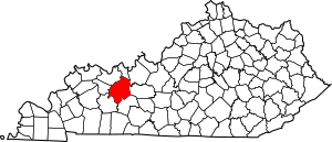
Welcome to Ohio County, Kentucky! This page is all about the special places here that are listed on the National Register of Historic Places. Think of this register as a very important list of buildings, sites, and districts across the United States that are worth saving because of their history or unique features.
In Ohio County, there are 19 places on this list. One of them is so important that it's called a National Historic Landmark, which is an even higher honor! Plus, six other sites are part of a larger National Historic Landmark that stretches across a few counties. Let's explore some of these amazing spots!
Ancient History: Shell Middens
Some of the oldest and most interesting places on the National Register in Ohio County are called "shell middens." These are like ancient trash piles, but they're actually super important archaeological sites! They were created by Native Americans who lived along the Green River thousands of years ago. These piles are mostly made of mussel shells, but they also contain tools, pottery, and even human burials. By studying them, scientists learn a lot about how people lived long, long ago.
Many of these shell midden sites are part of a bigger area called the Green River Shell Middens Archeological District. This district is so important that it's a National Historic Landmark!
Important Shell Midden Sites
- Archeological Site KHC-6 (15OH97): Found near Kirtley, this site is a key part of the Green River Shell Middens Archeological District.
- J.T. Barnard Shell Midden (KHC-1): Located across the Green River from South Carrollton, this is another important site in the district.
- Bowles Site (15OH13): You can find this site on the northern side of the Green River, opposite Rochester. It's also part of the famous shell middens district.
- Chiggerville Site (15OH1): This site is on the right bank of the Green River, a few miles above the Paradise Fossil Plant. It gives us clues about ancient life.
- Indian Knoll: This is a very special archaeological site near Paradise. It's so important that it's a National Historic Landmark all by itself! It has taught us a lot about early Native American cultures.
- Jackson Bluff Site (15OH12): This archaeological site near Rockport is also on the list, though its exact location is kept private to protect it.
- Jimtown Site (15OH19): Located on Jimtown Hill, a couple of miles above Livermore, this site is another piece of the Green River Shell Middens story.
- Smallhous Shell Mound (15OH10): Found on the right bank of the Green River at Smallhous, this mound is also part of the larger shell middens district.
Historic Buildings and Places
Ohio County also has many historic buildings and areas that tell us about more recent times, from the 1800s and 1900s. These places show us how people lived, worked, and gathered in the past.
Hartford's Historic Gems
Hartford, the county seat, has several places on the National Register:
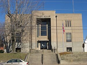
- Downtown Hartford Historic District: This area includes the main streets and Courthouse Square. It's a collection of buildings that show what the town looked like in earlier times. The Ohio County Courthouse is a key building in this district.
- Hartford Seminary: Located on East Center Street, this old seminary building has a long history in education.
- Samuel E. Hill House: This historic house on East Union Street gives us a peek into how people lived in Hartford.
- Old Town Historic District: This district covers another part of Hartford, with historic homes and buildings that show the town's growth. The Walker-Nall-Pirtle House is an example of a building in this district.
- John E. Pendleton House: Another historic home on East Union Street, this house is recognized for its historical value.
- Charles Wallace House: This house in Hartford is also on the list, but its exact address is not shared to protect the property.
Other Notable Buildings
- Ceralvo Masonic Hall and School: This building in Centertown served as both a meeting place for the Masons (a fraternal organization) and a school. It's a great example of community buildings from the past.
- Dundee Masonic Lodge No. 733: Located on Kentucky Route 69 North in Dundee, this lodge building is another example of a historic community gathering place.
- Louisville, Henderson, and St. Louis Railroad Depot: Found in Fordsville, this old train station was once a busy hub for travel and trade. It reminds us of the days when trains were a main way to get around.
- Bill Monroe Farm: Near Rosine, this farm is famous as the home of Bill Monroe, known as the "Father of Bluegrass Music." It's a special place for music history!
- Rosine General Store and Barn: Also in Rosine, this old general store and its barn show what rural life and commerce were like in the past.
These places help us remember and understand the rich history of Ohio County, Kentucky, from ancient times to more recent centuries. They are important parts of our shared heritage!
Images for kids


