National Register of Historic Places listings in Woodford County, Kentucky facts for kids
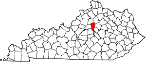
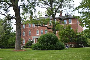
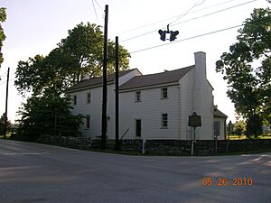
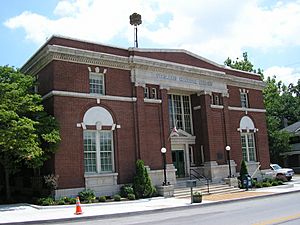
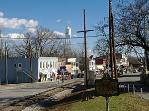
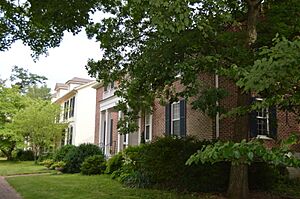
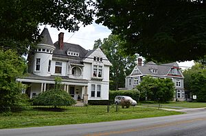
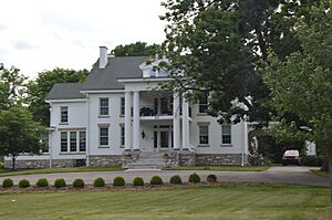
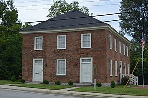
Hey there! Did you know that Woodford County, Kentucky is home to many super old and important places? These spots are so special that they're listed on something called the National Register of Historic Places. Think of it like a Hall of Fame for buildings, areas, and even old sites that tell us a lot about history!
In Woodford County, there are 85 of these amazing places. One of them is even more special and is called a National Historic Landmark. This means it's super important to the history of the whole United States. Let's explore some of these cool historic spots!
Homes with History
Many of the places on the National Register are old houses. These homes often have interesting stories and show us how people lived a long time ago.
Grand Old Houses
- Airy Mount: This old house was added to the list in 1978. It's located southwest of Versailles.
- Alexander Plantation House: Found off Old Frankford Pike near Midway, this house joined the list in 1983.
- John Allen House: You can find this historic home off Kentucky Route 169 in Keene. It was recognized in 1983.
- Arnold-Wooldridge House: South of Versailles, this house became historic in 1979.
- Ayres House: Located on the southern side of U.S. Route 421 near Midway, this house was added in 1994.
- Edward M. Blackburn House: This house on Spring Station Road near Midway was listed in 1985.
- Lucas Broadhead House: At the corner of Midway Pike and Aiken Road in Versailles, this house joined the list in 1994.
- Buck Pond: On Paynes Mill Road in Versailles, this site became historic in 1989.
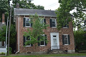
- Carter House:
This house at 110 Morgan Street in Versailles was listed in 1975. It's a great example of old architecture.
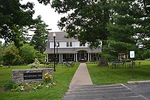
- Cleveland House:
Located at 140 Park Street in Versailles, this house was added in 2007. It's now part of the Woodford Inn.
- Richard Cole Homestead: This homestead is on the southern side of Leestown Road, northwest of Midway. It was recognized in 1994.
- Cooper House: On the northern side of Leestown Road, east of the Midway exit from Interstate 64, this house was listed in 1994.
- Joel DuPuy House:
This house on Griers Creek Road in Tyrone was added in 1983.
- Edgewood: About a mile east of Versailles on U.S. Route 60, Edgewood became historic in 1976.
- Thomas Edwards House and Quarters: Found on Kentucky Route 1659 in Tyrone, this property was listed in 1983.
- Elkwood: At 158 Leestown Pike, West, in Midway, Elkwood was recognized in 1994.
- William Garrett House: This house off Kentucky Route 169 in Keene was added in 1983.
- John Graham House: Southeast of Midway on Weisenberger Mill Road, this house became historic in 1978.
- Robert Guyn, Jr. House: South of Troy on Kentucky Route 33, this house was listed in 1983.
- Ezra Hammon House: Off Kentucky Route 33 in Keene, this house was added in 1983.
- A.T. Harris House: On Big Sink Pike in Versailles, this house was recognized in 1989.
- Hogan Quarters: Off Kentucky Route 33 in Versailles, these quarters were listed in 1983.
- Humphries Estate Quarters: On Kentucky Route 1967 in Versailles, these quarters were added in 1983.
- Dr. William Jennings House: South of Pinckard on Kentucky Route 169, this house was listed in 1983.
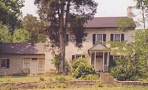
- Capt. Jack Jouett House: About 5 miles southwest of Versailles off Kentucky Route 1964, this house was recognized in 1972. Captain Jack Jouett was a hero during the American Revolution!
- Thomas Lyne House: South of Versailles on Smith Lane, this house became historic in 1980.
- Margaret Hall:
Located at 117 Elm Street in Versailles, Margaret Hall was added in 1987.
- Cyrus McCrackin House and Quarters: Off Steele Road in Tyrone, this property was listed in 1983.
- Miller's House at Mortonsville Mill: On Kentucky Route 1965 in Salvisa, this house was recognized in 1983.
- George F. Moore Place: Off U.S. Route 62 in Versailles, this place was added in 1983.
- Moss Side: Southwest of Versailles on McCowans Ferry Pike, Moss Side became historic in 1979.
- Andrew Muldrow Quarters: On Griers Creek Road in Tyrone, these quarters were listed in 1983.
- Claiborne W. Nuckols Farmstead: On the northern side of U.S. Route 60 in Versailles, this farmstead was recognized in 1994.
- Offutt-Cole Tavern:
North of Versailles on U.S. Route 62, this old tavern was added in 1977. Taverns were like inns or restaurants in the past.
- Lewis Payne House: On Lansing Lane in Midway, this house was listed in 1982.
- Pinkerton Hall: At 650 East Street in Midway, Pinkerton Hall was recognized in 1974.
- Pleasant Lawn: North of Versailles off U.S. Route 62, this property was added in 1978.
- Robertson Place: On Clifton and Steele Roads in Tyrone, this place became historic in 1983.
- Scearce House: On McCracken Pike in Versailles, this house was listed in 1987.
- Stone House at Fisher's Mill: Off U.S. Route 421 in Midway, this stone house was recognized in 1983.
- Stone House on Beale's Run: Off Kentucky Route 1685 in Midway, this house was added in 1983.
- Stone House on Clifton Pike: On Kentucky Route 1964 in Tyrone, this stone house became historic in 1983.
- Stone House on Steele's Grant: Off Kentucky Route 1964 in Tyrone, this house was listed in 1983.
- Stone House on Tanner's Creek: On Carpenter Pike in Salvisa, this house was recognized in 1983.
- E.W. Taylor House: On the eastern side of Midway Pike in Midway, this house was added in 1994.
- Solomon Thomas House: On Craigs Creek Road in Salvisa, this house became historic in 1983.
- W.B. Spring House: Off U.S. Route 62 in Versailles, this house was listed in 1983.
- Samuel Wallace House: On the northern side of Old Frankfort Pike, east of Wallace, this house was recognized in 1994.
- Wallace-Alford Farmstead: On S.S. Weisenberger (Craig's) Mill Road east of Lansing Lane in Midway, this farmstead was added in 1994.
- Welcome Hall: About 4 miles west of Versailles off Clifton Road, Welcome Hall became historic in 1975.
- Benjamin Wilson House: Off U.S. Route 62 in Versailles, this house was listed in 1983.
- Wyndehurst: About 5 miles southwest of Versailles off Kentucky Route 1964, Wyndehurst was recognized in 1978.
Historic Districts and Areas
Sometimes, it's not just one building that's historic, but a whole group of them or a special area!
Neighborhoods and Rural Landscapes
- Big Sink Rural Historic District: West of Midway off Interstate 64, this large area was recognized in 1994. It shows how the land was used long ago.
- Charles Black Farm: On Faywood Road in Versailles, this farm became a historic district in 1989.
- Clifton Country Club: At 1190 Buck Run Road in Versailles, this club was listed as a historic district in 1995.
- Clifton-McCraken Rural Historic District: This area along Clifton and McCraken Pikes and Steele Road in Versailles was added in 1999.
- Downtown Versailles Historic District:
This important area includes both sides of Main Street in Versailles. It was listed in 1975 and shows the town's early look.
- Guyn's Mill Historic District: This district includes Mundy's Landing and Pauls Mill Roads in Troy. It was recognized in 1983.
- Midway Historic District:
This district on U.S. Route 62 in Midway was added in 1978. It preserves the historic feel of the town.
- Morgan Street Historic District:
This district on Morgan Street in Versailles was listed in 1980. It features many old homes.
- Nugent's Crossroad Historic District: At the junction of Midway and Old Frankfort Pikes in Midway, this district was recognized in 1994.
- Paul Family Complex: West of Troy on Paul's Mill Road, this complex became a historic district in 1980.
- Pisgah Rural Historic District: This area northeast of Versailles, bounded by S. Elkhorn Creek, U.S. Route 60, and Big Sink Road, was added in 1989.
- Redd Road Rural Historic District: This area largely south and east of the junction of Redd and Frankfort Roads in Lexington (and extending into Fayette County) was recognized in 1991.
- Rose Hill Historic District:
This district on Rose Hill Avenue in Versailles was listed in 1982.
- Shipp House: This historic district in Midway was added in 1983. Its exact location is restricted for privacy.
- South Main Street Historic District:
This district at 298-321 South Main Street in Versailles was recognized in 1987.
- Wallace Station Historic District: This district at Wallace Station, Old Frankfort Pike, in Midway, was added in 1994.
Other Notable Historic Places
Woodford County has more than just houses and districts!
Churches and Monuments
- Big Spring Church:
This church at 121 Rose Hill Street in Versailles was listed in 1975. It's a beautiful old building.
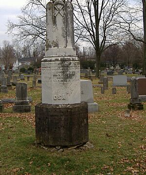
- Confederate Monument in Versailles:
This monument in the City Cemetery in Versailles was added in 1997. It remembers a time in history.
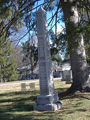
- Martyrs Monument in Midway:
This monument in the City Cemetery in Midway was listed in 1997.
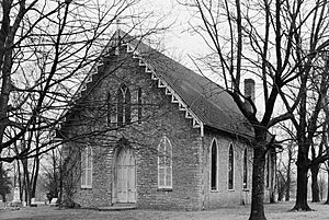
- Pisgah Presbyterian Church:
Off U.S. Route 60 in Versailles, this church was recognized in 1983.
Mills and Industries
- Labrot & Graham Distillery (Woodford Reserve): At 7855 McCracken Pike in Frankfort, this distillery was listed in 1995. It's famous for making bourbon!
- Leavy Tobacco Barn: On the eastern side of Georgetown Road, north of Midway, this barn was added in 1994. Tobacco was a very important crop in Kentucky's history.
- McCrackin Distillery and Mill: On Kentucky Route 1659 in Tyrone, this old distillery and mill were recognized in 1983.
- Weisenberger Mills and Related Buildings: Off U.S. Route 421 in Midway, this mill complex was listed in 1984. It even extends into Scott County!
Other Unique Sites
- Archeological Site 15Wd61: This site near Nonesuch was added in 1982. Its exact address is kept secret to protect it. Archeological sites are places where scientists find old tools, buildings, or other things that tell us about people who lived long ago.
- Bullock Site: This site near Versailles was listed in 2005. Like other archeological sites, its address is restricted.
- Marquis Calmes Tomb: On Paynes Mill Road in Versailles, this tomb was recognized in 1989.
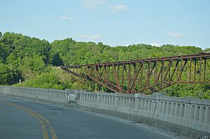
- Lexington Extension of the Louisville Southern Railroad:
This old railroad line from eastern Lawrenceburg to Milner was listed in 2004. It even goes into Anderson County.
- Munday's Landing: On Munday's Landing Road, south of Versailles on the Kentucky River, this spot was added in 1975. It was likely an important place for boats and trade in the past.
- Versailles Elementary School: At 299 South Main Street in Versailles, this school was listed in 2015. It's now the Safe Harbor Academy.
Former Listing
Sometimes, a place might be removed from the National Register if it changes too much or is moved.
- John Jordan Crittenden Birthplace Cabin: This cabin, the birthplace of famous politician John J. Crittenden, was once on the Register in 1972. It was located on US 60 in Versailles. However, it was moved and restored in 1978, so it was removed from the list.


