Regions of Pennsylvania facts for kids
Pennsylvania is a big state in the United States, and it's divided into different areas called regions. Each region has its own special features, like mountains, rivers, or unique cultures. Let's explore some of these interesting parts of Pennsylvania!
Contents
Lehigh Valley: A Growing Area
The Lehigh Valley gets its name from the Lehigh River that flows through it. This region is home to Allentown, which is the third-largest city in Pennsylvania. Nearby cities like Bethlehem and Easton are also part of this area, along with smaller towns and countryside.
Long ago, the Lehigh Valley was famous for making heavy goods like steel. Today, its economy is much more varied, and it's one of the fastest-growing parts of the state.
This region includes two counties in eastern Pennsylvania:
- Lehigh County
- Northampton County
- Population (2020): 687,508 people live here.
Southeastern Pennsylvania: Big Cities and Farmland
This part of Pennsylvania is busy with big cities and also has lots of farms.
Delaware Valley: Home to Philadelphia
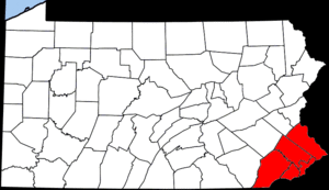
The Delaware Valley is named after the Delaware River. This river is very important to the region. The biggest city in Pennsylvania, Philadelphia, is right in the middle of the Delaware Valley. Philadelphia is also the sixth-largest city in the entire United States!
This region includes six Pennsylvania counties:
- Berks
- Bucks
- Chester
- Delaware
- Montgomery
- Philadelphia
- Population (2020): About 6.245 million people live in the Delaware Valley.
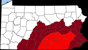
Pennsylvania Piedmont: Farming Heartlands
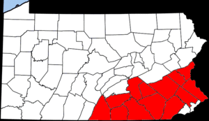
Pennsylvania's Piedmont region is a very important farming area. It's part of a larger flat area called the Piedmont Plateau.
This region includes seven Pennsylvania counties:
Pennsylvania Dutch Country: A Unique Culture
The Pennsylvania Dutch Country is a special area known for its many Amish and Mennonite residents. These groups often live simpler lives and have unique traditions. The Pennsylvania Dutch language was once very common here. Many Amish people in the state still speak it today.
This region includes these counties:
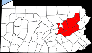
Northeastern Pennsylvania: Mountains and Coal History
This part of Pennsylvania is known for its mountains and its history with coal mining.
Northeastern Pennsylvania: A Large Mountainous Area
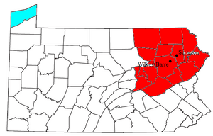
This large, mountainous area includes the Pocono Mountains and the Endless Mountains. It also has many cities and towns that were once important for anthracite coal mining.
Northeastern Pennsylvania is made up of 14 counties:
- Bradford County
- Carbon County
- Columbia County
- Lackawanna County
- Luzerne County
- Monroe County
- Montour County
- Northumberland County
- Pike County
- Schuylkill County
- Sullivan County
- Susquehanna County
- Wayne County
- Wyoming County
The Poconos: A Fun Getaway
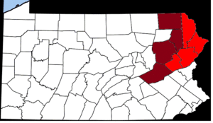
The Poconos are a mountain region in Northeastern Pennsylvania. They cover about 2,400 square miles. The Poconos are a very popular place for vacations. In winter, people love to go skiing and snowboarding. In other seasons, they enjoy hiking, kayaking, and tubing.
The main Poconos region includes four Pennsylvania counties:
Some other counties are sometimes considered part of the Poconos too:
Coal Region: Where Anthracite Was King
The Coal Region is a special area in Northeastern Pennsylvania. It's located in the central Appalachian Mountains. This region has the largest known deposits of anthracite coal in the world. There are an estimated seven billion tons of this valuable coal here!
Counties in the Coal Region include:
Wyoming Valley: Cities in a Crescent Shape
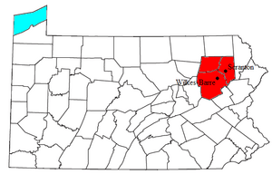
The Wyoming Valley is a crescent-shaped area in Northeastern Pennsylvania. It's part of the ridge-and-valley section of the Appalachians. This region includes the cities of Scranton and Wilkes-Barre.
The Wyoming Valley includes these counties:
Endless Mountains: A Plateau of Hills
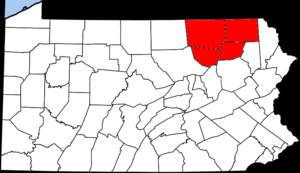
The Endless Mountains are a chain of hills in Northeastern Pennsylvania. They are part of the larger Appalachian Mountains chain. Even though they are called "mountains," they are actually a high, flat area that has been carved by rivers, making it look like many hills. This area is part of the Allegheny Plateau.
Counties in the Endless Mountains include:
Northern Tier: Pennsylvania's Top Edge
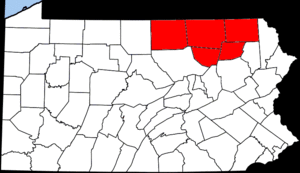
The Northern Tier is a geographic region located at the northern edge of Pennsylvania.
This region includes these counties:
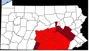
Central Pennsylvania: The Heart of the State
Central Pennsylvania is a large and varied region in the middle of the state.
Susquehanna River Valley: A Long River's Journey
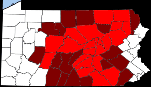
The Susquehanna River flows through the Northeastern United States. It's about 410 miles long, making it the longest river on the East Coast. The Susquehanna Valley region follows this important river.
South Central Pennsylvania: A Mix of Life
South Central Pennsylvania is a region that includes a mix of cities, towns, and rural areas.
It often includes these counties:
Sometimes, these counties are also included:
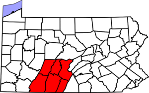
Southern Alleghenies: West Central Mountains
The Southern Alleghenies is a region in West Central Pennsylvania. It's named after the Allegheny Mountains.
This region includes these counties:
Happy Valley: Home of Penn State
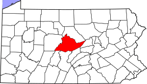
Happy Valley is a large valley located in central Pennsylvania. It's famous for being the home of Pennsylvania State University, a very large college.
This region mainly includes one county:
Cumberland Valley: Between Two Mountains
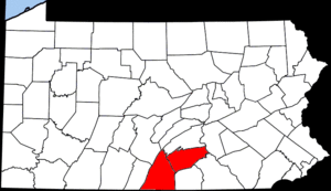
The Cumberland Valley is a geographic region that sits between two mountain ranges: South Mountain and the Blue Ridge Mountains. It stretches across parts of Central Pennsylvania and Western Maryland.
This region includes these counties:
Western Pennsylvania: From Cities to Forests
Western Pennsylvania has big cities and also large natural areas like forests.
Laurel Highlands: Scenic Mountain Ridges
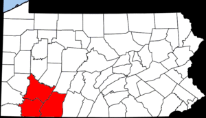
The Laurel Highlands are in the southwestern part of Pennsylvania. This region crosses the Laurel and Chestnut ridges, which are part of the Allegheny Mountains. It's known for its beautiful scenery.
This region includes these counties:
Greater Pittsburgh: The Steel City's Area

Also known as Southwestern Pennsylvania, this region is centered around Pittsburgh, a major city once famous for its steel industry.
The Greater Pittsburgh region includes these counties:
Allegheny National Forest: A Vast Woodland
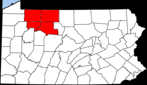
The Allegheny National Forest is a large forest located in northwestern Pennsylvania. It covers more than 500,000 acres of land, offering lots of space for nature and outdoor activities.
This region includes these counties:
Northwestern Pennsylvania: Near the Great Lakes

Northwestern Pennsylvania is the part of the state closest to Lake Erie, one of the Great Lakes.
This region includes these counties:


