Wiltshire facts for kids
Quick facts for kids
Wiltshire
|
|||||||||||||||||||||||||||||||||||||||||||||||||||
|---|---|---|---|---|---|---|---|---|---|---|---|---|---|---|---|---|---|---|---|---|---|---|---|---|---|---|---|---|---|---|---|---|---|---|---|---|---|---|---|---|---|---|---|---|---|---|---|---|---|---|---|
|
|
|||||||||||||||||||||||||||||||||||||||||||||||||||
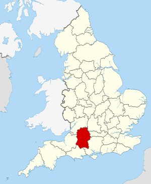
Wiltshire within England
|
|||||||||||||||||||||||||||||||||||||||||||||||||||
| Sovereign state | United Kingdom | ||||||||||||||||||||||||||||||||||||||||||||||||||
| Constituent country | England | ||||||||||||||||||||||||||||||||||||||||||||||||||
| Region | South West | ||||||||||||||||||||||||||||||||||||||||||||||||||
| Established | Ancient | ||||||||||||||||||||||||||||||||||||||||||||||||||
| Time zone | UTC±00:00 (Greenwich Mean Time) | ||||||||||||||||||||||||||||||||||||||||||||||||||
| • Summer (DST) | UTC+01:00 (British Summer Time) | ||||||||||||||||||||||||||||||||||||||||||||||||||
| Members of Parliament | List of MPs | ||||||||||||||||||||||||||||||||||||||||||||||||||
| Police | Wiltshire Police | ||||||||||||||||||||||||||||||||||||||||||||||||||
|
|||||||||||||||||||||||||||||||||||||||||||||||||||
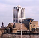
Wiltshire (often called Wilts) is a county in South West England. It shares borders with Gloucestershire, Oxfordshire, Berkshire, Hampshire, Dorset, and Somerset. The biggest town is Swindon. The county town, where the main offices are, is Trowbridge.
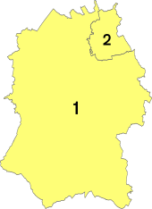
Wiltshire covers about 3,485 km2 (1,346 square miles). Around 720,060 people live here. Most of the county is countryside. The central and south-western parts have fewer people. After Swindon (with over 183,000 people), the largest places are Salisbury (a city with about 41,000 people), Chippenham (about 37,000 people), and Trowbridge (about 37,000 people). For local government, Wiltshire is split into two main areas: Swindon and Wiltshire.
Much of the county has rolling chalk downlands. These include the North Wessex Downs in the east, Salisbury Plain in the middle, and Cranborne Chase in the south. The north-west is part of the Cotswolds, which is a limestone area. Wiltshire has two main rivers, both called the Avon. The northern Avon flows from the north-west towards Bradford-on-Avon. The southern Avon starts on Salisbury Plain and flows through Salisbury into Hampshire.
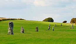
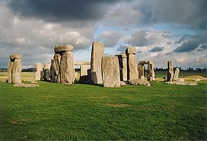
Salisbury Plain is famous for its ancient sites. These include the Stonehenge and Avebury stone circles. They are so important that they are a UNESCO World Heritage Site. A large part of Salisbury Plain is used by the British Army for training. The city of Salisbury is known for its beautiful medieval cathedral. You can also visit large country houses like Longleat, which has a safari park, and Stourhead, owned by the National Trust.
Contents
- What's in a Name? The History of "Wiltshire"
- Wiltshire's Past: A Journey Through Time
- Wiltshire's Natural Beauty: Land and Wildlife
- Wiltshire's Weather: A Mild Climate
- Wiltshire's Economy: How People Make a Living
- Learning in Wiltshire: Schools and Colleges
- Wiltshire's People: Population and Demographics
- Sports in Wiltshire: Football, Cricket, and More
- Wiltshire's Towns and City
- Media in Wiltshire: News and Entertainment
- Fun Places to Visit in Wiltshire
- Getting Around Wiltshire: Transport Links
- See also
What's in a Name? The History of "Wiltshire"
The name Wiltshire comes from the old county town of Wilton. In the 9th century, it was written as Wiltunscir.
Wiltshire's Past: A Journey Through Time
Wiltshire is very famous for its ancient history, even before the Romans arrived. People from the Mesolithic, Neolithic, and Bronze Age periods lived on the hills and downlands here. Stonehenge and Avebury are two of the most well-known Neolithic sites in the UK.
In the 6th and 7th centuries, Wiltshire was on the western edge of Saxon Britain. The Danes invaded the county in 878. After the Norman Conquest in 1066, much of the land became owned by the king and the church.
During the Domesday Survey (a big survey of England in 1086), farming was the main activity in Wiltshire. There were many mills, and even vineyards. Later, sheep farming became very important. Monasteries like Stanley Abbey sold wool to markets in Italy and Belgium.
In the 17th century, during the English Civil War, most people in Wiltshire supported the Parliament (they were called Parliamentarians). A big battle, the Battle of Roundway Down, was fought near Devizes. The Royalists won this battle.
In 1794, a group of local soldiers called the Yeomanry was formed in Wiltshire. They later became the Royal Wiltshire Yeomanry and served bravely in wars like the Boer War and both World Wars. Today, parts of this group are still active as squadrons in the Royal Wessex Yeomanry.
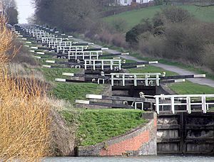
Around 1800, the Kennet and Avon Canal was built. This canal helped transport goods from Bristol to London. It was used until the Great Western Railway was built.
You can find out more about Wiltshire's 261 local parishes on the Wiltshire Council's Wiltshire Community History website. It has maps, facts about people, and old and new pictures.
People from Wiltshire are sometimes called "Moonrakers". This nickname comes from an old story about smugglers. They hid their illegal alcohol in a village pond. When customs officers came, the smugglers pretended to be trying to rake in the reflection of the full moon, saying it was a big cheese. The officers thought they were silly and left them alone. This allowed the smugglers to continue their illegal work. Many villages claim this story, but it's most often linked to The Crammer pond in Devizes.
Wiltshire's Natural Beauty: Land and Wildlife
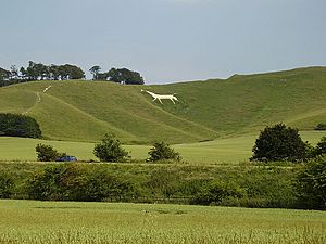
Wiltshire is mostly a rural county. Two-thirds of it sits on chalk, which is a soft, white, porous rock. This chalk forms high chalk downland landscapes. This chalk is part of a larger system of chalk hills across southern England. The biggest chalk area in Wiltshire is Salisbury Plain. It's mainly used for farming and as training areas for the British Army. The highest point in the county is the Tan Hill–Milk Hill ridge, which is 295 m (968 ft) above sea level.
The chalk uplands extend north-east into West Berkshire as the Marlborough Downs. They also go south-west into Dorset as Cranborne Chase. Both Cranborne Chase and Salisbury Plain have many ancient Stone Age and Bronze Age sites. The Marlborough Downs are part of the North Wessex Downs AONB (Area of Outstanding Natural Beauty). This is a 1,730 km2 (670-square-mile) protected area.
In the north-west, near South Gloucestershire and Bath and North East Somerset, the ground is made of oolite limestone. This area is part of the Cotswolds. A part of the Cotswolds AONB is also in Wiltshire.
Between the chalk and limestone hills are clay valleys. The largest is the Avon Vale. The River Avon flows through Bradford-on-Avon and then towards Bath and Bristol. The Vale of Pewsey cuts through the chalk in the middle of the county. In the south-west is the Vale of Wardour. The south-east of the county has sandy soils, which are part of the northern New Forest.
Chalk is a porous rock, meaning water sinks into it easily. So, the chalk hills have little surface water. This is why most towns are built where there is water. For example, Salisbury is located between the chalk of Salisbury Plain and marshy flood plains.
Protecting the Landscape: Green Belt Areas
Wiltshire has a special "green belt" area, mostly on its western side. This is part of the larger Avon Green Belt. It helps stop towns like Trowbridge from growing too much and protects the villages and towns around Bath.
Wiltshire's Weather: A Mild Climate
Like the rest of South West England, Wiltshire has a mild climate. It's generally wetter and milder than counties further east. The average yearly temperature is about 10 °C (50.0 °F). While the sea influences the weather, it's less strong than in counties closer to the coast. July and August are the warmest months, with average high temperatures around 22 °C (71.6 °F). In winter, average low temperatures are about 1 °C (33.8 °F) or 2 °C (35.6 °F), and frost is common.
In summer, high pressure from the Azores affects the south-west. However, clouds can form inland, reducing sunshine hours. The county gets slightly less sunshine than the regional average of 1,600 hours per year.
Most rain in the south-west comes from Atlantic depressions or from air rising over hills. Autumn and winter are the rainiest seasons because Atlantic depressions are most active then. While any month can be the wettest or driest, it's more likely to rain a lot between October and March. In summer, more rain comes from thunderstorms caused by the sun heating the ground. The northern part of Wiltshire often gets more showers in summer. In autumn and winter, the sea is warmer than the air, which can lead to more rain in the south of the county, like Salisbury. The average rainfall for Wiltshire is about 800 mm (31 in). Drier areas get around 700mm, and the wettest areas get about 900mm. It typically snows for 8–15 days a year. Winds are strongest from November to March and lightest from June to August. The wind usually blows from the south-west.
Wiltshire's Economy: How People Make a Living
Wiltshire's economy is strong because it's located near the "M4 corridor" (a busy area for businesses) and because its countryside and towns are very attractive. The northern part of the county is generally richer. Swindon is home to many large companies like Intel, Motorola, WHSmith, and Nationwide. Dyson is located nearby in Malmesbury.
Wiltshire has more people working in manufacturing than the national average. This includes making electrical equipment, food and drinks, furniture, rubber, pharmaceuticals, and plastic goods.
Also, many people work in public administration and defence. This is because of the military bases around the county, especially near Amesbury and Corsham. There are large British Army barracks at Tidworth, Bulford, and Warminster. The Royal School of Artillery is at Larkhill. RAF Lyneham was a big air transport base until 2011. Now, the MoD Lyneham site is used for Army technical training. Wiltshire also has a high number of working-age people who are employed, and low unemployment rates.
Learning in Wiltshire: Schools and Colleges
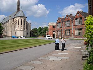
Wiltshire has 30 publicly funded secondary schools. The biggest is Warminster Kingdown. There are also eleven independent secondary schools, including Marlborough College, St Mary's Calne, and Dauntsey's near Devizes. Most county schools are comprehensives, meaning they accept students of all abilities. However, Salisbury still has two grammar schools (South Wilts Grammar School and Bishop Wordsworth's School) and three non-selective schools.
There are four further education colleges where students can continue their studies after school: New College (Swindon), Wiltshire College (with campuses in Chippenham, Trowbridge, and Salisbury), Salisbury Sixth Form College, and Swindon College. Wiltshire also has a University Technical College, UTC Swindon, which focuses on engineering.
Wiltshire is one of the few English counties without its own university. The closest university to Trowbridge is the University of Bath. However, Bath Spa University has a center at Corsham Court in Corsham. Oxford Brookes University has a small campus in Swindon. Swindon is the second-largest population center in the UK without its own university.
The headquarters for Service Children's Education (which supports children of military families) is in Upavon, Wiltshire.
Wiltshire's People: Population and Demographics
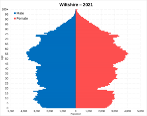
In the 2011 Census, Wiltshire had a population of 680,137 people. Wiltshire (not including Swindon) has a low population density of 1.4 people per hectare. This is much lower than the average for England, which is 4.1 people per hectare.
| Wiltshire | Swindon | Total | |
|---|---|---|---|
| Usual resident population | 470,981 | 209,156 | 680,137 |
| Age 65 or over | 18.1% | 13.7% | 16.8% |
| Density (persons per hectare) | 1.4 | 9.1 | 2.0 |
| Households | 194,194 | 88,360 | 282,554 |
Here's how Wiltshire's population has grown over time:
| 1801 | 1851 | 1901 | 1951 | 2001 |
|---|---|---|---|---|
| 185,107 | 254,221 | 271,394 | 386,692 | 613,024 |
Sports in Wiltshire: Football, Cricket, and More
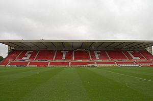
Wiltshire has one professional football club, Swindon Town. They play at the County Ground in Swindon. They joined the Football League in 1920 and have been in it ever since. Some of their biggest achievements include winning the Football League Cup in 1969 and getting promoted to the Premier League in 1993.
Chippenham Town is the highest-ranked non-league football club in the area. They play in the National League South. After Salisbury City closed down in 2014, a new club, Salisbury, was formed in 2015. They will also play in the National League South for the 2024/25 season.
The Wiltshire County Cricket Club plays in the Minor Counties league.
The Swindon Robins Speedway team used to race at the Blunsdon Abbey Stadium near Swindon since 1949. They stopped racing in 2020 and announced in 2022 that they would not return. The Swindon Wildcats play in the English Premier Ice Hockey League, which is the second level of British ice hockey. They play their home games at Swindon's Link Centre.
Wiltshire's Towns and City
Wiltshire has twenty-one towns and one city:
- Amesbury
- Bradford-on-Avon
- Calne
- Chippenham
- Corsham
- Cricklade
- Devizes
- Highworth (part of Swindon)
- Larkhill
- Ludgershall
- Malmesbury
- Marlborough
- Melksham
- Mere
- Royal Wootton Bassett
- Salisbury (city)
- Swindon (a separate local authority area)
- Tidworth
- Trowbridge
- Warminster
- Westbury
- Wilton
You can find a full list of places in Wiltshire at List of places in Wiltshire.
Media in Wiltshire: News and Entertainment
Local TV news for Wiltshire is provided by BBC West and ITV West Country. However, Swindon and Salisbury also get news from BBC South and ITV Meridian.
The county's local radio stations include BBC Radio Wiltshire, Heart West, Greatest Hits Radio South West, and Greatest Hits Radio South (for Salisbury and nearby areas).
County-wide local newspapers are the Gazette and Herald and Wiltshire Times.
Fun Places to Visit in Wiltshire
| Key | |
| Owned by the National Trust | |
| Owned by English Heritage | |
| Owned by the Forestry Commission | |
| A Country Park | |
| An Accessible open space | |
| Museum (free) | |
| Museum (charges entry fee) | |
| Heritage railway | |
| Historic House | |
Here are some interesting places to visit in Wiltshire:
- Arc Theatre, at the Trowbridge campus of Wiltshire College

- Ashcombe House

- Avebury, a Neolithic stone circle

- Avebury Manor and Garden

- Avon Valley Path

- Barbury Castle

- Bentley Wood

- Bowood House

- Caen Hill Locks, Devizes
- Castle Combe village
- Castle Hill, Mere

- Central Government War Headquarters, Corsham, an underground nuclear bunker
- Cherhill White Horse
- Chisbury Chapel

- Coate Water, East Swindon

- Corsham Court

- Cotswold Water Park
- The Courts Garden, Holt
- Crofton Pumping Station
- Edington Priory

- Fonthill Abbey

- Great Chalfield Manor
- Iford Manor and gardens

- Kennet and Avon Canal Museum, Devizes

- Kennet Avenue, Avebury

- King Alfred's Tower, Stourhead
- Lacock Abbey


- Lacock village, largely owned by the National Trust

- Littlecote House

- Longleat Safari Park


- Ludgershall Castle
- Lydiard Park & House, West Swindon


- Malmesbury Abbey

- Maud Heath's Causeway, near Chippenham
- Mompesson House, Salisbury
- Old Sarum, the site of the former cathedral

- Philipps House & Dinton Park
- Richard Jefferies Birthplace and Museum, near Swindon

- REME Museum

- River Thames

- Salisbury Cathedral

- The Salisbury Museum

- Science Museum library and archives, Wroughton
- Shearwater Lake
- Silbury Hill
- Stonehenge
- Stourhead
- Swindon and Cricklade Railway

- Swindon Steam Railway Museum

- Trafalgar House

- Wardour Castle

- West Kennet Long Barrow

- Westbury White Horse
- Westwood Manor

- Woodhenge

- Wilton House

- Wilton Windmill
- Wilts & Berks Canal
- Wiltshire Museum, Devizes

- Win Green Down


Areas of countryside in Wiltshire include:
- Cranborne Chase

- Marlborough Downs

- Salisbury Plain

- Vale of Pewsey

Getting Around Wiltshire: Transport Links
Roads: Connecting Wiltshire
Many roads run through Wiltshire. These include ancient routes like The Ridgeway and Roman roads such as the Fosse Way, the London to Bath road, and Ermin Way. Modern routes like National Cycle Route 4 and the Thames Path (a long walking trail) also cross the county.
Key roads in Wiltshire include:
- A4 road
- M4 motorway / M4 Corridor
- A303 trunk road
- A350 road
- A417 road
Waterways: Canals and Rivers
Navigable waterways in Wiltshire include:
Canals that are being restored for use again:
- Thames and Severn Canal
- North Wilts Canal
- Wilts & Berks Canal
Railways: Train Travel in Wiltshire
Three main railway lines with passenger services cross Wiltshire:
- Great Western Main Line (serving Swindon and Chippenham)
- Wessex Main Line (serving Bradford-on-Avon, Melksham, Trowbridge, Westbury, Warminster, Salisbury; also connects to Chippenham)
- West of England line (serving Salisbury and Tisbury)
Other train routes include:
- Reading to Taunton Line
- Heart of Wessex Line
- Golden Valley Line
- South Wales Main Line
The main stations where lines meet are Salisbury and Westbury. Important junctions are also found at Swindon, Chippenham, and Trowbridge.
There is also the Swindon and Cricklade Railway in the Thames Valley, which is a heritage railway.
Wiltshire has good train connections, with 14 stations. However, some towns like Calne, Marlborough, and Devizes do not have train stations. For these towns, you can often buy one ticket that covers both the bus and train journey.
Air Travel: Airports Near Wiltshire
Airfields in Wiltshire include Old Sarum Airfield and Clench Common Airfield. RAF Lyneham was a major air transport base for the British forces until it closed in 2012. For scheduled flights, airports near Wiltshire include Bournemouth Airport, Bristol Airport, Cardiff Airport, Exeter Airport, Gloucestershire Airport, Oxford Airport, Heathrow Airport, and Southampton Airport.
See also
 In Spanish: Wiltshire para niños
- List of hills of Wiltshire
- List of rivers of Wiltshire
- List of schools in Wiltshire
- List of settlements in Wiltshire by population
- Economy of Wiltshire
- History of Wiltshire
- Avon Green Belt


