List of Georgia state parks facts for kids
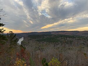
Georgia is a state in the southeastern United States. It has many amazing places to visit, including state parks and historic sites. These areas are managed by the state to protect nature and important historical spots.
The park system in Georgia started in 1931. Two of the first parks were Indian Springs State Park and Vogel State Park. Indian Springs is very old, possibly the oldest state park in the U.S., as it has been a public park since 1825! The newest state park is Don Carter State Park.
After 2008, Georgia faced some money problems. The state decided to cut the budget for its parks and historic sites. Five of these parks are now managed by a private company called Coral Hospitality. These parks are Amicalola Falls State Park & Lodge, Unicoi State Park & Lodge, Little Ocmulgee State Park & Lodge, Georgia Veterans State Park, and George T. Bagby State Park.
Contents
Georgia's State Parks: Explore Nature!
Georgia's state parks offer many ways to enjoy the outdoors. You can hike, camp, fish, and see beautiful landscapes. Each park has its own special features, from waterfalls to lakes.
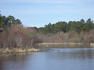
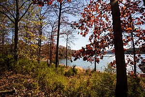
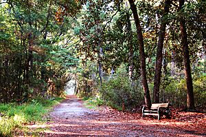
| Park Name | County | Size | Year Opened | Location | Water Body | Image | Cool Facts | |
|---|---|---|---|---|---|---|---|---|
| acres | ha | |||||||
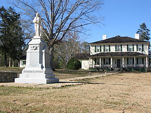
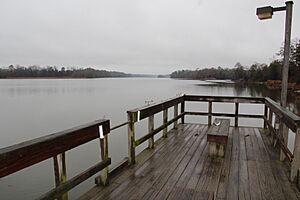
| A.H. Stephens State Park | Taliaferro | 1,177 | 476 | 1933 | 33°33′44.16″N 82°53′44.56″W / 33.5622667°N 82.8957111°W | Alexander Stevens State Park Lake | ||
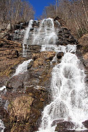
| Amicalola Falls State Park & Lodge | Dawson | 829 | 335 | 1940 | 34°34′34.11″N 84°14′10.5″W / 34.5761417°N 84.236250°W | Amicalola Falls | ||
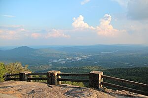
| Black Rock Mountain State Park | Rabun | 1,743 | 705 | 1952 | 34°54′34″N 83°24′55″W / 34.90944°N 83.41528°W | Black Rock Lake | ||
| Chattahoochee Bend State Park | Coweta | 2,910 | 1,180 | 2011 | 33°25′58.05″N 84°59′10.13″W / 33.4327917°N 84.9861472°W | Chattahoochee River | ||
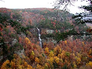
| Cloudland Canyon State Park | Dade | 3,488 | 1,412 | 1938 | 34°48′57.96″N 85°29′21.12″W / 34.8161000°N 85.4892000°W | Hemlock Falls | ||
| Crooked River State Park | Camden | 500 | 200 | 1939 | 30°50′35″N 81°33′29″W / 30.84306°N 81.55806°W | Intracoastal Waterway | ||
| Don Carter State Park | Hall | 1,316 | 533 | 2013 | 34°23′5.44″N 83°44′35.68″W / 34.3848444°N 83.7432444°W | Lake Lanier | ||
| Elijah Clark State Park | Lincoln | 447 | 181 | 1953 | 33°51′16.2″N 82°25′10.54″W / 33.854500°N 82.4195944°W | Clarks Hill Lake | ||
| F. D. Roosevelt State Park | Harris, Meriwether | 9,049 | 3,662 | 1938 | 32°49′55″N 84°48′29″W / 32.83194°N 84.80806°W | |||
| Florence Marina State Park | Stewart | 173 | 70 | 1985 | 32°5′26.88″N 85°2′35.99″W / 32.0908000°N 85.0433306°W | Walter F. George Lake | ||
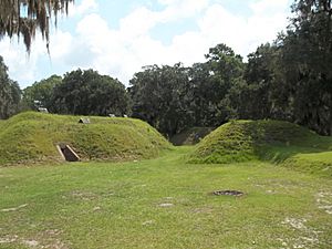
| Fort McAllister State Park | Bryan | 1,725 | 698 | 1980 | 31°53′28″N 81°11′46″W / 31.89111°N 81.19611°W | Ogeechee River & Atlantic Ocean | ||
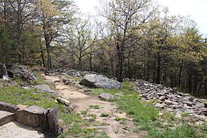
| Fort Mountain State Park | Murray | 3,712 | 1,502 | 1938 | 34°45′39.3″N 84°42′25.8″W / 34.760917°N 84.707167°W | Fort Mountain Lake | ||
| Fort Yargo State Park | Barrow | 1,816 | 735 | 1954 | 33°58′10.64″N 83°43′46.6″W / 33.9696222°N 83.729611°W | Fort Yargo Lake | ||
| General Coffee State Park | Coffee | 1,511 | 611 | 1970 | 31°31′26.4″N 82°46′1.2″W / 31.524000°N 82.767000°W | |||
| George L. Smith State Park | Emanuel | 1,634 | 661 | 1975 | 32°33′43.2″N 82°6′46.8″W / 32.562000°N 82.113000°W | Parish Pond | ||
| George T. Bagby State Park | Clay | 700 | 280 | 1970 | 31°39′57.6″N 85°3′25.2″W / 31.666000°N 85.057000°W | Walter F. George Lake | ||
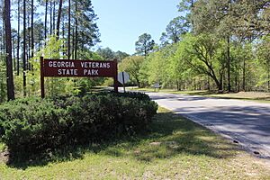
| Georgia Veterans State Park | Crisp | 1,308 | 529 | 1946 | 31°57′23″N 83°54′58″W / 31.95639°N 83.91611°W | Lake Blackshear | ||
| Jack Hill State Park | Tattnall | 662 | 268 | 1956 | 32°5′31.51″N 82°8′9.61″W / 32.0920861°N 82.1360028°W | Altamaha River | ||
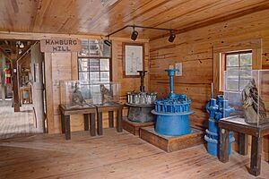
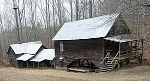
| Hamburg State Park | Warren | 741 | 300 | 1968 | 33°12′28.37″N 82°47′20.05″W / 33.2078806°N 82.7889028°W | Hamburg Mill Pond | ||
| Hard Labor Creek State Park | Morgan | 5,804 | 2,349 | 1946 | 33°39′49.88″N 83°36′22.15″W / 33.6638556°N 83.6061528°W | Hard Labor Creek | ||
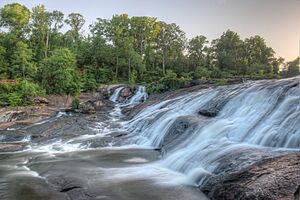
| High Falls State Park | Monroe | 1,050 | 420 | 1966 | 33°10′44.31″N 84°1′10.73″W / 33.1789750°N 84.0196472°W | Towaliga River | ||
| Indian Springs State Park | Butts | 528 | 214 | 1825 | 33°14′38″N 83°55′52″W / 33.24389°N 83.93111°W | Sandy Creek | ||
| James H. Floyd State Park | Chattooga | 561 | 227 | 1973 | 34°26′13.83″N 85°20′22.47″W / 34.4371750°N 85.3395750°W | Sloppy Floyd Lake | ||
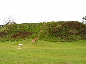
| Kolomoki Mounds State Park | Early | 1,293 | 523 | 1938 | 31°28′17.28″N 84°55′45.72″W / 31.4714667°N 84.9293667°W | Yahola & Kolomoki Lakes | ||
| Laura S. Walker State Park | Ware | 626 | 253 | 1941 | 31°8′10.67″N 82°12′36.3″W / 31.1362972°N 82.210083°W | Laura S. Walker Lake | ||
| Little Ocmulgee State Park & Lodge | Telfair | 1,360 | 550 | 1935 | 32°5′32.17″N 82°53′49.11″W / 32.0922694°N 82.8969750°W | Little Ocmulgee Lake | ||
| Magnolia Springs State Park | Jenkins | 1,070 | 430 | 1939 | 32°53′12″N 81°57′20″W / 32.88667°N 81.95556°W | Magnolia Springs State Park Lake | ||
| Mistletoe State Park | Columbia | 1,920 | 780 | 1965 | 33°38′37.56″N 82°23′2.7″W / 33.6437667°N 82.384083°W | Clarks Hill Lake | ||
| Moccasin Creek State Park | Rabun | 32 | 13 | 1966 | 34°49′36.84″N 83°33′18.36″W / 34.8269000°N 83.5551000°W | Lake Burton | ||
| Panola Mountain State Park | Henry | 1,635 | 662 | 1974 | 33°38′7″N 84°10′13″W / 33.63528°N 84.17028°W | Alexander Lake & South River | ||
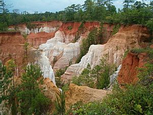
| Providence Canyon State Outdoor Recreation Area | Stewart | 1,003 | 406 | 1971 | 32°3′47.44″N 84°55′11.58″W / 32.0631778°N 84.9198833°W | |||
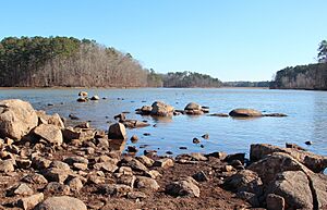
| Red Top Mountain State Park | Bartow | 1,776 | 719 | 1950 | 34°9′5.4″N 84°42′55.8″W / 34.151500°N 84.715500°W | Lake Allatoona | ||
| Reed Bingham State Park | Colquitt | 1,613 | 653 | 1958 | 31°10′14.49″N 83°33′16.98″W / 31.1706917°N 83.5547167°W | Reed Bingham Lake | ||
| Richard B. Russell State Park | Elbert | 2,508 | 1,015 | 1987 | 34°10′41.09″N 82°45′40.89″W / 34.1780806°N 82.7613583°W | Russell Lake | ||
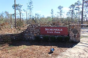
| Seminole State Park | Seminole | 604 | 244 | 1956 | 30°48′18.61″N 84°52′44.2″W / 30.8051694°N 84.878944°W | Lake Seminole | ||
| Skidaway Island State Park | Chatham | 588 | 238 | 1975 | 31°56′13.41″N 81°3′7.98″W / 31.9370583°N 81.0522167°W | Intracoastal Waterway | ||
| Smithgall Woods State Park | White | 5,664 | 2,292 | 1994 | 34°41′30.57″N 83°46′4.71″W / 34.6918250°N 83.7679750°W | Dukes Creek | ||
| Standing Boy Creek State Park | Muscogee | 1,579 | 639 | 2004 | 32°34′20.33″N 85°2′10.77″W / 32.5723139°N 85.0363250°W | Lake Oliver | ||
| Stephen C. Foster State Park | Charlton | 80 | 32 | 1954 | 30°49′35.86″N 82°22′45.9″W / 30.8266278°N 82.379417°W | Suwannee River | ||
| Sweetwater Creek State Park | Douglas | 2,549 | 1,032 | 1972 | 33°45′30″N 84°38′10″W / 33.75833°N 84.63611°W | Sweetwater Creek | ||
| Tallulah Gorge State Park | Rabun, Habersham | 2,739 | 1,108 | 1993 | 34°43′30″N 83°22′13″W / 34.72500°N 83.37028°W | Tallulah River | ||
| Tugaloo State Park | Franklin | 393 | 159 | 1965 | 34°29′41.37″N 83°4′4.54″W / 34.4948250°N 83.0679278°W | Lake Hartwell | ||
| Unicoi State Park & Lodge | White | 1,050 | 420 | 1954 | 34°43′22.92″N 83°43′20.28″W / 34.7230333°N 83.7223000°W | Unicoi Lake | ||
| Victoria Bryant State Park | Franklin | 502 | 203 | 1952 | 34°18′4.23″N 83°9′35.52″W / 34.3011750°N 83.1598667°W | North Fork of the Broad River | ||
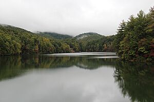
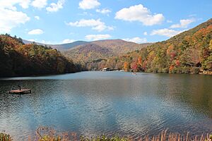
| Vogel State Park | Union | 233 | 94 | 1927 | 34°45′46″N 83°55′40″W / 34.76278°N 83.92778°W | Lake Trahlyta | ||
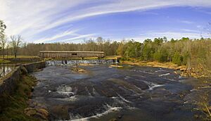
| Watson Mill Bridge State Park | Madison | 1,118 | 452 | 1969 | 34°1′34″N 83°4′23″W / 34.02611°N 83.07306°W | South Fork of the Broad River | ||
Georgia's Historic Sites: Step Back in Time
Georgia also protects many historic sites. These places help us learn about the past, from ancient Native American cultures to important events in American history.
| Site Name | County | Size | Year Opened | Location | Image | Cool Facts | |
|---|---|---|---|---|---|---|---|
| acres | ha | ||||||
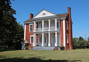
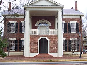
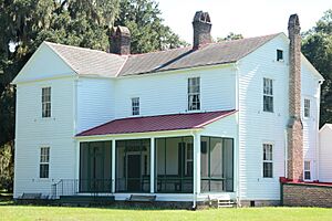
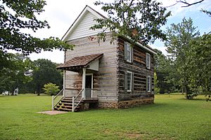
| Chief Vann House State Historic Site | Murray | 137 | 55 | 1952 | 34°45′47.21″N 84°49′19.14″W / 34.7631139°N 84.8219833°W | ||
| Dahlonega Gold Museum State Historic Site | Lumpkin | .264 | 0.107 | 1966 | 34°31′57.62″N 83°59′5.46″W / 34.5326722°N 83.9848500°W | ||
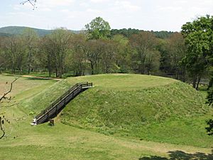
| Etowah Indian Mounds State Historic Site | Bartow | 54 | 22 | 1953 | 34°7′40.83″N 84°48′25.42″W / 34.1280083°N 84.8070611°W | ||
| Fort King George State Historic Site | McIntosh | 12 | 4.9 | 1940 | 31°21′59.18″N 81°24′57.13″W / 31.3664389°N 81.4158694°W | ||
| Fort Morris State Historic Site | Liberty | 67 | 27 | 1968 | 31°45′36.2″N 81°17′22.14″W / 31.760056°N 81.2894833°W | ||
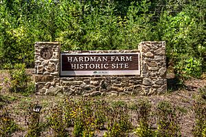
| Hardman Farm State Historic Site | White | 173 | 70 | 2014 | 34°41′5.97″N 83°42′29.73″W / 34.6849917°N 83.7082583°W | ||
| Hofwyl-Broadfield Plantation State Historic Site | Glynn | 1,286 | 520 | 1974 | 31°18′18.09″N 81°27′19.83″W / 31.3050250°N 81.4555083°W | ||
| Jarrell Plantation State Historic Site | Monroe | 200 | 81 | 1974 | 33°2′53.29″N 83°43′9.93″W / 33.0481361°N 83.7194250°W | ||
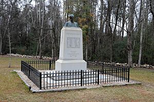
| Jefferson Davis Memorial State Historic Site | Irwin | 13 | 5.3 | 1997 | 31°39′52.38″N 83°23′12.07″W / 31.6645500°N 83.3866861°W | ||
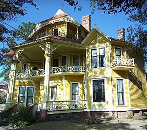
| Lapham-Patterson House State Historic Site | Thomas | 1 | 0.40 | 1971 | 30°50′44.2″N 83°58′58.45″W / 30.845611°N 83.9829028°W | ||
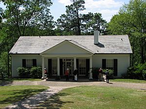
| Little White House State Historic Site | Meriwether | 163 | 66 | 1948 | 32°52′52.99″N 84°41′15.48″W / 32.8813861°N 84.6876333°W | ||
| New Echota State Historic Site | Gordon | 200 | 81 | 1962 | 34°32′27.55″N 84°54′33.59″W / 34.5409861°N 84.9093306°W | ||
| Pickett's Mill Battlefield State Historic Site | Paulding | 765 | 310 | 1974 | 33°58′26.41″N 84°45′32.93″W / 33.9740028°N 84.7591472°W | ||
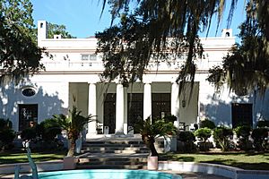
| Reynolds Mansion on Sapelo Island | McIntosh | 6,110 | 2,470 | 31°23′49.57″N 81°16′37.38″W / 31.3971028°N 81.2770500°W | |||
| Robert Toombs House State Historic Site | Wilkes | 4.34 | 1.76 | 1982 | 33°44′10.07″N 82°44′1.91″W / 33.7361306°N 82.7338639°W | ||
| Traveler's Rest State Historic Site | Stephens | 5.1 | 2.1 | 1955 | 34°36′33.26″N 83°14′19.73″W / 34.6092389°N 83.2388139°W | ||
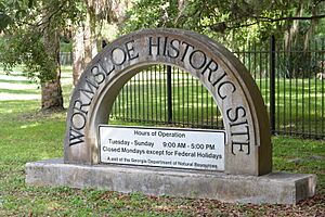
| Wormsloe State Historic Site | Chatham | 1,232 | 499 | 1973 | 31°58′48.69″N 81°4′9.26″W / 31.9801917°N 81.0692389°W | ||
Parks That Changed: Former State Parks
Some parks that were once state parks are now managed differently. This can happen for various reasons, like changes in budgets or new agreements with local governments.
| Park Name | County | Size | Year Established | Year Changed | Location | Image | What Happened | |
|---|---|---|---|---|---|---|---|---|
| acres | ha | |||||||
| Chehaw State Park | Dougherty | 800 | 320 | 1937 | 1977 | 31°37′3.44″N 84°8′17.17″W / 31.6176222°N 84.1381028°W | In 1974, part of the park was leased to create a wild animal park. Later, the state gave the entire park to the city of Albany to develop further. | |
| Bobby Brown State Park | Elbert | 665 | 269 | 1950s | 2015 | 33°58′26.93″N 82°34′43.6″W / 33.9741472°N 82.578778°W | This park was created on Clark Hills Lake. It was later downgraded and is now run by Elbert County, Georgia. | |
| George Washington Carver State Park | Bartow | 345 | 140 | 1950 | 1975 | 34°8′20.86″N 84°40′1.06″W / 34.1391278°N 84.6669611°W | This park was originally for African Americans during a time of segregation. Due to budget cuts, it was given to Bartow County and later got its original name back. | |
| Hart State Park | Hart | 147 | 59 | 1968 | 2020 | 34°22′35.16″N 82°54′38.4″W / 34.3764333°N 82.910667°W | In 2020, the city of Hartwell took over managing this park and renamed it Hartwell Lakeside Park. | |
| Jekyll Island State Park | Glynn | 5,700 | 2,300 | 1947 | 1950 | 31°4′12″N 81°25′13″W / 31.07000°N 81.42028°W | Jekyll Island was a state park for a short time. Since 1951, it has been managed by a special state agency called the Jekyll Island Authority. | |
| John Tanner State Park | Carroll | 138 | 56 | 1971 | 2013 | 33°36′7.92″N 85°10′3.72″W / 33.6022000°N 85.1677000°W | This park started as "Tanner's Beach." The state bought it in 1971, but later Carroll County took over its management and then bought it. | |
| Santo Domingo State Park | Glynn | 1934 | 1946 | 31°19′37.28″N 81°29′13.13″W / 31.3270222°N 81.4869806°W | The state sold this park property in 1946. It became a home for homeless boys and is now run by a children's services organization. | |||
| Sprewell Bluff State Park | Upson | 1,372 | 555 | 1993 | 2013 | 31°52′15.85″N 84°28′26.15″W / 31.8710694°N 84.4739306°W | This park was leased from Georgia Power. In 2013, Upson County, Georgia took over its management. | |
Other Notable Parks in Georgia
Besides state parks and historic sites, Georgia has other important recreational areas.
- Lake Lanier Islands were once managed by the state for recreation. Now, a private company runs them.
- Stone Mountain Park is owned by the state but managed by a special state agency. It operates like an amusement park under a contract with a private company.
Images for kids
See also
 | Emma Amos |
 | Edward Mitchell Bannister |
 | Larry D. Alexander |
 | Ernie Barnes |


