Mainland Australia facts for kids
 |
|
| Geography | |
|---|---|
| Area | 7,591,608 km2 (2,931,136 sq mi) |
| Administration | |
| Demographics | |
| Population | 25,895,442 |
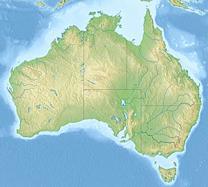
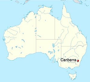
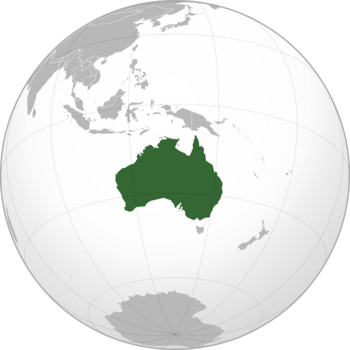
Mainland Australia is the biggest part of the Australian continent. It includes most of the country of Australia. This term usually means all of Australia except for Tasmania and other smaller islands nearby. People often use "mainland Australia" to talk about the states of New South Wales, Queensland, South Australia, Victoria, and Western Australia. It also includes the Australian Capital Territory, Jervis Bay Territory, and Northern Territory.
Sometimes, maps or events have left Tasmania out. This shows how people see Tasmania as separate from the mainland. For example, at the 1982 Commonwealth Games in Brisbane, Tasmania was missing from the map during the opening ceremony. The Australian Swim Team uniform for the 2014 Commonwealth Games also left it off.
The mainland covers about 7.6 million square kilometers (2.9 million sq mi). This is almost 99% of Australia's total land area. It's also about 1.5% of Earth's surface. Some people call it the world's largest island. It's more than three times bigger than Greenland. About 25.9 million people live here, which is 98% of Australia's population. Mainland Australia has many different climates. You can find tropical rainforests, deserts, cool forests, and even snow-covered mountains. Many unique Australian plants and animals live in these areas.
Contents
History of Mainland Australia
About 130 million years ago, during the Cretaceous period, Australia and Antarctica were joined. They were part of a huge landmass called Gondwana. Antarctica slowly started to move away from Australia about 85 million years ago. It moved just a few millimeters each year.
It took over 30 million years for Australia to fully separate from Antarctica. This happened about 53 million years ago. After that, Australia began moving towards its current location.
During the last ice age, about 35,000 years ago, sea levels around Australia dropped a lot. They fell by about 120 meters (390 feet). This created a land bridge between what is now Papua New Guinea, Australia, and Tasmania. Over the next 6,000 years, the ice melted. Sea levels rose again, cutting off Papua New Guinea and Tasmania from the mainland.
Ancient History
It is believed that Aboriginal people have lived on mainland Australia for a very long time. Some estimates say 50,000 to 60,000 years ago. This was long before the last ice age. Many DNA studies show that Aboriginal Australians are one of the oldest living groups of people outside of Africa.
Before Europeans arrived in the late 1700s, over 500 different Aboriginal groups lived on the mainland. Each group had its own unique culture, beliefs, and languages. Today, Indigenous people make up about 2.4% of Australia's population. They speak over 250 different language groups.
European Arrival
The first European to officially see the Australian mainland was Willem Janszoon in 1606. He sailed along Australia's north coast. He landed in what is now Cape York, Queensland. These early trips led to the idea of 'Terra Australis'. This is Latin for "South Land." People thought there must be land in the Southern Hemisphere to balance the land in the Northern Hemisphere.
Many other Dutch, Spanish, Portuguese, and British explorers visited Terra Australis in the 1600s and 1700s. They slowly mapped what we now call mainland Australia.
The most famous trip was 164 years after Janszoon's journey. It was led by British explorer James Cook. He was the first to map the eastern Australian coastline. On April 23, 1770, Cook saw Indigenous Australians for the first time near Brush Island. His journey and other reports led the British to set up a penal colony in Australia. The first one was at Botany Bay.
Geography of Mainland Australia
The geology and climate of the Australian mainland are very special. Even though it's surrounded by ocean, about 20% of the mainland is desert. This is because rainfall patterns are very different across the country. The center of the mainland gets very little rain. But coastal areas and the tropics get much more.
Australia sits in the middle of the Indo-Australian tectonic plate. This means it doesn't have many severe earthquakes or volcanoes. Over millions of years, the movement of these plates has changed the Australian mainland a lot. Mountains and seas have appeared and disappeared. Forces like weathering and erosion have shaped the land we see today.
These changes created four main landform areas across the mainland states and territories:
- The Coastal Plains
- The Eastern and Southern Highlands
- The Central Lowlands (and Deserts)
- The Western and Northern Plateaus (and Basins)
Coastal Plains
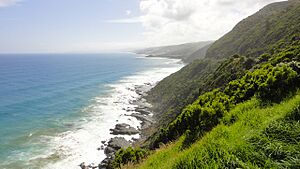
The Coastal Plains are a narrow strip of land along the eastern coast. They stretch from Queensland to Victoria. Many of Australia's major cities are here, like Brisbane, Sydney, and Melbourne. This area is good for living because of its mild conditions. Some people use "Coastal Plains" to mean the entire coastline of the mainland, not just the east.
Eastern Highlands
About 100 kilometers (62 miles) inland are the Eastern Highlands. These include the Great Dividing Range. They cover almost 10% of the mainland. This area has several mountain ranges that stretch for 3,700 kilometers (2,300 miles). They run along the east coast through Queensland, New South Wales, the Australian Capital Territory, and Victoria. These highlands formed about 80 million years ago. They are some of the oldest and most important mountain ranges in the world. This area is very rugged. It has many flat-topped hills and plateaus. The highlands are taller in the southeast, forming the Southern Highlands. These are in southern New South Wales, the Australian Capital Territory, and Victoria. These Southern Highlands, like the Snowy Mountains, get snow for more than half the year because they are so high up.
Central Lowlands
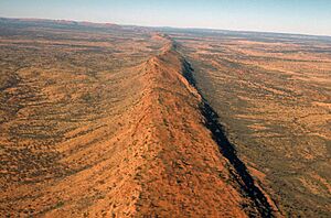
The Central Lowlands (and Deserts) cover about 25% of the Australian mainland. They are very flat, with an average height of less than 200 meters (660 feet) above sea level. This area is home to the Sturt and Simpson deserts. Closer to Central Australia, you can find some desert mountain ranges, like the MacDonnell and Musgrave.
The Central Lowlands have three main drainage basins:
- The Carpentaria Lowlands in the North.
- Lake Eyre in the center.
- The Murray-Darling Basin in the South.
The lowest point on the mainland is at Lake Eyre, which is 50 meters (160 feet) below sea level.
Western Plateau
Between 144 and 65 million years ago, during the Cretaceous period, a huge inland sea covered a quarter of the mainland. When this ocean dried up, it left behind what we now call the Western Plateau. The Western and Northern Plateaus cover almost all of Western Australia and the Northern Territory. They also include parts of South Australia.
These plateaus make up over one-third of the mainland. They are made of very old, stable igneous and metamorphic rock. Some of this rock is up to 3.6 billion years old. The Plateau is a huge area of flat-topped hills. Some parts average 500 meters (1,600 feet) above sea level. It is home to famous landmarks like Uluru, Kata Tjuta, the Finke River, the Victorian Desert, the Great Sandy Desert, and the Gibson Desert.
Much of the Western Plateau gets very little rain, so it looks red. But the Northern Plateau gets heavy rainfall during the wet season (November to April). This is because it's in a more tropical area than the Western Plateau.
Natural Resources
Australia's long separation from other continents led to a lot of uplift, erosion, and thick layers of sediment. Over millions of years, these processes created Australia's rich mineral, oil, and gas resources. Most of Australia's oil and gas are found offshore. But on the mainland, there are many minerals and metals. This has made mining a very important industry for Australia. The country exports many of these natural resources overseas.
Mining in Australia
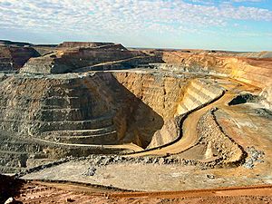
The Australian mainland has some of the world's largest open-cut and underground mines. There are over 350 active mines across the mainland states (except the ACT). They produce 19 different useful rocks and minerals. These mines make Australia one of the world's biggest producers of iron ore, coal, bauxite (for aluminum), manganese, nickel, copper, gold, silver, cobalt, lead, uranium, opal, and diamond. Some of the largest mines on the Australian mainland are listed below:
| Mine | Owner | State | Type | Minerals produced | Size |
|---|---|---|---|---|---|
| Mount Arthur | BHP | New South Wales | Open cut | Coal
Gold |
12 km2 |
| Peak Downs | BHP | Queensland | Open cut | Coal | 688 km2 |
| Cannington | South32 | Queensland | Underground | Silver
Lead |
5.25 km (multiple tunnels) |
| Carmichael | Bravus Mining and Resources (Adani) | Queensland | Open cut | Coal | 447 km2 |
| Olympic Dam | BHP | South Australia | Underground | Copper
Uranium Gold Silver |
450 km (multiple tunnels) |
| Argyle | Rio Tinto | Western Australia | Underground | Diamond | 40 km (multiple tunnels) |
| Boddington | Newmont | Western Australia | Open cut | Gold
Copper |
212 km2 |
| Fimiston | Kalgoorlie Consolidated Gold Mines | Western Australia | Open cut | Gold | 5.25 km2 (360m deep) |
| Roy Hill | Hancock Prospecting | Western Australia | Open cut
Underground |
Iron ore | 4,000 km2 |
| Worsley Alumina | South32 | Western Australia | Open cut | Bauxite | 5,000 km2 |
| Yandicoogina | Rio Tinto | Western Australia | Open cut | Iron ore | 267 km2 |
Renewable Energy
Because of its varied geology and climate, the Australian mainland uses more renewable energy. This includes solar, wind, and hydro power. In 2021, about 28.9% of the mainland's electricity came from renewable sources. South Australia led with 66.5% renewable energy. Victoria had 33.4%, Western Australia 31.5%, New South Wales 26.0%, and Queensland 19.6%. Most of this renewable energy came from wind (35.9%) and solar (38.3%).
Politics and Government
Important political decisions in Australia are usually made on the mainland. Even though Tasmania was one of Australia's first six British colonies, it is often less involved. This is because of its small size and being separated from the mainland. For example, the states and territories on mainland Australia have 146 of the 151 members in Parliament.
How States Were Formed
From 1788 to 1859, Britain set up five colonies on the Australian mainland. They also set up one in Tasmania. All six colonies were linked to Britain. Each had its own parliament and courts. Their laws had to follow the laws of the British Parliament.
These colonies became the six states of Australia. They were New South Wales, Victoria, Western Australia, South Australia (which included the Northern Territory at the time), Queensland, and Tasmania. In 1901, these six states joined together to form the Commonwealth of Australia. They created a new federal constitution. In 1911, the Northern Territory was given from South Australia to the Commonwealth. It then became a territory.
Choosing the Capital City
After Australia became a federation in 1901, everyone expected the capital city to be on the mainland. But choosing the exact location caused many years of arguments. Politicians from New South Wales and Victoria, the two biggest states, both wanted their capital cities to be the new national capital. Sydney and Melbourne were the main choices.
After years of debate, the two states finally agreed on a compromise. This plan followed the rules of the Australian Constitution. A separate territory (the Australian Capital Territory) would be created. New South Wales would give the land for it. But it had to be at least 100 miles (160 km) from Sydney. This new territory would hold Australia's official capital. The Parliament would meet in Melbourne until the new city (now Canberra) was built. This compromise was agreed upon in 1909 and became law in 1911.
On March 12, 1913, Canberra was officially named the capital of Australia. In 1915, Jervis Bay territory was added to the Australian Capital Territory. This was to make sure the Commonwealth had a seaport.
See also
 | John T. Biggers |
 | Thomas Blackshear |
 | Mark Bradford |
 | Beverly Buchanan |


