
National Register of Historic Places listings in Iowa facts for kids
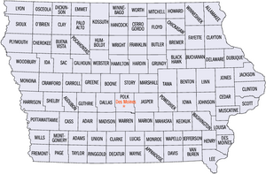
Iowa is home to many amazing historic places! These special spots are listed on the National Register of Historic Places, which is like a national scrapbook of important buildings, areas, and objects. There are over 2,300 of these cool places spread across all of Iowa's 99 counties. This list helps us learn about and protect these important parts of history.
| Top - 0-9 A B C D E F G H I J K L M N O P Q R S T U V W X Y Z |
Exploring Iowa's Historic Places by County
This section shares how many historic places are listed in each county. These numbers are from April 24, 2008, and new places are added often. So, these counts are close, but not always exact.
| County | # of Sites | |
|---|---|---|
| 1 | Adair | 9 |
| 2 | Adams | 5 |
| 3 | Allamakee | 21 |
| 4 | Appanoose | 13 |
| 5 | Audubon | 14 |
| 6 | Benton | 16 |
| 7 | Black Hawk | 45 |
| 8 | Boone | 18 |
| 9 | Bremer | 11 |
| 10 | Buchanan | 19 |
| 11 | Buena Vista | 10 |
| 12 | Butler | 7 |
| 13 | Calhoun | 12 |
| 14 | Carroll | 14 |
| 15 | Cass | 11 |
| 16 | Cedar | 17 |
| 17 | Cerro Gordo | 43 |
| 18 | Cherokee | 9 |
| 19 | Chickasaw | 4 |
| 20 | Clarke | 7 |
| 21 | Clay | 9 |
| 22 | Clayton | 54 |
| 23 | Clinton | 30 |
| 24 | Crawford | 14 |
| 25 | Dallas | 15 |
| 26 | Davis | 12 |
| 27 | Decatur | 7 |
| 28 | Delaware | 15 |
| 29 | Des Moines | 32 |
| 30 | Dickinson | 12 |
| 31 | Dubuque | 79 |
| 32 | Emmet | 3 |
| 33 | Fayette | 29 |
| 34 | Floyd | 19 |
| 35 | Franklin | 12 |
| 36 | Fremont | 9 |
| 37 | Greene | 17 |
| 38 | Grundy | 2 |
| 39 | Guthrie | 7 |
| 40 | Hamilton | 8 |
| 41 | Hancock | 9 |
| 42 | Hardin | 35 |
| 43 | Harrison | 13 |
| 44 | Henry | 51 |
| 45 | Howard | 8 |
| 46 | Humboldt | 7 |
| 47 | Ida | 5 |
| 48 | Iowa | 11 |
| 49 | Jackson | 75 |
| 50 | Jasper | 13 |
| 51 | Jefferson | 29 |
| 52 | Johnson | 87 |
| 53 | Jones | 29 |
| 54 | Keokuk | 9 |
| 55 | Kossuth | 6 |
| 56 | Lee | 45 |
| 57 | Linn | 96 |
| 58 | Louisa | 8 |
| 59 | Lucas | 16 |
| 60 | Lyon | 10 |
| 61 | Madison | 49 |
| 62 | Mahaska | 46 |
| 63 | Marion | 26 |
| 64 | Marshall | 15 |
| 65 | Mills | 6 |
| 66 | Mitchell | 10 |
| 67 | Monona | 10 |
| 68 | Monroe | 11 |
| 69 | Montgomery | 18 |
| 70 | Muscatine | 30 |
| 71 | O'Brien | 3 |
| 72 | Osceola | 1 |
| 73 | Page | 9 |
| 74 | Palo Alto | 4 |
| 75 | Plymouth | 12 |
| 76 | Pocahontas | 3 |
| 77 | Polk | 186 |
| 78 | Pottawattamie | 37 |
| 79 | Poweshiek | 24 |
| 80 | Ringgold | 6 |
| 81 | Sac | 13 |
| 82.1 | Scott: Davenport: Downtown | 54 |
| 82.2 | Scott: Davenport: East | 90 |
| 82.3 | Scott: Davenport: West | 108 |
| 82.4 | Scott: Davenport: Duplicates | (1) |
| 82.5 | Scott: Other | 32 |
| 82.6 | Scott: Total | 283 |
| 83 | Shelby | 12 |
| 84 | Sioux | 4 |
| 85 | Story | 35 |
| 86 | Tama | 11 |
| 87 | Taylor | 7 |
| 88 | Union | 6 |
| 89 | Van Buren | 20 |
| 90 | Wapello | 31 |
| 91 | Warren | 12 |
| 92 | Washington | 18 |
| 93 | Wayne | 3 |
| 94 | Webster | 14 |
| 95 | Winnebago | 3 |
| 96 | Winneshiek | 32 |
| 97 | Woodbury | 55 |
| 98 | Worth | 6 |
| 99 | Wright | 9 |
| (duplicates) | (4) | |
| Total: | 2,328 | |
Adair County Historic Sites
Adams County Historic Sites
| Name on the Register | Image | Date listed | Location | City or town | Description | |
|---|---|---|---|---|---|---|
| 1 | Adams County Jail |
 |
(#91000119) |
1000 Benton Ave. 40°59′32″N 94°44′04″W / 40.992222°N 94.734444°W |
Corning | This old jail building was added to the list in 1991. |
| 2 | Corning Commercial Historic District |
(#12000318) |
513-824 Davis Ave., 701-829 Benton Ave. & cross streets 40°59′21″N 94°44′05″W / 40.989066°N 94.734809°W |
Corning | This area includes many historic businesses in Corning. | |
| 3 | Corning Opera House |
(#93000954) |
800 Davis Ave. 40°59′25″N 94°44′01″W / 40.990278°N 94.733611°W |
Corning | The Corning Opera House is a historic theater. | |
| 4 | Noah Odell House |
 |
(#00000917) |
1245 240th St. 40°57′35″N 94°50′45″W / 40.959722°N 94.845833°W |
Nodaway | This house was built a long time ago. |
| 5 | Snider Bridge |
 |
(#98000774) |
220th St. over an unnamed stream 40°59′28″N 94°36′38″W / 40.991111°N 94.610556°W |
Corning | The Snider Bridge is an old bridge. |
Allamakee County Historic Sites
Appanoose County Historic Sites
Audubon County Historic Sites
Benton County Historic Sites
Black Hawk County Historic Sites
Boone County Historic Sites
Bremer County Historic Sites
Buchanan County Historic Sites
Buena Vista County Historic Sites
Butler County Historic Sites
| Name on the Register | Image | Date listed | Location | City or town | Description | |
|---|---|---|---|---|---|---|
| 1 | Cherry Street Bridge |
 |
(#98000753) |
Cherry St. over a tributary of the Shell Rock River 42°42′28″N 92°35′08″W / 42.707778°N 92.585556°W |
Shell Rock | This bridge crosses a small stream. |
| 2 | Coldwater Church of the Brethren |
(#79000883) |
100 block of N. High St. 42°53′31″N 92°48′32″W / 42.891944°N 92.808889°W |
Greene | This church is a historic building. | |
| 3 | Charles H. & Theresa H. McBride Bungalow |
 |
(#10001205) |
127 E. Adair St. 42°53′31″N 92°48′32″W / 42.891944°N 92.808889°W |
Shell Rock | This bungalow-style house is on the list. |
| 4 | Netcott-Pfeiffer House |
(#07000347) |
206 Buswell St. 42°34′43″N 92°47′28″W / 42.578611°N 92.791111°W |
Parkersburg | The Netcott-Pfeiffer House is a historic home. | |
| 5 | Renke and Wubke Renken House |
(#13001075) |
401 Coates St. 42°34′38″N 92°47′20″W / 42.577289°N 92.788802°W |
Parkersburg | This house was added in 2014. | |
| 6 | Shell Rock Bridge |
 |
(#99000307) |
Cherry St. over the Shell Rock River 42°42′40″N 92°34′53″W / 42.711111°N 92.581389°W |
Shell Rock | This bridge crosses the Shell Rock River. |
| 7 | Charles Wolf House |
(#79000884) |
401 5th St. 42°34′32″N 92°47′17″W / 42.575556°N 92.788056°W |
Parkersburg | The Charles Wolf House is a historic residence. |
Calhoun County Historic Sites
Carroll County Historic Sites
Cass County Historic Sites
Cedar County Historic Sites
Cerro Gordo County Historic Sites
Cherokee County Historic Sites
Chickasaw County Historic Sites
| Name on the Register | Image | Date listed | Location | City or town | Description | |
|---|---|---|---|---|---|---|
| 1 | Chickasaw County Courthouse |
 |
(#81000228) |
Prospect St. at Locust Ave. 43°09′36″N 92°18′49″W / 43.16°N 92.313611°W |
New Hampton | This courthouse is a very important building. |
| 2 | Chickasaw Octagon House |
(#79000888) |
Court St. 43°02′11″N 92°29′58″W / 43.036389°N 92.499444°W |
Chickasaw Township | This unique octagon-shaped house is historic. | |
| 3 | George Darrow Round Barn |
(#86001421) |
County Road T76 43°09′52″N 92°29′46″W / 43.164444°N 92.496111°W |
Alta Vista | This round barn is a special kind of farm building. | |
| 4 | John Foley House |
(#79000889) |
511 N. Locust St. 43°03′52″N 92°18′49″W / 43.064444°N 92.313611°W |
New Hampton | The John Foley House was added in 1979. |
Clarke County Historic Sites
| Name on the Register | Image | Date listed | Location | City or town | Description | |
|---|---|---|---|---|---|---|
| 1 | J.V. Banta House |
 |
(#83000348) |
222 McLane St. 41°01′49″N 93°46′08″W / 41.030319°N 93.768862°W |
Osceola | This historic house is located in Osceola. |
| 2 | Chicago, Burlington and Quincy Depot |
 |
(#08001283) |
215 N. Main St. 41°02′12″N 93°45′56″W / 41.03663°N 93.76566°W |
Osceola | This old train station is part of Iowa's railroad history. |
| 3 | George H. and Alice Spaulding Cowles House |
 |
(#06001161) |
229 W. Cass St. 41°02′03″N 93°46′09″W / 41.034167°N 93.769167°W |
Osceola | This house was added to the list in 2006. |
| 4 | John and Mary Jane Kyte Farmstead District |
 |
(#00001074) |
2875 Mormon Trail Rd. 40°56′09″N 93°39′22″W / 40.935833°N 93.656111°W |
Weldon | This historic farm includes several buildings. |
| 5 | Osceola Masonic Block |
 |
(#10000421) |
101-103 South Main St. 41°02′05″N 93°45′55″W / 41.034722°N 93.765278°W |
Osceola | The Masonic Block is a historic building in Osceola. |
| 6 | Marcellus Luther and Julia Protzman Temple House |
 |
(#96000361) |
502 S. Main St. 41°01′46″N 93°45′57″W / 41.029444°N 93.765833°W |
Osceola | This house was added to the list in 1996. |
| 7 | Dickinson Webster House |
 |
(#77000501) |
609 W. Jefferson St. 41°02′12″N 93°46′02″W / 41.036667°N 93.767222°W |
Osceola | The Dickinson Webster House is a historic home. |
Former Historic Sites in Clarke County
| Name on the Register | Image | Date listed | Date removed | Location | City or town | Summary | |
|---|---|---|---|---|---|---|---|
| 1 | Brady-Bolibaugh House |
(#85000003) |
|
217 W. Washington 41°02′12″N 93°45′45″W / 41.036667°N 93.7625°W |
Osceola | This house was removed from the list in 2009. |
Clay County Historic Sites
Clayton County Historic Sites
Clinton County Historic Sites
Crawford County Historic Sites
Dallas County Historic Sites
Davis County Historic Sites
Decatur County Historic Sites
| Name on the Register | Image | Date listed | Location | City or town | Description | |
|---|---|---|---|---|---|---|
| 1 | Decatur County Courthouse |
 |
(#81000233) |
9th St. 40°44′26″N 93°44′46″W / 40.740556°N 93.746111°W |
Leon | The Decatur County Courthouse is a landmark. |
| 2 | Grand River Bridge |
 |
(#98000794) |
County road over the Grand River 40°43′18″N 93°52′33″W / 40.721667°N 93.875833°W |
Leon | This bridge crosses the Grand River. |
| 3 | Liberty Hall |
 |
(#83000350) |
Main St. 40°37′30″N 93°57′07″W / 40.625°N 93.951944°W |
Lamoni | Liberty Hall is a historic building in Lamoni. |
| 4 | J.J. McClung House |
 |
(#90001856) |
Junction of Main and Vine Sts. 40°49′38″N 93°36′36″W / 40.827222°N 93.61°W |
Garden Grove | The J.J. McClung House was listed in 1990. |
| 5 | Missouri, Iowa & Nebraska Railway Co. Depot-Weldon |
 |
(#91001827) |
N. Main St. at the Decatur County line 40°53′57″N 93°44′01″W / 40.899167°N 93.733611°W |
Weldon | This old train depot is a historic site. |
| 6 | C.S. Stearns House |
 |
(#78001214) |
Main St. 40°49′36″N 93°36′10″W / 40.826667°N 93.602778°W |
Garden Grove | The C.S. Stearns House was listed in 1978. |
| 7 | Union Church |
 |
(#76000759) |
Clark at Sycamore St. 40°38′21″N 93°48′23″W / 40.639167°N 93.806389°W |
Davis City | Union Church is a historic church building. |
Delaware County Historic Sites
Des Moines County Historic Sites
Dickinson County Historic Sites
Dubuque County Historic Sites
Emmet County Historic Sites
| Name on the Register | Image | Date listed | Location | City or town | Description | |
|---|---|---|---|---|---|---|
| 1 | Brugjeld-Peterson Family Farmstead District |
 |
(#00000326) |
2349 450th Ave. 43°18′17″N 94°42′02″W / 43.304722°N 94.700556°W |
Wallingford | This farm has several historic buildings. |
| 2 | Ellsworth Ranch Bridge |
 |
(#98000869) |
130th St. over the East Fork of the Des Moines River 43°27′36″N 94°34′49″W / 43.46°N 94.580278°W |
Armstrong | This bridge crosses the Des Moines River. |
| 3 | Thomsen Round Barn |
(#86001426) |
Off Iowa Highway 15 43°20′46″N 94°29′52″W / 43.346111°N 94.497778°W |
Armstrong | This round barn is a unique piece of history. |
Fayette County Historic Sites
Floyd County Historic Sites
Franklin County Historic Sites
Fremont County Historic Sites
Greene County Historic Sites
Grundy County Historic Sites
| Name on the Register | Image | Date listed | Location | City or town | Description | |
|---|---|---|---|---|---|---|
| 1 | Grundy County Courthouse |
 |
(#81000239) |
Grundy Ave. 42°21′31″N 92°46′18″W / 42.358611°N 92.771667°W |
Grundy Center | The Grundy County Courthouse is a historic building. |
| 2 | Chris Neessen House |
(#84001253) |
601 E. 4th 42°26′04″N 92°55′29″W / 42.434444°N 92.924722°W |
Wellsburg | This house was added to the list in 1984. |
Guthrie County Historic Sites
| Name on the Register | Image | Date listed | Location | City or town | Description | |
|---|---|---|---|---|---|---|
| 1 | All Saints Catholic Church |
 |
(#00001478) |
420 N. Fremont 41°30′25″N 94°19′02″W / 41.506944°N 94.317222°W |
Stuart | This church is a historic place of worship. |
| 2 | John Cretsinger House |
(#98001206) |
1363 Burl Ln. 41°48′46″N 94°42′52″W / 41.812778°N 94.714444°W |
Coon Rapids | The John Cretsinger House was listed in 1998. | |
| 3 | Roswell and Elizabeth Garst Farmstead Historic District |
(#09000610) |
1390 Iowa Highway 141 41°50′55″N 94°38′43″W / 41.848544°N 94.64515°W |
Coon Rapids | This farmstead is a historic district. | |
| 4 | Masonic Temple Building |
 |
(#96000400) |
1311 N. 2nd St. 41°30′18″N 94°19′07″W / 41.505°N 94.318611°W |
Stuart | The Masonic Temple Building is a historic landmark. |
| 5 | Octagon Barn, Richland Township |
(#86001433) |
Off Iowa Highway 141 41°49′24″N 94°20′10″W / 41.823333°N 94.336111°W |
Richland Township | This octagon-shaped barn is a unique historic structure. | |
| 6 | Sexton Hotel |
 |
(#13000924) |
203 E. Front Street 41°30′14″N 94°19′00″W / 41.503832°N 94.316748°W |
Stuart | The Sexton Hotel is a historic hotel building. |
| 7 | Springbrook State Park, Civilian Conservation Corps Area |
(#90001671) |
Junction of Iowa Highway 384 and County Highway F25 41°46′38″N 94°27′54″W / 41.777222°N 94.465°W |
Guthrie Center | This state park area has historic structures. |
Former Historic Sites in Guthrie County
| Name on the Register | Image | Date listed | Date removed | Location | City or town | Summary | |
|---|---|---|---|---|---|---|---|
| 1 | Panora-Linden High School |
(#74000786) |
|
Bounded by Main, Market, 1st, and 2nd Sts. |
Panora | This school was taken down in 1991. |
Hamilton County Historic Sites
| Name on the Register | Image | Date listed | Location | City or town | Description | |
|---|---|---|---|---|---|---|
| 1 | Albright Bridge |
 |
(#98000776) |
130th St. at 510th Ave. over the Boone River 42°24′20″N 93°48′36″W / 42.405556°N 93.81°W |
Webster City | This bridge crosses the Boone River. |
| 2 | Kendall Young Public Library |
 |
(#83000361) |
1201 Willson Ave. 42°27′30″N 93°50′12″W / 42.458333°N 93.836667°W |
Webster City | The Kendall Young Public Library is a historic library. |
| 3 | William Oakland Round Barn |
 |
(#86001434) |
Off U.S. Route 69 42°29′11″N 93°38′00″W / 42.486389°N 93.633333°W |
Blairsburg | This round barn is a historic farm building. |
| 4 | Schultz Brothers Drug Store |
 |
(#96000518) |
116 Main St. 42°29′19″N 93°32′38″W / 42.488611°N 93.543889°W |
Williams | This old drug store building is on the list. |
| 5 | State Bank of Stratford |
 |
(#83000362) |
801 Shakespeare St. 42°16′14″N 93°55′01″W / 42.270556°N 93.916944°W |
Stratford | The State Bank of Stratford is a historic bank. |
| 6 | Tremaine Bridge |
 |
(#98000519) |
280th St. over the Boone River 42°23′12″N 93°48′31″W / 42.386667°N 93.808611°W |
Webster City | This bridge crosses the Boone River. |
| 7 | Webster City Post Office |
 |
(#82002619) |
801 Willson Ave. 42°28′06″N 93°49′09″W / 42.468333°N 93.819167°W |
Webster City | The Webster City Post Office is a historic building. |
| 8 | William J. and Hattie J. Zitterell House |
 |
(#96000057) |
821 Division St. 42°28′04″N 93°49′28″W / 42.467778°N 93.824444°W |
Webster City | This house was added to the list in 1996. |
Hancock County Historic Sites
Hardin County Historic Sites
Harrison County Historic Sites
Henry County Historic Sites
Howard County Historic Sites
| Name on the Register | Image | Date listed | Location | City or town | Description | |
|---|---|---|---|---|---|---|
| 1 | Bohemian Savings Bank |
 |
(#88002806) |
Main St. 43°13′05″N 92°05′26″W / 43.218056°N 92.090556°W |
Protivin | This old bank building is a historic site. |
| 2 | Cresco Opera House |
 |
(#81000245) |
115 W. 2nd Ave. 43°21′12″N 92°08′04″W / 43.353333°N 92.134444°W |
Cresco | The Cresco Opera House is a historic theater. |
| 3 | James C. Fellows House |
(#82002621) |
Main St. 43°22′02″N 92°33′05″W / 43.367222°N 92.551389°W |
Riceville | The James C. Fellows House was listed in 1982. | |
| 4 | Howard County Courthouse |
 |
(#81000246) |
Elm St. 43°22′26″N 92°07′03″W / 43.373889°N 92.1175°W |
Cresco | This courthouse is an important historic building. |
| 5 | Kellow House |
 |
(#77000517) |
324 4th Ave., W. 43°22′33″N 92°07′16″W / 43.375833°N 92.121111°W |
Cresco | The Kellow House was added to the list in 1977. |
| 6 | Lime Springs Mill Complex |
 |
(#77000518) |
Former Iowa Highway 157 43°27′54″N 92°16′45″W / 43.465°N 92.279167°W |
Lime Springs | This old mill complex is a historic site. |
| 7 | Polygonal Barn, New Oregon Township |
(#86001437) |
Off Iowa Highway 39 43°13′32″N 92°07′38″W / 43.225556°N 92.127222°W |
New Oregon Township | This barn has a unique polygonal shape. | |
| 8 | South Ward School |
 |
(#82000408) |
500 S. Elm St. 43°22′03″N 92°07′02″W / 43.3675°N 92.117222°W |
Cresco | The South Ward School is a historic school building. |
Humboldt County Historic Sites
| Name on the Register | Image | Date listed | Location | City or town | Description | |
|---|---|---|---|---|---|---|
| 1 | Berkhimer Bridge |
 |
(#98000523) |
245th St. over the Des Moines River 42°44′21″N 94°15′11″W / 42.739167°N 94.253056°W |
Humboldt | This bridge crosses the Des Moines River. |
| 2 | Corydon Brown House |
 |
(#78001223) |
East of Dakota City off Iowa Highway 3 42°43′28″N 94°11′27″W / 42.724444°N 94.190833°W |
Dakota City | The Corydon Brown House is a historic home. |
| 3 | Des Moines River Bridge |
(#98000522) |
Iowa Highway 3 over the West Fork of the Des Moines River 42°43′55″N 94°15′30″W / 42.731944°N 94.258333°W |
Humboldt | This bridge is on Iowa Highway 3. | |
| 4 | Humboldt County Court House |
.jpg) |
(#03000823) |
203 Main St. 42°43′21″N 94°12′58″W / 42.7225°N 94.216111°W |
Dakota City | The Humboldt County Courthouse is a historic building. |
| 5 | Humboldt Free Public Library |
 |
(#83000368) |
30 6th St., N. 42°43′16″N 94°13′10″W / 42.721111°N 94.219444°W |
Humboldt | This library was added to the list in 1983. |
| 6 | Renwick Generating Plant |
 |
(#95000099) |
103 N. Field St. 42°49′43″N 93°58′42″W / 42.828611°N 93.978333°W |
Renwick | This old power plant is a historic district. |
| 7 | Stephen Harris Taft House |
 |
(#02001601) |
809 1st Ave., N. 42°43′20″N 94°13′11″W / 42.722222°N 94.219722°W |
Humboldt | The Stephen Harris Taft House was listed in 2002. |
Ida County Historic Sites
| Name on the Register | Image | Date listed | Location | City or town | Description | |
|---|---|---|---|---|---|---|
| 1 | Alvin Bushnell Bell House |
(#83000369) |
310 Quimby St. 42°20′37″N 95°28′27″W / 42.343611°N 95.474167°W |
Ida Grove | This house was designed by a famous architect. | |
| 2 | Ida County Courthouse |
 |
(#74000787) |
401 Moorehead St. 42°20′31″N 95°28′04″W / 42.342023°N 95.467650°W |
Ida Grove | The Ida County Courthouse is a historic building. |
| 3 | Moorehead Stagecoach Inn |
(#74000788) |
Off U.S. Route 59 42°21′15″N 95°28′44″W / 42.354167°N 95.478889°W |
Ida Grove | This old inn was a stop for stagecoaches. | |
| 4 | Dr. Francis B. Warnock House |
(#88001945) |
201 Maple St. 42°18′57″N 95°36′02″W / 42.315806°N 95.600637°W |
Battle Creek | This house was also designed by a famous architect. | |
| 5 | Waveland Round Barn |
(#86001438) |
Off U.S. Route 20 42°29′46″N 95°42′09″W / 42.496111°N 95.7025°W |
Cushing | The Waveland Round Barn is a historic farm building. |
Former Historic Sites in Ida County
| Name on the Register | Image | Date listed | Date removed | Location | City or town | Summary | |
|---|---|---|---|---|---|---|---|
| 1 | Turner Hall |
(#75000691) |
|
SE corner of Keil and 2nd Streets |
Holstein | Turner Hall was removed from the list in 2007. |
Iowa County Historic Sites
Jackson County Historic Sites
Jasper County Historic Sites
Jefferson County Historic Sites
Johnson County Historic Sites
Jones County Historic Sites
Keokuk County Historic Sites
Kossuth County Historic Sites
| Name on the Register | Image | Date listed | Location | City or town | Description | |
|---|---|---|---|---|---|---|
| 1 | Algona Junior and Senior High School Building and High School Building Annex |
(#14001006) |
213 and 301 S. Harlan St. 43°04′03″N 94°14′01″W / 43.067375°N 94.233652°W |
Algona | These school buildings are historic. | |
| 2 | William C. and Hertha Dau House |
(#93000654) |
315 S. Dodge St. 43°03′58″N 94°14′10″W / 43.066111°N 94.236111°W |
Algona | This house was added to the list in 1993. | |
| 3 | Des Moines River Bridge |
(#98000535) |
County Road P14 over the East Fork of the Des Moines River 43°20′42″N 94°26′33″W / 43.345°N 94.4425°W |
Swea City | This bridge crosses the Des Moines River. | |
| 4 | G.A.R. Memorial Hall |
(#13001077) |
122 S. Dodge St. 43°04′07″N 94°14′12″W / 43.068636°N 94.236727°W |
Algona | This hall honors Civil War veterans. | |
| 5 | Land and Loan Office Building |
 |
(#98000250) |
123 E. State St. 43°04′08″N 94°14′08″W / 43.068889°N 94.235556°W |
Algona | This building was once a land and loan office. |
| 6 | Lu Verne City Jail |
|
(#92001662) |
307 3rd St. 42°54′39″N 94°05′00″W / 42.910833°N 94.083333°W |
Lu Verne | This old city jail is a historic site. |
Former Historic Sites in Kossuth County
| Name on the Register | Image | Date listed | Date removed | Location | City or town | Summary | |
|---|---|---|---|---|---|---|---|
| 1 | Longbottom Polygonal Barn |
(#86001456) |
|
Off Iowa Highway 226 |
Titonka | This barn was removed from the list in 2005. |
Lee County Historic Sites
Linn County Historic Sites
Louisa County Historic Sites
| Name on the Register | Image | Date listed | Location | City or town | Description | |
|---|---|---|---|---|---|---|
| 1 | Bethel Church |
 |
(#79003698) |
Northeast of Morning Sun, off U.S. Route 61 41°06′37″N 91°11′14″W / 41.11035833°N 91.18711389°W |
Morning Sun | Bethel Church is a historic church building. |
| 2 | Community Building |
 |
(#73000735) |
122 E. Maple St. 41°16′36″N 91°21′37″W / 41.276667°N 91.360278°W |
Columbus Junction | This community building is a historic site. |
| 3 | Commercial Hotel |
 |
(#01000912) |
227 N. Main St. 41°10′52″N 91°11′13″W / 41.181111°N 91.186944°W |
Wapello | This old hotel is now a historic landmark. |
| 4 | County Line Bridge |
 |
(#98000513) |
140th block of County Line Rd. over Long Creek 41°16′01″N 91°29′07″W / 41.266944°N 91.485139°W |
Columbus Junction | This bridge extends into Washington County. |
| 5 | Florence-Council On The Iowa Site |
 |
(#78001243) |
At the site of the now-gone village of Florence 41°06′29″N 91°06′57″W / 41.108056°N 91.115833°W |
Oakville | This site is where an old village used to be. |
| 6 | Gipple's Quarry Bridge |
 |
(#98000512) |
100 block of V Ave. over Buffington Creek 41°12′17″N 91°24′31″W / 41.204722°N 91.408611°W |
Columbus Junction | This bridge crosses Buffington Creek. |
| 7 | Louisa County Courthouse |
 |
(#81000253) |
Main St. 41°10′43″N 91°11′10″W / 41.178611°N 91.186111°W |
Wapello | The Louisa County Courthouse is a historic building. |
| 8 | Toolesboro Mound Group |
|
(#66000337) |
6568 Toolesboro Rd. 41°08′34″N 91°03′50″W / 41.142778°N 91.063889°W |
Toolesboro | These ancient mounds are a National Historic Landmark. |
Former Historic Sites in Louisa County
| Name on the Register | Image | Date listed | Date removed | Location | City or town | Summary | |
|---|---|---|---|---|---|---|---|
| 1 | Judge Francis Springer House |
(#83000388) |
|
South of Columbus City |
Columbus City | This house was removed from the list in 2000. |
Lucas County Historic Sites
Lyon County Historic Sites
Madison County Historic Sites
Mahaska County Historic Sites
Marion County Historic Sites
Marshall County Historic Sites
Mills County Historic Sites
| Name on the Register | Image | Date listed | Location | City or town | Description | |
|---|---|---|---|---|---|---|
| 1 | Davis Oriole Earthlodge Site |
 |
(#12001018) |
in Pony Creek Park 41°04′15″N 95°47′17″W / 41.070780°N 95.787957°W |
Glenwood vicinity | This site has ancient earthlodges. |
| 2 | Glenwood Archeological District |
 |
(#13000296) |
Address Restricted |
Glenwood | This area has many important archaeological finds. |
| 3 | Nishnabotna River Bridge |
(#98000496) |
County Road M16 over the Nishnabotna River north of Henderson 41°05′21″N 95°28′49″W / 41.089167°N 95.480278°W |
Anderson Township | This bridge crosses the Nishnabotna River. | |
| 4 | Plattsmouth Bridge |
 |
(#92000755) |
U.S. Route 34 over the Missouri River southwest of Pacific Junction 41°00′03″N 95°52′01″W / 41.00096°N 95.866836°W |
Plattville Township | This bridge connects Iowa and Nebraska. |
| 5 | Pony Creek Park |
|
(#71000299) |
Northwest of Glenwood 41°04′16″N 95°47′12″W / 41.071111°N 95.786667°W |
Oak Township | Pony Creek Park is a historic park. |
| 6 | West Oak Forest Earthlodge Site |
 |
(#10000342) |
Rural (Address Restricted) |
Glenwood vicinity | This site has ancient earthlodges. |
Mitchell County Historic Sites
Monona County Historic Sites
Monroe County Historic Sites
Montgomery County Historic Sites
Muscatine County Historic Sites
O'Brien County Historic Sites
| Name on the Register | Image | Date listed | Location | City or town | Description | |
|---|---|---|---|---|---|---|
| 1 | Carnegie Library |
 |
(#77001504) |
321 10th St. 43°10′47″N 95°51′14″W / 43.179722°N 95.853889°W |
Sheldon | This library was built with money from Andrew Carnegie. |
| 2 | Indian Village Site |
 |
(#66000888) |
Left bank of Waterman Creek, east of Sutherland 42°58′50″N 95°25′22″W / 42.980556°N 95.422778°W |
Sutherland | This site was once an Indian village. |
| 3 | O'Brien County Courthouse |
 |
(#81000656) |
Fir Ave. 43°05′12″N 95°37′38″W / 43.086667°N 95.627222°W |
Primghar | The O'Brien County Courthouse is a historic building. |
Osceola County Historic Sites
| Name on the Register | Image | Date listed | Location | City or town | Description | |
|---|---|---|---|---|---|---|
| 1 | Osceola County Courthouse |
.JPG) |
(#81000261) |
3rd Ave. and 8th St. 43°24′07″N 95°44′51″W / 43.401944°N 95.7475°W |
Sibley | The Osceola County Courthouse is a historic landmark. |
Page County Historic Sites
Palo Alto County Historic Sites
| Name on the Register | Image | Date listed | Location | City or town | Description | |
|---|---|---|---|---|---|---|
| 1 | Emmetsburg Public Library |
 |
(#83000397) |
10th St. on Courthouse Sq. 43°05′19″N 94°41′52″W / 43.088611°N 94.697778°W |
Emmetsburg | This public library is a historic building. |
| 2 | First Presbyterian Church |
(#10000276) |
101 1st Ave. SW 42°57′35″N 94°26′47″W / 42.959683°N 94.446417°W |
West Bend | This church was added to the list in 2010. | |
| 3 | Grotto of the Redemption |
 |
(#00001679) |
300 N. Broadway 42°57′50″N 94°26′44″W / 42.963889°N 94.445556°W |
West Bend | The Grotto of the Redemption is a famous religious site. |
| 4 | Ormsby-Kelly House |
(#77000545) |
2403 W. 7th St. 43°06′46″N 94°41′02″W / 43.112778°N 94.683889°W |
Emmetsburg | The Ormsby-Kelly House is a historic home. |
Plymouth County Historic Sites
Pocahontas County Historic Sites
| Name on the Register | Image | Date listed | Location | City or town | Description | |
|---|---|---|---|---|---|---|
| 1 | Laurens Carnegie Free Library |
.png) |
(#74000804) |
263 N. 3rd St. 42°50′54″N 94°50′56″W / 42.848333°N 94.848889°W |
Laurens | This library was built with money from Andrew Carnegie. |
| 2 | Pocahontas County Courthouse |
 |
(#81000264) |
Court Sq. 42°44′14″N 94°40′07″W / 42.737222°N 94.668611°W |
Pocahontas | The Pocahontas County Courthouse is a historic building. |
| 3 | Saints Peter and Paul Catholic Church |
 |
(#94000086) |
16 2nd Ave., NW. 42°44′05″N 94°40′15″W / 42.734722°N 94.670833°W |
Pocahontas | This church was added to the list in 1994. |
Polk County Historic Sites
Pottawattamie County Historic Sites
Poweshiek County Historic Sites
Ringgold County Historic Sites
| Name on the Register | Image | Date listed | Location | City or town | Description | |
|---|---|---|---|---|---|---|
| 1 | Beaconsfield Supply Store |
(#07000451) |
1621 Main St. 40°48′27″N 94°03′01″W / 40.8076°N 94.0504°W |
Beaconsfield | This store was the first Hy-Vee! | |
| 2 | W.J. Buck Polygonal Barn |
(#86001471) |
Off U.S. Route 169 40°46′57″N 94°15′25″W / 40.7825°N 94.256944°W |
Diagonal | This barn has a unique polygonal shape. | |
| 3 | Middlefork Methodist Episcopal Church |
(#90001801) |
South of U.S. Route 169 on the eastern side of the Middle Fork Grand River 40°35′47″N 94°19′03″W / 40.596389°N 94.3175°W |
Redding | This church was added to the list in 1990. | |
| 4 | Ringgold County Courthouse |
 |
(#81000267) |
Madison St. 40°42′46″N 94°14′26″W / 40.712778°N 94.240556°W |
Mount Ayr | The Ringgold County Courthouse is a historic building. |
| 5 | Ringgold County Jail |
(#79000939) |
201 E. Monroe St. 40°42′43″N 94°14′09″W / 40.711944°N 94.235833°W |
Mount Ayr | This old county jail is a historic site. | |
| 6 | Lee Shay Farmhouse |
(#86003172) |
Off County Road P27 40°41′13″N 94°22′57″W / 40.686944°N 94.3825°W |
Maloy | The Lee Shay Farmhouse was listed in 1986. |
Sac County Historic Sites
Scott County Historic Sites
Shelby County Historic Sites
Sioux County Historic Sites
| Name on the Register | Image | Date listed | Location | City or town | Description | |
|---|---|---|---|---|---|---|
| 1 | Charles M. and Emma M. Fischer Fleshman House |
(#92001743) |
919 9th St. 42°59′44″N 96°28′52″W / 42.995556°N 96.481111°W |
Hawarden | This house was added to the list in 1993. | |
| 2 | Hawarden City Hall, Fire Station and Auditorium |
(#09000107) |
715 Central Ave. 42°59′39″N 96°29′08″W / 42.994167°N 96.485556°W |
Hawarden | This building served as a city hall, fire station, and auditorium. | |
| 3 | Sioux County Courthouse |
 |
(#77000559) |
Off Iowa Highway 10 43°00′16″N 96°03′32″W / 43.004557°N 96.058889°W |
Orange City | The Sioux County Courthouse is a historic building. |
| 4 | Zwemer Hall, Northwestern College |
 |
(#75000698) |
101 7th St., SW. 42°59′53″N 96°03′30″W / 42.997963°N 96.058306°W |
Orange City | Zwemer Hall is part of Northwestern College. |
Story County Historic Sites
Tama County Historic Sites
Taylor County Historic Sites
| Name on the Register | Image | Date listed | Location | City or town | Description | |
|---|---|---|---|---|---|---|
| 1 | Bedford Commercial Historic District |
(#02001032) |
200-500 blocks of Main St., the 500 and 600 blocks of Court, and the 500 block of Central 40°40′01″N 94°43′07″W / 40.666944°N 94.718611°W |
Bedford | This district includes many historic businesses. | |
| 2 | Bedford House |
 |
(#77000560) |
306 Main St. 40°40′04″N 94°43′13″W / 40.667778°N 94.720278°W |
Bedford | The Bedford House is a historic home. |
| 3 | Bedford Oil Company Station |
(#99000831) |
601 Madison 40°40′02″N 94°43′15″W / 40.667222°N 94.720833°W |
Bedford | This old gas station is a historic site. | |
| 4 | Bedford Public Library |
(#83000405) |
Jefferson St. 40°36′29″N 94°44′53″W / 40.608056°N 94.748056°W |
Bedford | The Bedford Public Library is a historic building. | |
| 5 | Lenox Hotel |
(#02001538) |
114 S. Main St. 40°52′52″N 94°33′33″W / 40.881111°N 94.559167°W |
Lenox | The Lenox Hotel is a historic hotel. | |
| 6 | Lenox Round Barn |
(#99000490) |
1001 Pollock Boulevard 40°40′39″N 94°43′45″W / 40.6775°N 94.729167°W |
Bedford | This round barn is a unique historic structure. | |
| 7 | Taylor County Courthouse |
 |
(#81000271) |
Court Ave. 40°40′01″N 94°43′08″W / 40.666944°N 94.718889°W |
Bedford | The Taylor County Courthouse is a historic building. |
Union County Historic Sites
| Name on the Register | Image | Date listed | Location | City or town | Description | |
|---|---|---|---|---|---|---|
| 1 | Chicago, Burlington and Quincy Railroad-Creston Station |
 |
(#73000739) |
200 W. Adams St. 41°03′25″N 94°21′45″W / 41.056944°N 94.3625°W |
Creston | This old train station is a historic site. |
| 2 | Grand River Bridge |
(#98000479) |
230th St. over the Grand River 40°57′48″N 94°02′20″W / 40.963333°N 94.038889°W |
Arispe | This bridge crosses the Grand River. | |
| 3 | Iowana Hotel |
 |
(#09000298) |
203 W. Montgomery St. 41°03′31″N 94°21′47″W / 41.058611°N 94.363056°W |
Creston | The Iowana Hotel is a historic hotel building. |
| 4 | Jefferson Elementary School |
 |
(#02001223) |
501 North Cherry 41°03′45″N 94°21′23″W / 41.0625°N 94.356389°W |
Creston | This elementary school is a historic building. |
| 5 | Odd Fellows Block |
(#13001079) |
175 E. Kansas St. 41°01′42″N 94°11′49″W / 41.028224°N 94.196845°W |
Afton | The Odd Fellows Block is a historic building. | |
| 6 | U.S. Post Office |
 |
(#78001264) |
Maple St. 41°03′34″N 94°21′46″W / 41.059444°N 94.362778°W |
Creston | This post office is a historic building. |
Van Buren County Historic Sites
Wapello County Historic Sites
Warren County Historic Sites
Washington County Historic Sites
Wayne County Historic Sites
| Name on the Register | Image | Date listed | Location | City or town | Description | |
|---|---|---|---|---|---|---|
| 1 | Nelson Round Barn |
(#86003189) |
County Road J46 40°42′24″N 93°20′44″W / 40.706667°N 93.345556°W |
Allerton | This round barn is a historic farm building. | |
| 2 | Pleasant Hill School |
(#75000701) |
3 miles north of Lineville on U.S. Route 65 40°37′26″N 93°29′48″W / 40.623889°N 93.496667°W |
Lineville | The Pleasant Hill School is a historic schoolhouse. | |
| 3 | W.H. Tedford House |
(#79000947) |
312 S. West St. 40°45′25″N 93°19′24″W / 40.756944°N 93.323333°W |
Corydon | The W.H. Tedford House was listed in 1979. |
Webster County Historic Sites
Winnebago County Historic Sites
| Name on the Register | Image | Date listed | Location | City or town | Description | |
|---|---|---|---|---|---|---|
| 1 | Round Barn, Norway Township |
(#87000507) |
Off County Road R60 43°29′22″N 93°35′51″W / 43.489444°N 93.5975°W |
Norway Township | This round barn is a historic farm building. | |
| 2 | Charles J. Thompson House |
 |
(#78001271) |
336 N. Clark St. 43°15′58″N 93°38′18″W / 43.266111°N 93.638333°W |
Forest City | The Charles J. Thompson House was listed in 1978. |
| 3 | Winnebago County Courthouse |
 |
(#81000275) |
J St. 43°15′47″N 93°38′19″W / 43.263056°N 93.638611°W |
Forest City | The Winnebago County Courthouse is a historic building. |
Former Historic Sites in Winnebago County
| Name on the Register | Image | Date listed | Date removed | Location | City or town | Summary | |
|---|---|---|---|---|---|---|---|
| 1 | Forest City Public Library |
(#84001609) |
|
E. I St. and Clark 43°15′56″N 93°38′15″W / 43.265556°N 93.6375°W |
Forest City | This library was removed from the list in 2016. |
Winneshiek County Historic Sites
Woodbury County Historic Sites
Worth County Historic Sites
| Name on the Register | Image | Date listed | Location | City or town | Description | |
|---|---|---|---|---|---|---|
| 1 | Chicago, Milwaukee, and St. Paul Railroad-Grafton Station |
(#76000815) |
Iowa Highway 337 43°19′33″N 93°04′13″W / 43.325833°N 93.070278°W |
Grafton | This old train station is a historic site. | |
| 2 | First Methodist Episcopal Church |
(#00000985) |
401 2nd. St. 43°21′07″N 93°12′40″W / 43.351944°N 93.211111°W |
Kensett | This church was added to the list in 2000. | |
| 3 | Northwood Central Avenue Historic District |
 |
(#06000857) |
Roughly Central Ave., W. near 5th St. to 9th St. on the east 43°26′46″N 93°13′22″W / 43.446111°N 93.222778°W |
Northwood | This area includes many historic buildings. |
| 4 | Old Worth County Courthouse |
(#81000276) |
921 Central Ave. 43°26′38″N 93°13′07″W / 43.443889°N 93.218611°W |
Northwood | This old courthouse is a historic building. | |
| 5 | Rhodes Mill |
(#78001274) |
Main St. 43°15′50″N 93°25′16″W / 43.263889°N 93.421111°W |
Fertile | Rhodes Mill is a historic mill building. | |
| 6 | Worth County Courthouse |
 |
(#81000705) |
Central Ave. between 10th and 11th Sts. 43°26′40″N 93°13′03″W / 43.444444°N 93.2175°W |
Northwood | The Worth County Courthouse is a historic building. |
Wright County Historic Sites
Images for kids
-
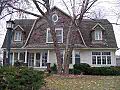
Phil Hoffman House, in Mahaska County
-
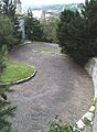
Snake Alley, in Des Moines County
-

Lock and Dam No. 14 Historic District, in Scott County
-

Grotto of the Redemption, in Palo Alto County
-
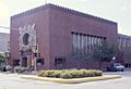
Merchants' National Bank in Poweshiek County, designed by Louis Sullivan
-

Howes Building, in Clinton County
-
Fourth Street Historic District, in Woodbury County


