
Sonoma County, California facts for kids
Quick facts for kids
Sonoma County, California
|
||
|---|---|---|
| County of Sonoma | ||
   |
||
|
||
| Motto(s):
"Agriculture, Industry, Recreation"
|
||

Location in the state of California
|
||
| Country | ||
| State | ||
| Region | San Francisco Bay Area | |
| Incorporated | February 18, 1850 | |
| Named for | the city of Sonoma | |
| County seat (and largest city) | Santa Rosa | |
| Government | ||
| • Type | Council–Administrator | |
| • Body | Sonoma County Board of Supervisors | |
| Area | ||
| • Total | 1,768 sq mi (4,580 km2) | |
| • Land | 1,576 sq mi (4,080 km2) | |
| • Water | 192 sq mi (500 km2) | |
| Highest elevation | 4,483 ft (1,366 m) | |
| Population
(2020)
|
||
| • Total | 488,863 | |
| • Density | 276.51/sq mi (106.760/km2) | |
| GDP | ||
| • Total | $36.877 billion (2022) | |
| Time zone | UTC−8 (Pacific Time Zone) | |
| • Summer (DST) | UTC−7 (Pacific Daylight Time) | |
| Area code | 707 | |
| FIPS code | 06-097 | |
| GNIS feature ID | 1657246 | |
| Congressional districts | 2nd, 4th | |

Sonoma County (![]() i/səˈnoʊmə/) is a county in California. As of 2020, about 488,863 people live there. Its main city and government center is Santa Rosa.
i/səˈnoʊmə/) is a county in California. As of 2020, about 488,863 people live there. Its main city and government center is Santa Rosa.
Sonoma County is part of the larger San Jose-San Francisco-Oakland area. It is the northernmost county in the nine-county San Francisco Bay Area.
This county is a big part of California's Wine Country. It has many wineries and is known for producing lots of grapes. People have also worked to protect natural areas, like forests and coastal lands. Over 8.4 million tourists visit Sonoma County each year.
Sonoma County is a top producer of hops, grapes, and apples. It also makes dairy and poultry products. This is because it has rich farmland and plenty of water for irrigation.
Contents
- History of Sonoma County
- What's in a Name? The Etymology of Sonoma
- Geography and Natural Beauty
- Getting Around: Transportation in Sonoma County
- People of Sonoma County: Demographics
- Economy: How Sonoma County Makes Money
- Learning in Sonoma County: Education
- Fun Places to Visit in Sonoma County
- Cities and Towns in Sonoma County
- Images for kids
- See also
History of Sonoma County
The first people to live in Sonoma County were the Pomo, Coast Miwok, and Wappo tribes. They settled here between 8000 and 5000 BC. They lived in a way that respected the land. You can still find ancient rock carvings made by these early people.
.jpg)
Later, people from Spain, Russia, and other parts of Europe came to the county. They were looking for timber, fur, and farmland. The Russians were the first to build a lasting settlement. They set up Fort Ross on the Sonoma Coast in 1812. This fort had hundreds of Russian and Aleut settlers. The Russians left in 1841 and sold the fort to John Sutter.

The Mission San Francisco Solano was built in 1823. It was the last of the 21 California missions. It is in the city of Sonoma. In 1836, General Mariano Guadalupe Vallejo established the Presidio de Sonoma. He watched over the Russian traders and managed the land. The city of Sonoma was also where the Bear Flag Revolt happened in 1846. This event was important for California becoming a state.
Sonoma was one of California's first counties when it became a state in 1850. The county seat was first the town of Sonoma. But by the 1850s, Sonoma was not as important. Other towns like Petaluma and Santa Rosa were growing fast. People wanted the county seat moved. In 1854, Santa Rosa became the new county seat. It is said that some Santa Rosa residents moved the county records there themselves one night!
After 1847, the city of Sonoma was a key stop for travelers. But then, Petaluma grew because of its location on the Petaluma River. It became a busy trade center. Later, Santa Rosa and Healdsburg also grew. When railroads arrived in the 1860s, Santa Rosa became the main center of the region.
Over time, Sonoma County has been claimed by several nations:
- The Spanish Empire claimed it first in 1542.
- The Kingdom of England claimed it in 1579.
- Spain claimed it again in 1775.
- The Russian Empire settled at Fort Ross in 1812.
- The First Mexican Empire and then the Mexican Republic ruled from 1821 to 1846.
- The California Republic was formed briefly in 1846.
- The United States has claimed it since July 9, 1846.
Sonoma County was hit hard by the 1906 San Francisco earthquake. More recently, wildfires have caused a lot of damage. Major fires include the Tubbs Fire (2017), Nuns Fire (2017), Kincade Fire (2019), Walbridge Fire (2020), and Glass Fire (2020).
The county has nearly 200 official historical landmarks.
What's in a Name? The Etymology of Sonoma

The name "Sonoma" comes from the local Native American tribes. The Pomo and Coast Miwok people said it means "valley of the moon" or "many moons." Their stories say the moon rested in this valley. This idea was made popular by writer Jack London in his 1913 novel The Valley of the Moon.
Other ideas for the name's meaning include "earth village" or even "nose." Some think it might come from a word for "nose" because a local chief had a big nose. Or it could refer to a nose-shaped hill. Another idea is that it means "redwood place."
Geography and Natural Beauty

Sonoma County covers about 1,768 square miles. Most of it is land, but 192 square miles are water.
The county is in the California Coast Ranges. It has mountains like the Mayacamas and Sonoma Mountains. The highest point is Mt. Saint Helena. You can find rare pygmy forests here, with small cypress trees. Sonoma Mountain has two public parks: Jack London State Historic Park and Fairfield Osborn Preserve.
The county includes the City of Sonoma and the Sonoma Valley. But Sonoma Valley is just one part of the county. There are many other valleys and areas, like the Petaluma Valley and the Russian River area.
Sonoma County has many different natural areas. These include oak forests, redwood forests, grasslands, and marshes. Annadel State Park has beautiful oak woodlands with many different plants and animals. These forests are special because they haven't been disturbed by farming or grazing.
Common trees in the oak woodlands include Pacific madrone and Douglas fir. You might also see coast live oak and California laurel.
Climate and Weather Patterns

Sonoma County has many different climates, even close together. This is because of how close it is to the ocean, its elevation, and the mountains. Weather usually comes from the Pacific Ocean. Places closer to the ocean get more rain and fog. Places further inland are warmer and drier.
The coast is often cool and foggy in summer. The fog usually rolls in during the afternoon and clears in the morning. Coastal summer temperatures are usually in the 60s or low 70s Fahrenheit.
Inland areas like Petaluma and Santa Rosa also get fog, but it's shorter-lived. Mid-day temperatures are much higher, often in the low 80s F. Areas further north, like Healdsburg, are warmer with less fog. Cloverdale, in the far north, is the hottest city, often reaching the 90s or even 100s F.
Even with these differences, most of the county has cool nights. This is due to the ocean's cooling effect. This means there's a big difference between daytime highs and nighttime lows.
Rainfall also varies. Most of the county gets 25-30 inches of rain a year. But areas in the northwest, like Guerneville and Cazadero, get much more. Cazadero can get over 70 inches of rain a year, making it one of the wettest places in California!
Snow is very rare in Sonoma County. You might only see it on the highest mountains like Mount Saint Helena.
Waterways and Coastline

Sonoma County has 76 miles of coastline along the Pacific Ocean. Key coastal spots include Bodega Bay and the mouths of the Russian River and Gualala River. All the county's beaches were very clean in 2010.
Most of the county's cities are in the Santa Rosa Plain. Water from the northern plain flows into the Russian River. Water from the southern plain flows into the Laguna de Santa Rosa, which then goes into the Russian River.
The Russian River

The Russian River is very important to central and northern Sonoma County. It starts in Mendocino County and flows south through Sonoma County. It turns west at Healdsburg and empties into the Pacific Ocean at Jenner.
Laguna de Santa Rosa
The Laguna de Santa Rosa is the largest stream feeding into the Russian River. It's 14 miles long and is a very important wildlife area. It has many different habitats like marshes, wetlands, and forests. It helps with water quality and flood control for the county.
Other Water Bodies
The county's southern border is near San Pablo Bay, which connects to San Francisco Bay. The Petaluma River, Tolay Creek, and Sonoma Creek flow into this bay. The area where they meet the bay is a huge marsh called the Napa Sonoma Marsh.
Other important creeks include Americano Creek and Sonoma Creek. Lakes and reservoirs include Lake Sonoma, Tolay Lake, and Lake Ilsanjo.
Marine Protected Areas
These are like underwater parks that help protect ocean wildlife and ecosystems.
- Del Mar Landing State Marine Reserve
- Stewarts Point State Marine Reserve & Stewarts Point State Marine Conservation Area
- Salt Point State Marine Conservation Area
- Gerstle Cove State Marine Reserve
- Russian River State Marine Reserve and Russian River State Marine Conservation Area
- Bodega Head State Marine Reserve & Bodega Head State Marine Conservation Area
- Estero Americano State Marine Recreational Management Area
Threatened and Endangered Species
Sonoma County is home to several rare and endangered plants and animals. These include:
- The California clapper rail (a type of bird)
- Salt marsh harvest mouse
- Northern red-legged frog
- Sacramento splittail (a fish)
- California freshwater shrimp
- Showy Indian clover (a plant)
- Hickman's potentilla (a plant)
- Northern spotted owl
- Marbled murrelet (a sea bird)
Some species are especially important locally. These include the California tiger salamander, coho salmon, and certain endangered plants. Some plants, like Sebastopol meadowfoam and Sonoma sunshine, are found only in Sonoma County.
The Sonoma County Water Agency has a program to help fish. They focus on protecting steelhead, Chinook salmon, and Coho salmon. These fish are listed as threatened or endangered.
Neighboring Counties
Sonoma County shares borders with:
- Mendocino County, California – to the north
- Lake County, California – to the northeast
- Napa County, California – to the east
- Solano County, California – to the southeast
- Marin County, California – to the south
- Contra Costa County, California – to the south-southeast
Protected Areas
Part of the San Pablo Bay National Wildlife Refuge is in Sonoma County.
Getting Around: Transportation in Sonoma County
Major Roads
![]() U.S. Route 101 U.S. Route 101 is a major highway that runs north and south through Sonoma County. It connects seven of the county's nine cities. It's a freeway for its entire length in the county. This highway can get very busy during rush hour. Work is being done to make parts of it wider.
U.S. Route 101 U.S. Route 101 is a major highway that runs north and south through Sonoma County. It connects seven of the county's nine cities. It's a freeway for its entire length in the county. This highway can get very busy during rush hour. Work is being done to make parts of it wider.
![]() State Route 1 Highway 1 follows the beautiful coastline of Sonoma County. It runs from the Mendocino County border down to the Marin County border.
State Route 1 Highway 1 follows the beautiful coastline of Sonoma County. It runs from the Mendocino County border down to the Marin County border.
![]() State Route 12
State Route 12

Highway 12 goes east from Sebastopol to Santa Rosa. Then it turns south through the Valley of the Moon to Sonoma. This highway also gets very busy in Santa Rosa.
![]() State Route 37 Highway 37 connects Highway 101 in Marin County to Interstate 80 in Solano County. In Sonoma County, it's also called Sears Point Road.
State Route 37 Highway 37 connects Highway 101 in Marin County to Interstate 80 in Solano County. In Sonoma County, it's also called Sears Point Road.
![]() State Route 116 Highway 116 is a winding road that goes from Jenner on the coast to near Sonoma. It has different names in different areas, like "Pocket Canyon" and "Gravenstein Highway."
State Route 116 Highway 116 is a winding road that goes from Jenner on the coast to near Sonoma. It has different names in different areas, like "Pocket Canyon" and "Gravenstein Highway."
![]() State Route 121 Highway 121 is a rural road that connects Highway 37 to Highway 128 in Napa County.
State Route 121 Highway 121 is a rural road that connects Highway 37 to Highway 128 in Napa County.
![]() State Route 128 The northern part of Highway 128 runs southeast from Highway 101 in Geyserville. It goes through the Alexander Valley into Napa County.
State Route 128 The northern part of Highway 128 runs southeast from Highway 101 in Geyserville. It goes through the Alexander Valley into Napa County.
Public Transport
- Sonoma County Transit provides bus service across the county.
- CityBus operates within Santa Rosa.
- Cloverdale and Petaluma also have their own local bus services.
- Golden Gate Transit connects Santa Rosa to Marin County and San Francisco.
- Mendocino Transit Authority runs buses north from Santa Rosa.
- Sonoma–Marin Area Rail Transit (SMART) is a train line. It currently runs between the Sonoma County Airport and Larkspur in Marin County. It plans to extend to Cloverdale.
Airports
The Charles M. Schulz - Sonoma County Airport is the main airport. It's located between Santa Rosa and Windsor. It offers daily flights from Alaska Airlines, American Airlines, and United Airlines.
There are also five smaller airports for general aviation:
- Cloverdale Municipal Airport
- Healdsburg Municipal Airport
- Petaluma Municipal Airport
- Sonoma Skypark
- Sonoma Valley Airport
Railroads


Railroads played a big role in Sonoma County's history. In 1864, the Petaluma and Haystack Railroad connected Petaluma to a ferry. In 1870, the San Francisco and North Pacific Railroad connected Santa Rosa to ferries. This line was later extended north to Healdsburg and Cloverdale.
Other rail lines were built to connect different parts of the county. Some of these old rail lines have now become trails, like the Joe Rodota Trail.
The Sonoma–Marin Area Rail Transit (SMART) train started passenger service in 2017. It uses some of the old railroad tracks.
People of Sonoma County: Demographics
Sonoma County has grown a lot over the years. In 1850, there were only 560 people. By 2020, the population was 488,863.
The county is very diverse. In 2020, about 58.5% of people were White (not Hispanic). About 28.9% of people were of Hispanic or Latino background. There are also communities of Black, Asian, Native American, and Pacific Islander people. Many people identify with two or more races.
The median age in 2000 was 38 years old. This means half the population was younger than 38 and half was older.
Economy: How Sonoma County Makes Money

Farming has always been very important to Sonoma County's economy. About 2% of the people work in agriculture. This is almost double the state average. The county's good climate and rich soil allow for many different crops and livestock.
Winemaking is the most valuable industry. It started in 1850. Sonoma County is famous for its wine. In 2019, the wine industry produced over $654 million worth of grapes. About 80% of the county's farmland is used for vineyards. The most common grapes grown are Chardonnay, Sauvignon Blanc, Cabernet Sauvignon, and Pinot Noir. Sonoma County has over 425 wineries.
Dairy farming is another big industry, especially in the western part of the county. In 2019, it was worth nearly $140 million. Sonoma County has about 65 dairies, including well-known ones like Clover Sonoma. Many dairies here are certified organic.
Poultry farming (raising chickens for eggs and meat) and other livestock are also important. This includes cattle and sheep. In 2019, this industry was worth $250 million.
Fishing and crabbing are focused on Bodega Bay. In 2019, this industry was worth over $9.3 million. The main catches are Dungeness crab and Chinook salmon.
After grapes, apples are the second most common crop. They are grown mostly near Sebastopol. The county is known for its Gravenstein apples. Farmers also grow olives, hay, and various vegetables. There are also many nurseries that grow flowers and other decorative plants.
The timber industry is not as big as it used to be. It's mainly along the western coast. The most common trees cut are Redwoods, pines, and oaks.
Sonoma County also has some technology companies, like Keysight in Santa Rosa. It's also home to several well-known brewing companies, such as Lagunitas Brewing Company. The clothing company Marmot is based in Rohnert Park.
Learning in Sonoma County: Education
Colleges and Universities
- Empire College, Santa Rosa
- Golden Gate University (Rohnert Park)
- Santa Rosa Junior College
- Sonoma State University, Rohnert Park
- University of San Francisco (Santa Rosa Campus)
K-12 Schools
Sonoma County has many different school districts. They are divided into unified (all grades), secondary (high school), and elementary (kindergarten to middle school).
Library System
The Sonoma County Library system has a main library in Santa Rosa. It also has 10 branch libraries and two smaller stations. More than half of the county's residents have library cards. They borrow over 2.5 million items each year. The library also helps adults learn to read and provides free internet access.
Fun Places to Visit in Sonoma County


Sonoma County has many interesting places to explore:
- Armstrong Redwoods State Reserve: See giant redwood trees.
- Bodega Bay: A beautiful coastal town.
- Doran Regional Park: A popular park near the coast.
- Fort Ross: A historic Russian fur trade outpost.
- Grove of Old Trees: Another place to see ancient trees.
- Hood Mountain Regional Park: Great for hiking.
- Jack London State Historic Park: The former home of famous author Jack London.
- Lake Sonoma: A large lake for recreation.
- Luther Burbank Center for the Arts: A place for performances and events.
- Luther Burbank Home and Gardens: The home and gardens of the famous plant breeder.
- Mission San Francisco Solano: A historic Spanish mission.
- Safari West: A wildlife preserve where you can see African animals.
- Sonoma Coast State Beach: Beautiful beaches along the Pacific Ocean.
- Sonoma Raceway: A famous race track.
- Sonoma TrainTown Railroad: A fun miniature railroad.
- Spring Lake Regional Park: A popular park with a lake.
- Sugarloaf Ridge State Park: Offers great views and hiking.
- Tolay Lake Regional Park: A park with a historic lake.
Cities and Towns in Sonoma County
Sonoma County has nine official cities and towns.


| Community | Population | Incorporation Date |
|---|---|---|
| City of Cloverdale | 8,618 | February 28, 1872 |
| City of Cotati | 7,265 | July 16, 1963 |
| City of Healdsburg | 11,254 | February 20, 1867 |
| City of Petaluma | 57,941 | April 12, 1858 |
| City of Rohnert Park | 40,971 | August 28, 1962 |
| City of Santa Rosa | 167,815 | March 26, 1868 |
| City of Sebastopol | 7,379 | June 13, 1902 |
| City of Sonoma | 10,648 | September 3, 1883 |
| Town of Windsor | 26,801 | July 1, 1992 |
Other Communities (Census-Designated Places)
These are areas that are not officially cities but are recognized for census purposes.
- Bloomfield
- Bodega
- Bodega Bay
- Boyes Hot Springs
- Carmet
- Cazadero
- El Verano
- Eldridge
- Fetters Hot Springs-Agua Caliente
- Forestville
- Fulton
- Geyserville
- Glen Ellen
- Graton
- Guerneville
- Jenner
- Kenwood
- Larkfield-Wikiup
- Monte Rio
- Occidental
- Penngrove
- Roseland
- Salmon Creek
- Sea Ranch
- Sereno del Mar
- Sonoma State University
- Temelec
- Timber Cove
- Valley Ford
Other Unincorporated Places
These are smaller communities that are not officially incorporated as cities or towns.
- Annapolis
- Asti
- Camp Meeker
- Carneros
- Duncans Mills
- Freestone
- The Geysers
- Guernewood Park
- Hacienda
- Kellogg
- Korbel
- Lakeville
- Lytton
- Mark West
- Mark West Springs
- Mercuryville
- Mesa Grande
- Rio Nido
- Schellville
- Stewarts Point
- Two Rock
- Venado
- Villa Grande
- Vineburg
Images for kids
-
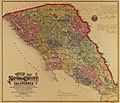
An 1884 map showing the 14 civil townships of Sonoma County.

See also
 In Spanish: Condado de Sonoma para niños
