Geography of Brisbane facts for kids
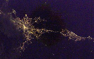
Brisbane is a big city located on the coast in the southeastern part of Queensland, Australia. It's right in the middle of Australia's east coast. The city sits on the Moreton Bay Floodplain. It stretches from Caboolture in the north to Beenleigh in the south and Ipswich in the west. The Pacific Ocean borders it to the east.
Contents
How Brisbane's Land Was Formed (Geology)
Over millions of years, layers of sediment built up in the Brisbane area. This region was once a large area under the sea. As more sediment piled up and the land slowly changed, it rose above sea level. This happened with the help of continents moving around. The Brisbane River and its mouth were then formed by erosion (wearing away) and weathering (breaking down rocks). You can also find some volcanic rock here, which means there was volcanic activity in the past.
Different types of rocks are found under the Brisbane region. These rocks depend on how high the land is. In the southern parts, old sedimentary rocks form the rolling hills. The flatter areas where people live have volcanic and sedimentary rocks on top of older, deeper rocks. These often include fine-grained rocks like shale, siltstone, sandstone, and some rhyolite and tuff. Higher areas to the northwest of Brisbane are built on strong rocks like greywacke, phyllite, and schist. These rocks are very old, from the Palaeozoic era.
Much of Brisbane is built on a special rock called Brisbane tuff. This rock is a type of volcanic ash that has hardened. You can see it clearly at the Kangaroo Point Cliffs and the New Farm Cliffs along the Brisbane River. This stone was used to build old buildings like the Commissariat Store and the Cathedral of St Stephen. Even today, some roadside kerbs in central Brisbane are made from Brisbane tuff.
Rivers and Waterways
The Brisbane River is the longest river in South East Queensland. It flows for 344 kilometres from Mount Stanley to Moreton Bay. Its source is about 140 kilometres northeast of central Brisbane. Many smaller streams and rivers, like the Stanley River, join it. The river and its branches cover a huge area of 13,500 square kilometres.
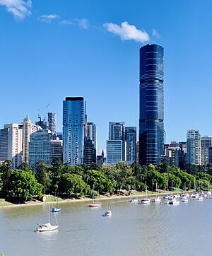
As the river winds through the city, it passes the original settlement area. This is where Brisbane's Central Business District (CBD) is today. The river is also blocked by the Wivenhoe Dam, which creates Lake Wivenhoe. This lake is the main water supply for the city. In the past, the river banks were mostly used for industries and port facilities. But over the last 30 years, these areas have changed. Now, you'll find parks, apartments, and arts centres along the river.
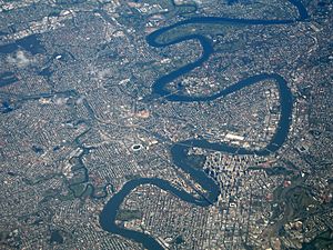
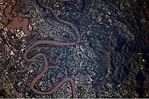
The Brisbane River is a wide tidal river mouth, called an estuary. Its waters in the city are mostly brackish (a mix of fresh and salt water) and are easy to travel on by boat. The river has many curves as it flows through the city from the southwest to Moreton Bay in the east.
Several other rivers and creeks also flow through Brisbane. These include the North Pine and South Pine rivers in the north. They join to form the Pine River estuary. Further north is the Caboolture River. In the southeast, you'll find the Logan and Albert rivers. The Bremer River in the southwest and many creeks like Breakfast Creek and Bulimba Creek also flow into the Brisbane River. Because the city is on a low-lying floodplain, there's a risk of flooding, especially from these suburban creeks.
Plants and Animals (Ecology)
Brisbane has more types of plants, animals, and insects than any other major city in Australia. This is mainly because of the many trees and plants in the city. They create a subtropical landscape and a lot of biodiversity (different kinds of life). There's a mix of native and introduced species here. Trees cover 44% of the city's area. This 'urban forest' stores a lot of carbon and helps clean the air.
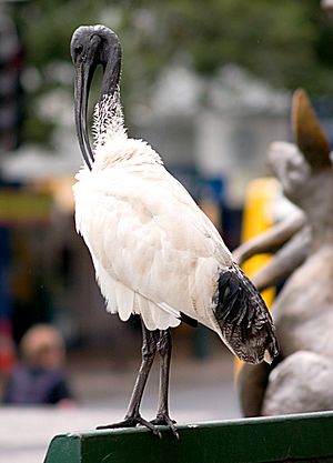
The city's 2500 types of plants are home to over 550 types of animals with backbones, plus many insects. Some common birds you might see are the Australian magpie, masked lapwing, torresian crow, and noisy miner. These birds can sometimes swoop at people, especially during nesting season. The Australian bush turkey is another common bird. It hunts insects in gardens and woodlands and helps spread plant seeds. The White Ibis is also common, often found in wet areas around Moreton Bay.
Another interesting animal in Brisbane is the flying-fox. These are the largest flying mammals in the world. People sometimes mistake them for bats. They are nocturnal (active at night) and are very important for spreading plant seeds and helping new plants grow in Brisbane. There are three types of flying-foxes in Brisbane: the black flying-fox, little red flying-fox, and grey-headed flying-fox.
Trees that are special to Brisbane include the Moreton Bay fig. This is a very large evergreen tree with huge roots. You often see them lit up with lights in the city. The jacaranda is another popular tree. It's from South America and has beautiful purple flowers in October, which locals call 'jacaranda season'. Some parts of the Brisbane River and Moreton Bay are home to mangrove wetlands.
Brisbane has many bird species. Common ones include rainbow lorikeets, galahs, Australian white ibises, and Australian brushturkeys. You might also see reptiles like common garden skinks, Australian water dragons, and blue-tongued lizards. The Brisbane River has many fish, including yellowfin bream and bull sharks. The waters of Moreton Bay are home to dugongs, humpback whales, dolphins, and different types of crabs.
The Shape of the Land (Topography)
Even though much of Brisbane is on low-lying floodplains, many suburbs are built on large hills. The western edge of Brisbane sits on the Herbert Taylor Range. This includes suburbs like Mount Coot-tha, Enoggera, and Chapel Hill. Mount Coot-tha is 300 metres above sea-level. It's a famous landmark that offers clear views of most of the city.
Brisbane is a hilly city. The city centre and other urban areas are partly raised by parts of the Herbert Taylor Range. The D'Aguilar National Park, which includes the D'Aguilar Range, is to the northwest of Brisbane. It has taller peaks like Mount Nebo and Mount Glorious. Other important hills in Brisbane are Mount Gravatt and Toohey Mountain. Smaller hills like Highgate Hill and Mount Ommaney are also found across the city.
City Areas and Green Spaces
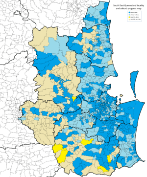
Brisbane is part of the South-East Queensland region.
Brisbane's city area is often split into the 'northside' and the 'southside'. The Brisbane River is the dividing line. To get from one side to the other by land, you need to cross one of the fifteen bridges. Because the river winds a lot, some areas south of the city centre are still called 'northside' and vice versa. There are also other general areas like the 'westside' and the 'bayside' (for areas near Moreton Bay).
Brisbane has many beautiful parks. Some major ones include the City Botanic Gardens by the river, Roma Street Parkland, and South Bank Parklands. The Brisbane Botanic Gardens at Mount Coot-tha and New Farm Park are also popular.
There are many national parks around Brisbane. The D'Aguilar National Park is a big park to the northwest. The Glass House Mountains National Park is north of the city, providing green space towards the Sunshine Coast. The Tamborine National Park is to the south.
The eastern part of Brisbane is next to the Moreton Bay Marine Park. This park includes Moreton, North Stradbroke, and Bribie islands. These islands also have their own national parks. The Boondall Wetlands are a large area of wetlands with mangroves and shorebirds, perfect for walking.
Brisbane has many different neighbourhoods and districts. The Brisbane City Centre is the main business area. South Bank is a fun area with lots to do. The Manly District is by the harbour and is mostly homes. Fortitude Valley, New Farm, and Chinatown are historically important. Chinatown is known for its amazing Chinese and Cantonese food. Kangaroo Point and Wooloongabba are mostly residential with parks. Milton, Paddington, and Spring Hill have many hotels, restaurants, and cafes. The Pacific Ocean to the east has islands like Moreton Island, Peel Island, and St. Helena Island. These are great for scuba diving, with beautiful beaches, lakes, and amazing coral reefs.
Moreton Bay
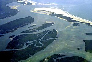
Moreton Bay is a very important natural area in Queensland. It stretches 125 kilometres from Caloundra in the north to Surfers Paradise in the south. It's the entrance to the Brisbane River. Large islands like Moreton Island, North Stradbroke Island, and South Stradbroke Island protect it from the Coral Sea. The bay itself is 35 kilometres wide at its widest point. It has 360 small islands, including protected wetlands, muddy areas, sandy areas, and coral and seagrass beds. More than 25% of Australia's bird species live here, making it an Important Bird Area.
The waters of Moreton Bay are usually calm because the islands protect it from big waves. However, the eastern coasts of the islands have surf beaches. The southern part of Moreton Bay also has smaller islands like St Helena Island, Peel Island, and Russell Island.
The Scenic Rim
Southwest of Brisbane is the Scenic Rim. This area has three large, inactive volcanoes west of the Brisbane River. These volcanoes now form highlands that include Toowoomba and Mt Superbus. They were once some of the biggest shield volcanoes on Earth. The land here ranges from 300 to 1500 metres above sea level, making temperatures cooler. Because of this, the lower areas have warm, subtropical rainforests. As you go higher, the temperature drops, and the rainforests become cool and temperate.
Brisbane's Weather (Climate)
Brisbane has a humid subtropical climate. This means it has warm, sunny weather, mild evenings, and generally steady weather all year. The average highest temperature is 25.5 degrees Celsius, and the average lowest is 15.7 degrees Celsius. Because Brisbane is close to the Coral Sea and Pacific Ocean, its temperatures don't change as much throughout the year as in other major cities. This is mainly due to the warmer ocean currents nearby. Brisbane has almost never recorded a temperature below zero degrees Celsius, except for one night.
| Statistics | Jan | Feb | Mar | Apr | May | Jun | Jul | Aug | Sep | Oct | Nov | Dec | Annually |
|---|---|---|---|---|---|---|---|---|---|---|---|---|---|
| Mean Maximum Temperatures (Degrees Celsius) | 29.4 | 29.0 | 28.0 | 26.1 | 23.2 | 20.9 | 20.4 | 21.8 | 24 | 26.1 | 27.8 | 29.1 | 25.5 |
| Mean Minimum Temperatures (Degrees Celsius) | 20.7 | 20.6 | 19.4 | 16.6 | 13.3 | 10.9 | 9.5 | 10.3 | 12.9 | 15.8 | 18.1 | 19.8 | 15.7 |
Brisbane gets a lot of rain, especially from thunderstorms. Severe weather like hail storms, heavy rain, and strong winds happen every year. The region has about 124 clear days a year. The average rainfall is 142 millimetres per year. However, the floodplain has also had long periods of extreme drought. For example, between 2001 and 2010, dam levels dropped very low. People had to save water, using less than 140 litres per person per day. This was the lowest water use per person in any developed country at that time.
This dry period ended in January 2011 when a low pressure system brought heavy rain. This caused flash flooding. Generally, Brisbane gets consistent rainfall. The longest time without rain was 22 days in November 2011.
| Statistics | Jan | Feb | Mar | Apr | May | Jun | Jul | Aug | Sep | Oct | Nov | Dec | Annually |
|---|---|---|---|---|---|---|---|---|---|---|---|---|---|
| Mean Rainfall (mm) | 159.6 | 158.3 | 140.7 | 92.5 | 73.7 | 67.8 | 56.5 | 45.9 | 45.7 | 75.4 | 97.0 | 133.3 | 1148.8 |
| Mean Number of Days of rain > 1mm | 8.4 | 8.8 | 9.4 | 6.8 | 5.8 | 4.5 | 4.2 | 4.0 | 4.4 | 5.9 | 6.5 | 7.7 | 76.4 |
 | Sharif Bey |
 | Hale Woodruff |
 | Richmond Barthé |
 | Purvis Young |


