San Diego County, California facts for kids
Quick facts for kids
San Diego County
|
|||||
|---|---|---|---|---|---|
| County of San Diego | |||||
|
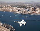
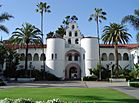
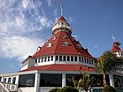
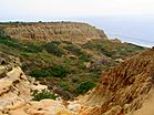
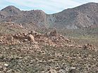
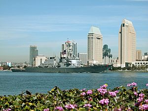
From top down and left to right: F/A-18 Hornet flying over San Diego, Mission San Diego de Alcalá, San Diego State University's Hepner Hall, Hotel del Coronado, Torrey Pines State Natural Reserve, Jacumba Mountains
|
|||||
|
|||||
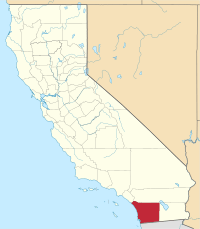
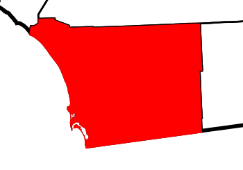
Location in California
|
|||||
| Country | |||||
| State | |||||
| Formed | February 18, 1850 | ||||
| Named for | Saint Didacus of Alcalá | ||||
| County seat | San Diego | ||||
| Largest city | San Diego | ||||
| Government | |||||
| • Type | Council–CEO | ||||
| • Body | Board of Supervisors | ||||
| Area | |||||
| • Total | 4,260.9 sq mi (11,036 km2) | ||||
| • Land | 3,942 sq mi (10,210 km2) | ||||
| • Water | 319 sq mi (830 km2) | ||||
| Highest elevation | 6,533 ft (1,991 m) | ||||
| Population | |||||
| • Total | 3,298,634 | ||||
| • Estimate
(2023)
|
3,269,973 |
||||
| • Density | 774.164/sq mi (298.906/km2) | ||||
| GDP | |||||
| • Total | 7.341 billion (2022) | ||||
| Time zone | UTC–8 (Pacific Time Zone) | ||||
| • Summer (DST) | UTC–7 (Pacific Daylight Time) | ||||
| Area codes | 760/442 and 619/858 | ||||
| FIPS code | 06-073 | ||||
| Congressional districts | 48th, 49th, 50th, 51st, 52nd | ||||
San Diego County is a county in the southwest part of California. It's right next to the border with Mexico. In 2020, over 3.2 million people lived here, making it the second most populated county in California. Its main city is San Diego, which is the second largest city in California.
San Diego County is special because it has 18 Indian reservations, which is more than any other county in the United States. It's also home to many Navy, Marine Corps, and Coast Guard bases.
The county stretches from the Pacific Ocean in the west to Imperial County in the east. It has over 70 miles (110 km) of coastline. The weather is usually mild, like a Mediterranean area, with lots of chaparral plants. As you go east, it gets colder in the mountains, which even get snow in winter!
Contents
History of San Diego County
The land that is now San Diego County has been home to Kumeyaay, Luiseño, Cupeño, and Cahuilla Native American tribes for over 10,000 years.
In 1542, an explorer named Juan Rodríguez Cabrillo claimed San Diego Bay for Spain. He called the area "San Miguel." Later, in 1602, another explorer, Sebastián Vizcaíno, explored the harbor and named it after Saint Didacus, also known as San Diego.
European settlement began in 1769 when Spanish soldiers and priests started the Presidio of San Diego and Mission San Diego de Alcalá. This area was part of New Spain until Mexico became independent in 1821. From 1821 to 1848, it was part of Mexico.
San Diego County became part of the United States in 1848 after the U.S.-Mexican War. This happened because of the Treaty of Guadalupe Hidalgo. The treaty made sure that the United States got the important natural harbor of San Diego Bay.
In 1850, San Diego County was one of the first counties created when California became a state. Back then, it was much bigger! It included parts of what are now Inyo, San Bernardino, Riverside, and Imperial counties. Over time, these other counties were formed, making San Diego County its current size. The last change was in 1907 when Imperial County was created.
Geography and Natural Features
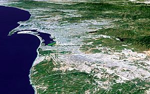
San Diego County is a large area, bigger than the states of Rhode Island and Delaware combined! It has many different types of land. The western side has 70 miles (110 km) of coastline. Most of the area between the coast and the mountains has hills, flat-topped lands called mesas, and small canyons.
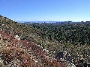
To the northeast, you'll find mountains that get snow in winter. To the far east is the Sonoran Desert. A large part of the county, especially in the central area, is covered by Cleveland National Forest. The Anza-Borrego Desert State Park takes up most of the northeast.
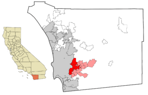
Even though the western part of the county has many cities, the mountains and deserts in the eastern two-thirds are mostly undeveloped. These areas are home to a native plant community called chaparral. San Diego County has more than a million acres (4,000 km²) of chaparral, which is more than any other county in California.
- North County: This area includes the northern suburbs and some northern parts of the city of San Diego.
- East County: These are the eastern suburbs, mostly still in the western part of the county.
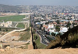
- South Bay: This includes the southern suburbs and the southern part of San Diego city, reaching the Mexican border.
The area sometimes has large wildfires that make thousands of people leave their homes. Recent fires include the May 2014 fires, the Witch Creek Fire in 2007, and the Cedar Fire in 2003.
Climate and Weather Patterns
San Diego has warm, dry summers and mild winters. Most of the rain falls between November and March. The city usually has mild, dry weather, with about 201 days a year where the temperature is above 70°F (21°C). It doesn't rain much, only about 9 to 13 inches (23–33 cm) each year.
Summer temperatures are generally warm, with highs between 70–78°F (21–26°C). Temperatures rarely go above 90°F (32°C). Winter temperatures are mild, with highs between 66–70°F (19–21°C).
The weather in San Diego can change a lot over short distances. This is because of the hills, mountains, and canyons. For example, near the coast, it can be cool and foggy, especially in May and June (called "May gray/June gloom"). But just 5–10 miles (8–16 km) inland, it can be sunny and much warmer. The ocean helps keep coastal temperatures more steady.
Rainfall is higher in the mountains, where some areas get 11–13 inches (28–33 cm) of rain a year.
Neighboring Areas
San Diego County shares borders with:
- Orange County (northwest)
- Riverside County (north)
- Imperial County (east)
- Tijuana, Baja California, Mexico (south)
- Tecate, Baja California, Mexico (south)
- Pacific Ocean (west)
Protected Natural Areas
San Diego County has many protected areas, including:
- Cabrillo National Monument
- Cleveland National Forest (part of it)
- San Diego National Wildlife Refuge Complex (includes several wildlife refuges)
There are also 7 official wilderness areas in the county, which are protected lands where nature is kept wild.
State Parks and Beaches
The county is home to many state parks and beaches, perfect for outdoor activities:
- Anza-Borrego Desert State Park (part)
- Torrey Pines State Reserve
- Cuyamaca Rancho State Park
- Palomar Mountain State Park
- San Pasqual Battlefield State Historic Park
- Old Town San Diego State Historic Park
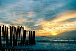
- Border Field State Park
- Tijuana River Natural Estuarine Research Reserve
- San Onofre State Beach
- Moonlight State Beach
- Carlsbad State Beach
- South Carlsbad State Beach
- Leucadia State Beach
- San Elijo State Beach
- Cardiff State Beach
- Torrey Pines State Beach
- Silver Strand State Beach
Mountains, Bays, and Lakes
San Diego County has many mountains, bays, and lakes:
- Mountains: Cuyamaca Mountains, Laguna Mountains, Palomar Mountain, Peninsular Ranges. The highest point is Hot Springs Mountain.
- Bays and Lagoons: Buena Vista Lagoon, Agua Hedionda Lagoon, Mission Bay, San Diego Bay.
- Lakes: Lake Cuyamaca, Lake Hodges, Santee Lakes, Sweetwater Reservoir, Otay Lakes, Lake Murray, and many more.
Rivers Flowing Through the County
Several rivers flow through San Diego County, including:
- San Diego River
- San Luis Rey River
- San Dieguito River
- Sweetwater River (California)
- Otay River
- Tijuana River
- Santa Margarita River
Population and People
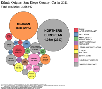
San Diego County is a very diverse place. In 1847, a census found 2,287 people living here, including Native Americans, Pacific Islanders, and African Americans. By 2020, the population grew to over 3.2 million!
Since 2014, San Diego County has been the fifth most populated county in the United States. Most people who live here also work here.
Who Lives in San Diego County?
The 2020 census showed that the county's population is made up of many different groups:
- White: 43.1%
- Hispanic or Latino (any race): 33.9%
- Asian: 12.1% (including Filipino, Vietnamese, Chinese, and others)
- Black or African American: 4.4%
- Mixed Race: 5.1%
- Native American: 0.4%
- Pacific Islander: 0.4%
Most people (67%) speak only English at home. Spanish is spoken by 21.9% of residents, Tagalog by 3.1%, and Vietnamese by 1.2%.
The median age in 2000 was 33 years old. About 25.7% of the population was under 18.
Economy and Jobs
San Diego County has a strong and varied economy. It's known for having a high cost of living, meaning things like housing and water can be expensive.
Farming and Agriculture
Farming is a big business in San Diego County, worth $1.85 billion in 2013. It's one of the top five counties in the US for producing eggs. In 2013, it also had the most small farms of any county in the country.
San Diego County is a top producer of avocados and nursery crops (plants grown for sale). It also has a growing wine industry, with about 100 vineyards and wineries as of 2016.
Craft Beer Scene
The county is often called "the Craft Beer Capital of America." Many local breweries are among the largest and best craft brewers in the United States and even the world.
Tourism and Fun Activities
Tourism is a huge part of San Diego's economy. People visit for shopping, surfing, and the great weather. Popular places to visit include:
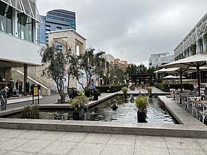
- Shopping: Westfield UTC, Seaport Village, Fashion Valley.
- Amusement Parks: SeaWorld San Diego, Legoland California, Sesame Place San Diego.
- Golf: Torrey Pines Golf Course, Balboa Park Golf Course.
- Museums: Museum of Us, the San Diego Museum of Art, Fleet Science Center, San Diego Natural History Museum, USS Midway Museum, San Diego Air & Space Museum.
- Historical Places: Gaslamp Quarter, Balboa Park, Old Town San Diego State Historic Park.
- Wildlife: San Diego Zoo, San Diego Zoo Safari Park, Birch Aquarium, San Diego-La Jolla Underwater Park.
- Outdoor Adventures: Hiking and biking in the Peninsular Ranges, surfing at famous spots like Swami's and Black's Beach.
The Port of San Diego is also a major hub for cruise ships, bringing in millions of dollars each year.
Culture and Local Life
San Diego's culture is a mix of American and Mexican influences. This is because it's a border city with a large Hispanic population and a history tied to Spain and Mexico. The strong presence of the U.S. military also shapes the local culture.
Today, San Diego is known for its many historical sites, museums, lively music and theater scene, special events, diverse food, and its reputation as a top place for craft brewing.
Places to Explore
- Mount Laguna Observatory and Palomar Observatory: Great places to look at the stars.
- Ramona Valley: A region known for its wineries.
- San Diego Zoo Safari Park: A huge wildlife park.
- SeaWorld San Diego: An aquatic theme park.
- Mission Bay Park: A popular spot for water sports.
- Mission San Diego de Alcalá: California's first Spanish mission.
- Mission San Luis Rey de Francia: Another historic Spanish mission.
- Balboa Park: A large urban park with many museums and cultural attractions.
- San Diego Zoo: A world-famous zoo located in Balboa Park.
- USS Midway: A former aircraft carrier now a floating museum in San Diego Bay.
- San Diego Botanic Garden: A beautiful garden with plants from all over the world.
- Legoland California: A Lego-themed park in Carlsbad.
- Sesame Place San Diego: A Sesame Street-themed park in Chula Vista.
Sports in San Diego County
San Diego County has professional sports teams and college athletics.
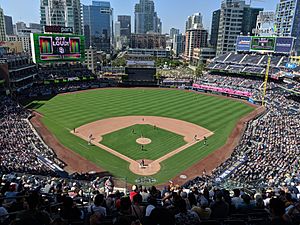
- Major League Baseball (MLB): The San Diego Padres play here.
- Major League Soccer (MLS): San Diego FC is a new team.
Many universities in the county have teams that compete in NCAA Division I sports, like the San Diego State Aztecs. The Farmers Insurance Open, a professional golf tournament, is held every year at Torrey Pines Golf Course.
San Diego County used to have NFL, NBA, and WHA teams, but they moved to other cities. The city of San Diego is the largest American city that has not won a championship in a "Big Four" major professional league (NFL, NBA, NHL, MLB).
Education and Learning
San Diego County offers many educational opportunities, from public schools to major universities.
Universities and Colleges
There are three public state universities:
- University of California, San Diego (UC San Diego)
- San Diego State University (SDSU)
- California State University, San Marcos (CSUSM)
Major private universities include:
- University of San Diego (USD)
- Point Loma Nazarene University (PLNU)
- Alliant International University (AIU)
- National University
The county also has three law schools.
School Districts and Libraries
The county has 24 elementary school districts, 6 high school districts, and 12 unified school districts (which cover K-12). There are also five community college districts.
Many cities have their own public library systems. The San Diego County Library serves all other areas. In 2010, the county library had 33 branches and was one of the busiest libraries in the country.
Military Presence
San Diego is a very important location for the U.S. Navy on the West Coast. It's the main place for Navy operations in the Pacific Ocean.
- Naval Base San Diego is home to many ships of the Pacific Fleet.
- Naval Air Station North Island is where many helicopter squadrons and aircraft carriers are based.
- The Naval Special Warfare Center, where SEALs train, is also in Coronado.
The area also has a major U.S. Marines base, Marine Corps Base Camp Pendleton, which is their main training base on the West Coast.
- Naval Base San Diego
- Naval Amphibious Base Coronado
- Naval Air Station North Island
- Naval Base Point Loma (includes Submarine Base)
- Space and Naval Warfare Systems Command (SPAWAR)
- Naval Medical Center San Diego
U.S. Marine Corps Facilities
- Marine Corps Base Camp Pendleton
- Marine Corps Air Station Miramar
- Marine Corps Recruit Depot San Diego
U.S. Coast Guard Facilities
- Coast Guard Air Station San Diego
Media and News
San Diego County gets its news and entertainment from many sources, including TV and radio stations based in San Diego city.
Newspapers
The main newspaper for the region is The San Diego Union-Tribune. Many cities and towns also have their own local newspapers. Papers like the Military Press Newspaper serve the military community.
Transportation and Travel
San Diego County has many ways to get around, from major highways to trains and airports.
Major Highways
- Interstate 5
- Interstate 8
- Interstate 15
- Interstate 805
- Many California State Routes like 52, 54, 56, 67, 75, 76, 78, 79, 94, 125, 163, 188, 282, and 905.
Border Crossings to Mexico
Trains and Public Transit
- Amtrak's Pacific Surfliner train
- Coaster commuter train
- Metrolink
- San Diego Trolley (light rail)
- San Diego Metropolitan Transit System (MTS) for buses and trolleys
- Sprinter commuter train
- North County Transit District (NCTD)
Airports
- McClellan–Palomar Airport (Carlsbad)
- Gillespie Field (El Cajon)
- Oceanside Municipal Airport (Oceanside)
- San Diego International Airport (San Diego)
- Montgomery-Gibbs Executive Airport (San Diego)
- Brown Field Municipal Airport (San Diego)
- Several smaller airports in unincorporated areas like Ramona and Borrego Valley.
Communities in San Diego County
San Diego County is made up of many different cities and communities.
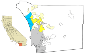
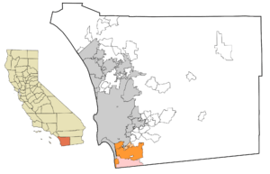
Cities in San Diego County
| City | Population |
|---|---|
| San Diego |
1,307,402
|
| Chula Vista |
243,916
|
| Oceanside |
183,095
|
| Escondido |
143,911
|
| Carlsbad |
105,328
|
| El Cajon |
99,478
|
| Vista |
93,834
|
| San Marcos |
83,781
|
| Encinitas |
59,518
|
| National City |
58,582
|
| La Mesa |
57,065
|
- Carlsbad
- Chula Vista
- Coronado
- Del Mar
- El Cajon
- Encinitas
- Escondido
- Imperial Beach
- La Mesa
- Lemon Grove
- National City
- Oceanside
- Poway
- San Diego (county seat)
- San Marcos
- Santee
- Solana Beach
- Vista
Other Communities
San Diego County also has many other communities, including:
- Census-designated places (CDPs): These are areas that are like towns but are not officially incorporated as cities. Examples include Alpine, Fallbrook, Julian, Ramona, and Spring Valley.
- Unincorporated communities: These are smaller areas that are not part of any city or CDP. Examples include 4S Ranch, Cardiff-by-the-Sea, and Tecate.
Indian Reservations
San Diego County has 18 federally recognized Indian reservations. This is more than any other county in the United States! These reservations are home to various Native American tribes. While they are smaller compared to some reservations in other states, they are important cultural and historical sites.
Some of the Indian Reservations include:
- Barona Indian Reservation
- Campo Indian Reservation
- La Jolla Indian Reservation
- Pala Indian Reservation
- Rincon Indian Reservation
- Sycuan Indian Reservation
- Viejas Indian Reservation
See also
 In Spanish: Condado de San Diego para niños
 | DeHart Hubbard |
 | Wilma Rudolph |
 | Jesse Owens |
 | Jackie Joyner-Kersee |
 | Major Taylor |


