Geography of Montana facts for kids
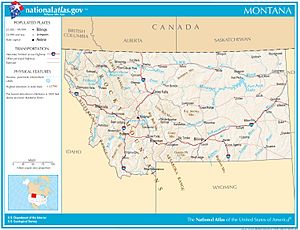
Montana is a big state in the western part of the United States. It's known as one of the "Mountain States." To the east, it shares borders with North Dakota and South Dakota. To the south is Wyoming, and to the west and southwest is Idaho. What's really cool is that Montana is the only U.S. state that borders three Canadian provinces: British Columbia, Alberta, and Saskatchewan are all to its north!
Montana is huge, covering about 147,040 square miles (380,800 square kilometers). That's a bit bigger than Japan! It's the fourth-largest state in the U.S., after Alaska, Texas, and California. It's also the biggest state that doesn't touch the ocean.
Contents
Montana's Mountains and Plains
Montana's land is mostly split into two main parts by the Continental Divide. This is a line that runs through the mountains, separating where rivers flow. Rivers on one side flow to the Pacific Ocean, and rivers on the other side flow towards the Atlantic (or Gulf of Mexico).
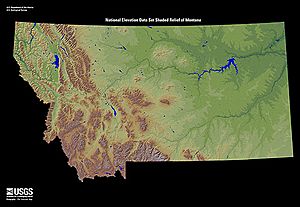
Most of Montana's many mountain ranges are in the western half. This area is part of the northern Rocky Mountains. Some ranges, like the Absaroka and Beartooth in the south-central part, are also part of the Central Rocky Mountains. The Rocky Mountain Front is a special area where the mountains meet the flat plains.
About 60% of Montana is flat prairie land, which is part of the northern Great Plains. You'll also find some smaller, isolated mountains, called "island ranges," scattered across these plains.
Western Mountains
The Bitterroot Mountains are one of the longest mountain chains in the Rockies, stretching all the way from Alaska to Mexico. These mountains, along with smaller ranges like the Coeur d'Alene Mountains and Cabinet Mountains, separate Montana from Idaho. Other big mountain ranges west of the Continental Divide include the Anaconda Range, the Missions, the Garnet Range, the Sapphire Mountains, and the Flint Creek Range.
The northern part of the divide, where mountains quickly turn into plains, is called the Rocky Mountain Front. This area is very noticeable in the Lewis Range, which is mostly in Glacier National Park.
At a place called Triple Divide Peak in Glacier National Park, something unique happens. Rivers here flow in three different directions! The Waterton River, Belly, and Saint Mary rivers flow north into Alberta, Canada. They then join the Saskatchewan River, which eventually reaches Hudson Bay.
Eastern Mountains and Plains
East of the Continental Divide, in the southern part of Montana, you'll find several mountain ranges that run roughly side-by-side. These include the Gravelly Range, Madison Range, Gallatin Range, Absaroka Mountains, and Beartooth Mountains. The Beartooth Plateau is a huge area over 10,000 feet (3,000 meters) high. It's home to Montana's highest point, Granite Peak, which is 12,799 feet (3,901 meters) tall!
North of these ranges are the Big Belt Mountains, Bridger Mountains, Tobacco Roots, and several "island ranges" like the Crazy Mountains and Little Belt Mountains.
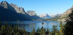
Between many of these mountain ranges are beautiful river valleys. Places like the Big Hole Valley, Bitterroot Valley, Gallatin Valley, Flathead Valley, and Paradise Valley are great for farming and offer lots of fun things to do for tourists.
Further east and north, you'll find the vast, open Northern Plains. This area has flat tablelands, more small "island mountain ranges," and unique badlands. Many of these eastern mountain ranges formed millions of years ago when hot rock (magma) pushed up from deep inside the Earth, cracking and bending the surface.
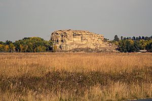
The north-central part of eastern Montana is famous for the Missouri Breaks and other amazing rock formations. South of Great Falls, you can see three large hills called buttes: Cascade, Crown, and Square. These are special types of hills called laccoliths, formed when igneous rock pushed through cracks in softer sedimentary rock.
The ground in this area is very different depending on whether it was shaped by glaciers, is a mountain valley, or a flat tableland. Some areas have weathered stone or bare rock, while others have soil made of clay, gravel, sand, silt, and volcanic ash. The flat tablelands often have gravel and weathered quartzite.
The Hell Creek Formation in Northeast Montana is a very important place for finding dinosaur fossils. Paleontologist Jack Horner from the Museum of the Rockies in Bozeman helped make this area famous with his many discoveries.
Rivers, Lakes, and Reservoirs
Montana has thousands of rivers and creeks. About 450 miles (720 kilometers) of these are known for amazing "blue-ribbon" trout fishing! Montana's water is used for fun activities, making electricity (hydropower), watering crops, mining, and for people to drink.
Montana is one of the few places in the world where rivers flow into three different major ocean systems! This happens at Triple Divide Peak in Glacier National Park. Rivers from here can end up in the Pacific Ocean, the Gulf of Mexico, or Hudson Bay. If Hudson Bay is counted as part of the Arctic Ocean, then Triple Divide Peak is the only place on Earth where water flows to three different oceans!
Rivers Flowing to the Pacific Ocean
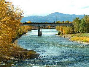
All the water in Montana west of the Continental Divide eventually flows into the Columbia River. The Clark Fork river starts near Butte and flows northwest to Missoula. There, it's joined by the Blackfoot River and Bitterroot River. Further on, the Flathead River joins it before it enters Idaho. The Clark Fork/Pend Oreille river system is the longest river in the Rocky Mountains, stretching about 579 miles (932 kilometers). The Kootenai River in northwest Montana is another important river that flows into the Columbia.
Rivers Flowing to the Gulf of Mexico
East of the divide, the Missouri River begins near Three Forks. It's formed by the joining of the Jefferson, Madison, and Gallatin Rivers. The Missouri flows north through central Montana, past Great Falls, and then generally east through farmlands and the Missouri Breaks to Fort Peck reservoir. This river drains more than half of Montana's land!
Almost a third of the Missouri River in Montana has 10 dams on it. Other major rivers that join the Missouri in Montana include the Smith, Milk, Marias, Judith, and Musselshell Rivers. Montana also claims to have the world's shortest river, the Roe River, near Great Falls. All these rivers eventually join the Mississippi River and flow into the Gulf of Mexico.
The Yellowstone River starts in Wyoming and flows north through Yellowstone National Park. It enters Montana near Gardiner and flows through the Paradise Valley to Livingston. It then goes northeast across the state, passing through Billings, Miles City, Glendive, and Sidney. The Yellowstone joins the Missouri River in North Dakota. It's the longest river in the lower 48 states that doesn't have any dams, and it drains about a quarter of Montana's land.
Rivers Flowing to Hudson Bay
As mentioned before, the Northern Divide turns east in Montana at Triple Divide Peak. This causes the Waterton, Belly, and Saint Mary Rivers to flow north into Alberta, Canada. There, they join the Saskatchewan River, which eventually empties into Hudson Bay.
Lakes and Reservoirs
Montana has around 3,000 named lakes and reservoirs. The biggest natural freshwater lake in the western U.S. is Flathead Lake, located here. Other important lakes include Whitefish Lake and Lake McDonald and St. Mary Lake in Glacier National Park.
The largest reservoir in Montana is Fort Peck Reservoir on the Missouri River. It's held back by the second-largest earthen dam in the world! Other big reservoirs include Hungry Horse on the Flathead River and Lake Koocanusa on the Kootenai River.
Montana's Plants and Animals
Montana is home to many different kinds of plants and animals. About 25% of the state is covered in forests. You'll find trees like lodgepole pine, ponderosa pine, Douglas fir, larch, spruce, aspen, birch, red cedar, hemlock, ash, alder, rocky mountain maple, and cottonwood.
Montana also has beautiful flowers like asters, bitterroots (the state flower!), daisies, lupins, poppies, primroses, columbine, lilies, orchids, and dryads. You'll also see many types of sagebrush, cactus, and various grasses.
Montana's wildlife is very diverse. It has 14 types of amphibians, 90 kinds of fish, 117 different mammals, 20 types of reptiles, and 427 kinds of birds! There are also more than 10,000 types of invertebrates, including 180 kinds of mollusks and 30 kinds of crustaceans.
Montana has the largest population of grizzly bears in the lower 48 states. Some animals in Montana are considered federally endangered species, meaning they are at high risk of disappearing forever. These include the black-footed ferret, whooping crane, least tern, pallid sturgeon, and white sturgeon. There are also seven threatened species, like the grizzly bear, Canadian lynx, and bull trout.
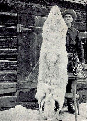
Thanks to conservation efforts, the gray wolf population has grown and is no longer considered endangered. The Montana Department of Fish, Wildlife and Parks helps manage hunting and fishing seasons for many animals, including 17 types of game fish (like seven kinds of trout, walleye, and smallmouth bass) and 29 types of game birds and animals (like pheasants, grey partridge, elk, pronghorn antelope, mule deer, whitetail deer, gray wolf, and bighorn sheep).
Special Protected Areas
Montana is home to some amazing protected lands. These include Glacier National Park, often called "The Crown of the Continent," and parts of Yellowstone National Park, which has three of its five entrances in Montana.
Other important national sites are the Little Bighorn National Monument, Bighorn Canyon National Recreation Area, and Big Hole National Battlefield. The CSKT Bison Range is managed by the Confederated Salish and Kootenai Tribes, and the American Prairie is a huge nature reserve run by a non-profit group.
About 35% of Montana's land, or 31.3 million acres (127,000 square kilometers), is managed by federal and state agencies. The U.S. Department of Agriculture Forest Service manages 16.8 million acres (68,000 square kilometers) of forest land in ten National Forests. There are also about 3.3 million acres (13,000 square kilometers) of wilderness in 12 special areas, protected by the Wilderness Act of 1964.
The U.S. Department of the Interior Bureau of Land Management looks after 8.1 million acres (33,000 square kilometers) of federal land. The Fish and Wildlife Service manages 110,000 acres (450 square kilometers) of National Wildlife Refuges and waterfowl areas. The Bureau of Reclamation manages about 300,000 acres (1,200 square kilometers) of land and water.
The Montana Department of Fish, Wildlife and Parks manages about 275,265 acres (1,114 square kilometers) of state parks and access points for rivers and lakes. The Montana Department of Natural Resources and Conservation manages 5.2 million acres (21,000 square kilometers) of School Trust Land. These lands were given to the state by the federal government in 1889 when Montana became a state, and they are managed to help support public schools and other institutions.
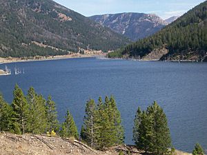
Here are some of the special places managed by the National Park Service:
- Big Hole National Battlefield near Wisdom
- Bighorn Canyon National Recreation Area near Fort Smith
- Glacier National Park
- Grant-Kohrs Ranch National Historic Site at Deer Lodge
- Lewis and Clark National Historic Trail
- Little Bighorn Battlefield National Monument near Crow Agency
- Nez Perce National Historical Park
- Yellowstone National Park
Montana's Climate and Weather
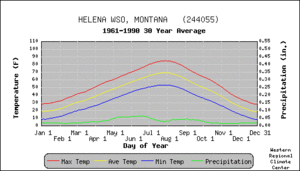

Montana is a very large state, and its weather can be quite different from one place to another. This is because of its varied geography, mountains, and how high up it is. The state stretches from below the 45th parallel (halfway between the equator and the North Pole) to the 49th parallel, and elevations range from under 2,000 feet (600 meters) to almost 13,000 feet (4,000 meters) above sea level.
The western half of Montana is mountainous with many large valleys. Eastern Montana has plains and badlands, with some hills and isolated mountains. This eastern part has a semi-arid, continental climate, meaning it's dry and has big temperature changes between seasons.
The Continental Divide really affects the climate. It stops warmer, moist air from the Pacific Ocean from moving east, and dry continental air from moving west. So, the area west of the divide has milder winters, cooler summers, less wind, and a longer growing season for plants. In winter, low clouds and fog often form in the western valleys, but this is rare in the east.
Average daytime temperatures range from about 28°F (–2°C) in January to 84.5°F (29°C) in July. Temperatures can vary a lot across the state. The highest summer temperature ever recorded was 117°F (47°C) in Glendive in 1893 and Medicine Lake in 1937. Summer nights are usually cool and pleasant. Very hot weather is less common in areas above 4,000 feet (1,200 meters). Snow has been recorded in every month of the year in the mountains of central and western Montana, though it's rare in July and August.
The coldest temperature ever recorded in Montana is also the coldest for the entire contiguous United States! On January 20, 1954, it was –70°F (–57°C) at a gold mining camp near Rogers Pass. However, temperatures can be very different even nearby. On the same day, Helena, about 40 miles (64 kilometers) southeast, was only –36°F (–38°C).
Winter cold spells usually happen when cold air comes south from Canada. This often causes a big temperature drop in just 24 hours. On the other hand, winds from the southwest, called "chinooks," can suddenly warm parts of Montana. These steady winds, often 25–50 mph (40–80 km/h) or more, can make temperatures rise by 50–60°F (10–16°C) for 10 days or longer, especially just east of the mountains.
Loma holds the record for the most extreme temperature change in 24 hours in the U.S. On January 15, 1972, a chinook wind caused the temperature to jump from –54°F (–48°C) to 49°F (9°C)!
The average yearly rainfall in Montana is about 15 inches (380 mm), but this varies a lot. The mountain ranges block moist air from the Pacific, keeping moisture in the western valleys and creating "rain shadows" to the east. Heron, in the west, gets the most rain, about 34.70 inches (881 mm). On the eastern side of a mountain range, the valleys are much drier. For example, Lonepine averages 11.45 inches (291 mm), and Deer Lodge averages 11.00 inches (279 mm). The mountains themselves can get over 100 inches (2,500 mm) of precipitation, like the Grinnell Glacier in Glacier National Park, which gets 105 inches (2,700 mm).
Most of the larger cities get 30 to 50 inches (0.76 to 1.27 meters) of snow each year. Mountain ranges can get 300 inches (7.6 meters) of snow during a winter! Heavy snowstorms can happen from September through May, but most snow falls from November to March.
Montana's climate has been getting warmer. The glaciers in Glacier National Park are shrinking and are expected to melt completely in a few decades. Winters are warmer too, with fewer very cold periods. These cold spells used to kill off bark beetles, but now these beetles are attacking western Montana's forests. The combination of warmer weather, beetle attacks, and past forest management has led to more severe forest fires in Montana.
Climate Data for Montana Cities
| Location | July (°F) | Coldest month (°F) | July (°C) | Coldest month (°C) |
|---|---|---|---|---|
| Billings | 89/54 | 32/14 | 32/15 | 4/–9 |
| Missoula | 86/51 | 30/11 | 31/16 | −0/–8 |
| Great Falls | 83/51 | 28/11 | 34/15 | 1/–9 |
| Bozeman | 81/51 | 27/10 | 31/12 | −0/–11 |
| Butte | 80/45 | 27/7 | 30/5 | −1/–15 |
| Helena | 86/54 | 30/12 | 31/12 | −0/–11 |
| Kalispell | 81/48 | 27/9 | 29/14 | −1/–10 |
Cities and Towns in Montana
Montana has 56 counties. It also has 364 "places" defined by the United States Census Bureau. These include 129 official cities and towns, and 235 "census-designated places" (areas that are like towns but not officially incorporated). The incorporated places are made up of 52 cities, 75 towns, and two places that combine city and county government.
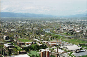
Montana has one city, Billings, with a population over 100,000 people. Three other cities have populations over 50,000: Missoula, Great Falls, and Bozeman.
The state also has five "Micropolitan Statistical Areas," which are smaller urban areas. These are centered around Bozeman, Butte, Helena, Kalispell, and Havre.
These cities (except Havre) are often called the "big seven" because they are consistently the largest communities in the state. In order of population, they are Billings, Missoula, Great Falls, Bozeman, Butte, Helena, and Kalispell. In 2013, these cities held 35% of Montana's population, and their counties were home to 62% of the state's population.
The geographic center of Montana's population is in a less populated area, in Meagher County, in the town of White Sulphur Springs.
 | Aaron Henry |
 | T. R. M. Howard |
 | Jesse Jackson |


