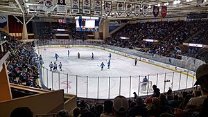
Maine facts for kids
Quick facts for kids
Maine
|
|||
|---|---|---|---|
|
|||
| Nicknames:
The Pine Tree State
Vacationland |
|||
| Motto(s):
"Dirigo"
(Latin for "I lead", "I guide", or "I direct") |
|||
| Anthem: State of Maine |
|||
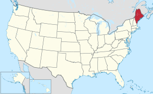
Location of Maine within the United States
|
|||
| Country | United States | ||
| Before statehood | Part of Massachusetts (District of Maine) | ||
| Admitted to the Union | March 15, 1820 (23rd) | ||
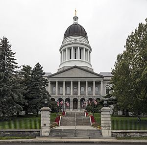
| Capital | Augusta | ||
| Largest city | Portland | ||
| Largest county or equivalent | Cumberland | ||
| Largest metro and urban areas | Portland | ||
| Legislature | State Legislature | ||
| • Upper house | Senate | ||
| • Lower house | House of Representatives | ||
| Judiciary | Maine Supreme Judicial Court | ||
| U.S. senators | Susan Collins (R) Angus King (I) |
||
| U.S. House delegation | 1. Chellie Pingree (D) 2. Jared Golden (D) (list) |
||
| Area | |||
| • Total | 35,385 sq mi (91,646 km2) | ||
| • Land | 30,862 sq mi (80,005 km2) | ||
| • Water | 4,523 sq mi (11,724 km2) 13.5% | ||
| Area rank | 39th | ||
| Dimensions | |||
| • Length | 320 mi (515 km) | ||
| • Width | 205 mi (330 km) | ||
| Elevation | 600 ft (180 m) | ||
| Highest elevation | 5,270 ft (1,606.4 m) | ||
| Lowest elevation | 0 ft (0 m) | ||
| Population
(2024)
|
|||
| • Total | |||
| • Rank | 42nd | ||
| • Density | 43.8/sq mi (16.9/km2) | ||
| • Density rank | 38th | ||
| • Median household income | $73,700 (2023) | ||
| • Income rank | 35th | ||
| Demonym(s) | Mainer | ||
| Language | |||
| • Spoken language | |||
| Time zone | UTC−05:00 (Eastern) | ||
| • Summer (DST) | UTC−04:00 (EDT) | ||
| USPS abbreviation |
ME
|
||
| ISO 3166 code | US-ME | ||
| Traditional abbreviation | Me. | ||
| Latitude | 42° 58′ N to 47° 28′ N | ||
| Longitude | 66° 57′ W to 71° 5′ W (45°N 69°W / 45°N 69°W) | ||
| Song |
|
|---|---|
| Bird | Black-capped chickadee |
| Fish | Landlocked Atlantic salmon |
| Flower | White pine cone and tassel |
| Fruit | Wild blueberry |
| Tree | White pine |
| Plant | Wintergreen |
| Insect | Honey bee |
Maine (![]() i/meɪn/ mayn) is a state in the New England region of the United States. It is the northeasternmost state in the Contiguous United States. Maine shares borders with New Hampshire to the west and the Gulf of Maine to the southeast. It also borders the Canadian provinces of New Brunswick and Quebec.
i/meɪn/ mayn) is a state in the New England region of the United States. It is the northeasternmost state in the Contiguous United States. Maine shares borders with New Hampshire to the west and the Gulf of Maine to the southeast. It also borders the Canadian provinces of New Brunswick and Quebec.
Maine is the largest state in New England by land area. It is almost as big as the other five New England states combined. Among all 50 U.S. states, Maine is the 12th smallest by area. It is also the 9th least populated and the most rural state. Augusta is Maine's capital city. Portland is its largest city, with about 68,408 people as of 2020.
Native American groups have lived in Maine for about 12,000 years. These groups, known as the Wabanaki Confederacy, spoke Algonquian languages. Europeans first settled here in 1604, led by the French. The first English settlement was the Popham Colony in 1607. Maine was part of Massachusetts until 1820. It became the 23rd U.S. state on March 15, 1820, as part of the Missouri Compromise.
Today, Maine is famous for its rocky coastline, mountains, and thick forests. It is also known for its delicious food, especially wild blueberries and seafood like lobster and clams. The coastal areas, especially near Portland, are growing as centers for creative businesses.
Maine's History
Early Inhabitants and European Arrival
The first people known to live in Maine were the Wabanaki peoples. These included the Passamaquoddy, Maliseet, Penobscot, and others. They lived in permanent villages or moved between summer coastal camps and winter inland camps.
Some historians believe Vikings might have visited Maine around 1000 CE. They may have traded with the native Penobscot people. An 11th-century Norwegian coin, called the Maine penny, was found at a Native American site. This suggests early European contact.
The first confirmed European settlement was in 1604 on Saint Croix Island. French explorer Pierre Dugua, Sieur de Mons led this group, which included Samuel de Champlain. The French called the whole area Acadia. The first English settlement was the Popham Colony in 1607, but it lasted only 14 months.
Becoming a State
Maine was often fought over by the French, English, and Native American groups in the 1600s and 1700s. After the British won against the French in the 1740s, eastern Maine became part of Nova Scotia. During the American Revolution and the War of 1812, British forces occupied eastern Maine. However, it was returned to the United States after peace treaties.
Maine was physically separate from the rest of Massachusetts. Many people in Maine wanted to become their own state. This feeling grew stronger during the War of 1812. Massachusetts leaders did not defend Maine from British invaders. In 1819, Massachusetts agreed to let Maine become a separate state.
Maine officially became the 23rd U.S. state on March 15, 1820. This happened as part of the Missouri Compromise. This agreement helped keep a balance between states that allowed slavery and those that did not. Portland was Maine's first capital. The capital moved to Augusta in 1832.
Maine's Geography
Location and Borders
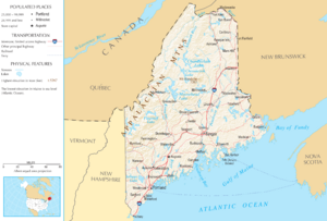
Maine is bordered by the Gulf of Maine to the south and east. New Hampshire is to the west. The Canadian provinces of New Brunswick and Quebec are to the north and northwest. Maine is the only U.S. state that borders just one other American state.
The town of Lubec is the easternmost town in the United States. Its Quoddy Head Lighthouse is the closest place in the U.S. to Africa and Europe. Estcourt Station is Maine's northernmost point.
Landmarks and Natural Features
Moosehead Lake is the largest lake entirely within New England. Mount Katahdin is the northern end of the Appalachian Trail. This trail stretches all the way to Georgia.
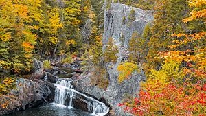
Maine is called the "Pine Tree State." This is because it has many pine trees. Over 80% of Maine's land is covered by forests. This is more than any other U.S. state. Many parts of the interior are uninhabited.
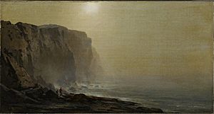
Maine has about 230 miles (370 km) of ocean coastline. If you count all the bays and inlets, it's about 3,500 miles (5,600 km) of tidal coastline. Along the coast, you can find lighthouses, beaches, fishing villages, and thousands of islands.
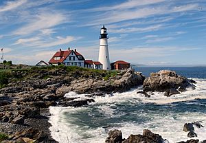
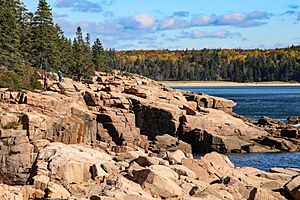
Geologists call Maine's coast a "drowned coast." This means that rising sea levels have covered old land features. Valleys became bays, and mountain tops became islands. This happened after the last ice age when glaciers melted.
Acadia National Park is the only national park in New England. It is near Bar Harbor. Other protected areas include the Appalachian Trail and Saint Croix Island International Historic Site.
Maine's Climate
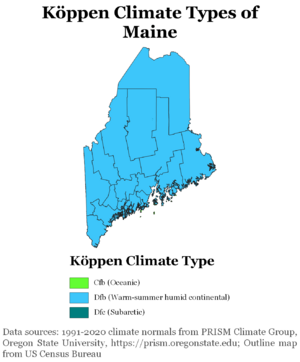
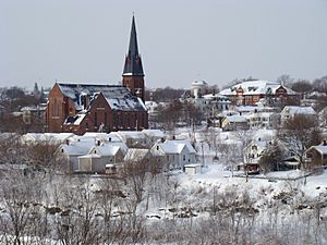
Maine has a humid continental climate. This means it has warm, sometimes humid summers. Winters are long, cold, and very snowy. Winters are colder in northern and western Maine. Coastal areas are a bit milder due to the Atlantic Ocean.
In July, daytime temperatures are usually between 75°F and 85°F (24°C and 29°C). Overnight lows are around 50s°F (10-15°C). In January, temperatures range from 30°F (–1°C) on the southern coast to below 0°F (–18°C) in the far north.
Maine gets rain and snow throughout the year. Coastal areas often get more rain or snow in late fall or early winter. Thunderstorms are less common in Maine than in other eastern states. Tornadoes are rare, but their number is increasing.
| Location | July (°F) | July (°C) | January (°F) | January (°C) |
|---|---|---|---|---|
| Portland | 78/59 | 26/15 | 31/13 | −0/−10 |
| Lewiston | 81/61 | 27/16 | 29/11 | −2/−12 |
| Bangor | 79/57 | 26/14 | 27/6 | −2/−14 |
| Augusta | 79/60 | 26/15 | 27/11 | −2/−11 |
| Presque Isle | 77/55 | 25/13 | 20/1 | −6/−17 |
Plants and Animals of Maine
Maine has many different plants and animals. These live in its forests, along its coast, and in its wetlands. Forests have trees like balsam fir and sugar maple. The state tree is the Eastern white pine. Coastal areas have tough plants like sea milkwort and bayberry.
Maine's animals include moose, black bears, and white-tailed deer. Smaller animals like red squirrels and raccoons also live here. Maine has the largest populations of moose and black bears in the lower 48 states. Many birds, like piping plovers and black-capped chickadees, live in Maine. Wetlands are home to spotted salamanders and wood frogs. Freshwater fish include brook trout and landlocked salmon. In the ocean, you can find Atlantic puffins, harbor seals, and lobster. Maine is the biggest producer of lobster in the United States.
Maine's Population
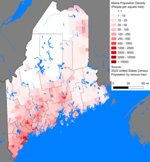
As of 2024, Maine's population is estimated to be about 1,405,012 people. This is a small increase since the 2010 census. Maine is the least densely populated state east of the Mississippi River. It is also the most rural state, with most people living outside urban areas.
The largest population center is the Greater Portland area. This area has almost 40% of Maine's population. Portland itself had 68,408 people in 2020.
Maine has a slow population growth rate. However, in 2021 and 2022, more people moved into Maine than left it. This growth is mostly in the southern coastal counties. Maine has the highest percentage of people aged 65 or older in the U.S.
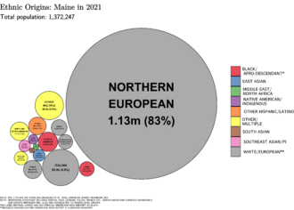
Maine has the highest percentage of non-Hispanic White people of any state, at 94.4% in 2010. Many people in Maine have English, Irish, or French backgrounds. Maine has the highest percentage of French Americans in the country. Many of them are of French Canadian origin.
Today, there are four federally recognized Native American tribes in Maine. These include the Mi'kmaq Nation.
Languages Spoken in Maine
Maine does not have an official language. English is the most common language. In 2010, about 92.91% of Maine residents spoke only English at home. French is the main minority language. Maine has the highest percentage of French speakers at home of any state (3.93%). Spanish is the third most common language.
Religion in Maine
Religious self-identification, per Public Religion Research Institute's 2022 American Values Survey Protestantism (41%) Catholicism (21%) Unitarian/Universalist (1%) Unaffiliated (30%) Judaism (5%) New Age (1%) Other (1%)
Most people in Maine are Christian. In 2022, about 63% of the population identified as Christian. About 30% said they were not affiliated with any religion. The largest Christian groups are Catholics and Protestants (like Baptists and Methodists). A small percentage of people follow other religions like Judaism or New Age beliefs.
Maine's Economy
Maine's total economic output was $91.1 billion in 2023. The average income per person in 2023 was $63,117. As of July 2025, Maine's unemployment rate is 3.2%. The minimum wage is $14.65.
Key Industries
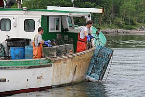
Commercial fishing is still important, especially lobstering. Maine is the largest producer of lobster in the U.S. Oyster and seaweed farming are also growing.
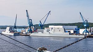
Maine's factories produce paper, wood products, electronics, and food. Shipbuilding is also a key industry. Major shipyards include Bath Iron Works in Bath and Portsmouth Naval Shipyard in Kittery.
Brunswick Landing, a former U.S. Navy base, is now a business park. It also has a campus for Southern Maine Community College.
Tourism and Recreation
Tourism is a very important part of Maine's economy. In 2023, over 15 million visitors spent more than $9 billion in Maine. People started visiting Maine for summer vacations even before the Civil War. They came for the fresh air, clean water, and beautiful scenery.
Acadia National Park is very popular. It attracts over 4 million visitors each year. In 2024, visitors spent $475 million in the Bar Harbor area near the park. The flagship L.L. Bean store in Freeport also attracts millions of visitors. Maine is a great place for hunting, sport fishing, snowmobiling, skiing, boating, camping, and hiking.
Creative Economy and Arts
Maine has a growing "creative economy," especially around Portland. This includes artists, craftspeople, museums, and cultural attractions. In 2022, Portland's arts and culture industry brought in $86 million.
Agriculture in Maine
Farms and farming are a big part of Maine's culture. Many families have farms, homesteads, or gardens. Native American groups like the Wabanaki Confederacy farmed corn and other crops in southern Maine long ago.
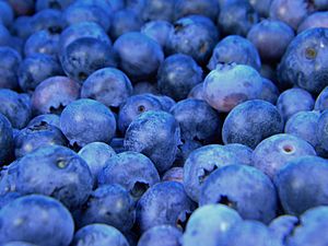
Maine is known for its potato crops, especially in Aroostook County. Potatoes bring in over $166 million a year. Maine is also the top U.S. producer of wild low-bush blueberries. In 2012, Maine produced over 91 million pounds of blueberries.
The seaweed industry is also growing. In 2022, Maine seaweed farmers harvested over 1 million pounds of seaweed. About 60% of American seaweed comes from Maine. Maine also has many organic farms.
Shipbuilding History
Maine has a long history of shipbuilding. In the 1700s and 1800s, many shipyards built wooden sailing ships. These ships carried goods and passengers across the ocean. Families like the Pennells, Skolfields, and Morses owned many of these shipyards. Wooden shipbuilding was a big part of Maine's economy back then.
Taxes in Maine
Maine has an income tax with two rates: 6.5% and 7.95%. The general sales tax rate is 5.5%. There are also taxes on lodging (9%) and short-term car rentals (10%). Blueberry sellers pay a small tax per pound of fruit sold. All property in Maine is taxed unless the law says otherwise.
Transportation in Maine
Airports
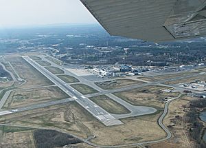
Maine has passenger jet service at its two largest airports: Portland International Jetport and Bangor International Airport. Both have daily flights to major cities like New York and Atlanta. Smaller airports around the state offer regional flights.
Highways
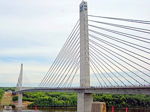
Interstate 95 (I-95) runs through Maine. Other important routes include U.S. Route 1, which starts in Fort Kent and goes all the way to Florida. U.S. Route 2 also passes through Maine.
Rail Travel
Passenger Trains
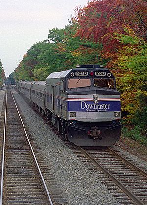
The Downeaster passenger train is run by Amtrak. It offers service between Brunswick and Boston. It stops in towns like Freeport, Portland, and Saco. The Downeaster makes five trips every day.
Freight Trains
Several companies provide freight train service in Maine. These include Pan Am Railways and St. Lawrence and Atlantic Railroad.
Shipping by Sea
The International Marine Terminal in Portland handles shipping containers. In 2021, about 36,700 shipping containers moved through this terminal. The Icelandic shipping company Eimskip has its U.S. headquarters in Portland. Its ships stop in Portland weekly, connecting Maine to Canada, Iceland, Europe, and Asia.
Government and Law
Maine's state government has three main parts: the executive, legislative, and judicial branches.
The legislative branch is the Maine Legislature. It has two parts: the Maine House of Representatives (151 members) and the Maine Senate (35 members). Their job is to create and pass laws.
The executive branch is led by the Governor of Maine. The Governor is elected every four years and can serve two terms in a row. The current Governor is Janet Mills. Maine is one of seven states that does not have a lieutenant governor.
The highest court in Maine's judicial branch is the Maine Supreme Judicial Court. Judges are chosen by the Governor and approved by the Legislature.
In 2012, Maine was one of the first U.S. states to allow marriage for same-sex couples.
Politics in Maine
Maine's politics are often varied. Governors sometimes win with less than a majority of votes. There are often changes in who represents different areas. Maine is seen as a state that leans Democratic but also supports independent candidates.
Maine uses ranked choice voting for some elections. This system allows voters to rank candidates in order of preference. This was approved by voters in 2016.
Counties of Maine
Maine is divided into 16 counties. These counties vary greatly in size.
| County name | County seat | Year founded | Population 2020 Census |
Percent of total | Area (sq. mi.) | Percent of total |
|---|---|---|---|---|---|---|
| Androscoggin | Auburn | 1854 | 111,139 | 8.16% | 497 | 1.44% |
| Aroostook | Houlton | 1839 | 67,105 | 4.93% | 6,829 | 19.76% |
| Cumberland | Portland | 1760 | 303,069 | 22.25% | 1,217 | 3.52% |
| Franklin | Farmington | 1838 | 29,456 | 2.16% | 1,744 | 5.05% |
| Hancock | Ellsworth | 1789 | 55,478 | 4.07% | 1,522 | 4.40% |
| Kennebec | Augusta | 1799 | 123,642 | 9.08% | 951 | 2.75% |
| Knox | Rockland | 1860 | 40,607 | 2.98% | 1,142 | 3.30% |
| Lincoln | Wiscasset | 1760 | 35,237 | 2.59% | 700 | 2.03% |
| Oxford | Paris | 1805 | 57,777 | 4.24% | 2,175 | 6.29% |
| Penobscot | Bangor | 1816 | 152,199 | 11.17% | 3,556 | 10.29% |
| Piscataquis | Dover-Foxcroft | 1838 | 16,800 | 1.23% | 4,377 | 12.67% |
| Sagadahoc | Bath | 1854 | 36,699 | 2.69% | 370 | 1.07% |
| Somerset | Skowhegan | 1809 | 50,477 | 3.71% | 4,095 | 11.85% |
| Waldo | Belfast | 1827 | 39,607 | 2.91% | 853 | 2.47% |
| Washington | Machias | 1790 | 31,095 | 2.28% | 3,255 | 9.42% |
| York | Alfred | 1636 | 211,972 | 15.56% | 1,271 | 3.68% |
| Total counties: 16 | Total 2020 population: 1,362,359 | Total state area: 34,554 square miles (89,494 km2) |
Cities and Towns
Organized Communities
An organized municipality has its own elected local government. This government provides services, keeps records, and can pass local rules. Most towns and plantations use a town meeting style of government. Most cities use a council-manager system. As of 2022, Maine has 23 cities, 430 towns, and 30 plantations. These organized communities cover less than half of the state. Maine also has three Native American Reservations.
- The largest city by population is Portland (68,408 people).
- The smallest city by population is Eastport (1,288 people).
- The largest town by population is Brunswick (21,756 people).
- The smallest town by population is Frye Island, a resort town with almost no year-round residents.
Unorganized Territory
Some parts of Maine are "unorganized territory." This means they have no local government. The state and county governments handle services and rules for these areas. Unorganized territory covers more than half of Maine's land. About 9,000 people live there year-round. Most of this area is in the vast, empty Great North Woods.
Largest Cities and Towns
|
Largest cities or towns in Maine
2020 U.S. Census populations |
||
|---|---|---|
| Rank | Name | Pop. |
| 1 | Portland | 68,408 |
| 2 | Lewiston | 37,121 |
| 3 | Bangor | 31,753 |
| 4 | South Portland | 26,498 |
| 5 | Auburn | 24,061 |
| 6 | Biddeford | 22,552 |
| 7 | Scarborough | 22,135 |
| 8 | Sanford | 21,982 |
| 9 | Brunswick | 21,756 |
| 10 | Westbrook | 20,400 |
Many cities and towns in Maine are close together, forming larger population areas. For example:
- Portland, South Portland, Westbrook, Scarborough, and Falmouth are all part of one large area.
- Lewiston and Auburn are often called "L/A."
- Bangor, Orono, and Brewer form another cluster.
Education in Maine
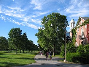
Maine has 30 colleges and universities. The University of Maine is the oldest and largest. It was founded in 1865 and is the state's only research university. It is located in Orono. There are also University of Maine campuses in Augusta, Farmington, Fort Kent, Machias, and Presque Isle.
Bowdoin College in Brunswick was founded in 1794. It is the oldest college in Maine. Colby College in Waterville (founded 1813) and Bates College in Lewiston (founded 1855) are also very old. These three colleges are known for being among the best liberal arts colleges in the U.S.
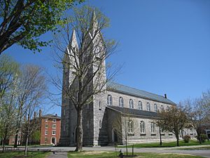
Maine also has community colleges. These colleges offer associate degrees and job training programs. Examples include Southern Maine Community College and Central Maine Community College.
There is one medical school, the University of New England College of Osteopathic Medicine. There is also one law school, the University of Maine School of Law.
Maine's Culture
Farms and Food
Farms are a big part of Maine's history and culture. Family farms and gardens are common. Before Europeans arrived, Native American groups in southern Maine grew large crops of corn.
Maine is famous for its food scene. Portland was named "Restaurant City of the Year" by Bon Appetit magazine in 2018. Biddeford was also named one of America's next great food cities in 2022.
Maine food uses many ingredients from Wabanaki cuisine. These include corn, beans, squash, wild blueberries, and maple syrup. The Maine Italian sandwich was invented in Portland in 1902. Baked beans are also a common dish, often cooked in a "bean hole" for community meals.
Festivals and Events
Maine has many annual fairs and festivals. These include:
- La Kermesse: A celebration of French and French Canadian heritage.
- The Fryeburg Fair and Cumberland Fair: Popular agricultural fairs.
- The Common Ground Country Fair: Focuses on organic farming and rural living.
- Many "Old Home Days" festivals.
- Various food festivals in Portland.
Sports Teams
Professional Sports
- Maine Celtics: Basketball team in the NBA G League.
- Portland Sea Dogs: Minor league baseball team.
- Maine Mariners: Ice hockey team.
- Portland Hearts of Pine: Soccer team.
College Sports
Maine has several college sports teams that play in the NCAA and USCAA. Some of these include:
- Maine Black Bears
- Bates Bobcats
- Colby Mules
- Bowdoin Polar Bears
Unique Maine Words
Maine has some special words and phrases:
- "Ayuh" - Means "Yes."
- "Can't get there from here" - Describes a place that is hard to reach.
- "Down cellah" - Means "in the basement."
- "Downeast" - Refers to the coastline of Washington and Hancock counties.
- "From away" - A person who is not originally from Maine.
- "Hard tellin’ not knowin'" - Means "I don't know."
- "Puckerbrush" - Thick plants that can scratch your legs.
- "Upta camp" - Going to a rustic, out-of-the-way cabin.
People from Maine
People from Maine are often called Mainers. The term "Downeaster" can refer to people from the northeast coast. Some people use the term "Mainiac" with pride, even though it can sometimes be seen as negative.
See also
 In Spanish: Maine para niños


