
National Register of Historic Places listings in Montana facts for kids

Have you ever wondered about old buildings or special places in Montana that have a lot of history? This article is all about those amazing spots! They are called properties and historic districts and are listed on the National Register of Historic Places. Think of it like a special list of important places across the United States.
Montana has over 1,100 of these cool places! They are spread out across all 56 of its counties. Each place on this list is important because it tells a story about Montana's past.
Contents
- Montana's Historic Places by County
- Historic Places in Blaine County
- Historic Places in Broadwater County
- Historic Places in Carter County
- Historic Places in Daniels County
- Historic Places in Fallon County
- Historic Places in Garfield County
- Historic Places in Golden Valley County
- Historic Places in Hill County
- Historic Places in Jefferson County
- Historic Places in Judith Basin County
- Historic Places in Lake County
- Historic Places in Liberty County
- Historic Places in Lincoln County
- Historic Places in McCone County
- Historic Places in Meagher County
- Historic Places in Musselshell County
- Historic Places in Petroleum County
- Historic Places in Phillips County
- Historic Places in Pondera County
- Historic Places in Powder River County
- Historic Places in Prairie County
- Historic Places in Richland County
- Historic Places in Roosevelt County
- Historic Places in Sheridan County
- Historic Places in Stillwater County
- Historic Places in Sweet Grass County
- Historic Places in Teton County
- Historic Places in Toole County
- Historic Places in Treasure County
- Historic Places in Wheatland County
- Historic Places in Wibaux County
- Images for kids
Montana's Historic Places by County
Here's a quick look at how many historic places are in each county in Montana.
.jpg)
| County | Number of Sites | |
|---|---|---|
| 1 | Beaverhead | 19 |
| 2 | Big Horn | 39 |
| 3 | Blaine | 7 |
| 4 | Broadwater | 7 |
| 5 | Carbon | 64 |
| 6 | Carter | 2 |
| 7 | Cascade | 46 |
| 8 | Chouteau | 21 |
| 9 | Custer | 18 |
| 10 | Daniels | 3 |
| 11 | Dawson | 13 |
| 12 | Deer Lodge | 33 |
| 13 | Fallon | 3 |
| 14 | Fergus | 42 |
| 15 | Flathead | 146 |
| 16 | Gallatin | 105 |
| 17 | Garfield | 1 |
| 18 | Glacier | 34 |
| 19 | Golden Valley | 5 |
| 20 | Granite | 11 |
| 21 | Hill | 9 |
| 22 | Jefferson | 8 |
| 23 | Judith Basin | 3 |
| 24 | Lake | 10 |
| 25 | Lewis and Clark | 69 |
| 26 | Liberty | 2 |
| 27 | Lincoln | 7 |
| 28 | Madison | 18 |
| 29 | McCone | 2 |
| 30 | Meagher | 6 |
| 31 | Mineral | 16 |
| 32 | Missoula | 84 |
| 33 | Musselshell | 2 |
| 34 | Park | 29 |
| 35 | Petroleum | 3 |
| 36 | Phillips | 5 |
| 37 | Pondera | 4 |
| 38 | Powder River | 2 |
| 39 | Powell | 17 |
| 40 | Prairie | 3 |
| 41 | Ravalli | 85 |
| 42 | Richland | 3 |
| 43 | Roosevelt | 4 |
| 44 | Rosebud | 21 |
| 45 | Sanders | 21 |
| 46 | Sheridan | 7 |
| 47 | Silver Bow | 17 |
| 48 | Stillwater | 11 |
| 49 | Sweet Grass | 8 |
| 50 | Teton | 1 |
| 51 | Toole | 7 |
| 52 | Treasure | 3 |
| 53 | Valley | 13 |
| 54 | Wheatland | 2 |
| 55 | Wibaux | 4 |
| 56 | Yellowstone | 37 |
| (less duplicates) | (9) | |
| TOTAL | 1,153 | |
Historic Places in Blaine County
| Name on the Register | Image | Date listed | Location | City or town | Description | |
|---|---|---|---|---|---|---|
| 1 | Chief Joseph Battleground of the Bear's Paw |
 |
(#70000355) |
About 15 miles south of Chinook, T30NR19E, Sections 1 and 12 48°22′39″N 109°12′26″W / 48.3775°N 109.207222°W |
Chinook | This is where the famous Battle of Bear Paw happened. It was a very important event in the history of the Nez Perce people. |
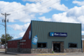
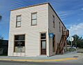
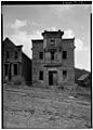
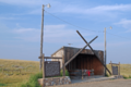
| 2 | Dave's Texaco |
_-_Blaine_County,_Montana.png) |
(#94000862) |
237 Pennsylvania St. 48°35′35″N 109°13′54″W / 48.593056°N 109.231667°W |
Chinook | An old gas station that shows what car service places looked like a long time ago. |
| 3 | Ervin Homestead-Gist Bottom Historic District |
(#16000410) |
River Mile 122.3 Left Coordinates missing |
Hays vicinity | This area includes an old homestead and land along the river, showing early farming life. | |
| 4 | Lodgepole Community Hall |
(#00000148) |
Fort Belknap Indian Community 48°02′04″N 108°31′57″W / 48.034444°N 108.5325°W |
Lodgepole | A community building important to the Fort Belknap Indian Community. | |
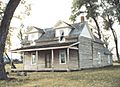
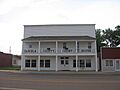
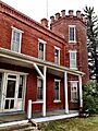
| 5 | Lohman Block |
 |
(#80002399) |
239-225 Indiana St. 48°35′35″N 109°13′49″W / 48.593056°N 109.230278°W |
Chinook | A historic building in Chinook that was once used for businesses and homes. |
| 6 | Anna Scherlie Homestead Shack |
(#98001338) |
Montana Highway 241, south of the Canada–US border 48°51′01″N 108°23′26″W / 48.850278°N 108.390556°W |
Turner | This small house shows how early settlers lived when they claimed land. | |
| 7 | Young Brothers Chevrolet Garage |
(#94000867) |
201 Pennsylvania St. 48°35′38″N 109°13′54″W / 48.593889°N 109.231667°W |
Chinook | Another old garage that tells about the early days of cars and businesses. |
Historic Places in Broadwater County
| Name on the Register | Image | Date listed | Location | City or town | Description | |
|---|---|---|---|---|---|---|
| 1 | Crow Creek Water Ditch |
(#01000323) |
Helena National Forest-Headwaters Resource Area 46°19′49″N 111°41′04″W / 46.330278°N 111.684444°W |
Townsend | An old water ditch used for irrigation, showing how people brought water to their farms. | |
| 2 | Eagle Guard Station |
 |
(#01001014) |
11 miles west of Townsend 46°19′15″N 111°42′26″W / 46.320833°N 111.707222°W |
Townsend | A historic building used by forest rangers to watch over the forests. |
| 3 | McCormick's Livery and Feed Stable Sign |
(#81000339) |
West of Townsend 46°19′06″N 111°37′43″W / 46.318333°N 111.628611°W |
Townsend | An old sign from a stable where people kept horses, showing how people traveled long ago. | |
| 4 | Rankin Ranch |
(#76001119) |
Avalanche Gulch Road 46°37′46″N 111°34′11″W / 46.629412°N 111.569648°W |
Townsend vicinity | A historic ranch that tells the story of farming and ranching in Montana. | |
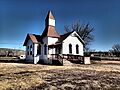
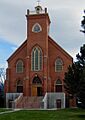
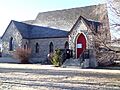
| 5 | St. Joseph's Catholic Mission Church |
(#98001339) |
3497 Montana Highway 284 46°24′32″N 111°26′55″W / 46.408889°N 111.448611°W |
Townsend | An old church that was part of a mission, important for the history of the area. | |
| 6 | State Bank of Townsend |
_-_Broadwater_County,_Montana.png) |
(#91001941) |
400 Broadway 46°19′12″N 111°31′51″W / 46.32°N 111.530833°W |
Townsend | A historic bank building that shows how important banks were to towns growing in Montana. |
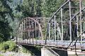
| 7 | Toston Bridge |
_-_Broadwater_County,_Montana.png) |
(#05000720) |
Spanning the Missouri River, on an abandoned segment of old U.S. Route 287, at Toston 46°10′19″N 111°26′34″W / 46.171944°N 111.442778°W |
Toston | An old bridge over the Missouri River, showing how people crossed rivers before modern roads. |
Historic Places in Carter County
| Name on the Register | Image | Date listed | Location | City or town | Description | |
|---|---|---|---|---|---|---|
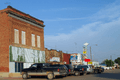
| 1 | First National Bank of Ekalaka and Rickard Hardware Store Building |
(#15000815) |
103 & 105 N. Main St. 45°53′25″N 104°32′54″W / 45.890378°N 104.548431°W |
Ekalaka | These two buildings together show what main street businesses looked like in the past. | |
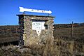
| 2 | Medicine Rocks State Park |
 |
(#100000539) |
1141 MT 7 46°02′43″N 104°27′30″W / 46.045410°N 104.458233°W |
Ekalaka vicinity | A state park known for its unique rock formations. It's a special natural and historical place. |
Historic Places in Daniels County
| Name on the Register | Image | Date listed | Location | City or town | Description | |
|---|---|---|---|---|---|---|
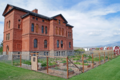
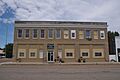
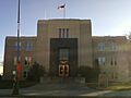
| 1 | Daniels County Courthouse |
 |
(#95000535) |
213 Main St. 48°47′27″N 105°25′12″W / 48.790833°N 105.42°W |
Scobey | The main building for the county government, showing important local history. |
| 2 | Mansfield A. Daniels House |
(#97000503) |
Approximately 2 miles west of Montana Highway 13 and 2 miles southwest of Scobey 48°46′23″N 105°27′51″W / 48.773056°N 105.464167°W |
Scobey | The home of Mansfield A. Daniels, an important person in the county's history. | |
| 3 | LaPierre Barn |
(#05000279) |
Approximately 3.5 miles northwest of Scobey on Tande Ranch Rd. 48°50′41″N 105°28′42″W / 48.844722°N 105.478333°W |
Scobey | A historic barn that shows how farming and ranching were done in the past. |
Historic Places in Fallon County
| Name on the Register | Image | Date listed | Location | City or town | Description | |
|---|---|---|---|---|---|---|
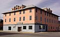
| 1 | Baker Hotel |
_(destroyed)_-_Fallon_County,_Montana.png) |
(#04001435) |
4 S. Main St. 46°22′07″N 104°16′28″W / 46.368611°N 104.274444°W |
Baker | An old hotel that was a key place for travelers and locals in Baker. |
| 2 | Cottonwood Creek Bridge |
_-_Fallon_County,_Montana.png) |
(#14000079) |
Mi. 2.2 Ismay Rd. 46°27′24″N 104°47′19″W / 46.456637°N 104.788596°W |
Ismay | A historic bridge over Cottonwood Creek, showing old building styles. |
| 3 | Fallon County Jail |
_-_Fallon_County,_Montana.png) |
(#98000946) |
723 S. Main St. 46°21′37″N 104°16′31″W / 46.360278°N 104.275278°W |
Baker | The old county jail, an important part of the area's law enforcement history. |
Historic Places in Garfield County
| Name on the Register | Image | Date listed | Location | City or town | Description | |
|---|---|---|---|---|---|---|
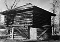
| 1 | Hornaday Camp |
(#91000298) |
10 miles south of Montana Highway 200 46°58′11″N 107°23′58″W / 46.969722°N 107.399444°W |
Sand Springs | A historic camp site, possibly used by early explorers or settlers. |
Historic Places in Golden Valley County
| Name on the Register | Image | Date listed | Location | City or town | Description | |
|---|---|---|---|---|---|---|
| 1 | Adams Hotel |
 |
(#05001377) |
1 Main St. 46°17′43″N 108°56′16″W / 46.295278°N 108.937778°W |
Lavina | A historic hotel that served travelers and locals in Lavina. |
| 2 | Grace Lutheran Church of Barber |
 |
(#82003171) |
West of Ryegate 46°18′51″N 109°23′04″W / 46.314167°N 109.384444°W |
Ryegate | An old church building that shows the history of the community. |
| 3 | Lavina State Bank |
 |
(#07001293) |
101 Main St. 46°17′40″N 108°56′15″W / 46.294444°N 108.9375°W |
Lavina | This bank building is a good example of early 20th-century architecture. |
| 4 | Sims-Garfield Ranch |
(#80002419) |
East of Ryegate Coordinates missing |
Ryegate | A historic ranch that played a role in the area's farming and ranching past. | |
| 5 | Slayton Mercantile Co. |
 |
(#00001567) |
23 Main St. 46°17′47″N 108°56′17″W / 46.296389°N 108.938056°W |
Lavina | An old general store, where people bought everything they needed in the past. |
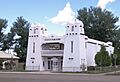
Historic Places in Hill County
| Name on the Register | Image | Date listed | Location | City or town | Description | |
|---|---|---|---|---|---|---|
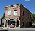
| 1 | Carnegie Public Library |
_-_Hill_County,_Montana.png) |
(#86001934) |
447 4th Ave. 48°32′57″N 109°40′35″W / 48.549167°N 109.676389°W |
Havre | A library built with money from Andrew Carnegie, a famous businessman. Many towns have these historic libraries. |
| 2 | H. Earl Clack House |
(#85003385) |
532 2nd Ave. 48°32′54″N 109°40′48″W / 48.548333°N 109.680000°W |
Havre | The home of H. Earl Clack, an important person in Havre's history. | |
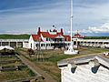
| 3 | Fort Assinniboine |
 |
(#89000040) |
County Route 82nd Ave. West, 0.5 miles southeast of U.S. Route 87 48°29′59″N 109°47′39″W / 48.499722°N 109.794167°W |
Havre | An old army fort that was important for protecting settlers and keeping peace. |
| 4 | Havre Residential Historic District |
 |
(#89001630) |
Roughly bounded by 3rd St., 7th Ave., 11th St., 5th Ave., 10th St., 3rd Ave., 7th St., and 1st Ave. 48°32′48″N 109°40′38″W / 48.546667°N 109.677222°W |
Havre | This area has many old homes that show how people lived in Havre long ago. |
| 5 | Heltne Oil Company |
(#94000865) |
140 1st St. 48°33′14″N 109°40′44″W / 48.553889°N 109.678889°W |
Havre | An old oil company building, showing the history of fuel and transportation. | |
| 6 | Kiwanis Meeting Hall |
(#10000133) |
17863 Beaver Creek Rd. 48°25′12″N 109°42′49″W / 48.420083°N 109.713514°W |
Havre | A meeting hall for the Kiwanis Club, a group that helps the community. | |
| 7 | Too Close for Comfort Site (24HL101) |
(#74001098) |
Behind the Wahkpa Chu'gn Meat Market on U.S. Route 2 48°33′40″N 109°42′55″W / 48.561111°N 109.715278°W |
Havre | An important archaeological site that tells about ancient people who lived here. | |
| 8 | US Post Office and Courthouse-Havre Main |
 |
(#86000682) |
306 3rd Ave. 48°33′05″N 109°40′42″W / 48.551389°N 109.678333°W |
Havre | This building served as both a post office and a courthouse, showing how government services were provided. |
| 9 | Young-Almas House |
(#80002421) |
419 4th Ave. 48°32′59″N 109°40′35″W / 48.549722°N 109.676389°W |
Havre | A historic house that shows the architecture and lifestyle of the past. |
Historic Places in Jefferson County
| Name on the Register | Image | Date listed | Location | City or town | Description | |
|---|---|---|---|---|---|---|
| 1 | Boulder Hot Springs Hotel |
 |
(#79001403) |
Southeast of Boulder on Montana Highway 281 46°12′02″N 112°05′33″W / 46.200556°N 112.0925°W |
Boulder | A hotel built around natural hot springs, a popular place for relaxation and health. |
| 2 | W.C. Child Ranch |
_-_Jefferson_County,_Montana.png) |
(#77000819) |
South of East Helena on Montana Highway 518 46°34′05″N 111°54′42″W / 46.568056°N 111.911667°W |
East Helena | An old ranch that shows the history of farming and ranching in the area. |
| 3 | Fraternity Hall |
 |
(#75001084) |
Main St. 46°16′30″N 111°56′44″W / 46.275°N 111.945556°W |
Elkhorn | A hall used by a fraternity or social group, important for community gatherings. |
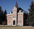
| 4 | Jefferson County Courthouse |
 |
(#80002422) |
200 Centennial Ave. 46°14′09″N 112°07′16″W / 46.235833°N 112.121111°W |
Boulder | The county courthouse, where important legal and government work happened. |
| 5 | MacHaffie Site (24JF4) |
(#86000619) |
Address Restricted |
Montana City | An archaeological site that gives clues about ancient human life in Montana. | |
| 6 | Modern Hotel |
(#11000951) |
Legion Ave. & Main St. 45°52′11″N 112°05′58″W / 45.869758°N 112.099339°W |
Whitehall | A historic hotel that shows the style of buildings from its time. | |
| 7 | Montana Deaf and Dumb Asylum |
_-_Jefferson_County,_Montana.png) |
(#85000994) |
Off Montana Highway 281 46°13′52″N 112°08′24″W / 46.231111°N 112.14°W |
Boulder | An important building that served as a school for deaf and mute people, showing the history of education. |
| 8 | Montana State Training School Historic District |
(#14000957) |
Roughly bounded by Montana Highway 69, Riverside Road, and the Boulder River 46°13′40″N 112°07′09″W / 46.227797°N 112.119280°W |
Boulder | This area includes buildings from a historic training school, showing how people with special needs were cared for. |
Historic Places in Judith Basin County
| Name on the Register | Image | Date listed | Location | City or town | Description | |
|---|---|---|---|---|---|---|
| 1 | Judith River Ranger Station |
 |
(#92000333) |
Along the Middle Fork of the Judith River, southwest of Utica in Lewis and Clark National Forest 46°50′51″N 110°17′25″W / 46.8475°N 110.290278°W |
Utica | An old ranger station, important for the history of forest management and protection. |
| 2 | Meadowbrook Stock Farm |
(#91001938) |
U.S. Route 87 47°01′35″N 109°50′57″W / 47.026389°N 109.849167°W |
Hobson | A historic farm that shows the agricultural past of the region. | |
| 3 | Wood Lawn Farm |
(#92001762) |
5 miles west of Hobson on Utica Road 239 46°59′17″N 109°58′36″W / 46.988056°N 109.976667°W |
Hobson | Another historic farm, important for understanding early farming methods. |
Historic Places in Lake County
| Name on the Register | Image | Date listed | Location | City or town | Description | |
|---|---|---|---|---|---|---|
| 1 | Big Arm School |
(#07000816) |
7th and D Sts. 47°47′48″N 114°17′41″W / 47.796667°N 114.294722°W |
Big Arm | An old school building that shows how education was provided in the past. | |
| 2 | Dayton State Bank |
(#12000829) |
133 C St. 47°51′52″N 114°16′40″W / 47.864363°N 114.277794°W |
Dayton | A historic bank building, important for the town's economic history. | |
| 3 | Fort Connah Site |
(#82003173) |
U.S. Route 93 47°24′20″N 114°05′14″W / 47.405556°N 114.087222°W |
Post Creek | The site of an old trading post, important for the fur trade and early interactions. | |
| 4 | Kootenai Lodge Historic District |
(#84002476) |
Sunburst Dr. 48°01′16″N 113°58′33″W / 48.021111°N 113.975833°W |
Bigfork | A group of historic buildings that were part of a lodge, showing early tourism. | |
| 5 | Frank Bird Linderman House |
(#84002479) |
Address Restricted |
Lake | The home of Frank Bird Linderman, a famous author and artist who wrote about Native American cultures. | |
| 6 | Don E. Olsson House and Garage |
(#08001325) |
503 4th Ave. SW. 47°31′29″N 114°06′11″W / 47.524634°N 114.103149°W |
Ronan | A historic house and garage that show the architectural styles of the past. | |
| 7 | Polson Feed Mill |
(#80002423) |
501 Main St. 47°41′28″N 114°09′44″W / 47.691111°N 114.162222°W |
Polson | An old mill that processed animal feed, important for the local agriculture. | |
| 8 | St. Ignatius Mission |
_2002-05.jpg) |
(#73001053) |
About 0.1 miles (0.16 km) southeast of Montana Highway 93 in St. Ignatius 47°18′54″N 114°06′07″W / 47.315°N 114.101944°W |
St. Ignatius | A beautiful and historic mission church with a rich history in the area. |
| 9 | St. Joseph's Catholic Church |
(#99000345) |
D'Aste Townsite 47°23′07″N 114°11′47″W / 47.385278°N 114.196389°W |
Moiese | Another historic Catholic church, showing the religious history of the community. | |
| 10 | Swan Lake Rock House Historic District |
(#84002485) |
Off Montana Highway 83 47°57′18″N 113°53′33″W / 47.955°N 113.8925°W |
Swan Lake | A group of unique houses built with rocks, showing a special building style. |
Historic Places in Liberty County
| Name on the Register | Image | Date listed | Location | City or town | Description | |
|---|---|---|---|---|---|---|
| 1 | First Episcopal Methodist Church of Chester |
(#97000974) |
Junction of 2nd St. and Madison 48°30′39″N 110°57′44″W / 48.510833°N 110.962222°W |
Chester | An old church building that tells about the religious history of Chester. | |
| 2 | First State Bank of Chester |
 |
(#97000975) |
Junction of Washington Ave. and 1st St., E. 48°30′47″N 110°57′52″W / 48.513056°N 110.964444°W |
Chester | The first state bank in Chester, important for the town's early business. |
Historic Places in Lincoln County
| Name on the Register | Image | Date listed | Location | City or town | Description | |
|---|---|---|---|---|---|---|
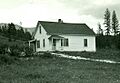
| 1 | Ant Flat Ranger Station |
 |
(#94001021) |
United States Forest Service Road 36, 2 miles south of Fortine in the Kootenai National Forest 48°43′26″N 114°52′35″W / 48.723889°N 114.876389°W |
Fortine | A historic ranger station used by forest service workers. |
| 2 | The Coram Hotel |
 |
(#12000593) |
302 California Ave. 48°23′36″N 115°33′08″W / 48.393251°N 115.552336°W |
Libby | An old hotel in Libby, showing what lodging was like in the past. |
| 3 | Eureka Community Hall |
(#85003236) |
Cliff St. 48°52′46″N 116°02′00″W / 48.879444°N 116.033333°W |
Eureka | A community hall that was a center for town events and gatherings. | |
| 4 | Farmers and Merchants State Bank |
 |
(#95001062) |
223 Dewey Ave. 48°52′50″N 115°03′08″W / 48.880556°N 115.052222°W |
Eureka | This bank building shows the history of business and finance in Eureka. |
| 5 | Libby High School |
(#08000823) |
Southwestern corner of the junction of Mineral Ave. and E. Lincoln Boulevard Coordinates missing |
Libby | The old high school building, important for the history of education in Libby. | |
| 6 | Theodore Roosevelt Memorial Bridge |
 |
(#06001178) |
Crossing the Kootenai River at Riverside Dr. 48°28′12″N 115°53′11″W / 48.47°N 115.886389°W |
Troy | A bridge named after President Theodore Roosevelt, showing old bridge building styles. |
| 7 | Troy Jail |
.jpg) |
(#06001179) |
316 E. Yaak Ave. 48°27′47″N 115°53′21″W / 48.463056°N 115.889167°W |
Troy | The old jail in Troy, a part of the town's early history of law and order. |
Historic Places in McCone County
| Name on the Register | Image | Date listed | Location | City or town | Description | |
|---|---|---|---|---|---|---|
| 1 | Gladstone Hotel |
.jpg) |
(#80004592) |
101 Main St. 47°25′02″N 105°35′15″W / 47.417306°N 105.587472°W |
Circle | A historic hotel that served as a central point for the community of Circle. |
| 2 | Lewis and Clark Bridge |
 |
(#97001451) |
Montana Highway 13 over the Missouri River 48°04′02″N 105°32′06″W / 48.067222°N 105.535°W |
Wolf Point | This bridge crosses the Missouri River and is named after the famous explorers Lewis and Clark. It also extends into Roosevelt County. |
Historic Places in Meagher County
| Name on the Register | Image | Date listed | Location | City or town | Description | |
|---|---|---|---|---|---|---|
| 1 | Fort Logan and Blockhouse |
 |
(#70000360) |
17 miles northwest of White Sulphur Springs 46°40′48″N 111°10′03″W / 46.68°N 111.1675°W |
White Sulphur Springs | An old fort and blockhouse, important for military history and protecting early settlements. |
| 2 | Parberry Block East |
(#09000237) |
18–20 East Main Street 46°32′53″N 110°54′11″W / 46.548056°N 110.902917°W |
White Sulphur Springs | A historic building that was part of the town's main business area. | |
| 3 | Byron R. Sherman House |
 |
(#77000820) |
310 2nd Ave., NE. 46°33′03″N 110°54′00″W / 46.550833°N 110.9°W |
White Sulphur Springs | The historic home of Byron R. Sherman, a notable person in the community. |
| 4 | Stockmen's Bank of Martinsdale |
_-_Meagher_County,_Montana.png) |
(#13000224) |
9 Main St. 46°27′31″N 110°18′54″W / 46.458629°N 110.315095°W |
Martinsdale | An old bank building that shows the financial history of Martinsdale. |
| 5 | Union League of America Hall |
(#98001084) |
Crawford St. at Central Ave., S. 46°32′42″N 110°54′08″W / 46.545°N 110.902222°W |
White Sulphur Springs | A hall used by the Union League of America, a group with historical importance. | |
| 6 | Wellman Block |
(#94000140) |
206 E. Main St. 46°32′52″N 110°54′04″W / 46.547778°N 110.901111°W |
White Sulphur Springs | Another historic building on Main Street, showing the town's past businesses. |
Historic Places in Musselshell County
| Name on the Register | Image | Date listed | Location | City or town | Description | |
|---|---|---|---|---|---|---|
| 1 | Roundup Central School |
 |
(#07001243) |
600 1st St., W. 46°26′50″N 108°32′37″W / 46.447222°N 108.543611°W |
Roundup | A historic school building that served the students of Roundup. |
| 2 | St. Benedict's Catholic School |
 |
(#88001120) |
524 1st St., W. 46°26′47″N 108°32′33″W / 46.446389°N 108.5425°W |
Roundup | Another historic school, showing the history of Catholic education in the area. |
Historic Places in Petroleum County
| Name on the Register | Image | Date listed | Location | City or town | Description | |
|---|---|---|---|---|---|---|
| 1 | Cat Creek Oil Field Sign |
 |
(#14001127) |
Mi. 150, MT 200 Coordinates missing |
Mosby vicinity | A sign marking the historic Cat Creek Oil Field, important for Montana's oil industry. |
| 2 | Winnett Block |
 |
(#09000815) |
301 E. Main St. Coordinates missing |
Winnett | A historic building in Winnett, likely used for businesses or homes. |
| 3 | Winnett School |
(#95000383) |
Junction of Moulton Ave. and Rowley St. 47°00′07″N 108°21′12″W / 47.00206°N 108.35343°W |
Winnett | The old school building in Winnett, important for the town's educational history. |
Historic Places in Phillips County
| Name on the Register | Image | Date listed | Location | City or town | Description | |
|---|---|---|---|---|---|---|
| 1 | H. Earl Clack Service Station |
_-_Phillips_County,_Montana.png) |
(#94000863) |
Southern side of U.S. Route 2 48°27′23″N 107°20′37″W / 48.456389°N 107.343611°W |
Saco | An old service station, showing the early days of cars and travel. |
| 2 | Phillips County Carnegie Library |
_-_Phillips_County,_Montana.png) |
(#80002428) |
S. 1st St. 48°21′35″N 107°52′34″W / 48.359722°N 107.876111°W |
Malta | Another Carnegie Library, a gift from Andrew Carnegie to help communities have libraries. |
| 3 | Fred Robinson Bridge |
(#12000171) |
Milepost 88, US 191, 51 miles (82 km) north of Lewistown 47°37′51″N 108°41′06″W / 47.630723°N 108.684937°W |
Lewistown vicinity | A historic bridge over the Missouri River, important for transportation. It also extends into Fergus County. | |
| 4 | Saco Mercantile |
_-_Phillips_County,_Montana.png) |
(#97001452) |
201 Taylor St. 48°27′22″N 107°20′30″W / 48.456111°N 107.341667°W |
Saco | An old general store, where people bought goods and supplies in the past. |
| 5 | Sleeping Buffalo Rock |
_-_Phillips_County,_Montana.png) |
(#96000548) |
Junction of U.S. Route 2 and Montana Highway 243 48°28′10″N 107°32′56″W / 48.469444°N 107.548889°W |
Saco | A large rock formation that is important to Native American history and culture. |
Historic Places in Pondera County
| Name on the Register | Image | Date listed | Location | City or town | Description | |
|---|---|---|---|---|---|---|
| 1 | Conrad City Hall |
 |
(#80002429) |
15 4th Ave., SW. 48°10′10″N 111°56′49″W / 48.169444°N 111.946944°W |
Conrad | The city hall building, where local government decisions were made. |
| 2 | Froggie's Stopping Place on the Whoop-Up Trail |
(#93000277) |
Address Restricted |
Conrad | A historic stopping point along the old "Whoop-Up Trail," a famous trade route. | |
| 3 | Two Medicine Fight Site |
(#70000361) |
About 25 miles southeast of Browning 48°28′N 112°28′W / 48.46°N 112.46°W |
Browning | The site of a historic battle or conflict, important for understanding the region's past. | |
| 4 | Valier Public School |
(#85000646) |
820 3rd St. 48°18′16″N 112°15′21″W / 48.304444°N 112.255833°W |
Valier | The old public school building in Valier, showing the history of education. |
Historic Places in Powder River County
| Name on the Register | Image | Date listed | Location | City or town | Description | |
|---|---|---|---|---|---|---|
| 1 | Cheever-Cain Ranch |
(#10000184) |
8 Trails End Rd. 45°36′47″N 105°55′19″W / 45.613083°N 105.921958°W |
Volborg | A historic ranch that tells about the ranching lifestyle in Montana. | |
| 2 | Cross Ranch Headquarters |
(#96000118) |
East of Montana Highway 59, roughly 26 miles south of Broadus 45°05′44″N 105°19′10″W / 45.095556°N 105.319444°W |
Broadus | The main buildings of a historic ranch, showing how large ranches operated. |
Historic Places in Prairie County
| Name on the Register | Image | Date listed | Location | City or town | Description | |
|---|---|---|---|---|---|---|
| 1 | Grandey Elementary School |
(#78001689) |
Off U.S. Route 10 46°47′29″N 105°18′30″W / 46.791389°N 105.308333°W |
Terry | An old elementary school building, important for the history of local education. | |
| 2 | Powder River Bridge |
(#09001186) |
Milepost 6 on Interstate 94 (Old U.S. Route 10) 46°44′14″N 105°25′43″W / 46.737228°N 105.428603°W |
Terry | A historic bridge over the Powder River, showing older bridge construction. | |
| 3 | Yellowstone River Bridge |
 |
(#09001187) |
Milepost 1 on Interstate 94 (Old U.S. Route 10) 46°51′20″N 105°06′59″W / 46.855564°N 105.116367°W |
Fallon | A historic bridge over the Yellowstone River, a major waterway in Montana. |
Historic Places in Richland County
| Name on the Register | Image | Date listed | Location | City or town | Description | |
|---|---|---|---|---|---|---|
| 1 | Burgess Garage |
(#04001434) |
Corner of 3rd and Main 47°41′06″N 104°37′15″W / 47.685°N 104.620833°W |
Fox Lake | An old garage building, showing the history of cars and repairs in the area. | |
| 2 | Fort Union Trading Post National Historic Site |
 |
(#66000103) |
15550 Highway 1804 47°59′58″N 104°02′13″W / 47.999444°N 104.036944°W |
Williston, North Dakota, vicinity | A very important historic site that was a major fur trading post. It's partly in North Dakota and Roosevelt County, Montana. |
| 3 | Peoples' Congregational Church |
(#82003179) |
203 2nd Ave., SW. 47°42′53″N 104°09′33″W / 47.714722°N 104.159167°W |
Sidney | A historic church building, showing the religious heritage of Sidney. |
Historic Places in Roosevelt County
| Name on the Register | Image | Date listed | Location | City or town | Description | |
|---|---|---|---|---|---|---|
| 1 | Fort Peck Agency |
 |
(#70000365) |
In Poplar 48°06′51″N 105°11′36″W / 48.114167°N 105.193333°W |
Poplar | The historic agency for the Fort Peck Indian Reservation. |
| 2 | Fort Union Trading Post National Historic Site |
|
(#66000103) |
15550 Highway 1804 47°59′58″N 104°02′13″W / 47.999444°N 104.036944°W |
Williston, North Dakota, vicinity | A very important historic site that was a major fur trading post. It's partly in North Dakota and Richland County, Montana. |
| 3 | Hale's Filling Station and Grocery |
(#94000864) |
Lanark Townsite 48°08′34″N 104°21′26″W / 48.142778°N 104.357222°W |
Bainville | An old gas station and grocery store, showing how people got their supplies. | |
| 4 | Lewis and Clark Bridge |
|
(#97001451) |
Montana Highway 13 over the Missouri River 48°04′02″N 105°32′06″W / 48.067222°N 105.535°W |
Wolf Point | This bridge crosses the Missouri River and is named after the famous explorers Lewis and Clark. It also extends into McCone County. |
Historic Places in Sheridan County
| Name on the Register | Image | Date listed | Location | City or town | Description | |
|---|---|---|---|---|---|---|
| 1 | Comertown Historic District |
(#93001149) |
Roughly the entire community of Comertown, west of Westby 48°53′49″N 104°15′00″W / 48.896944°N 104.25°W |
Comertown | This historic area includes many buildings from the old community of Comertown. | |
| 2 | Aage and Kristine Larsen Homestead |
(#93001146) |
County Highway 516 north of Dagmar 48°37′46″N 104°11′14″W / 48.629444°N 104.187222°W |
Dagmar | A historic homestead that shows how early settlers lived and farmed. | |
| 3 | Outlook Depot |
(#93001144) |
South of the western edge of Marr St., south of Block 10 48°53′08″N 104°46′37″W / 48.885556°N 104.776944°W |
Outlook | The old train station in Outlook, important for the town's connection to the railway. | |
| 4 | Raymond Grain Elevators Historic District |
(#93001148) |
Unnamed county road east of Montana Highway 16, northeast of Raymond 48°52′43″N 104°34′39″W / 48.878611°N 104.5775°W |
Raymond | A group of historic grain elevators, showing the importance of farming and grain storage. | |
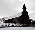
| 5 | Rocky Valley Lutheran Church |
(#93001145) |
Junction of Ueland St. and an unnamed county road 48°52′54″N 104°23′18″W / 48.881667°N 104.388333°W |
Dooley | A historic church building in Rocky Valley. | |
| 6 | Thornwood School |
(#93001147) |
Unnamed county road approximately 17 miles west of Reserve 48°36′06″N 104°47′55″W / 48.601667°N 104.798611°W |
Reserve | An old school building, showing how rural education was provided. | |
| 7 | Tipi Hills |
(#75001085) |
Address Restricted |
Medicine Lake | A historic site important to Native American culture, likely where tipis were set up. |
Historic Places in Stillwater County
| Name on the Register | Image | Date listed | Location | City or town | Description | |
|---|---|---|---|---|---|---|
| 1 | 4K Ranch |
(#02000049) |
Fiddler Creek Rd. 45°22′48″N 109°41′45″W / 45.38°N 109.695833°W |
Dean | A historic ranch that shows the history of ranching in the area. | |
| 2 | Atlas Block |
 |
(#11000588) |
523 & 528 E. Pike Ave. 45°38′13″N 109°15′11″W / 45.636944°N 109.253056°W |
Columbus | A historic building in Columbus, likely used for businesses or apartments. |
| 3 | Halfway House |
(#02000047) |
3951 Montana Highway 78 45°34′08″N 109°19′57″W / 45.568889°N 109.3325°W |
Columbus | A historic stopping point for travelers, often called a "halfway house" because it was halfway between two towns. | |
| 4 | Oliver H. Hovda House |
 |
(#84002506) |
N. Woodward St. 45°31′19″N 109°26′23″W / 45.521944°N 109.439722°W |
Absarokee | The historic home of Oliver H. Hovda, showing past architectural styles. |
| 5 | Michael Jacobs House |
 |
(#86003676) |
4 W. 1st Ave., N. 45°38′24″N 109°15′33″W / 45.64°N 109.259167°W |
Columbus | The historic home of Michael Jacobs. |
| 6 | Mountain View Cemetery |
(#87001200) |
U.S. Route 10 and Rapelje Rd. 45°38′31″N 109°16′22″W / 45.641944°N 109.272778°W |
Columbus | A historic cemetery, important for understanding the community's past residents. | |
| 7 | W.H. Norton House |
 |
(#82000597) |
3rd Ave. 45°38′27″N 109°15′11″W / 45.640833°N 109.253056°W |
Columbus | The historic home of W.H. Norton. |
| 8 | Sandstone and Cobblestone Schools |
 |
(#86002949) |
142 S. Woodard Ave. 45°30′37″N 109°26′45″W / 45.510278°N 109.445833°W |
Absarokee | Two old school buildings, one made of sandstone and one of cobblestone, showing different building materials. |
| 9 | Stoltz House |
(#91000422) |
405 SW. 1st St. 45°37′45″N 108°54′44″W / 45.629167°N 108.912222°W |
Park City | The historic Stoltz House. | |
| 10 | Torgrimson Place |
(#01000921) |
W. Rosebud Rd. 45°23′39″N 109°32′52″W / 45.394167°N 109.547778°W |
Fishtail | A historic place that tells about the early settlement of the area. | |
| 11 | United Methodist Episcopal Church |
(#10000497) |
Southeast corner of Clark St. and Second Ave. 45°37′50″N 108°54′54″W / 45.630556°N 108.915°W |
Park City | A historic church building in Park City. |
Historic Places in Sweet Grass County
| Name on the Register | Image | Date listed | Location | City or town | Description | |
|---|---|---|---|---|---|---|
| 1 | Big Timber Town Hall |
 |
(#98000125) |
225 McLeod St. 45°50′02″N 109°57′11″W / 45.833889°N 109.953056°W |
Big Timber | The town hall building, important for local government and community events. |
| 2 | Brannin Ranch |
(#88003142) |
West of Melville on Sweet Grass Creek 46°07′27″N 110°11′53″W / 46.124167°N 110.198056°W |
Melville | A historic ranch that shows the history of ranching in the area. | |
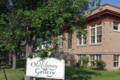
| 3 | Carnegie Public Library |
 |
(#02000725) |
314 McLeod St. 45°49′57″N 109°57′07″W / 45.8325°N 109.951944°W |
Big Timber | Another Carnegie Library, a gift from Andrew Carnegie to help communities have libraries. |
| 4 | Grand Hotel |
 |
(#85002424) |
139 McLeod St. 45°50′04″N 109°57′14″W / 45.834444°N 109.953889°W |
Big Timber | A grand old hotel that served travelers and locals in Big Timber. |
| 5 | Waborn (Wabe) and Sarah E. Harrison Ranch House |
(#98001111) |
Roughly located at the confluence of the Sweet Grass Creek and the Yellowstone River 45°47′16″N 109°46′57″W / 45.787778°N 109.7825°W |
Greycliff | The historic ranch house of the Harrison family. | |
| 6 | John Otto Spannring Family Farm |
(#95000145) |
7 miles east of Big Timber 45°48′50″N 109°50′48″W / 45.813889°N 109.846667°W |
Big Timber | A historic family farm that shows the agricultural history of the area. | |
| 7 | St. Mark's Episcopal Church |
 |
(#95000900) |
W. 4th Ave. 45°49′53″N 109°57′12″W / 45.831389°N 109.953333°W |
Big Timber | A historic church building in Big Timber. |
| 8 | Yellowstone Crossing, Bozeman Trail |
(#78003407) |
Northeast of Springdale on U.S. Route 10 45°45′13″N 110°09′56″W / 45.753611°N 110.165556°W |
Springdale | This site marks where the famous Bozeman Trail crossed the Yellowstone River. |
Historic Places in Teton County
| Name on the Register | Image | Date listed | Location | City or town | Description | |
|---|---|---|---|---|---|---|
| 1 | Teton County Courthouse |
 |
(#06001093) |
1 Main Ave., S. 47°48′39″N 112°10′53″W / 47.810833°N 112.181389°W |
Choteau | The county courthouse, an important building for the local government. |
Historic Places in Toole County
| Name on the Register | Image | Date listed | Location | City or town | Description | |
|---|---|---|---|---|---|---|
| 1 | Bethany Lutheran Church |
(#93001375) |
0.25 miles (0.40 km) south of Gus Blaze Rd. 48°41′37″N 111°38′41″W / 48.693611°N 111.644722°W |
Oilmont | A historic Lutheran church building in Oilmont. | |
| 2 | Kevin Depot |
|
(#80002433) |
Central Ave. and 1st St. 48°44′45″N 111°58′04″W / 48.745719°N 111.96766°W |
Kevin | The old train station in Kevin, important for the town's connection to the railway. |
| 3 | Marias River Bridge |
(#12000173) |
Mile 6, Marias Valley Rd. 48°25′38″N 111°53′26″W / 48.427307°N 111.890624°W |
Shelby vicinity | A historic bridge over the Marias River. | |
| 4 | Rainbow Conoco |
 |
(#94000866) |
400 Main St. 48°30′23″N 111°51′31″W / 48.506389°N 111.858611°W |
Shelby | An old Conoco gas station with a unique rainbow design. |
| 5 | Rocky Springs Segment of the Whoop-Up Trail |
(#93000278) |
Address Restricted |
Kevin | A part of the historic "Whoop-Up Trail," an old trade route. | |
| 6 | Shelby Town Hall |
(#06000040) |
100 Montana Ave. 48°30′16″N 111°51′15″W / 48.504444°N 111.854167°W |
Shelby | The town hall building, important for Shelby's local government. | |
| 7 | US Customs Building |
(#91000152) |
Interstate 15 just south of the Canada–US border 48°59′54″N 111°57′31″W / 48.998333°N 111.958611°W |
SweetGrass | A building used by U.S. Customs at the border with Canada. |
Historic Places in Treasure County
| Name on the Register | Image | Date listed | Location | City or town | Description | |
|---|---|---|---|---|---|---|
| 1 | Big Horn River Bridge |
(#09001188) |
Milepost 2 on Montana Highway 104 (Old U.S. Route 10) 46°08′50″N 107°28′03″W / 46.147331°N 107.467608°W |
Custer | A historic bridge over the Big Horn River. | |
| 2 | Sanders Gymnasium and Community Hall |
(#97000976) |
Old Montana Highway 10, 6 miles east of Hysham 46°17′25″N 107°06′06″W / 46.290278°N 107.101667°W |
Sanders | A historic building that served as both a gym and a community hall. | |
| 3 | Yucca Theatre |
 |
(#93001447) |
520 Division St. 46°17′34″N 107°14′00″W / 46.292778°N 107.233333°W |
Hysham | A historic movie theater in Hysham. |
Historic Places in Wheatland County
| Name on the Register | Image | Date listed | Location | City or town | Description | |
|---|---|---|---|---|---|---|
| 1 | Graves Hotel |
 |
(#80002434) |
106 S. Central Ave. 46°26′01″N 109°49′50″W / 46.4336°N 109.83059°W |
Harlowton | A historic hotel in Harlowton. |
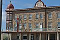
| 2 | Milwaukee Road Historic District |
 |
(#88001024) |
Southern end of Central Ave. 46°25′49″N 109°49′38″W / 46.430278°N 109.827222°W |
Harlowton | This area includes historic buildings related to the Milwaukee Road railway. |
Former Listings
| Name on the Register | Image | Date listed | Date removed | Location | City or town | Summary | |
|---|---|---|---|---|---|---|---|
| 1 | McQuitty Building |
(#80002435) |
|
121 N. Central Ave. |
Harlowton | This building was once on the list but was later removed. |
Historic Places in Wibaux County
| Name on the Register | Image | Date listed | Location | City or town | Description | |
|---|---|---|---|---|---|---|
| 1 | St. Peter's Catholic Church |
.jpg) |
(#90000356) |
W. Orgain Ave. 46°59′14″N 104°11′28″W / 46.987222°N 104.191111°W |
Wibaux | A historic Catholic church in Wibaux. |
| 2 | Vogt-Nunberg Farm |
(#08000269) |
7262 Montana Highway 7 46°49′02″N 104°13′27″W / 46.81735°N 104.22417°W |
Wibaux | A historic farm that shows the agricultural history of the area. | |
| 3 | Wibaux Commercial Historic District |
_-_Wibaux_County,_Montana.png) |
(#89002170) |
Roughly bounded by W. Orgain Ave., Wibaux, E. 1st Ave., S., and E 46°59′11″N 104°11′15″W / 46.986389°N 104.1875°W |
Wibaux | This area includes many historic business buildings in Wibaux. |
| 4 | Pierre Wibaux House |
 |
(#71000483) |
Orgain Ave. 46°59′12″N 104°11′06″W / 46.986667°N 104.185°W |
Wibaux | The historic home of Pierre Wibaux, an important figure in the town's history. |
Images for kids
-
Chief Plenty Coups' House in Big Horn County. He was a famous Crow chief.
-
The Yucca Theatre in Treasure County, a historic movie theater.
-
The Battle of Bear Paw site in Blaine County.
-

Dave's Texaco in Chinook, Blaine County.
-

The Lohman Building in Chinook, Blaine County.
-
Eagle Guard Station in Broadwater County.
-
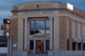
The State Bank of Townsend in Broadwater County.
-
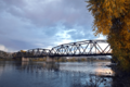
The Toston Bridge over the Missouri River.
-
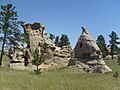
Medicine Rocks State Park in Carter County.
-
The Daniels County Courthouse in Scobey.
-
The Baker Hotel in Fallon County (now destroyed).
-
Cottonwood Creek Bridge in Fallon County.
-
The Fallon County Jail in Baker.
-

The Adams Hotel in Lavina, Golden Valley County.
-
Grace Lutheran Church of Barber in Golden Valley County.
-
Lavina State Bank in Golden Valley County.
-

Slayton Mercantile Co. in Lavina, Golden Valley County.
-
Carnegie Public Library in Havre, Hill County.
-
Company Officers' Quarters at Fort Assinniboine.
-

A historic home in the Havre Residential Historic District.
-

The Old Post Office and Courthouse in Havre.
-

Boulder Hot Springs Hotel in Jefferson County.
-
The W.C. Child Ranch in Jefferson County.
-
Fraternity Hall in Elkhorn, Jefferson County.
-
Jefferson County Courthouse in Boulder.
-
The Montana Deaf and Dumb Asylum.
-
Judith River Ranger Station in Judith Basin County.
-
St. Ignatius Mission in Lake County.
-

First State Bank of Chester in Liberty County.
-
Ant Flat Ranger Station in Lincoln County.
-
The Coram Hotel in Libby, Lincoln County.
-
Farmers and Merchants State Bank in Eureka.
-
Theodore Roosevelt Memorial Bridge in Troy.
-
The Troy Jail in Lincoln County.
-
Gladstone Hotel in Circle, McCone County.
-
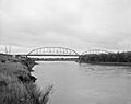
Lewis and Clark Bridge near Wolf Point.
-
Fort Logan Blockhouse in Meagher County.
-

Byron R. Sherman House in White Sulphur Springs.
-

Stockmen's Bank of Martinsdale.
-

Roundup Central School in Musselshell County.
-

St. Benedict's Catholic School in Roundup.
-
Cat Creek Oil Field Sign in Petroleum County.
-
Winnett Block in Winnett, Petroleum County.
-

H. Earl Clack Service Station in Saco.
-

Phillips County Carnegie Library in Malta.
-
Saco Mercantile in Saco.
-
Sleeping Buffalo Rock near Saco.
-
Conrad City Hall in Pondera County.
-

Yellowstone River Bridge in Prairie County.
-
Fort Union Trading Post National Historic Site.
-

Big Timber Town Hall in Sweet Grass County.
-

Carnegie Public Library in Big Timber.
-
Grand Hotel in Big Timber.
-
St. Mark's Episcopal Church in Big Timber.
-

Teton County Courthouse in Choteau.
-

Kevin Depot in Toole County.
-

Rainbow Conoco in Shelby.
-
Yucca Theatre in Hysham.
-
Graves Hotel in Harlowton, Wheatland County.
-

Milwaukee Road Historic District in Harlowton.
-
St. Peter's Catholic Church in Wibaux.
-
Wibaux Commercial Historic District.
-

Pierre Wibaux House in Wibaux.
