Rockland County, New York facts for kids
Quick facts for kids
Rockland County
|
|||
|---|---|---|---|
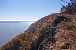
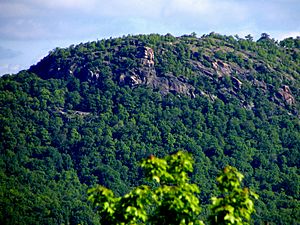
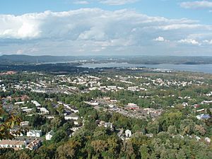
The Hudson River looking southward from Hook Mountain State Park
|
|||
|
|||
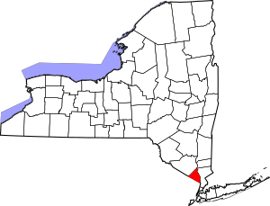
Location within the U.S. state of New York
|
|||
 New York's location within the U.S. |
|||
| Country | |||
| State | |||
| Founded | February 23, 1798 | ||
| Named for | Its rocky terrain | ||
| Seat | New City | ||
| Largest town | Ramapo | ||
| Area | |||
| • Total | 199.34 sq mi (516.3 km2) | ||
| • Land | 173.55 sq mi (449.5 km2) | ||
| • Water | 25.79 sq mi (66.8 km2) 13% | ||
| Population
(2020)
|
|||
| • Total | 338,329 | ||
| • Estimate
(2022)
|
339,022 | ||
| • Density | 1,697.25/sq mi (655.310/km2) | ||
| Time zone | UTC−5 (Eastern) | ||
| • Summer (DST) | UTC−4 (EDT) | ||
| Area code | 845 | ||
| Congressional district | 17th | ||
Rockland County is located in New York. It's on the west side of the Hudson River, south of Orange County. This area is part of the larger New York metropolitan area.
In 2020, about 338,329 people lived here. This makes it one of the most crowded counties in New York, outside of New York City. The main town and largest community is New City. You can reach Rockland County by major roads like the New York State Thruway and the Palisades Parkway. The county's name comes from its "rocky land," which describes the area well. This is mostly because of the Hudson River Palisades, which are tall cliffs along the river. Rockland County is also part of the Hudson Valley region.
Rockland County is the smallest county in New York State, not counting those within New York City. It has five towns and many villages and hamlets. A big part of the county, almost one-third, is parkland. This means there are lots of green spaces to explore. Rockland County also has the largest percentage of Jewish people in any U.S. county.
Contents
History of Rockland County
The land that is now Rockland County was first home to Native American groups. These included the Munsee and Lenape people, who spoke Algonquian languages.
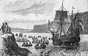
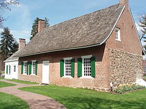
In 1609, Henry Hudson sailed his ship, the Half Moon, up the river that is now named after him. He was looking for a way to sail to Asia. He stopped near what is now Haverstraw. The first Europeans to settle here were the Dutch around 1675. They moved from Manhattan to escape city life. You can still see some unique Dutch-style red sandstone houses today. Many local place names also show their Dutch origins.
When New York State was first divided into counties in 1683, Rockland County was part of Orange County. It was called "Orange County South of the Mountains." Over time, the English settled in places like Nyack and Tappan. The Native Americans then moved further north to find undisturbed land.
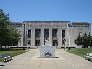
It was hard to govern such a large area because of the Ramapo Mountains. So, in 1798, Rockland County separated from Orange County to form its own county. The main government office moved from Tappan to New City, where a new courthouse was built.
During the American Revolution, the British wanted to control the Hudson River. This led to many small fights in Rockland County. Important battles happened at the Battle of Stony Point. General "Mad" Anthony Wayne earned his nickname there. George Washington also had his headquarters in the area for a while.
A famous event involved British Major John André and American traitor Benedict Arnold. They met near Stony Point to discuss Arnold's plan to give away the fortifications at West Point. André was caught with the plans and later tried and hanged in Tappan.
After the Revolution, Rockland became known for its stone and bricks. Later, people wanted to protect the beautiful natural areas. E. H. Harriman, a railroad president, donated land and money to create Bear Mountain/Harriman State Park. This park opened in 1910 and quickly became very popular.
Rockland County stayed mostly rural until the 1950s. Then, new roads like the Palisades Interstate Parkway and the Tappan Zee Bridge were built. This made it easier to get to the county. Many people moved from cities to the suburbs, and Rockland County grew a lot. Its population went from about 89,276 in 1950 to 265,475 in 1990.
Geography and Nature
Rockland County covers about 199 square miles. Around 174 square miles are land, and 26 square miles are water. It's the smallest county in New York State outside of New York City.
The county is just north of the New Jersey-New York border. It's west of Westchester County across the Hudson River. To its north is Orange County.
The land in Rockland County ranges from sea level along the Hudson River to 1,283 feet high on Rockhouse Mountain. About 30% of the county is parkland. These parks offer walking and hiking trails, sports fields, and historic sites. Some popular state parks include Bear Mountain State Park, Harriman State Park, and Nyack Beach State Park. Rockland also has many public and private golf courses.
Neighboring Counties
Rockland County shares borders with these other counties:
- Orange County (to the northwest)
- Putnam County (to the northeast)
- Westchester County (to the east)
- Passaic County, New Jersey (to the west)
- Bergen County, New Jersey (to the south)
People and Population
2020 Census Information
In 2020, there were 338,329 people living in Rockland County. The population density was about 1,950 people per square mile. There were 100,438 households in the county.
| Rockland County Demographics | |
|---|---|
| Racial demographics of Rockland according to 2020 US Census Bureau data: | |
| Race | Percentage |
| White (Whites of non-Hispanic origin: 62.7%) | 77.9% |
| Hispanics and Latinos (of any race) | 18.4% |
| Black | 13.1% |
| Asian | 6.2% |
| Multiracial | 2.1% |
| American Indian and Alaska Native persons | 0.6% |
| Native Hawaiian and Other Pacific Islander persons | 0.1% |
About 38% of households had children under 18 living with them. Most households, 63%, were married couples. The average household had 3 people, and the average family had 3.5 people.
The median age in the county was 36 years old. This means half the people were older than 36 and half were younger. The median income for a household was $93,024. This is the middle income for all households.
Jewish Community
As of 2017, about 15% of the people in Rockland County are from the Orthodox Jewish and Hasidic Jewish communities.
Education and Learning
Rockland County is home to several schools that have won the Blue Ribbon School of Excellence Award. This award is given by the U.S. Department of Education for high achievement.
- In 2000–2001, Liberty Elementary School in Valley Cottage
- In 2007, Strawtown Elementary School in West Nyack
- In 2008 & 2014, Franklin Avenue Elementary School in Pearl River
- In 2009, George W. Miller Elementary School in Nanuet
- In 2011, Pearl River Middle School in Pearl River
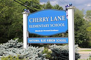
- In 2013, Cherry Lane Elementary School in Airmont
- In 2016, Nanuet Senior High School in Nanuet
- In 2018, Clarkstown High School South
- In 2022, Nanuet Senior High School in Nanuet
School Districts
Here are the different school districts in Rockland County:
- Clarkstown Central School District
- East Ramapo Central School District
- Nanuet Union Free School District
- North Rockland Central School District (Haverstraw-Stony Point)
- Nyack Public Schools
- Pearl River Union Free School District
- South Orangetown Central School District
- Suffern Central School District
Colleges and Universities
Rockland County also has several colleges and universities:
- Beth Medrash Elyon
- Dominican University New York - Orangeburg
- Long Island University extension site at Rockland Community College - Suffern
- Columbia University's Lamont–Doherty Earth Observatory
- Rabbinical College Beth Shraga - Monsey, NY
- Rockland Community College - Suffern, NY
- St. Thomas Aquinas College - Sparkill, NY
- Yeshiva D'Monsey Rabbinical College - Monsey
- Yeshivath Viznitz - Kaser (Monsey)
Getting Around Rockland County
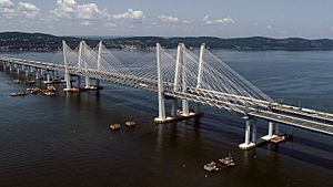
The Governor Mario M. Cuomo Bridge, also known as the Tappan Zee Bridge, connects Rockland County to Westchester County across the Hudson River. A new bridge was built in 2017 to replace the old one.
Main Roads
Several major highways serve Rockland County. These include Interstate 87/287, which is part of the New York Thruway. The Palisades Interstate Parkway connects the county to the George Washington Bridge in the south. The Garden State Parkway also connects New Jersey to the Thruway.
 I-87
I-87 I-287
I-287 US 6
US 6 US 9W
US 9W US 202
 Garden State Parkway
 Palisades Parkway
 NY 17
NY 17 NY 45
NY 45 NY 59
NY 59 NY 210
 NY 303
 NY 304
 NY 306
 NY 340
Bus Services
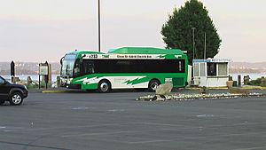
The Transport of Rockland (TOR) runs local bus routes throughout the county. There are also express buses called Hudson Link that go to nearby cities and train stations in Westchester County. TOR connects to other bus services and private commuter lines that go to North Jersey and New York City.
Train Services
NJ Transit/Metro-North Railroad operates train lines that stop in Rockland County. The Port Jervis Line stops at Suffern and Sloatsburg. The Pascack Valley Line stops at Pearl River, Nanuet, and Spring Valley. These lines can take you to Hoboken Terminal in New Jersey, where you can connect to other trains or buses to New York City.
Ferry Services
NY Waterway runs a ferry service between Haverstraw in Rockland County and Ossining in Westchester County. This ferry helps people get to Metro-North's Hudson Line trains, which go to Grand Central Terminal in New York City. The ferry usually stops running in winter when the Hudson River freezes.
Airports Nearby
If you need to fly, there are several airports close to Rockland County:
- In New York: John F. Kennedy International Airport, LaGuardia Airport, Westchester County Airport, and Stewart International Airport
- In New Jersey: Newark Liberty International Airport, Teterboro Airport
Sports and Recreation
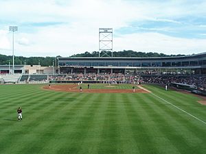
- The New York Boulders are a professional baseball team that plays in the Frontier League. They play their home games at Clover Stadium in Ramapo.
- Rockland Country Club in Sparkill, New York has an 18-hole golf course.
- The New York Raiders are a semi-professional rugby league team. They play their home games at Rockland Lake State Park.
Local Media
- The Journal News
- Our Town
- WRKL AM 910
- WRCR AM 1700
- Left of the Hudson
- Rockland World Radio
- Nyack News and Views
- Rockland County Times
- Rockland Review
- The Hook
- Rockland County's Best Magazine
- Clipper
Solar Power Project
In 2014, Clarkstown built a large solar power system. It has about 4,300 solar panels on top of a closed landfill in West Nyack. This system can create enough electricity to power about 200 homes each year. It provides one-third of the electricity needed for the Town of Clarkstown government. This project helps save taxpayers money and produces clean energy.
Towns and Villages
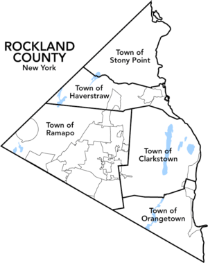
Rockland County has five main towns. The town with the most people is Ramapo, and the one with the fewest is Stony Point.
In 2015, some towns and villages in Rockland County were ranked among the safest places in New York. These included Clarkstown, Haverstraw, Orangetown, Ramapo, Stony Point, Spring Valley, and Suffern.
There are nineteen incorporated villages in Rockland County. Many of these are in the town of Ramapo. There are also seventeen Census-designated places and seven hamlets within the county's five towns.
Towns (5)
Villages (19)
Census-Designated Places (17)
Hamlets (7)
Places to Visit
Educational and Cultural Sites
- Major John Andre Monument - In Tappan, New York. This monument remembers British officer John André, who was executed during the American Revolutionary War.
- Camp Shanks - In Orangetown, New York. A museum located at a former military camp.
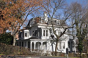
- Edward Hopper Birthplace and Boyhood Home - In Nyack, New York. This was the home of famous American painter Edward Hopper. It is now an art center.
- Mount Moor African-American Cemetery - Established in 1849, this cemetery has about 90 known graves. It is located near Palisades Center in West Nyack.
- The Old 76 House - In Tappan, New York. One of the oldest bars in America, it was a meeting place for Patriots during the Revolutionary War.
- Washington Avenue Soldier's Monument and Triangle - In Suffern, New York. This monument honors George Washington and Rochambeau.
Shopping and Fun
- Clover Stadium - In Ramapo, New York. A baseball stadium that is home to the New York Boulders baseball team.
- Lafayette Theatre - A historic movie theater in downtown Suffern, New York, opened in 1924.
- Palisades Center - In West Nyack, New York. Opened in 1998, it is one of America's largest shopping malls.
- Rockland Bakery - In Nanuet, New York. A large bakery that supplies bread to many places, including the United States Military Academy at West Point.
- The Shops at Nanuet - In Nanuet, New York. This shopping center opened in 1969.
Parks and Outdoors
- Bear Mountain State Park - Stony Point, New York
- Blauvelt State Park - Blauvelt, New York
- Harriman State Park (shared with Orange County)
- High Tor State Park - Clarkstown, New York
- Hook Mountain State Park - Clarkstown, New York
- Nyack Beach State Park - Upper Nyack, New York
- Rockland Lake State Park - Congers, New York
- Tallman Mountain State Park - Orangetown, New York
Famous People from Rockland County
Many well-known people have lived in Rockland County, including:
- Al Pacino (actor)
- Angelina Jolie (actress)
- Bill Murray (actor/comedian)
- Carson McCullers (writer)
- Edward Hopper (painter)
- George M. Cohan (entertainer)
- Grace VanderWaal (singer)
- Hayden Panettiere (actress)
- Helen Hayes (actress)
- Jack Klugman (actor)
- Jake T. Austin (actor)
- John Flaherty (former baseball player)
- John Steinbeck (writer)
- Jonathan Demme (film director)
- Julianna Margulies (actress)
- Katharine Hepburn (actress)
- Kurt Weill (composer)
- Lotte Lenya (singer/actress)
- Mikhail Baryshnikov (dancer)
- Mitch Miller (musician)
- Noël Coward (playwright)
- Orson Welles (actor/director)
- Rosie O'Donnell (comedian/TV host)
- Sebastian Stan (actor)
- Stephen Baldwin (actor)
- Steven Hill (actor)
- Tina Fey (comedian/writer)
- Toni Morrison (writer)
- Trey Anastasio (musician)
- Tyne Daly (actress)
- Valerie Harper (actress)
- Vivien Leigh (actress)
- William Hurt (actor)
- William Styron (writer)
See also
 In Spanish: Condado de Rockland para niños
 | James Van Der Zee |
 | Alma Thomas |
 | Ellis Wilson |
 | Margaret Taylor-Burroughs |


