Prince George's County, Maryland facts for kids
Quick facts for kids
Prince George's County
|
|||||
|---|---|---|---|---|---|
| Prince George's County, Maryland, | |||||
|
|||||
| Nickname(s):
"PG County", "P.G."
|
|||||
| Motto(s):
"Semper Eadem" (English: "Ever the Same")
|
|||||
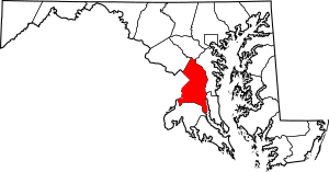
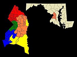
Location within the U.S. state of Maryland
|
|||||
 Maryland's location within the U.S. |
|||||
| Country | |||||
| State | |||||
| Founded | April 23, 1696 | ||||
| Named for | Prince George of Denmark | ||||
| Seat | Upper Marlboro | ||||
| Largest city | Bowie | ||||
| Area | |||||
| • Total | 499 sq mi (1,290 km2) | ||||
| • Land | 483 sq mi (1,250 km2) | ||||
| • Water | 16 sq mi (40 km2) 3.2% | ||||
| Population
(2020)
|
|||||
| • Total | 967,201 |
||||
| • Density | 1,900/sq mi (700/km2) | ||||
| Demonym(s) | Prince Georgian | ||||
| Time zone | UTC−5 (Eastern) | ||||
| • Summer (DST) | UTC−4 (EDT) | ||||
| ZIP Codes |
20607–20774
|
||||
| Area code | 240, 301 | ||||
| Congressional districts | 4th, 5th, 8th | ||||
Prince George's County, often called PG County or PG, is a county in Maryland, USA. It's right next to the eastern part of Washington, D.C.. In 2020, about 967,201 people lived here. This makes it the second most populated county in Maryland, just after Montgomery County.
Prince George's County is part of the Capital region of Maryland. It is also home to many important government places. These include Joint Base Andrews and the main office for the United States Census Bureau.
Contents
- Why the Name Prince George's County?
- A Look at Prince George's County History
- Understanding Prince George's County Geography
- Getting Around Prince George's County
- Prince George's County Population and People
- Prince George's County Economy
- Learning in Prince George's County
- Fun and Entertainment in Prince George's County
- Communities in Prince George's County
- Sister Cities
- Famous People from Prince George's County
- Namesakes
- See also
Why the Name Prince George's County?
The county's official name is "Prince George's County, Maryland." It was named after Prince George of Denmark (1653–1708). He was the husband of Anne, Queen of Great Britain.
People from the county are called Prince Georgians. The county's motto is Semper Eadem, which means "Ever the Same." This phrase was also used by Queen Anne.
Many people shorten the name to "PG" or "PG County." Some residents like this shorter name, while others prefer the full name.
A Look at Prince George's County History
Long, long ago, in the Cretaceous Era, dinosaurs roamed this area. You can still find their fossils in a 7.5-acre park in Laurel. This site has found fossilized teeth from dinosaurs like Astrodon. It is known as one of the best fossil sites in the eastern United States.
Later, Native Americans lived here. When the first European settlers arrived, the Piscataway Indian Nation called this land home. Today, three branches of this tribe still exist, and two are based in Prince George's County.
The 1600s: How the County Began
The Council of Maryland created Prince George's County in April 1696. It was formed from parts of Charles and Calvert counties. The county was split into six areas called "Hundreds."
The 1700s: Changes and New Borders
In 1748, a part of Prince George's County was used to create Frederick County. Later, Frederick County was divided into other counties. This means that Allegany, Garrett, Montgomery, and Washington counties all came from what was once Prince George's County.
In 1791, some parts of Prince George's County became part of the new District of Columbia.
The 1800s: War, Freedom, and a Famous Escape
During the War of 1812, British soldiers marched through the county. They went through Bladensburg to burn the White House. On their way back, they captured a doctor named William Beanes. A lawyer named Francis Scott Key helped get him released. This event led Key to write "The Star-Spangled Banner".
At one point, Prince George's County had the most enslaved people in Maryland. These enslaved Africans were forced to work on tobacco farms.
During the American Civil War, many enslaved Black men in Prince George's County gained freedom. They joined the Union Army to fight against the Confederate forces. In 1864, Maryland citizens voted to end slavery. The vote was very close, but slavery was finally ended in the state.
After the Civil War, many African Americans tried to join Maryland politics. However, they faced many challenges.
In April 1865, John Wilkes Booth escaped through Prince George's County. He was on his way to Virginia after killing President Abraham Lincoln.
The 1900s: Growth and New Leaders
In the early 1990s, the number of African Americans in the county grew again. The county became majority African American. In 1994, Wayne K. Curry was elected as the first African American County Executive.
In 1997, a part of Takoma Park that was in Prince George's County moved to Montgomery County. This happened after residents voted for the change.
The 2000s: A Growing Community
By 2020, the county's population was almost one million people. It was the largest and wealthiest county with a Black majority in the United States for a while. However, Charles County, Maryland surpassed it in 2020. The number of Hispanic residents also grew, reaching 21% of the total population.
The county saw a big drop in crime for a time. However, in 2021 and 2022, violent crime increased by 30%. From 2020 to mid-2022, over 2,200 residents died from COVID-19. Many more had long-term symptoms.
Understanding Prince George's County Geography
The county covers about 499 square miles. About 483 square miles are land, and 16 square miles (3.2%) are water.
Prince George's County is in the Atlantic coastal plain. It has gentle hills and valleys. Along its western border, areas like Adelphi and West Laurel rise into the piedmont. These areas are over 300 feet high.
The Patuxent River forms the county's eastern border. It separates Prince George's from Howard, Anne Arundel, Charles, and Calvert counties.
Regions of Prince George's County
Prince George's County has five main regions. These areas have different landscapes, cultures, and populations. The regions are North County, Central County, the Rural Tier, the Inner Beltway, and South County. These are not official areas, and their names can change. Generally, the county is split into North and South County, with U.S. Route 50 as the dividing line.
The southern part of Prince George's County is also considered part of the Southern Maryland region.
North County: Innovation and Nature
Northern Prince George's County includes towns like Laurel, Beltsville, and College Park. This area is close to the Capital Beltway and the Baltimore–Washington Parkway.
Key employers here are the University of Maryland, the Beltsville Agricultural Research Center, and NASA-Goddard Space Flight Center. You can also find Greenbelt Park, a wooded area next to the planned community of Greenbelt. Lake Artemesia offers fishing and trails along the Anacostia River.
Central County: Growing Communities
Central County is just outside the Capital Beltway. It includes places like Mitchellville, Woodmore, and Bowie. This region has been growing quickly.
Central Avenue and Old Crain Highway are major roads here. Joint Base Andrews, Bowie State University, and Prince George's Community College are in this central area.
Inner Beltway: Close to the Capital
The Inner Beltway communities are next to Washington, D.C. These include Capitol Heights, District Heights, and Suitland. This area has easy access to Metro's blue line and shopping centers.
Bowie is known as a planned community. It has grown to be the largest city in Prince George's County, with over 50,000 people. It also has a large Caucasian population compared to other parts of the county.
Rural Tier: Preserving Nature
The Rural Tier is an area where officials want to keep residential growth low. It's just beyond the Beltway to the west and south of Central County. This area holds the county's origins. Many small villages and old towns are here.
The Rural Tier focuses on preserving its natural beauty. Patuxent River Park is a large nature preserve. It offers public access for birdwatching and enjoying the waterfront. You can also rent canoes and kayaks on the Patuxent River. Many historic homes and scenic roads are in this area.
South County: Riverfront Fun
South County mixes the green spaces of the rural tier with new developments. Major communities include Clinton, Oxon Hill, and Fort Washington. This is the only part of Prince George's County with access to the Potomac River.
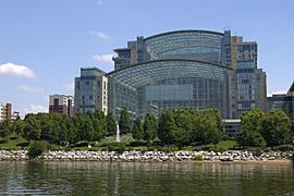
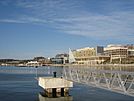
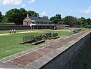
The National Harbor project is a big attraction here. It's a town center with shops, restaurants, and hotels right on the Potomac. It also has entertainment like MGM National Harbor and Tanger Outlets. You can take a Water taxi from National Harbor to other places along the Potomac. Fort Washington Park is a historic site where you can tour an old fort and enjoy river views.
Neighboring Areas
Prince George's County shares borders with these counties and cities:
- Anne Arundel County (east)
- Calvert County (southeast)
- Charles County (south)
- Howard County (north)
- Montgomery County (northwest)
- Fairfax County, Virginia (southwest)
- Alexandria, Virginia (southwest)
- Washington, D.C. (west)
Prince George's and Montgomery Counties work together on planning and parks through the M-NCPPC. They also share a water and sewer service called the Washington Suburban Sanitary Commission.
Protected Natural Areas
The county is home to several national protected areas:
- Fort Washington Park
- Greenbelt Park
- Patuxent Wildlife Research Refuge (part)
- Piscataway Park
- Cedarville State Forest (main entrance in Prince George's County)
Getting Around Prince George's County

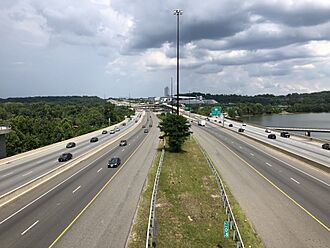
The county has a 28-mile section of the 65-mile-long Capital Beltway. The Intercounty Connector ("ICC"), a toll freeway, opened in 2012. It connects I-270 in Montgomery County to Interstate 95 and U.S. 1 in Laurel.
The Baltimore–Washington Parkway also runs for 11.5 miles through the county.
Public Transportation Options
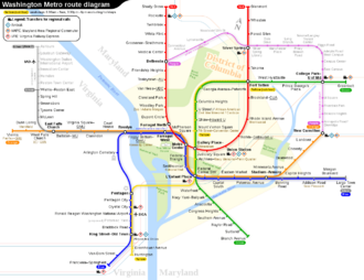
The Washington Metropolitan Area Transit Authority runs Metrobus and Metrorail services. These help people travel in and out of the county. They also have MetroAccess for people with disabilities.
The Prince George's County Department of Public Works and Transportation operates TheBus. This is a county-wide bus system. They also have Call-A-Bus for those who need special transport.
Metro Rail in Prince George's County
The Washington Metro system has fifteen stations in Prince George's County. Four of these are end-of-the-line stations: Greenbelt, New Carrollton, Downtown Largo, and Branch Avenue.
The Purple Line is currently being built. It will connect areas in Montgomery and Prince George's Counties. It is expected to open in 2026. This line will connect to the Red Line and other Metro lines.
Commuter Rail in Prince George's County
The MARC Train (Maryland Area Rail Commuter) has two lines that go through Prince George's County. The Camden Line stops at six stations in the county. The Penn Line stops at three stations.
Airports in the Area
The College Park Airport (CGS) opened in 1909. It is the oldest airport that has been running continuously in the world. It also has the College Park Aviation Museum.
Other smaller airports include Freeway Airport in Mitchellville and Potomac Airfield in Friendly.
The main airports serving the area are:
- Ronald Reagan Washington National Airport (DCA) in Arlington County, Virginia
- Baltimore–Washington International Thurgood Marshall Airport (BWI) in Anne Arundel County
- Dulles International Airport (IAD) in Dulles, Virginia
Andrews Air Force Base (ADW) is also near Camp Springs.
Water Taxi Service
You can take a water taxi from the National Harbor. It goes to Alexandria, Virginia, and to The Wharf in Washington, D.C.
Major Roads and Highways
Future Transportation Plans
Because of its location, Prince George's County might be part of future transit projects. These include a proposed hyperloop from Washington to New York. Also, a superconducting maglev train route connecting Washington to Baltimore is being considered. No stops are planned within the county for these projects.
Prince George's County Population and People
| Historical population | |||
|---|---|---|---|
| Census | Pop. | %± | |
| 1790 | 21,344 | — | |
| 1800 | 21,175 | −0.8% | |
| 1810 | 20,589 | −2.8% | |
| 1820 | 20,216 | −1.8% | |
| 1830 | 20,474 | 1.3% | |
| 1840 | 19,539 | −4.6% | |
| 1850 | 21,549 | 10.3% | |
| 1860 | 23,327 | 8.3% | |
| 1870 | 21,138 | −9.4% | |
| 1880 | 26,451 | 25.1% | |
| 1890 | 26,080 | −1.4% | |
| 1900 | 29,898 | 14.6% | |
| 1910 | 36,147 | 20.9% | |
| 1920 | 43,347 | 19.9% | |
| 1930 | 60,095 | 38.6% | |
| 1940 | 89,490 | 48.9% | |
| 1950 | 194,182 | 117.0% | |
| 1960 | 357,395 | 84.1% | |
| 1970 | 660,567 | 84.8% | |
| 1980 | 665,071 | 0.7% | |
| 1990 | 729,268 | 9.7% | |
| 2000 | 801,515 | 9.9% | |
| 2010 | 863,420 | 7.7% | |
| 2020 | 967,201 | 12.0% | |
| 2023 (est.) | 947,430 | 9.7% | |
| =U.S. Decennial Census 1790–1960 1900–1990 1990–2000 2010–2020 |
|||
2020 Census Information
| Race / Ethnicity (NH = Non-Hispanic) | Pop 2000 | Pop 2010 | Pop 2020 | % 2000 | % 2010 | % 2020 |
|---|---|---|---|---|---|---|
| White alone (NH) | 194,836 | 128,853 | 109,060 | 24.31% | 14.92% | 11.28% |
| Black or African American alone (NH) | 498,301 | 548,439 | 571,866 | 62.17% | 63.52% | 59.13% |
| Native American or Alaska Native alone (NH) | 2,274 | 2,156 | 1,887 | 0.28% | 0.25% | 0.20% |
| Asian alone (NH) | 30,803 | 34,815 | 41,436 | 3.84% | 4.03% | 4.28% |
| Pacific Islander alone (NH) | 318 | 330 | 335 | 0.04% | 0.04% | 0.03% |
| Other race alone (NH) | 1,706 | 2,167 | 5,746 | 0.21% | 0.25% | 0.59% |
| Mixed race or Multiracial (NH) | 16,220 | 17,688 | 31,408 | 2.02% | 2.05% | 3.25% |
| Hispanic or Latino (any race) | 57,057 | 128,972 | 205,463 | 7.12% | 14.94% | 21.24% |
| Total | 801,515 | 863,420 | 967,201 | 100.00% | 100.00% | 100.00% |
The number of Hispanic people in the county continues to grow. Several cities and areas now have a majority Latino population.
Education Levels
About 30.1% of all residents over 25 years old have a college degree. This includes bachelor's degrees or professional degrees. Also, 86.2% of residents over 25 have graduated from high school or higher.
Religious Life
Prince George's County is quite religious. It has over 800 churches, including 12 very large ones. There are also many mosques, synagogues, and Hindu and Buddhist temples. About 1.8% of the county's land is used by religious groups.
Prince George's County Economy
From 2000 to 2020, Prince George's County was the wealthiest county in the United States with a majority African American population. However, Charles County, Maryland became wealthier in 2020.
Top Employers in the County
Here are some of the biggest employers in Prince George's County:
| Employer | Employees (2021) |
Employees (2014) |
Employees (2011) |
Employees (2005) |
|---|---|---|---|---|
| University of Maryland Capital Region Health | 4,800 | NR | NR | NR |
| United Parcel Service | 3,300 | 4,220 | 4,220 | 2,300 |
| MGM National Harbor | 2,400 | NR | NR | NR |
| Gaylord National Resort and Convention Center | 2,000 | 2,430 | 2,000 | NR |
| Verizon | 1,800 | 2,738 | 2,738 | NR |
| Southern Maryland Hospital Center | 1,308 | 1,242 | 1,300 | 1,300 |
| Doctor's Community Hospital | 1,233 | 1,300 | 1,300 | NR |
| Melwood Horticultural Training Center | 1,200 | NR | NR | NR |
| Marriott International | 1,000 | NR | NR | NR |
| Orndoff & Spaid, Inc | 1,000 | NR | NR | NR |
| Giant | NR | 3,000 | 3,600 | 6,152 |
| Dimensions Healthcare System | NR | 2,500 | 2,500 | 2,100 |
| Shoppers Food & Pharmacy | NR | 1,975 | 1,975 | 1,975 |
| Safeway | NR | 1,605 | 1,605 | 2,400 |
| Capital One Bank | NR | NR | 1,456 | NR |
| Target | NR | 1,400 | 1,400 | NR |
Here are the top public (government) employers:
| Employer | Employees (2021) |
Employees (2014) |
Employees (2011) |
|---|---|---|---|
| Joint Base Andrews Naval Air Facility Washington | 18,000 | 13,500 | 8,057 |
| University System of Maryland | 13,000 | 17,905 | 16,014 |
| NASA/Goddard Space Flight Center | 12,200 | 3,397 | 3,171 |
| Internal Revenue Service | 4,500 | 5,539 | 5,539 |
| U.S. Census Bureau | 4,285 | 4,414 | 4,287 |
| National Maritime Intelligence-Integration Office | 3,000 | 1,724 | 1,724 |
| Prince George's Community College | 1,800 | 2,637 | 1,700 |
| U.S. Department of Agriculture | 1,500 | 1,850 | 1,850 |
| Adelphi Laboratory Center | 1,500 | NR | NR |
| National Oceanic and Atmospheric Administration | 1,200 | 1,350 | 1,350 |
| Prince George's County | NR | 7,003 | 7,052 |
Learning in Prince George's County
Colleges and Universities
- Bowie State University, near Bowie
- Brightwood College, in Beltsville
- Capital Seminary & Graduate School, in Greenbelt
- Capitol Technology University, south of Laurel
- Prince George's Community College, in Largo
- Strayer University, PG Campus, in Suitland
- University of Maryland, College Park, in College Park
- University of Maryland Global Campus, in Adelphi
Public Schools
The Prince George's County Public Schools system manages all the public schools in the county.
Fun and Entertainment in Prince George's County
Prince George's County has many interesting places. These include the United States Department of Agriculture's Henry A. Wallace Beltsville Agricultural Research Center. Also, NASA's Goddard Space Flight Center and the United States Census Bureau are here.
You can visit Six Flags America and Six Flags Hurricane Harbor. The county is also home to Northwest Stadium, where the Washington Commanders football team plays. The National Harbor is a large area with a convention center, hotels, and shops.
Media and News
- WPGC-FM, a radio station, gets its name from Prince George's County.
- The Prince George's Sentinel is a weekly newspaper.
- The annual Prince George's Film Festival takes place here.
Recreation and Sports
While the Washington Commanders play in Landover, Prince George's County doesn't have other major professional sports teams. However, Bowie hosts the Chesapeake Baysox, a Minor League Baseball team.
The county is famous for its successful youth basketball players. ESPN has even called Prince George's County a "Hoops Hot Bed." Many basketball stars, like Kevin Durant, Victor Oladipo, and Jeff Green, came from AAU teams here. High schools like DeMatha Catholic High School have also produced great basketball talent.
The 2020 documentary Basketball County highlights the county's basketball talent. It was produced by Kevin Durant.
The Junior Tennis Champions Center, where Frances Tiafoe trained, is in College Park.
Communities in Prince George's County
This county includes the following cities and towns:
Cities
Towns
- Berwyn Heights
- Bladensburg
- Brentwood
- Capitol Heights
- Cheverly
- Colmar Manor
- Cottage City
- Eagle Harbor
- Edmonston
- Fairmount Heights
- Forest Heights
- Landover Hills
- Morningside
- North Brentwood
- Riverdale Park
- University Park
- Upper Marlboro (county seat)
Part of Takoma Park used to be in Prince George's County. But since 1997, it has been fully in Montgomery County.
Census-Designated Places (CDPs)
These are areas that are not officially towns but are recognized by the Census Bureau.
- Accokeek
- Adelphi
- Andrews AFB
- Aquasco
- Baden
- Beltsville
- Brandywine
- Brock Hall
- Brown Station
- Calverton
- Camp Springs
- Cedarville
- Chillum
- Clinton
- Coral Hills
- Croom
- East Riverdale
- Fairwood
- Forestville
- Fort Washington
- Friendly
- Glassmanor
- Glenn Dale
- Hillandale
- Hillcrest Heights
- Kettering
- Konterra
- Lake Arbor
- Landover
- Langley Park
- Lanham
- Largo
- Marlboro Meadows
- Marlboro Village
- Marlow Heights
- Marlton
- Maryland Park
- Melwood
- Mitchellville
- National Harbor
- Oxon Hill
- Peppermill Village
- Queen Anne
- Queensland
- Rosaryville
- Seabrook
- Silver Hill
- South Laurel
- Springdale
- Suitland
- Summerfield
- Temple Hills
- Walker Mill
- West Laurel
- Westphalia
- Woodlawn
- Woodmore
Other Unincorporated Communities
These areas do not have their own local government.
- Ardmore
- Avondale
- Carmody Hills
- Carole Highlands
- Cedar Heights
- Chapel Oaks
- Cheltenham
- Collington
- Danville
- Green Meadows
- Indian Creek Village
- Kentland
- Lewisdale
- Meadows
- Montpelier
- Muirkirk
- Palmer Park
- Piscataway
- Raljon
- Rogers Heights
- South Bowie
- Tantallon
- Tuxedo
- Vansville
- West Hyattsville
- White Hall
- Woodyard
A Former Town
- Good Luck is considered a ghost town.
Sister Cities
Prince George's County has special partnerships with cities in other countries:
 Royal Bafokeng Nation, South Africa
 Rishon LeZion, Israel
 Ziguinchor, Senegal
Famous People from Prince George's County
- Karen Allen, actor, grew up in New Carrollton.
- Angela Alsobrooks County Executive, grew up in Camp Springs.
- Thurl Bailey, professional basketball player, grew up in Landover.
- Jonathan Banks, actor, grew up in Chillum.
- Ben Barnes, politician, from Greenbelt.
- Michael Beasley, professional basketball player.
- Len Bias, basketball star, grew up in Landover Hills.
- Riddick Bowe, former boxing champion, lived in Fort Washington.
- Sergey Brin, Google founder, grew up in Adelphi.
- Steve Byrnes, NASCAR TV analyst, grew up in New Carrollton.
- John Carroll, first Catholic bishop in the U.S., born in Upper Marlboro.
- Eva Cassidy, singer and guitarist, grew up in Oxon Hill and Bowie.
- JC Chasez, singer/producer, grew up in Bowie.
- Frank Cho, cartoonist, grew up in Beltsville.
- Thomas John Claggett, first Episcopal bishop in the U.S., from Upper Marlboro.
- Leonard Covington, U.S. congressman, born in Aquasco.
- Jermaine Crawford, actor, born and raised in the county.
- Kevin Durant, NBA player, grew up in Prince George's County.
- Roger L. Easton, GPS inventor, lived in Oxon Hill.
- John Fahey, guitarist, grew up in Takoma Park.
- Francis B. Francois, engineer and politician, lived in Bowie for over 40 years.
- Markelle Fultz, NBA player, born and raised in Upper Marlboro.
- Danny Gatton, guitarist, lived in Oxon Hill and Accokeek.
- Kathie Lee Gifford, TV personality, grew up in Bowie.
- Ginuwine, R&B musician, lived in Fort Washington.
- Lyle Goodhue, inventor, lived in Prince George's County.
- Jeff Green, NBA player.
- Goldie Hawn, actress, grew up in Takoma Park.
- Jim Henson, Muppets creator, grew up in University Park.
- Taraji P. Henson, actress, attended Oxon Hill High School.
- Roy Hibbert, professional basketball player, raised in Adelphi.
- Larry Hogan, former Maryland governor, grew up in Landover.
- Steny Hoyer, U.S. House Floor leader, lived in Suitland and Mitchellville.
- Cathy Hughes, Radio One founder.
- Jarrett Jack, basketball player.
- Isis King, first transgender contestant on America's Next Top Model.
- Jeff Kinney, Diary of a Wimpy Kid author, is from Fort Washington.
- Martin Lawrence, actor and comedian, lived in Landover.
- Ty Lawson, basketball player.
- Lettice Lee, colonial society hostess.
- Sugar Ray Leonard, boxing champion, grew up in Palmer Park.
- G. Gordon Liddy, author and radio personality, lived in Fort Foote.
- John P. McDonough, Maryland Secretary of State, from Bladensburg.
- Thomas V. "Mike" Miller, Maryland State Senate President, born and raised in Clinton.
- Mýa, R&B musician, attended Eleanor Roosevelt High School.
- Rico Nasty, rapper, born in Largo, raised in Palmer Park.
- Sammy Nestico, music arranger, lived in Oxon Hill.
- Redveil, rapper, songwriter, and producer.
- Lio Rush, professional WWE wrestler from Lanham.
- Jan Scruggs, conceived the National Vietnam Veterans Memorial, grew up in Bowie.
- Walt Simonson, comic book writer, grew up in College Park.
- Substantial, rapper from Cheverly.
- Michael Sweetney, former professional basketball player.
- Kameron Taylor, basketball player.
- Turkey Tayac, Piscataway Indian leader, lived in Accokeek.
- Frances Tiafoe, tennis player, from Hyattsville.
- Dominic Wade, professional boxer, from Largo.
- Wale, hip-hop artist, often mentions "PG County" in his songs.
- Sumner Welles, U.S. Undersecretary of State, built and lived in Oxon Hill Manor.
- Delonte West, former NBA player.
- Morgan Wootten, famous high school basketball coach.
- Link Wray, rock guitarist, lived in Accokeek.
- Xanman, rapper from Landover.
Namesakes
- The USS Prince Georges (AK-224) was a United States Navy cargo ship named after the county.
See also
 In Spanish: Condado de Prince George (Maryland) para niños
 | Jewel Prestage |
 | Ella Baker |
 | Fannie Lou Hamer |


