Hampshire County, West Virginia facts for kids
Quick facts for kids
Hampshire County
|
||
|---|---|---|
|
||
|
||
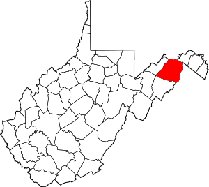
Location within the U.S. state of West Virginia
|
||
 West Virginia's location within the U.S. |
||
| Country | ||
| State | ||
| Founded | December 13, 1754 | |
| Named for | Hampshire, England | |
| Seat | Romney | |
| Largest city | Romney | |
| Area | ||
| • Total | 645 sq mi (1,670 km2) | |
| • Land | 640 sq mi (1,700 km2) | |
| • Water | 4.4 sq mi (11 km2) 0.7%% | |
| Population
(2020)
|
||
| • Total | 23,093 | |
| • Estimate
(2023)
|
23,649 |
|
| • Density | 35.803/sq mi (13.824/km2) | |
| Time zone | UTC−5 (Eastern) | |
| • Summer (DST) | UTC−4 (EDT) | |
| Congressional district | 2nd | |
Hampshire County is a place in West Virginia, a state in the United States. It's one of the many counties there. In 2020, about 23,093 people lived here.
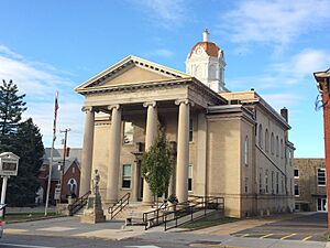
The main town, or county seat, is Romney. This town is West Virginia's oldest, founded in 1762. Hampshire County itself was created in 1754 by the Virginia General Assembly. It was made from parts of Frederick and Augusta Counties in Virginia. This makes Hampshire County the oldest county in West Virginia. The county is located in the Potomac Highlands part of the state.
Hampshire County is also part of the larger Winchester, Virginia-West Virginia area.
| Top - 0-9 A B C D E F G H I J K L M N O P Q R S T U V W X Y Z |
Why is it Called Hampshire County?
Even though Hampshire County was approved in 1754, it wasn't officially set up until 1757. This delay happened because of the French and Indian War (1754–1763). The area was not safe for new settlers.
There's a fun story about how the county got its name! It's said that Thomas Fairfax, 6th Lord Fairfax of Cameron (1693–1781) owned a lot of land in this area. He saw some very big hogs in Winchester. He asked where they came from. He was told they were from the South Branch Potomac River Valley, which is now Hampshire County. Lord Fairfax then said that when a new county was formed west of Frederick, he would name it after Hampshire, England. That English county was famous for its very fat hogs!
A Look Back: Hampshire County's History
First European Settlers Arrive
Romney was first settled around 1725 by hunters and traders. In 1738, brothers John Pearsall and Job Pearsall built homes there. Later, in 1758, they built a fort called Fort Pearsall to protect against Native American attacks. This settlement was first known as Pearsall's Flats.
In 1748, Thomas Fairfax, 6th Lord Fairfax of Cameron sent a group to survey his lands. A 16-year-old George Washington was part of this group. He spent three summers and falls mapping Lord Fairfax's land. This land included all of what is now the Eastern Panhandle of West Virginia. Washington visited the area that is now Romney in 1749. While some stories say he laid out Romney, records show another surveyor, James Genn, did it before Washington arrived.
Hampshire County in the 1700s
In 1756, Fort Pearsall was built on Job Pearsall's land. It was for protection against Native American raids. George Washington helped supply and guard the fort until 1758. At that time, about 100 people lived in the area.
After the fighting ended, Lord Fairfax wanted more settlers to move in. He could earn money by selling plots of land. In 1762, he sent a survey team to Romney to officially map out 100 lots. He renamed the town Romney. This name honored a city on the English Channel in Kent, England.
For many years, there was confusion about who owned what land in Romney. The first settlers and those who bought lots from Lord Fairfax's surveys often had different claims.
The first Hampshire County Court meeting was in 1757. It was held at Fort Pleasant, which is now in Hardy County. By this time, many settlers had left Hampshire County because they were afraid of Native American attacks. Only a few families remained near Fort Pearsall (near Romney) and Fort Edwards (near Capon Bridge). Most of the remaining settlers were protected by forts in the Old Fields-Moorefield-Petersburg area.
After Native Americans were defeated at the Battle of Point Pleasant in 1774, settlers returned to the county. Also, after the American Revolution, the Virginia Legislature canceled the English land grant to Lord Fairfax. They gave land to settlers who already had agreements with Lord Fairfax. The rest of the land became public for settlement.
By 1790, Hampshire County had 7,346 residents. This made it the second most populated county in what is now West Virginia. Berkeley was the most populated. At that time, nine counties made up the area that is now West Virginia, with a total of 55,873 people.
During the Whiskey Rebellion in 1794, many men from Hampshire County joined Major General Daniel Morgan. They helped put down the uprising. These men likely volunteered in Moorefield and marched to Cumberland, Maryland. About 1,200 of Morgan's 12,950 men came from the area that would become West Virginia.
Early Churches in the Area
Many early settlers in the Cacapon area were German Baptist Brethren. These were peaceful farmers who often made friends with local Native Americans.
Other early missionaries helped people keep their religious faith. In 1775, two Baptist missionaries moved to the Cacapon area. They started the first European church in the county. In 1771, the Methodist Episcopal Church began its work here.
In 1753, Hampshire County became a parish for the Protestant Episcopal Church. From 1772 to 1777, Rev. Nathaniel Manning served near present-day Moorefield. In 1787, a Primitive Baptist church was started at North River. After the American Revolution, Presbyterians also began preaching in different parts of the county. In 1792, a Presbyterian church was formed in Romney. Another, Mount Bethel Church, was organized at Three Churches.
Early Jobs and Industries
Hampshire County's wide, flat lands were great for agriculture. Farmers grew fields of wheat and tobacco. The rolling hills were good for raising horses, cattle, sheep, and hogs. These animals were then taken to market in Winchester.
The streams had lots of fish. The mountains provided game, timber, and stone for homes. Limestone was burned for lime at Bloomery Gap. You can still see old lime-kilns there, showing this early industry. People also found iron ore. Much of it was taken to what is now Keyser. In Bloomery Gap, a ruined furnace still stands, showing another old industry.
As more people moved in, farming and raising animals grew. Other new industries also started. Hampshire County was also known for its many gunmakers. They were located on or near the main road from Winchester to Romney. Some of these gunmakers included Henry Topper, Jacob Kline, George Young, and the Sheetz Family.
Hampshire County in the 1800s
The building of the Northwestern Turnpike (U.S. Route 50) was very important for Hampshire County. General Daniel Morgan first suggested this road in 1748. But it wasn't built until the 1830s. Colonel Claudius Crozet, who had worked for Napoleon Bonaparte, designed the road. It connected Parkersburg with Winchester, Virginia.
The turnpike went through many Hampshire County communities. These included Capon Bridge, Loom, Hanging Rock, Augusta, and Romney. Over the years, Romney became an important stop for travelers. This helped the local economy, as hotels and taverns opened in the area.
During the American Civil War, some local groups joined the Confederate Army. There were no huge battles in Hampshire County. However, Romney changed hands at least fifty-six times during the war! This means one army would leave, and the other would move in. Romney is second only to Winchester for changing hands the most during the Civil War. On June 11, 1861, it changed hands twice in one day. Some local historians think Romney changed hands even more than Winchester, but there are no records to prove it.
In 1863, West Virginia's counties were divided into townships. This was to help local government. But it didn't work well in the countryside. So, in 1872, the townships became "magisterial districts." Between 1866 and 1871, Hampshire County had six townships: Bloomery, Capon, Gore, Romney, Sherman, and Springfield. These became districts in 1872. A seventh district, Mill Creek, was also formed.
Geography: What the Land Looks Like
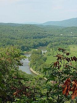
Hampshire County covers about 645 square miles. Most of this (640 square miles) is land. Only a small part (4.4 square miles) is water.
Main Roads
 U.S. Route 50
 U.S. Route 220
 West Virginia Route 9
 West Virginia Route 28
 West Virginia Route 29
 West Virginia Route 127
 West Virginia Route 259
Neighboring Counties
- Allegany County, Maryland (north)
- Morgan County (northeast)
- Frederick County, Virginia (east)
- Hardy County (south)
- Mineral County (west)
Rivers and Streams
- Potomac River
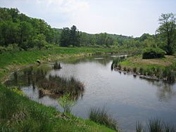
- Cacapon River
- Capon Springs Run
- Dillons Run
- Edwards Run
- Mill Branch
- North River
- Grassy Lick Run
- Tearcoat Creek
- Cacapon River
*Bearwallow Creek
Mountains in Hampshire County
- South Branch Mountain, 3,028 feet (923 m)
- Pinnacle Ridge, 2,844 feet (867 m)
- Nathaniel Mountain, 2,739 feet (835 m)
- Mill Creek Mountain, 2,648 feet (807 m)
- Cacapon Mountain, 2,618 feet (798 m)
- Spring Mountain, 2,436 feet (742 m)
- Spring Gap Mountain, 2,237 feet (682 m)
- North River Mountain, 2,149 feet (655 m)
- Cooper Mountain, 2,028 feet (618 m)
- Baker Mountain, 2,024 feet (617 m)
- Patterson Creek Mountain, 2,005 feet (611 m)
- Sideling Hill, 1,930 feet (588 m)
- Little Cacapon Mountain, 1,575 feet (480 m)
- Ice Mountain, 1,489 feet (454 m)
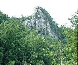
- The Devil's Nose, 1,121 feet (342 m)
Other Cool Rock Formations
Who Lives Here? (Demographics)
| Historical population | |||
|---|---|---|---|
| Census | Pop. | %± | |
| 1790 | 7,346 | — | |
| 1800 | 8,348 | 13.6% | |
| 1810 | 9,784 | 17.2% | |
| 1820 | 10,889 | 11.3% | |
| 1830 | 11,279 | 3.6% | |
| 1840 | 12,295 | 9.0% | |
| 1850 | 14,036 | 14.2% | |
| 1860 | 13,913 | −0.9% | |
| 1870 | 7,643 | −45.1% | |
| 1880 | 10,366 | 35.6% | |
| 1890 | 11,419 | 10.2% | |
| 1900 | 11,806 | 3.4% | |
| 1910 | 11,694 | −0.9% | |
| 1920 | 11,713 | 0.2% | |
| 1930 | 11,836 | 1.1% | |
| 1940 | 12,974 | 9.6% | |
| 1950 | 12,577 | −3.1% | |
| 1960 | 11,705 | −6.9% | |
| 1970 | 11,710 | 0.0% | |
| 1980 | 14,867 | 27.0% | |
| 1990 | 16,498 | 11.0% | |
| 2000 | 20,203 | 22.5% | |
| 2010 | 23,964 | 18.6% | |
| 2020 | 23,093 | −3.6% | |
| 2023 (est.) | 23,649 | −1.3% | |
| U.S. Decennial Census 1790–1960 1900–1990 1990–2000 2010-2020 |
|||
2020 Census Information
In 2020, there were 23,093 people living in Hampshire County. There were 9,912 households. Most people (94.3%) were White. About 0.8% were African American, and 0.3% were Asian. About 1.5% of the population were Hispanic or Latino.
The average age in the county was 47.3 years. About 20.2% of the people were under 18 years old. The average income for a household was $50,890. About 17.9% of the population lived below the poverty line.
Education: Schools in the County
Public Schools
- Hampshire County Schools
- West Virginia Schools for the Deaf and Blind
Private Schools
- Maranatha Christian Academy
- Slanesville Christian School
Fun Places: Parks and Recreation
County Parks
- Central Hampshire Park, Augusta
- Green Spring Recreational Park, Green Spring
- Hampshire Park & 4-H Camp, Romney
- Romney Recreation Center, Romney
- Shanks Roadside Park, Shanks
Wildlife Areas
These are special areas where animals and nature are protected.
- Edwards Run Wildlife Management Area
- Fort Mill Ridge Wildlife Management Area
- Nathaniel Mountain Wildlife Management Area
- Short Mountain Wildlife Management Area
- South Branch Wildlife Management Area
- Wardensville Wildlife Management Area
National Forests
- George Washington National Forest
Communities: Towns and Areas
City
Town
- Capon Bridge
Magisterial Districts
These are like smaller areas within the county for local government.
- Bloomery
- Capon
- Gore
- Mill Creek
- Romney
- Sherman
- Springfield
Census-Designated Places
These are areas that are like towns but not officially incorporated.
Other Communities (Unincorporated)
- Augusta
- Barnes Mill
- Bloomery
- Blues Beach
- Bubbling Spring
- Capon Lake
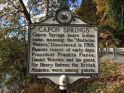
- Capon Springs
- Capon Springs Station
- Cold Stream
- Concord
- Creekvale
- Davis Ford
- Delray
- Dillons Run
- Donaldson
- Forks of Cacapon
- Frenchburg
- Glebe
- Good
- Grace
- Hainesville
- Hanging Rock
- Higginsville
- High View
- Hooks Mills
- Hoy
- Intermont
- Jericho
- Johnson
- Junction
- Kirby
- Largent
- Lehew
- Levels
- Little Cacapon
- Loom
- Mechanicsburg
- Millbrook
- Millen
- Milleson
- Neals Run
- Nero
- North River Mills
- Okonoko
- Pancake
- Pin Oak
- Pleasant Dale
- Points
- Purgitsville
- Rada
- Raven Rocks
- Ridgedale
- Rio
- Ruckman
- Sector
- Sedan
- Shanks
- Shiloh
- Slanesville
- South Branch Depot
- Three Churches
- Valley
- Vance
- Vanderlip
- Wappocomo
- Woodrow
- Yellow Spring
Famous People from Hampshire County
- Jesse B. Aikin, a "singing master" for Shape note music
- Stephen Ailes, a former U.S. Secretary of the Army
- James Dillon Armstrong, a state lawmaker and judge
- William Armstrong, a U.S. Congressman from Virginia
- John Rinehart Blue, a West Virginia House Delegate (state lawmaker)
- James Caudy, a frontiersman and "Indian fighter"
- William C. Clayton, a West Virginia State Senator
- Edna Brady Cornwell, First Lady of West Virginia
- John J. Cornwell, the 15th Governor of West Virginia
- Marshall S. Cornwell, a Newspaper publisher, poet, and author
- William B. Cornwell, a railroad and timber executive
- John Collins Covell, principal of the WVSDB
- Rick Hillenbrand, a West Virginia state representative
- Susan Dew Hoff, a doctor
- Samuel Lightfoot Flournoy, a West Virginia State Senator
- Samuel Lightfoot Flournoy, a well-known lawyer in Charleston
- William Foreman, an early American military leader
- Henry Bell Gilkeson, a West Virginia State Legislator
- Henepola Gunaratana, who founded the Bhavana Society (a monastery and meditation center)
- John J. Jacob, the 4th Governor of West Virginia
- Howard Hille Johnson, founder and educator at the WVSDB
- Gabriel Jones, a Burgess and Hampshire County Clerk of Court
- Jonah Edward Kelley, a Medal of Honor winner
- Herman G. Kump, the 19th Governor of West Virginia
- James Sloan Kuykendall, a West Virginia House Delegate
- Charles S. Lawrence, Executive Vice President of the IFT
- Thomas Bryan Martin, a Burgess and Hampshire County judge
- Angus William McDonald, a Confederate States Army Colonel
- Cornelia Peake McDonald, an American diarist
- Marshall McDonald, a United States Fish Commissioner
- Jerry Mezzatesta, a West Virginia House Delegate
- Alexander W. Monroe, West Virginia House Speaker
- Ann Pancake, an Author
- Chet Pancake, a Filmmaker
- Sam Pancake, an Actor
- Isaac Parsons (1752–1796), a Virginia House Delegate
- Isaac Parsons (1814–1862), a Virginia House Delegate
- Lee Hawse Patteson, First Lady of West Virginia
- Ruth Rowan, a West Virginia House Delegate
- Mary Ann Shaffer, an American writer
- Arthur R. M. Spaid, an American educator and writer
- Joseph Sprigg, West Virginia Attorney General
- Richard Stafford, a pioneer
- Howard Llewellyn Swisher, an American businessperson, real estate developer, and historian
- Felix Walker, a U.S. Congressman from North Carolina
- Alexander White, a U.S. Congressman from Virginia
- Christian Streit White, Hampshire County Clerk of Court
- Francis White, a U.S. Congressman from Virginia
- John Baker White, Hampshire County Clerk of Court
- John Baker White, a West Virginia Board of Control member
- Robert White, West Virginia Attorney General
- Robert White, a West Virginia State Senator
- Charles M. Williams, a Harvard Business School professor
- Andrew Wodrow, Hampshire County Clerk of Court
- Joshua Soule Zimmerman, a West Virginia House Delegate
See also
 In Spanish: Condado de Hampshire (Virginia Occidental) para niños
 | Madam C. J. Walker |
 | Janet Emerson Bashen |
 | Annie Turnbo Malone |
 | Maggie L. Walker |


