
Lanarkshire facts for kids
Quick facts for kids
Lanarkshire
|
|
|---|---|

Rolling Lanarkshire countryside near Lanark
|
|
 |
|
| Sovereign state | |
| Country | |
| County town | Lanark (historic) Glasgow (1890–1964) Hamilton (1964–1975) |
| Area | |
| • Total | 879 sq mi (2,277 km2) |
| Ranked 11th of 34 | |
| Chapman code |
LKS
|
Lanarkshire, also known as the County of Lanark, is a historic area in the middle of Scotland. It's no longer used for local government, but its name lives on in two modern areas: North Lanarkshire and South Lanarkshire. This region is sometimes called Clydesdale because the River Clyde flows through it.
Lanarkshire is bordered by several other historic counties. To the north are Dunbartonshire and Stirlingshire. To the east, you'll find West Lothian, Midlothian, and Peeblesshire. In the south, it borders Dumfriesshire, and to the west, Ayrshire and Renfrewshire. The southern part of Lanarkshire is mostly countryside with hills, while the northern part is more built-up and includes much of Glasgow, Scotland's largest city.
Contents
History of Lanarkshire
.jpg)
It's not exactly known when Lanarkshire was first created as a "shire," which was an area controlled by a sheriff. It was likely set up by King David I between 1124 and 1153. He was known for bringing new ways of governing to Scotland. The first time Lanarkshire was officially mentioned was during the rule of King Malcolm IV, who reigned from 1153 to 1165.
Lanarkshire covered a large part of the River Clyde valley. It got its name from the town of Lanark, which was the first main town of the county. In the early 1400s, a western part of Lanarkshire became a separate area called Renfrewshire. The rest of Lanarkshire was then split into different sections called "wards." These wards were managed by their own local sheriffs. Over time, the area was divided into three wards: Upper Ward (based in Lanark), Middle Ward (based in Hamilton), and Lower Ward (based in Glasgow).
.jpg)
In 1890, elected councils were created to manage the counties. The Lanarkshire County Council looked after the three wards. However, big towns like Airdrie, Glasgow, and Hamilton managed their own affairs at first. In 1893, Glasgow became its own "county of itself," meaning it was separate from Lanarkshire for some legal and administrative reasons. Later, in 1930, Airdrie and Hamilton also came under the county council's control.
The Lanarkshire County Council first had its main office in Glasgow. Even though Glasgow was not part of the county council's area, it was easy for councillors to meet there. In 1964, the county council moved its headquarters to Lanark County Buildings in Hamilton.

In 1975, the county council was ended. A new system of larger "regions" and smaller "districts" was set up. Lanarkshire became part of the Strathclyde region. Its former area was split into seven districts, including Clydesdale, East Kilbride, and Glasgow.
Then, in 1996, the regions and districts were also removed. They were replaced by new "council areas" that handle all local government tasks. Today, parts of historic Lanarkshire are found in the modern council areas of East Dunbartonshire, Glasgow, North Lanarkshire, and South Lanarkshire.
Lanarkshire's Coat of Arms
.jpg)
Lanarkshire was given its own special coat of arms in 1886. A coat of arms is like a unique symbol for a place or family. The shield on Lanarkshire's arms is red and silver. It has two five-leaf shapes, called "cinquefoils," which come from the Clan Hamilton family's arms. It also has a man's heart, which comes from the Clan Douglas family's arms. These were two important families in the area.
Above the shield, there is a half-eagle with two heads, which is black with red beaks. The motto, or saying, for Lanarkshire is VIGILANTIA, which means "Vigilance" or "Watchfulness."
Geography of Lanarkshire

Lanarkshire is mostly located in the valley of the River Clyde. The river flows through the county from the northwest to the southeast. The land is mostly flat and used for farming. However, in the south, it rises into the Lowther Hills, which are part of the Southern Uplands. The highest point in the county is Culter Fell, which is 748 meters (2,454 feet) high.
In the east, a small part of the Pentland Hills can be found near Tarbrax and Dunsyre. In the far south, there's the Daer Reservoir. The northern part of Lanarkshire is mainly covered by the large city area of Greater Glasgow. Even there, you can find some small lakes and reservoirs like Roughrigg Reservoir and Hillend Reservoir. Other important towns in Lanarkshire include Coatbridge, East Kilbride, Motherwell, Airdrie, and Hamilton.
Rivers
Mining Industry
From the mid-1700s to the early 1900s, Lanarkshire was very important for its rich coal mines. As the coal industry grew around Glasgow, the price of coal went up because a group of coal owners controlled it. To solve this, a canal was built to bring coal from the Monklands area, where coal was plentiful and not controlled by the same group.
By 1793, the Monklands Canal was finished, and the coal industry in Lanarkshire really took off. This busy period lasted for over 100 years, reaching its peak around the 1910s. Even after two world wars, the coal industry started to shrink. By 1970, only four coal mines were left in Lanarkshire. The last one, Cardowan, closed in 1983, marking the end of a long history of coal mining in the area.
Transport in Lanarkshire

Lanarkshire has good transport links. The M74 motorway connects Glasgow to places further south like Carlisle. The M8 links Glasgow to Edinburgh. Glasgow and the areas around it have many roads and train lines. The West Coast Main Line train track runs north to south through the county, connecting Glasgow with major cities like Manchester, Birmingham, and London. Glasgow also has its own underground train system, the Glasgow Subway.
Events
Lanarkshire was proud to host the International Children's Games in August 2011. This big event brought together about 1,300 young athletes and coaches. They came from 77 cities in 33 different countries around the world to compete.
Civil Parishes
- Barony (Glasgow)
- Bothwell
- Blantyre
- Biggar
- Cadder
- Carmunnock
- Cambusnethan
- Carluke
- Carstairs
- Carnwath
- Covington
- Carmichael
- Crawfordjohn
- Crawford
- Coulter
- Dalziel
- Dalserf
- Dunsyre
- Dolphinton
- Douglas
- Govan
- Gorbals
- Glasgow
- Hamilton
- East Kilbride
- Lesmahagow
- Lanark
- Libberton
- Lamington
- New Monkland, Airdrie
- Old Monkland
- Pettinain
- Royalty
- Rutherglen
- Shotts
- Strathaven
- Stonehouse
- Symington
- Wilston
- Wiston and Roberton
Settlements
- Abington
- Airdrie
- Allanton
- Anderston
- Annathill
- Ashgill
- Auchengray
- Auchenheath
- Auchenshuggle
- Auldhouse
- Baillieston
- Balornock
- Bargeddie
- Barlanark
- Barmulloch
- Bellahouston
- Bellshill
- Biggar
- Birkenshaw
- Birniehill
- Bishopbriggs
- Blackhill
- Blackwood
- Blantyre
- Blythswood Hill
- Bogside
- Bonkle
- Bothwell
- Braehead
- Braidfauld
- Braidwood
- Bridgeton
- Broomhill
- Broomhouse
- Budhill
- Burnbank
- Burnside
- Busby
- Cadder
- Calderbank
- Caldercruix
- Caldermill
- Calderwood
- Calton
- Cambuslang
- Camlachie
- Carnwath
- Cardowan
- Carfin
- Carluke
- Carmichael
- Carmunnock
- Carmyle
- Carnbroe
- Carntyne
- Carstairs
- Carstairs Junction
- Cartland
- Castlemilk
- Cessnock
- Chapelhall
- Chapelton
- Chryston
- Cleghorn
- Cleland
- Coalburn
- Coatbridge
- College Milton
- Colston
- Coulter
- Cowcaddens
- Cowlairs
- Craigend
- Craigton
- Cranhill
- Crawford
- Crawfordjohn
- Croftfoot
- Crossford
- Crutherland
- Dalmarnock
- Dalserf
- Dennistoun
- Dolphinton,
- Douglas
- Dowanhill
- Drumoyne
- Drumsagard
- Dumbreck
- Dunsyre
- East Crindledyke
- Eastfield
- East Kilbride
- East Mains
- Easterhouse
- Easthall
- Elsrickle
- Fernhill
- Ferniegair
- Finnieston
- Forrestfield
- Forth
- Gallowgate
- Gardenhall
- Garnethill
- Garnkirk
- Garrion Bridge
- Garrowhill
- Gartcosh
- Gartloch
- Garthamlock
- Germiston
- Gilshochill
- Glasgow
- Glasgow Harbour
- Glassford
- Glenboig
- Glenmavis
- Glespin
- Gorbals
- Govan
- Govanhill
- Greenfield
- Greengairs
- Greenhills
- Haghill
- Hairmyres
- Halfwayhouse
- Hamilton
- Hamiltonhill
- Harthope
- Harthill
- Hartwood
- Hillhead
- Hillhouse
- Hogganfield
- Holytown
- Hutchesontown
- Hyndland
- Ibrox
- Jackton
- Kelvin
- Kelvinbridge
- Kelvindale
- Kelvinside
- Kilncadzow
- King's Park
- Kinning Park
- Kingston
- Kirkfieldbank
- Kirkhill
- Kirkmuirhill
- Lambhill
- Lamington
- Lanark
- Larkhall
- Laurieston
- Law
- Leadhills
- Lesmahagow
- Lightburn
- Lilybank
- Lindsayfield
- Linthouse
- Longriggend
- Luggiebank
- Maryhill
- Maryhill Park
- Millerston
- Milton
- Mollinsburn
- Morningside
- Moodiesburn
- Mossend
- Mossneuk
- Motherwell
- Mount Vernon
- Muirhead
- The Murray
- Nemphlar
- Nerston
- Netherburn
- New Lanark
- New Stevenston
- Newarthill
- Newbank
- Newbigging
- Newhouse
- Newlandsmuir
- Newmains
- Newton
- North Kelvinside
- Oatlands
- Overtown
- Park District
- Parkhead
- Parkhouse
- Partick
- Partickhill
- Peel Park
- Pettinain
- Philipshill
- Plains
- Plantation
- Port Dundas
- Possilpark
- Provanhall
- Provanmill
- Quarter
- Queenslie
- Quothquan
- Ravenscraig
- Ravenstruther
- Riddrie
- Rigside
- Robertson
- Robroyston
- Rosebank
- Royston
- Ruchazie
- Ruchill
- Rutherglen
- St Leonards
- Salsburgh
- Sandford
- Sandyhills
- Shettleston
- Shieldhall
- Shotts
- Sighthill
- South Busby
- Springboig
- Springburn
- Springhill
- Stand
- Stepps
- Stewartfield
- Stonehouse
- Strathaven
- Summerston
- Swinton
- Symington
- Tannochside
- Tarbrax
- Thankerton
- Thorntonhall
- Thornwood
- Tillietudlem
- Tollcross
- Toryglen
- Townhead
- Tradeston
- Uddingston
- Viewpark
- The Village
- Wattston
- Wellhouse
- Westburn
- West Mains
- Westwood
- Westwoodhill
- Whitehills
- Whiteinch
- Whitlawburn
- Wilsontown
- Wishaw
- Wiston
- Woodlands
- Woolfords
- Yieldshields
- Yorkhill
Images for kids
-
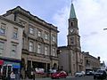
Airdrie
-
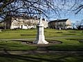
Carluke
-
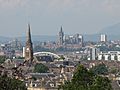
Glasgow
-
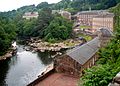
New Lanark


See also
 In Spanish: Lanarkshire para niños
