
List of archaeological sites on the National Register of Historic Places in Illinois facts for kids
This page lists archaeological sites in Illinois that are recognized as important historical places. These sites are special because they help us learn about the past, showing us how people lived long ago.
In the United States, places can be added to the National Register of Historic Places if they meet certain rules. One rule, called Criterion D, is for places where archaeologists can find clues about history. These clues might be from Native American communities or from European settlers.
Illinois has over eighty such sites! This list includes all the archaeological places in Illinois that are officially recognized for their historical value.
Exploring Illinois' Ancient History
Archaeological sites are like giant puzzles left behind by people who lived centuries ago. By studying these sites, experts called archaeologists can piece together stories about daily life, tools, homes, and cultures from different time periods.
What is an Archaeological Site?
An archaeological site is any place where people have left evidence of their past activities. This evidence can be anything from old tools and pottery to the remains of buildings or even entire villages. These sites are super important because they are often the only way we can learn about people who didn't write down their history.
Why Are These Sites Protected?
These sites are protected to make sure they are not damaged or destroyed. This allows archaeologists to study them carefully and helps us all learn about the rich history of Illinois. Many of these sites are open for visitors, so you can explore them too!
Important Archaeological Sites in Illinois
Here's a list of some of the most important archaeological sites in Illinois. Each one tells a unique story about the people who lived there long ago.
| Site Name | Image | Location | County | Who Lived There | Cool Facts | |
|---|---|---|---|---|---|---|
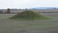
| 1 | Albany Mounds Site | Albany: Albany Mounds Trail | Whiteside | Middle Woodland: Hopewell | This site has ancient burial mounds built by the Hopewell people. | |
| 2 | Alton Military Prison Site | Alton: inside the block bounded by Broadway and William, 4th, and Mill Sts. | Madison | Euro-American | Remains of a Civil War prison for Confederate soldiers. | |
| 3 | Apple River Fort Site | Elizabeth: 0.25 miles east-southeast of the junction of Myrtle and Illinois Sts. | Jo Daviess | Euro-American | Site of a fort built during the Black Hawk War. | |
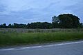
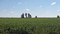
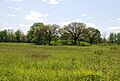
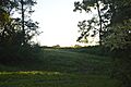
| 4 | Warren Bane Site | Ellsworth: northeast of the junction of 3000E and 750N | McLean | Kickapoo | An important village site of the Kickapoo people. | |
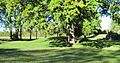
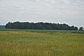
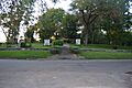
| 5 | Beattie Park Mound Group | Rockford: N. Main St. between Park and Mound Aves. | Winnebago | Late Woodland | A group of ancient mounds in a city park. | |
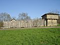
| 6 | Bieker-Wilson Village Site | New Haven: Sandy Slough, southeast of the junction of County Road 300N and 1650E | White | Late Woodland and Mississippian | This site shows evidence of two different ancient cultures. | |
| 7 | Briscoe Mounds | Channahon: Front St. along the Des Plaines River | Will | Oneota | Mounds built by the Oneota people near the river. | |
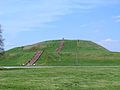
| 8 | Cahokia Mounds | Collinsville: 7850 Collinsville Rd. at Cahokia Mounds State Park | St. Clair | Mississippian | One of the largest and most important ancient cities in North America. | |
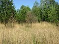
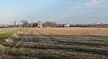
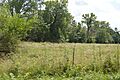
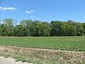
| 9 | Carrier Mills Archeological District | Carrier Mills: along the Saline River south of Carrier Mills | Saline | Late Archaic through Middle Woodland | A large area with many ancient sites from different time periods. | |
| 10 | John Chapman Village Site | Hanover: western side of Illinois Route 84, south of Hanover | Jo Daviess | Late Woodland and Mississippian | A village site showing long-term occupation by different groups. | |
| 11 | Civilian Conservation Corps Camp Shiloh Encampment Site | Pleasant Grove Township | Coles | Euro-American | Remains of a camp from the Great Depression era. | |
| 12 | Clear Lake Site | Manito: junction of 1200E and 2600N in Sand Ridge State Park | Mason and Tazewell | Late Woodland and Mississippian | An important site near a lake, showing different ancient cultures. | |
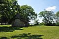
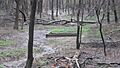
| 13 | Cleiman Mound and Village Site | Gorham: northeast of the junction of Big Lake and Thomas Town Rds. | Jackson | Middle Woodland through Mississippian | This site includes both mounds and a village area. | |
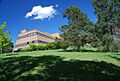
| 14 | Collins Archeological District | Danville: west of Lake Mingo at Kennekuk County Park | Vermilion | Late Woodland | A district with many archaeological findings from the Late Woodland period. | |
| 15 | Corbin Farm Site | Utica: Long Point, between Illinois Route 71 and the Illinois River | LaSalle | Late Woodland and Upper Mississippian | An ancient village site near the Illinois River. | |
| 16 | Dickson Mounds | Lewistown: off County Road 4 | Fulton | Mississippian | A famous site with ancient Mississippian burial mounds and a museum. | |
| 17 | Dogtooth Bend Mounds and Village Site | Willard: western end of Lake Milligan | Alexander | Mississippian | A Mississippian village and mound site near a lake. | |
| 18 | Duffy site | New Haven: Sally Hardin Rd., southeast of New Haven | Gallatin | Late Woodland | An important Late Woodland period site. | |
| 19 | Duncan Farm | Grafton: southern side of Illinois Route 100, ½ mile west of Brussels Ferry | Jersey | Paleoindian through Mississippian | This site shows evidence of human activity from very early times to the Mississippian period. | |
| 20 | Emerald Mound and Village Site | Lebanon: northwest of the junction of Emerald Mound Grange and Midgley Neiss Rd. | St. Clair | Mississippian | A Mississippian mound and village site. | |
| 21 | Evelyn Site | Newark: midway between Newark and Lisbon Center Rds., east of Big Grove Rd. | Kendall | Archaic | An ancient site from the Archaic period. | |
| 22 | Farm Creek Section | East Peoria: southern side of Farm Creek | Tazewell | Not applicable | This site is important for studying ancient geology and climate, not human cultures. | |
| 23 | Fort Massac Site | Metropolis: southeast of Metropolis on the Ohio River | Massac | Euro-American | The remains of an old French and later American fort. | |
| 24 | French Colonial Historic District | Prairie du Rocher: from Fort Chartres State Park to Kaskaskia Island | Monroe and Randolph | Paleoindian through Mississippian and Euro-American | A large historical area with evidence of both ancient and early European settlements. | |
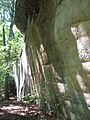
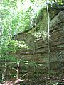
| 25 | Giant City Stone Fort Site | Makanda: Stone Fort Rd. | Jackson | Late Woodland | An ancient stone fort built by Late Woodland people. | |
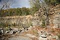
| 26 | Golden Eagle-Toppmeyer Site | Brussels: western side of Quarry Rd., south of Illinois River Rd. | Calhoun | Late Woodland | A Late Woodland period site. | |
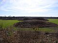
| 27 | Grand Tower Mining, Manufacturing and Transportation Company Site | Grand Tower: Devil's Backbone Park | Jackson | Euro-American | Remains of an old industrial site from the 1800s. | |
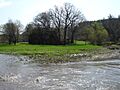
| 28 | Griggsville Landing Lime Kiln | Valley City: Township Road 490, north of Napoleon Hollow | Pike | Euro-American | An old kiln used to make lime, important for building. | |
| 29 | Horseshoe Lake Mound and Village Site | Granite City: southwest of the junction of Illinois Route 111 and Horseshoe Lake Rd. | Madison | Late Woodland through Mississippian | A large site with mounds and a village near Horseshoe Lake. | |
| 30 | Hotel Plaza Site | Utica: northeast of the lodge at Starved Rock State Park | LaSalle | Archaic through Upper Mississippian | This site shows a long history of human use, from Archaic to Upper Mississippian times. | |
| 31 | Hubele Mounds and Village Site | Maunie: east of the junction of County Roads 950N and 1900E | White | Middle Woodland: Hopewell | Mounds and a village from the Hopewell culture. | |
| 32 | Kamp Mound Site | Kampsville: Illinois Route 100, north of Kampsville | Calhoun | Woodland | An important mound site from the Woodland period. | |
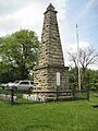
| 33 | Kellogg's Grove | Kent: southeast of Kent | Stephenson | Sauk and Euro-American | A historic site with ties to both Native American and early American history. | |
| 34 | Kincaid site | Brookport: Newcut Rd. | Massac and Pope | Mississippian | A very large and important Mississippian city site. | |
| 35 | Kolmer Site | Prairie du Rocher: Levee Rd., west of Fort Chartres State Park | Randolph | Michigamea | A village site of the Michigamea people. | |
| 36 | Koster Site | Eldred: 200 yards (180 m) east of the Eldred-Hillview road, 5.5 miles (8.9 km) south of Eldred | Greene | Archaic | One of the most important Archaic period sites, showing thousands of years of human life. | |
| 37 | Kuhn Station Site | Edwardsville: Rosewood Hills Dr. | Madison | Mississippian | A Mississippian period site. | |
| 38 | Larson Site | Lewistown: Waterford Rd. north of the Waterford Cemetery | Fulton | Late Woodland through Mississippian | This site shows a transition from Late Woodland to Mississippian cultures. | |
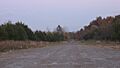
| 39 | Lebanon Historic District | Lebanon: irregular pattern centered along St. Louis and Belleville Sts. | St. Clair | Late Woodland through Mississippian | A historic area that includes evidence of ancient cultures. | |
| 40 | Little Beaver Site | Utica: Starved Rock State Park, west of Illinois Route 178 | LaSalle | Middle Woodland | A Middle Woodland period site within Starved Rock State Park. | |
| 41 | Lunsford-Pulcher Archeological Site | Columbia: western side of Oklahoma Hill Rd. | Monroe and St. Clair | Mississippian | A large Mississippian site with mounds and a village. | |
| 42 | Marseilles Hydro Plant | Marseilles: Commercial St. | LaSalle | Euro-American | An old hydroelectric power plant, showing early industrial history. | |
| 43 | Pierre Martin House | North Dupo: 1st St. at Old Illinois Route 3 | St. Clair | Euro-American | An old house from the French colonial period. | |
| 44 | Mayberry Mound and Village Site | Sims: northeast of the junction of County Road 900E and the Skillet Fork | Wayne | Archaic | An Archaic period mound and village site. | |
| 45 | McCune Mound and Village Site | Sterling: western side of Illinois Route 40, north of Science Ridge Rd. | Whiteside | Upper Mississippian | An Upper Mississippian mound and village site. | |
| 46 | Millstone Bluff | Glendale: Illinois Route 147 west of its junction with Illinois Route 145 | Pope | Late Woodland through Mississippian | A bluff with ancient rock art and evidence of different cultures. | |
| 47 | Millville Town Site | Apple River: Apple River Canyon State Park, 8663 E. Canyon Rd. | Jo Daviess | Euro-American | The remains of an early American town. | |
| 48 | Mitchell Archeological Site | Mitchell: western end of University Dr. | Madison | Mississippian | A significant Mississippian period site. | |
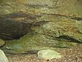
| 49 | Modoc Rock Shelter | Modoc: northeastern side of County Road 7 southeast of Roscow Hollow Rd. | Randolph | Early Archaic through Mississippian | A rock shelter with evidence of human use for thousands of years. | |
| 50 | Morris Wide Water Canal Boat Site | Morris: E. Washington St. | Grundy | Euro-American | The site of an old canal boat, showing transportation history. | |
| 51 | Mound House Site | Hillview: Eastern bank of the Illinois River, ½ mile west of the end of 600E | Greene | Early Woodland through Mississippian | A site with mounds and evidence of different ancient cultures. | |
| 52 | Naples Archeological District | Naples: eastern bank of the Illinois River south of Naples | Scott | Early Woodland through Mississippian | A large area with many archaeological findings near the Illinois River. | |
| 53 | Naples Mound 8 | Griggsville: north of Interstate 72 just west of the Illinois River | Pike | Middle Woodland: Hopewell | A specific mound from the Hopewell culture. | |
| 54 | New Philadelphia Town Site | Barry: Township Road 156, east of Barry | Pike | Euro-American | The remains of the first town in the U.S. founded by an African American. | |
| 55 | Nutwood Site | Nutwood: western side of Illinois Route 100, 500 feet south of the Narrows Creek bridge | Jersey | Late Woodland | A Late Woodland period site. | |
| 56 | Ogden-Fettie Site | Lewistown: south of Lewistown | Fulton | Middle Woodland: Hopewell | Another important Hopewell culture site. | |
| 57 | Old Kaskaskia Village | Ottawa: Dee Bennett Rd. on the northern side of the Illinois River | LaSalle | Kaskaskia | The main village of the Kaskaskia people. | |
| 58 | Orendorf Site | Canton: western side of U.S. Route 24 near the northern end of the Duck Creek Cooling Pond | Fulton | Mississippian | A Mississippian period village site. | |
| 59 | Orr-Herl Mound and Village Site | Rosiclare: northern bank of the Ohio River midway between Elizabethtown and Rosiclare | Hardin | Mississippian | A Mississippian mound and village site along the Ohio River. | |
| 60 | Piney Creek Site | Campbell Hill: north of Piney Creek in Piney Creek Ravine Nature Preserve | Randolph | Late Woodland through Mississippian | A site within a nature preserve with evidence of different cultures. | |
| 61 | Piney Creek South Site | Campbell Hill: south of Piney Creek in Piney Creek Ravine Nature Preserve | Randolph | Late Woodland | Another Late Woodland site in the Piney Creek area. | |
| 62 | Piney Creek West Site | Campbell Hill: north of Piney Creek in Piney Creek Ravine Nature Preserve | Randolph | Late Woodland | A third Late Woodland site in the Piney Creek Ravine. | |
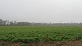
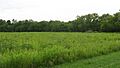
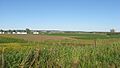
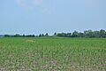
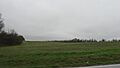
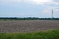
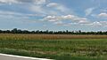
| 63 | Riverton Site | Palestine: northern side of 1150th Avenue immediately west of the Wabash River, northeast of Palestine | Crawford | Late Archaic: Riverton | A key site for understanding the Riverton culture of the Late Archaic period. | |
| 64 | Rock Island Arsenal | Rock Island: Rock Island in the Mississippi River | Rock Island | Euro-American | A historic military manufacturing center. | |
| 65 | Rockwell Mound | Havana: Rockwell Park at the northern end of Orange St. | Mason | Middle Woodland: Havana Hopewell | A mound from the Havana Hopewell culture. | |
| 66 | John Roy Site | Clayton: southwest of the junction of 1700th Ave. and 2950th St. | Adams | Late Woodland | A Late Woodland period site. | |
| 67 | Saline Springs | Equality: Salt Well Rd., ½ mile west of the Saline River bridge | Gallatin | Early Woodland through Mississippian and Euro-American | An important site for salt production, used by both ancient peoples and early settlers. | |
| 68 | Schudel No. 2 Site | Hamburg: 200N, west of Mississippi River Rd. | Calhoun | Early Woodland through Mississippian | This site shows a long history of occupation from Early Woodland to Mississippian times. | |
| 69 | Shaky Shelter Site | Utica: in a ravine south of Illinois Route 71 at Starved Rock State Park | LaSalle | Upper Mississippian | A rock shelter used by Upper Mississippian people. | |
| 70 | Sheets Site | Lewistown: County Road 14, west of Lewistown | Fulton | Late Archaic through Early Woodland | A site showing the transition from the Late Archaic to Early Woodland periods. | |
| 71 | Sinnissippi site | Sterling: Sinnissippi Park, off 13th St. | Whiteside | Middle Woodland: Hopewell | Mounds built by the Hopewell culture. | |
| 72 | Sleeth Site | Liverpool: northeast of the junction of U.S. Route 24 and Pollitt Rd. | Fulton | Mississippian | A Mississippian period site. | |
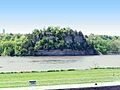
| 73 | Starved Rock | Ottawa: 6 miles from Ottawa on Illinois Route 71, Starved Rock State Park | LaSalle | Kaskaskia and Euro-American | A famous rock formation with a long history, including Native American and early French use. | |
| 74 | Stoner Site | Robinson: eastern side of 1550th St. between 1300th and 1235th Aves. | Crawford | Allison-Lamotte | A site from the Allison-Lamotte culture. | |
| 75 | Swan Island Site | Palestine: northern side of the junction of the Wabash River and the Crawford/Lawrence county line | Crawford | Late Archaic: Riverton | Another important site for the Riverton culture. | |
| 76 | Tampico Mounds | Maples Mill: west of the junction of U.S. Route 24 and County Road 8 | Fulton | Late Woodland | Mounds from the Late Woodland period. | |
| 77 | Tegtmeyer Site | Campbell Hill: north of Piney Creek in Piney Creek Ravine Nature Preserve | Randolph | Mississippian | A Mississippian period site in the Piney Creek Ravine. | |
| 78 | Ware Mounds and Village Site | Ware: west of the junction of Illinois Routes 3 and 146 at Ware | Union | Late Woodland through Mississippian | A site with mounds and a village, showing different ancient cultures. | |
| 79 | White and Company's Goose Lake Stoneware Manufactury | Morris: 5010 N. Jugtown Rd. | Grundy | Euro-American | The remains of an old factory that made stoneware. | |
| 80 | White and Company's Goose Lake Tile Works | Morris: 5010 N. Jugtown Rd. | Grundy | Euro-American | The remains of an old factory that made tiles. | |
| 81 | Wilson Mounds and Village Site | Maunie: within and surrounding the Marshall Ferry Cemetery at Rising Sun | White | Middle Woodland: Havana Hopewell | Mounds and a village from the Havana Hopewell culture. | |
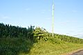
| 82 | Windrose Site | Bourbonnais: Kankakee River Nature Preserve, west of Bradley | Kankakee | Pottawatomie | An important village site of the Pottawatomie people. |


.jpg)


Images for kids
-
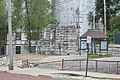
Alton Military Prison remains
-
Apple River Fort
-
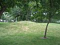
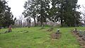
Beattie Park Mounds
-
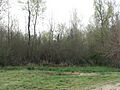
Bieker-Wilson Village Site
-
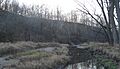
Briscoe Mounds
-
Monks Mound at Cahokia
-
Carrier Mills Archaeological District
-
Wapello Land and Water Reserve
-

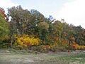
CCC Camp Shiloh at night
-
Cleiman Mound with village
-
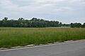
Site core at the Collins Archeological District
-
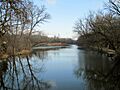
Long Point near Corbin Farm Site
-
Dickson Mounds Museum
-
Dogtooth Bend Village Site
-
Duffy Site south of New Haven
-
Duncan Farm Site
-
Emerald Mound
-
Farm Creek Section
-
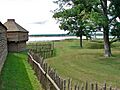
Fort Massac
-
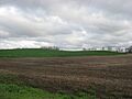
American Bottom in Randolph County
-
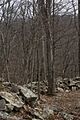
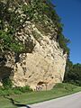
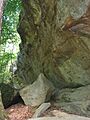
Stone Fort Wall
-
Toppmeyer Site
-
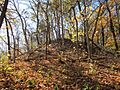
Grand Tower Park hillside
-

Horseshoe Lake Village
-
Hotel Plaza Site
-
Hubele Mounds and Village Site
-
Kamp Mound Site
-
Kellogg's Grove
-
Kincaid Mounds
-
Kolmer Site
-

Kuhn Station Site
-
Larson Site
-
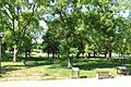
Lunsford-Pulcher Site
-
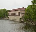
Marseilles Hydro Plant
-
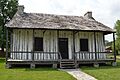
Pierre Martin House
-
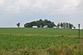
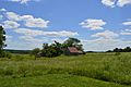
Mayberry Mound and Village Site
-
McCune Village near Sterling
-
Millstone Bluff
-
Millville Town Site
-

Mitchell Archaeological Site
-
Modoc Rock Shelter
-
Morris Wide Water Canal Boat Site
-
Naples-Russel Mound 8
-
New Philadelphia townsite
-
Dickson Mound
-
Old Kaskaskia Village
-
Orr-Herl Village Site
-
Piney Creek Site overview
-
Piney Creek South Site
-
Piney Creek West Site
-
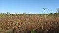
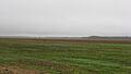
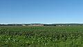
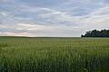
Fields at the Riverton Site
-
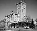
Rock Island Arsenal
-
Rockwell Mound
-
John Roy Site
-
Saline Springs site
-
Schudel No. 2 Site
-
Sleeth Site
-
Starved Rock on Illinois River
-
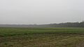
Stoner Site fields
-
Swan Island Site
-
Tegtmeyer Site
-
Ware Mounds and Village Site
-
White and Company's Goose Lake Stoneware Manufactury
-
White and Company's Goose Lake Tile Works
-
Wilson Mounds at Rising Sun
See also
