Historic roads and trails facts for kids

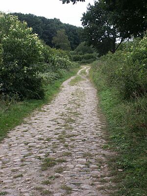
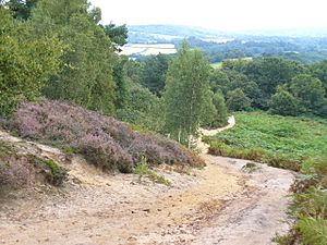
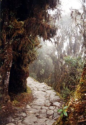
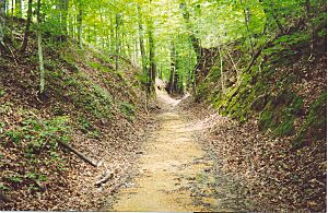
Historic roads are old paths or routes that are important because people used them for a long time. These roads can be from prehistoric times up to the early 1900s. They include very old paths, long-lasting roads, important trade routes, and trails used for moving from one place to another.
Many historic routes, like the Silk Road, the Amber Road, and the Royal Road of the Persian Empire, covered huge distances. Their impact on where people live today can still be seen.
One of the oldest known built paths is the Post Track. It's a prehistoric walkway in England from about 3800 BCE. The world's oldest known paved road was built in Egypt between 2600 and 2200 BC.
The Romans were amazing road builders in the ancient world. At the peak of the Roman Empire, they had over 400,000 kilometers (250,000 miles) of roads. More than 80,000 kilometers (50,000 miles) of these were paved with stone. Another empire, the Incas in pre-Columbian South America, also built a huge and advanced road system.
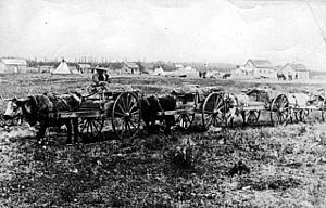
Later historic roads include the Red River Trails between Canada and the US, from the 1800s. These pioneer trails often used older routes first made by indigenous people.
Contents
North American Trails
Some people believe that the first roads were made by humans following animal paths. They suggest that trails made by buffalo herds shaped the routes used by indigenous peoples and later by settlers, especially in North America.
It is thought that buffalo often found the easiest ways across mountains and through forests. For example, the Cumberland Gap, an important mountain pass, was likely discovered by buffalo. Many modern roads and railways in the eastern US follow these ancient animal paths. However, not everyone agrees with this idea.
North American indigenous peoples also used portage routes. These were paths used to carry canoes and goods around rough water. Over centuries, these paths became well-worn trails.
Asian Roads
China's Famous Routes
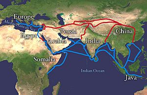
The Silk Road was a very important trade route between China, India, Europe, and Arabia. It got its name from the valuable silk that was traded along it. This trade began during the Han dynasty (207 BCE–220 CE). The Chinese government even extended the Great Wall of China to help protect this trade route.
Even before the Silk Road, an older route existed through the Eurasian Steppe. Along this route, people traded silk, horses, furs, weapons, and precious stones. This route was about 10,000 kilometers (6,200 miles) long.
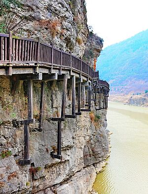
The Shudao (meaning "Roads to Shu") is a system of mountain roads in China. These roads linked the Chinese provinces of Shaanxi and Sichuan. They were built and used since the 4th century BC. A special part of these roads were "gallery roads." These were wooden planks built on beams stuck into the sides of cliffs.
Japan's Kaidō Roads
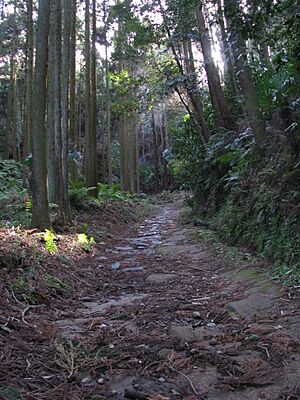
Kaidō (meaning "road") were important roads in Japan during the Edo period (1603-1868). They were like the Appian way of ancient Roman roads, helping with transportation. The most famous ones are the Edo Five Routes, all starting from Edo (which is now Tokyo).
Many modern highways and railway lines in Japan still follow these old routes and even have the same names.
Indian Subcontinent Highways
The Grand Trunk Road in the Indian subcontinent was a main road from modern-day Bangladesh, through India, Pakistan, and Afghanistan. This route has been used since ancient times. The Maurya Empire built it into a proper highway around 300 BC.
Later, the Mughals extended the road westwards from Lahore to Kabul, crossing the Khyber Pass. The British rulers later improved and extended it from Calcutta to Peshawar. For many centuries, this road has been vital for trade, travel, and mail. Today, the Grand Trunk Road is still used for transportation in India.
Brick-paved streets were found in India as early as 3000 BC.
European Pathways
Besides Roman roads, other European paths were often not in good condition. In the early Middle Ages, people often traveled along high ridges instead of in valleys. This was because valleys had thick forests and other natural barriers.
The Amber Road was an ancient trade route used to move amber from the coasts of the North Sea and Baltic Sea to the Mediterranean Sea. Amber was very valuable, sometimes called "the gold of the north." It was transported overland to the Mediterranean from at least the 16th century BC.
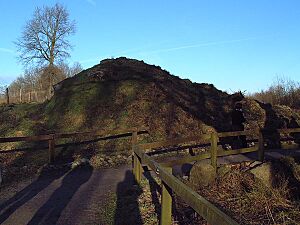
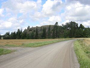
The Hærvejen (Danish for "the army road") ran from Viborg, Denmark to Hamburg, Germany. This road followed the high ground of the Jutland Peninsula. This way, travelers could avoid rivers or use shallow crossings near where rivers started. Parts of this road are over 4000 years old.
Roman Roads: Engineering Marvels
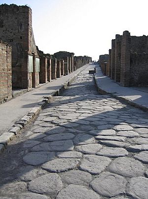
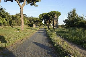
Roman roads were super important for the Roman Empire. They were built from about 300 BC as the Roman Republic and Empire grew. These roads ranged from small local paths to wide, long-distance highways connecting cities, towns, and military bases.
These main roads were often paved with stone and had a curved shape for drainage. They also had footpaths and ditches on the sides. Roman engineers surveyed the land carefully. They cut through hills and built bridges over rivers and ravines. Some sections were even built on rafts or piles over swampy ground.
At its peak, Rome had 29 major military highways starting from the capital. The empire's 113 provinces were connected by 372 great roads. In total, there were over 400,000 kilometers (250,000 miles) of roads, with more than 80,000 kilometers (50,000 miles) paved with stone. Many Roman roads survived for thousands of years, and some modern roads even follow their original paths.
Frankish Empire Routes
The Frankish Empire was a large kingdom in Western Europe after the Roman Empire. It is the ancestor of modern France and Germany.
The Old Salt Route (Alte Salzstraße) was a medieval trade route in northern Germany. It was used to transport salt from Lüneburg to Lübeck.
The Rennsteig is an old path and historical boundary in Central Germany. It connected small independent states in Thuringia. It is now part of a European long-distance walking network.
The Via Regia (meaning "king's road") was a medieval road that ran from Frankfurt am Main to Görlitz in what is now Poland.
German Historic Paths
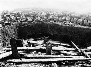
The Wittemoor timber trackway is an old log path built across a bog in Germany. It dates back to 135 BCE. It connected higher ground with a river. A part of this trackway has been rebuilt for people to see.
The Wittmoor Bog Trackways are two other historic paths found in northern Hamburg. They are from the 4th and 7th centuries AD. A part of the older trackway is on display at the Archaeological Museum Hamburg.
Hellweg was a common name for main trade routes in medieval Germany. These roads were kept wide enough for a lance, about three meters, by the landowners.
Great Britain's Ancient Ways
England's Oldest Roads
The Post Track and Sweet Track in England are believed to be some of the oldest purpose-built roads in the world. They are from around 3800 BC. These were walkways made of wooden planks laid over marshy areas. They helped connect dry land areas across the swamps.
Older paths connected farms, fields, and burial sites. Some were likely used for ceremonies, like the one leading to the huge temple at Avebury. On British hills, paths often run just below the top of a ridge. This might have offered shelter from the wind or kept travelers hidden from attackers.
Examples include the Harrow Way and the Pilgrims' Way. The Harrow Way is an ancient path in southern England, likely used since the Stone Age. The eastern part of it later became known as the Pilgrims' Way. This was a pilgrimage route to Canterbury after Thomas Beckett became a saint.
The Ridgeway is another ancient path that stays on high ground. Travelers have used it for at least 5,000 years. It was a reliable trade route along chalk hills, offering easy travel and a good view for protection.
Scotland's Drovers' Roads
In Aberdeenshire, Scotland, ancient paths include the Causey Mounth and Elsick Mounth. These were old drovers' roads, used for moving livestock. They were some of the few ways to cross the Grampian Mountains in prehistoric and medieval times. Roman legions even marched along the Elsick Mounth.
Roman Britain's Military Routes
In Roman Britain, the Romans often built their roads on top of existing paths. Before the Romans, people used simple paths between settlements. But these were not good for moving troops and equipment quickly. Mastiles Lane was a Roman marching road. Later, it became an important route for monks moving sheep.
Ley Lines and Old Paths
The idea of ley lines was suggested in 1921. It proposes that ancient paths were built in straight lines across the landscape. Some believe these alignments made overland travel easier in ancient times.
Greece's Paved Roads
By 2000 BC, people in the Middle East and Greece had better tools for cutting stone. This meant local streets could be paved. Around 2000 BC, the Minoans built a 50-kilometer (31-mile) paved road on Crete. This road had drains, a thick pavement of sandstone blocks, and separate shoulders. It was very advanced, even better than some Roman roads.
The Via Pythia was the route to Delphi, a very important religious site in ancient Greece.
The Sacred Way (Hierá Hodós) was the road from Athens to Eleusis. It was called "Sacred" because a procession celebrating the Eleusinian Mysteries used this route. Today, a modern road in Athens is named after this ancient path.
Ireland's Bog Trackways
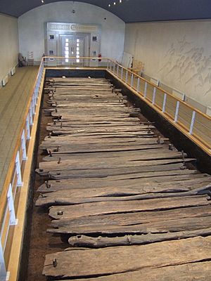
The Corlea Trackway is an ancient road built on a bog in Ireland. It was made of packed hazel, birch, and alder planks. This trackway is from about 148 BC and was found in 1994. It is the largest trackway of its kind found in Europe.
Ireland's very old roads were not very developed. But oak-plank paths covered many boggy areas. Five major paths (slighe) met at the Hill of Tara, an important ancient site.
The Esker Riada is a series of natural gravel ridges left by glaciers. It formed a raised path from east to west, connecting Galway to Dublin.
Russia's Long Routes
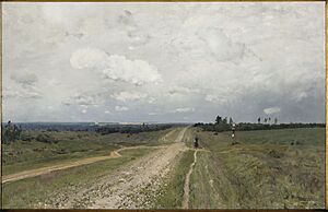
The Siberian Route (Sibirsky trakt) was a historic route connecting European Russia to Siberia and China. Its construction began in 1730 and finished in the mid-1800s. Before this, most transport in Siberia was by river.
The Siberian route started in Moscow as the Vladimir Highway. It passed through many cities like Kazan, Perm, Yekaterinburg, and Irkutsk. After crossing Lake Baikal, the road split. One branch went east to Nerchinsk, and the other went south to Kyakhta. From there, camel caravans crossed Mongolia to China.
In the early 1800s, the route was moved further south. It remained a vital connection until the late 1800s, when the Trans-Siberian Railway took its place.
Middle East's Early Pavements
Streets paved with cobblestones appeared in the city of Ur in the Middle East as early as 4000 BC.
The Royal Road was an ancient highway rebuilt by the Persian king Darius the Great in the 5th century BCE. Darius built this road to help messages travel quickly across his huge empire, from Susa to Sardis.
South America's Inca Roads
The Inca road system was the biggest and most advanced transportation system in South America before Europeans arrived. It was about 40,000 kilometers (24,800 miles) long. Building these roads took a lot of time and effort.
The network had two main north-south roads with many smaller branches. The most famous part is the Inca Trail to Machu Picchu. Some parts of this road system were built by older cultures before the Inca Empire. In 2014, the Inca road system became a UNESCO World Heritage Site.
In Peru, parts of the Inca road system crossed the Andes mountains to connect different areas of the Inca Empire.
North American Trails and Roads
United States' Historic Routes
The United States has a complex system of prehistoric trails. For example, at Tumamoc Hill in Arizona, archaeologists found traces of old paths, petroglyphs (rock carvings), and pottery. In Chaco Canyon, New Mexico, timber beams for cliff dwellings were carried long distances along ancient trails. The Great Hopewell Road in Ohio connected large mound groups.
The Natchez Trace is a historic forest trail in the United States. It stretches about 440 miles (710 km) from Natchez, Mississippi, to Nashville, Tennessee. This trail connected the Cumberland, Tennessee, and Mississippi Rivers. Native Americans used it for centuries. Later, European and American explorers, traders, and settlers used it in the late 1700s and early 1800s. Today, the Natchez Trace Parkway follows a similar path.
In the American Old West, the Oregon Trail was a 19th-century pioneer route from Illinois to Oregon. Much of it was also used by the Mormon Trail and California Trail. The Santa Fe Trail was a major trade and military route from Missouri to Santa Fe, New Mexico.
In modern times, the Lincoln Highway (opened in 1913) was the first road for cars across the United States. It was 3,389 miles long, going from New York City to San Francisco.
The Mojave Road was an old path used by desert-dwelling indigenous people. Later, Spanish missionaries and settlers followed it. It crossed the Mojave Desert between watering holes.
Corduroy Roads
Corduroy roads are made by placing logs side-by-side across a wet or swampy area. They were used a lot during the American Civil War.
Plank Roads
A plank road is a road made of wooden planks. These were common in Canada and the US in the early 1800s. They were often built by companies that charged a fee (toll) to use them.
The "Plank Road Boom" was a time when many plank roads were built in the US, especially in New York. In about 10 years, over 3,500 miles of plank road were built in New York alone.
Canada's Historic Routes
In Canada, the Carlton Trail was a fur trade route from south-west Manitoba to Fort Edmonton in Alberta.
The Red River Trails were a network of ox cart routes. They connected the Red River Colony in Canada with the Mississippi River in the United States. These trade routes ran from what is now Winnipeg to Mendota and Saint Paul, Minnesota.
Travelers started using these trails in the 1820s. They were most used from the 1840s to the early 1870s, when railways took over. These cartways were the best way to travel between the isolated Red River Colony and the outside world.
See also
- Ancient road in Tarsus, Turkey.
- Bishop's Road (Meißen–Stolpen). Germany.
- Bog of Allen, Ireland
- Camino Real de Tierra Adentro. Mexico.
- Great Indian Warpath. Native American trail, in USA.
- History of road transport
- Incense Route
- Jerusalem pilgrim road
- King's Highway (ancient)
- List of medieval roads in Romania.
- List of Ontario colonization roads. Canada.
- Old Dresden to Teplitz Post Road
- Old Freiberg to Teplitz Post Road
- Pre-Islamic Arab trade
- Ridgeway (road)
- Sacbe: paved road built by the Maya civilization of pre-Columbian Mesoamerica.
- Stock route. Australian drovers' road.
- Sunken lane
- Toll road
- Toll roads in Great Britain.
- Trade routes.
- Via Imperii. Germany.
- Via Maris: linking Egypt with the northern empires of Syria, Anatolia and Mesopotamia
- Way of the Patriarchs. Israel


