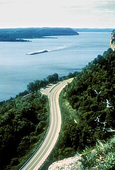
Mississippi River facts for kids
Quick facts for kids Mississippi River |
|
|---|---|
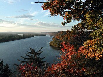
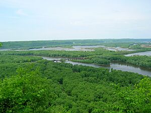
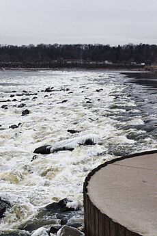
The Mississippi River in Iowa
|
|
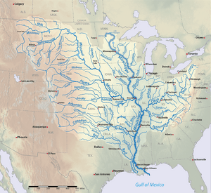
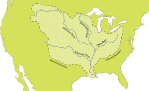
Mississippi River basin
|
|
| Country | United States |
| State | Minnesota, Wisconsin, Iowa, Illinois, Missouri, Kentucky, Tennessee, Arkansas, Mississippi, Louisiana |
| Cities | Saint Cloud, MN, Minneapolis, MN, St. Paul, MN, La Crosse, WI, Quad Cities, IA/IL, St. Louis, MO, Memphis, TN, Greenville, MS, Vicksburg, MS, Baton Rouge, LA, New Orleans, LA |
| Physical characteristics | |
| Main source | Lake Itasca (traditional) Itasca State Park, Clearwater County, MN 1,475 ft (450 m) 47°14′23″N 95°12′27″W / 47.23972°N 95.20750°W |
| River mouth | Gulf of Mexico Pilottown, Plaquemines Parish, LA 0 ft (0 m) 29°09′04″N 89°15′12″W / 29.15111°N 89.25333°W |
| Length | 2,340 mi (3,766 km) |
| Discharge (location 2) |
|
| Discharge (location 3) |
|
| Basin features | |
| Basin size | 1,151,000 sq mi (2,980,000 km2) |
| Tributaries | |
The Mississippi River is the longest river in the United States and the second longest in North America. It starts at Lake Itasca in northern Minnesota and flows south for about 2,340 miles (3,766 km) until it reaches the Gulf of Mexico.
Many smaller rivers, called tributaries, flow into the Mississippi. Together, they form a huge watershed that covers parts of 32 U.S. states and two Canadian provinces. This watershed is the fourth largest in the world! The Mississippi River itself passes through or borders 10 states: Minnesota, Wisconsin, Iowa, Illinois, Missouri, Kentucky, Tennessee, Arkansas, Mississippi, and Louisiana.
For thousands of years, Native Americans lived along the Mississippi. Some were hunter-gatherers, while others, like the Mound Builders, built large farming communities and cities. When Europeans arrived in the 1500s, they explored and settled the area. The river became an important route for transportation and communication. In the 1800s, it helped people move west across the United States. The Mississippi is also famous from books, especially those by Mark Twain.
The land around the lower Mississippi is very fertile because of the river's silt deposits. In the 1800s, steamboats were used to ship farm goods and other products. During the American Civil War, controlling the Mississippi was very important. Union forces capturing the river was a major step towards their victory. Later, engineers built huge levees, locks, and dams to control the river and help bigger ships travel.
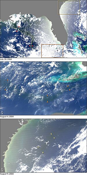
Today, the Mississippi River faces challenges like pollution from farms. This pollution can create a "dead zone" in the Gulf of Mexico, where marine life struggles to survive.
Contents
What's in a Name?
The name "Mississippi" comes from the Ojibwe (a Native American language) words Misi-ziibi, which means "Great River."
In the 1700s, the Treaty of Paris made the Mississippi River the western border of the new United States. Later, after the Louisiana Purchase, it became a natural dividing line between the eastern and western parts of the country. That's why the Gateway Arch in St. Louis symbolizes the "Gateway to the West."
The river is so big and important that it's often called The Mighty Mississippi.
Sections of the Mississippi River
The Mississippi River is usually divided into three main parts:
- The Upper Mississippi: from its source to where it meets the Missouri River.
- The Middle Mississippi: from the Missouri River to the Ohio River.
- The Lower Mississippi: from the Ohio River to the Gulf of Mexico.
Upper Mississippi River
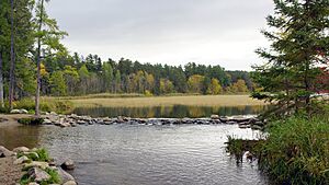

The Upper Mississippi starts at Lake Itasca in Minnesota. This lake is about 1,475 feet (450 m) above sea level. The name Itasca comes from combining parts of Latin words meaning "truth" (veritas) and "head" (caput).
From Lake Itasca to St. Louis, Missouri, the river's flow is controlled by 43 dams. Many of these dams have locks that help boats and barges move up and down the river. These dams and thousands of "wing dikes" (small walls that guide the water) help keep the river deep enough for ships and prevent erosion.
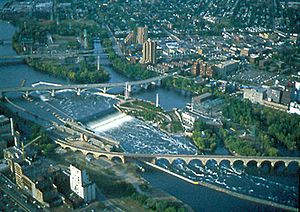
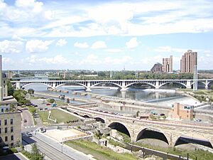
The only natural waterfall on the entire Mississippi River is Saint Anthony Falls in Minneapolis. Before dams were built, this waterfall was the highest point boats could travel upstream.
The Upper Mississippi has several natural and man-made lakes. Its widest point is Lake Winnibigoshish, which is over 11 miles (18 km) wide.
Many rivers join the Upper Mississippi, including the Minnesota River, St. Croix River, Wisconsin River, Rock River, Iowa River, and Des Moines River.
Middle Mississippi River
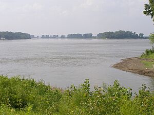
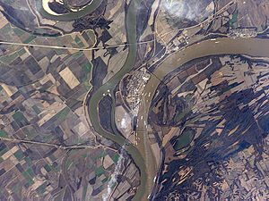
The Middle Mississippi River flows for about 190 miles (310 km) from its meeting point with the Missouri River at St. Louis, Missouri, to where it joins the Ohio River at Cairo, Illinois.
This section of the river flows quite freely. It drops about 220 feet (67 m) over its length. Not many major rivers flow into the Middle Mississippi, except for the Missouri and Meramec rivers.
Lower Mississippi River
The Lower Mississippi River stretches about 1,000 miles (1,600 km) from its meeting point with the Ohio River to the Gulf of Mexico. When the Ohio River joins the Mississippi, it actually adds more water than the Mississippi itself has at that point!
Other important rivers that join the Lower Mississippi include the White River, Arkansas River, Big Black River, and Yazoo River.
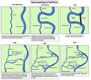
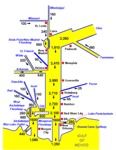
A special structure in Louisiana, called the Old River Control Structure, helps control how much water flows into the Atchafalaya River. This is important because the Atchafalaya offers a shorter path to the Gulf of Mexico, and without control, the Mississippi might change its main course away from cities like New Orleans.
Mississippi River Watershed
The Mississippi River has the world's fourth-largest drainage basin (also called a "watershed" or "catchment"). This huge area covers over 1,245,000 square miles (3,220,000 km2), including nearly 40% of the continental United States. All the water from this basin eventually flows into the Gulf of Mexico. The highest point in this watershed is Mount Elbert in the Rocky Mountains, which is 14,440 feet (4,400 m) high.
The Mississippi River drains most of the land between the Rocky Mountains and the Appalachian Mountains. The river empties into the Gulf of Mexico about 100 miles (160 km) south of New Orleans. It takes about 90 days for water to travel from Lake Itasca to the Gulf.
Outflow and Salt Water
The Mississippi River sends a huge amount of water into the Gulf of Mexico each year, making it the fourteenth largest river in the world by volume.
Before 1900, the river carried about 440 million short tons (400 million metric tons) of sediment (like mud and sand) to the Gulf every year. Now, it carries much less, around 160 million short tons (145 million metric tons) per year. This change is because of dams and other structures built on the Mississippi and its tributaries.
Mixing with Salt Water
Near the mouth of the river, heavier salt water from the Gulf of Mexico can sometimes move upstream along the river bottom. This is called a salt wedge. Fresh water from the river flows on top. During dry years, when there's less fresh water, the salt water can travel many miles upstream, making drinking water salty. Engineers have built "saltwater sills" or "underwater levees" to help stop this.
When the fresh river water flows into the Gulf, it doesn't mix with the salt water right away. You can see a large plume of fresh water that stays separate as it flows through the Gulf of Mexico and even into the Gulf Stream along the coast of Florida.
River Course Changes
Over long periods, the Mississippi River has changed its main path many times. This happens because the river deposits so much silt and sediment that it can clog its own channel. Eventually, the river finds a new, steeper path to the Gulf of Mexico. The old paths become smaller waterways called bayous.
For example, the town of Kaskaskia, Illinois, was once on a peninsula. But after a big flood in 1881, the Mississippi changed course, cutting off the town from the rest of Illinois. Now, it's an island only reachable from the Missouri side.
The New Madrid Seismic Zone, near New Madrid, Missouri, is an area where the Earth's crust is still active. In 1811 and 1812, four huge earthquakes (estimated at magnitude 8) happened here. They were so strong they created Reelfoot Lake in Tennessee by changing the landscape.
Length and Depth
When measured from its traditional source at Lake Itasca, the Mississippi River is about 2,340 miles (3,766 km) long. However, if you measure from its longest source, Brower's Spring in Montana (which is the source of the Missouri River), the Mississippi River system is about 3,710 miles (5,971 km) long. This makes it the fourth longest river system in the world!
At its source in Lake Itasca, the Mississippi is only about 3 feet (0.91 m) deep. The average depth between Saint Paul and Saint Louis is about 9 and 12 feet (2.7–3.7 m). The deepest part of the river is in New Orleans, where it can reach 200 feet (61 m) deep!
Cultural Geography
State Boundaries Along the River
The Mississippi River forms parts of the borders of 10 states. On the east side are Wisconsin, Illinois, Kentucky, Tennessee, and Mississippi. On the west side are Iowa, Missouri, and Arkansas. Parts of Minnesota and Louisiana are on both sides of the river.
When these borders were set, they followed the middle of the riverbed. But the river sometimes shifts its course. When this happens, the state borders don't change, leaving small pieces of one state on the "wrong" side of the river. For example, there's a small part of western Kentucky that is separated from the rest of Kentucky by the river.
Cities Along the River
Many important cities and towns are located along the Mississippi River. Here are some of the largest metropolitan areas:
| Metro Area | Population |
|---|---|
| Minneapolis–Saint Paul | 3,946,533 |
| St. Louis | 2,916,447 |
| Memphis | 1,316,100 |
| New Orleans | 1,214,932 |
| Baton Rouge | 802,484 |
| Quad Cities, IA-IL | 387,630 |
Bridges Over the Mississippi
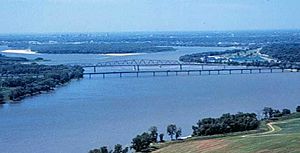
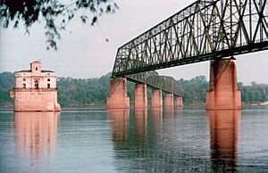
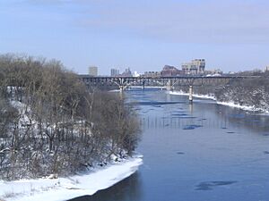
The very first bridge across the Mississippi River was built in 1855 in Minneapolis. There are no highway or railroad tunnels that go under the Mississippi River.
The first railroad bridge was built in 1856 between Rock Island, Illinois, and Davenport, Iowa. Steamboat captains were worried about competition from railroads. Just two weeks after the bridge opened, a steamboat hit it and set it on fire! Abraham Lincoln even defended the railroad in the lawsuit that followed.
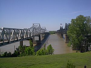
Here are some notable bridges over the Mississippi:
- Stone Arch Bridge in Minneapolis: A former railroad bridge, now for pedestrians.
- I-35W Saint Anthony Falls Bridge in Minneapolis: Replaced a bridge that sadly collapsed in 2007.
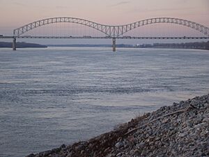
- Hernando de Soto Bridge in Memphis, Tennessee: A large bridge carrying Interstate 40.
- Eads Bridge in St. Louis: Built in 1874, it was the longest arch bridge in the world at the time and was one of the first to use steel.
- John James Audubon Bridge in Louisiana: The second-longest cable-stayed bridge in the Western Hemisphere.
- Huey P. Long Bridge in Jefferson Parish, Louisiana: The first Mississippi River bridge built in Louisiana.
- Crescent City Connection in New Orleans: Connects the east and west banks of the city and is one of the longest cantilever bridges in the world.

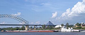
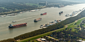
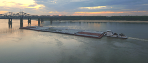
The Mississippi River is a very important waterway for trade. Large barges and other ships use it to move goods. The United States Army Corps of Engineers is in charge of keeping the river clear for navigation. They remove obstacles and maintain a deep channel.
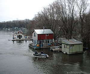
The upper parts of the Mississippi often freeze in winter, but the main channel usually only freezes in very cold years, sometimes as far south as St. Louis.
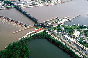
There are 29 locks and dams on the Upper Mississippi. Most were built in the 1930s to help commercial barges travel. These dams make the river deeper and wider, but they are not meant to stop floods. During high water, the gates are opened, and the dams don't hold back the water. Below St. Louis, the river flows more freely, but it's guided by many levees and "wing dams." These levees are like huge walls built along the riverbanks to keep the water on course.
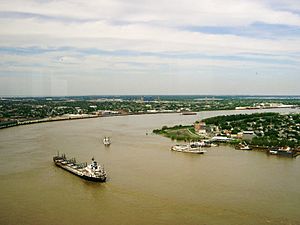
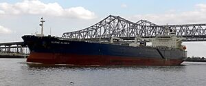
On the Lower Mississippi, from Baton Rouge to the Gulf, the river is kept 45 feet (14 m) deep. This allows large container ships and cruise ships to use ports like New Orleans.
History of River Control
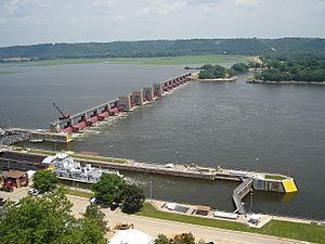
In the 1800s, parts of the Mississippi had shallow, rocky areas called rapids, which made travel difficult. Canals and dams were built to bypass these obstacles. For example, the Illinois and Michigan Canal was built in 1848 to connect the Mississippi River to Lake Michigan.
Before the huge Great Mississippi Flood of 1927, engineers thought that making the river flow faster would prevent floods. But the 1927 flood proved this wrong. After that, a new plan was made to build a 9-foot-deep (2.7 m) channel using more locks and dams.
In the 1950s, scientists realized the Mississippi River was trying to change its main path to the Atchafalaya River because it was a shorter route to the Gulf. To prevent this, the U.S. Congress approved the Old River Control Structure. This project stops the Mississippi from leaving its current channel, which is important for cities like New Orleans.
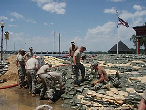
Today, the Corps of Engineers also uses "spillways" and "floodways" to direct extra water into other channels and lakes during floods. This helps protect cities from severe flooding.
Future River Changes
Geologists believe the lower Mississippi could still change its main course in the future, especially if flood control structures are damaged during a very big flood. Two possible new routes are through the Atchafalaya Basin or through Lake Pontchartrain.
The Old River Control Structure is very important. It usually sends 30% of the Mississippi's water into the Atchafalaya River. If this structure were to fail during a major flood, the river might permanently switch its main channel. Engineers have made many improvements to this structure since a close call during the 1973 flood.
Another control point is the Morganza Spillway. During the 2011 floods, the Corps of Engineers opened this spillway to release some water, which helped reduce stress on the main river channel and prevented a potential course change.
History of the Mississippi
About 50,000 years ago, the central United States was covered by an inland sea. The Mississippi River and its tributaries drained this sea, creating the rich, fertile land we see today, especially in places like Louisiana.
Native American History
Native American people first settled the Mississippi River basin. They were hunters and gatherers, but they also started growing plants like sunflowers and squash thousands of years ago. Over time, their way of life became more settled.
Between 200 and 500 AD, a trade network called the Hopewell interaction sphere connected communities from the Gulf of Mexico to the Great Lakes. Later, around 800 AD, an advanced farming society called the Mississippian culture developed. They built large cities and complex societies.
The most famous Mississippian city was Cahokia, near modern-day St. Louis. At its peak, it had between 8,000 and 40,000 people, which was larger than London, England, at that time! By the time Europeans arrived, many of these cities had been abandoned.
Today, many Native American nations, like the Cheyenne, Sioux, and Ojibwe, still live in the Mississippi basin. The word Mississippi itself comes from the Ojibwe name Misi-ziibi (Great River).
European Exploration
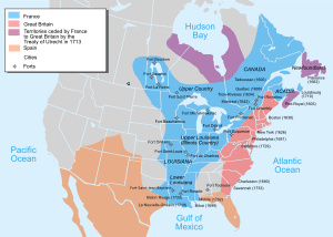
In 1519, Spanish explorer Alonso Álvarez de Pineda was the first European to record reaching the Mississippi River. Later, Hernando de Soto reached it in 1541 and called it Río del Espíritu Santo ("River of the Holy Spirit").
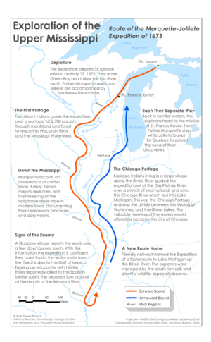
French explorers Louis Jolliet and Jacques Marquette explored the Mississippi in the 1600s. In 1682, René-Robert Cavelier, Sieur de La Salle claimed the entire Mississippi River valley for France, naming the region La Louisiane after King Louis XIV. In 1718, New Orleans was founded along the river.
Colonization and Growth
After a war in 1763, the Mississippi River became the border between the British and Spanish empires. The Treaty of Paris (1783), which ended the American Revolutionary War, said that the Mississippi River would always be free for British and U.S. citizens to navigate.
The United States gained control of the river when it bought the Louisiana Territory from France in 1803. This huge purchase greatly expanded the country. Many settlers traveled west through the Mississippi River basin.
The Steamboat Era
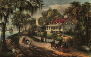
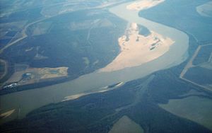
The period from 1830 to 1870 was known as the "steamboat era" on the Mississippi. Mark Twain wrote about this time in his famous book, Life on the Mississippi.
The first steamboat to travel the entire Lower Mississippi to New Orleans was the New Orleans in 1811. Steamboats changed the economy and travel on the Mississippi, making it a busy route for both passengers and goods.
The Civil War
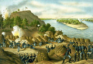
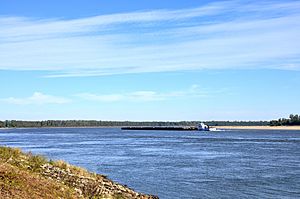
Controlling the Mississippi River was a major goal for both sides during the American Civil War. In 1862, Union forces captured key points along the river, including New Orleans, Louisiana. The Union's victory at the Siege of Vicksburg in July 1863 gave them full control of the lower Mississippi. This was a turning point in the war.
Modern Times
In 1927, the river caused the Great Mississippi Flood of 1927, breaking its banks in many places and flooding a huge area.
In 1930, Fred Newton became the first person to swim the entire length of the river, from Minneapolis to New Orleans. It took him 176 days!
In 1962 and 1963, industrial accidents spilled millions of gallons of soybean oil into the river, causing an environmental disaster and leading to more efforts to control water pollution.
The Great Flood of 1993 was another major flood, especially affecting the Mississippi north of Cairo, Illinois.
In 2002, Slovenian swimmer Martin Strel swam the entire length of the river over 68 days.
Recreation on the Mississippi
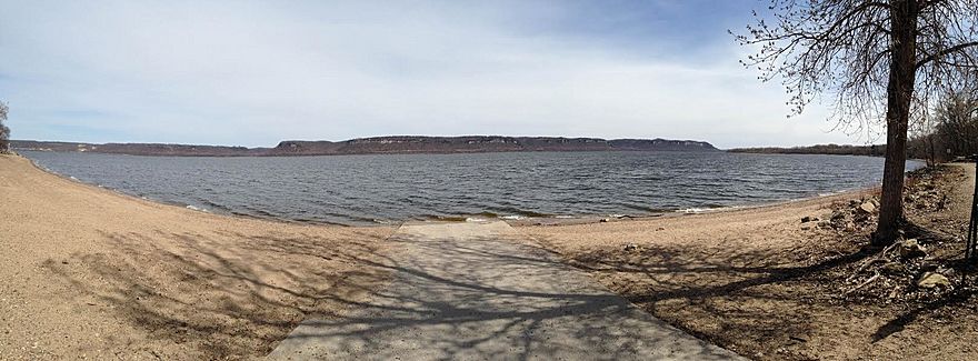
The sport of water skiing was invented on Lake Pepin, a wide part of the river between Minnesota and Wisconsin. Ralph Samuelson created his skiing technique there in 1922.
There are seven National Park Service sites along the Mississippi River, including the Mississippi National River and Recreation Area, which focuses on protecting and explaining the river itself.
Ecology of the Mississippi River

The Mississippi River basin is home to a huge variety of aquatic animals. It's often called the "mother fauna" of North American freshwater.
Fish Species
About 375 different kinds of fish live in the Mississippi basin. This is a very high number for a river in temperate regions! Many of these fish are found nowhere else, and some are ancient species like paddlefish, sturgeon, and gar.
The Upper Mississippi River alone has about 120 fish species, including popular ones like walleye, bass, catfish, and northern pike.
Other Animals
Many reptiles live in the river and its basin, such as American alligators and several types of turtles. There are also aquatic amphibians and crayfish.
The Mississippi River is also incredibly important for birds. About 40% of all migratory birds in the U.S. use the Mississippi River corridor during their spring and fall journeys. In fact, 60% of all migratory birds in North America (326 species) use this river basin as their flyway!
Introduced Species
Unfortunately, some non-native species have been introduced to the Mississippi, and some of these are invasive. For example, Asian carp have spread throughout much of the basin. These fish compete with native species and are known for their jumping behavior, which can be dangerous for boaters. Other invasive species like zebra mussels have also been found in parts of the river.
See also
 In Spanish: Río Misisipi para niños
 | Georgia Louise Harris Brown |
 | Julian Abele |
 | Norma Merrick Sklarek |
 | William Sidney Pittman |


