National Register of Historic Places listings in Hennepin County, Minnesota facts for kids
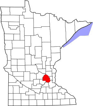
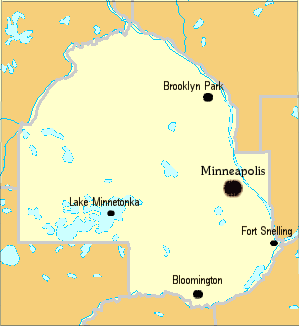
This page lists amazing old buildings and special areas in Hennepin County, Minnesota. These places are so important that they are on the National Register of Historic Places. As of April 2023, there are 190 of them! Many of these historic spots came about because of Fort Snelling, the powerful Saint Anthony Falls, and the busy city of Minneapolis that grew around the falls. Other cool historic places outside Minneapolis are linked to early settlers who started farms, schools, and missions in areas that are now suburbs.
Contents
A Look Back in Time
In 1680, a European explorer named Father Louis Hennepin was the first to see and name Saint Anthony Falls. This was the tallest waterfall on the Mississippi River. The Ojibwe and Sioux Native American tribes already knew about the falls. But Father Hennepin told everyone about them when he went back to France in 1683.
The land east of the Mississippi River became part of England in 1763. After the American Revolutionary War in 1783, it became American land. Then, in 1803, the United States bought the western side of the falls as part of the Louisiana Purchase.
In 1805, Zebulon Pike explored the Mississippi River. He made a deal with the Sioux people to get land on both sides of the river, from where the Minnesota River joins it all the way to Saint Anthony Falls. The United States didn't really settle the land until 1819. That's when Lieutenant Colonel Henry Leavenworth was told to build a military base there. The next year, Colonel Josiah Snelling built a strong fort on a bluff overlooking Pike Island. This spot was where the Mississippi and Minnesota Rivers met. The fort was first called Fort Saint Anthony, but later became Fort Snelling. It was like a small town in the middle of the wilderness.
In 1837, Franklin Steele claimed land on the east side of Saint Anthony Falls. Over the next ten years, he built a sawmill at the falls. Lumberjacks from the north started cutting trees and sending them to Steele's sawmill. In 1849, Steele divided his land and created a map for the town of Saint Anthony. Sawmilling and early attempts at flour milling were very successful. By 1855, the new town of Saint Anthony had more than three thousand people.
The west side of the river was part of the Fort Snelling military area until 1854. In 1849, John H. Stevens got 160 acres (0.65 km2) of land on the west side of the falls. He got this land in exchange for running a ferry boat at the falls. Hennepin County was created in 1852. The settlement on the west side of the river was named Minneapolis by Charles Hoag. Both towns grew because of businesses that used the power of the falls. But business was even better on the west side. Minneapolis officially became a city in 1867. Three years later, it joined with the village of Saint Anthony.
Over time, flour mills became more important than sawmills at the falls. In 1860, flour production was 30,000 barrels. By 1869, it reached 256,100 barrels! By 1874, Charles A. Pillsbury and Company owned five mills at the falls. In 1879, Washburn-Crosby Company (which is now General Mills) owned four mills. The old Washburn "A" Mill building on the west side of the falls exploded on May 2, 1878. But its owners quickly rebuilt the area, including a new, bigger Washburn "A" Mill. Meanwhile, in 1880, Pillsbury started building the huge Pillsbury "A" Mill on the east side of the falls. When it first opened, it could make 4,000 barrels of flour each day.
New ways of milling made it possible to grind tough spring wheat into a very fine flour. This was called Minnesota "patent" flour, and it was the best bread flour in the world at that time. By 1900, Minneapolis was grinding 14.1 percent of all the grain in the world!
Historic Places You Can See Today
| Name on the Register | Image | Date listed | Location | City or town | Description | |
|---|---|---|---|---|---|---|
| 1 | Abbott Hospital |
(#11000323) |
110 E. 18th St. 44°57′56″N 93°16′34″W / 44.9656°N 93.2761°W |
Minneapolis | This hospital building was built in five stages between 1910 and 1958. It shows how medical care became more specialized and advanced in the 20th century. | |
| 2 | Advance Thresher/Emerson-Newton Implement Company |
(#77000736) |
700–704 S. 3rd St. 44°58′36″N 93°15′32″W / 44.9767°N 93.2588°W |
Minneapolis | These two buildings, built in 1900 and 1904, show the Sullivanesque architectural style. This style was popular for large industrial and business buildings around 1900. | |
| 3 | Alano Society of Minneapolis Clubhouse |
(#100007071) |
2218 1st Ave. S. 44°57′36″N 93°16′37″W / 44.9601°N 93.2769°W |
Minneapolis | This building was the main office from 1942 to 1968 for Minnesota's first and most important Alcoholics Anonymous group. It's an 1887 house with additions from 1916 and 1950. | |
| 4 | Ames-Florida House |
(#79003714) |
8131 Bridge St. 45°05′12″N 93°43′54″W / 45.0868°N 93.7318°W |
Rockford | This 1856 house is in the Greek Revival style. It belonged to the mill owners who started the town of Rockford. Today, it's a museum. | |
| 5 | Anoka-Champlin Mississippi River Bridge |
(#79001181) |
U.S. Route 169 over Mississippi River 45°11′30″N 93°23′43″W / 45.1918°N 93.3952°W |
Champlin | This 1929 bridge is a great example of the concrete arch bridges built in the Twin Cities in the late 1920s. It also connects two important river towns. It goes into Anoka County too. | |
| 6 | Architects and Engineers Building |
(#84001414) |
1200 2nd Ave. S. 44°58′15″N 93°16′26″W / 44.9708°N 93.2740°W |
Minneapolis | This 1920 building was a shared office space for designers. It's known for its beautiful Renaissance Revival architecture by Hewitt and Brown. Many famous architects and engineers worked here. | |
| 7 | George W. Baird House |
(#80002067) |
4400 W. 50th St. 44°54′47″N 93°20′13″W / 44.9131°N 93.337°W |
Edina | This 1886 house is in the Queen Anne style. It was designed by Charles S. Sedgwick for George and Sarah Baird, who were early settlers and leaders of the Grange. | |
| 8 | Bardwell-Ferrant House |
(#84001416) |
2500 Portland Ave. S. 44°57′26″N 93°16′05″W / 44.9571°N 93.2680°W |
Minneapolis | This house, built around 1883, was remodeled in 1890 with a Moorish Revival look. It's a colorful example of how people in the late 1800s loved unique and exotic styles. | |
| 9 | Riley Lucas Bartholomew House |
(#78001545) |
6901 Lyndale Ave. S. 44°52′39″N 93°17′18″W / 44.8776°N 93.2884°W |
Richfield | This house, built around 1853, belonged to Riley Bartholomew (1807–1894). He was an important early Minnesotan who served as a judge, state senator, and soldier. Today, it's a museum. | |
| 10 | Basilica of St. Mary |
(#75000985) |
1600 Hennepin Ave. 44°58′23″N 93°17′11″W / 44.9731°N 93.2863°W |
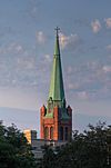
Minneapolis | This famous church was built from 1907 to 1914. It's known for its amazing Baroque Revival architecture. It was the first Catholic basilica in the United States. | |
| 11 | Bennett-McBride House |
(#77000737) |
3116 3rd Ave. S. 44°56′46″N 93°16′24″W / 44.9461°N 93.2732°W |
Minneapolis | This is a great example of a Queen Anne house, built in 1891. It's special because its inside and outside wooden details are still perfectly preserved. | |
| 12 | Fredrika Bremer Intermediate School |
(#78001536) |
1214 Lowry Ave. N. 45°00′49″N 93°17′42″W / 45.0135°N 93.2950°W |
Minneapolis | This is Minneapolis's oldest school building that is still standing, built in 1886. Its castle-like design shows how important education was in the 1800s. | |
| 13 | Bridge No. 90646 |
(#15001016) |
Spanning Minnehaha Creek on Wooddale Ave. 44°54′42″N 93°20′21″W / 44.9118°N 93.3392°W |
Edina | This bridge crosses Minnehaha Creek. It's a multi-plate arch bridge with pretty limestone decorations that match a nearby church. | |
| 14 | Charles H. Burwell House |
(#74001025) |
13209 E. McGinty Rd. 44°56′29″N 93°26′53″W / 44.9414°N 93.4481°W |
Minnetonka | This 1883 house and its other buildings are in the Carpenter Gothic/Stick style. It was built by the manager of the Minnetonka Mills Company, which was the first mill west of Minneapolis. Today, it's a museum and park. | |
| 15 | Butler Brothers Company |
(#71000437) |
518 1st Ave. N. 44°58′48″N 93°16′30″W / 44.9801°N 93.2749°W |
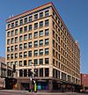
Minneapolis | This is a great example of a warehouse and office building in the Chicago School style. It was designed by Harry Wild Jones and built from 1906 to 1908. It's now called Butler Square. | |
| 16 | Buzza Company Building |
(#11001039) |
1006 W. Lake St. 44°56′55″N 93°17′32″W / 44.9486°N 93.2923°W |
Minneapolis | This was one of the few factories left in the country that made early greeting cards, from 1923 to 1942. It's also known for making important military optics during World War II. | |
| 17 | Cahill School |
(#70000297) |
4924 Eden Ave. 44°54′39″N 93°20′59″W / 44.9108°N 93.3498°W |
Edina | This 1864 building is an example of the one-room schoolhouses that were common in rural Minnesota in the 1800s. Today, the Edina Historical Society manages it. | |
| 18 | Calhoun Beach Club |
(#03001335) |
2730 W. Lake St. 44°57′00″N 93°18′55″W / 44.9499°N 93.3153°W |
Minneapolis | This apartment hotel was mostly built from 1928 to 1929. It's a rare example of a special type of city housing from the 1920s. | |
| 19 | Calvary Baptist Church |
(#100006586) |
2608 Blaisdell Ave. S. 44°57′19″N 93°16′48″W / 44.9553°N 93.28°W |
Minneapolis | This 1889 church is in the Romanesque Akron Plan style, with additions from 1903 and 1928. It's a well-preserved example of the work of architects Warren H. Hayes and Harry Wild Jones. | |
| 20 | Calvary Lutheran Church |
(#100007577) |
3901 Chicago Ave. 44°55′56″N 93°15′44″W / 44.9321°N 93.2621°W |
Minneapolis | This 1930 church, with an addition from 1953, is an excellent example of the work of the busy Minneapolis architectural firm Lang and Raugland. | |
| 21 | Cameron Transfer and Storage Company Building |
(#14000390) |
756 N. 4th St. 44°59′14″N 93°16′49″W / 44.9872°N 93.2804°W |
Minneapolis | This warehouse was built from 1909 to 1911. It shows a big change in warehouse building in the early 1900s, mixing old timber framing with new reinforced concrete construction. | |
| 22 | Cappelen Memorial Bridge |
(#78001537) |
Franklin Ave. and the Mississippi River 44°57′49″N 93°13′23″W / 44.9637°N 93.2230°W |
Minneapolis | This is a top example of the famous concrete arch bridges in the Twin Cities from the 1920s. Its main span was the longest of its kind in the world when it was finished in 1923. It's better known as the Franklin Avenue Bridge. | |
| 23 | Aaron Carlson Corporation Factory |
(#100005672) |
1505 Central Ave. NE 45°00′13″N 93°14′50″W / 45.0037°N 93.2473°W |
Minneapolis | This local millwork company made parts for pontoon bridges during World War II. They even won an award for their great production. | |
| 24 | Elbert L. Carpenter House |
(#77000738) |
314 Clifton Ave. 44°57′59″N 93°17′03″W / 44.9664°N 93.2841°W |
Minneapolis | This 1906 house belonged to Elbert Carpenter (1862–1945), a lumber company executive and a founder of the Minneapolis Symphony Orchestra. It's also known for its Georgian Revival design by William Channing Whitney. | |
| 25 | Eugene J. Carpenter House |
(#77001566) |
300 Clifton Ave. 44°57′58″N 93°17′00″W / 44.9662°N 93.2833°W |
Minneapolis | This 1906 house belonged to Eugene Carpenter (1865–1922), another important lumber executive and a supporter of the Minneapolis Institute of Arts. | |
| 26 | J.I. Case Building |
(#100006558) |
233 Park Ave. 44°58′39″N 93°15′31″W / 44.9774°N 93.2585°W |
Minneapolis | This warehouse was used from 1907 to 1958 by the J. I. Case Threshing Machine Company, a top farm equipment maker. It also helped start a new warehouse area in Minneapolis. | |
| 27 | Cedar Avenue Bridge |
(#89001845) |
10th Ave. over the Mississippi River 44°58′43″N 93°14′38″W / 44.9787°N 93.2438°W |
Minneapolis | This bridge, finished in 1929, is a great example of the huge concrete arch bridges built in the Twin Cities for cars. It was designed by engineer Kristoffer Olsen Oustad. It's now called the 10th Avenue Bridge. | |
| 28 | Cedar Square West |
(#10001090) |
1600 S. 6th St. 44°58′08″N 93°14′54″W / 44.9688°N 93.2484°W |
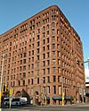
Minneapolis | This large apartment complex, built from 1970 to 1974, was important for city planning. It was the first project funded under a special national law. It's also a major work by architect Ralph Rapson. It's now known as Riverside Plaza. | |
| 29 | Loren L. Chadwick Cottages |
(#84001417) |
2617 W. 40th St. 44°55′49″N 93°18′50″W / 44.9303°N 93.3139°W |
Minneapolis | These two small cottages from 1902 are unique examples of the simple summer homes built in the Minneapolis lake district. They were joined into one house in the 1970s. | |
| 30 | Chamber of Commerce Building |
(#95000821) |
400 4th St. S. 44°58′39″N 93°15′49″W / 44.9776°N 93.2637°W |
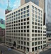
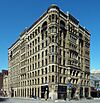
Minneapolis | This long-serving marketplace for goods helped make Minneapolis a major international grain trade center. It has three buildings built from 1902 to 1928. It's also known for being the city's first steel building. It was renamed the Minneapolis Grain Exchange in 1947. | |
| 31 | Chicago, Milwaukee and St. Paul Railroad Grade Separation |
(#05000508) |
Parallel to 29th St. between Humboldt and 20th Aves. S. 44°57′01″N 93°16′18″W / 44.9503°N 93.2717°W |
Minneapolis | This 2.8-mile (4.5 km) trench and 28 bridges were built from 1912 to 1916. They separated train tracks from streets to make things safer and better for business. It's now part of the Midtown Greenway bike path. | |
| 32 | Chicago, Milwaukee, St. Paul and Pacific Depot |
(#69000072) |
W. 37th St. and Brunswick Ave. 44°56′13″N 93°21′29″W / 44.9370°N 93.3580°W |
St. Louis Park | This 1887 train station was the main way to connect to Minneapolis. It's one of the few early buildings left in St. Louis Park and shows how the town grew. Today, it's a museum. | |
| 33 | Chicago, Milwaukee, St. Paul and Pacific Depot Freight House and Train Shed |
(#78001542) |
201 3rd Ave. S. 44°58′48″N 93°15′48″W / 44.9800°N 93.2632°W |
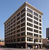
Minneapolis | This is Minneapolis's oldest train station still standing, built from 1897 to 1899. It also has an older freight house from 1879. It's important for its architecture and for being one of the few train sheds with a truss roof left in the country. It's now a business complex called The Depot. | |
| 34 | Christ Church Lutheran |
(#01000654) |
3244 34th Ave. S. 44°56′37″N 93°13′24″W / 44.9435°N 93.2233°W |
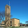
Minneapolis | This church, built from 1948 to 1949, is a very important example of modernist design. It's the main work of famous 20th-century architect Eliel Saarinen, with an addition from his equally famous son Eero Saarinen. | |
| 35 | Church of the Incarnation and Rectory |
(#100007352) |
3801–3817 Pleasant Ave. 44°56′02″N 93°16′57″W / 44.93375°N 93.282638°W |
Minneapolis | This Roman Catholic church complex was built from 1913 to 1932. It's a unique local example of different architectural styles mixed together in the early 1900s. | |
| 36 | Church of St. Stephen (Catholic) |
(#91001058) |
2201 Clinton Ave. S. 44°57′39″N 93°16′16″W / 44.9607°N 93.2711°W |
Minneapolis | This church, built from 1889 to 1891, is a well-preserved early example of a Richardsonian Romanesque/Romanesque Revival style church. | |
| 37 | Amos B. Coe House |
(#84001418) |
1700 S. 3rd Ave. 44°57′58″N 93°16′23″W / 44.9661°N 93.273°W |
Minneapolis | This 1884 house and its 1886 carriage house are great examples of the Queen Anne homes that upper-middle-class families lived in during the late 1800s. | |
| 38 | Coliseum Building and Hall |
(#100007557) |
2708 E. Lake St. 44°56′55″N 93°13′58″W / 44.9487°N 93.2327°W |
Minneapolis | This commercial building with an event hall was built in 1917 and made bigger several times. It was a key part of a busy business area in Longfellow, Minneapolis in the 20th century. | |
| 39 | Como-Harriet Streetcar Line and Trolley |
(#77000739) |
42nd St. W. and Queen Ave. S. 44°55′40″N 93°18′35″W / 44.9277°N 93.3096°W |
Minneapolis | This 1908 streetcar and its restored 0.5-mile (0.80 km) track are a working reminder of the Twin Cities' big public transportation system that ran until 1954. It's now run by the Minnesota Streetcar Museum. | |
| 40 | Country Club Historic District |
(#82002958) |
Roughly bounded by 45th St., Arden Ave., 50th St., and Browndale Ave. 44°55′00″N 93°20′24″W / 44.9167°N 93.3399°W |
Edina | This suburban neighborhood, started in 1922, was one of Minnesota's first fully planned communities. It was a model for other housing developments in Edina. It's also known for its similar Period Revival architecture. | |
| 41 | Crane Island Historic District |
(#91001005) |
Crane Island in Lake Minnetonka 44°54′02″N 93°39′45″W / 44.9006°N 93.6625°W |
Minnetrista | This island has 14 summer cottages from the early 1900s. They show how more middle-class people started having summer homes as they got better jobs and could travel by train. | |
| 42 | John R. Cummins Farmhouse |
(#82002957) |
13600 Pioneer Trail 44°49′48″N 93°26′56″W / 44.8299°N 93.4490°W |
Eden Prairie | This is a rare farmhouse still standing in southern Hennepin County. It was built in 1879 and made bigger in 1910. It belonged to a well-known local gardener and diarist (1834–1921). | |
| 43 | B. O. Cutter House |
(#76001058) |
400 10th Ave. SE. 44°58′58″N 93°14′27″W / 44.9828°N 93.2407°W |
Minneapolis | This is the only remaining example of the Carpenter Gothic cottages that used to be common in the Twin Cities. It was built by master carpenter B.O. Cutter for himself in 1856. | |
| 44 | Dayton's Department Store |
(#100004147) |
700 Nicollet Mall 44°58′36″N 93°16′21″W / 44.9767°N 93.2724°W |
Minneapolis | This was the first Dayton's department store, built in 1902 and expanded many times. It was the main store and office for a very important local retail company. | |
| 45 | District No. 99 School |
(#100009722) |
10980 West River Road 45°09′14″N 93°20′26″W / 45.1539°N 93.3405°W |
Champlin | ||
| 46 | District No. 107 School |
(#100003081) |
22995 County Rd. 10 45°07′24″N 93°37′31″W / 45.1234°N 93.6253°W |
Corcoran | This 1894 one-room school with its original outhouses shows how local communities worked to provide education in rural Hennepin County. It's also known as the Burschville School. | |
| 47 | East Lake Branch Library |
(#00000542) |
2916 E. Lake St. 44°56′55″N 93°13′45″W / 44.948635°N 93.229058°W |
Minneapolis | This 1924 library branch is connected to the important growth of the Minneapolis Public Library from 1894 to 1936. It's also linked to its famous director, Gratia Countryman (1866–1953). | |
| 48 | Eitel Hospital |
(#07001313) |
1367 Willow St. 44°58′09″N 93°16′54″W / 44.969053°N 93.281642°W |
Minneapolis | This 1911 surgical hospital is important because it shows a big change in hospitals. It's also linked to influential local doctors George G. (1858–1928) and Jeanette Eitel (1875–1951). | |
| 49 | Excelsior Commercial Historic District |
(#100007070) |
Roughly bounded by Lake St., West Dr., 3rd St., and East Dr. 44°54′13″N 93°33′58″W / 44.9035°N 93.5662°W |
Excelsior | This two-block business area shows Excelsior's early days as a tourist spot and its growth into a suburban area in the mid-1900s. It has 32 important buildings built from 1886 to 1958. | |
| 50 | Excelsior Public School |
(#80002068) |
261 School Ave. 44°54′05″N 93°33′53″W / 44.901483°N 93.564809°W |
Excelsior | This important school building, built from 1899 to 1901, shows how Excelsior grew up. It has beautiful architecture and is in a prominent location. | |
| 51 | Farmers and Mechanics Savings Bank |
(#84001419) |
115 S. 4th St. 44°58′43″N 93°16′04″W / 44.978738°N 93.26779°W |
Minneapolis | This bank building was built from 1891 to 1892 and updated in 1908. It's important as an early example of the Beaux-Arts/Neoclassical style that became popular in Minneapolis. | |
| 52 | Farmers and Mechanics Savings Bank |
(#06000094) |
88 S. 6th St. 44°58′40″N 93°16′13″W / 44.977759°N 93.270242°W |
Minneapolis | This was Minnesota's only long-lasting mutual savings bank. Its move to this building in 1942 and a big addition in 1963 show how downtown Minneapolis changed and how architecture shifted from Streamline Moderne to International Style. | |
| 53 | Fire Station No. 19 |
(#82002960) |
2001 University Ave. SE. 44°58′34″N 93°13′37″W / 44.976001°N 93.226844°W |
Minneapolis | This 1893 fire station shows the design of the late 1800s and early 1900s, when fire trucks were still pulled by horses. It's also where "kittenball," a game that led to softball, was invented by firefighters. | |
| 54 | First Church of Christ, Scientist |
(#86001340) |
614-620 E. 15th St. 44°58′06″N 93°16′00″W / 44.968302°N 93.266669°W |
Minneapolis | This 1897 church is known for its excellent small-scale Beaux-Arts architecture. It was the first Christian Science church in the Upper Midwest. | |
| 55 | First Congregational Church |
(#79001249) |
500 8th Ave. SE. 44°59′06″N 93°14′34″W / 44.984979°N 93.242705°W |
Minneapolis | This 1886 church is in the Richardsonian Romanesque style, designed by Warren H. Hayes. It was built for Minnesota's first congregational church, started in 1851, and is known for helping the community. | |
| 56 | First National Bank–Soo Line Building |
(#08000402) |
101 S. 5th St. 44°58′40″N 93°16′09″W / 44.97788°N 93.269039°W |
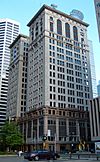
Minneapolis | This 1915 office building was the main office for two of the city's biggest companies: the First National Bank of Minneapolis and the Minneapolis, St. Paul and Sault Ste. Marie Railroad. | |
| 57 | First Presbyterian Church of Oak Grove Cemetery |
(#14000956) |
10340 Lyndale Ave. S. 44°48′55″N 93°17′23″W / 44.815255°N 93.289740°W |
Bloomington | This cemetery, started in 1856, has burials of pioneers and Dakota people. It also has an 1890 monument for soldiers. It shows how Bloomington changed from a frontier settlement to a part of state affairs. | |
| 58 | Woodbury Fisk House |
(#83003654) |
424 5th St. SE. 44°59′11″N 93°14′53″W / 44.986296°N 93.247997°W |
Minneapolis | This house, built around 1870, is one of Minneapolis's best examples of Italian Villa architecture. | |
| 59 | Flour Exchange Building |
(#77000740) |
310 4th Ave. S. 44°58′42″N 93°15′50″W / 44.978257°N 93.263964°W |
Minneapolis | This tall office building was started in 1892 and finished in 1909. It was the first building in Minneapolis designed in a simple commercial style. | |
| 60 | Fort Snelling |
(#66000401) |
Bounded by Minnehaha Park, the Mississippi River, the airport, and Bloomington Rd. 44°53′34″N 93°10′51″W / 44.892774°N 93.180719°W |
Minneapolis | This military base was started in 1819 and used until 1946. It was very important for the growth of the Upper Midwest and for the U.S. Army becoming a major force. It also extends into Dakota County. | |
| 61 | Fort Snelling National Cemetery |
(#16000060) |
7601 34th Ave. S. 44°52′20″N 93°13′09″W / 44.872121°N 93.219032°W |
Minneapolis | This national cemetery dates back to 1939. It's one of seven cemeteries created after World War I to bury more veterans. | |
| 62 | Fort Snelling–Mendota Bridge |
(#78001534) |
Minnesota Highway 55 over the Minnesota River 44°53′15″N 93°10′39″W / 44.8875°N 93.1775°W |
Minneapolis | This 4,119-foot (1,255 m) bridge was built from 1925 to 1926. It's known for its clever design and was once the world's longest continuous concrete arch bridge. It also extends into Dakota County. | |
| 63 | Foshay Tower |
(#78001538) |
821 Marquette Ave. 44°58′28″N 93°16′18″W / 44.97443°N 93.271563°W |
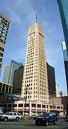
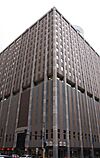
Minneapolis | This fancy office building was built from 1927 to 1929 and was Minneapolis's tallest skyscraper. It's known for its unique obelisk shape and shows the rich spending of the Roaring Twenties. | |
| 64 | Lawrence A. and Mary Fournier House |
(#95000618) |
3505 Sheridan Ave. N. 45°01′08″N 93°18′44″W / 45.018866°N 93.312343°W |
Minneapolis | This 1910 bungalow shows how Prairie School architecture started to appear within the Arts and Crafts movement. | |
| 65 | Fowler Methodist Episcopal Church |
(#76001062) |
2011 Dupont Ave. S. 44°57′45″N 93°17′34″W / 44.962428°N 93.292809°W |
Minneapolis | This church was started by Warren H. Hayes in 1894 and finished by Harry Wild Jones in 1906. It's the only building they worked on together. It also shows the community work of the Scottish Rite since it became the Scottish Rite Temple in 1915. | |
| 66 | Franklin Branch Library |
(#00000545) |
1314 E. Franklin Ave. 44°57′47″N 93°15′21″W / 44.96296°N 93.255866°W |
Minneapolis | This 1914 Carnegie library is connected to the important growth of the Minneapolis Public Library from 1894 to 1936. It's also linked to its famous director, Gratia Countryman (1866–1953). | |
| 67 | Gethsemane Episcopal Church |
(#84001424) |
901-905 4th Ave. S. 44°58′20″N 93°16′06″W / 44.972296°N 93.268244°W |
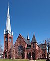
Minneapolis | This 1884 church is known for its Gothic Revival architecture and for being one of the oldest churches still standing in Minneapolis. | |
| 68 | Peter Gideon Farmhouse |
(#74001019) |
24590 Glen Rd. 44°54′13″N 93°35′32″W / 44.903692°N 93.592206°W |
Shorewood | This house and orchard are where gardener Peter Gideon (1820–1899) experimented starting in 1854. He worked to grow fruit trees that could survive cold winters, and he famously created the Wealthy apple. | |
| 69 | Glen Lake Children's Camp |
(#99000932) |
6350 Indian Chief Rd. 44°53′16″N 93°27′55″W / 44.887678°N 93.465265°W |
Eden Prairie | This is one of the few remaining summer camps for children with tuberculosis, which was open from 1925 to 1950. It's also linked to the Glen Lake Sanatorium and generous people George and Leonora Christian. It's now called Camp Eden Wood. | |
| 70 | John G. and Minnie Gluek House and Carriage House |
(#90000103) |
2447 Bryant Ave. S. 44°57′27″N 93°17′25″W / 44.957576°N 93.290287°W |
Minneapolis | This important Georgian Revival house and carriage house were both built in 1902. The house was designed by William Kenyon, a key local architect. | |
| 71 | Grace Evangelical Lutheran Church |
(#96001557) |
324 Harvard St. SE. 44°58′22″N 93°13′50″W / 44.97279°N 93.230686°W |
Minneapolis | This church, built from 1915 to 1917, belonged to a Swedish American group. It's known for its Gothic Revival architecture and for trying to help younger members feel more American. | |
| 72 | Grain Belt Beer Sign |
(#16000511) |
4 Island Ave. W. 44°59′10″N 93°15′48″W / 44.986135°N 93.263440°W |
Minneapolis | This billboard was put up in 1950. It's a local landmark and the only big, free-standing advertisement left from the 20th century for Grain Belt Beer, a popular Minnesota brand. | |
| 73 | Great Northern Implement Company |
(#77000745) |
616 S. 3rd St. 44°58′37″N 93°15′35″W / 44.977077°N 93.259603°W |
Minneapolis | This 1910 commercial and industrial building is known for its simple decorations, inspired by the work of famous architect Louis Sullivan. It's also known as the Pittsburgh Plate Glass Company Building. | |
| 74 | Great Northern Railroad Depot |
(#81000322) |
402 E. Lake St. 44°58′12″N 93°30′59″W / 44.969868°N 93.516318°W |
Wayzata | This 1906 train station for passengers and freight is known for its architecture. It shows how Wayzata first didn't want, then later accepted, the Great Northern Railway route along its downtown lakefront. It now has a museum. | |
| 75 | Jonathan Taylor Grimes House |
(#76001056) |
4200 W. 44th St. 44°55′16″N 93°20′14″W / 44.921°N 93.337249°W |
Edina | This 1869 house is in the Gothic Revival style. It belonged to an early Minnesota gardener (1818–1903) who provided many of Minneapolis's shade trees. He also planted the first ginkgo and catalpa trees in the state. | |
| 76 | Hagel Family Farm |
(#06001182) |
11475 Tilton Trail S. 45°09′46″N 93°34′10″W / 45.162838°N 93.569394°W |
Rogers | This farm is a very well-preserved example of the mixed farms that were common in Minnesota in the late 1800s and early 1900s. It was started around 1855 and has 18 important buildings, mostly built in the 1890s. | |
| 77 | Hanover Bridge |
(#79001268) |
Off County Highway 19 over the Crow River 45°09′12″N 93°39′43″W / 45.153352°N 93.661915°W |
Hanover | This bridge, built in 1885, is the oldest and most complete example of the pin-connected Pratt truss bridges that were once common in the area. Now, only people can walk across it. It also extends into Wright County. | |
| 78 | Healy Block Residential Historic District |
(#93000417) |
3101–3145 2nd Ave. S. and 3116–3124 3rd Ave. S. 44°56′45″N 93°16′25″W / 44.945851°N 93.27369°W |
Minneapolis | These 14 similar houses were built from 1886 to 1898 by contractor Theron P. Healy. They show how upper-middle-class neighborhoods were designed and built by single contractors during Minneapolis's growth in the late 1800s. | |
| 79 | Hennepin County Library |
(#78001546) |
4915 N. 42nd Ave. 45°01′52″N 93°20′31″W / 45.03116°N 93.341981°W |
Robbinsdale | This 1925 library was built entirely with money raised by the Robbinsdale Library Club. It shows the early 1900s idea of people working to improve themselves. It's now the Robbinsdale Historical Society Museum. | |
| 80 | Hennepin Theatre |
(#95001548) |
910 Hennepin Ave. 44°58′35″N 93°16′39″W / 44.97632°N 93.27749°W |
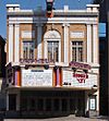
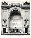
Minneapolis | This leading 1921 theater is a great example of the fancy vaudeville theaters from the early 1900s. It's linked to Minneapolis's entertainment area and popular culture. It's now the Orpheum Theatre. | |
| 81 | Edwin H. Hewitt House |
(#78001539) |
126 E. Franklin Ave. 44°57′47″N 93°16′30″W / 44.96293°N 93.274991°W |
Minneapolis | This 1906 house is in the Tudor Revival style. It was built for himself by famous Minnesota architect Edwin Hawley Hewitt. It's now a funeral home. | |
| 82 | Hiawatha Golf Course |
(#100008905) |
4553 Longfellow Ave. 44°55′13″N 93°14′37″W / 44.9202°N 93.2437°W |
Minneapolis | This city golf course had the first clubhouse in the city to be desegregated in 1952. This led to more civil rights progress for Black golfers in Minnesota. | |
| 83 | Hinkle-Murphy House |
(#84001438) |
619 10th St. S. 44°58′12″N 93°15′57″W / 44.969867°N 93.265749°W |
Minneapolis | This is Minnesota's oldest remaining Georgian Revival house, built from 1886 to 1887. It was one of the first examples of Colonial Revival architecture brought to the state by architects William Channing Whitney and Harry Wild Jones. | |
| 84 | Hollywood Theater |
(#13001145) |
2815 Johnson St. NE 45°01′09″N 93°14′13″W / 45.019060°N 93.236814°W |
Minneapolis | This 1935 movie theater is in the Streamline Moderne style, designed by famous theater architects Liebenberg & Kaplan. It also shows how local, neighborhood cinemas grew during the Great Depression. | |
| 85 | Intercity Bridge |
(#89001838) |
Ford Parkway over the Mississippi River 44°55′04″N 93°12′05″W / 44.917861°N 93.201361°W |
Minneapolis | This huge 1927 concrete arch bridge was designed by Martin Sigvart Grytbak. It extends into Ramsey County and is better known as the Ford Bridge. | |
| 86 | Interlachen Bridge |
(#89001840) |
William Berry Dr. over a Minnesota Transportation Museum street railway track in William Berry Park 44°55′53″N 93°18′32″W / 44.931351°N 93.308832°W |
Minneapolis | This is Minnesota's oldest documented bridge made of reinforced concrete, built in 1900. It's a very early example that still looks original. | |
| 87 | Harry W. Jones House |
(#76001060) |
5101 Nicollet Ave. 44°54′37″N 93°16′40″W / 44.910239°N 93.277741°W |
Minneapolis | This 1887 house, also called Elmwood, was built for himself by important Minneapolis architect Harry Wild Jones (1859–1935). It's designed like a Norman castle. | |
| 88 | Lake Harriet Methodist Episcopal Church |
(#14000217) |
4401 Upton Ave. S. 44°55′24″N 93°18′53″W / 44.923201°N 93.314694°W |
Minneapolis | This important Classical Revival church, built in 1916, is a unique example of the City Beautiful movement in a church building. | |
| 89 | Lake Street Sash and Door Company |
(#16000440) |
4001–4041 Hiawatha Ave. 44°55′46″N 93°13′30″W / 44.929444°N 93.225°W |
Minneapolis | This factory complex belonged to one of Minneapolis's main millwork companies. It has three buildings built from 1926 to 1928, showing what factories in this industry looked like back then. | |
| 90 | Lakewood Cemetery Memorial Chapel |
(#83003657) |
3600 Hennepin Ave. 44°56′10″N 93°17′57″W / 44.936075°N 93.299141°W |
Minneapolis | This beautiful cemetery chapel, built from 1908 to 1910, is in the Byzantine Revival style, like the Hagia Sophia. It has Minnesota's best Byzantine-style mosaic inside. | |
| 91 | Laurel Apartments |
(#100005245) |
15 15th St. N. 44°58′27″N 93°17′04″W / 44.9743°N 93.2845°W |
Minneapolis | This 1893 apartment complex is known for its fancy Queen Anne design by local architect Septimus J. Bowler. | |
| 92 | Arthur and Edith Lee House |
(#14000391) |
4600 Columbus Ave. S. 44°55′10″N 93°15′51″W / 44.919558°N 93.26414°W |
Minneapolis | This 1923 house became famous because an African American family lived there from 1931 to 1933 in a mostly white neighborhood. This caused one of Minnesota's biggest protests about race, showing the problem of housing discrimination in Minneapolis. | |
| 93 | Harry F. Legg House |
(#76001061) |
1601 Park Ave. S. 44°58′01″N 93°15′53″W / 44.967001°N 93.264733°W |
Minneapolis | This 1887 house is in the Queen Anne style. It's a good example of homes built for the middle class during that time. | |
| 94 | Lincoln Bank Building |
(#12000846) |
730 Hennepin Ave. 44°58′39″N 93°16′34″W / 44.97755°N 93.276139°W |
Minneapolis | This 1921 commercial building shows how the banking industry grew in the 1920s. It was one of the city's first branch offices of a national bank. | |
| 95 | Linden Hills Branch Library |
(#00000540) |
2900 W. 43rd St. 44°55′30″N 93°18′59″W / 44.925021°N 93.316484°W |
Minneapolis | This 1931 library branch is connected to the important growth of the Minneapolis Public Library from 1894 to 1936. It's also linked to its famous director, Gratia Countryman (1866–1953). | |
| 96 | Little Sisters of the Poor Home for the Aged |
(#78001540) |
215 Broadway Ave. NE. 44°59′56″N 93°15′55″W / 44.998935°N 93.265376°W |
Minneapolis | This important charity home for seniors has an original section from 1895. It's a rare building by Minneapolis architect Frederick Corser that is still standing. | |
| 97 | McLeod and Smith Inc. Headquarters |
(#16000277) |
700–708 Central Ave. NE. 44°59′27″N 93°15′04″W / 44.99091°N 93.251165°W |
Minneapolis | This 1897 factory and its 1909 warehouse (made bigger in 1922) were built for Minneapolis's first and largest furniture maker. It was a key part of a big furniture-making area. | |
| 98 | Lock and Dam No. 2 |
(#03000522) |
Mississippi River north of Lake St/Marshall Ave. 44°57′14″N 93°12′28″W / 44.953889°N 93.207778°W |
Minneapolis | These are the remains of the first lock and dam on the Upper Mississippi River, used from 1907 to 1912. It's better known as the Meeker Island Lock and Dam. It also extends into Ramsey County. | |
| 99 | John Lohmar House |
(#77000742) |
1514 Dupont Ave. N. 44°59′41″N 93°17′32″W / 44.994798°N 93.292338°W |
Minneapolis | This 1898 house is a well-preserved example of an upper-middle-class home in the late Queen Anne style. | |
| 100 | Long Meadow Bridge |
(#13000324) |
Old Cedar Avenue at Minnesota River 44°49′48″N 93°14′31″W / 44.830°N 93.242°W |
Bloomington | This is Minnesota's longest through truss bridge, built in 1920 with five camelback sections to cross a wide lake. It's also known as the Old Cedar Avenue Bridge. | |
| 101 | Lumber Exchange Building |
(#83000903) |
425 Hennepin Ave., 10 S. 5th St. 44°58′47″N 93°16′18″W / 44.979644°N 93.271783°W |
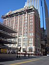
Minneapolis | This building, built from 1885 to 1890, is one of Minneapolis's last business blocks in the Richardsonian Romanesque style. It's also known for its early fire-resistant design by Long and Kees and its link to the city's lumber business. | |
| 102 | Charles J. Martin House |
(#78001541) |
1300 Mount Curve Ave. 44°58′04″N 93°17′46″W / 44.967807°N 93.295978°W |
Minneapolis | This 1903 mansion and its grounds are in the Renaissance Revival style. It's a well-preserved example of a fancy city estate from the early 1900s. | |
| 103 | Masonic Temple |
(#75000987) |
528 Hennepin Ave. 44°58′45″N 93°16′26″W / 44.979192°N 93.273904°W |
Minneapolis | This 1888 Masonic headquarters is known for its Richardsonian Romanesque architecture by Long and Kees and its beautiful stonework. It's now the Hennepin Center for the Arts. | |
| 104 | Maternity Hospital |
(#80002069) |
300 Queen Ave. N. 44°58′49″N 93°18′32″W / 44.980257°N 93.308809°W |
Minneapolis | These three buildings (built 1909–1916) are what's left of a groundbreaking women's hospital. It was started by social reformer and women's rights advocate Dr. Martha Ripley (1843–1912). | |
| 105 | Milwaukee Avenue Historic District |
(#74001021) |
Milwaukee Ave. from Franklin Ave. to 24th St. 44°57′39″N 93°14′24″W / 44.960967°N 93.240041°W |
Minneapolis | This was Minneapolis's first planned community for working-class families, mapped out in 1883. It has 32 small houses still standing that are known for looking very similar. | |
| 106 | Minneapolis Armory |
(#85002491) |
500-530 6th St. S. 44°58′31″N 93°15′49″W / 44.975208°N 93.263481°W |
Minneapolis | This armory, built from 1935 to 1936, is known for its excellent PWA Moderne architecture and its new use of a reinforced concrete floor system. | |
| 107 | Minneapolis Brewing Company |
(#90000988) |
Junction of Marshall St. and 13th Ave. NE. 44°59′59″N 93°16′13″W / 44.99975°N 93.270147°W |
Minneapolis | This important brewery complex, built from 1891 to 1910, is significant for its architecture by several famous designers. It also represents a major industry in the Upper Midwest. | |
| 108 | Minneapolis City Hall-Hennepin County Courthouse |
(#74001022) |
400 S. 4th Ave. 44°58′39″N 93°15′55″W / 44.977373°N 93.265359°W |
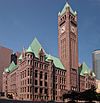
Minneapolis | This government building, used for a long time, was built from 1889 to 1905 in the Richardsonian Romanesque style. It's called "one of the most impressive nineteenth century public buildings in the state and the Midwest." | |
| 109 | Minneapolis Fire Department Repair Shop |
(#05000447) |
24 University Ave. NE. and 222 1st Ave. NE. 44°59′19″N 93°15′26″W / 44.9887°N 93.257253°W |
Minneapolis | This 1909 maintenance shop for the Minneapolis Fire Department, with a 1922 addition, is linked to the city's services becoming more centralized and the department switching to motorized vehicles. | |
| 110 | Minneapolis Pioneers and Soldiers Memorial Cemetery |
(#02000612) |
2925 Cedar Ave. S. 44°56′59″N 93°14′41″W / 44.9496°N 93.2448°W |
Minneapolis | This is Minneapolis's oldest cemetery still in use, dating back to 1858. It was redeveloped from 1928 to 1936, showing both the city's early days and an early movement to save historic places. | |
| 111 | Minneapolis Public Library, North Branch |
(#77000743) |
1834 Emerson Ave. N. 44°59′55″N 93°17′38″W / 44.9986°N 93.2938°W |
Minneapolis | This was the first library in the country built specifically with book shelves that people could easily access. It was built in 1893 and is an important landmark in the Near North neighborhood. | |
| 112 | Minneapolis Warehouse Historic District |
(#89001937) |
Roughly bounded by River St., 1st Ave. N., 6th St. N., 2nd Ave. N., 5th St. N., 5th Ave. N., 3rd St. N., and 10th Ave. N. 44°59′08″N 93°16′26″W / 44.9856°N 93.2739°W |
Minneapolis | This 30-block warehouse area shows how Minneapolis became a major distribution center in the late 1800s and early 1900s. It has 142 important buildings built from 1865 to 1930 by leading local architects. | |
| 113 | Minneapolis YMCA Central Building |
(#95001375) |
36 S. 9th St. (formerly 30 S. 9th St.) 44°58′33″N 93°16′32″W / 44.9759°N 93.2756°W |
Minneapolis | This building, built from 1917 to 1919, is a rare example of late Gothic Revival architecture in downtown Minneapolis. | |
| 114 | Minnehaha (steamboat) |
(#100007073) |
140 George St. 44°54′11″N 93°34′29″W / 44.90313°N 93.574642°W |
Excelsior | This is the only working example of the Twin City Rapid Transit Company passenger boats. These boats served summer residents and tourists around Lake Minnetonka from 1906 to 1926, extending the streetcar system. It was sunk in 1926, raised in 1980, and rebuilt as a museum ship in 1996. | |
| 115 | Minnehaha Grange Hall |
(#70000914) |
4918 Eden Ave. 44°54′39″N 93°20′58″W / 44.9107°N 93.3495°W |
Edina | This 1879 hall belonged to Minnesota's oldest Grange group, started in 1873. It was a long-standing place for social events and is the only original building left in Edina. It's now managed by the Edina Historical Society. | |
| 116 | Minnehaha Historic District |
(#69000369) |
Roughly Hiawatha and Minnehaha Aves. and Godfrey Rd. 44°54′56″N 93°12′39″W / 44.9156°N 93.2108°W |
Minneapolis | This 1889 park around Minnehaha Falls is known for its city planning and several historic sites. These sites are linked to early settler life, transportation, business, and architecture. | |
| 117 | Minnesota Linseed Oil Company |
(#13000325) |
1101 S. 3rd St. and 312 11th Ave. S. 44°58′26″N 93°15′13″W / 44.9740°N 93.2537°W |
Minneapolis | This 1904 factory belonged to Minneapolis's main producer of linseed oil and its products. This was a big industry in Minnesota in the early 1900s. | |
| 118 | Minnesota Soldiers' Home Historic District |
(#89000076) |
Roughly bounded by Minnehaha Ave., the Mississippi River, and Godfrey Parkway 44°54′44″N 93°12′14″W / 44.9123°N 93.2038°W |
Minneapolis | This state home for old soldiers has 16 important buildings built from 1888 to 1937. It's known for its architecture, its new way of caring for veterans, and its landscape design by Horace Cleveland. | |
| 119 | Minnetonka Beach Water Tower |
(#100004758) |
2510 Woodbridge Rd. 44°56′23″N 93°35′01″W / 44.9398°N 93.5837°W |
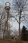
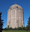
Minnetonka Beach | This 1928 water tower was key to the town's water system. It allowed Minnetonka Beach to grow from a rich resort to a place where people lived all year. It's also a well-preserved example of a common design from the early 1900s. | |
| 120 | Minnetonka Town Hall |
(#86003815) |
13231 Minnetonka Dr. 44°56′25″N 93°26′53″W / 44.9402°N 93.4481°W |
Minnetonka | ||
| 121 | Moline, Milburn and Stoddard Company |
(#75000986) |
250 3rd Ave. N. 44°59′02″N 93°16′25″W / 44.9840°N 93.2737°W |
Minneapolis | This building, built in 1886, is a leading example of Chicago School architecture in Minneapolis. It's also part of the Minneapolis Warehouse Historic District. It's now the Traffic Zone Center for Visual Art. | |
| 122 | Elisha and Lizzie Morse Jr. House |
(#76001057) |
2325-2327 Pillsbury Ave. S. 44°57′33″N 93°16′51″W / 44.9593°N 93.2809°W |
Minneapolis | This 1874 Italianate house has wood siding that looks like stone. It's one of the few buildings left in Minneapolis that shows this style and the middle-class desire for fancy looks. | |
| 123 | Frieda and Henry J. Neils House |
(#04000531) |
2801 Burnham Blvd. 44°57′30″N 93°19′04″W / 44.9582°N 93.3177°W |
Minneapolis | This 1950 house is an example of the Usonian style by Frank Lloyd Wright. It's the only home he designed using marble. | |
| 124 | New Main-Augsburg Seminary |
(#83003653) |
731 21st Ave. S. 44°57′56″N 93°14′31″W / 44.9656°N 93.2420°W |
Minneapolis | This 1901 seminary building became a campus center. It's known for being well-preserved and for its long history as an educational place. It's now Augsburg University's Old Main. | |
| 125 | George R. Newell House |
(#77000744) |
1818 LaSalle Ave. 44°57′53″N 93°16′48″W / 44.9648°N 93.2799°W |
Minneapolis | This 1888 house is in the Richardsonian Romanesque style. It belonged to a pioneering grocery merchant (1845–1921) whose company grew into the big retailer SuperValu. | |
| 126 | Noerenberg Estate Barn |
(#15000527) |
2865 N. Shore Dr. 44°57′26″N 93°35′41″W / 44.9572°N 93.5947°W |
Orono | This barn, built around 1912, is very well-preserved and well-made. It's a rare reminder of the working farms that rich estate owners had around Lake Minnetonka in the late 1800s and early 1900s. | |
| 127 | Nokomis Knoll Residential Historic District |
(#99000938) |
Bounded by W. 52nd St., W. Lake Nokomis Pkwy., E. 54th St., and Bloomington Ave. 44°54′26″N 93°15′04″W / 44.9072°N 93.2512°W |
Minneapolis | This well-preserved neighborhood, once on the edge of the city, shows how the middle class grew, cars became popular, and period revival architecture was loved in the 1920s and 1930s. | |
| 128 | North East Neighborhood House |
(#01000749) |
1929 2nd St. NE. 45°00′30″N 93°15′57″W / 45.0082°N 93.2659°W |
Minneapolis | This 1919 settlement house was an important social place. It was created to help poor people and to help immigrants learn about and join the community. | |
| 129 | Northrop Mall Historic District |
(#100001973) |
Roughly bounded by Pillsbury Drive SE, E River, & Union & Delaware Sts. SE 44°58′28″N 93°14′07″W / 44.9745°N 93.23535°W |
Minneapolis | This is a formal academic campus at the University of Minnesota. It's the state's largest City Beautiful complex, with 19 important buildings planned in 1910 and built until 1971. | |
| 130 | Northrup, King & Company Complex |
(#100006005) |
1500 Jackson St. NE 45°00′13″N 93°15′01″W / 45.0035°N 93.2502°W |
Minneapolis | This office and factory complex belonged to Northrup-King, the country's largest seed seller for much of the 20th century. It has seven important buildings built from 1916 to 1947. | |
| 131 | Northstar Center |
(#16000441) |
625 Marquette Ave. & 608, 618, & 618½ 2nd Ave. S. 44°58′36″N 93°16′14″W / 44.9766°N 93.2706°W |
Minneapolis | This was Minneapolis's first mixed-use development, with offices, shops, entertainment, and a hotel. It opened in 1963 and was expanded in 1966, playing a key role in making downtown lively again. | |
| 132 | Northwestern Knitting Company Factory |
(#83000904) |
718 Glenwood Ave. 44°58′49″N 93°17′20″W / 44.980241°N 93.288989°W |
Minneapolis | This factory complex, built from 1904 to 1915, made products for the famous national underwear brand Munsingwear. It's also known for being the first building in Minneapolis made of reinforced concrete without a frame. It's now International Market Square. | |
| 133 | Northwestern National Life Insurance Company Home Office |
(#12000414) |
430 Oak Grove St. 44°58′05″N 93°17′08″W / 44.967975°N 93.285671°W |
Minneapolis | This headquarters, built in 1924, belonged to Minnesota's largest life insurance company, which started in 1885. It's also important for its Beaux-Arts architecture. It's now 430 Oak Grove apartments. | |
| 134 | Ogden Apartment Hotel |
(#91001956) |
66-68 S. 12th St. 44°58′22″N 93°16′39″W / 44.972792°N 93.277433°W |
Minneapolis | This 1910 building is an example of the apartment hotels that were once common. They offered furnished and unfurnished rooms and meals from a central kitchen, a popular housing choice for the middle class in the early 1900s. It's now The Continental group residential housing. | |
| 135 | Floyd B. Olson House |
(#74001023) |
1914 W. 49th St. 44°54′52″N 93°18′15″W / 44.914392°N 93.304101°W |
Minneapolis | This 1922 house belonged to progressive leader Floyd B. Olson (1891–1936). He was the governor of Minnesota for three terms during the Great Depression and helped start the Minnesota Farmer–Labor Party. | |
| 136 | Osseo Water Tower |
(#100001023) |
25 4th St. 45°07′14″N 93°24′10″W / 45.120540°N 93.402789°W |
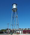
Osseo | This 1915 water tower is linked to Osseo's town planning and growth. It's one of the few remaining examples of a style that was common between 1890 and 1940. | |
| 137 | Dr. Oscar Owre House |
(#84001446) |
2625 Newton Ave. S. 44°57′28″N 93°18′22″W / 44.95765°N 93.305996°W |
Minneapolis | This 1912 house is known for its Prairie School design by Purcell, Feick, & Elmslie. It's also linked to a famous professor from the University of Minnesota School of Dentistry. | |
| 138 | Charles and Grace Parker House |
(#92000699) |
4829 Colfax Ave. S. 44°54′54″N 93°17′30″W / 44.915083°N 93.291665°W |
Minneapolis | This 1913 house is an excellent example of a Prairie School design by Purcell, Feick, & Elmslie. | |
| 139 | Peavey–Haglin Experimental Concrete Grain Elevator |
(#78001547) |
Junction of Minnesota Highways 7 and 100 44°56′33″N 93°20′43″W / 44.942388°N 93.3452°W |
St. Louis Park | This was the world's first known cylindrical grain elevator made of reinforced concrete. It was built from 1899 to 1900 as a test model for a type of building that became widely used across North America. | |
| 140 | Peavey Plaza |
(#12001173) |
1101 Nicollet Mall 44°58′21″N 93°16′32″W / 44.972425°N 93.275621°W |
Minneapolis | This 1975 urban park plaza is in the Modernist style, designed by M. Paul Friedberg and Associates. It was a key part of making downtown Minneapolis lively again in the 1960s and 70s. | |
| 141 | Pence Automobile Company Building |
(#07001314) |
800 Hennepin Ave. 44°58′38″N 93°16′35″W / 44.977222°N 93.276389°W |
Minneapolis | This 1909 car dealership shows the rapid growth of the early automobile industry. It's also linked to important local dealer Harry E. Pence (1867–1933). | |
| 142 | Phi Gamma Delta Fraternity House |
(#05001040) |
1129 University Ave. SE. 44°58′52″N 93°14′21″W / 44.980974°N 93.239298°W |
Minneapolis | This early modernist fraternity house was designed by Carl B. Stravs in 1912. It influenced the design of fraternity housing at the University of Minnesota. | |
| 143 | Pillsbury A Mill |
(#66000402) |
301 Main St. SE. 44°59′02″N 93°15′11″W / 44.983825°N 93.252983°W |
Minneapolis | This is the only major building left from Minneapolis's milling district. It was finished in 1881 and was the world's largest and most advanced flour mill for many years. It's also part of the St. Anthony Falls Historic District. | |
| 144 | Plymouth Building |
(#13001146) |
12 S. 6th St. 44°58′44″N 93°16′23″W / 44.978756°N 93.272945°W |
Minneapolis | This 1911 commercial building is important as an early example of concrete frame construction and other new building techniques. | |
| 145 | Gideon H. Pond House |
(#70000296) |
401 E. 104th St. 44°48′48″N 93°16′17″W / 44.813332°N 93.271319°W |
Bloomington | This 1856 house and mission school belonged to Gideon Hollister Pond (1810–1878). He was an early missionary to the Dakota people and created an alphabet and dictionary for the Dakota language. It's now part of Pond-Dakota Mission Park. | |
| 146 | Prospect Park Residential Historic District |
(#15000213) |
Roughly bounded by University & Williams Aves. SE., Emerald St. SE., and I-94 44°57′58″N 93°12′46″W / 44.966°N 93.2128°W |
Minneapolis | This unique neighborhood in Minneapolis feels like a suburb. It has 692 important buildings built from 1884 to 1968. It's known for its landscape design over hilly land, different types of houses, and strong community spirit. | |
| 147 | Prospect Park Water Tower and Tower Hill Park |
(#97001426) |
55 Malcolm Ave. SE. 44°58′07″N 93°12′46″W / 44.968673°N 93.212688°W |
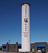
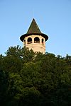
Minneapolis | This 1906 park and its unique 1913 "Witch's Hat" water tower are linked to city planning, city services, and the work of architect Frederick William Cappelen. They are also part of the Prospect Park Residential Historic District. | |
| 148 | William Gray Purcell House |
(#74001024) |
2328 Lake Pl. 44°57′33″N 93°18′03″W / 44.959269°N 93.300807°W |
Minneapolis | This 1913 house belonged to architect William Gray Purcell. It's a leading example of the Prairie School homes designed by his firm Purcell & Elmslie. It's now the Purcell-Cutts House of the Minneapolis Institute of Arts. | |
| 149 | Queen Avenue Bridge |
(#89001847) |
Linden Hills Blvd. over Como-Harriet Streetcar Line 44°55′28″N 93°18′41″W / 44.924464°N 93.311272°W |
Minneapolis | This bridge, built in 1905, is Minnesota's third-oldest remaining reinforced concrete arch bridge. | |
| 150 | Elizabeth C. Quinlan House |
(#12000428) |
1711 Emerson Ave. S. 44°58′01″N 93°17′39″W / 44.966864°N 93.294124°W |
Minneapolis | This 1925 house is in the Renaissance Revival style. It shows the mix of styles popular in the 1920s and the fancy homes designed by Frederick L. Ackerman. | |
| 151 | Rand Tower |
(#84003937) |
527-529 Marquette Ave. 44°58′39″N 93°16′11″W / 44.977365°N 93.269662°W |
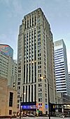
Minneapolis | This 1929 skyscraper is known for its stepped Art Moderne design by Holabird & Root. | |
| 152 | Roosevelt Branch Library |
(#00000543) |
4026 28th Ave. S. 44°55′47″N 93°13′57″W / 44.929594°N 93.232502°W |
Minneapolis | This 1927 library branch is connected to the important growth of the Minneapolis Public Library from 1894 to 1936. It's also linked to its famous director, Gratia Countryman (1866–1953). | |
| 153 | St. Olafs Norwegian Lutheran Church |
(#100007534) |
2901 Emerson Ave. N. 45°00′35″N 93°17′41″W / 45.0098°N 93.2948°W |
Minneapolis | This 1911 church was very important to the Norwegian-American heritage and social life of Near North, Minneapolis. | |
| 154 | Schmid Farmhouse Ruin |
(#15000849) |
.38 mi. NE. of jct. of Cty Rd. 44 and Minnesota State Highway 7 44°53′49″N 93°40′14″W / 44.896936°N 93.670441°W |
Minnetrista | These are the ruins of an 1876 farmhouse. They offer a look into the life and building methods of a German immigrant community on Lake Minnetonka in the late 1800s. It's preserved within Lake Minnetonka Regional Park. | |
| 155 | Sears, Roebuck and Company Mail-Order Warehouse and Retail Store |
(#05000745) |
2929 Chicago Ave. S. 44°56′57″N 93°15′39″W / 44.9493°N 93.2609°W |
Minneapolis | This warehouse and shop complex dates back to 1927. It shows how the big American retailer Sears changed from selling by mail to having physical stores. It also shows the rise of shopping for people who drove cars. It's now the Midtown Exchange. | |
| 156 | Anne C. and Frank B. Semple House |
(#98000151) |
100–104 W. Franklin Ave. 44°57′47″N 93°16′47″W / 44.9630°N 93.2798°W |
Minneapolis | This 1901 house and carriage house are important for their Renaissance Revival architecture. It's now the Semple Mansion event and wedding venue. | |
| 157 | Sam S. Shubert Theatre |
(#95001230) |
516 Hennepin Ave. S. 44°58′46″N 93°16′24″W / 44.9794°N 93.2734°W |
Minneapolis | This excellent 1910 Shubert Brothers theater was designed by William Albert Swasey. It was important in the growth of the early theater scene in Minneapolis. It's now the Cowles Center for Dance and the Performing Arts. | |
| 158 | H. Alden Smith House |
(#76001063) |
1403 Harmon Pl. 44°58′21″N 93°16′55″W / 44.9724°N 93.282°W |
Minneapolis | This 1887 house is known for its excellent Richardsonian Romanesque architecture and design by William Channing Whitney. It's now Minneapolis Community and Technical College's Wells Family College Center. | |
| 159 | Lena O. Smith House |
(#91001472) |
3905 5th Ave. S. 44°55′56″N 93°16′07″W / 44.9321°N 93.2686°W |
Minneapolis | This house belonged to pioneering Black female lawyer Lena O. Smith (1885–1966). She was an important person in local civil rights and activism from 1927 to 1940. | |
| 160 | St. Anthony Falls Historic District |
(#71000438) |
Around the Mississippi River between Plymouth and S. 10th Aves. 44°58′58″N 93°15′31″W / 44.9827°N 93.2587°W |
Minneapolis | This 800-acre (320 ha) area around Saint Anthony Falls was the center of Minnesota's largest city. It's an early landmark, provided power for Minneapolis's milling industry, and was the site of the country's first hydroelectric plant in 1882. | |
| 161 | Station 13 Minneapolis Fire Department |
(#03001340) |
4201 Cedar Ave. S. 44°55′36″N 93°14′49″W / 44.9267°N 93.2469°W |
Minneapolis | This 1923 American Craftsman fire station was built to fit in with the neighborhood. It shows new ideas for fire protection and city design during a time of fast growth in Minneapolis. | |
| 162 | Station 28 Minneapolis Fire Department |
(#93001235) |
2724 W. 43rd St. 44°55′29″N 93°18′50″W / 44.9247°N 93.3138°W |
Minneapolis | This 1914 fire station shows how city services expanded to Minneapolis's last outer neighborhood, Linden Hills. It also shows the Minneapolis Fire Department switching to motorized equipment. | |
| 163 | Stevens Square Historic District |
(#93000594) |
Roughly bounded by E. 17th St., 3rd Ave. S., Franklin Ave., and 1st Ave. S. 44°57′53″N 93°16′29″W / 44.9646°N 93.2746°W |
Minneapolis | This area is Minneapolis's best example of many middle-class homes built close together in the early 1900s. It has 54 apartment buildings constructed from 1912 to 1926 around a 1908 park. | |
| 164 | Stewart Memorial Presbyterian Church |
(#78001543) |
116 E. 32nd St. 44°56′43″N 93°16′32″W / 44.9452°N 93.2756°W |
Minneapolis | This is a rare example of a Prairie School church, built in 1909 from designs by William Gray Purcell and George Feick, Jr.. | |
| 165 | Strutwear Knitting Company Building |
(#15000791) |
1010 S. 7th St. 44°58′17″N 93°15′26″W / 44.9714°N 93.2572°W |
Minneapolis | This 1920s clothing factory was the site of a successful eight-month strike from 1935 to 1936. This was a major moment for the labor movement in Minneapolis history. | |
| 166 | Studio 80 |
(#100005399) |
2709 East 25th St. 44°57′26″N 93°13′58″W / 44.9573°N 93.2328°W |
Minneapolis | This was a top-notch recording studio used from 1971 to 1981. It attracted famous artists from around the world and helped make the music of Minnesota popular. Prince (1958–2016) recorded early music here that helped create the "Minneapolis sound." | |
| 167 | Sumner Branch Library |
(#00000539) |
611 Emerson Ave. N. 44°59′05″N 93°17′41″W / 44.9847°N 93.2946°W |
Minneapolis | This 1915 Carnegie library is connected to the important growth of the Minneapolis Public Library from 1894 to 1936. It's also linked to its famous director, Gratia Countryman (1866–1953). | |
| 168 | Swinford Townhouses and Apartments |
(#90001552) |
1213–1221 and 1225 Hawthorne Ave. 44°58′30″N 93°16′54″W / 44.9750°N 93.2818°W |
Minneapolis | This group of 1886 townhouses and 1897 apartments is known for its Renaissance Revival architecture. They were some of the first fancy, compact homes in Minneapolis. | |
| 169 | Thirty-sixth Street Branch Library |
(#00000541) |
347 E. 36th St. 44°56′15″N 93°16′14″W / 44.9374°N 93.2706°W |
Minneapolis | This 1916 Carnegie library is connected to the important growth of the Minneapolis Public Library from 1894 to 1936. It's also linked to its famous director, Gratia Countryman (1866–1953). It's now the Hosmer Library. | |
| 170 | Thompson Flats |
(#100003916) |
1605–1607 Hennepin Ave. S. 44°58′20″N 93°17′09″W / 44.9723°N 93.2858°W |
Minneapolis | This 1899 apartment building is an early example of homes for middle-class families who wanted to live near downtown Minneapolis. It also had shops on the ground floor. | |
| 171 | Thompson Summer House |
(#97001652) |
3012 Shoreline Dr. 44°56′20″N 93°36′00″W / 44.9390°N 93.6000°W |
Minnetonka Beach | This is a rare, well-preserved summer house from 1887. It also shows how Lake Minnetonka became a resort for upper-middle-class people and the economic boom in Minneapolis in the 1880s. | |
| 172 | Swan Turnblad House |
(#71000436) |
2600 Park Ave. 44°57′19″N 93°15′57″W / 44.9552°N 93.2658°W |
Minneapolis | This Châteauesque mansion belonged to Swedish American cultural promoter Swan Turnblad (1860–1933). It was built from 1903 to 1910 and became the American Swedish Institute in 1929. | |
| 173 | Twin City Rapid Transit Company Steam Power Plant |
(#94001385) |
600 Main St. SE 44°58′51″N 93°14′57″W / 44.9808°N 93.2491°W |
Minneapolis | This 1903 power plant provided electricity for the Twin City Rapid Transit streetcar system, which was the main public transport in the area until the 1950s. | |
| 174 | United States Post Office |
(#10000130) |
212 3rd Ave. S. 44°58′51″N 93°15′51″W / 44.9807°N 93.2641°W |
Minneapolis | This post office, built from 1912 to 1915, is known for its excellent Neoclassical architecture. It's now best known as the Old Federal Building. | |
| 175 | University of Minnesota Old Campus Historic District |
(#84001463) |
University Ave. and 15th Ave. 44°58′40″N 93°14′10″W / 44.977768°N 93.23612°W |
Minneapolis | This area has 13 campus buildings built from 1886 to 1907. They are important because they show the University of Minnesota's first period of growth and were designed by several famous Minnesota architects. | |
| 176 | Horatio P. Van Cleve House |
(#76001064) |
603 5th St. SE 44°59′10″N 93°14′45″W / 44.985999°N 93.245722°W |
Minneapolis | This Greek Revival house was lived in from 1862 to the 1920s by Civil War general Horatio P. Van Cleve (1809–1891) and his wife Charlotte (1819–1907), who was a writer and humanitarian. | |
| 177 | George W. and Nancy B. Van Dusen House |
(#95000607) |
1900 LaSalle Ave. 44°57′50″N 93°16′47″W / 44.963967°N 93.279746°W |
Minneapolis | This fancy 1893 mansion was designed by famous Minneapolis architect Edgar Joralemon. It mixes Richardsonian Romanesque and Renaissance Revival styles to show the wealth of a local business leader. | |
| 178 | Walker Branch Library |
(#00000544) |
2901 Hennepin Ave. S. 44°56′59″N 93°17′53″W / 44.949829°N 93.298003°W |
Minneapolis | This 1911 library branch is connected to the important growth of the Minneapolis Public Library from 1894 to 1936. It's also linked to its famous director, Gratia Countryman (1866–1953). | |
| 179 | Washburn A Mill Complex |
(#83004388) |
1st St. S. at Portland Ave. 44°58′44″N 93°15′25″W / 44.978889°N 93.256944°W |
Minneapolis | This group of seven buildings dates back to 1879. It's linked to major new ideas in the flour milling industry and the growth of General Mills. It's also part of the St. Anthony Falls Historic District. The main building is now the Mill City Museum. | |
| 180 | Washburn Park Water Tower |
(#83003663) |
401 Prospect Ave. 44°54′39″N 93°17′04″W / 44.910733°N 93.284313°W |
Minneapolis | This 1932 water tower is important because it was a team effort between architect Harry Wild Jones, engineer William S. Hewitt, and sculptor John K. Daniels. | |
| 181 | Washburn-Fair Oaks Mansion District |
(#78001544) |
1st and 2nd Aves., 22nd St., and Stevens Ave. 44°57′40″N 93°16′31″W / 44.961111°N 93.275278°W |
Minneapolis | This area has seven mansions built from 1884 to 1912. They are linked to the second generation of important Minneapolis residents and show the popular architecture of the time by famous local architects. | |
| 182 | Wayzata Bay Wreck |
(#16000386) |
Location Restricted |
Minnetonka vicinity | This 1879 shipwreck is the best-preserved remains of a "model barge." This was a little-known design pointed at both ends so it could be pulled in either direction. | |
| 183 | Wayzata Section House |
(#100006584) |
738 Lake St. East 44°58′06″N 93°30′37″W / 44.9682°N 93.5103°W |
Wayzata | This is an example of the unique two-story section houses built and kept by the Great Northern Railway for its employees. It was built in 1902 and made bigger in 1944. | |
| 184 | Wesley Methodist Episcopal Church |
(#84001469) |
101 E. Grant St. 44°58′10″N 93°16′34″W / 44.969544°N 93.276133°W |
Minneapolis | This church, built from 1890 to 1891, is a leading work by the main architect of a time when many churches were built in Minneapolis. It uses Warren H. Hayes' version of the Akron Plan and other new features. | |
| 185 | Westminster Presbyterian Church |
(#98000716) |
83 12th St. S. 44°58′17″N 93°16′33″W / 44.971413°N 93.275892°W |
Minneapolis | This church, built from 1896 to 1897, belongs to one of Minneapolis's oldest and most important groups. It's significant for providing social and community services since it started in 1857. | |
| 186 | White Castle Building No. 8 |
(#86002868) |
3252 Lyndale Ave. S. 44°56′35″N 93°17′18″W / 44.943037°N 93.288437°W |
Minneapolis | This 1936 prefabricated White Castle building is a rare example of the earliest fast food stands. It's also known for its new use of porcelain enameled steel in its design. | |
| 187 | Malcolm Willey House |
(#84001472) |
255 Bedford St. SE. 44°57′38″N 93°12′31″W / 44.96053°N 93.208646°W |
Minneapolis | This 1934 house is Minnesota's most important Frank Lloyd Wright house from the Great Depression era. It was an early example of his Usonian style. It's also part of the Prospect Park Residential Historic District. | |
| 188 | Theodore Wirth House–Administration Building |
(#02000611) |
3954 Bryant Ave. S. 44°55′52″N 93°17′30″W / 44.931088°N 93.291706°W |
Minneapolis | This 1910 house and office, and the park around it, are linked to Theodore Wirth (1863–1949). He was a nationally famous landscape architect and an important superintendent of the Minneapolis park system. | |
| 189 | The Woman's Club of Minneapolis |
(#100007357) |
410 Oak Grove Dr. 44°58′04″N 93°17′05″W / 44.9678°N 93.2848°W |
Minneapolis | This 1927 clubhouse shows the woman's club movement in the United States and how local women helped develop Minneapolis's civic and cultural life. | |
| 190 | Allemarinda and James Wyer House |
(#77000735) |
201 Mill St. 44°54′06″N 93°33′45″W / 44.9017°N 93.562446°W |
Excelsior | This is the largest and best-preserved summer home in Excelsior in the Eastlake style, built around 1880. | |
| 191 | Zinsmaster Baking Company Building |
(#100005246) |
2900 Park Ave. 44°57′00″N 93°15′57″W / 44.95°N 93.265833°W |
Minneapolis | This modern 1928 bread factory shows how big bakeries grew and how people started buying mass-produced bread from stores. |
Places That Used to Be Listed
Some places were once on the National Register of Historic Places but are no longer listed. This usually happens if they are moved or if they are destroyed.
| Name on the Register | Image | Date listed | Date removed | Location | City or town | Summary | |
|---|---|---|---|---|---|---|---|
| 1 | Isaac Atwater House |
(#70000913) |
|
1607 S. 5th St. |
Minneapolis | This house was moved to the Shakopee Historic District in 1972. | |
| 2 | Dania Hall |
(#74001020) |
|
Corner of 5th St. and Cedar Ave. |
Minneapolis | This building burned down on February 28, 2000. | |
| 3 | Excelsior Fruit Growers Association Building |
(#82002959) |
|
450 3rd St. |
Excelsior | This 1910 hall for a farming group was torn down in 2001. | |
| 4 | Forum Cafeteria |
(#76001059) |
|
36-38 S. 7th St. |
Minneapolis | This 1929 restaurant in the Moderne style was torn down in 1979 for new buildings. However, its inside parts were saved and put back together at 40 S. 7th St. | |
| 5 | New Century Mill |
(#80002070) |
|
Oak and 5th Streets |
Minneapolis | This mill was first listed in 1980 and expanded in 1987. It burned down in 1990. | |
| 6 | Nicollet Hotel |
(#87002008) |
|
235 Hennepin Avenue |
Minneapolis | This 1924 hotel was torn down in 1991. | |
| 7 | Philander Prescott House |
(#75000988) |
|
4458-4460 Snelling Ave. S |
Minneapolis | This 1852 house belonged to early pioneer and interpreter Philander Prescott (1801–1862). It was torn down in 1980. |
More to Explore


