
Wyoming facts for kids
Quick facts for kids
Wyoming
|
|||
|---|---|---|---|
|
|||
| Nicknames:
Equality State (official);
Cowboy State; Big Wyoming |
|||
| Motto(s):
Equal Rights
|
|||
| Anthem: "Wyoming" |
|||

Location of Wyoming within the United States
|
|||
| Country | United States | ||
| Before statehood | Wyoming Territory | ||
| Admitted to the Union | July 10, 1890 (44th) | ||
| Capital (and largest city) |
Cheyenne | ||
| Largest county or equivalent | Laramie | ||
| Largest metro and urban areas | Cheyenne | ||
| Legislature | Wyoming Legislature | ||
| • Upper house | Senate | ||
| • Lower house | House of Representatives | ||
| Judiciary | Wyoming Supreme Court | ||
| U.S. senators | John Barrasso (R) Cynthia Lummis (R) |
||
| U.S. House delegation | Harriet Hageman (R) (list) | ||
| Area | |||
| • Total | 97,813 sq mi (253,335 km2) | ||
| Area rank | 10th | ||
| Dimensions | |||
| • Length | 371.8 mi (599 km) | ||
| • Width | 279 mi (451 km) | ||
| Elevation | 6,700 ft (2,040 m) | ||
| Highest elevation | 13,809 ft (4,209.1 m) | ||
| Lowest elevation
(Belle Fourche River at South Dakota border)
|
3,101 ft (945 m) | ||
| Population
(2025)
|
|||
| • Total | |||
| • Rank | 50th | ||
| • Density | 5.97/sq mi (2.28/km2) | ||
| • Density rank | 49th | ||
| • Median household income | $72,400 (2023) | ||
| • Income rank | 31st | ||
| Demonym(s) | Wyomingite, Wyomingian | ||
| Language | |||
| • Official language | English | ||
| Time zone | UTC−07:00 (Mountain) | ||
| • Summer (DST) | UTC−06:00 (MDT) | ||
| USPS abbreviation |
WY
|
||
| ISO 3166 code | US-WY | ||
| Traditional abbreviation | Wyo. | ||
| Latitude | 41°N to 45°N | ||
| Longitude | 104°3'W to 111°3'W | ||


Wyoming ( wye-OH-ming) is a state located in the western part of the United States. It's known as a "landlocked" state because it doesn't touch any ocean. Wyoming shares borders with Montana, South Dakota, Nebraska, Idaho, Utah, and Colorado.
Even though Wyoming is the 10th largest state in terms of land area, it has the smallest population of all U.S. states. As of 2024, about 587,618 people live there. This means it also has the second-lowest population density after Alaska. The capital and largest city is Cheyenne.
Wyoming's western side is mostly covered by the Rocky Mountains. The eastern side has high prairie lands, called the High Plains. The weather in Wyoming can be quite dry and windy, with big changes between hot and cold temperatures.
Almost half of Wyoming's land is owned by the U.S. government. This land is protected for public use. It includes famous places like Grand Teton and Yellowstone, which is the world's first national park.
Native American groups lived in this area for thousands of years. Tribes like the Arapaho, Crow, Lakota, and Shoshone have deep roots here. Parts of Wyoming became U.S. land through different agreements, like the Louisiana Purchase and the Oregon Treaty.
Many pioneers traveled through Wyoming on trails like the Oregon Trail. Later, the Transcontinental Railroad brought more settlers. Wyoming became the 44th state on July 10, 1890.
Wyoming is famous for its political culture, which often favors individual freedom. It's also known as "The Equality State" because it was the first place to give women the right to vote and hold elected office. In fact, it was the first state to elect a female governor!
The state's economy relies a lot on tourism and mining for things like coal, natural gas, and oil. Farming and ranching are also important. Wyoming does not have a state income tax, which means people don't pay state taxes on their earnings.
Contents
Wyoming's Past: A Look at History

Many Native American groups lived in the area now called Wyoming. These included the Crow, Arapaho, Lakota, and Shoshone tribes. European explorers first met these groups when they arrived.
The southwestern part of Wyoming was once claimed by the Spanish Empire. After Mexico became independent in 1821, this land was part of Alta California. The U.S. later gained these territories after the Mexican–American War in 1848.
Early Explorers and Trails
In the late 1700s, French-Canadian fur trappers came to the area to trade with the tribes. You can still see French names like Téton and La Ramie in Wyoming today.
The first English description of the region was recorded in 1807 by John Colter. He was part of the Lewis and Clark Expedition. Colter's stories about the Yellowstone area were thought to be made up at the time.
In 1812, Robert Stuart and his group discovered South Pass. This became an important route for pioneers on the Oregon Trail heading west. Later, in 1850, Jim Bridger found Bridger Pass. This pass was used for the Union Pacific Railroad in 1868 and later for Interstate 80.
Growth and Statehood
When the Union Pacific Railroad reached Cheyenne in 1867, more people started moving to the area. The U.S. government created the Wyoming Territory on July 25, 1868. Unlike Colorado, Wyoming didn't have a huge population boom because it had less gold and silver. However, South Pass City had a brief gold rush.
After government trips confirmed the amazing landscapes of Yellowstone, Yellowstone National Park was created in 1872. It was the world's first national park, and most of it is in Wyoming.

The Equality State
Wyoming made history on December 10, 1869. The territorial Governor, John Allen Campbell, gave women the right to vote. This made Wyoming the first territory, and later the first state, to grant women's suffrage. Women also served on juries in Wyoming starting in 1870.
Wyoming was a leader in allowing women to be involved in politics. It had the first female court bailiff and the first female justice of the peace in the country. In 1924, Wyoming was the first state to elect a female governor, Nellie Tayloe Ross. Because of this history, Wyoming is known as "The Equality State," and its motto is "Equal Rights."
Wyoming officially became the 44th state on July 10, 1890. Its constitution also included important rules about water rights.
Ranching Conflicts
In 1892, Wyoming was the site of the Johnson County War. This was a conflict between different groups of cattle ranchers. When the Homestead Act brought many small ranchers, fights broke out over who could use the public land.
What's in a Name? The Etymology of Wyoming
The name Wyoming was used by 1865. Representative James Mitchell Ashley from Ohio suggested the name for the new territory. It was named after the Wyoming Valley in Pennsylvania.
The poet Thomas Campbell wrote a poem called "Gertrude of Wyoming" in 1809. This poem was inspired by the Battle of Wyoming during the American Revolutionary War. The name Wyoming comes from a Native American word, xwé:wamənk, which means "at the big river flat."
Wyoming's Landscape and Weather
Wyoming's Climate: Weather Patterns

Wyoming's climate is generally dry and windy. It has big temperature changes between seasons. This is because of the state's mountains and high plains.
Summers are warm, with July temperatures usually between 80 and 90°F (27 and 32°C). In higher mountain areas, it's cooler, around 70°F (21°C). Summer nights cool down quickly. Most rain falls in late spring and early summer.
Winters are cold, but temperatures can change a lot. Sometimes, warm winds called Chinook winds bring unusually mild weather.
Wyoming is a dry state. Many areas get less than 10 inches (254 mm) of rain each year. The lowest areas, like the Bighorn Basin, are almost like a true desert. Some mountain areas get a lot of snow, sometimes over 200 inches (508 cm) annually.
The highest temperature ever recorded in Wyoming was 114°F (46°C) in Basin in 1900. The lowest was -66°F (-54°C) in Riverside in 1933.
Thunderstorms happen most often in the southeastern plains during late spring and early summer. This area is also the most likely to see tornadoes. However, tornadoes in Wyoming are usually small and don't last long.
Where is Wyoming? Location and Size
Wyoming's borders are straight lines of latitude and longitude. It's one of only three states with borders defined this way. Wyoming is bordered by Montana to the north, South Dakota and Nebraska to the east, Colorado to the south, Utah to the southwest, and Idaho to the west.
It is the tenth largest state in the U.S., covering about 97,814 square miles (253,335 km²). From north to south, it's about 276 miles (444 km) long. From east to west, it's about 365 miles (587 km) wide at its southern end.
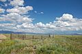
Wyoming's Natural Wonders: Landforms

.jpg)
Wyoming is where the Great Plains meet the Rocky Mountains. The state is a large plateau with many mountain ranges. The highest point is Gannett Peak in the Wind River Range, at 13,804 feet (4,207 m). The lowest point is the Belle Fourche River valley, at 3,125 feet (952 m).
In the northwest, you'll find the Absaroka, Owl Creek, Gros Ventre, Wind River, and Teton mountains. The Big Horn Mountains are in the north-central part. The Black Hills are in the northeast. In the south, there are the Laramie, Snowy, and Sierra Madre ranges.
The Continental Divide runs north to south through the middle of Wyoming. Rivers east of this divide flow into the Missouri River Basin and eventually to the Gulf of Mexico. These include the North Platte, Wind, Bighorn, and Yellowstone rivers. The Snake River in northwest Wyoming flows to the Pacific Ocean. The Green River also flows to the Pacific through the Colorado River Basin.
There's a special area in south-central Wyoming called the Great Divide Basin. Water that falls here doesn't reach any ocean; it just sinks into the ground and evaporates.
Basins: Unique Landscapes
Much of Wyoming is covered by large basins. These areas have different natural environments, from shrublands to small deserts. Basins are usually at lower elevations. They feature rolling hills, valleys, and mesas. They also have natural springs, rivers, and artificial lakes. Common plants include different types of sagebrush and grasses. Basins are known for their wide variety of plant and animal species.
Islands in Wyoming
Wyoming has 32 named islands. Most of them are in Jackson Lake and Yellowstone Lake, which are both inside Yellowstone National Park. The Green River in the southwest also has several islands.
How Wyoming is Governed

Wyoming's government has three main parts: the executive, legislative, and judicial branches. The state legislature makes laws. It has two parts: the House of Representatives with 60 members and the Senate with 30 members.
The executive branch is led by the governor. It also includes a secretary of state, auditor, treasurer, and superintendent of public instruction. Wyoming does not have a lieutenant governor. The secretary of state takes over if the governor cannot do their job.
Because Wyoming has a small population, it only has one representative in the U.S. House of Representatives. This means it has only three votes in the Electoral College for presidential elections.
Wyoming's Court System
The highest court in Wyoming is the Supreme Court of Wyoming. Five justices hear appeals from lower courts. Wyoming is unique because it doesn't have a middle level of appeals court like most states. This is due to its small population and fewer court cases. Appeals from district courts go straight to the Supreme Court.
Wyoming also has state circuit courts. These courts handle smaller civil cases, minor criminal offenses, and initial hearings for serious crimes.
Judges in Wyoming are chosen through a special process. The Judicial Nominating Commission suggests candidates, and the Governor appoints them. After one year, voters decide if the judge should stay in office.
Wyoming's Counties and Cities
Counties of Wyoming

Wyoming has 23 counties. The largest county by population is Laramie County, where the capital city, Cheyenne, is located.

Wyoming license plates have a number on the left side. This number tells you which county the vehicle is registered in. The numbers are based on the property values of the counties back in 1930.
Major Cities and Towns


Wyoming has 99 official cities and towns. The most populated cities are:
In 2020, more than half of Wyoming's residents lived in one of its 12 largest cities.
Wyoming's People: Demographics

Wyoming is the least populated state in the U.S. It has the second-lowest population density, meaning there are very few people per square mile. Only Alaska has fewer people per square mile.
In 2020, the population was 576,851 people. Most people in Wyoming are white. Other groups include American Indian and Alaska Native, Black or African American, and Asian American. About 24.9% of children under one year old in Wyoming are from minority groups.

The largest ancestry groups in Wyoming are German, English, and Irish. In 2018, the top countries where immigrants in Wyoming came from were Mexico, China, Germany, England, and Canada.
Languages Spoken in Wyoming
Most people in Wyoming speak English at home. In 2010, about 93.39% of people over age 5 spoke English. The next most common language was Spanish, spoken by about 4.47% of the population. Other languages spoken include German and French.
Religion in Wyoming
Wyoming is often ranked among the least religious states in the country.
Religious self-identification in Wyoming, 2020. Unaffiliated (40%) Protestantism (33%) Catholicism (15%) Mormonism (7%) Judaism (1%) Other (4%)
In 2020, about 55% of adults in Wyoming identified as Christian. This includes evangelical and mainline Protestants, Roman Catholics, and Mormons. About 40% of the population said they had no religious affiliation.
The largest religious groups in Wyoming are the Church of Jesus Christ of Latter-day Saints (Mormons), the Catholic Church, and the Southern Baptist Convention.
Wyoming's Economy and Transportation

Wyoming's economy is mainly driven by mining and tourism. The U.S. government owns about 42.3% of the state's land. This land is often used for national parks and forests, which attract many tourists.
In 2018, the tourism industry brought in over $3.8 billion in revenue. Millions of people visit Wyoming's national parks and monuments each year. Popular attractions include Grand Teton National Park, Yellowstone National Park, Devils Tower National Monument, and Fossil Butte National Monument.
Farming and ranching have always been important to Wyoming's economy and culture. The main farm products include livestock (like beef), hay, sugar beets, grain (wheat and barley), and wool. More than 91% of Wyoming's land is considered rural.
Wyoming is also trying to encourage new technologies like blockchain technology and cryptocurrencies.
Mining and Energy Production


Wyoming is rich in minerals and energy resources. These include coal, natural gas, crude oil, uranium, and trona.
Coal Mining
Wyoming is a major producer of coal. In 2019, it produced 277 million short tons of coal. The state has huge coal reserves, estimated at 68.7 billion tons. The Powder River Basin is a key coal mining area.
Oil and Gas
Wyoming is also a significant producer of crude oil, ranking fifth nationwide in 2007. The state also produces a lot of natural gas.
Wind Energy
Wyoming has great potential for wind power in Wyoming due to its geography. The Chokecherry and Sierra Madre Wind Energy Project is planned to be one of the largest wind farms in North America.
Other Minerals
Wyoming has the world's largest known reserve of trona. This mineral is used to make glass, paper, soaps, and baking soda. The state also has deposits of uranium and rare earth metals.
Taxes in Wyoming
Wyoming is unique because it does not have a state income tax for individuals or corporations. This means people don't pay state taxes on their earnings or retirement income.
The state has a sales tax of 4%. Counties can add another 1% or 2% if voters approve. Food is not taxed. Property taxes are based on the value of the property, but there are limits on how much they can increase.
Wyoming does not collect inheritance taxes. In 2008, Wyoming was ranked as the most "business-friendly" state for taxes in the U.S.
Getting Around: Transportation

Wyoming's largest airport is Jackson Hole Airport. Three interstate highways and 13 U.S. highways cross through Wyoming. The Wyoming state highway system also helps people travel across the state.
- Interstate 25 runs north-south, connecting Cheyenne and Casper.
- Interstate 80 crosses the southern part of the state from west to east, passing through Evanston, Rock Springs, Rawlins, Laramie, and Cheyenne.
- Interstate 90 goes through the northeastern part of the state, serving Sheridan and Gillette.
Wyoming is one of only two states in the mainland U.S. not served by Amtrak passenger trains. However, intercity buses like Express Arrow, Greyhound Lines, and Jefferson Lines connect residents across the state.
Wind River Indian Reservation

The Eastern Shoshone and Northern Arapaho tribes share the Wind River Indian Reservation. It's located in central western Wyoming, near Lander. About 2,500 Eastern Shoshone and 5,000 Northern Arapaho live there.
The reservation was created in 1868 for the Shoshone. Later, the Northern Arapaho were also moved there. Today, both tribes jointly own the land and its resources. They have their own governments, and until 2014, they worked together on a Joint Business Council.
Public Lands in Wyoming

The U.S. federal government owns nearly half of Wyoming's land. This land is managed by groups like the Bureau of Land Management and the U.S. Forest Service. It includes many national forests and "public" lands.

Wyoming is home to several important national sites:
- National Parks:
- Grand Teton National Park
- Yellowstone National Park (the world's first national park)
- Memorial Parkway:
- The John D. Rockefeller Jr. Memorial Parkway connects Yellowstone and Grand Teton.
- National Recreation Areas:
- National Monuments:
- Devils Tower National Monument (the first national monument in the U.S.)
- Fossil Butte National Monument
- National Historic Trails and Sites:
- National Fish Hatcheries:
- Jackson National Fish Hatchery
- Saratoga National Fish Hatchery
- National Wildlife Refuges:
- National Elk Refuge
- Seedskadee National Wildlife Refuge
Learning in Wyoming: Education

Public education in Wyoming is overseen by the state superintendent of public instruction. The State Board of Education sets policies for schools. Local school boards decide on what is taught and what textbooks are used.
Colleges and Universities
Wyoming has one public four-year university, the University of Wyoming in Laramie. It also has a private four-year college, Wyoming Catholic College, in Lander. There are seven two-year community colleges throughout the state.
Wyoming's Media and Culture
Media Outlets
Wyoming has 16 broadcast TV stations, many radio stations, and several small to medium-sized newspapers. There are also independent news sources like Wyofile.com and Oil City News.
Sports in Wyoming
Wyoming doesn't have any major professional sports teams because of its small population. However, the Wyoming Cowboys and Cowgirls college teams are very popular, especially their football and basketball teams. Their stadiums in Laramie are very high up, about 7,200 feet (2,195 m) above sea level!
The Wyoming High School Activities Association supports twelve sports for high school students. There are also three junior ice hockey teams in the state. Casper has hosted the College National Finals Rodeo since 2001.
State Symbols of Wyoming

Wyoming has many official state symbols that represent its unique character:
- State bird: western meadowlark
- State coin: Sacagawea dollar
- State dinosaur: Triceratops
- State emblem: Bucking Horse and Rider
- State fish: cutthroat trout
- State flag: Flag of the State of Wyoming
- State flower: Wyoming Indian paintbrush
- State fossil: Knightia
- State gemstone: Wyoming nephrite jade
- State grass: western wheatgrass
- State insect: Sheridan's green hairstreak butterfly
- State mammal: American bison
- State motto: Equal Rights
- State nicknames: Equality State; Cowboy State; Big Wyoming
- State reptile: horned lizard
- State seal: Great Seal of the State of Wyoming
- State song: "Wyoming"
- State sport: rodeo
- State tree: plains cottonwood
Images for kids
-
Thunder Basin National Grassland
-
Seedskadee National Wildlife Refuge
.jpg)


See also
 In Spanish: Wyoming para niños
