
List of tallest buildings and structures in the Birmingham Metropolitan Area, West Midlands facts for kids
Quick facts for kids Tall buildings in Birmingham |
|
|---|---|

Birmingham's skyline viewed from the west in 2022, featuring the Mercian tower
|
|
| Tallest building | The Octagon (2025) |
| Tallest building height | 155 m (509 ft) |
| First 150 m+ building | The Octagon (2025) |
| Buildings above 100 m | 9 (2025) |
| Buildings above 150 m | 2 (2025) |
Welcome to our guide about the tallest buildings and structures in the Birmingham Metropolitan Area, West Midlands! This list shows how tall buildings and other structures are, including their spires and fancy tops, but not things added later. The very tallest building in the Birmingham area is called Octagon. It's a huge 49-storey home tower, about 155 meters (509 feet) tall, located right in the middle of Birmingham city centre. Octagon became the tallest in September 2024, passing the 140-meter (458 feet) BT Tower and the 132-meter (433 feet) Mercian tower.
Contents
What is the Birmingham Metropolitan Area?
The Birmingham Metropolitan Area is a large urban area in the West Midlands part of England. It's home to about 4.3 million people, making it the second-biggest metropolitan area in the United Kingdom. This area includes three cities: Birmingham, Coventry, and Wolverhampton. It also has four important boroughs: Dudley, Sandwell, Solihull, and Walsall.
The area also stretches into nearby places like Bromsgrove and Redditch in Worcestershire, and towns in Staffordshire and Warwickshire. All these places have at least one tall building or structure that is 35 meters (about 115 feet) or taller.
Some other towns and cities, like Lichfield and Cannock, are also connected to Birmingham's economy and transport, even if they are a bit further out. We've included their tall buildings in our lists too!
The Birmingham Metropolitan Area is made up of many different towns and cities, not just one big center. They are separated by green spaces. This means you can see many different styles of buildings, from very old ones like Medieval and Tudor to modern and Contemporary designs. Every period has at least one tall building or structure.
You'll notice that all the buildings listed on this page have a special color code. This color tells you which part of the Birmingham Metropolitan Area they are in. You can use the map to find out where each building is located!

Birmingham's Tall Buildings
Birmingham is a city with lots of tall buildings! It has over 400 within its borders, more than any other UK city except London. Most of the tallest buildings and structures in the West Midlands region are right here in Birmingham.
Currently, Birmingham has eleven structures that are 100 meters (328 feet) or taller. Six more are being built right now. This makes Birmingham the third city in the UK with the most completed or under-construction tall buildings (100m or more).
_%E2%80%93_Cropped.jpg)

How Birmingham's Skyline Grew
The first structure in Birmingham to reach 100 meters (328 feet) was the Joseph Chamberlain Memorial Clock Tower. It was built in 1908 and is still the tallest free-standing clock tower in the world!
Building really tall structures in Birmingham started after World War II, in the 1960s and 1970s. More than 25 commercial buildings over 50 meters (164 feet) tall were built in the city center. During this time, two more structures over 100 meters tall appeared: the 152-meter (499 feet) BT Tower (which is still the tallest non-building structure) and the 100-meter (328 feet) Alpha Tower. Many residential tower blocks were also built, though most of these have since been taken down.
Building slowed down in the 1980s and 1990s. But at the start of the 2000s, there was new excitement about building tall in central Birmingham. The 122-meter (397 feet) 10 Holloway Circus, finished in 2006, became the city's tallest building where people could live or work. The Brindleyplace area also saw many new tall office buildings.
After some new rules about building heights, many very tall building plans had to be changed or stopped. For example, the 245-meter (805 feet) Arena Central Tower, which was planned to be the tallest skyscraper in the UK, was never built. Because of this, some of Birmingham's most famous 21st-century buildings, like the Selfridges Building and the Library of Birmingham, are under 100 meters tall.
New and Future Tall Buildings
.jpg)
Birmingham's City Council wants to build even more! Many tall buildings have been approved or are being built across the city center. These new developments will create exciting clusters of tall structures.
The city center is home to some of the tallest. The 155-meter (509 feet) Octagon tower is part of the Paradise project. It's the tallest octagon-shaped residential building in the world! Other approved towers like the 148-meter (486 feet) Centenary Tower and 110-meter (361 feet) Cambrian Wharf will join it soon.
In the Colmore Business District, the 108-meter (354 feet) 103 Colmore Row was finished in 2022. It became the tallest office building built outside London since 1973. Also, plans are in for a 48-storey residential tower called 2 Snowhill Plaza, which is set to become one of the largest 'Build to Rent' schemes.
In Westside and Ladywood, Moda Living's 132-meter (433 feet) Mercian residential tower was completed in 2022. It is currently the tallest of a group of high-rise buildings around Broad Street. Other significant residential projects in this area include Cortland Broad Street (111 meters), Bank Tower II (102 meters), and the approved 100 Broad Street (103 meters). The 145-meter (476 feet) Essington tower, approved for construction in 2024, will be even taller!
The Eastside district will soon have One Eastside, a 155-meter (509 feet) residential skyscraper. It is due for completion in 2025 and will be part of the entrance to Birmingham's new HS2 railway station. This tower will stand with the 111-meter (364 feet) Exchange Square, and another 124-meter (406 feet) tower at Glasswater Locks which is currently under construction. The Curzon Wharf masterplan also includes approval for two more tall buildings, one of which is a skyscraper rising to 172 meters (564 feet).
Many areas, like Digbeth, are also getting new tall buildings. The 113-meter (371 feet) Beorma Tower is currently under construction. Other approved towers include the 146-meter (479 feet) Tower Leaf, 122-meter (400 feet) Garrison Circus tower, 108-meter (354 feet) Clyde Street tower, and 102-meter (335 feet) Upper Trinity Street tower. A 32-storey mixed-use tower is planned for the large Smithfield site, which will connect Digbeth to the Southside and Highgate district.
In the future, if all approved, proposed, and emergent projects come to life, Birmingham's skyline will have more than 550 tall buildings and structures! This includes nine skyscrapers above 150 meters (492 feet) and 34 more towers above 100 meters (328 feet).
≥100 metres
This list ranks all complete and topped out buildings and free-standing structures in the Birmingham Metropolitan Area that stand at least 100 metres (328 ft) tall, based on standard height measurements. An equals sign (=) following a rank indicates the same height between two or more buildings. Buildings that have been demolished are not included.
Updated December 2024
| Rank | Authority | Auth. Rank | Name | Image | Height | Floors | Year completed | Primary Use | District | Alternative Name/s | Coordinates | Ref. | |
|---|---|---|---|---|---|---|---|---|---|---|---|---|---|
| (m) | (ft) | ||||||||||||
| 1= | Birmingham | 1= | Octagon |  |
155 | 509 | 49 | T/O | Residential | City Centre | Paradise Phase 2 | 52°28′51″N 1°54′25″W / 52.4809624°N 1.9070729°W | |
| Birmingham | One Eastside |  |
155 | 509 | 51 | T/O | Residential | Eastside | 52°28′56″N 1°53′24″W / 52.4822295°N 1.8900030°W | ||||
| 3 | Birmingham | 3 | BT Tower | .jpg) |
140 | 458 | – | 1966 | Telecommunication | Jewellery Quarter | Post Office Tower GPO Tower |
52°29′01″N 1°54′15″W / 52.483547°N 1.904303°W | |
| 4 | Birmingham | 4 | The Mercian |  |
132 | 433 | 42 | 2021 | Residential | Westside | 2one2 Broad Street Broad Street Tower |
52°28′33″N 1°54′50″W / 52.475903°N 1.913821°W | |
| – | Rugby | 1 | Cemex Tower |  |
123 | 400 | – | 2000 | Works/Chimney | New Bilton | Rugby Cement Plant | 52°22′42″N 1°17′19″W / 52.3782872°N 1.2886076°W | |
| 5 | Birmingham | 5 | 10 Holloway Circus |  |
122 | 397 | 39 | 2005 | Hotel / Residential | Southside | Holloway Circus Tower Beetham Tower Birmingham |
52°28′31″N 1°54′01″W / 52.475406°N 1.900164°W | |
| 6= | Birmingham | 6= | Cortland Broad Street |  |
111 | 364 | 35 | 2023 | Residential | Westside | The Square, Broad Street | 52°28′28″N 1°54′59″W / 52.4745448°N 1.9163671°W | |
| Birmingham | The Silver Yard |  |
111 | 364 | 36 | 2023 | Residential | Eastside | Exchange Square Phase 2, Tower | 52°28′53″N 1°53′29″W / 52.4814801°N 1.8913368°W | |||
| 8 | Birmingham | 8 | 103 Colmore Row | .jpg) |
108 | 354 | 26 | 2020 | Office | Colmore Business District | 52°28′51″N 1°54′04″W / 52.4808343°N 1.9010482°W | ||
| 9 | Birmingham | 9 | The Bank Tower II |  |
102 | 335 | 33 | 2019 | Residential | Westside | 52°28′33″N 1°54′50″W / 52.475903°N 1.913821°W | ||
| 10= | Birmingham | 10= | Alpha Tower |  |
100 | 328 | 28 | 1973 | Office | Westside | 52°28′43″N 1°54′23″W / 52.478611°N 1.906389°W | ||
| Birmingham | Joseph Chamberlain Memorial Clock Tower |  |
100 | 329 | – | 1908 | Clock Tower | Edgbaston | Old Joe | 52°26′59″N 1°55′50″W / 52.449844°N 1.930674°W | |||
50–99 metres
This list ranks all complete and topped out buildings and free-standing structures in the Birmingham Metropolitan Area that stand between 50 metres (164 ft) and 99 metres (325 ft) tall, based on standard height measurements. An equals sign (=) following a rank indicates the same height between two or more buildings. Buildings that have been demolished are not included.
Updated March 2025
| Rank | Authority | Auth. Rank | Name | Image | Height | Floors | Year completed | Primary Use | District | Alternative Name/s | Coordinates | Ref. | |
|---|---|---|---|---|---|---|---|---|---|---|---|---|---|
| (m) | (ft) | ||||||||||||
| 12 | Birmingham | 12 | South Central Tower |  |
98 | 320 | 30 | T/O | Mixed-use | Southside | Essex Street Tower | 52°28′24″N 1°53′57″W / 52.4734667°N 1.8992180°W | |
| 13 | Birmingham | 13 | Sherlock Yard |  |
97 | 318 | 30 | T/O | Mixed-use | Southside | Makers' Yard Sherlock Street Tower | 52°28′15″N 1°53′41″W / 52.4709720°N 1.8945864°W | |
| – | Cannock Chase | 1 | Pye Green BT Tower |  |
97 | 318 | – | 1966 | Telecommunication | Hednesford | 52°43′43″N 2°01′11″W / 52.728655°N 2.019655°W | ||
| 14 | Coventry | 1 | Coventry Waste to Energy Plant | .jpg) |
92 | 302 | – | 1974 | Chimney | Cheylesmore | Coventry Waste Incineration Plant | 52°23′45″N 1°29′33″W / 52.3958657°N 1.4925970°W | |
| 15= | Birmingham | 14= | Cleveland Tower |  |
90 | 295 | 32 | 1971 | Residential | Southside | The Sentinels | 52°28′28″N 1°54′05″W / 52.47449°N 1.90132°W | |
| Birmingham | Clydesdale Tower |  |
90 | 295 | 32 | 1972 | Residential | Southside | The Sentinels | 52°28′28″N 1°54′05″W / 52.47449°N 1.90132°W | |||
| Birmingham | Orion Building | .jpg) |
90 | 295 | 28 | 2007 | Residential | City Centre | 52°28′39″N 1°54′08″W / 52.477486°N 1.902353°W | ||||
| Birmingham | Three Snowhill |  |
90 | 290 | 18 | 2019 | Office | Colmore Business District | BT Regional Hub | 52°29′05″N 1°53′58″W / 52.484700°N 1.899316°W | |||
| 19 | Coventry | 2 | Cathedral Church of Saint Michael |  |
88 | 289 | – | 1400- | Monument / Place of Worship | City Centre | Coventry Old Cathedral | 52°24′32″N 1°30′25″W / 52.4088990°N 1.5068241°W | |
| 20= | Birmingham | 18= | Exchange Square 1 Tower 3 |  |
81 | 266 | 23 | 2019 | Residential | Eastside | Allegro Living Tower 3 | 52°28′57″N 1°53′30″W / 52.482441°N 1.891659°W | |
| Birmingham | The Rotunda |  |
81 | 266 | 23 | 1965 | Residential / Aparthotel | City Centre | 52°28′42″N 1°53′43″W / 52.478342°N 1.895389°W | ||||
| 22= | Birmingham | 20= | Aston Place |  |
80 | 262 | 26 | 2019 | Residential | Westside | Dandara Living Arena Central | 52°28′41″N 1°54′20″W / 52.478097°N 1.905604°W | |
| Birmingham | Veolia Energy Recovery Facility |  |
80 | 262 | – | 1996 | Chimney | Tyseley | Tyseley Waste Incineration Plant | 52°27′34″N 1°50′36″W / 52.459382°N 1.843248°W | |||
| 24 | Birmingham | 22 | Lancaster Wharf |  |
77 | 253 | 24 | T/O | Residential | Gun Quarter | 52°29′18″N 1°53′39″W / 52.4883671°N 1.8942278°W | ||
| – | Lichfield | 1 | Lichfield Cathedral |  |
77 | 253 | – | 1340 | Place of Worship | City Centre | 52°41′07″N 1°49′52″W / 52.6853813°N 1.8310944°W | ||
| 25= | Birmingham | 23= | Centre City Tower |  |
76 | 249 | 21 | 1975 | Office | Southside | 52°28′34″N 1°53′55″W / 52.476017°N 1.898503°W | ||
| Birmingham | Five Ways Tower | .jpg) |
76 | 249 | 22 | 1979 | Office (vacant) | Five Ways & Hagley Road | 52°28′17″N 1°54′59″W / 52.471317°N 1.916328°W | ||||
| Birmingham | Onyx |  |
76 | 250 | 24 | 2020 | Student accommodation | Gun Quarter | 52°29′11″N 1°53′36″W / 52.4864542°N 1.8932624°W | ||||
| Coventry | 3 | CODE Coventry Block B | .jpg) |
76 | 249 | 23 | 2019 | Student accommodation | City Centre | 52°24′35″N 1°30′17″W / 52.4098297°N 1.5046434°W | |||
| Dudley | 1 | Dudley Energy from Waste Plant | .jpg) |
76 | 249 | – | 1998 | Chimney | Netherton | Lister Road Incinerator | 52°29′57″N 2°04′58″W / 52.4990427°N 2.0829015°W | ||
| Wolverhampton | 1 | Victoria Hall |  |
76 | 249 | 25 | 2009 | Student accommodation | Springfield | Student Village | 52°35′23″N 2°07′17″W / 52.5897978°N 2.1212892°W | ||
| 31= | Birmingham | 26= | Hyatt Regency |  |
75 | 246 | 24 | 1990 | Hotel | Westside | 52°28′41″N 1°54′32″W / 52.477933°N 1.908907°W | ||
| Birmingham | Two Snowhill |  |
75 | 246 | 15 | 2013 | Office | Colmore Business District | 52°28′41″N 1°54′32″W / 52.477933°N 1.908907°W | ||||
| 33 | Birmingham | 28 | 3 Arena Central |  |
73 | 239 | 14 | 2020 | Office | Westside | HMRC Building | 52°28′41″N 1°54′25″W / 52.4780178°N 1.9069095°W | |
| 34= | Birmingham | 29 | One Snow Hill Plaza |  |
72 | 236 | 20 | 1973 | Hotel | Colmore Business District | Holiday Inn Express Birmingham Snow Hill | 52°29′05″N 1°53′54″W / 52.484831°N 1.898317°W | |
| Coventry | 4 | Holy Trinity Church |  |
72 | 236 | – | 1100- | Place of Worship | City Centre | 52°24′30″N 1°30′32″W / 52.4083608°N 1.5089591°W | |||
| Wolverhampton | 2 | Wolverhampton MESE Energy from Waste Plant |  |
72 | 236 | – | 1998 | Chimney | Dunstall Hill | Wolverhampton Civic Incinerator | 52°35′48″N 2°07′29″W / 52.5966482°N 2.1248065°W | ||
| 37= | Birmingham | 30= | The Cube |  |
71 | 231 | 23 | 2010 | Mixed-use | Westside | 52°28′30″N 1°54′25″W / 52.4750°N 1.9070°W | ||
| Birmingham | JQ Rise | |
71 | 233 | 24 | T/O | Residential | Jewellery Quarter | 52°29′01″N 1°55′03″W / 52.4836650°N 1.9175093°W | ||||
| 39= | Birmingham | 32= | Colmore Gate |  |
70 | 230 | 15 | 1992 | Office | Colmore Business District | 52°28′57″N 1°53′49″W / 52.482403°N 1.897078°W | ||
| Birmingham | One Centenary Way |  |
70 | 230 | 13 | 2022 | Office | Westside | Paradise Plot G | 52°28′46″N 1°54′23″W / 52.4795695°N 1.9063050°W | |||
| Birmingham | Quayside Tower |  |
70 | 230 | 18 | 1965 | Office | Westside | 52°28′38″N 1°54′40″W / 52.477231°N 1.911008°W | ||||
| Coventry | 5 | CODE Coventry Block D | |
70 | 230 | 21 | 2019 | Student accommodation | City Centre | 52°24′35″N 1°30′17″W / 52.4098297°N 1.5046434°W | |||
| 43= | Birmingham | 35= | McLaren Building |  |
69 | 226 | 21 | 1972 | Office | Eastside | 52°28′55″N 1°53′32″W / 52.482072°N 1.892308°W | ||
| Birmingham | One Hagley Road |  |
69 | 226 | 19 | 1974 | Residential / Serviced Apartments | Five Ways & Hagley Road | Metropolitan House | 52°28′23″N 1°55′11″W / 52.473181°N 1.919614°W | |||
| – | Stratford-upon-Avon | 1 | Church of the Holy Trinity |  |
69 | 226 | – | 1465– | Place of Worship | Avonside | Holy Trinity Church Shakespeare's Church |
52°11′11″N 1°42′25″W / 52.1864701°N 1.7069561°W | |
| 45= | Birmingham | 37 | The Bank Tower 1 |  |
68 | 223 | 22 | 2019 | Residential | Westside | 52°28′34″N 1°54′51″W / 52.4760896°N 1.9140985°W | ||
| Coventry | 6 | Mercia House |  |
68 | 223 | 20 | 1968 | Mixed-use | Spon End | 52°24′31″N 1°30′52″W / 52.4084865°N 1.5145412°W | |||
| 47= | Birmingham | 38= | Midland Building |  |
67 | 220 | 17 | 1967 | Office | City Centre | BT Midland ATE | 52°28′36″N 1°54′01″W / 52.476578°N 1.900378°W | |
| Birmingham | Snowhill Wharf |  |
67 | 220 | 21 | 2021 | Residential | Gun Quarter | 52°29′11″N 1°53′54″W / 52.4863020°N 1.8982733°W | ||||
| 49 | Birmingham | 40 | Bank House |  |
66 | 217 | 20 | 1967 | Office | Colmore Business District | 52°28′49″N 1°53′51″W / 52.480397°N 1.897538°W | ||
| 50= | Birmingham | 41 | Brindley House |  |
65 | 213 | 18 | 1967 | Mixed-use | Jewellery Quarter | 52°29′01″N 1°54′18″W / 52.483602°N 1.905036°W | ||
| Coventry | 7 | Weaver Place Block C |  |
65 | 213 | 20 | 2020 | Student accommodation | City Centre | iQ Student Accommodation | 52°24′42″N 1°30′41″W / 52.4116205°N 1.5114602°W | ||
| South Staffordshire | 1 | Baggeridge Brickworks |  |
65 | 213 | – | 1944 | Chimney | Gospel End | Baggeridge Country Park | 52°32′09″N 2°08′55″W / 52.5358631°N 2.1487474°W | ||
| 53= | Birmingham | 42= | Chamberlain Hall |  |
64 | 210 | 21 | 2015 | Student accommodation | Edgbaston | 52°27′47″N 1°55′21″W / 52.463140°N 1.922594°W | ||
| Birmingham | Cumberland House | .png) |
64 | 210 | 18 | 1964 | Hotel | Westside | Hampton by Hilton Birmingham Broad Street | 52°28′30″N 1°54′50″W / 52.475069°N 1.913881°W | |||
| Birmingham | Fifty4 Hagley Road |  |
64 | 210 | 18 | 1976 | Office | Five Ways & Hagley Road | 52°28′18″N 1°55′27″W / 52.471680°N 1.924188°W | ||||
| Coventry | 8 | Christchurch Spire |  |
64 | 210 | – | 1832 | Monument | City Centre | Greyfriars | 52°24′21″N 1°30′42″W / 52.4057201°N 1.5115452°W | ||
| 57= | Birmingham | 45= | Centenary Plaza |  |
63 | 207 | 20 | 2002 | Residential / Hotel | Westside | Arena Central Phase One (Block E) | 52°28′36″N 1°54′25″W / 52.476567°N 1.906872°W | |
| Birmingham | Queen Elizabeth Hospital, Tower 1 |  |
63 | 207 | 14 | 2010 | Public Facility | Edgbaston | The QE | 52°27′06″N 1°56′35″W / 52.451767°N 1.943083°W | |||
| Birmingham | Queen Elizabeth Hospital, Tower 2 | 63 | 207 | 14 | 2010 | ||||||||
| Birmingham | Queen Elizabeth Hospital, Tower 3 | 63 | 207 | 14 | 2010 | ||||||||
| Coventry | 9 | Hillman House |  |
63 | 207 | 16 | 1964 | Residential | City Centre | 52°24′35″N 1°30′46″W / 52.4097658°N 1.5128631°W | |||
| 62= | Birmingham | 49= | Hagley House |  |
62 | 203 | 17 | 1965 | Office | Five Ways & Hagley Road | Cobalt Square | 52°28′21″N 1°55′21″W / 52.472493°N 1.922618°W | |
| Birmingham | Muirhead Tower |  |
62 | 203 | 15 | 1971 | University building | Edgbaston | University of Birmingham | 52°27′06″N 1°55′46″W / 52.451727°N 1.929350°W | |||
| Coventry | 10 | Parkside Infinity Tower 1 |  |
62 | 203 | 20 | 2017 | Student accommodation | City Centre | UNINN Parkside Phase 1 | 52°24′13″N 1°30′27″W / 52.4037237°N 1.5074257°W | ||
| Wolverhampton | 3= | Brockfield House |  |
62 | 203 | 23 | 1969 | Residential | Heath Town | 52°35′39″N 2°06′29″W / 52.5942268°N 2.1079310°W | |||
| Wolverhampton | Hampton View |  |
62 | 203 | 23 | 1969 | Residential | Heath Town | Alder House | 52°35′32″N 2°06′32″W / 52.5923562°N 2.1088946°W | |||
| 67= | Birmingham | 51= | The Bath House |  |
61 | 200 | 19 | 2023 | Residential | Southside | Kent Street Baths | 52°28′20″N 1°53′55″W / 52.4722960°N 1.8986003°W | |
| Birmingham | Holiday Inn Express Birmingham City Centre |  |
61 | 201 | 18 | 2017 | Hotel | Westside | Arena Central Plot F | 52°28′39″N 1°54′24″W / 52.477412°N 1.906697°W | |||
| Birmingham | Jurys Inn |  |
61 | 200 | 18 | 1975 | Hotel | Westside | 52°28′36″N 1°54′41″W / 52.476729°N 1.911498°W | ||||
| Birmingham | St Martin in the Bull Ring |  |
61 | 200 | – | 1855 | Place of Worship | City Centre | 52°28′37″N 1°53′37″W / 52.477045°N 1.893508°W | ||||
| Birmingham | Trident House |  |
61 | 200 | 19 | 1981 | Residential | Westside | 52°28′31″N 1°54′41″W / 52.475359°N 1.911472°W | ||||
| – | Rugby | 2 | St Marie's Church | .jpg) |
61 | 200 | – | 1847 | Place of Worship | Overslade | 52°22′00″N 1°15′50″W / 52.3665378°N 1.2638724°W | ||
| 72= | Birmingham | 56= | James Watt Residences |  |
60 | 197 | 18 | 2010 | Student accommodation | Eastside | Aston University Student Village | 52°29′07″N 1°53′19″W / 52.485224°N 1.888473°W | |
| Birmingham | Mary Sturge Residences |  |
60 | 197 | 18 | 2013 | Student accommodation | Eastside | Aston University Student Village | 52°29′05″N 1°53′29″W / 52.484602°N 1.891371°W | |||
| Birmingham | Library of Birmingham |  |
60 | 197 | 10 | 2013 | Library | Westside | 52°28′47″N 1°54′31″W / 52.479772°N 1.908491°W | ||||
| Birmingham | St Nicolas' Church |  |
60 | 197 | – | 1475 | Place of Worship | Kings Norton | 52°24′31″N 1°55′44″W / 52.40862°N 1.92892°W | ||||
| Birmingham | University Locks |  |
60 | 197 | 17 | 2016 | Student accommodation | Eastside | No. 1 Eastside Locks | 52°29′00″N 1°52′51″W / 52.483345°N 1.880894°W | |||
| Bromsgrove | 1 | St John the Baptist Church |  |
60 | 198 | – | 1100- | Place of Worship | Town Centre | 52°20′03″N 2°03′53″W / 52.3342823°N 2.0648246°W | |||
| Coventry | 11 | Trinity View |  |
60 | 197 | 21 | 2019 | Student accommodation | City Centre | Friars Road Student Accommodation | 52°24′12″N 1°30′42″W / 52.4034517°N 1.5116996°W | ||
| Wolverhampton | 5 | New Cross Hospital Incinerator |  |
60 | 198 | – | 1970 | Chimney | Heath Town | 52°36′09″N 2°05′49″W / 52.6026125°N 2.0968272°W | |||
| 80= | Birmingham | 61= | Eleven Brindleyplace |  |
59 | 194 | 13 | 2008 | Office | Westside | 52°28′36″N 1°54′51″W / 52.476714°N 1.914253°W | ||
| Birmingham | Lloyd House |  |
59 | 194 | 13 | 1964 | Office | Colmore Business District | West Midlands Police Headquarters | 52°29′02″N 1°53′51″W / 52.483769°N 1.897378°W | |||
| Birmingham | Lyndon House |  |
59 | 194 | 17 | 1964 | Office | Five Ways & Hagley Road | 52°28′19″N 1°55′30″W / 52.4718161°N 1.9251051°W | ||||
| Birmingham | Temple Point |  |
59 | 194 | 14 | 1962 | Office | City Centre | Windsor House | 52°28′53″N 1°53′47″W / 52.4815254°N 1.8963063°W | |||
| Sandwell | 1 | Briarley | |
59 | 194 | 21 | 1966 | Residential | West Bromwich | 52°32′46″N 1°58′30″W / 52.5462462°N 1.9751362°W | |||
| 85= | Birmingham | 65= | Barry Jackson Tower |  |
58 | 190 | 20 | 1972 | Residential | Aston | 52°30′04″N 1°53′18″W / 52.5010741°N 1.8883221°W | ||
| Birmingham | Battery Park Selly Oak |  |
58 | 190 | 15 | 2019 | Student accommodation | Selly Oak | Unite Students Battery Park | 52°30′25″N 1°52′48″W / 52.507069°N 1.879999°W | |||
| Birmingham | Londonderry House |  |
58 | 230 | 17 | 1960– | Student accommodation / car park | City Centre | Host Students Londonderry House | 52°28′56″N 1°53′34″W / 52.482236°N 1.892894°W | |||
| Birmingham | One Centenary Square |  |
58 | 190 | 11 | 2018 | Office | Westside | HSBC UK Personal and Business Banking Headquarters Two Arena Central |
52°28′43″N 1°54′25″W / 52.4787°N 1.9070°W | |||
| Birmingham | Parish Church of SS Peter and Paul |  |
58 | 190 | – | 1480 | Place of Worship | Aston | 52°30′25″N 1°52′48″W / 52.507069°N 1.879999°W | ||||
| Birmingham | Park Regis Birmingham |  |
58 | 190 | 16 | 1964 | Hotel | Westside | Auchinleck House | 52°28′22″N 1°55′01″W / 52.472875°N 1.916957°W | |||
| Coventry | 12= | Two Friargate |  |
58 | 191 | 12 | 2022 | Mixed-use | City Centre | 52°24′06″N 1°30′48″W / 52.4017781°N 1.5132502°W | |||
| Coventry | Ramada Hotel Coventry | .jpg) |
58 | 190 | 17 | 2005 | Hotel | Spon End | Telecom House Burlington House |
52°24′19″N 1°31′19″W / 52.4051920°N 1.5218530°W | |||
| Warwick | 1 | St John the Baptist's Church | .jpg) |
~58 | ~190 | – | 1878 | Place of Worship | Royal Leamington Spa | 52°16′42″N 1°31′49″W / 52.2781949°N 1.5302870°W | |||
| 94= | Birmingham | 71= | City Centre House |  |
57 | 187 | 13 | 1965 | Mixed-use | City Centre | 52°28′45″N 1°53′45″W / 52.479285°N 1.895968°W | ||
| Birmingham | Corkfield, Block 1 |  |
57 | 187 | 18 | 2022 | Residential | Edgbaston | Residences Edgbaston, Block 1 | 52°27′22″N 1°54′23″W / 52.4560452°N 1.9064000°W | |||
| Birmingham | One Snowhill |  |
57 | 187 | 12 | 2009 | Mixed-use | Colmore Business District | 52°29′01″N 1°53′54″W / 52.483597°N 1.898223°W | ||||
| Birmingham | Brinklow Tower | |
57 | 187 | 20 | 1967 | Residential | Highgate | 52°27′52″N 1°53′18″W / 52.4643086°N 1.8882822°W | ||||
| Birmingham | Studley Tower | 57 | 187 | 20 | 1969 | Residential | 52°27′59″N 1°53′02″W / 52.4664166°N 1.8839696°W | ||||||
| Birmingham | Wilmcote Tower | 57 | 187 | 20 | 1967 | Residential | 52°27′53″N 1°53′13″W / 52.4647335°N 1.8869370°W | ||||||
| Birmingham | Canterbury Tower | |
57 | 187 | 20 | 1967 | Residential | Ladywood | 52°29′03″N 1°55′11″W / 52.4840490°N 1.9197337°W | ||||
| Birmingham | Durham Tower | 57 | 187 | 20 | 1970 | Residential | 52°28′57″N 1°55′02″W / 52.4826164°N 1.9172444°W | ||||||
| Birmingham | Salisbury Tower | 57 | 187 | 20 | 1968 | Residential | 52°29′04″N 1°55′19″W / 52.4845430°N 1.9218801°W | ||||||
| Birmingham | Century Tower |  |
57 | 187 | 20 | 1968 | Residential | Edgbaston | 52°27′22″N 1°54′32″W / 52.456155°N 1.908839°W | ||||
| Birmingham | Wickets Tower |  |
57 | 187 | 20 | 1967 | Residential | 52°27′22″N 1°54′26″W / 52.456043°N 1.907304°W | |||||
| Birmingham | Hodgson Tower |  |
57 | 187 | 20 | 1971 | Residential | Newtown | 52°29′50″N 1°54′08″W / 52.4973356°N 1.9022816°W | ||||
| Birmingham | Pritchett Tower | |
57 | 187 | 20 | 1971 | Residential | Small Heath | 52°28′19″N 1°52′09″W / 52.4718968°N 1.8692498°W | ||||
| Birmingham | Victor Tower | |
57 | 187 | 20 | 1969 | Residential | Nechells | 52°29′41″N 1°52′20″W / 52.4946506°N 1.8722946°W | ||||
| Coventry | 14= | City Village Block A |  |
57 | 187 | 20 | 2017 | Student accommodation | City Centre | Downing Students Accommodation & Housing Belgrade Plaza Phase 3 |
52°24′36″N 1°30′56″W / 52.4098620°N 1.5156734°W | ||
| Coventry | Elliott's Yard |  |
57 | 187 | 16 | 2021 | Student accommodation | Coventry University | Gulson Road Block B | 52°24′16″N 1°30′03″W / 52.4044697°N 1.5009691°W | |||
| Sandwell | 2 | West Plaza |  |
57 | 187 | 11 | 1965/2008 | Mixed-use | West Bromwich | West Plaza Hotel former Premier Inn West Bromwich |
52°30′58″N 1°59′22″W / 52.5159792°N 1.9895508°W | ||
| Solihull | 1 | St Alphege Church |  |
57 | 187 | – | 1200- | Place of Worship | Town Centre | 52°24′41″N 1°46′33″W / 52.4114985°N 1.7759665°W | |||
| 112= | Birmingham | 85 | Methodist Central Hall | .jpg) |
56 | 185 | 3 | 1904 | Mixed-use | Eastside | 52°29′01″N 1°53′34″W / 52.4836275°N 1.8928611°W | ||
| Wolverhampton | 6= | Campion House |  |
56 | 185 | 21 | 1969 | Residential | Heath Town | 52°35′38″N 2°06′21″W / 52.5939647°N 2.1057640°W | |||
| Wolverhampton | Longfield House |  |
56 | 185 | 21 | 1972 | Residential | Heath Town | 52°35′30″N 2°06′21″W / 52.5916358°N 2.1058241°W | ||||
| Wolverhampton | St. Cecilia's | |
56 | 185 | 20 | 1970 | Residential | Wednesfield | Bover Court Hickman Street RDA |
52°35′55″N 2°05′24″W / 52.5986715°N 2.0898856°W | |||
| Wolverhampton | William Bentley Court |  |
56 | 185 | 20 | 1966 | Residential | Wednesfield | Hickman Street RDA | 52°36′01″N 2°05′10″W / 52.6001472°N 2.0860778°W | |||
| Wolverhampton | Wodensfield Tower | 56 | 185 | 20 | 1966 | Residential | Wednesfield | Hickman Street RDA | 52°35′59″N 2°05′18″W / 52.5998206°N 2.0883196°W | ||||
| 118 | Birmingham | 86 | The Church of St Augustine of Hippo |  |
56 | 185 | – | 1868 | Place of Worship | Edgbaston | St Augustine's Church, Edgbaston | 52°28′24″N 1°56′44″W / 52.4733785°N 1.9455186°W | |
| 119= | Birmingham | 87= | Hive |  |
55 | 179 | 15 | 2011 | Residential | Eastside | Masshouse Block M | 52°28′54″N 1°53′22″W / 52.481591°N 1.889355°W | |
| Birmingham | Three Brindleyplace |  |
55 | 180 | 13 | 1998 | Mixed-use | Westside | 52°28′42″N 1°54′48″W / 52.478393°N 1.913238°W | ||||
| – | Lichfield | 2 | St Mary's Church | .jpg) |
55 | 179 | – | 1870 | Place of Worship / Mixed-use | City Centre | 52°37′57″N 1°47′33″W / 52.6325190°N 1.7925826°W | ||
| Rugby | 3 | St Andrew's Church |  |
55 | 182 | – | 1140- | Place of Worship | Town Centre | 52°22′22″N 1°15′42″W / 52.3727223°N 1.2615734°W | |||
| Wyre Forest | 1 | Slingfield Mill |  |
55 | 180 | – | 1864 | Chimney | Kidderminster | Weaver's Wharf | 52°23′11″N 2°15′07″W / 52.3865015°N 2.2519457°W | ||
| 121= | Birmingham | 89= | Albany House |  |
54 | 177 | 12 | 1962 | Mixed-use | Southside | 52°28′30″N 1°53′53″W / 52.4749802°N 1.8979344°W | ||
| Birmingham | The Colmore Building |  |
54 | 177 | 14 | 2008 | Office | Colmore Business District | Colmore Plaza | 52°29′01″N 1°53′45″W / 52.483665°N 1.895918°W | |||
| Birmingham | Heritage Building Clock Tower |  |
~54 | ~177 | 14 | 1938 | Education | Edgbaston | University of Birmingham Medical School The Old Queen Elizabeth Hospital |
52°27′09″N 1°56′22″W / 52.4523831°N 1.9394365°W | |||
| Coventry | 16 | Bishop Gate Tower 1 |  |
54 | 177 | 17 | 2018 | Residential | City Centre | Bishop Gate Phase 1 Block A | 52°24′44″N 1°30′42″W / 52.4121375°N 1.5117265°W | ||
| 125= | Birmingham | 92= | 45 Church Street |  |
53 | 173 | 14 | 2008 | Office | Colmore Business District | 52°28′59″N 1°54′03″W / 52.48306915°N 1.900886°W | ||
| Birmingham | The Lansdowne |  |
53 | 173 | 18 | 2018 | Residential | Five Ways & Hagley Road | 52°28′22″N 1°55′13″W / 52.472850°N 1.920262°W | ||||
| Birmingham | Opal Court |  |
53 | 173 | 18 | 2007 | Student accommodation | Edgbaston | Opal 1 | 52°28′01″N 1°54′02″W / 52.4668181°N 1.9005247°W | |||
| Birmingham | St Martin's Place |  |
53 | 173 | 17 | 2020 | Residential | Westside | 52°28′24″N 1°55′00″W / 52.4733789°N 1.9166714°W | ||||
| Coventry | 17= | Arundel House Block B | .jpg) |
53 | 173 | 18 | 2020 | Student accommodation | Coventry University | Canvas Coventry Arundel House Nido Arundel House |
52°24′21″N 1°30′10″W / 52.4057047°N 1.5028437°W | ||
| Coventry | One Friargate |  |
53 | 173 | 12 | 2017 | Office | City Centre | Coventry City Council HQ | 52°24′10″N 1°30′46″W / 52.4026945°N 1.5127925°W | |||
| Dudley | 2 | Church of St. Thomas |  |
53 | 173 | – | 1815 | Place of Worship | Town Centre | Church of St. Thomas the Apostle Top Church |
52°30′40″N 2°04′38″W / 52.5112067°N 2.0772798°W | ||
| Sandwell | 3 | Midland Metropolitan University Hospital | |
53 | 173 | 9 | 2021 | Public facility | Smethwick | 52°29′27″N 1°56′57″W / 52.49093°N 1.94924°W | |||
| Warwick | 2 | Collegiate Church of St Mary | .jpg) |
53 | 174 | – | 1123 | Place of Worship | Town Centre | 52°16′56″N 1°35′18″W / 52.2822572°N 1.5884318°W | |||
| 134= | Birmingham | 96= | Eight Brindleyplace |  |
52 | 171 | 14 | 2002 | Mixed-use | Westside | 52°28′37″N 1°54′48″W / 52.477001°N 1.913369°W | ||
| Birmingham | Exchange Square 1, Tower 2 |  |
52 | 170 | 16 | 2019 | Residential | Eastside | Allegro Living Tower 2 | 52°28′56″N 1°53′27″W / 52.482326°N 1.890964°W | |||
| Birmingham | St Alban the Martyr |  |
52 | 170 | – | 1881 | Place of Worship | Highgate | 52°27′57″N 1°53′20″W / 52.4658825°N 1.8888393°W | ||||
| Coventry | 19= | Coventry Cathedral | _(Cropped).jpg) |
~52 | ~170 | – | 1962 | Place of Worship | City Centre | The New Cathedral Church of Saint Michael | 52°24′33″N 1°30′25″W / 52.409031°N 1.5068705°W | ||
| Coventry | Friars House |  |
~52 | ~170 | 11 | 1990 | Office | City Centre | 52°24′12″N 1°30′48″W / 52.4034143°N 1.5132093°W | ||||
| Coventry | Study Inn Tower | .jpg) |
52 | 170 | 12 | 1989 | Student accommodation | City Centre | AXA Insurances Building, AXA Assurance Building | 52°24′38″N 1°30′43″W / 52.4105242°N 1.5120474°W | |||
| North Warwickshire | 1 | Church of St Peter and St Paul |  |
52 | 170 | – | 1400– | Place of Worship | Coleshill | 52°29′57″N 1°42′19″W / 52.4991065°N 1.7053512°W | |||
| Sandwell | 4 | Darley House |  |
52 | 170 | 19 | 1969 | Residential | Oldbury | 52°29′47″N 2°02′05″W / 52.4964763°N 2.0347142°W | |||
| Walsall | 1 | St Matthew's Church | .jpg) |
52 | 170 | – | 1200– | Place of Worship | Town Centre | 52°34′57″N 1°58′39″W / 52.5824798°N 1.9775490°W | |||
| Wolverhampton | 11 | St. Luke's Church | _Church,_Blakenhall,_Wolverhampton_-_geograph.org.uk_-_522096.jpg) |
52 | 170 | – | 1861 | Place of Worship | Blakenhall | 52°34′21″N 2°07′48″W / 52.5724793°N 2.1299356°W | |||
| 144= | Birmingham | 99= | Commonwealth Games Village Plot 7 | |
51 | 167 | 15 | 2022 | Residential | Perry Barr | former BCU City North Campus | 52°31′02″N 1°54′01″W / 52.5173142°N 1.9001861°W | |
| Birmingham | Great Charles Street, Block B1 | |
51 | 167 | 16 | T/O | Residential | Jewellery Quarter | 52°29′02″N 1°54′06″W / 52.4838578°N 1.9017367°W | ||||
| Birmingham | One Colmore Row |  |
51 | 167 | 12 | 2004 | Office | Colmore Business District | 52°28′58″N 1°53′52″W / 52.482824°N 1.897771°W | ||||
| Birmingham | One Eastside, Block B | |
51 | 167 | 15 | T/O | Residential | Eastside | 52°28′57″N 1°53′23″W / 52.4825321°N 1.8895924°W | ||||
| Birmingham | Premier Inn Exchange Square |  |
51 | 167 | 14 | 2022 | Hotel | Eastside | Exchange Square Phase 2 | 52°28′54″N 1°53′32″W / 52.4816406°N 1.8922753°W | |||
| Coventry | 22= | Alpha House |  |
51 | 167 | 17 | 1963 | Residential | Barras Green | 52°24′58″N 1°29′00″W / 52.4160722°N 1.4834494°W | |||
| Coventry | Caradoc Hall | 51 | 167 | 17 | 1969 | Residential | Potters Green | 52°25′40″N 1°27′27″W / 52.4278845°N 1.4574489°W | |||||
| Coventry | Dewis House | 51 | 167 | 17 | 1965 | Residential | Bell Green | 52°26′10″N 1°28′21″W / 52.4362378°N 1.4723764°W | |||||
| Coventry | Falkener House | 51 | 167 | 17 | 1968 | Residential | Foleshill | 52°25′35″N 1°29′40″W / 52.4263421°N 1.4943407°W | |||||
| Coventry | Longfield House | 51 | 167 | 17 | 1967 | Residential | Courthouse Green | 52°25′54″N 1°28′57″W / 52.4316833°N 1.4823939°W | |||||
| Coventry | Meadow House | 51 | 167 | 17 | 1967 | Residential | Spon End | 52°24′29″N 1°31′15″W / 52.4079700°N 1.5209438°W | |||||
| Coventry | Nauls Mill House | 51 | 167 | 17 | 1964 | Residential | Canal Basin | 52°24′49″N 1°30′57″W / 52.4135722°N 1.5158902°W | |||||
| Coventry | Pioneer House | 51 | 167 | 17 | 1966 | Residential | Hillfields | 52°24′51″N 1°30′01″W / 52.4141308°N 1.5003141°W | |||||
| Coventry | Samuel Vale House | 51 | 167 | 17 | 1969 | Residential | Canal Basin | 52°24′50″N 1°30′49″W / 52.4137617°N 1.5136723°W | |||||
| Coventry | Thomas King House | 51 | 167 | 17 | 1968 | Residential | Hillfields | 52°24′48″N 1°29′55″W / 52.4132819°N 1.4985175°W | |||||
| Coventry | William Batchelor House | 51 | 167 | 17 | 1966 | Residential | Canal Basin | 52°24′48″N 1°30′38″W / 52.4133666°N 1.5105488°W | |||||
| 160= | Birmingham | 104= | Aston University Main Building | .jpg) |
50 | 164 | 12 | 1953 | Education | Eastside | 52°29′12″N 1°53′25″W / 52.4865690°N 1.8902465°W | ||
| Birmingham | Campus Living Villages |  |
50 | 164 | 17 | 2011 | Student accommodation | Gun Quarter | Bagot Street Blocks A, B, C | 52°29′20″N 1°53′34″W / 52.4889995°N 1.8927472°W | |||
| Birmingham | The Charters |  |
50 | 164 | 9 | ~1950 | Mixed-use | City Centre | Centural House | 52°28′45″N 1°54′03″W / 52.4792468°N 1.9006948°W | |||
| Birmingham | Edgbaston Cricket Ground | .jpg) |
50 | 164 | – | 2011 | Sport Stadium | Edgbaston | Warwickshire County Cricket Ground The County Ground |
52°27′19″N 1°54′16″W / 52.4553800°N 1.9044234°W | |||
| Birmingham | Edmund House |  |
50 | 164 | 12 | 1970 | Office | Colmore Business District | 52°28′53″N 1°54′07″W / 52.4812506°N 1.9019578°W | ||||
| Birmingham | Embassy House |  |
50 | 164 | 11 | 1985 | Office | Colmore Business District | 60 Church Street | 52°28′58″N 1°54′05″W / 52.4828468°N 1.9014238°W | |||
| Birmingham | Lakeside West Building |  |
50 | 164 | 16 | 1999 | Student accommodation | Eastside | Unite Students Lakeside Residences | 52°29′00″N 1°53′26″W / 52.4834394°N 1.89043449°W | |||
| Birmingham | Masshouse Plaza |  |
50 | 164 | 16 | 2006 | Residential | Eastside | Masshouse Block I | 52°28′53″N 1°53′26″W / 52.4815225°N 1.8904679°W | |||
| Birmingham | One Martineau Place |  |
50 | 164 | 12 | 1959 | Aparthotel | City Centre | Staybridge Suites Birmingham | 52°28′49″N 1°53′44″W / 52.4803706°N 1.8956533°W | |||
| Birmingham | St Paul's Church |  |
50 | 164 | – | 1823 | Place of Worship | Jewellery Quarter | 52°29′07″N 1°54′21″W / 52.4853°N 1.9058°W | ||||
| Birmingham | Tricorn House |  |
50 | 164 | 12 | 1976 | Office | Five Ways & Hagley Road | 52°28′22″N 1°55′18″W / 52.4727749°N 1.9215807°W | ||||
| Sandwell | 5= | Ashcroft House |  |
~50 | ~163 | 15 | 1970/2015 | Residential | Smethwick | The Crofts | 52°29′37″N 1°57′14″W / 52.4936264°N 1.9540019°W | ||
| Sandwell | Birchcroft House |  |
~50 | ~163 | 15 | 1965/2015 | Residential | Smethwick | The Crofts | 52°29′33″N 1°57′17″W / 52.4925127°N 1.9546133°W | |||
| Sandwell | Elmcroft House |  |
~50 | ~163 | 15 | 1966/2015 | Residential | Smethwick | The Crofts | 52°29′37″N 1°57′17″W / 52.4935087°N 1.9546298°W | |||
| Warwick | 3= | All Saints Church | .jpg) |
50 | 163 | – | 1869 | Place of Worship | Royal Leamington Spa | 52°17′10″N 1°31′55″W / 52.2861201°N 1.5319291°W | |||
| Warwick | Church of St Peter The Apostle |  |
50 | 163 | – | 1877 | Place of Worship | Royal Leamington Spa | 52°17′18″N 1°32′12″W / 52.2883952°N 1.5367538°W | ||||
| Wolverhampton | 12 | Church of St. John in the Square |  |
50 | 163 | – | 1776 | Place of Worship | City Centre | 52°34′53″N 2°07′42″W / 52.5812922°N 2.1282273°W | |||
35–49 metres
This list ranks selected buildings and free-standing structures in the Birmingham Metropolitan Area that stand between 35 metres (115 ft) and 49 metres (161 ft) tall, based on standard height measurements. An equals sign (=) following a rank indicates the same height between two or more buildings.
Updated March 2025
| Rank | Authority | Auth. Rank | Name | Image | Height | Floors | Year completed | Primary Use | District | Alternative Name/s | Coordinates | Ref. | |
|---|---|---|---|---|---|---|---|---|---|---|---|---|---|
| (m) | (ft) | ||||||||||||
| 177= | Birmingham | 115= | Compass |  |
49 | 161 | 15 | 2022 | Student accommodation | Eastside | 52°29′00″N 1°52′44″W / 52.4833487°N 1.8788908°W | ||
| Birmingham | Ladywood House |  |
49 | 161 | 12 | 1970 | Office | City Centre | 52°28′43″N 1°53′57″W / 52.4785939°N 1.8992460°W | ||||
| Birmingham | St. Michael's Church | .jpg) |
49 | 161 | – | 1855 | Place of Worship | Handsworth | 52°30′02″N 1°55′27″W / 52.5004351°N 1.9242009°W | ||||
| Coventry | 33 | Eaton House |  |
~49 | ~161 | 13 | 1975 | Office | City Centre | Greyfriars House | 52°24′08″N 1°30′53″W / 52.4020998°N 1.5146830°W | ||
| – | Cannock Chase | 2 | Roman Catholic Church of St Joseph and St Etheldreda | .jpg) |
49 | 161 | – | 1868 | Place of Worship | Rugeley | 52°45′32″N 1°56′00″W / 52.7588167°N 1.93338411°W | ||
| 181= | Birmingham | 118= | Bagot Street 2 |  |
48 | 158 | 17 | 2018 | Student accommodation | Gun Quarter | Bagot Street Blocks D, E | 52°29′20″N 1°53′35″W / 52.4888861°N 1.8929507°W | |
| Birmingham | Broadway House |  |
48 | 158 | 10 | 1976 | Mixed-use | Westside | 2 Broadway, Broadway Residences | 52°28′25″N 1°55′05″W / 52.4736395°N 1.9179178°W | |||
| Birmingham | Emporium |  |
48 | 158 | 15 | 2018 | Student accommodation | Eastside | 52°28′54″N 1°53′20″W / 52.4817858°N 1.8887665°W | ||||
| Birmingham | Landrow Place |  |
48 | 158 | 14 | 2021 | Residential | Jewellery Quarter | Lionel House | 52°28′56″N 1°54′21″W / 52.4820841°N 1.9057998°W | |||
| Coventry | 34= | Arundel House Block A |  |
48 | 158 | 16 | 2020 | Student accommodation | Coventry University | Canvas Coventry Arundel House Nido Arundel House |
52°24′21″N 1°30′09″W / 52.4057317°N 1.5025038°W | ||
| Coventry | City Club Apartments |  |
48 | 158 | 15 | 2019 | Student accommodation | City Centre | Canvas Coventry City Club Belgrade Plaza Phase 2 (Downing Students) |
52°24′40″N 1°30′54″W / 52.4111542°N 1.5149728°W | |||
| 187= | Birmingham | 122= | Boulevard Southside |  |
47 | 154 | 15 | T/O | Residential | Southside | Affinity Living Southside St Luke's, South Block A |
52°28′03″N 1°54′03″W / 52.4676244°N 1.9008168°W | |
| Birmingham | Soho Wharf, Block 1 | |
47 | 154 | 14 | 2022 | Residential | Ladywood | 52°29′12″N 1°55′45″W / 52.4867835°N 1.9291497°W | ||||
| 189= | Birmingham | 124= | Birmingham Museum and Art Gallery Clock Tower | .jpg) |
46 | 151 | 5 | 1885 | Civic Building | City Centre | Big Brum | 52°28′49″N 1°54′14″W / 52.4802189°N 1.9037723°W | |
| Birmingham | Birmingham Central Mosque |  |
46 | 151 | 2 | 1969 | Place of Worship | Highgate | 52°27′52″N 1°53′28″W / 52.4645694°N 1.8909850°W | ||||
| Birmingham | Brecon Tower | |
46 | 151 | 16 | 1965/2021 | Residential | Ladywood | 52°28′42″N 1°55′24″W / 52.4784567°N 1.9234515°W | ||||
| Birmingham | 49-51 Holloway Head, Block C |  |
46 | 151 | – | T/O | Residential | Southside | 52°28′28″N 1°54′06″W / 52.4744635°N 1.9017023°W | ||||
| Birmingham | 49-51 Holloway Head, Block D | 46 | 151 | – | T/O | Residential | Southside | 52°28′28″N 1°54′06″W / 52.4744635°N 1.9017023°W | |||||
| Birmingham | Metropolitan Cathedral and Basilica of St Chad |  |
46 | 150 | – | 1841 | Place of Worship | Jewellery Quarter | St Chad's Cathedral | 52°29′07″N 1°53′56″W / 52.4853632°N 1.8987807°W | |||
| Birmingham | The Timber Yard | |
46 | 151 | 14 | 2022 | Residential | Southside | 52°28′24″N 1°53′43″W / 52.4733419°N 1.8951443°W | ||||
| Birmingham | Truro Tower | |
46 | 151 | 16 | 1965/2021 | Residential | Ladywood | 52°28′38″N 1°55′30″W / 52.4773522°N 1.9250027°W | ||||
| Birmingham | Wells Tower | |
46 | 151 | 16 | 1965/2021 | Residential | Ladywood | 52°28′43″N 1°55′33″W / 52.4786114°N 1.9259280°W | ||||
| Walsall | 2 | Tameway Plaza | .png) |
46 | 151 | 12 | 1979/2019 | Residential | City Centre | Tameway Tower | 52°35′03″N 1°58′42″W / 52.5841443°N 1.9783584°W | ||
| Warwick | 5= | Eden Court |  |
46 | 151 | 15 | 1960 | Residential | Leamington Spa | 52°18′01″N 1°30′35″W / 52.3003955°N 1.5096275°W | |||
| Warwick | St Paul's Church |  |
46 | 151 | – | 1874 | Place of Worship | Leamington Spa | 52°17′38″N 1°31′43″W / 52.2939148°N 1.5287488°W | ||||
| 201= | Birmingham | 133= | 127 Colmore Row |  |
45 | 148 | 10 | 2002 | Office | Colmore Business District | 52°28′49″N 1°54′08″W / 52.4804110°N 1.9021537°W | ||
| Birmingham | Canterbury House |  |
45 | 148 | 12 | Student Accommodation | Jewellery Quarter | 52°28′59″N 1°54′16″W / 52.4829513°N 1.9045507°W | |||||
| Birmingham | Enterprise Wharf |  |
45 | 148 | 11 | 2022 | Office | Eastside | 52°29′24″N 1°53′18″W / 52.4899961°N 1.8882763°W | ||||
| Birmingham | Fort Dunlop |  |
45 | 148 | 7 | 1920s/2006 | Mixed-use | Erdington | 52°30′35″N 1°48′43″W / 52.5097°N 1.8120°W | ||||
| Birmingham | The Harborne Hospital |  |
45 | 148 | 7 | 2023 | Public Facility | Edgbaston | QE Specialist Hospital Facility | 52°27′06″N 1°56′28″W / 52.4515332°N 1.9411991°W | |||
| Birmingham | Toybox |  |
45 | 148 | 15 | 2019 | Student accommodation | Westside | 52°28′23″N 1°54′43″W / 52.4729251°N 1.9118812°W | ||||
| Birmingham | Sirius |  |
45 | 148 | 15 | 2008 | Residential | City Centre | 52°28′37″N 1°54′08″W / 52.4768114°N 1.9020942°W | ||||
| Birmingham | St. Edburgha's Church |  |
45 | 148 | – | 1461 | Place of Worship | Yardley | Yardley Old Church | 52°28′28″N 1°48′11″W / 52.4745783°N 1.8029203°W | |||
| Birmingham | St Mary's Church |  |
45 | 148 | – | 1861 | Place of Worship | Selly Oak | 52°26′17″N 1°56′46″W / 52.4381248°N 1.9459756°W | ||||
| Coventry | 36 | Bishop Gate Tower 3 |  |
45 | 148 | 14 | 2018 | Student accommodation | City Centre | Bishop Gate Phase 1 Block C | 52°24′45″N 1°30′39″W / 52.4123624°N 1.5107811°W | ||
| Nuneaton and Bedworth | 1 | Bedworth Water Tower | .jpg) |
45 | 148 | 6 | 1898 | Water Tower | Bedworth | 52°28′34″N 1°28′45″W / 52.4761037°N 1.4791781°W | |||
| 212= | Birmingham | 142= | Three Chamberlain Square | |
44 | 144 | 10 | 2024 | Office | City Centre | 52°28′44″N 1°54′18″W / 52.4788499°N 1.9049854°W | ||
| Birmingham | The Mailbox | .jpg) |
44 | 144 | 6 | 1970 | Mixed-use | Westside | 52°28′36″N 1°54′12″W / 52.4765519°N 1.9033815°W | ||||
| Birmingham | University College Birmingham, Summer Row Campus |  |
44 | 144 | 11 | 1967 | Education | City Centre | 52°28′53″N 1°54′24″W / 52.4814722°N 1.9065432°W | ||||
| Sandwell | 8 | Thompson Gardens |  |
44 | 144 | 15 | 1961/2008 | Residential | West Bromwich | Thompson House | 52°29′18″N 1°58′44″W / 52.4884595°N 1.9788268°W | ||
| Warwick | 7= | Leamington Spa Town Hall |  |
44 | 144 | 5 | 1884 | Civic building | Leamington Spa | 52°17′21″N 1°32′07″W / 52.2892201°N 1.5351532°W | |||
| Warwick | Warwick Castle |  |
44 | 144 | – | c.1360 | Castle | Warwick | Ceaser's Tower | 52°16′48″N 1°35′07″W / 52.2800948°N 1.5851828°W | |||
| 218= | Birmingham | 145= | Equipoint |  |
43 | 141 | 12 | 1968/2021 | Residential | Yardley | Swan Office Centre, The Swan | 52°27′45″N 1°48′57″W / 52.4625443°N 1.8159132°W | |
| Birmingham | Westside One |  |
43 | 141 | 15 | 2002 | Residential | City Centre | Elizabeth House | 52°28′37″N 1°54′08″W / 52.4768114°N 1.9020942°W | |||
| Coventry | 37= | Paradise Student Village Tower 1 |  |
43 | 141 | 14 | 2018 | Student accommodation | Coventry University | AXO Student Living Paradise Street Block A | 52°24′13″N 1°30′08″W / 52.4037039°N 1.5021616°W | ||
| Coventry | Parkside Infinity Tower 2 | |
43 | 141 | 14 | 2021 | Student accommodation | Coventry University | UNINN Parkside Phase 2 | 52°24′14″N 1°30′26″W / 52.4038422°N 1.5073302°W | |||
| Solihull | 2 | Resorts World Birmingham | .jpg) |
43 | 141 | 7 | 2015 | Leisure & Entertainment | Bickenhill | Resorts World NEC | 52°26′55″N 1°43′06″W / 52.4485198°N 1.7183110°W | ||
| Wolverhampton | 13 | Holy Trinity Church | |
43 | 141 | – | 1852 | Place of Worship | Heath Town | 52°35′47″N 2°06′12″W / 52.5962675°N 2.1032558°W | |||
| 224= | Birmingham | 147= | No. 1 Colmore Square |  |
42 | 138 | 10 | 2003 | Office | Colmore Business District | 52°28′57″N 1°53′47″W / 52.4825921°N 1.8964916°W | ||
| Birmingham | UNITE Staniforth House |  |
42 | 138 | 14 | 2018 | Student accommodation | Gun Quarter | 52°29′17″N 1°53′32″W / 52.4879314°N 1.8922684°W | ||||
| Birmingham | The Wesleyan |  |
42 | 138 | 9 | 1992 | Office | Colmore Business District | 52°28′59″N 1°53′48″W / 52.4831738°N 1.8966494°W | ||||
| Coventry | 39= | Bishop Gate Tower 2 |  |
42 | 138 | 13 | 2018 | Student accommodation | City Centre | Bishop Gate Phase 1 Block B | 52°24′44″N 1°30′40″W / 52.4122512°N 1.5111780°W | ||
| Coventry | City Point | |
42 | 138 | 14 | 2019 | Student accommodation | City Centre | Canvas Coventry City Point Belgrade Plaza Phase 2 (Downing Students) |
52°24′40″N 1°30′58″W / 52.4109832°N 1.5159991°W | |||
| Coventry | Copper Towers Block 1 |  |
42 | 138 | 14 | 2022 | Student accommodation | City Centre | Vita Student Warwick Road, Tower A | 52°24′14″N 1°30′46″W / 52.4037590°N 1.5128893°W | |||
| Tamworth | 1 | Church of St Editha | .jpg) |
42 | 138 | – | c.1369 | Place of Worship | Tamworth | 52°37′09″N 1°36′46″W / 52.6190611°N 1.6127601°W | |||
| – | Rugby | 4 | Rugby School Chapel | .jpg) |
42 | 138 | – | 1872 | Education / Place of Worship | Town Centre | 52°22′13″N 1°15′51″W / 52.3702872°N 1.2640746°W | ||
| 231= | Birmingham | 150= | Belgrave Village, Block B | |
41 | 135 | 13 | T/O | Residential | Balsall Heath | 52°27′48″N 1°53′16″W / 52.4632781°N 1.8877478°W | ||
| Birmingham | Corkfield, Block 2 | |
41 | 135 | 13 | 2022 | Residential | Edgbaston | Residences Edgbaston, Block 2 | 52°27′22″N 1°54′23″W / 52.4560452°N 1.9064000°W | |||
| Birmingham | Louden's Yard, Block F2 | |
41 | 135 | 14 | T/O | Residential | Five Ways & Hagley Road | New Garden Square, Block F2 | 52°28′22″N 1°55′38″W / 52.4727806°N 1.9272825°W | |||
| Bromsgrove | 2 | St Batholemew's Church | .jpg) |
41 | 135 | – | 1776 | Place of Worship | Tardebigge | 52°19′13″N 2°00′28″W / 52.3203166°N 2.0077731°W | |||
| Solihull | 3 | Solihull Retirement Village |  |
41 | 135 | 13 | 2020 | Residential | Shirley | Extra Care Retirement Village | 52°24′55″N 1°49′46″W / 52.4153871°N 1.8295191°W | ||
| 236= | Birmingham | 153= | 12 Calthorpe Road | |
40 | 132 | 11 | 1962 | Office | Five Ways & Hagley Road | Shell Mex House Former Birmingham HSBC Offices |
52°28′16″N 1°55′08″W / 52.4710259°N 1.9187931°W | |
| Birmingham | Crossway |  |
40 | 132 | 10 | 1981 | Office | Jewellery Quarter | Civic House 156 Great Charles Street |
52°28′52″N 1°54′20″W / 52.4811716°N 1.9055207°W | |||
| Birmingham | Exchange Building |  |
40 | 132 | 12 | 1967 | Mixed-use | City Centre | HSBC Bank New Street Premier Inn New Street Station |
52°24′15″N 1°59′48″W / 52.4042559°N 1.9965951°W | |||
| Birmingham | Hollymoor Hospital Water Tower | .jpg) |
40 | 132 | – | 1905 | Water Tower | Northfield | 52°24′15″N 1°59′48″W / 52.4042559°N 1.9965951°W | ||||
| Birmingham | Matthew Boulton College |  |
40 | 132 | 8 | 2005 | Education | Eastside | Birmingham Metropolitan College Matthew Boulton Campus | 52°28′59″N 1°53′22″W / 52.4830152°N 1.8893594°W | |||
| Birmingham | Setl |  |
40 | 131 | 12 | T/O | Residential | Jewellery Quarter | formerly Cornwall House | 52°29′02″N 1°54′12″W / 52.4839361°N 1.9033365°W | |||
| Birmingham | Cathedral Church of St Philip | .jpg) |
40 | 131 | – | 1715 | Place of worship | Colmore Business District | 52°28′52″N 1°53′57″W / 52.4810921°N 1.8992330°W | ||||
| Birmingham | University of Birmingham Health Innovation Campus Phase 1 | |
40 | 131 | 7 | 2023 | Education | Edgbaston | 52°26′49″N 1°56′18″W / 52.4469243°N 1.9382817°W | ||||
| Coventry | 42 | St Osburg's Church |  |
40 | 130 | – | 1845 | Place of Worship | Spon End | Church of The Most Holy Sacrament and St. Osburg's | 52°24′40″N 1°31′10″W / 52.4110750°N 1.5194964°W | ||
| Sandwell | 9 | West Bromwich Town Hall | .jpg) |
40 | 130 | – | 1875 | Civic Building | West Bromwich | 52°31′15″N 1°59′54″W / 52.5207082°N 1.9982186°W | |||
| 246= | Birmingham | 161= | One Chamberlain Square | .jpg) |
39 | 128 | 8 | 2020 | Office | City Centre | Paradise | 52°28′49″N 1°54′17″W / 52.4803654°N 1.9046991°W | |
| Birmingham | Holiday Inn Birmingham City Centre |  |
39 | 128 | 12 | 1962 | Hotel | City Centre | Albany Hotel, Smallbrook Street Hotel | 52°28′32″N 1°53′56″W / 52.4756458°N 1.8989325°W | |||
| Wolverhampton | 14 | TheStudios24 | .jpg) |
39 | 128 | 13 | 1960's/2019 | Residential | Chapel Ash | Construction House former Carillion Head Office |
52°35′12″N 2°08′03″W / 52.5865618°N 2.1342565°W | ||
| 249= | Birmingham | 163= | Altura | |
38 | 125 | 12 | 2020 | Student accommodation | Westside | Bath Court | 52°28′19″N 1°54′48″W / 52.4719646°N 1.9134651°W | |
| Birmingham | bCentral |  |
38 | 125 | 12 | 1904/1976 | Residential | City Centre | Queens College Chambers | 52°28′45″N 1°54′13″W / 52.4790655°N 1.9036515°W | |||
| Birmingham | Crowne Plaza Hotel |  |
38 | 125 | 12 | 1973 | Hotel | Westside | 52°28′39″N 1°54′22″W / 52.4775703°N 1.9060303°W | ||||
| Birmingham | Penworks House |  |
38 | 125 | 11 | 2013 | Student accommodation | Gun Quarter | iQ Penworks House, Moland Street Student Residences | 52°29′19″N 1°53′28″W / 52.48847642°N 1.891152°W | |||
| Birmingham | Two Chamberlain Square | .jpg) |
38 | 125 | 8 | 2019 | Office | City Centre | Paradise | 52°28′48″N 1°54′17″W / 52.4799994°N 1.9046298°W | |||
| Coventry | 43= | City Village Block B | _(Cropped).jpg) |
38 | 125 | 9 | 2017 | Student accommodation | City Centre | Downing Students Accommodation & Housing Belgrade Plaza Phase 3 |
52°24′36″N 1°30′56″W / 52.4098620°N 1.5156734°W | ||
| Coventry | Severn Trent Centre |  |
38 | 125 | 9 | 2010 | Office | City Centre | Severn Trent Headquarters | 52°24′17″N 1°30′24″W / 52.4046196°N 1.5067581°W | |||
| Sandwell | 10 | St Paul's Church | .png) |
38 | 125 | – | 1874 | Place of Worship | Wednesbury | St Paul's & St Luke's | 52°33′46″N 2°00′19″W / 52.5628289°N 2.0052251°W | ||
| – | Cannock Chase | 3= | Holiday Inn Birmingham North | |
38 | 125 | 12 | 2007 | Hotel | Cannock | 52°40′25″N 2°01′31″W / 52.6736048°N 2.0251669°W | ||
| Cannock Chase | Lakeside Plaza |  |
38 | 125 | 12 | 2006 | Office | Cannock | 52°40′17″N 2°02′03″W / 52.6714611°N 2.0340495°W | ||||
| 257= | Birmingham | 168= | Birmingham Oratory |  |
37 | 121 | – | 1909 | Place of Worship | Five Ways & Hagley Road | 52°28′20″N 1°55′45″W / 52.4722846°N 1.9291377°W | ||
| Birmingham | Charles House |  |
37 | 121 | 9 | 1939 | Office | Jewellery Quarter | 148 Great Charles Street | 52°28′54″N 1°54′17″W / 52.4817612°N 1.9046490°W | |||
| Birmingham | Great Charles Street, Block B2 | |
37 | 121 | 11 | T/O | Residential | Jewellery Quarter | 52°29′02″N 1°54′06″W / 52.4838578°N 1.9017367°W | ||||
| Birmingham | Jennens Court | _(Cropped).jpg) |
37 | 121 | 13 | 2009 | Student accommodation | Eastside | Etna House | 52°28′57″N 1°53′19″W / 52.4825688°N 1.8886056°W | |||
| Birmingham | St Agatha's Church |  |
37 | 121 | – | 1901 | Place of Worship | Sparkbrook | 52°27′40″N 1°52′25″W / 52.4611048°N 1.8736754°W | ||||
| Birmingham | true Birmingham |  |
37 | 121 | 11 | 2020 | Student accommodation | Southside | 52°28′31″N 1°53′43″W / 52.4751765°N 1.8952198°W | ||||
| Coventry | 45 | Paradise Student Village Tower 2 | |
37 | 121 | 12 | 2018 | Student accommodation | Coventry University | AXO Student Living Paradise Street Block B | 52°24′13″N 1°30′08″W / 52.4037039°N 1.5021616°W | ||
| Sandwell | 11 | Sandwell College Central Campus | .png) |
37 | 121 | 8 | 2012 | Education | West Bromwich | 52°30′52″N 1°59′29″W / 52.5145031°N 1.9915080°W | |||
| Solihull | 4= | Birmingham Airport Air Traffic Control Tower |  |
37 | 121 | 7 | 2013 | Tower | Bickenhill | 52°26′49″N 1°44′55″W / 52.4469779°N 1.7485330°W | |||
| Solihull | Resorts World Arena |  |
37 | 121 | – | 1980/2009 | Indoor Arena | Bickenhill | NEC Arena LG Arena Genting Arena |
52°26′54″N 1°43′14″W / 52.4484171°N 1.7204631°W | |||
| Walsall | 3 | The New Art Gallery Walsall | .jpg) |
37 | 120 | – | 2000 | Art Gallery | City Centre | 52°35′09″N 1°59′11″W / 52.5857256°N 1.9862685°W | |||
| Wolverhampton | 15= | Mander House |  |
37 | 120 | 10 | 1968 | Office | City Centre | 52°35′07″N 2°07′40″W / 52.5852603°N 2.1278652°W | |||
| Wolverhampton | St Peter's Church |  |
37 | 120 | – | c.1350 | Place of Worship | City Centre | 52°35′12″N 2°07′42″W / 52.5867132°N 2.1283735°W | ||||
| 270= | Birmingham | 174= | Erdington Abbey Church |  |
36 | 118 | – | 1850 | Place of Worship | Erdington | Church of Saints Thomas and Edmund of Canterbury | 52°31′42″N 1°50′11″W / 52.5283164°N 1.8362561°W | |
| Birmingham | One Swallow Street |  |
36 | 118 | 12 | 2016 | Residential | City Centre | 52°28′44″N 1°54′09″W / 52.4787928°N 1.9025281°W | ||||
| Birmingham | Rutland House |  |
36 | 118 | 11 | 1970 | Office | Colmore Business District | 52°28′57″N 1°54′03″W / 52.4823813°N 1.9007697°W | ||||
| Birmingham | WOLO House |  |
36 | 118 | 11 | 1959/2024 | Office | Colmore Business District | Britannia House 50 Great Charles Street |
52°28′58″N 1°54′09″W / 52.4828794°N 1.9026113°W | |||
| Coventry | 46 | Copper Towers Block 2 | |
36 | 118 | 12 | 2022 | Student accommodation | City Centre | Vita Student Warwick Road, Tower B | 52°24′14″N 1°30′46″W / 52.4037590°N 1.5128893°W | ||
| – | Stratford-upon-Avon | 2 | Royal Shakespeare Theatre Tower | .jpg) |
36 | 118 | – | 2010 | Observation Tower | Waterside | 52°11′26″N 1°42′14″W / 52.1906111°N 1.7037986°W | ||
| 276= | Birmingham | 178= | 19 Cornwall Street |  |
35 | 115 | 8 | ~1992 | Office | Colmore Business District | 52°28′59″N 1°54′04″W / 52.4831231°N 1.9010640°W | ||
| Birmingham | Edgbaston Waterworks Tower |  |
35 | 115 | 6 | 1870 | Works Tower | Edgbaston | Edgbaston Pumping Station | 52°28′33″N 1°56′01″W / 52.4758°N 1.9336°W | |||
| Birmingham | Glasswater Locks, Plot E1 | |
35 | 115 | 9 | T/O | Residential | Edgbaston | 52°29′06″N 1°52′57″W / 52.4850425°N 1.8824951°W | ||||
| Birmingham | Glasswater Locks, Plot E2 | |
35 | 115 | 9 | T/O | Residential | Edgbaston | 52°29′06″N 1°52′57″W / 52.4850425°N 1.8824951°W | ||||
| Birmingham | Glasswater Locks, Plot E3 | |
35 | 115 | 9 | T/O | Residential | Edgbaston | 52°29′06″N 1°52′57″W / 52.4850425°N 1.8824951°W | ||||
| Birmingham | Glasswater Locks, Plot E4 | |
35 | 115 | 9 | T/O | Residential | Edgbaston | 52°29′06″N 1°52′57″W / 52.4850425°N 1.8824951°W | ||||
| Birmingham | House of Fraser | .jpg) |
35 | 115 | 9 | 1955– | Mixed-use | City Centre | Rackhams | 52°28′51″N 1°53′46″W / 52.4808732°N 1.8961051°W | |||
| Birmingham | Moseley Road Baths |  |
35 | 115 | – | 1907 | Leisure & Entertainment | Balsall Heath | Moseley Road Library and Public Baths | 52°27′26″N 1°53′09″W / 52.4572991°N 1.8858127°W | |||
| Birmingham | Royd House |  |
35 | 115 | 12 | 2005 | Residential | City Centre | Westside 2 | 52°28′34″N 1°54′06″W / 52.4761239°N 1.90160148°W | |||
| Birmingham | Selfridges Building | _(Cropped).jpg) |
35 | 115 | 4 | 2003 | Retail | City Centre | BullRing | 52°28′41″N 1°53′31″W / 52.4780458°N 1.8919534°W | |||
| Birmingham | St Stephen's Church |  |
35 | 115 | – | 1871 | Place of Worship | Selly Park | 52°26′37″N 1°55′22″W / 52.4434928°N 1.9228159°W | ||||
| Birmingham | St Thomas' Church | .jpg) |
35 | 115 | – | 1829 | Place of Worship / Ruin | Westside | 52°28′23″N 1°54′23″W / 52.4731446°N 1.9063903°W | ||||
| Lichfield | 3 | Toslon's Mill |  |
35 | 115 | – | 1886/2020 | Residential | Fazeley | 52°36′51″N 1°42′03″W / 52.6142090°N 1.7008807°W | |||
| Rugby | – | Ashlawn Water Tower |  |
35 | 115 | – | 1934 | Water Tower | Overslade | Rugby Water Tower | 52°21′01″N 1°15′17″W / 52.3501551°N 1.2546488°W | ||
Other tall buildings and structures
This is a list of selected buildings and free-standing structures in the Birmingham Metropolitan Area that are likely to stand at least 35 metres (115 ft) tall but for which no height-specific documentation or reliable supporting reference is currently available. The buildings are not ranked but are instead listed in alphabetical order by metropolitan or regional authority.
Currently updating
| Rank | Authority | Auth. Rank | Name | Est. Height | Floors | Year completed | Primary Use | District | Alternative Name/s | Coordinates | Gen. ref. | |
|---|---|---|---|---|---|---|---|---|---|---|---|---|
| (m) | (ft) | |||||||||||
| – | Birmingham | – | All Saints Church | 35+ | 115+ | – | 1860– | Place of Worship | Kings Heath | 52°25′59″N 1°53′38″W / 52.4331°N 1.8938°W | ||
| Birmingham | Church of SS Mary and Ambrose | 35+ | 115+ | – | 1898 | Place of Worship | Edgbaston | 52°27′31″N 1°54′14″W / 52.4585°N 1.9038°W | ||||
| Birmingham | Millennium Apartments | 35+ | 115+ | – | Residential | Jewellery Quarter | 52°29′00″N 1°54′19″W / 52.4832573°N 1.9052320°W | |||||
| Birmingham | St Andrew's Church | 35+ | 115+ | – | 1909 | Place of Worship | Handsworth | 52°30′50″N 1°56′11″W / 52.5139692°N 1.9364054°W | ||||
| Birmingham | St Anne's Church, Moseley | 35+ | 115+ | – | 1874 | Place of Worship | Moseley | 52°27′03″N 1°53′30″W / 52.4508348°N 1.8916472°W | ||||
| Birmingham | St Cyprian's Church | 35+ | 115+ | – | 1878 | Place of Worship | Hay Mills | 52°27′47″N 1°50′27″W / 52.4629456°N 1.8409096°W | ||||
| Birmingham | Summerfield Community Centre and Job Preparation Unit | 35+ | 115+ | 5 | 1878 | Civic Building | Summerfield | former Dudley Road Board School | 52°29′03″N 1°56′25″W / 52.48403°N 1.94025°W | |||
| Birmingham | Witton Cemetery Chapel | 35+ | 115+ | – | 1863 | Place of Worship | Witton | 52°31′30″N 1°52′43″W / 52.5249°N 1.878697°W | ||||
| Dudley | – | Our Lady and All Saints Catholic Church | 35+ | 115+ | – | 1864 | Place of Worship | Stourbridge | 52°27′16″N 2°08′42″W / 52.4544940°N 2.1450976°W | |||
| Dudley | St John the Baptist Church | 35+ | 115+ | – | 1083– | Place of Worship | Halesowen | 52°27′01″N 2°03′02″W / 52.4503050°N 2.0506503°W | ||||
| North Warwickshire | – | All Saints Church | 35+ | 115+ | – | 1883 | Place of Worship | Seckington | 52°39′50″N 1°37′00″W / 52.6637941°N 1.6167011°W | |||
| Redditch | – | St Stephen's Church | 35+ | 115+ | – | 1855 | Place of Worship | Town Centre | 52°18′25″N 1°56′28″W / 52.3070198°N 1.9410687°W | |||
| Sandwell | – | Solvay Solutions UK Limited | 35+ | 115+ | – | Chimney | Langley Green | 52°29′38″N 2°00′48″W / 52.4938366°N 2.0133811°W | ||||
| Sandwell | St Michael and Holy Angels Church | 35+ | 115+ | – | 1907 | Place of Worship | West Bromwich | 52°31′08″N 1°59′41″W / 52.5187856°N 1.9946698°W | ||||
| Solihull | – | St Peter's Church | 35+ | 115+ | – | 1140– | Place of Worship | Bickenhill | 52°26′21″N 1°43′30″W / 52.4390466°N 1.7251267°W | |||
| Walsall | – | Walsall Council House | 35+ | 115+ | 6 | 1905 | Civic building | Town Centre | 52°35′09″N 1°58′48″W / 52.5858°N 1.9801°W | |||
| Warwick | – | All Saints Church | 35+ | 115+ | – | 1864 | Place of Worship | Sherbourne | 52°14′54″N 1°37′03″W / 52.2482993°N 1.6174395°W | |||
| Warwick | St Nicholas Church | 35+ | 115+ | – | 1780– | Place of Worship | Town Centre | 52°16′55″N 1°34′54″W / 52.2818669°N 1.5816152°W | ||||
| Wolverhampton | – | St George's Church | 35+ | 115+ | – | 1830 | Place of Worship (Disused) | City Centre | 52°39′50″N 1°37′00″W / 52.6637941°N 1.6167011°W | |||
| Wolverhampton | St Mark's Church | 35+ | 115+ | – | 1849 | Office | Chapel Ash | 52°35′04″N 2°08′13″W / 52.5844177°N 2.1370711°W | ||||
Tallest under construction
This list ranks all under-construction buildings and free-standing structures in the Birmingham Metropolitan Area that will stand at least 35 metres (115 ft) tall, based on standard height measurements.
Updated March 2025
| Rank | Authority | Auth. Rank | Name | Alternative name(s) | Function | Height | Floors | District | Estimated completion |
Ref. | |
|---|---|---|---|---|---|---|---|---|---|---|---|
| (m) | (ft) | ||||||||||
| 1 | Birmingham | 1 | Edition, Centenary Tower | Ora Tower Brindley Drive 1 Project Drive |
Residential | 148 | 486 | 46 | Westside | 2027 | |
| 2 | Birmingham | 2 | MODA Great Charles Street | Residential | 126 | 413 | 39 | Jewellery Quarter | 2025 | ||
| 3 | Birmingham | 3 | Glasswater Locks, Plot D | Residential | 124 | 406 | 38 | Eastside | 2027 | ||
| 4 | Birmingham | 4 | Beorma Tower | Beorma Quarter Phase 2 | Mixed-use | 113 | 371 | 27 | City Centre | 2025 | |
| 5= | Birmingham | 5 | Upper Trinity Street, Block H | Mixed-use | 102 | 337 | 32 | Digbeth | 2027 | ||
| Walsall | 1 | Encyclis EfW Plant | Walsall Energy from Waste Plant | Chimney | 102 | 335 | – | Bloxwich | 2025 | ||
| 7= | Birmingham | 6 | Crown Place | 75-79 Lancaster St | Student accommodation | 100 | 328 | 33 | Gun Quarter | 2025 | |
| Sandwell | 1 | Enfinium Kelvin EfW Plant | Chimney | 100 | 328 | – | West Bromwich | 2025 | |||
| 9 | Birmingham | 7 | Enclave | Lower Essex Street | Residential | 98 | 322 | 27 | Southside | 2025 | |
| 10 | Birmingham | 8 | Vita Student Suffolk Street | Student accommodation | 92 | 302 | 29 | Southside | 2025 | ||
| 11 | Birmingham | 9 | Smith's Gardens | Camp Hill Gardens Sulzer Camp Hill |
Residential | 90 | 295 | 26 | Bordesley | 2025 | |
| 12 | Birmingham | 10 | Bloc Grand Central | Hotel | 74 | 272 | 22 | City Centre | Stalled | ||
| 13 | Birmingham | 11 | Glasswater Locks, Plot F2 | Residential | 60 | 197 | 18 | Eastside | 2027 | ||
| 14 | Birmingham | 12 | Upper Trinity Street, Block J | Residential | 57 | 187 | 19 | Digbeth | 2026 | ||
| 15= | Birmingham | 13= | Former 'The Trees' Public House | Student accommodation | 53 | 174 | 17 | Southside | 2026 | ||
| Birmingham | Upper Trinity Street, Block A | Residential | 53 | 174 | 16 | Digbeth | 2026 | ||||
| 17 | Birmingham | 15 | Park Residence | Ora 2 Brindley Drive 2 Project Drive |
Residential | 52 | 171 | 15 | Westside | 2026 | |
| 18 | Birmingham | 16 | Upper Trinity Street, Block B | Residential | 51 | 168 | 15 | Digbeth | 2026 | ||
| 19 | Birmingham | 17 | Upper Trinity Street, Block C | Residential | 49 | 162 | 15 | Digbeth | 2026 | ||
| 20 | Birmingham | 18 | Neighbourhood Heights | Morville Street Apartments | Residential | 48 | 158 | 14 | Ladywood | 2025 | |
| 21 | Birmingham | 19 | HAÜS (refurb and extension) | VOCO St James Hotel 12 Calthorpe Road |
Mixed-use | 46 | 151 | 13 | Five Ways & Hagley Road | 2025 | |
| 22 | Birmingham | 20 | Glasswater Locks, Plot F1 | Residential | 40 | 132 | 10 | Eastside | 2027 | ||
| 23= | Birmingham | 21= | Curzon Street Station | High Speed Rail (HS2) terminal | Transport | 35 | 115 | – | Eastside | 2027 | |
| Birmingham | Upper Trinity Street, Block E | Residential | 35 | 115 | 11 | Digbeth | 2026 | ||||
Tallest proposed
Approved
This list ranks all buildings and free-standing structures in the Birmingham Metropolitan Area that have been granted full planning permission and will stand at least 35 metres (115 ft) tall when completed.
Updated March 2025
| Rank | Authority | Auth. Rank | Name | Alternative name(s) | Function | Height | Floors | District | Year approved |
Ref. | |
|---|---|---|---|---|---|---|---|---|---|---|---|
| (m) | (ft) | ||||||||||
| 1 | Birmingham | 1 | Boulton Tower | Curzon Wharf, Tower 1 | Residential | 172 | 564 | 53 | Eastside | 2023 | |
| 2= | Birmingham | 2= | HUB | 2 Snowhill Plaza | Residential | 151 | 495 | 48 | City Core | 2023 | |
| Birmingham | SBQ 3 | Smallbrook Queensway 3 | Residential | 151 | 495 | 48 | Southside | 2023 | |||
| 4 | Birmingham | 4 | The Essington | Glassworks | Residential | 145 | 476 | 47 | Westside | 2023 | |
| 5 | Birmingham | 5 | Tower Leaf | Irish Centre Tower | Residential | 146 | 479 | 48 | Digbeth | 2021 | |
| 6 | Birmingham | 6 | Watt Tower | Curzon Wharf, Tower 2 | Student accommodation | ~134 | ~440 | 41 | Eastside | 2023 | |
| 7 | Birmingham | 7 | Garrison Circus Block D | Mixed-use | 122 | 400 | 37 | Digbeth | 2024 | ||
| 8 | Birmingham | 8 | 211 Broad Street | Super Slender Tower | Aparthotel | 117 | 383 | 36 | Westside | 2020 | |
| 9 | Birmingham | 9 | Louden's Yard, Plot D | New Garden Square Phase 2, Tower | Residential | 115 | 378 | 37 | Five Ways & Hagley Road | 2024 | |
| 10 | Birmingham | 10 | Cambrian Wharf Canalside Block | Student accommodation | 110 | 361 | 34 | Westside | 2024 | ||
| 11 | Birmingham | 11 | High Street/Clyde Street Bordesley | former Safestyle building | Residential | 108 | 354 | 34 | Westside | 2023 | |
| 12 | Birmingham | 12 | The Hundred | 100 Broad Street | Residential | 103 | 338 | 32 | Westside | 2024 | |
| 13 | Birmingham | 13 | Queens Hospital Tower | Student accommodation | 101 | 331 | 33 | Westside | 2024 | ||
| 14 | Birmingham | 14 | The Stone Yard, Block D | Residential | 98 | 322 | 30 | Digbeth | 2020 | ||
| 15 | Birmingham | 15 | New Monaco Tower 1 | formerly Monaco House | Residential | 90 | 295 | 29 | Southside | 2021 | |
| 16 | Birmingham | 16 | Connaught Square | Residential | 88 | 289 | 27 | Digbeth | 2017 | ||
| 17 | Birmingham | 17 | Princip Street Tower | Residential | 82 | 269 | 26 | Gun Quarter | 2024 | ||
| 18= | Birmingham | 18= | Hay Hall Energy Recovery Facility | Hay Hall Bio Power Facility | Chimney | 80 | 262 | – | Tyseley | 2019 | |
| Birmingham | New Monaco Tower 2 | formerly Monaco House | Residential | 80 | 262 | 26 | Southside | 2021 | |||
| 20 | Birmingham | 20 | Hoskin's Yard | Lunar Rise | Residential | 77 | 253 | 25 | Digbeth | 2025 | |
| 21 | Birmingham | 21 | Smithfield Lofts | The Pressworks | Office | 74 | 243 | 23 | Digbeth | 2023 | |
| 22 | Birmingham | 22 | Smithfield, Plot 4A | Mixed-use | 70 | 230 | 19 | Smithfield | 2025 | ||
| 23 | Birmingham | 23 | One Ratcliff Square | Paradise Phase 2 | Hotel | 68 | 223 | 22 | City Centre | 2021 | |
| 24 | Birmingham | 24 | Volume Works III | 35 and 50 Cliveland Street | Student accommodation | 65 | 213 | 20 | Gun Quarter | 2025 | |
| 25 | Birmingham | 25 | The Five | former Ladywood Social Club | Residential | 61 | 200 | 17 | Ladywood | 2021 | |
| 26 | Coventry | 1 | Paradise Street | Residential | 57 | 187 | 17 | City Centre | 2025 | ||
| 27= | Birmingham | 26 | Smithfield, Plot 3A | Office | 56 | 184 | 12 | Smithfield | 2024 | ||
| Coventry | 2 | Bishops Gate Tower 5 | Bishopgate Phase 2 | Mixed-use | 56 | 185 | 18 | City Centre | 2023 | ||
| 29 | Coventry | 3 | The Butts Student Residences | Student accommodation | 55 | 178 | 19 | City Centre | 2021 | ||
| 30= | Birmingham | 27= | Cambrian Wharf Courtyard Block | Student accommodation | 54 | 177 | 14 | Westside | 2023 | ||
| Birmingham | Garrison Circus Block C | Mixed-use | 54 | 177 | 15 | Digbeth | 2024 | ||||
| Birmingham | Smithfield, Plot 1D, Building A | Residential | 54 | 177 | 16 | Smithfield | 2024 | ||||
| 33= | Birmingham | 30 | Queensgate Square | Residential | 53 | 174 | 15 | Westside | 2024 | ||
| Sandwell | 1 | Wellbeing Tower | former Kings Cinema | Residential | ~53 | ~172 | 15 | West Bromwich | 2022 | ||
| 35= | Birmingham | 31 | Park Residence | Ora 2 Brindley Drive 2 Project Drive |
Residential | 52 | 171 | 15 | Westside | 2022 | |
| North Warks. | 1 | The Eternal Wall | The Wall of Answered Prayer | Monument | 52 | 170 | – | Coleshill | 2020 | ||
| 37 | Birmingham | 32 | Warners Fields, Plot C4 | Rea Street South | Mixed-use | ~51 | ~167 | 15 | Digbeth | 2025 | |
| 38= | Birmingham | 33= | Former Goods Yard, Pershore Street | Student accommodation | 50 | 165 | 15 | Southside | 2024 | ||
| Birmingham | Nyx Hotel | Hotel | 50 | 165 | 15 | Westside | 2019 | ||||
| Birmingham | The Stone Yard, Block B | Residential | 50 | 165 | 15 | Digbeth | 2020 | ||||
| 41= | Birmingham | 36= | Commonwealth Games Village Plot 10 | former BCU City North Campus | Mixed-use | 49 | 161 | 14 | Perry Barr | 2022 | |
| Birmingham | Warners Fields, Plot C2 | Rea Street South | Mixed-use | 49 | 162 | 15 | Digbeth | 2025 | |||
| 43 | Birmingham | 38 | 5 Centenary Square | Office | 48 | 158 | 12 | Westside | 2020 | ||
| 44 | Sandwell | 2 | PJ House | Residential | 47 | 154 | 14 | Smethwick | 2022 | ||
| 45= | Birmingham | 39= | The Drapery (refurb and extension) | 120 Edmund Street | Office | 44 | 144 | 11 | Colmore Business District | 2025 | |
| Birmingham | ICOB Masjid Rahmania Community and Education Centre | Quadria Trust Mosque | Place of worship | ~44 | ~144 | 7 | Sparkbrook | 2020 | |||
| 47= | Birmingham | 41= | Smithfield, Plot 1D, Building B | Residential | 43 | 141 | 12 | Smithfield | 2024 | ||
| Birmingham | Warners Fields, Plot A2 | Rea Street South | Mixed-use | 43 | 141 | 13 | Digbeth | 2025 | |||
| 49= | Birmingham | 43= | Base | Lead Works | Student accommodation | 42 | 138 | 14 | Westside | 2024 | |
| Birmingham | Oasis Southside | Mixed-use | 42 | 138 | 12 | Southside | 2022 | ||||
| 51= | Birmingham | 45= | Kent Street | Residential | 40 | 131 | 12 | Southside | 2024 | ||
| Birmingham | Smithfield, Plot 1D, Building D | Residential | 40 | 131 | 12 | Smithfield | 2024 | ||||
| Solihull | 1 | The Lantern | 64-66 Station Road | Mixed-use | 40 | 131 | 11 | Town Centre | 2022 | ||
| 54 | Birmingham | 47 | Southside Residences | 16 Kent Street | Residential | 39 | 128 | 12 | Southside | 2023 | |
| 55= | Birmingham | 48= | Birmingham Church of Jesus Christ of Latter-day Saints | Place of Worship | 38 | 125 | – | Sutton Coldfield | 2025 | ||
| Birmingham | Leopold Works | Residential | 38 | 125 | 11 | Digbeth | 2023 | ||||
| Birmingham | Smithfield House | Aparthotel | 38 | 125 | 12 | Digbeth | 2021 | ||||
| 58 | Birmingham | 51 | Maple House | 150 Corporation Street | Residential | 37 | 121 | 10 | City Core | 2025 | |
| 59 | Solihull | 2 | Westgate 21 | Office | 36 | 118 | 8 | Town Centre | 2021 | ||
| 60= | Birmingham | 52= | 2 Brindleyplace (refurb and extension) | Office | 35 | 115 | 8 | Westside | 2023 | ||
| Birmingham | 40 Upper Gough Street, Building 1 | Office | 35 | 115 | 9 | Westside | 2021 | ||||
| Birmingham | Icknield Square, Plot B1 | Residential | 35 | 115 | 10 | Ladywood | 2025 | ||||
| Birmingham | The Stone Yard, Block A | Residential | 35 | 115 | 10 | Digbeth | 2020 | ||||
| Birmingham | The Stone Yard, Block C | Residential | 35 | 115 | 10 | Digbeth | 2020 | ||||
This list ranks all buildings and free-standing structures in the Birmingham Metropolitan Area that have received outline planning permission and will stand at least 35 metres (115 ft) tall when full planning permission is sought and granted.
Updated March 2025
| Rank | Authority | Auth. Rank | Name | Alternative name(s) | Function | Height | Floors | District | Year approved |
Ref. | |
|---|---|---|---|---|---|---|---|---|---|---|---|
| (m) | (ft) | ||||||||||
| 1 | Birmingham | 1 | SBQ 2 | Smallbrook Queensway 2 | Residential | 180 | 591 | 56 | Southside | 2023 | |
| 2 | Birmingham | 2 | SBQ 1 | Smallbrook Queensway 1 | Residential | 142 | 466 | 44 | Southside | 2023 | |
| 3 | Birmingham | 3 | Martineau Galleries, Plot 2c | Residential | 126 | 413 | 35 | City Centre | 2020 | ||
| 4= | Birmingham | 4 | Adderley Street, Plot 2 | former Digbeth Central Bus Garage | Mixed-use | 83 | 272 | 25 | Bordesley | 2021 | |
| Wolverhampton | 1 | Brewers Yard, Plot 1A | Mixed-use | 83 | 272 | 23 | Springfield | 2023 | |||
| 6 | Birmingham | 5 | Martineau Galleries, Plot 5 | Office | 80 | 262 | 17 | City Centre | 2020 | ||
| 7 | Birmingham | 6 | Martineau Galleries, Plot 4c | Residential | 74 | 243 | 20 | City Centre | 2020 | ||
| 8 | Wolverhampton | 2 | Brewers Yard, Tower 2 | Mixed-use | 72 | 236 | 25 | Springfield | 2023 | ||
| 9 | Birmingham | 7 | Martineau Galleries, Plot 6 | Office | 69 | 226 | 14 | City Centre | 2020 | ||
| 10 | Coventry | 1 | City Centre South, Block D | Mixed-use | ~67 | ~220 | ~21 | City Centre | 2022 | ||
| 11 | Coventry | 2 | Abbott's Park, Plot 1 | Gas Works, Block 1 | Residential | 66 | 217 | 21 | City Centre | 2023 | |
| 12= | Birmingham | 8= | BCU Eastside, Plot A | Mixed-use | 62 | 203 | 14 | Eastside | 2023 | ||
| Birmingham | Martineau Galleries, Plot 7 | Office | 62 | 203 | 13 | City Centre | 2020 | ||||
| 14 | Coventry | 3 | City Centre South, Block B | Mixed-use | ~61 | ~200 | ~19 | City Centre | 2022 | ||
| 15= | Birmingham | 10= | Martineau Galleries, Plot 3c | Residential / Hotel | 60 | 197 | 16 | City Centre | 2020 | ||
| Birmingham | Martineau Galleries, Plot 1 | Office | 60 | 197 | 12 | City Centre | 2020 | ||||
| 17 | Birmingham | 12 | Martineau Galleries, Plot 3f | Residential / Hotel | 59 | 194 | 16 | City Centre | 2020 | ||
| 18= | Birmingham | 13 | Duddeston Viaduct Building | Digbeth Regeneration, Plot V1-10 | Mixed-use | 57 | 187 | 15 | Digbeth | 2024 | |
| Coventry | 4 | Bishop Street Block B | former Coventry Evening Telegraph | Student accommodation | 57 | 187 | 19 | City Centre | 2018 | ||
| 20 | Birmingham | 14 | Martineau Galleries, Plot 2b | Residential | 54 | 177 | 14 | City Centre | 2020 | ||
| 21 | Birmingham | 15 | Martineau Galleries, Plot 4b | Residential | 53 | 174 | 14 | City Centre | 2020 | ||
| 22 | Birmingham | 16 | Three Congreve Square | Paradise Phase 3 | Mixed-use | ~53 | ~174 | 12 | City Centre | 2013 | |
| 23= | Birmingham | 17 | The Metalworks | Adderley Street, Plot 1 | Residential | 50 | 165 | 15 | Bordesley | 2021 | |
| Coventry | 5 | City Centre South, Block C | Mixed-use | ~50 | ~164 | ~16 | City Centre | 2022 | |||
| Wolverhampton | 3 | Brewers Yard, Plot 1B | Mixed-use | 50 | 164 | 13 | Springfield | 2023 | |||
| 26 | Birmingham | 18 | One Congreve Square | Paradise Phase 3 | Mixed-use | ~49 | ~161 | 11 | City Centre | 2013 | |
| 27= | Birmingham | 19= | Adderley Street, Plot 5 | former Digbeth Central Bus Garage | Mixed-use | 48 | 158 | 13 | Bordesley | 2021 | |
| Birmingham | Adderley Street, Plot 6 | former Digbeth Central Bus Garage | Mixed-use | 48 | 158 | 13 | Bordesley | 2021 | |||
| Birmingham | New Bond Street, Zone 1A | Residential | 48 | 158 | 15 | Bordesley | 2021 | ||||
| Birmingham | New Bond Street, Zone 2C | Residential | 48 | 158 | 15 | Bordesley | 2021 | ||||
| 31= | Birmingham | 23 | Martineau Galleries, Plot 4d | Residential | 47 | 155 | 11 | City Centre | 2020 | ||
| Coventry | 6 | Abbott's Park, Plot 2A | Gas Works, Block 2A | Residential | 47 | 154 | 15 | City Centre | 2023 | ||
| 33 | Birmingham | 24 | Martineau Galleries, Plot 3d | Residential / Hotel | 46 | 151 | 12 | City Centre | 2020 | ||
| 34 | Birmingham | 25 | Adderley Street, Plot 3 | former Digbeth Central Bus Garage | Mixed-use | 44 | 144 | 12 | Bordesley | 2021 | |
| 35= | Birmingham | 26 | BCU Eastside, Plot C | Mixed-use | 42 | 138 | 8 | Eastside | 2023 | ||
| Coventry | 7 | Abbott's Park, Plot 2B | Gas Works, Block 2B | Residential | 42 | 138 | 13 | City Centre | 2023 | ||
| 37 | Birmingham | 27 | Two Centenary Way | Paradise Phase 3 | Mixed-use | ~41 | ~134 | 9 | City Centre | 2013 | |
| 38 | Birmingham | 28 | Martineau Galleries, Plot 3e | Residential / Hotel | 40 | 131 | 10 | City Centre | 2020 | ||
| 39 | Birmingham | 29 | Martineau Galleries, Plot 3b | Residential / Hotel | 37 | 121 | 9 | City Centre | 2020 | ||
Proposed
This list ranks all buildings and free-standing structures in the Birmingham Metropolitan Area that will stand at least 35 metres (115 ft) tall, for which planning permission has been sought but not yet granted.
Updated March 2025
| Rank | Authority | Auth. Rank | Name | Alternative name(s) | Function | Height | Floors | District | Year of submission |
Ref. | |
|---|---|---|---|---|---|---|---|---|---|---|---|
| (m) | (ft) | ||||||||||
| 1 | Birmingham | 1 | Perryian Works, Tower 1 | 1 Lancaster Circus | Student Accommodation | 162 | 531 | 48 | Gun Quarter | 2024 | |
| 2 | Birmingham | 2 | Goods Station, Tower 1 | Former Axis site | Mixed-use | 153 | 502 | 49 | Westside | 2024 | |
| 3 | Birmingham | 3 | Perryian Works, Tower 2 | 1 Lancaster Circus | Student Accommodation | 140 | 459 | 41 | Gun Quarter | 2024 | |
| 4 | Birmingham | 4 | The Glassworks | Residential | 134 | 440 | 43 | Westside | Refused | ||
| 5 | Birmingham | 5 | Trifecta Residences | Residential | 133 | 436 | 40 | Southside | Refused | ||
| 6 | Birmingham | 6 | Goods Station, Tower 2 | Former Axis site | Mixed-use | 123 | 404 | 39 | Westside | 2024 | |
| 7 | Birmingham | 7 | Edgbaston Street Gardens, Block A | Former Indoor Markets Site | Residential | 100 | 328 | 32 | Southside | 2024 | |
| 8 | Birmingham | 8 | Goods Station, Tower 3 | Former Axis site | Mixed-use | 93 | 305 | 29 | Westside | 2024 | |
| 9 | Birmingham | 9 | Edgbaston Street Gardens, Block B | Former Indoor Markets Site | Residential | 91 | 299 | 29 | Southside | 2024 | |
| 10 | Birmingham | 10 | Edgbaston Street Gardens, Block C–D | Former Indoor Markets Site | Residential | 64 | 210 | 20 | Southside | 2024 | |
| 11 | Birmingham | 11 | Goods Station, Tower 4 | Former Axis site | Mixed-use | 63 | 207 | 19 | Westside | 2024 | |
| 12 | Birmingham | 12 | 55 Holloway Head | Lee Bank Business Centre Projekt 55 |
Mixed-use | 47 | 154 | 11 | Westside | 2024 | |
| 13 | Birmingham | 13 | The White Lion | Student accommodation | 45 | 148 | 14 | Southside | 2024 | ||
| 14 | Solihull | 14 | Mell Square | Mixed-use | 44 | 145 | 14 | Town Centre | 2025 | ||
| 15= | Birmingham | 15= | The Barrel Works | 146-148 Charles Henry Street | Residential | 42 | 138 | 15 | Digbeth | 2024 | |
| Birmingham | Lonsdale House | Residential | 42 | 138 | 12 | Digbeth | 2025 | ||||
| 17 | Birmingham | 17 | Western Business Park, Block 6 | Residential | 38 | 125 | 12 | Winson Green | 2022 | ||
Emergent
This list ranks pre-applications and emergent proposals for buildings and free-standing structures in the Birmingham Metropolitan Area that will stand at least 35 metres (115 ft) tall, if full planning permission is sought and granted. Please note that the data for each structure may not be complete.
Updated March 2025
| Rank | Authority | Auth. Rank | Name | Alternative name(s) | Function | Height | Floors | District | Year published |
Ref. | |
|---|---|---|---|---|---|---|---|---|---|---|---|
| (m) | (ft) | ||||||||||
| 1 | Birmingham | 1 | The Wharf, Tower 1 | Residential | 180 | 591 | 57 | Westside | 2024 | ||
| 2 | Birmingham | 2 | Electric Cinema, 47 Station Street | Residential | ~50 | City Centre | 2024 | ||||
| 3 | Birmingham | 3 | Gas Quarter, Tower 1 | Mixed-use | ~45 | Westside | 2024 | ||||
| 4 | Birmingham | 4 | The Wharf, Tower 2 | Residential | 131 | 430 | 41 | Westside | 2024 | ||
| 5 | Birmingham | 5 | Gas Quarter, Tower 2 | Mixed-use | ~39 | Westside | 2024 | ||||
| 6 | Birmingham | 6 | Five Ways House and Tower | Mixed-use | 32 | Five Ways & Hagley Road | 2023 | ||||
| 7= | Birmingham | 7= | Former Goods Yard Pershore Street, Phase 1C | Mixed-use | ~90 | ~295 | ~30 | Southside | 2023 | ||
| Birmingham | Gas Quarter, Tower 3 | Mixed-use | ~30 | Westside | 2024 | ||||||
| Birmingham | Aston University Campus Plot 11 | Gateway Tower | Student accommodation | ~30 | Eastside | 2020 | |||||
| 10 | Birmingham | 10 | The Narrowhouse | Gather & Soul | Residential | 29 | Westside | 2025 | |||
| 11= | Birmingham | 11 | Bradford Street | Mixed-use Residential | 20 | Digbeth | 2024 | ||||
| Coventry | 1 | "Twisting" Tower | Student accommodation | 60 | 197 | 20 | City Centre | 2021 | |||
| 13 | Birmingham | 12 | Aston University Campus Plot 12 | Student accommodation | ~20 | Eastside | 2020 | ||||
| 14 | Birmingham | 13 | Gas Quarter, Tower 4 | Mixed-use | ~17 | Westside | 2024 | ||||
| 15= | Birmingham | 14= | Aston University Campus Plot 1 | Student accommodation | ~15 | Eastside | 2020 | ||||
| Birmingham | Aston University Campus Plot 13 | Student accommodation | ~15 | Eastside | 2020 | ||||||
| Birmingham | The Races | former Perry Barr Greyhound Track | Residential | ~15 | Perry Barr | 2023 | |||||
| Birmingham | The Wharf, Hotel | Residential | 46 | 151 | 15 | Westside | 2024 | ||||
| Coventry | 2 | 1 Lincoln Street | Student accommodation | 15 | City Centre | 2023 | |||||
| Wolverhampton | 1 | Cornhill Tower | Mixed-use | ~15 | City Centre | 2018 | |||||
| 21 | Birmingham | 18 | Premier Inn, Essington Street (Conversion) | Student Accommodation | 14 | Westside | 2025 | ||||
| 22 | Birmingham | 19 | New Birmingham Children's Hospital | Public Facility | 10 | City Core | 2020 | ||||
Unbuilt
This list ranks proposals for the construction of buildings and free-standing structures in Birmingham that were planned to rise at least 100 metres (328 ft), for which planning permission was rejected or which were otherwise withdrawn.
| Rank | Authority | Auth. Rank | Name | Function | Height | Floors | District | Year proposed |
Notes | Ref. | |
|---|---|---|---|---|---|---|---|---|---|---|---|
| (m) | (ft) | ||||||||||
| 1 | Birmingham | 1 | Regal Tower | Mixed-use | 201 | 659 | 56 | Westside | 2007 | ||
| 2 | Birmingham | 2 | VTP200 | Observation Tower | 200 | 656 | 10 | Eastside | 2010 | ||
| 3 | Birmingham | 3 | Original 100 Broad Street Proposal | Residential | 193 | 634 | 61 | Westside | 2020 | Originally planned to be the tallest building in Birmingham, but it was reduced to 33 floors due to financial unviability of the larger project. | |
| 4= | Birmingham | 4= | Arena Central Tower | Office | 175 | 574 | 50 | Westside | 2007 | The Arena Central project was originally masterplanned by HOK International in 1998. The plan called for a landmark 50-storey tower of around 245 metres (805 feet) in height, always intended to be built as one of the latter phases of the scheme. In the aftermath of the World Trade Center attack and after considering market forces, the developers removed 15-storeys from the planned tower. Superseded by the V Building proposal. | |
| Birmingham | The Birmingham Pinnacle | Observation Tower | 175 | 574 | – | Eastside | 2008 | The Pinnacle was proposed as Europe's first vertical theme park. It would have provided a range of theme park rides, an observation deck, restaurants, shops, bars and leisure facilities. Superseded by VTP200. | |||
| 6 | Birmingham | 6 | Act One. Chung Ying Plaza | Mixed-use | 170 | 558 | 52 | Southside | 2022 | Withdrawn in 2023. | |
| 7 | Birmingham | 7 | Bull Ring Tower | Office | 160 | 525 | 35 | City Centre | 1990 | Developed by London and Edinburgh Trust and designed by Chapman Taylor were plans that surfaced continuously between 1987 and 1990 for the redevelopment of the Bull Ring Shopping Centre in Birmingham and the demolition of the Rotunda. In the place of the Rotunda was to stand a 160 metre tall office block, a Post Modern design with Art Deco hints of a similar manner to One Liberty Place in Philadelphia. The recession at the start of the 1990s however saw the plans fail to come to fruition and the Rotunda was later listed and restored. | |
| 8 | Birmingham | 8 | 103 Colmore Row | Office | 160 | 525 | 35 | Colmore Business District | 2008 | In December 2006 a planning application was submitted to demolish the National Westminster Tower at 103 Colmore Row and replace it with a 35-storey office building. The proposal received planning permission from Birmingham City Council in September 2008 but due to the effects of the 2008 financial crisis the scheme was never progressed. In 2014 the building was sold and new plans were submitted for the now completed 103 Colmore Row. | |
| 9 | Birmingham | 9 | V Building | Residential | 152 | 499 | 51 | Westside | 2006 | Superseded by Aston Place. | |
| 10 | Birmingham | 10 | Post and Mail Scheme (Tower 1 Scheme C) | Office | 150 | 492 | 35 | Colmore Business District | 2010 | ||
| 11 | Birmingham | 11 | Snow Hill Tower | Residential | 137 | 449 | 43 | Colmore Business District | 2006 | Superseded by Three Snowhill | |
| 12= | Birmingham | 12= | New Street Station 'Gateway Plus' Tower 1 | Mixed-use | 130 | 427 | 30 | City Centre | 2006 | ||
| Birmingham | New Street Station 'Gateway Plus' Tower 1 | Mixed-use | 130 | 427 | 30 | City Centre | 2006 | ||||
| 14= | Birmingham | 14= | Rough Diamond Hotel Tower | Hotel | 120 | 394 | Jewellery Quarter | 2005 | |||
| Birmingham | Rough Diamond Office Tower | Office | 120 | 394 | Jewellery Quarter | 2005 | |||||
| Birmingham | Rough Diamond Residential Tower | Residential | 120 | 394 | Jewellery Quarter | 2005 | |||||
| 17 | Birmingham | 17 | 1 Snow Hill Plaza | Office | 118 | 387 | 29 | Colmore Business District | 2011 | 1 Snow Hill Plaza was to be constructed on the site of the Kennedy Tower, however these proposals were dropped following the collapse of the developer, Kenmore. The building that stands on the site has now been renovated and turned into a new Holiday Inn Express indicating that the proposal for a new office building is permanently dead. | |
| 18 | Birmingham | 18 | Martineau Galleries Tower Plot 3 | Residential | ~110 | ~360 | 29 | City Centre | 2005 | Part of the original planning application for the redevelopment of the Martineau Galleries site, which was cancelled in 2009 and subsequently revised and resubmitted by Hammerson in 2020. | |
| 19 | Birmingham | 19 | Lancaster Circus Tower, West Midlands Fire Station | Mixed-use | 108 | 354 | 30 | Eastside | 2011 | ||
| 20 | Birmingham | 20 | Beorma Quarter Block A | Mixed-use | 107 | 351 | 27 | City Centre | 2009 | First iteration of the landmark mixed-use tower approved for the Beorma Quarter site, which was subsequently reimagined and revised upwards in height. | |
| 21 | Birmingham | 21 | Axis Square, Building 3 | Office | 100 | 328 | 23 | Westside | 2018 | The tallest of four office buildings to receive planning permission on the site of the former Axis Building, before the site was sold on. The Axis Square development is expected to be superseded by The Goods Station, a mixed-use development by Urban regeneration specialist, Vita Group. | |
Demolished
This list ranks buildings and free-standing structures in the Birmingham Metropolitan Area that are undergoing demolition or have been demolished since the year 2000, having stood at least 50 metres (164 ft) in height.
| Rank | Authority | Auth. Rank | Name | Function | Height | Floors | District | Year built |
Year demolished |
Notes | Ref. | |
|---|---|---|---|---|---|---|---|---|---|---|---|---|
| (m) | (ft) | |||||||||||
| – | Cannock Chase | 1 | Rugeley B Power Station Chimney | Chimney | 183 | 600 | – | Rugeley | 1970 | 2021 | Demolished on 24 January 2021. | |
| Cannock Chase | 2= | Rugeley B Power Station Tower 1 | Cooling Tower | 117 | 384 | – | Rugeley | 1970 | 2021 | Demolished on 6 June 2021. | ||
| Cannock Chase | Rugeley B Power Station Tower 2 | Cooling Tower | 117 | 384 | – | Rugeley | 1970 | 2021 | Demolished on 6 June 2021. | |||
| Cannock Chase | Rugeley B Power Station Tower 3 | Cooling Tower | 117 | 384 | – | Rugeley | 1970 | 2021 | Demolished on 6 June 2021. | |||
| Cannock Chase | Rugeley B Power Station Tower 4 | Cooling Tower | 117 | 384 | – | Rugeley | 1970 | 2021 | Demolished on 6 June 2021. | |||
| 1 | Birmingham | 1 | Birmingham Battery and Metal Co. | Chimney | 85 | 279 | – | Selly Oak | 1871 | 2000 | Demolished in September 2000. | |
| 2 | Birmingham | 2 | National Westminster Tower | Office | 80 | 262 | 23 | Colmore Business District | 1976 | 2017 | Demolished to make way for 103 Colmore Row. | |
| – | Wyre Forest | 1= | British Sugar Beet Factory, Silo 1 | Factory | 80 | 262 | – | Kidderminster | c.1925 | 2012 | Demolished in July 2012 to make way for the Silverwoods Park estate. | |
| Wyre Forest | British Sugar Beet Factory, Silo 2 | Factory | 80 | 262 | – | Kidderminster | c.1925 | 2012 | Demolished in July 2012 to make way for the Silverwoods Park estate. | |||
| – | Wyre Forest | 3 | British Sugar Beet Factory, Chimney | Chimney | 75 | 246 | – | Kidderminster | c.1925 | 2008 | Demolished in February 2008 to make way for the Silverwoods Park estate. | |
| – | Cannock Chase | 6 | Rugeley B Power Station Boiler Room | Industrial facility | 74 | 245 | – | Rugeley | 1970 | 2020 | Demolition of the turbine hall and boiler house took place in several phases between November 2019 and August 2020. | |
| 3 | Birmingham | 3 | Edgbaston House | Office | 69 | 226 | 18 | Five Ways & Hagley Road | 1976 | 2018 | Demolished to make way for New Garden Square. | |
| 4= | Birmingham | 4 | Birmingham Post and Mail HQ | Office | 67 | 222 | 16 | Colmore Business District | 1966 | 2005 | The building was designed by John Madin and was one of his key modernist buildings. It was demolished in 2005 to make way for Colmore Plaza, which stands at 54 metres (177 ft). | |
| Sandwell | 1= | Aiken House | Residential | 67 | 222 | 24 | Smethwick | 1970 | 1992 | |||
| Sandwell | Hamilton House | Residential | 67 | 222 | 24 | Smethwick | 1970 | 2007 | Demolished on 18 March 2007. | |||
| 7= | Coventry | 1= | Massey Ferguson Tower | Office | 64 | 210 | 20 | Tile Hill | 1966 | 2012 | Demolished on 8 July 2012. | |
| Coventry | Priory Hall | Residential | 64 | 210 | 20 | City Centre | 1966 | 2018 | ||||
| Coventry | Webster Hemming & Sons Brickworks | Chimney | 64 | 210 | – | Foleshill | c.1870 | 2016 | Demolished in July 2016 to make way for Paragon Park housing development. | |||
| 10= | Birmingham | 5 | Stephenson Tower | Residential | 63 | 207 | 20 | City Centre | 1967 | 2011 | Demolished in the summer of 2011 as part of site clearance for the redeveloped New Street railway station. | |
| Coventry | 4 | Civic Centre Building Four | Office | 63 | 207 | 14 | City Centre | 1971 | 2019 | |||
| 12 | Birmingham | 6 | Wheel of Birmingham | Ferris Wheel | 62 | 203 | – | Westside | 2004 | 2006 | The wheel normally comes back every Christmas season between November and January, along with an ice rink. | |
| 13= | Birmingham | 7 | Dalton Tower | Residential | 61 | 200 | 21 | Eastside | 1971 | 2011 | Demolished on 8 May 2011 as part of phase II of the Aston University student village development. | |
| Coventry | 5 | Coventry Point | Office | 61 | 200 | 14 | City Centre | 1975 | 2020 | |||
| Sandwell | 3= | Malthouse Point | Residential | 61 | 200 | 21 | Smethwick | 1969 | 1997 | Demolished on 18 May 1997. | ||
| Sandwell | Sandfield Point | Residential | 61 | 200 | 21 | Smethwick | 1969 | 1997 | Demolished on 18 May 1997. | |||
| 17= | Birmingham | 8= | Lawrence Tower | Residential | 59 | 194 | 21 | Eastside | 1971 | 2011 | Demolished on 8 May 2011 as part of phase II of the Aston University student village development. | |
| Birmingham | Clyde Tower | Residential | 59 | 194 | 20 | Aston | 1967 | 2006 | Demolished on 5 February 2006. | |||
| Sandwell | 5= | Blades House | Residential | 59 | 194 | 21 | West Bromwich | 1966 | 1995 | Demolished on 19 November 1995. | ||
| Sandwell | Dugdale House | Residential | 59 | 194 | 21 | West Bromwich | 1966 | 1995 | Demolished on 19 November 1995. | |||
| Walsall | 1 | Churchill House | Residential | 59 | 194 | 21 | Yew Tree | 1966 | 1996 | Demolished on 17 November 1996. | ||
| 22= | Birmingham | 10= | Calthorpe House | Office | 58 | 190 | 17 | Five Ways & Hagley Road | 1968 | 2008 | Demolished on 9 March 2008. | |
| Birmingham | Stafford Tower | Residential | 58 | 190 | 21 | Eastside | 1971 | 2014 | Demolished on 27 April 2014 as part of phase II of the Aston University student village development. | |||
| Dudley | 1= | Byron House | Residential | 58 | 190 | 20 | Halesowen | 1968 | 1999 | Demolished on 25 July 1999. | ||
| Dudley | Kipling House | Residential | 58 | 190 | 20 | Halesowen | 1968 | 1999 | Demolished on 25 July 1999. | |||
| Dudley | Millfield Court | Residential | 58 | 190 | 20 | Eve Hill | 1969 | 1999 | Demolished on 18 July 1999. | |||
| Dudley | Prince of Wales Court | Residential | 58 | 190 | 20 | Eve Hill | 1969 | 1999 | Demolished on 18 July 1999. | |||
| 28= | Birmingham | 12= | Bayley Tower | Residential | 57 | 187 | 20 | Hodge Hill | 1967 | 2011 | Demolished 2011. | |
| Birmingham | Brooks Tower | Residential | 57 | 187 | 20 | Aston | 1971 | 2002 | Demolished on 4 August 2002. | |||
| Birmingham | Charlecote Tower | Residential | 57 | 187 | 20 | Southside fka Lee Bank | 1965 | 2000 | Demolished on 29 October 2000 to make way for Village Park Central. | |||
| Birmingham | Chatsworth Tower | Residential | 57 | 187 | 20 | Southside fka Lee Bank | 1966 | 2002 | Demolished on 27 October 2002 to make way for Village Park Central. | |||
| Birmingham | Chillinghome Tower | Residential | 57 | 187 | 20 | Hodge Hill | 1967 | 2004 | Demolished on 21 November 2004. | |||
| Birmingham | Concorde Tower | Residential | 57 | 187 | 20 | Castle Vale | 1968 | 2000 | Demolished 2000. | |||
| Birmingham | Flint Tower | Residential | 57 | 187 | 20 | Edgbaston | 1971 | 2004 | Demolished on 8 February 2004. | |||
| Birmingham | Haddon Tower | Residential | 57 | 187 | 20 | Southside fka Lee Bank | 1967 | 2006 | Demolished on 23 July 2006 to make way for Village Park Central. | |||
| Birmingham | Holbrook Tower | Residential | 57 | 187 | 20 | Hodge Hill | 1968 | 2018 | Demolished March 2018. | |||
| Birmingham | Longleat Tower | Residential | 57 | 187 | 20 | Southside fka Lee Bank | 1968 | 2000 | Demolished on 29 October 2000 to make way for Village Park Central. | |||
| Birmingham | Princethorpe Tower | Residential | 57 | 187 | 20 | Hockley | 1970 | 2003 | Demolished on 17 August 2003. | |||
| Birmingham | Sapphire Tower | Residential | 57 | 187 | 20 | Aston | 1971 | 2016 | Demolished December 2016. | |||
| Birmingham | Stoneycroft Tower | Residential | 57 | 187 | 20 | Hodge Hill | 1967 | 2011 | Demolished 2011. | |||
| Birmingham | Warstone Tower | Residential | 57 | 187 | 20 | Hodge Hill | 1967 | 2019 | Demolished December 2019. | |||
| Birmingham | Wiggin Tower | Residential | 57 | 187 | 20 | Aston | 1967 | 2002 | Demolished on 4 August 2002. | |||
| 43= | Sandwell | 7= | Croxhall Tower | Residential | 56 | 184 | 20 | Smethwick | 1965 | 1993 | Demolished on 4 April 1993. | |
| Sandwell | Mill Tower | Residential | 56 | 184 | 20 | Smethwick | 1963 | 1993 | Demolished on 4 April 1993. | |||
| 45 | Birmingham | 27 | No. 12 Gasholder, Windsor Street | Gas Holder | 55 | 180 | – | Nechells | 1877/1934 | 2022 | ||
| 46 | South Staffordshire | 1 | SI Group UK | Chimney | 55 | 180 | – | Four Ashes | c.1960 | 2013 | Demolished in June 2013. | |
| 47 | Wolverhampton | 1 | Goodyear Tire and Rubber Company | Chimney | 55 | 180 | – | Oxley | 1927 | 2008 | Demolished on 29 June 2008. | |
| 48 | Coventry | 6 | Station Tower | Office | 54 | 178 | 15 | City Centre | 1972 | 2016 | ||
| 49= | Birmingham | 28= | Cornwall Tower | Residential | 52 | 171 | 18 | Hockley | 1970 | 2014 | Demolished on 26 October 2014. | |
| Birmingham | Dorset Tower | Residential | 52 | 171 | 18 | Hockley | 1971 | 2010 | Demolished 2010. | |||
| Birmingham | Norfolk Tower | Residential | 52 | 171 | 18 | Hockley | 1971 | 2017 | Demolished 2017. | |||
| Birmingham | Normansell Tower | Residential | 52 | 171 | 18 | Aston | 1972 | 2012 | Demolished on 2 September 2012. | |||
| 53= | Birmingham | 32= | Axis Building | Office | 51 | 167 | 12 | Westside | 1976 | 2022 | Demolition commenced August 2022. | |
| Birmingham | Longbridge Car Plant | Chimney | 51 | 168 | – | Longbridge | 1995 | 2020 | Demolished December 2020. | |||
| 55= | Birmingham | 34= | Arconic Aluminium Chimney 1 | Chimney | 50 | 165 | – | Kitts Green | 1938 | 2018 | Demolished May 2018. | |
| Birmingham | Arconic Aluminium Chimney 2 | Chimney | 50 | 165 | – | Kitts Green | 1938 | 2018 | Demolished May 2018. | |||
| Birmingham | Arconic Aluminium Chimney 3 | Chimney | 50 | 165 | – | Kitts Green | 1938 | 2018 | Demolished May 2018. | |||
| Birmingham | Eden Tower | Residential | 50 | 165 | 18 | Edgbaston | 1964 | 2014 | Demolished March 2014. | |||
| Birmingham | No. 13 Gasholder, Windsor Street | Gas Holder | 50 | 165 | – | Nechells | 1885 | 2022 | ||||
| Birmingham | No. 14 Gasholder, Windsor Street | Gas Holder | 50 | 165 | – | Nechells | 1885 | 2022 | ||||
| Coventry | 7 | Courtaulds | Chimney | 50 | 164 | – | Little Heath | 1924 | 2010 | Demolished in March 2010. | ||
| South Staffordshire | 2 | SI Group UK | Chimney | 50 | 164 | – | Four Ashes | c.1960 | 2013 | Demolished in February 2013. | ||
Timeline of the tallest
This is a list of the tallest surviving buildings and free-standing structures in the Birmingham Metropolitan Area constructed during each of the UK's major architectural periods, listed in chronological order. Buildings are only included where their existing highest point was built during the period and in the architectural style stated.
Was the tallest building or structure in the city or district authority upon completion. Currently the tallest building or structure in the city or district authority.
| Period (AD) | Architectural style | Authority | Name | Function | Image | Height | Year completed |
Notes | Ref. | |||
|---|---|---|---|---|---|---|---|---|---|---|---|---|
| (m) | (ft) | |||||||||||
| 410 – 1066 | Anglo-Saxon | Anglo-Saxon | c. 410 – c. 1066 | Wolverhampton | St Peter's High Cross | Monument | .jpg) |
~4 | ~13 | c. 996 | Although the West Midlands lies at the heart of the ancient Anglo-Saxon Kingdom of Mercia, there is little architecture evidence from this period to be found in the region. An exception is St Peter's High Cross, also known as the Wolverhampton Pillar, the shaft of a highly decorated Anglian High cross which still stands in its original location in the churchyard of St Peter's Collegiate Church. It is a scheduled ancient monument. | |
| 1066 – 1485 | Medieval | Norman (English Romanesque) |
c. 1066 – c. 1189 | Warwick | St Mary's Church, Stoneleigh | Place of worship |  |
~15 | ~49 | c. 1180 | Located in the small village of Stoneleigh-in-Arden in Warwickshire, 4.5 miles (7.25 km) south of Coventry, Grade I listed Church of St Mary is one of several surviving Norman churches in the region. Built in the late 1100s, it is ambitious for its date, with its red sandstone ashlar chancel, nave and west tower. Nearby St. Mary's Church in Cubbington is of a similar age and size. | |
| Fortified | c. 1066 – c. 1485 | Warwick | Warwick Castle | Castle | |
44 | 144 | c. 1360 | Warwick Castle was established by William the Conqueror in 1068. Originally a motte-and-bailey castle, it was replaced by a stone keep during the reign of King Henry II (1154–1189) and later fortified by Thomas Beauchamp, 11th Earl of Warwick (1330–1360) with a gatehouse, barbican, and two main towers. Ceaser's Tower is the taller of the two towers, although Guy's Tower appears more prominent on the skyline due to its elevated setting. At a height of 44 metres (144 feet), it makes Warwick Castle the tallest medieval castle in the United Kingdom. | |||
| Early English Gothic | c. 1189 – c. 1307 | Birmingham | St Laurence's Church | Place of worship |  |
~14 | ~46 | c. 1230 | Grade I listed Church of St Laurence in Northfield dates from the 12th century and contains some of the finest Early English work in the West Midlands. | |||
| Decorated Gothic | c. 1307 – c. 1377 | Wolverhampton | St Peter's Church | Place of worship | |
37 | 120 | c.1350 | St Peter's Church is built of red sandstone on an elevated site in the centre of the city. The oldest part of the building above ground is the crossing under the tower, which probably dates from around 1200. Much of the Church was rebuilt and extended in the 14th century, in a Decorated style, with the upper part of the tower being rebuilt from about 1475 to a height of 37 metres (120 feet). It remained the tallest building in Wolverhampton until the completion of St John's Church in 1776. | |||
| Perpendicular Gothic | c. 1377 – c. 1547 | Coventry | The Cathedral Church of Saint Michael | Ruin |  |
88 | 289 | c1425 | The Old Cathedral Church of St Michael's was a 14th-century Gothic church designed in the perpendicular style. It was one of the largest parish churches in England when, in 1918, it was elevated to cathedral status on the creation of the Diocese of Coventry. This cathedral now stands ruined, having been bombed during World War II, but the spire remains the tallest in Coventry and the third tallest in England. | |||
| Vernacular | c. 1450 – c. 1630 | Sandwell | Oak House, West Bromwich | House and museum | .jpg) |
~13 | ~42 | c. 1620 | Many of the finest examples of late medieval half-timbering in the region can be found in and around Solihull and Warwick. However, the unusual prospect tower atop Grade II* listed Oak House in West Bromwich elevates the height of this former yeoman's house above its better-known peers. Restored in 1898, the house is now run as a museum. | |||
| 1485–1603 | Tudor | Early Tudor (transitional) | c. 1485 – c. 1560 | Stratford-upon-Avon | Coughton Court | Country house |  |
~20 | ~66 | 1536 | Coughton Court is an English Tudor country house situated on the main road between Studley and Alcester in Warwickshire, built between 1509–1536. It is a Grade I listed building. The house has a long crenellated façade directly facing the main road, at the centre of which is the Tudor Gatehouse, dating from after 1536; this has hexagonal turrets and oriel windows in the English Renaissance style. The Gatehouse is the oldest part of the house and is flanked by later wings. | |
| Fortified (Tudor) | c. 1485 – c. 1603 | Warwick | Leicester's Gatehouse | Castle | .jpg) |
18 | 59 | 1571 | Leicester's Gatehouse is one of the few parts of Kenilworth castle to remain completely intact. It was built by Robert Dudley, 1st Earl of Leicester to provide a fashionable entrance to the castle from the direction of Coventry. The external design, with its three-storey stone tower and four octagonal corner turrets, echoes the medieval fortified style popular a century or more before, while the interior is designed in the Elizabethan fashion of the time. | |||
| Elizabethan | c. 1547 – c. 1603 | Stratford-upon-Avon | Charlecote Park | Country house |  |
~16 | ~52 | 1558 | Charlecote Park is located on the banks of the River Avon in the village of Charlecote, on the border between Stratford-upon-Avon and Warwick districts. It was built in 1558 by Sir Thomas Lucy, and although the house was modified by successive generations of the Lucy family, the outline of the original Elizabethan house remains. It is a fine example of an Elizabethan prodigy house and a Grade I listed building. | |||
| 1603 – 1714 | Stuart | Jacobean | c. 1603 – c. 1630 | Birmingham | Aston Hall | Prodigy House / Museum |  |
~23 | ~75 | 1635 | Designed by John Thorpe and built between 1618 and 1635 for Sir Thomas Holte, Grade I listed Aston Hall is one of the last great Jacobean prodigy houses and the largest of its type in the region. Located two miles to the north of Birmingham city centre in Aston Park, it is now a community museum and visitor attraction managed by the Birmingham Museums Trust. | |
| Post-medieval Gothic (incl. Gothic Survival; Gothic-Renaissance) | c.1600 – c.1820 | Warwick | Collegiate Church of St Mary | Place of worship |  |
53 | 174 | 1704 | Although classically inspired architecture began to supplant Gothic in the 17th century, some regional architects continued to work in Gothic styles, employing traditional gothic designs or fusing gothic features with the classical zeitgeist. The Collegiate Church of St Mary is an outstanding example of the latter, rebuilt in 1704 in a Gothic-Renaissance style following the Great Fire of Warwick in 1693. The building was designed by William Wilson and may have been supervised by Sir Christopher Wren. Its unique 53-metre tower is gothic in appearance but incorporates classical detailing. | |||
| Early English Classical (incl. Cromwellian) | c.1625 – c.1660 | Redditch | Norgrove Court | Country House |  |
~15 | ~49 | 1649 | Norgrove Court is one of a number of classically influenced houses built across the region prior to the Restoration period of 1660. It features sandstone ashlar dressings, a hipped roof with dormer windows, and rows of sash-window bays in a quasi-Mannerist style. The vast central chimney stack raises the overall height of the building above similar houses of the period, for example Blyth Hall in Warwickshire. It is the only Grade I-listed building in the district of Redditch. | |||
| Carolean (Restoration) |
c.1660 – c.1690 | Stratford-upon-Avon | Ragley Hall | Country House |  |
~22 | ~72 | 1683 | Ragley Hall is located near Alcester, around 8km south of Redditch. It was designed for Edward Conway, 1st Earl of Conway by Roger or William Hurlbut circa 1677 and modified by the scientist and amateur architect Dr Robert Hooke in 1678. The mansion comprises a double-pile house with corner pavilions and a full-height portico supported on Ionic columns. It is a Grade I listed building and the ancestral seat of the Marquess of Hertford. | |||
| English Baroque | c.1690 – c.1730 | Birmingham | Cathedral Church of St Philip | Place of worship | |
40 | 131 | 1715 | The Cathedral Church of Saint Philip is the Church of England cathedral and the seat of the Bishop of Birmingham, having been granted cathedral status in 1905. Built between 1711 and 1715, it was the city's tallest building for 52 years, until it was supplanted by the 58 metre (190 feet) spire of Parish Church of SS Peter and Paul in 1777. It is a Grade I listed building. | |||
| 1714 – 1837 | Georgian | Neo-Palladian | c.1715 – c.1760 | Bromsgrove | Hagley Hall | Country House | .jpg) |
~23 | ~76 | 1760 | The fashion for Neo-Palladian houses started in London around 1720 and spread to the provinces in the years that followed. Designed by Sanderson Miller for George Lyttelton, 1st Baron Lyttelton, Hagley Hall was built between 1754 and 1760, and has been described as the last of England's great Palladian houses. Notable Neo-Palladian features include the Venetian windows and the corner towers with pyramidal roofs, which have since been restored. It is a Grade I listed building. | |
| Georgian Neoclassical | c.1750 – c.1840 | Wolverhampton | Church of St John in the Square | Place of worship |  |
50 | 164 | 1776 | St. John's Church is a Grade II* listed Church of England parish church, built between 1758 and 1776 in the neoclassical style. It is the second oldest church in Wolverhampton City Centre and the first to be built within its own square. It is believed Roger Eykyn, who was the building contractor, used the design as a model for St. Paul's Church in Birmingham, which was built between 1777 and 1779. However, the lofty spire of St. John's is marginally the taller of the two. | |||
| Early Gothic Revival (incl. 'Strawberry Hill' Gothic; Gothick) | c.1750 – c.1810 | Nuneaton and Bedworth | Arbury Hall | Country House |  |
~12 | ~39 | 1803 | Arbury Hall was originally a three-storey Elizabethan house built on the site of the 12th-century Augustinian Priory of Arbury. In 1750, then owner Sir Roger Newdigate began major alterations to the property in the 18th-century Gothic Revival style, which continued until his death in 1806. The refronted mansion incorporates crenellated parapets with pinnacle finials, traceried windows and other gothic ornaments typical of the 'Strawberry Hill Gothic' style. It is a Grade I listed building. | |||
| Regency (Classical Revival) | c.1810 – c.1840 | Warwick | Parade, Royal Leamington Spa | Residential |  |
~20 | ~66 | 1810–1840 | The mineral spring bathhouses of Royal Leamington Spa became fashionable during the Regency era and this is reflected in the classical architecture of the town. Many of its grandest stucco-fronted Regency buildings are located on the main thoroughfare, Parade, although similarly proportioned residential terraces can be found around the town, including Grade II* listed Royal Terrace (formerly Newbold Terrace) and Lansdowne Circus. | |||
| Greek Neoclassical | c.1810 – c.1880 | Birmingham | St Thomas' Church | Ruin | |
~40 | ~131 | 1829 | St Thomas' was a Commissioners' church constructed between 1826 and 1829. At the time it was the largest church in Birmingham. Although architect Thomas Rickman was noted for his contribution to Gothic revivalism, St Thomas' neoclassical design took its cues from Greek revivalism, typical of the Regency period. In 1940, the building was largely destroyed during the Birmingham Blitz. The remaining portico and tower, rising to 40 metres, have been preserved and form part of St. Thomas' Peace Garden. | |||
| Regency (Medieval Revival) | c.1810 – c.1840 | Birmingham | St Mary's College, Oscott | Education |  |
~26 | ~85 | 1838 | Grade II* listed St Mary's College is the Roman Catholic seminary of the Archdiocese of Birmingham. It was designed by Joseph Potter of Lichfield and built between 1835 and 1838. The tudor building envisaged by Potter was supplemented by the decorative input of Augustus Pugin, forming a unique combination of medieval and Gothic Revival architecture in red brick and stone. This fusion of styles marks a step change from the early Gothic Revival of the Georgian era to the High Victorian Gothic of the mid-to-late 19th century. | |||
| 1837 – 1901 | Victorian | Romanesque Revival | c.1840 – c.1925 | Nuneaton and Bedworth | Bedworth Water Tower | Water Tower | |
45 | 148 | 1898 | This Grade II listed former water tower was built in 1898 provide the people of Bedworth with clean drinking water. Designed in a simplified Romanesque style, its six high-storey bond brick tower and steep pagoda-style roof make it the tallest free-standing structure in the Nuneaton and Bedworth district. In 2015 the tower was sold to be converted into luxury apartments, but development is yet to begin. | |
| Victorian Gothic Revival (incl. Early English; Decorated; Perpendicular) | c.1840 – c.1900 | Birmingham | St Martin in the Bull Ring | Place of worship |  |
61 | 200 | 1855 | St Martin in the Bull Ring is the original parish church of Birmingham and stands between the Bull Ring Shopping Centre and the markets. The present Victorian Gothic church was rebuilt by architect J. A. Chatwin on the site of a 13th-century predecessor, although the eighteenth-century tower and spire were preserved. St Martin's supplanted the Church of SS Peter & Paul in Aston as the tallest building in Birmingham, which it remained for 53 years. | |||
| Renaissance Revival (incl. Italianate; Neo-Baroque) | c.1850 – c.1890 | Birmingham | Birmingham Museum and Art Gallery | Civic building | |
45 | 148 | 1885 | Birmingham Museum and Art Gallery was built to extend the Council House, which had been completed in 1879. Designed by Yeoville Thomason, the building follows the Neo-Baroque design of the Council House, with entry through a two-storeyed portico with sculptured pediment. Directly to the left of the entrance is the 45-metre clock tower with tiled roof known locally as 'Big Brum'. | |||
| High Victorian Gothic (Ruskinian Gothic) (incl. French and Italian styles) | c.1850 – c.1880 | Wolverhampton | St Luke's Church | Place of worship | _Church,_Blakenhall,_Wolverhampton_-_geograph.org.uk_-_521845.jpg) |
52 | 170 | 1861 | St Luke's Church is a Grade II* listed parish church designed in the Ruskinian style by G. T. Robinson of Leamington Spa, and consecrated by the Bishop of Lichfield on 18 July 1861. At 52 metres, its polychrome spire with Gothic detailing is the tallest structure of its type in the region, surpassing those exemplified by Martin & Chamberlain's Birmingham Board Schools such as Oozells Street and Icknield Street. | |||
| Eclectic | c.1860 – c.1910 | Birmingham | Methodist Central Hall | Hall |  |
56 | 131 | 1904 | Methodist Central Hall is a Grade II* listed red brick and terracotta building located at the northern end of Corporation Street. It was built between 1903 and 1904 to complement the Victoria Law Courts on the opposite side of the street, but unlike the Victorian-gothic courts is built in an eclectic style with baroque detailing, swinging voussoirs, paired ionic columns, domed corner turrets and a 56-metre tower rising to a square belfry. The main hall was designed to seat 2,000 people but the building has remained empty since 2015. | |||
| British Arts and Crafts movement (incl. British Queen Anne Revival) | c.1870 – c.1940 | Birmingham | St Agatha's Church | Place of worship | |
37 | 120 | 1901 | Designed by the noted Birmingham architect, William Bidlake, St Agatha's church is an expression of the Arts & Crafts approach to Gothic architecture at the end of the 19th century, combining red and blue brick with decorative stone features. It is a Grade I listed building. | |||
| Tudor Revival (incl. Old English; Mock Tudor; Tudorbethan) | c.1890 – c.1920 | Coventry | Old Council House | Government | .jpg) |
~32 | ~105 | 1917 | The Grade II-listed Coventry Council House was designed in the Elizabethan style by Edward Garrett and Henry Walter Simister. The building is faced in stone and decorated with turrets and crenellations, oriel and bay windows, and a corner clock tower rising to a height of around 32 metres, making it the tallest example of Tudor Revival architecture in the region. | |||
| 1901 – 1910 | Edwardian | Edwardian Classicism (incl. Edwardian Baroque) | c.1901 – c.1914 | Birmingham | Joseph Chamberlain Memorial Clock Tower | Education |  |
100 | 131 | 1908 | Forming the centrepiece of Chancellor's Court on the University of Birmingham's main campus, "Old Joe" was designed by architects Aston Webb and Ingress Bell and constructed between 1900 and 1908, helping to popularise the term "Red Brick" university. The 100-metre campanile was modelled on the Torre del Mangia in Siena and remained the tallest building in Birmingham until 1965. | |
| 1910 – 2000 | Modern | Industrial | c.1910 – c.1950 | South Staffordshire | Baggeridge Brick Chimney | Chimney | .jpg) |
65 | 213 | c.1937 | In 1937, Baggeridge Brickworks was built next to the Earl of Dudley's coal pits at Gospel End, Sedgely, and continued to manufacture bricks until its takeover by Wienerberger AG in 2007. The site has since been transformed into a craft village and residential development adjacent to Baggeridge Country Park, and the 65-metre (213 feet) chimney remains one of the few visual reminders of the area's industrial past. It is the tallest structure of its type in the region. | |
| Art Deco | c.1920 – c.1940 | Birmingham | Heritage Building (Queen Elizabeth Hospital) | Education | .jpg) |
~54 | ~177 | 1938 | The main building, including the clock tower, was constructed between 1933 and 1938 as a wing of the old Birmingham Queen Elizabeth Hospital. The new 600-bed Hospital Centre building was designed by architectural firm Lanchester and Lodge. Completed in 1938, the medical school building and hospital opened simultaneously. | |||
| Functionalist | c.1930 – c.1980 | Birmingham | BT Tower | Communications Tower |  |
152 | 499 | 1965 | BT Tower is currently the tallest structure in Birmingham city centre. Construction of the tower commenced in July 1963 and was completed in September 1965. At one time the Post Office wanted to increase the height from 500 feet (150 m), which had been agreed by the Ministry of Aviation, to 600 feet (180 m), but this was refused to avoid non-standard procedures for aircraft on the approach to Birmingham Airport. | |||
| International Style | c.1930 – c.1980 | Birmingham | McLaren Building | Office |  |
69 | 226 | 1972 | The 21-storey McLaren Building characterises the rectangular footprint, box-shaped form and grid-like glass and steel facade of the post-war, international-style commercial high rise. Designed by Paul Bonham Associates and built in 1972 for HSBC, the thin, brown-tinted slab is currently the 21st tallest occupied building in Birmingham. | |||
| Brutalist | c.1950 – c.1980 | Birmingham | Centre City Tower | Office |  |
76 | 249 | 1975 | The tallest of several remaining Brutalist office buildings in the centre of Birmingham, Centre City was designed by Richard Seifert & Partners. The complex consists of two buildings, the Tower and the Podium. The Podium is a low-rise building that surrounds the Tower base, but (with the exception of fire escapes) there is no direct connection between the two. This arrangement means that the first floor of the Tower is at approximately seventh-floor level when compared with other buildings. | |||
| Late Modernist | c.1950 – c.1980 | Birmingham | Alpha Tower | Office | .jpg) |
100 | 328 | 1973 | Alpha Tower is a Grade II listed office skyscraper designed by the Birmingham-born architect George Marsh of Richard Seifert & Partners and was the former headquarters of ATV (Associated Television). Marsh's architectural influences are said to have included Le Corbusier, Oscar Niemeyer and the American architectural practice Skidmore, Owings & Merrill, marking a departure from the Brutalist movement of the time. Prior to the completion of 103 Colmore Row in 2021, Alpha Tower was the tallest commercial building in the city and one of only three commercial buildings outside of London to reach a height of 100 metres. | |||
| Structural Expressionist (High-tech) |
c. 1960 – present | Birmingham | International Convention Centre (ICC) | Conference facility | .jpg) |
~25 | ~82 | 1991 | The International Convention Centre (ICC) is a major conference venue owned and operated by the NEC Group. Designed by Percy Thomas Partnership, the main entrance is marked by blue-tinted windows and exposed stanchions, while inside the building, connecting bridges and walkways criss-cross the atrium. The centre incorporates Symphony Hall, which has since been redesigned with a dedicated front entrance. | |||
| 1970 – present | Postmodern | International Postmodern | c. 1970 – c. 2000 | Birmingham | Colmore Gate | Office |  |
70 | 230 | 1992 | One of the few tall buildings to be constructed in Birmingham during the 1980s and 1990s, Colmore Gate draws on Art Deco features within its postmodern aesthetic. Its glazed appearance bears a notable resemblance to Philip Johnson's PPG Place in Pittsburg. | |
| New Classical (Neotraditional; Neohistoric) | c.1970 – Present | Birmingham | Three Brindleyplace | Mixed-use |  |
55 | 180 | 1998 | Brindleyplace is a large mixed-use canalside development in the Westside district of Birmingham. A variety of architects were commissioned to design buildings in a range of architectural styles. Situated between the canal and Central Square, Three Brindleyplace was designed by Demetri Porphyrios, an exponent of New Classical Architecture, and this is reflected in the Venetian Palazzo-style facade of the building. Its 55-metre (180 feet) clock tower makes it the second tallest building in the complex. | |||
| Deconstructive | c.1980 – Present | Birmingham | The Cube | Mixed-use |  |
71 | 231 | 2010 | The Cube is a 25-storey mixed-use development in the centre of Birmingham, designed by Ken Shuttleworth of Make Architects. In an ironic postmodern twist, the outer cladding – a kaleidoscope of glazed and gold colour anodised aluminium panels – obscures the fact that the building is not, in fact, cuboid, but a deconstructed crown sitting atop a glazed atrium. | |||
| 2000 – Present | Contemporary | Sustainable | c.2000 – Present | Coventry | Lanchester Library | Education |  |
~30 | ~98 | 2000 | Opened in September 2000 on the Coventry University campus, the Frederick Lanchester Library is the largest deep-plan stack-ventilated building in Europe. The library, conceptualised by Short & Associates, is designed to maximise the use of natural daylight and features sustainable power and network infrastructures. The building's 30-metre elevated air-conditioned vents are fundamental to its energy saving design. | |
| Biomorphic | c.2000 – Present | Birmingham | Selfridges Building | Retail |  |
~35 | ~115 | 2003 | Designed by British-based Czech architect Jan Kaplický of (Future Systems), the iconic building is the part of the Bullring Shopping Centre that houses the Selfridges Department Store. It is one of the world's leading examples of "Blobitecture", a neofuturist architectural movement based on amoeba-shaped forms. Its biomorphic façade comprises 15,000 anodised aluminium discs mounted on a blue background. | |||
| Modular | c.2000 – Present | Wolverhampton | Victoria Hall | Student accommodation | .jpg) |
76 | 249 | 2009 | Victoria Hall is a modular complex comprising four blocks of student accommodation, the tallest of which is 25 stories. When the building was completed in 2009, it held the world record for overall height and number of stories in a residential building constructed principally off-site. It remains the tallest modular structure in the Birmingham Metropolitan Area and the tallest habitable building in Wolverhampton. | |||
| Neofuturist | c.2000 – Present | Birmingham | Bournville College | Education | .jpg) |
30 | 99 | 2011 | Designed by global architecture and design practice Broadway Malyan, this landmark campus in Longbridge is set in 4.2 acres of grounds on the site of the former MG Rover automobile factory and is home to 15,000 students. The building is hinged around a linear central spine which houses classrooms, and is described as one of the most contemporary learning environments in Europe. | |||
| Neomodern | c.2000 – Present | Birmingham | The Mercian | Residential |  |
132 | 433 | 2021 | Designed by Glenn Howells Architects, The Mercian (right) is a 42-storey skyscraper located on Broad Street in the Westside district of Birmingham. It is the tallest habitable building, and second tallest built structure, in the Birmingham Metropolitan Area. | |||
Gallery
Birmingham
 |
.jpg) |
 |
 |
 |
 |
.jpg) |
 |
.jpg) |
 |
 |
 |
Images for kids
-
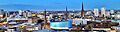
The skyline of Coventry viewed from the roof of One Friargate, November 2020.
-
The skyline of Wolverhampton viewed from the foot of Beacon Hill, Sedgley, May 2020.
-
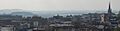
The skyline of Dudley Town Centre viewed from Dudley Castle, September 2008.
-
The skyline of Walsall Town Centre viewed from The New Walsall Art Gallery.
-
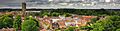
The 53-metre tower of the Collegiate Church of St Mary, viewed from the ramparts of Warwick Castle, July 2009.
-
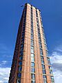
South Central Tower, Birmingham
-
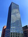
Sherlock Yard, Birmingham
-
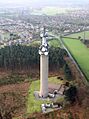
Pye Green BT Tower, Cannock Chase
-
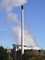
Coventry Waste to Energy Plant
-
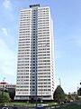
Cleveland Tower, Birmingham
-
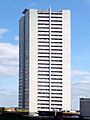
Clydesdale Tower, Birmingham
-
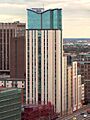
Orion Building, Birmingham
-
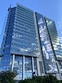
Three Snowhill, Birmingham
-
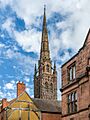
Cathedral Church of Saint Michael, Coventry
-
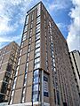
Exchange Square 1 Tower 3, Birmingham
-
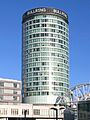
The Rotunda, Birmingham
-
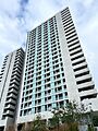
Aston Place, Birmingham
-
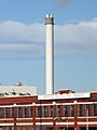
Veolia Energy Recovery Facility, Birmingham
-

Lancaster Wharf, Birmingham
-
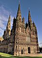
Lichfield Cathedral
-
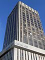
Centre City Tower, Birmingham
-
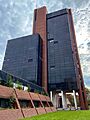
Five Ways Tower, Birmingham
-
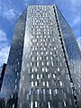
Onyx, Birmingham
-
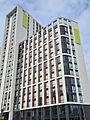
CODE Coventry Block B
-
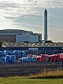
Dudley Energy from Waste Plant
-
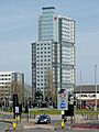
Victoria Hall, Wolverhampton
-
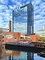
Hyatt Regency Birmingham
-
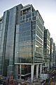
Two Snowhill, Birmingham
-
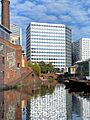
3 Arena Central, Birmingham
-
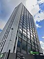
One Snow Hill Plaza, Birmingham
-
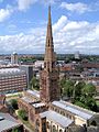
Holy Trinity Church, Coventry
-
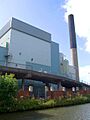
Wolverhampton MESE Energy from Waste Plant
-
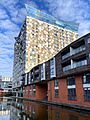
The Cube, Birmingham
-
JQ Rise, Birmingham
-
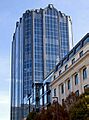
Colmore Gate, Birmingham
-
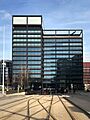
One Centenary Way, Birmingham
-
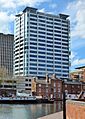
Quayside Tower, Birmingham
-
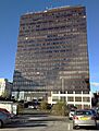
McLaren Building, Birmingham
-
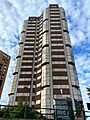
One Hagley Road, Birmingham
-
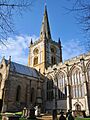
Church of the Holy Trinity, Stratford-upon-Avon
-
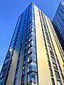
The Bank Tower 1, Birmingham
-
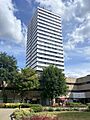
Mercia House, Coventry
-
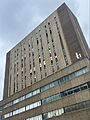
Midland Building, Birmingham
-
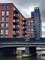
Snowhill Wharf, Birmingham
-
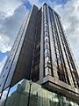
Bank House, Birmingham
-
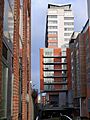
Brindley House, Birmingham
-
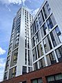
Weaver Place Block C, Coventry
-
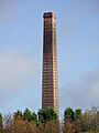
Baggeridge Brickworks, South Staffordshire
-
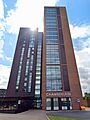
Chamberlain Hall, Birmingham
-
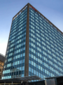
Cumberland House, Birmingham
-
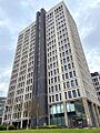
Fifty4 Hagley Road, Birmingham
-
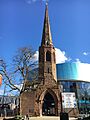
Christchurch Spire, Coventry
-
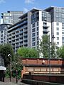
Centenary Plaza, Birmingham
-
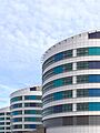
Queen Elizabeth Hospital Birmingham, Tower 1
-
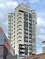
Hillman House, Coventry
-
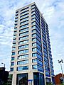
Hagley House, Birmingham
-
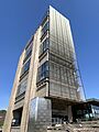
Muirhead Tower, Birmingham
-
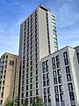
Parkside Infinity Tower 1, Coventry
-
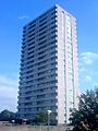
Brockfield House, Wolverhampton
-
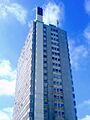
Hampton View, Wolverhampton
-
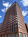
The Bath House, Birmingham
-
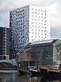
Holiday Inn Express Birmingham City Centre
-
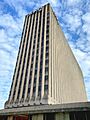
Jurys Inn Birmingham
-
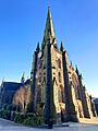
St Martin in the Bull Ring, Birmingham
-
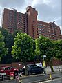
Trident House, Birmingham
-
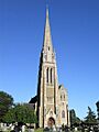
St Marie's Church, Rugby
-
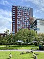
James Watt Residences, Birmingham
-
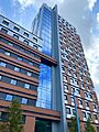
Mary Sturge Residences, Birmingham
-
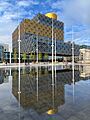
Library of Birmingham
-
St Nicolas' Church, Kings Norton
-
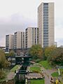
University Locks, Birmingham
-
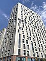
Trinity View, Coventry
-
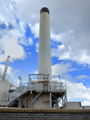
New Cross Hospital Incinerator, Wolverhampton
-
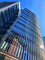
Eleven Brindleyplace, Birmingham
-
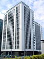
Lloyd House, Birmingham
-
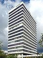
Lyndon House, Birmingham
-
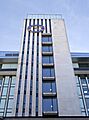
Temple Point, Birmingham
-
Briarley, Sandwell
-
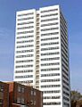
Barry Jackson Tower, Birmingham
-
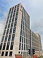
Battery Park Selly Oak, Birmingham
-
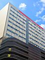
Londonderry House, Birmingham
-
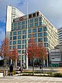
One Centenary Square, Birmingham
-
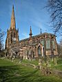
Parish Church of SS Peter and Paul, Aston
-
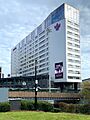
Park Regis Birmingham
-
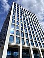
Two Friargate, Coventry
-
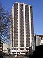
Ramada Hotel Coventry
-
St John the Baptist's Church, Leamington Spa
-
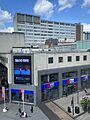
City Centre House, Birmingham
-
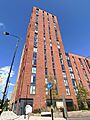
Corkfield, Block 1, Birmingham
-
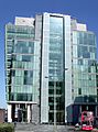
One Snowhill, Birmingham
-
Brinklow Tower, Birmingham
-
Studley Tower, Birmingham
-
Wilmcote Tower, Birmingham
-
Canterbury Tower, Birmingham
-
Durham Tower, Birmingham
-
Salisbury Tower, Birmingham
-
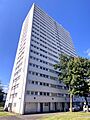
Century Tower, Birmingham
-
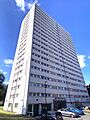
Wickets Tower, Birmingham
-
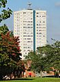
Hodgson Tower, Birmingham
-
Pritchett Tower, Birmingham
-
Victor Tower, Birmingham
-
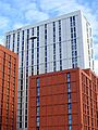
City Village Block A, Coventry
-
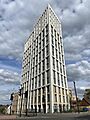
Elliott's Yard, Coventry
-
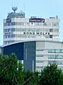
West Plaza, Sandwell
-
St Alphege Church, Solihull
-
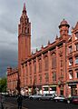
Methodist Central Hall, Birmingham
-
Campion House, Wolverhampton
-
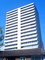
Longfield House, Wolverhampton
-
St. Cecilia's, Wolverhampton
-
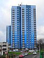
William Bentley Court, Wolverhampton
-
Wodensfield Tower, Wolverhampton
-
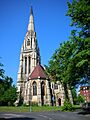
The Church of St Augustine of Hippo, Birmingham
-
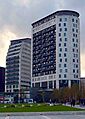
Hive, Birmingham
-
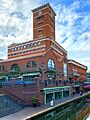
Three Brindleyplace, Birmingham
-
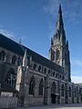
St Mary's Church, Lichfield
-
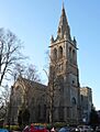
St Andrew's Church, Rugby
-
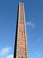
Slingfield Mill, Wyre Forest
-
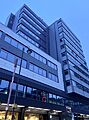
Albany House, Birmingham
-
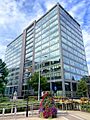
The Colmore Building, Birmingham
-
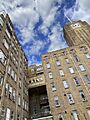
Heritage Building Clock Tower, Birmingham
-
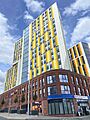
Bishop Gate Tower 1, Coventry
-
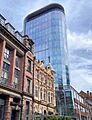
45 Church Street, Birmingham
-
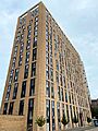
The Lansdowne, Birmingham
-
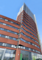
Opal Court, Birmingham
-
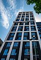
St Martin's Place, Birmingham
-
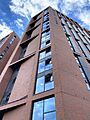
Arundel House Block B, Coventry
-
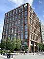
One Friargate, Coventry
-
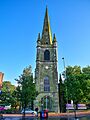
Church of St. Thomas, Dudley
-
Midland Metropolitan University Hospital, Sandwell
-
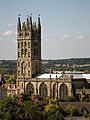
Collegiate Church of St Mary, Warwick
-
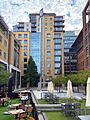
Eight Brindleyplace, Birmingham
-
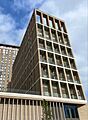
Exchange Square 1, Tower 2, Birmingham
-
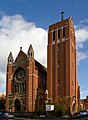
St Alban the Martyr, Birmingham
-
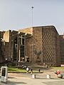
Coventry Cathedral
-
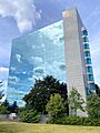
Friars House, Coventry
-
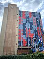
Study Inn Tower, Coventry
-
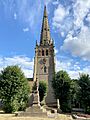
Church of St Peter and St Paul, Coleshill
-
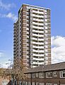
Darley House, Sandwell
-
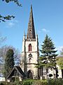
St Matthew's Church, Walsall
-
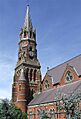
St. Luke's Church, Wolverhampton
-
Commonwealth Games Village Plot 7, Birmingham
-
Great Charles Street, Block B1, Birmingham
-
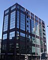
One Colmore Row, Birmingham
-
One Eastside, Block B, Birmingham
-
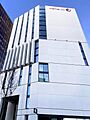
Premier Inn Exchange Square, Birmingham
-
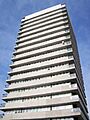
Alpha House, Coventry
-
Caradoc Hall, Coventry
-
Dewis House, Coventry
-
Falkener House, Coventry
-
Longfield House, Coventry
-
Meadow House, Coventry
-
Nauls Mill House, Coventry
-
Pioneer House, Coventry
-
Samuel Vale House, Coventry
-
Thomas King House, Coventry
-
William Batchelor House, Coventry
-
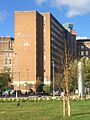
Aston University Main Building
-
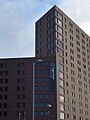
Campus Living Villages, Birmingham
-
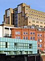
The Charters, Birmingham
-
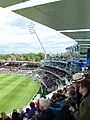
Edgbaston Cricket Ground
-
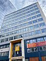
Edmund House, Birmingham
-
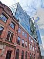
Embassy House, Birmingham
-
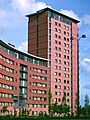
Lakeside West Building, Birmingham
-
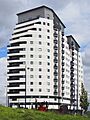
Masshouse Plaza, Birmingham
-
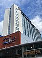
One Martineau Place, Birmingham
-
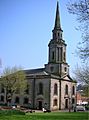
St Paul's Church, Birmingham
-
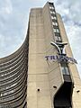
Tricorn House, Birmingham
-
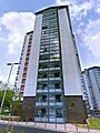
Ashcroft House, Sandwell
-
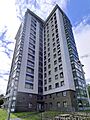
Birchcroft House, Sandwell
-
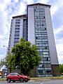
Elmcroft House, Sandwell
-
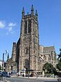
All Saints Church, Leamington Spa
-
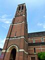
Church of St Peter The Apostle, Leamington Spa
-
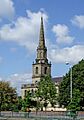
Church of St. John in the Square, Wolverhampton
-
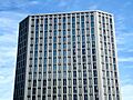
Compass, Birmingham
-
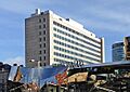
Ladywood House, Birmingham
-
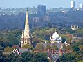
St. Michael's Church, Handsworth
-
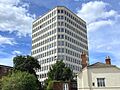
Eaton House, Coventry
-
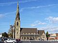
Roman Catholic Church of St Joseph and St Etheldreda, Cannock Chase
-
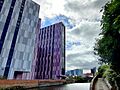
Bagot Street 2, Birmingham
-
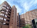
Broadway House, Birmingham
-
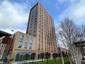
Emporium, Birmingham
-
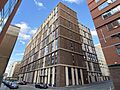
Landrow Place, Birmingham
-
Arundel House Block A, Coventry
-
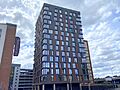
City Club Apartments, Coventry
-

Boulevard Southside, Birmingham
-
Soho Wharf, Block 1, Birmingham
-
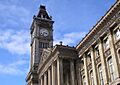
Birmingham Museum and Art Gallery Clock Tower
-
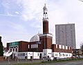
Birmingham Central Mosque
-
Brecon Tower, Birmingham
-
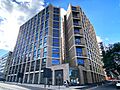
49-51 Holloway Head, Block C, Birmingham
-
49-51 Holloway Head, Block D, Birmingham
-
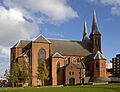
Metropolitan Cathedral and Basilica of St Chad, Birmingham
-
The Timber Yard, Birmingham
-
Truro Tower, Birmingham
-
Wells Tower, Birmingham
-
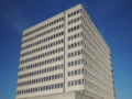
Tameway Plaza, Walsall
-
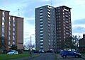
Eden Court, Leamington Spa
-
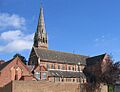
St Paul's Church, Leamington Spa
-
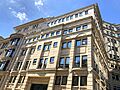
127 Colmore Row, Birmingham
-
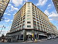
Canterbury House, Birmingham
-
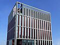
Enterprise Wharf, Birmingham
-
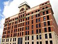
Fort Dunlop, Birmingham
-
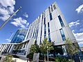
The Harborne Hospital, Birmingham
-
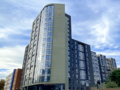
Toybox, Birmingham
-

Sirius, Birmingham
-
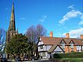
St. Edburgha's Church, Yardley
-
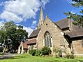
St Mary's Church, Selly Oak
-
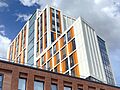
Bishop Gate Tower 3, Coventry
-
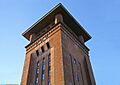
Bedworth Water Tower, Nuneaton and Bedworth
-
Three Chamberlain Square, Birmingham
-
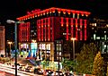
The Mailbox, Birmingham
-
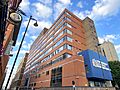
University College Birmingham, Summer Row Campus
-
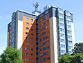
Thompson Gardens, Sandwell
-
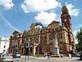
Leamington Spa Town Hall
-
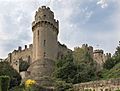
Warwick Castle
-
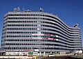
Equipoint, Birmingham
-
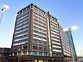
Westside One, Birmingham
-
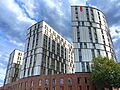
Paradise Student Village Tower 1, Coventry
-
Parkside Infinity Tower 2, Coventry
-
Resorts World Birmingham, Solihull
-
Holy Trinity Church, Heath Town, Wolverhampton
-
No. 1 Colmore Square, Birmingham
-
UNITE Staniforth House, Birmingham
-
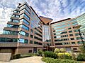
The Wesleyan, Birmingham
-
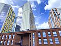
Bishop Gate Tower 2, Coventry
-
City Point, Coventry
-
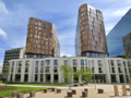
Copper Towers Block 1, Coventry
-
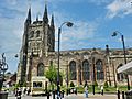
Church of St Editha, Tamworth
-
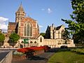
Rugby School Chapel
-
Belgrave Village, Block B, Birmingham
-
Corkfield, Block 2, Birmingham
-
Louden's Yard, Block F2, Birmingham
-
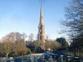
St Batholemew's Church, Bromsgrove
-
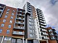
Solihull Retirement Village
-
12 Calthorpe Road, Birmingham
-
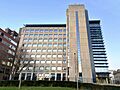
Crossway, Birmingham
-
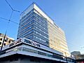
Exchange Building, Birmingham
-
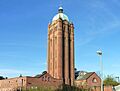
Hollymoor Hospital Water Tower, Birmingham
-
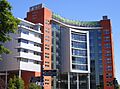
Matthew Boulton College, Birmingham
-
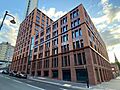
Setl, Birmingham
-
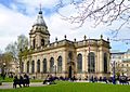
Cathedral Church of St Philip, Birmingham
-
University of Birmingham Health Innovation Campus Phase 1
-
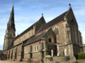
St Osburg's Church, Coventry
-
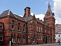
West Bromwich Town Hall
-
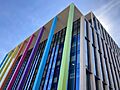
One Chamberlain Square, Birmingham
-
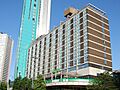
Holiday Inn Birmingham City Centre
-
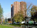
TheStudios24, Wolverhampton
-
Altura, Birmingham
-
bCentral, Birmingham
-
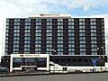
Crowne Plaza Hotel, Birmingham
-
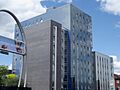
Penworks House, Birmingham
-
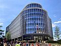
Two Chamberlain Square, Birmingham
-
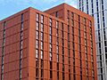
City Village Block B, Coventry
-
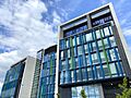
Severn Trent Centre, Coventry
-
St Paul's Church, Sandwell
-
Holiday Inn Birmingham North, Cannock Chase
-
Lakeside Plaza, Cannock Chase
-
Birmingham Oratory
-
Charles House, Birmingham
-
Great Charles Street, Block B2, Birmingham
-
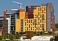
Jennens Court, Birmingham
-
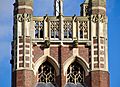
St Agatha's Church, Sparkbrook
-
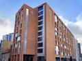
true Birmingham
-
Paradise Student Village Tower 2, Coventry
-
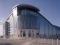
Sandwell College Central Campus
-
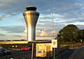
Birmingham Airport Air Traffic Control Tower
-
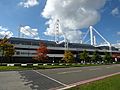
Resorts World Arena, Solihull
-
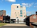
The New Art Gallery Walsall
-
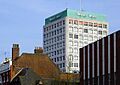
Mander House, Wolverhampton
-
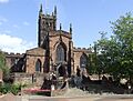
St Peter's Church, Wolverhampton
-
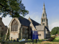
Erdington Abbey Church
-
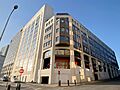
One Swallow Street, Birmingham
-
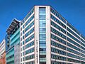
Rutland House, Birmingham
-

WOLO House, Birmingham
-
Copper Towers Block 2, Coventry
-
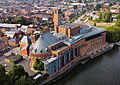
Royal Shakespeare Theatre Tower, Stratford-upon-Avon
-
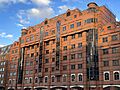
19 Cornwall Street, Birmingham
-

Edgbaston Waterworks Tower
-
Glasswater Locks, Plot E1, Birmingham
-
Glasswater Locks, Plot E2, Birmingham
-
Glasswater Locks, Plot E3, Birmingham
-
Glasswater Locks, Plot E4, Birmingham
-
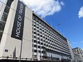
House of Fraser, Birmingham
-
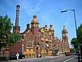
Moseley Road Baths, Birmingham
-
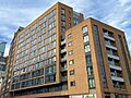
Royd House, Birmingham
-
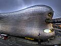
Selfridges Building, Birmingham
-
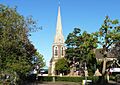
St Stephen's Church, Selly Park
-
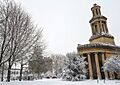
St Thomas' Church, Birmingham
-
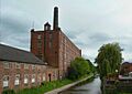
Toslon's Mill, Lichfield
-
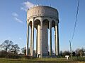
Ashlawn Water Tower, Rugby
-
St Peter's High Cross, Wolverhampton
-
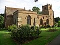
St Mary's Church, Stoneleigh
-
Warwick Castle
-
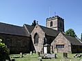
St Laurence's Church, Northfield
-
St Peter's Church, Wolverhampton
-
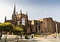
The Cathedral Church of Saint Michael, Coventry
-
Oak House, West Bromwich
-
Coughton Court, Stratford-upon-Avon
-
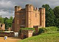
Leicester's Gatehouse, Kenilworth Castle
-
Charlecote Park, Stratford-upon-Avon
-
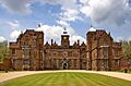
Aston Hall, Birmingham
-
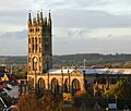
Collegiate Church of St Mary, Warwick
-
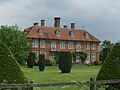
Norgrove Court, Redditch
-
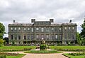
Ragley Hall, Stratford-upon-Avon
-
Cathedral Church of St Philip, Birmingham
-
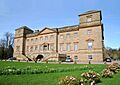
Hagley Hall, Bromsgrove
-
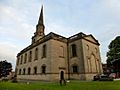
Church of St John in the Square, Wolverhampton
-
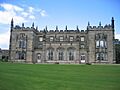
Arbury Hall, Nuneaton and Bedworth
-
Parade, Royal Leamington Spa
-
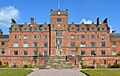
St Mary's College, Oscott
-
Bedworth Water Tower, Nuneaton and Bedworth
-
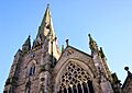
St Martin in the Bull Ring, Birmingham
-
Birmingham Museum and Art Gallery
-
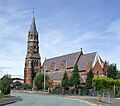
St Luke's Church, Blakenhall
-
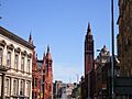
Methodist Central Hall, Birmingham
-
St Agatha's Church, Sparkbrook
-
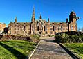
Old Council House, Coventry
-
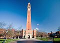
Joseph Chamberlain Memorial Clock Tower, Birmingham
-
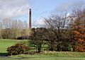
Baggeridge Brick Chimney, South Staffordshire
-
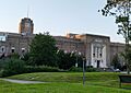
Heritage Building (Queen Elizabeth Hospital), Birmingham
-
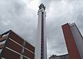
BT Tower, Birmingham
-
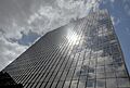
McLaren Building, Birmingham
-
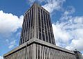
Centre City Tower, Birmingham
-
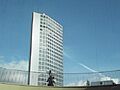
Alpha Tower, Birmingham
-
International Convention Centre (ICC), Birmingham
-
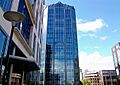
Colmore Gate, Birmingham
-
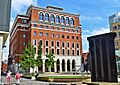
Three Brindleyplace, Birmingham
-
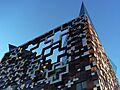
The Cube, Birmingham
-
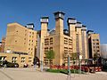
Lanchester Library, Coventry University
-
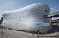
Selfridges Building, Birmingham
-
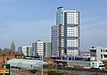
Victoria Hall, Wolverhampton
-
Bournville College, Birmingham
-
The Mercian, Birmingham
-
Broad Street Aerial at Night, Birmingham
-
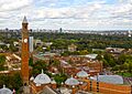
University of Birmingham Aerial Photography
-
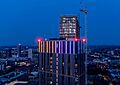
The Mercian and Bank II, Birmingham
-
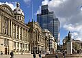
Birmingham Council House and 103 Colmore Row
-
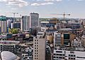
Central Birmingham
-
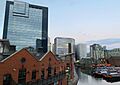
Gas Street Basin, Birmingham
-
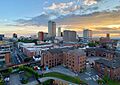
Birmingham Westside
-
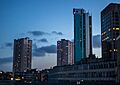
Holloway Circus at dusk, Birmingham
-
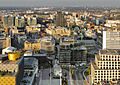
Centenary Square, Birmingham
-
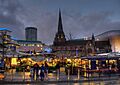
Bullring markets, Birmingham
-
Edmund Street, Birmingham
-
Snowhill, Birmingham
See also
- List of tallest buildings in Europe
- List of tallest buildings in the United Kingdom
- List of tallest structures in the United Kingdom
- List of tallest buildings by United Kingdom settlement
- List of tallest buildings and structures in the United Kingdom by usage
- List of tallest church buildings in the United Kingdom
- Architecture of Birmingham
- History of Birmingham
- History of Coventry
