
List of tallest structures in the United Kingdom facts for kids
This list is all about the tallest structures in the United Kingdom! We're talking about anything that stands 150 metres (490 ft) or taller. This height is usually what makes a building count as a skyscraper.
Some of the heights you see might be approximate (not exact) numbers.
-
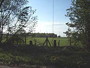
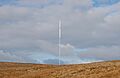
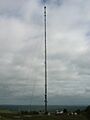
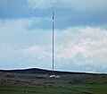
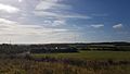
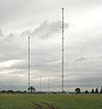
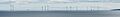
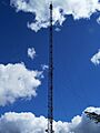
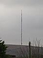
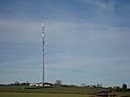
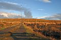
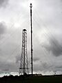
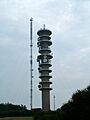
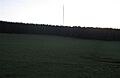
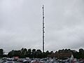
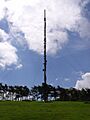
Skelton transmitting station
-
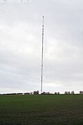
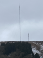
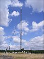
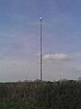
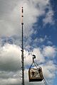
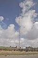
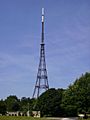
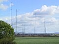
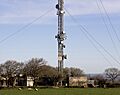
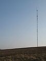
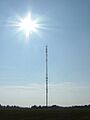
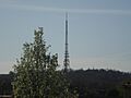
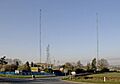
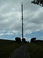
Belmont transmitting station


Contents
Structures Over 300 Metres Tall
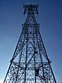
These are the giants of the UK, reaching higher than 300 metres! Most of them are communication masts, which are like super-tall antennas that send out TV and radio signals.
- Skelton Mast
- Belmont Mast
- Height: 351.65 m
(1,153.7 ft) - Year Built: 1965
- Use: Communication.
- Location: Donington on Bain, Lincolnshire.
- Type: A tubular steel mast held up by guy-wires.
- Fun Fact: It was once the tallest tubular steel mast in the world!
- Height: 351.65 m
- New Caldbeck Mast
- Height: 337.2 m
(1,106 ft) - Year Built: 2008
- Use: Communication.
- Location: Caldbeck, Cumbria.
- Type: A guyed steel lattice mast.
- Fun Fact: This new mast replaced an older one that was taken down in 2008.
- Height: 337.2 m
- Emley Moor Tower
- Height: 330.5 m
(1,084 ft) - Year Built: 1970
- Use: Communication.
- Location: Huddersfield, West Yorkshire.
- Type: A strong concrete tower.
- Fun Fact: This is the tallest structure in the UK that stands on its own (it doesn't need guy-wires). An earlier mast here collapsed in 1969 due to ice and strong winds!
- Height: 330.5 m
- Durris Mast
- Height: 322.6 m
(1,058 ft) - Year Built: 1961
- Use: Communication.
- Location: Durris, Aberdeenshire.
- Type: A guyed steel lattice mast.
- Fun Fact: It's the tallest structure in Scotland!
- Height: 322.6 m
- Arfon Mast
- Height: 317.4 m
(1,041 ft) - Year Built: 1962
- Use: Communication.
- Location: Penygroes, Gwynedd.
- Type: A guyed steel lattice mast.
- Fun Fact: This is the tallest structure in Wales!
- Height: 317.4 m
- Emley Moor Temporary Broadcasting Mast
- Height: 317 m
(1,040 ft) - Year Built: 2018
- Use: Temporary communication.
- Location: Huddersfield, West Yorkshire.
- Type: A guyed lattice steel mast.
- Fun Fact: This mast was put up for a short time while the main Emley Moor Tower was being updated.
- Height: 317 m
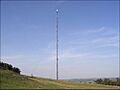
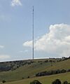
- Winter Hill Mast
- Height: 309.5 m
(1,015 ft) - Year Built: 1965
- Use: Communication.
- Location: Bolton, Greater Manchester.
- Type: A guyed tubular steel mast.
- Fun Fact: An older tower here was replaced in 1964.
- Height: 309.5 m
- Waltham Mast
- Height: 315 m
(1,033 ft) - Year Built: 1968
- Use: Communication.
- Location: Melton Mowbray, Leicestershire.
- Type: A guyed tubular steel mast.
- Fun Fact: The first mast built here in 1966 collapsed before it was even finished!
- Height: 315 m
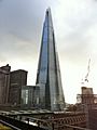
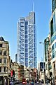
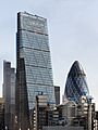
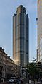
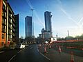
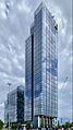
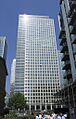
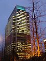
- The Shard
- Height: 309.6 m
(1,016 ft) - Year Built: 2012
- Use: Offices, homes, and other uses.
- Location: Southwark, London.
- Type: A skyscraper.
- Fun Fact: This is the tallest building in London and was once the tallest building in Western Europe!
- Height: 309.6 m
- Black Hill Mast
- Height: 306.6 m
(1,006 ft) - Year Built: 1961
- Use: Communication.
- Location: Salsburgh, North Lanarkshire.
- Type: A guyed steel lattice mast.
- Fun Fact: An older mast here was replaced in 1961.
- Height: 306.6 m
- Bilsdale Mast
- Height: 311.5 m
(1,022 ft) - Year Built: 2023
- Use: Communication.
- Location: Bilsdale, North Yorkshire.
- Type: A guyed steel lattice mast.
- Fun Fact: The original mast here burned down in 2021 and was replaced in 2023.
- Height: 311.5 m
- Strabane Mast
- Height: 309.9 m
(1,017 ft) - Year Built: 1963
- Use: Communication.
- Location: Strabane, County Tyrone.
- Type: A guyed steel lattice mast.
- Fun Fact: This is the tallest structure in Ireland.
- Height: 309.9 m
- Mendlesham Mast
- Height: 305.6 m
(1,003 ft) - Year Built: 1959
- Use: Communication.
- Location: Mendlesham, Suffolk.
- Type: A guyed steel lattice mast.
- Fun Fact: When it was built, it was the tallest television mast in Europe!
- Height: 305.6 m
- Lichfield Mast
- Height: 305.2 m
(1,001 ft) - Year Built: 1961
- Use: Communication.
- Location: Tamworth, Staffordshire.
- Type: A guyed steel lattice mast.
- Fun Fact: An older tower here was replaced in 1961.
- Height: 305.2 m
- Mendip Mast
- Height: 305.0 m
(1,000.7 ft) - Year Built: 1967
- Use: Communication.
- Location: St Cuthbert Out, Somerset.
- Type: A guyed tubular steel mast.
- Height: 305.0 m
Structures 250 to 300 Metres Tall
These structures are also super tall, reaching between 250 and 300 metres!
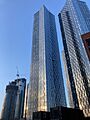
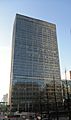
- 22 Bishopsgate
- Height: 278 m
(912 ft) - Year Built: 2019
- Use: Offices.
- Location: City of London.
- Type: A skyscraper.
- Fun Fact: This is the tallest building in the City of London.
- Height: 278 m
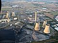
- Crimond Royal Naval Wireless Telegraphy Station, Large Mast
- Height: 274.3 m
(900 ft) - Year Built: Unknown
- Use: Communication.
- Location: Crimond, Aberdeenshire.
- Type: A guyed steel lattice mast.
- Height: 274.3 m
- Sutton Coldfield Mast
- Height: 270.5 m
(887 ft) - Year Built: 1983
- Use: Communication.
- Location: Birmingham, West Midlands.
- Type: A guyed steel lattice mast.
- Fun Fact: The original mast was built in 1949 and replaced in 1983.
- Height: 270.5 m
- Wenvoe Mast
- Height: 265 m
(869 ft) - Year Built: 1985
- Use: Communication.
- Location: Vale of Glamorgan.
- Type: A guyed steel lattice mast.
- Fun Fact: The original mast was built in 1952 and replaced in 1985.
- Height: 265 m
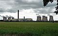
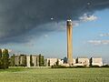
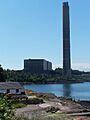
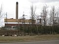
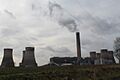
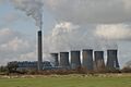
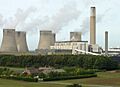
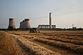
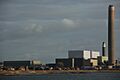
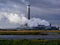
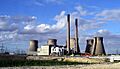
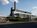
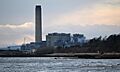
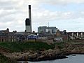
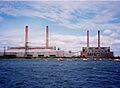
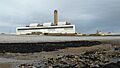
- Drax Power Station
- Height: 259 m
(850 ft) - Year Built: 1969
- Use: Chimney for a power station.
- Location: Selby, North Yorkshire.
- Type: A concrete tower.
- Fun Fact: This is the tallest chimney in the UK!
- Height: 259 m
- Rugby VLF Mast
- Height: 250 m
(820 ft) - Year Built: 1925
- Use: Communication.
- Location: Rugby, Warwickshire.
- Type: Guyed steel lattice masts.
- Fun Fact: There were 12 of these masts, but they were taken down in 2004 and 2007.
- Height: 250 m
Structures 200 to 250 Metres Tall
These structures stand between 200 and 250 metres high!
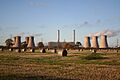
- Grain Power Station
- Height: 244 m (801 ft)
- Year Built: 1979
- Use: Chimney.
- Location: Isle of Grain, Kent.
- Type: A concrete tower.
- Fun Fact: This chimney was taken down on September 7, 2016.
- Mounteagle Mast
- Height: 243.8 m (800 ft)
- Year Built: 1961
- Use: Communication.
- Location: Fortrose, Ross-shire.
- Type: A guyed steel lattice mast.
- Dover Mast
- Height: 243.2 m (798 ft)
- Year Built: 1960
- Use: Communication.
- Location: Dover, Kent.
- Type: A guyed steel lattice mast.
- Landmark Pinnacle
- Height: 239 m (784 ft)
- Year Built: 2020
- Use: Homes.
- Location: Isle of Dogs.
- Type: A skyscraper.
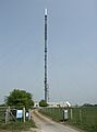
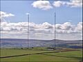
- Sandy Heath Mast
- Height: 240.8 m (790 ft)
- Year Built: 1965
- Use: Communication.
- Location: Sandy, Bedfordshire.
- Type: A guyed steel lattice mast.
- Selkirk Mast
- Height: 238.8 m (783 ft)
- Year Built: 1961
- Use: Communication.
- Location: Selkirk, Scottish Borders.
- Type: A guyed steel lattice mast.
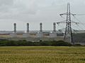
- Caradon Hill Mast
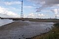
- Inverkip Power Station
- Height: 236 m (774 ft)
- Year Built: 1976
- Use: Chimney.
- Location: Wemyss Bay, Inverclyde.
- Type: A concrete tower.
- Fun Fact: This was once the tallest free-standing structure in Scotland. It was taken down with explosives on July 28, 2013.
- Preseli Mast
- Height: 235.4 m (772 ft)
- Year Built: 1962
- Use: Communication.
- Location: Crymych, Pembrokeshire.
- Type: A guyed steel lattice mast.
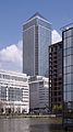
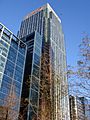
- One Canada Square
- Height: 235.1 m (771 ft)
- Year Built: 1991
- Use: Offices.
- Location: Canary Wharf, London.
- Type: A skyscraper.
- Stockland Hill Mast
- Moel-y-Parc Mast
- Height: 230 m (750 ft)
- Year Built: 1963
- Use: Communication.
- Location: Caerwys, Flintshire.
- Type: A guyed steel lattice mast.
- Heron Tower
- Height: 230 m (750 ft)
- Year Built: 2010
- Use: Offices.
- Location: City of London.
- Type: A skyscraper.
- Angus Mast
- Height: 229.5 m (753 ft)
- Year Built: 1965
- Use: Communication.
- Location: Angus.
- Type: A guyed steel lattice mast.
- Rumster Forest Mast
- Ashkirk Mast
- Height: 229.1 m (752 ft)
- Year Built: 1963
- Use: Communication.
- Location: Selkirk, Scottish Borders.
- Type: A guyed steel lattice mast.
- Chillerton Down Mast
- Height: 228.9 m (751 ft)
- Year Built: 1958
- Use: Communication.
- Location: Newport, Isle of Wight.
- Type: A guyed steel lattice mast.
- Black Mountain Mast
- Height: 228.6 m (750 ft)
- Year Built: 1959
- Use: Communication.
- Location: Belfast, Northern Ireland.
- Type: A guyed steel lattice mast.
- Burnhope Mast
- Height: 228.6 m (750 ft)
- Year Built: 1958
- Use: Communication.
- Location: Burnhope, County Durham.
- Type: A guyed steel lattice mast.
- St. Hilary Mast
- Height: 227.1 m (745 ft)
- Year Built: 1957
- Use: Communication.
- Location: Cowbridge, Vale of Glamorgan.
- Type: A guyed steel lattice mast.
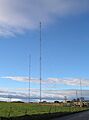
- Anthorn Radio Station
- Height: 227 m (745 ft)
- Year Built: 1964
- Use: Communication.
- Location: Anthorn, Cumbria.
- Type: Guyed steel lattice masts.
- Holme Moss Mast
- Height: 225 m (738 ft)
- Year Built: 1984
- Use: Communication.
- Location: Holmfirth, West Yorkshire.
- Type: A guyed steel lattice mast.
- Leadenhall Building
- Height: 225 m (738 ft)
- Year Built: 2014
- Use: Offices.
- Location: City of London.
- Type: A skyscraper.
- Crystal Palace Tower
- Height: 219 m (719 ft)
- Year Built: 1950
- Use: Communication.
- Location: Norwood, London.
- Type: A lattice tower.
- Pembroke Power Station
- Height: 217.3 m (713 ft)
- Year Built: 1968
- Use: Chimney.
- Location: Pembroke, Pembrokeshire.
- Type: A concrete tower.
- Fun Fact: This chimney was taken down on November 25, 2000.
- Littlebrook "D" Power Station
- Height: 215 m (705 ft)
- Year Built: 1981
- Use: Chimney.
- Location: Dartford, Kent.
- Type: A concrete tower.
- Fun Fact: This chimney was taken down with explosives on December 15, 2019.
- Droitwich Mast 1
- Height: 213.4 m (700 ft)
- Year Built: 1934
- Use: Communication.
- Location: Droitwich, Worcestershire.
- Type: A guyed steel lattice mast.
- Fun Fact: There are two masts of the same height here, used for broadcasting Radio 4.
- Droitwich Mast 2
- Height: 213.4 m (700 ft)
- Year Built: 1934
- Use: Communication.
- Location: Droitwich, Worcestershire.
- Type: A guyed steel lattice mast.
- Tacolneston Mast (replacement)
- Height: 206.1 m (676 ft)
- Year Built: 2009
- Use: Communication.
- Location: Tacolneston, Norfolk.
- Type: A guyed steel lattice mast.
- Fun Fact: This mast was built to replace an older one for the switch to digital TV.
- Ironbridge "B" Power Station
- Height: 205 m (673 ft)
- Year Built: 1969
- Use: Chimney.
- Location: Telford, Shropshire.
- Type: A concrete tower.
- Fun Fact: Also known as Buildwas Power Station, this chimney was taken down on September 3, 2021.
- European Offshore Wind Deployment Centre
- Height: 204 m (669 ft)
- Year Built: 2018
- Use: A wind farm.
- Location: Aberdeenshire (3 km offshore).
- Type: 11 large wind turbines.
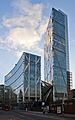
- Deansgate Square South Tower
- Height: 201 m (659 ft)
- Year Built: 2018
- Use: Homes.
- Location: Manchester, Greater Manchester.
- Type: A skyscraper.
- Fun Fact: This is the tallest building in the UK outside of London.
- Fiddlers Ferry Power Station
- Height: 200 m (660 ft)
- Year Built: 1971
- Use: Chimney.
- Location: Cuerdley, Cheshire.
- Type: A concrete tower.
- Fun Fact: This chimney was taken down on December 3, 2023.
- West Burton "A" Power Station
- Height: 200 m (660 ft)
- Year Built: 1966
- Use: Chimney.
- Location: West Burton, Nottinghamshire.
- Type: Concrete towers.
- Fun Fact: This power station has twin chimneys. The original ones were replaced in 2003.
- Eggborough Power Station
- Height: 200 m (660 ft)
- Year Built: 1966
- Use: Chimney.
- Location: Eggborough, North Yorkshire.
- Type: A concrete tower.
- Fun Fact: This chimney was taken down on July 24, 2022.
Structures 150 to 200 Metres Tall
These structures are between 150 and 200 metres high!
- Citigroup Centre
- Height: 199.5 m (655 ft)
- Year Built: 2001
- Use: Offices.
- Location: Canary Wharf, London.
- Type: A skyscraper.
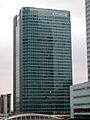
- HSBC Tower
- Height: 199.5 m (655 ft)
- Year Built: 2002
- Use: Offices.
- Location: Canary Wharf, London.
- Type: A skyscraper.
- Didcot "A" Power Station
- Height: 199.5 m (655 ft)
- Year Built: 1968
- Use: Chimney.
- Location: Didcot, Oxfordshire.
- Type: A concrete tower.
- Fun Fact: This chimney was taken down on February 9, 2020.
- Ratcliffe-on-Soar Power Station
- Height: 199 m (653 ft)
- Year Built: 1967
- Use: Chimney.
- Location: Kegworth, Nottinghamshire.
- Type: A concrete tower.
- Cottam Power Station
- Height: 198 m (650 ft)
- Year Built: 1968
- Use: Chimney.
- Location: Retford, Nottinghamshire.
- Type: A concrete tower.
- Fun Fact: This chimney was taken down in 2024.
- Kilroot power station
- Height: 198 m (650 ft)
- Year Built: 1981
- Use: Chimney.
- Location: Carrickfergus, Northern Ireland.
- Type: A concrete tower.
- Fawley Power Station
- Height: 198 m (650 ft)
- Year Built: 1969
- Use: Chimney.
- Location: Fawley, Hampshire.
- Type: A concrete tower.
- Fun Fact: This chimney was taken down on October 31, 2021.
- Ferrybridge "C" Power Station
- Height: 198 m (650 ft)
- Year Built: 1966
- Use: Chimney.
- Location: Ferrybridge, West Yorkshire.
- Type: Concrete towers.
- Fun Fact: This power station had twin chimneys, which were taken down on August 22, 2021.
- Kingsnorth Power Station
- Height: 198 m (650 ft)
- Year Built: 1970
- Use: Chimney.
- Location: Rochester, Kent.
- Type: A concrete tower.
- Fun Fact: This chimney was taken down on March 22, 2018.
- North Hessary Tor Mast
- Height: 196.0 m (643.0 ft)
- Year Built: 1955
- Use: Communication.
- Location: Princetown, Devon.
- Type: A guyed steel lattice mast.
- Samsung Heavy Industries 7 MW wind turbine prototype
- Height: 196 m (643 ft)
- Year Built: 2014
- Use: Wind turbine.
- Location: Methil, Fife.
- Type: A tower.
- 400 kV Thames Crossing
- Height: 190 m (620 ft)
- Year Built: Unknown
- Use: electricity pylon.
- Location: River Thames, Swanscombe.
- Type: Lattice towers.
- Fun Fact: These are two pylons of the same height, one on each side of the River Thames.
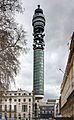
- BT Tower
- Height: 188.4 m (618 ft)
- Year Built: 1964
- Use: Communication.
- Location: Fitzrovia, London.
- Type: A concrete tower.
- Fun Fact: It used to be called the Post Office Tower and had a spinning restaurant at the top!
- Rowridge transmitting station, new mast
- Height: 187 m (614 ft)
- Year Built: 2009
- Use: Communication.
- Location: Rowridge, Isle of Wight.
- Type: A guyed steel lattice mast.
- Crimond Royal Naval Wireless Telegraphy Station, Mast Southwest
- Height: 183.2 m (601 ft)
- Year Built: Unknown
- Use: Communication.
- Location: Crimond, Aberdeenshire.
- Type: A guyed steel lattice mast.
- Kirk o' Shotts Mast
- Height: 183 m (600 ft)
- Year Built: 1952
- Use: Communication.
- Location: Salsburgh, North Lanarkshire.
- Type: A guyed steel lattice mast.
- Masts of RNAS Inskip
- Height: 183 m (600 ft)
- Year Built: Unknown
- Use: Communication.
- Location: Inskip, Lancashire.
- Type: Guyed steel lattice masts.
- Stirling Transmitting Station
- Height: 183 m (600 ft)
- Year Built: Unknown
- Use: Communication.
- Location: Stirling.
- Type: A guyed mast.
- Kidsdale Transmitting Station
- Height: 183 m (600 ft)
- Year Built: Unknown
- Use: Communication.
- Location: Whithorn, Dumfries and Galloway.
- Type: A guyed mast.
- Fun Fact: This mast has been taken down.
- Tower 42
- Height: 183 m (600 ft)
- Year Built: 1980
- Use: Offices.
- Location: City of London.
- Type: A skyscraper.
- Fun Fact: It used to be known as "The Nat West Tower."
- Rugeley "B" Power Station
- Height: 183 m (600 ft)
- Year Built: 1970
- Use: Chimney.
- Location: Rugeley, Staffordshire.
- Type: A concrete tower.
- Fun Fact: The original chimney was replaced in 2009, and the replacement was taken down on January 24, 2021.
- Longannet Power Station
- Height: 183 m (600 ft)
- Year Built: 1969
- Use: Chimney.
- Location: Longannet, Fife.
- Type: A concrete tower.
- Fun Fact: This chimney was taken down on December 9, 2021.
- Crimond Royal Naval Wireless Telegraphy Station, Mast Southeast
- Height: 182.88 m (600.0 ft)
- Year Built: Unknown
- Use: Communication.
- Location: Crimond, Aberdeenshire.
- Type: A guyed steel lattice mast.
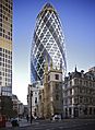
- 30 St Mary Axe
- Height: 179.8 m (590 ft)
- Year Built: 2004
- Use: Offices.
- Location: City of London.
- Type: A skyscraper.
- Fun Fact: This building is often called "The Gherkin" because of its shape!
- Wrotham Mast
- Height: 176.6 m (579 ft)
- Year Built: 1981
- Use: Communication.
- Location: Wrotham, Kent.
- Type: A guyed steel lattice mast.
- Fun Fact: This mast was used for the first FM radio broadcasts in the UK.
- Redruth Mast
- Height: 173 m (568 ft)
- Year Built: 1962
- Use: Communication.
- Location: Redruth, Cornwall.
- Type: A guyed steel lattice mast.
- Rowridge Mast
- Height: 172 m (564 ft)
- Year Built: 2010
- Use: Communication.
- Location: Newport, Isle of Wight.
- Type: A guyed steel lattice mast.
- Fun Fact: This mast replaced an older one.
- Peterhead Power Station
- Height: 170.6 m (560 ft)
- Year Built: 1980
- Use: Chimney.
- Location: Peterhead, Aberdeenshire.
- Type: A concrete tower.
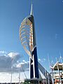
- Spinnaker Tower
- Height: 170 m (560 ft)
- Year Built: 2005
- Use: Observation (for looking out).
- Location: Portsmouth, Hampshire.
- Type: A concrete tower.
- Fun Fact: This is the tallest structure in the UK outside London that you can visit!
- Blyth B Power Station
- Height: 170 m (560 ft)
- Year Built: 1962
- Use: Chimneys.
- Location: Blyth, Northumberland.
- Type: Concrete towers.
- Fun Fact: These twin chimneys were taken down on December 7, 2003.
- Oxford Mast
- Height: 169.0 m (554.5 ft)
- Year Built: 1968
- Use: Communication.
- Location: Oxford, Oxfordshire.
- Type: A guyed steel lattice mast.
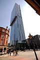
- Beetham Tower
- Height: 168.9 m (554 ft)
- Year Built: 2006
- Use: Homes.
- Location: Manchester, Greater Manchester.
- Type: A skyscraper.
- Fun Fact: Until 2018, this was the tallest building in the UK outside of London. It's also known as "Hilton Tower."
- Divis Mast B
- Height: 165.8 m (544 ft)
- Year Built: 2011
- Use: Communication.
- Location: Hannahstown, County Antrim.
- Type: A guyed steel lattice mast.
- Broadgate Tower
- Height: 165.0 m (541.3 ft)
- Year Built: 2008
- Use: Offices.
- Location: City of London.
- Type: A skyscraper.
- Tacolneston Mast
- Height: 165.0 m (541.3 ft)
- Year Built: 1956
- Use: Communication.
- Location: Norwich, Norfolk.
- Type: A guyed steel lattice mast.
- Fun Fact: This mast was replaced by a taller one in 2011.
- Ridge Hill Mast
- Height: 164.6 m (540 ft)
- Year Built: 1968
- Use: Communication.
- Location: Ledbury, Herefordshire.
- Type: A guyed steel lattice mast.
- Huntshaw Cross Mast
- Height: 163.7 m (537 ft)
- Year Built: Unknown
- Use: Communication.
- Location: Great Torrington, Devon.
- Type: A guyed steel lattice mast.
- Sudbury "A" Mast
- British Airways i360
- Height: 162 m (531 ft)
- Year Built: 2016
- Use: Observation.
- Location: Brighton.
- Type: A steel tower.
- Eitshal Mast
- Height: 161.3 m (529 ft)
- Year Built: 1976
- Use: Communication.
- Location: Stornoway, Isle of Lewis.
- Type: A guyed steel lattice mast.
- Chatton Mast
- Height: 161.0 m (528.2 ft)
- Year Built: Unknown
- Use: Communication.
- Location: Alnwick, Northumberland.
- Type: A guyed steel lattice mast.
- Aberthaw Power Station
- Height: 160 m (520 ft)
- Year Built: 1971
- Use: Chimney.
- Location: Gileston, Vale of Glamorgan.
- Type: A concrete tower.
- Blackpool Tower
- Height: 158 m (518 ft)
- Year Built: 1894
- Use: Observation.
- Location: Blackpool, Lancashire.
- Type: A lattice tower.
- Deansgate Square East Tower
- Height: 158 m (518 ft)
- Year Built: 2019
- Use: Homes.
- Location: Manchester, Greater Manchester.
- Type: A skyscraper.
- Moorside Edge Mast 1
- Height: 158 m (518 ft)
- Year Built: 1982
- Use: Communication.
- Location: Huddersfield, West Yorkshire.
- Type: A guyed steel lattice mast.
- Fun Fact: There are two masts of the same height here.
- Moorside Edge Mast 2
- Height: 158 m (518 ft)
- Year Built: 1982
- Use: Communication.
- Location: Huddersfield, West Yorkshire.
- Type: A guyed steel lattice mast.
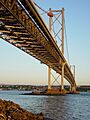
- Forth Road Bridge
- Height: 156 m (512 ft)
- Year Built: 1964
- Use: A bridge.
- Location: Firth of Forth, East Scotland.
- Type: Steel towers.
- One Churchill Place
- Height: 156 m (512 ft)
- Year Built: 2004
- Use: Offices.
- Location: Canary Wharf, London.
- Type: A skyscraper.
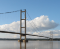
- Humber Bridge
- Height: 155.5 m (510 ft)
- Year Built: 1981
- Use: A bridge.
- Location: River Humber, Yorkshire/Lincolnshire.
- Type: Concrete towers.
- Haverfordwest Mast
- Height: 154.4 m (507 ft)
- Year Built: Unknown
- Use: Communication.
- Location: Haverfordwest, Pembrokeshire.
- Type: A guyed steel lattice mast.
- Manningtree Mast
- Height: 154.4 m (507 ft)
- Year Built: Unknown
- Use: Communication.
- Location: Manningtree, Essex.
- Type: A guyed steel lattice mast.
- Burghead Medium Wave Mast
- Height: 154.2 m (506 ft)
- Year Built: 1936
- Use: Communication.
- Location: Burghead, Moray.
- Type: A guyed steel lattice mast.
- Fun Fact: It's insulated from the ground.
- Elizabeth Tower
- Height: 154 m (505 ft)
- Year Built: 2022
- Use: Homes.
- Location: Manchester, Greater Manchester.
- Type: A skyscraper.
- Peterborough Mast
- Height: 153.9 m (505 ft)
- Year Built: 2006
- Use: Communication.
- Location: Morborne, Cambridgeshire.
- Type: A guyed steel lattice mast.
- Fun Fact: The original mast was destroyed by fire in 2004.
- 275 kV Forth Crossing, Tower South
- Height: 153.9 m (505 ft)
- Year Built: Unknown
- Use: Electricity pylon.
- Location: Airth, Falkirk.
- Type: A lattice tower.
- Burghead Long Wave Mast
- Height: 153.6 m (504 ft)
- Year Built: 1936
- Use: Communication.
- Location: Burghead, Moray.
- Type: A guyed steel lattice mast.
- Fun Fact: It's insulated from the ground.
- 25 Bank Street
- Height: 153 m (502 ft)
- Year Built: 2003
- Use: Offices.
- Location: Canary Wharf, London.
- Type: A skyscraper.
- 40 Bank Street
- Height: 153 m (502 ft)
- Year Built: 2003
- Use: Offices.
- Location: Canary Wharf, London.
- Type: A skyscraper.
- Sandale Mast
- Height: 153 m (502 ft)
- Year Built: 1957
- Use: Communication.
- Location: Wigton, Cumbria.
- Type: A guyed steel lattice mast.
- Croydon Tower
- Height: 152.6 m (501 ft)
- Year Built: 1962
- Use: Communication.
- Location: Norwood, London.
- Type: A lattice tower.
- Fun Fact: An older, shorter tower was replaced by this one in 1962.
- Darvel Mast
- Height: 152.4 m (500 ft)
- Year Built: Unknown
- Use: Communication.
- Location: Darvel, East Ayrshire.
- Type: A guyed steel lattice mast.
- Forfar Mast
- Membury Mast
- Height: 152.4 m (500 ft)
- Year Built: 1965
- Use: Communication.
- Location: Hungerford, Berkshire.
- Type: A guyed steel lattice mast.
- Washford Masts
- Height: 152 m (499 ft)
- Year Built: 1933
- Use: Communication.
- Location: Washford, Somerset.
- Type: Guyed steel lattice masts.
- BT Tower (Birmingham)
- Height: 152 m (499 ft)
- Year Built: 1965
- Use: Communication.
- Location: Birmingham, West Midlands.
- Type: A concrete tower.
- Cockenzie Power Station
- Height: 152 m (499 ft)
- Year Built: 1966
- Use: Chimney.
- Location: Cockenzie, East Lothian.
- Type: Concrete towers.
- Fun Fact: These twin chimneys were taken down on September 26, 2015.
- Westerglen Mast
- Height: 152 m (499 ft)
- Year Built: 1980
- Use: Communication.
- Location: Falkirk, Stirlingshire.
- Type: A guyed steel lattice mast.
- Carmel Mast
- Height: 151.9 m (498 ft)
- Year Built: Unknown
- Use: Communication.
- Location: Cross Hands, Carmarthenshire.
- Type: A guyed steel lattice mast.
- Hannington Mast
- Height: 151.9 m (498 ft)
- Year Built: 1969
- Use: Communication.
- Location: Hannington, Hampshire.
- Type: A guyed steel lattice mast.
- 10 Upper Bank Street
- Height: 151 m (495 ft)
- Year Built: 2003
- Use: Offices.
- Location: Canary Wharf, London.
- Type: A skyscraper.
- Blaenplwyf Mast
- Height: 150.5 m (494 ft)
- Year Built: Unknown
- Use: Communication.
- Location: Aberystwyth, Ceredigion.
- Type: A guyed steel lattice mast.
Other Amazing Tall Structures
Here are some other tall structures in the UK that are famous for different reasons, even if they aren't all over 150 metres!
- Salisbury Cathedral at 123 m (404 ft) – This is the tallest church spire in the United Kingdom.
- Joseph Chamberlain Memorial Clock Tower, Birmingham at 100 m (330 ft) – This is the tallest clock tower in the world that stands on its own.
- Monument to the Great Fire of London, London at 61.57 m (202.0 ft) – This is the tallest stone column in the world that stands by itself.
- ArcelorMittal Orbit, Olympic Park, London at 115 m (377 ft) – This is the tallest free-standing public artwork in the United Kingdom.
- Hyperia, Thorpe Park at 72 m (236 ft) - This is the tallest rollercoaster in the United Kingdom!
See also
- List of tallest buildings in the United Kingdom
- List of tallest buildings and structures in the United Kingdom by usage
- List of tallest buildings and structures in the United Kingdom by settlement
- List of tallest buildings and structures in Birmingham
- List of tallest buildings and structures in Brighton and Hove
- List of tallest buildings and structures in Bristol
- List of tallest buildings and structures in Cardiff
- List of tallest buildings and structures in Croydon
- List of tallest buildings and structures in Edinburgh
- List of tallest buildings and structures in Glasgow
- List of tallest buildings and structures in Greater Manchester
- List of tallest buildings and structures in Leeds
- List of tallest buildings and structures in Liverpool
- List of tallest buildings and structures in London
- List of tallest buildings and structures in Newcastle upon Tyne
- List of tallest buildings and structures in Portsmouth
- List of tallest buildings and structures in Salford
- List of tallest buildings and structures in Sheffield
- List of tallest buildings and structures in Southampton
- List of tallest buildings in Yorkshire
- List of tallest structures in the world
Images for kids
-
Skelton Mast, a very tall communication tower.
-
Belmont Mast, another giant communication tower.
-

Emley Moor Tower, the UK's tallest free-standing structure.
-
Winter Hill Mast, a communication tower in Greater Manchester.
-
The Shard, a famous skyscraper in London.
-
Bilsdale Mast, a communication tower in North Yorkshire.
-

22 Bishopsgate, a tall office building in London.
-

Crimond Royal Naval Wireless Telegraphy Station, Large Mast.
-
Drax Power Station, with its tall chimney.
-
Grain Power Station chimney.
-

Landmark Pinnacle, a residential skyscraper.
-
Sandy Heath Mast, a communication tower.
-
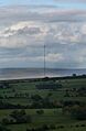
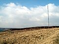
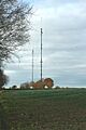
Caradon Hill Mast, a communication tower in Cornwall.
-
Inverkip Power Station chimney.
-
Preseli Mast, a communication tower in Pembrokeshire.
-
One Canada Square, an office skyscraper.
-
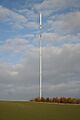
Stockland Hill Mast, a communication tower in Devon.
-
Moel-y-Parc Mast, a communication tower in Flintshire.
-
Heron Tower, an office skyscraper.
-
Angus Transmitting Station.
-
Ashkirk Mast, a communication tower.
-
Chillerton Down Mast, a communication tower on the Isle of Wight.
-
Burnhope Mast, a communication tower in County Durham.
-
St. Hilary Mast, a communication tower.
-
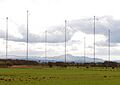
Anthorn Radio Station, with its many masts.
-
Holme Moss Mast, a communication tower.
-
Leadenhall Building, an office skyscraper.
-
Crystal Palace Tower, a communication tower in London.
-
Pembroke Power Station chimney.
-
Littlebrook "D" Power Station chimney.
-
Droitwich Mast, a communication tower.
-
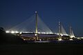
Queensferry Crossing, a modern bridge.
-
Tacolneston Mast, a communication tower.
-
Ironbridge "B" Power Station chimney.
-
European Offshore Wind Deployment Centre, with its wind turbines.
-
Deansgate Square South Tower, a residential skyscraper.
-
Fiddlers Ferry Power Station chimney.
-
West Burton "A" Power Station chimneys.
-
Eggborough Power Station chimney.
-
Citigroup Centre, an office skyscraper.
-

HSBC Tower, an office skyscraper.
-
Didcot "A" Power Station chimney.
-
Ratcliffe-on-Soar Power Station chimney.
-
Cottam Power Station chimney.
-
Kilroot power station chimney.
-
Fawley Power Station chimney.
-
Ferrybridge "C" Power Station chimneys.
-
Kingsnorth Power Station chimney.
-

North Hessary Tor Mast, a communication tower.
-
400 kV Thames Crossing pylons.
-
BT Tower, a famous communication tower in London.
-
Rowridge transmitting station, new mast.
-
Kirk o' Shotts Mast, a communication tower.
-
Masts of RNAS Inskip.
-
Tower 42, an office skyscraper.
-

Rugeley "B" Power Station chimney.
-
Longannet Power Station chimney.
-
30 St Mary Axe, also known as "The Gherkin."
-
Redruth Mast, a communication tower.
-
Peterhead Power Station chimney.
-
Spinnaker Tower, an observation tower.
-
Blyth B Power Station chimneys.
-
Beetham Tower, a residential skyscraper.
-

Tilbury "B" Power Station chimneys.
-
Divis Mast B, a communication tower.
-
Broadgate Tower, an office skyscraper.
-
Ridge Hill Mast, a communication tower.
-
Huntshaw Cross Mast, a communication tower.
-
Sudbury "A" Mast, a communication tower.
-
British Airways i360, an observation tower.
-
Eitshal Mast, a communication tower.
-
Chatton Mast, a communication tower.
-
Aberthaw Power Station chimney.
-
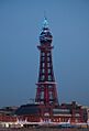
Blackpool Tower, a famous observation tower.
-
Deansgate Square East Tower, a residential skyscraper.
-
Moorside Edge Masts, communication towers.
-
Forth Road Bridge.
-
One Churchill Place, an office skyscraper.
-
Humber Bridge.
-
Haverfordwest Mast, a communication tower.
-
Manningtree Mast, a communication tower.
-
Burghead Medium Wave Mast.
-
Elizabeth Tower, a residential skyscraper.
-
Peterborough Mast, a communication tower.
-
275 kV Forth Crossing, Tower South.
-
25 Bank Street, an office skyscraper.
-
40 Bank Street, an office skyscraper.
-
Sandale Mast, a communication tower.
-
Croydon Tower, a communication tower.
-
Darvel Mast, a communication tower.
-
Membury Mast, a communication tower.
-
Washford Masts, communication towers.
-

BT Tower (Birmingham), a communication tower.
-

Cockenzie Power Station chimneys.
-
Westerglen Mast, a communication tower.
-
Carmel Mast, a communication tower.
-
Hannington Mast, a communication tower.
-
10 Upper Bank Street, an office skyscraper.
-
Blaenplwyf Mast, a communication tower.


_-_geograph.org.uk_-_2714432.jpg)

.png)


.jpg)


.jpg)


.jpg)


.jpg)


.jpg)


.jpg)
.jpg)


