Unorganized Borough, Alaska facts for kids
Quick facts for kids
Unorganized Borough
|
|
|---|---|

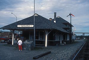
Nenana Depot
|
|

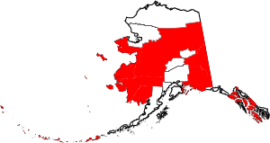
Location within the U.S. state of Alaska
|
|
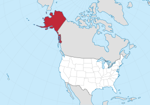
 Alaska's location within the U.S. |
|
| Country | |
| State | |
| Seat | None |
| Largest community | Bethel |
| Area | |
| • Total | 323,440 sq mi (837,700 km2) |
| Population
(2020)
|
|
| • Total | 77,157 |
| • Density | 0.24/sq mi (0.092/km2) |
| Time zones | UTC−9 (Alaska) |
| • Summer (DST) | UTC−8 (ADT) |
| UTC−10 (Hawaii–Aleutian) | |
| • Summer (DST) | HADT |
The Unorganized Borough is a huge part of Alaska that doesn't have its own local government, like a county or a borough. It's not a borough itself, but rather the name for all the areas in Alaska that aren't part of the 19 organized boroughs.
This area covers almost half of Alaska's land, about 323,440 square miles (837,700 square kilometers). In 2020, about 77,157 people lived there. That's about 10.5% of Alaska's total population. The biggest towns in the Unorganized Borough are Bethel, Unalaska, and Valdez.
Contents
What is the Unorganized Borough?
This huge area doesn't have a local government like most places in the United States. Instead, the state of Alaska or local tribal governments provide most services. This includes things like law enforcement.
Some cities within the Unorganized Borough manage their own services. School districts are either run by these cities or by the Alaska Department of Education. These school areas are called Rural Education Attendance Areas.
How are people counted in the Unorganized Borough?
Alaska is different from other U.S. states because it doesn't have counties everywhere. To help count people for the Census, the United States Census Bureau worked with Alaska. They divided the Unorganized Borough into 11 smaller areas called census areas.
These census areas help the government collect information about the population. Their borders and names have been updated several times since they were first created in 1970.
| Census area |
FIPS code | Largest town (as of 2000) |
What it's named for | Density |
Population | Area | Map |
|---|---|---|---|---|---|---|---|
| Aleutians West Census Area | 016 | Unalaska | Its location in the western Aleutian Islands. | 1.27 | 5,232 | 4,394 sq mi (11,380 km2) |
 |
| Bethel Census Area | 050 | Bethel | The city of Bethel, which means "house of God" in the Biblical term. | 0.45 | 18,666 | 40,631 sq mi (105,234 km2) |
 |
| Chugach Census Area | 063 | Valdez | The Chugach people. | 0.71 | 7,102 | 9,530 sq mi (24,683 km2) |
 |
| Copper River Census Area | 066 | Copper River | The Copper River. | 0.11 | 2,617 | 24,692 sq mi (63,952 km2) |
 |
| Dillingham Census Area | 070 | Dillingham | The city of Dillingham, named after Senator William P. Dillingham. | 0.27 | 4,857 | 18,334 sq mi (47,485 km2) |
 |
| Hoonah–Angoon Census Area | 105 | Hoonah | The cities of Hoonah and Angoon. | 0.33 | 2,365 | 6,555 sq mi (16,977 km2) |
 |
| Kusilvak Census Area | 158 | Hooper Bay | Kusilvak Mountains. | 0.48 | 8,368 | 17,077 sq mi (44,229 km2) |
 |
| Nome Census Area | 180 | Nome | The city of Nome. | 0.43 | 10,046 | 22,970 sq mi (59,492 km2) |
 |
| Prince of Wales-Hyder Census Area | 198 | Craig | Prince of Wales Island and the town of Hyder. | 1.18 | 5,753 | 5,264 sq mi (13,634 km2) |
 |
| Southeast Fairbanks Census Area | 240 | Deltana | Its location, southeast of Fairbanks. | 0.28 | 6,808 | 24,823 sq mi (64,291 km2) |
 |
| Yukon-Koyukuk Census Area | 290 | Fort Yukon | Yukon River and the city of Koyukuk. | 0.04 | 5,343 | 145,576 sq mi (377,040 km2) |
 |
History of Alaska's Government Structure
In the 1950s, when Alaska was becoming a state, there were very few local governments. The U.S. Congress had not allowed Alaska to set up counties, which are common in other states.
When Alaska's leaders wrote the Alaska Constitution, they decided not to create counties. Instead, they chose a system of "boroughs." Some boroughs would be "organized" with their own governments. Other areas would be "unorganized," meaning the state would provide services.
The goal was to have local control without too many different government groups. They wanted a system that fit Alaska's unique character. They also wanted to avoid problems that counties had faced in other states.
So, in 1961, Alaska officially adopted the borough system. The entire state was first defined as one huge Unorganized Borough. Over time, organized boroughs were created out of this large unorganized area.
The first organized borough was the Bristol Bay Borough. Then, in 1963, a law called the "Mandatory Borough Act" was passed. This law said that certain areas with enough people had to form their own organized boroughs by January 1, 1964. These areas included places like Ketchikan, Juneau, Anchorage, and Fairbanks.
Later, in 1975, 21 Regional Education Attendance Areas (REAAs) were set up. These were regional divisions within the Unorganized Borough. Their purpose was to create rural school districts. Many of these REAAs were later included in new organized boroughs.
Regional Educational Attendance Areas (REAA)
There are 19 Regional Educational Attendance Areas in the Unorganized Borough. These areas help manage schools in rural parts of Alaska.
| Regional name | Headquarters | REAA or Borough School Locations | Notes |
|---|---|---|---|
| Alaska Gateway | Tok | Northeast central Alaska area | |
| Aleutian Region | Nikolski (closed) | ||
| Annette Island | Metlakatla | ||
| Bering Straits | Unalakleet | Norton Sound
Seward Peninsula |
|
| Chatham | Angoon | Elfin Cove (closed), Cube Cove (closed) | |
| Chugach | |||
| Copper River | Glennallen |
|
Chistochina (closed), Copper Center (closed), Gakona (closed), Nelchina (closed) |
| Delta/Greely | Delta Junction |
|
Healy Lake (closed), Fort Greely (closed) |
| Iditarod | McGrath | Lake Minchumina (closed), Lime Village (closed) | |
| Kuspuk | Aniak | Red Devil (closed) | |
| Lower Kuskokwim | Nunivak Island | ||
| Lower Yukon | Mountain Village | Pitkas Point (closed) | |
| Pribilof Islands | Saint Paul | Saint George (closed) | |
| Southeast Island | Edna Bay (closed), Port Protection (closed) | ||
| Southwest Region | Aleknagik | Portage Creek (closed) | |
| Yukon Flats | Fort Yukon | Birch Creek (closed), Central (closed) | |
| Yukon-Koyukuk | Bettles (closed) | ||
| Yupiit (Akiachak, Akiak, Tuluksak) | Akiachak | ||
| Kashunamiut (Chevak) | Chevak |
Future of the Unorganized Borough
Since the Mandatory Borough Act, some new boroughs have been created. These often formed in areas with valuable resources like oil or popular tourist spots. This allowed them to collect taxes.
Many people who live in the Unorganized Borough like things the way they are. They don't want their areas to become organized boroughs.
However, some Alaskans in organized boroughs feel that they pay more taxes to support services in the Unorganized Borough, especially for schools. In 2003, a state group found eight areas in the Unorganized Borough that met the requirements to become organized boroughs. Laws have been suggested to make these areas form boroughs, but none have passed yet.
Major Communities in the Unorganized Borough
- Bethel (the largest city in the Unorganized Borough)
- Cordova
- Craig
- Delta Junction
- Deltana
- Dillingham
- Edna Bay
- Fort Yukon
- Hooper Bay
- Metlakatla
- Nenana
- Nome
- Tok
- Unalaska
- Valdez
See also
 In Spanish: Borough no organizado para niños
 | Misty Copeland |
 | Raven Wilkinson |
 | Debra Austin |
 | Aesha Ash |

