
List of islands of California facts for kids
California is home to many islands, both big and small! This list will help you discover some of these cool places, organized from north to south. The state has over 500 named islands.
Contents
- Humboldt County Islands
- Northern California Islands
- San Francisco Bay Area Islands
- Farallon Islands
- Suisun Bay and Sacramento–San Joaquin River Delta Islands
- Channel Islands
- Greater Los Angeles Area Islands
- Newport Bay Islands
- Lake Islands
- River Islands
- Other Interesting Islands
- Images for kids
- See also
Humboldt County Islands
Humboldt County is in northern California. It has islands both offshore and inside Humboldt Bay.
Offshore Islands
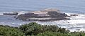
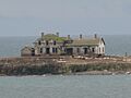
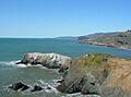
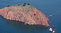
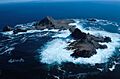
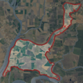
- Sugar Loaf Island: This island is off the coast of Cape Mendocino. It rises 128 feet (39 meters) high. It's a special protected area and people are not allowed to visit it. Because it's off Cape Mendocino, it's known as the westernmost island in California!
Humboldt Bay Islands
Three islands are found in Humboldt Bay, right in the middle section of the bay. This area is part of the city of Eureka, California.
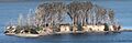
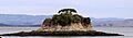
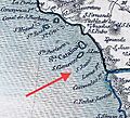
- Daby Island: This is the smallest island in Humboldt Bay. It's only about 3 feet (1 meter) high. It sits a little northeast of Woodley Island.
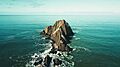
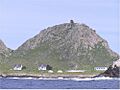
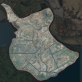
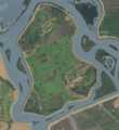
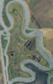
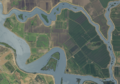
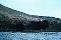
- Tuluwat Island: This is the biggest island in Humboldt Bay, about 1.3 miles (2.1 km) long. It was once a very important place for the Wiyot people, who are the native people of this area. It is now protected, and most people are not allowed to visit, except for the Wiyot people and some older residents.
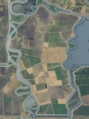
- Woodley Island: This is the second largest island in Humboldt Bay. It's home to Eureka's biggest marina, the local office for the National Weather Service, and other important offices.
Northern California Islands
This section covers islands along the northern coast of California.
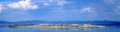
- Año Nuevo Island: This small island is about 0.2 miles (0.3 km) long. It's south of the Golden Gate and is part of the Año Nuevo State Reserve. It's a very important home for seabirds and other coastal animals.
- Bird Rock: This is a small island in the Pacific Ocean, west of Tomales Point. It's mostly a home for seabirds and covers about 2 acres (0.8 hectares).
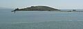
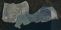
- Hog Island (Tomales Bay): This is a 2-acre (0.8-hectare) island located in Tomales Bay.
San Francisco Bay Area Islands
The San Francisco Bay Area has many islands, some natural and some made by people!
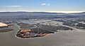
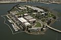
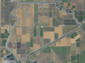
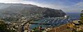
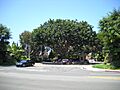
- Alameda Island: This island is 6 miles (9.7 km) long in San Francisco Bay. It's the main part of the City of Alameda.
- Alcatraz Island: This famous 22-acre (8.9-hectare) island in San Francisco Bay was once a lighthouse, a military fort, and a federal prison until 1963. Now, it's part of the Golden Gate National Recreation Area and a popular tourist spot.
- Angel Island: This island covers 1.2 square miles (3.1 km2) in San Francisco Bay. From 1910 to 1940, about 1 million immigrants came through here to enter the U.S. Today, it's a state park.
- Bair Island: This 2,600-acre (1,100-hectare) island is in San Francisco Bay near Redwood City. It's part of the Don Edwards San Francisco Bay National Wildlife Refuge, which protects wildlife.
- Bay Farm Island: This used to be an island in San Francisco Bay, but it's now connected to the mainland. It's also part of the City of Alameda.
- Belvedere Island: This island in Richardson Bay is no longer a true island; it's connected to the mainland. It's part of the City of Belvedere.
- Bird Island: A small island in the Pacific Ocean, located between Point Bonita and Rodeo Cove.
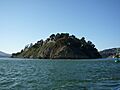
- Brooks Island: This 65-acre (26-hectare) island is in San Francisco Bay, south of Richmond. It's protected as part of the Brooks Island Regional Shoreline.
- The Brothers: These are two small islands, East Brother and West Brother, west of Point San Pablo. Each is about 300 feet (91 meters) long. East Brother has a lighthouse and a bed and breakfast.
- Castro Rocks: These rocks are located under the Richmond–San Rafael Bridge.
- Coast Guard Island: This 67-acre (27-hectare) artificial island is in the Oakland Estuary. It's part of Alameda and is home to many United States Coast Guard facilities.
- Corinthian Island: This island was connected to the mainland in the 1980s. It's split between the city of Belvedere and the town of Tiburon.
- East Marin Island: Located near San Rafael, California.
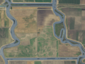
- Greco Island: This 817-acre (331-hectare) island in San Francisco Bay near Redwood City is part of the Don Edwards San Francisco Bay National Wildlife Refuge.
- Gull Rock: A Pacific island near Mount Tamalpais, about 200 feet (61 meters) long.
- Hog Island (Petaluma River): An island found in the wetlands of the Petaluma River.
- Hooks Island: This 36-acre (15-hectare) island is a salt marsh island in the Palo Alto Baylands Nature Preserve.
- Kent Island: An island in Bolinas Lagoon, near the town of Bolinas. It's about 0.5 miles (0.8 km) long.
- Mare Island: This island is in San Pablo Bay near Vallejo. It's about 3.5 miles (5.6 km) long and was once the site of a major shipyard.
- Mussel Rock: A rock formation in the Pacific Ocean near Daly City, about 200 feet (61 meters) long.
- Rat Rock: An 18-foot (5.5-meter) tall rock north of China Camp.
- Red Rock Island: This uninhabited 5.8-acre (2.3-hectare) island is in San Francisco Bay, just south of the Richmond–San Rafael Bridge. It's a unique spot where three counties meet, and it's privately owned.
- San Pedro Rock: A Pacific island near the city of Pacifica, about 800 feet (240 meters) long.
- Seal Rocks (San Francisco, California): A group of large rocks in the Pacific Ocean that are home to a sea lion colony.
- Seal Rock (San Mateo County, California): A Pacific island south of Half Moon Bay, about 500 feet (150 meters) long.
- The Sisters: A pair of small islands in San Pablo Bay, 2,000 feet (610 meters) south of Point Saint Pedro.
- Treasure Island: This 403-acre (163-hectare) artificial island in San Francisco Bay is connected to Yerba Buena Island. It was built by dredging the bay for the Golden Gate International Exposition in 1939-40.
- West Marin Island: Also near San Rafael, California.
- Newby Island: Located near Alviso, San Jose.
- Ogilvie Island: Also near Alviso, San Jose.
- Yerba Buena Island: This island in San Francisco Bay has a Coast Guard station. The San Francisco–Oakland Bay Bridge goes through it using a tunnel.
Farallon Islands
The Farallon Islands are a group of rugged small islands more than 20 miles (32 km) offshore from San Francisco. They are part of San Francisco County. These islands are divided into north, south, and middle sections, plus a large underwater bank. The waters around them were once used to dispose of radioactive waste.
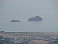
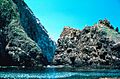
- Aulone Island and Great Arch Rock: North of Southeast Farallon Island, about 200 feet (61 meters) wide and 400 feet (120 meters) long.
- Middle Farallon Island: A medium-sized island 1.8 miles (2.9 km) northwest of Southeast Farallon Island. It's 210 feet (64 meters) long and covers 0.8 acres (0.32 hectares).
- North Farallon Island: A medium-sized island 500 feet (150 meters) long and 100 feet (30 meters) high, covering 2 acres (0.81 hectares).
- Island of St. James: A medium-sized island, 3 acres (1.2 hectares) in size, measuring 410 feet (120 meters) long and 154 feet (47 meters) high.
- Sea Lion Rock: A small island northwest of Aulon Island, about 130 feet (40 meters) long.
- Seal Rock: A small island south of Southeast Farallon Island, with a maximum height of 82 feet (25 meters).
- Maintop Island: West of Southeast Farallon Island, with a maximum height of 223 feet (68 meters).
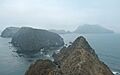
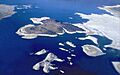
- Southeast Farallon Island: This is the largest of the Farallon Islands, covering 0.19 square miles (0.49 km2). It's the only Farallon Island where people live, and it's also where the Farallon Island Light (a lighthouse) is located.
- Sugarloaf Island: Northeast of Aulone and Great Arch Rock, about 80 feet (24 meters) high.
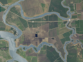
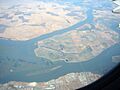
Suisun Bay and Sacramento–San Joaquin River Delta Islands
Suisun Bay Islands
Suisun Bay is an arm of the San Francisco Bay estuary. It connects the Sacramento River and San Joaquin River to the Carquinez Strait.
- Chipps Island
- Dutton Island
- Freeman Island: A small island.
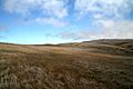
- Grizzly Island
- Hammond Island
- Joice Island: A marshy island 6 miles (9.7 km) long, north of Grizzly Bay.
- Morrow Island: A small island that is 7 feet (2 meters) high.
- Roe Island: Located in Suisun Bay.
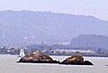
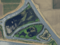
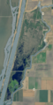
- Ryer Island: A 475-hectare (1,170-acre) island, about 2 miles (3.2 km) long. It's the largest island in some photos of the area.
- Seal Islands: Located in Suisun Bay.
- Simmons Island
- Snag Island: The smallest island in some photos of the area.
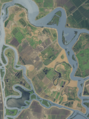
- Van Sickle Island: An island 2.5 miles (4.0 km) long at the point where the Sacramento River, San Joaquin River, and Suisun Bay meet.
- Wheeler Island
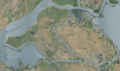
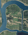
Sacramento–San Joaquin River Delta Islands
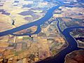
The Sacramento–San Joaquin River Delta is where the Sacramento and San Joaquin rivers meet. There are about 57 named islands in this Delta.
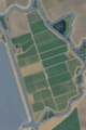
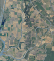
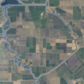
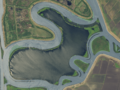
- Andrus Island: A 3,000-hectare (7,400-acre) island, surrounded by several rivers and sloughs.
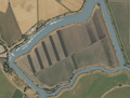
- Bacon Island: A 2,200-hectare (5,400-acre) island, surrounded by different waterways.
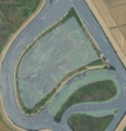
- Bethel Island: A 1,450-hectare (3,600-acre) island, surrounded by sloughs.
- Bouldin Island: A 2,400-hectare (5,900-acre) island surrounded by rivers and sloughs.
- Bradford Island: An 885-hectare (2,190-acre) island in the lower delta. You can only get there by ferry from Jersey Island.
- Browns Island: A 275-hectare (680-acre) island, surrounded by sloughs and Suisun Bay.
- Coney Island
- Dead Horse Island
- Decker Island: A small island.
- Fay Island
- Grand Island
- Jersey Island: A 1,425-hectare (3,520-acre) island, surrounded by various rivers and sloughs.
- Jones Tract: A 4,900-hectare (12,000-acre) island (actually two tracts, Upper and Lower), located 10 km (6.2 mi) east of Stockton.
- King Island: A 1,300-hectare (3,200-acre) island surrounded by sloughs.
- Kings Island: A 3.5-hectare (8.6-acre) island in Old River.
- Little Mandeville Island
- Mandeville Island
- McDonald Island: A 2,400-hectare (5,900-acre) island, surrounded by rivers and sloughs.
- Medford Island
- Merritt Island: A 5,000-acre (2,000-hectare) island formed by the Sacramento River and Elk Slough.
- Mildred Island
- Prospect Island
- Quimby Island
- Rhode Island
- Roberts Island
- Ruff and Ready Island: An island about 2.3 square miles (6.0 km2) in Stockton, California. It used to be a United States Navy base.
- Ryer Island: A 4,750-hectare (11,700-acre) island, surrounded by sloughs.
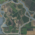
- Sherman Island: A 5,500-hectare (14,000-acre) island surrounded by the Sacramento River, Three Mile Slough, and the San Joaquin River.
- Staten Island: A 3,700-hectare (9,100-acre) island surrounded by the North and South Mokelumne Rivers.
- Sutter Island: Formed by the Sacramento River, Steamboat Slough, and Sutter Slough.
- Twitchell Island: A 3,000-hectare (7,400-acre) island, surrounded by sloughs and the San Joaquin River.
- Tyler Island
- Union Island
- Van Sickle Island
- Venice Island: A 1,250-hectare (3,100-acre) island surrounded by sloughs and the San Joaquin River.
- Victoria Island: A 2,900-hectare (7,200-acre) island surrounded by canals and rivers.
- West Island
- Winter Island
- Woodward Island: A 725-hectare (1,790-acre) island surrounded by other islands and canals.
Channel Islands
The Channel Islands are a group of eight main islands and several smaller ones in the Pacific Ocean. They are off the coast of Santa Barbara, Los Angeles, and Ventura counties in Southern California. Four of the northern islands are protected as part of Channel Islands National Park. Two of the islands are used by the U.S. Navy. These islands are part of the Greater Los Angeles Area.
- Anacapa Island: Located 14 miles (23 km) off the coast of Ventura, California. It has 728 acres (295 hectares) of land spread across three hilly islands. Only a few people live there permanently.
- Begg Rock: A 15-foot (4.6-meter) high rock, located 8 miles (13 km) from San Nicolas Island.
- Prince Island: Located near San Miguel Island and measures about 35 acres (14 hectares).
- San Clemente Island: This is the southernmost Channel Island, with 56.81 square miles (147.1 km2) of land. It's 24 miles (39 km) long and no one lives there permanently. An active U.S. Navy base is on the island. It's in Los Angeles County.
- San Juan Island: This used to be an island, but now it's mostly underwater. It's a high underwater mountain (seamount) that is usually submerged. It's known for having some of the world’s largest surf. It's the furthest out of the Channel Islands.
- San Miguel Island: This is the westernmost Channel Island. It's 8 miles (13 km) long and 3.7 miles (6.0 km) wide, covering 9,325 acres (3,774 hectares). No one lives on the island, and it's not visited very often.
- San Nicolas Island: This is considered the most remote of the Channel Islands. The U.S. Navy uses it for testing weapons and training. No civilians live there, but military personnel do. It covers 14,562 acres (5,893 hectares).
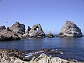
- Santa Barbara Island: This is the smallest Channel Island, covering 640 acres (260 hectares). It's located between San Nicolas and Santa Catalina Island.
- Santa Catalina Island: This is the most populated of the Channel Islands. It's about 22 miles (35 km) long and up to 8 miles (13 km) wide, covering 74.98 square miles (194.2 km2). It's in Los Angeles County.
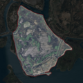
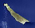
- Santa Cruz Island: Santa Cruz Island is 22 miles (35 km) long and about 4 miles (6.4 km) wide, covering 96.5 square miles (250 km2). It's the largest Channel Island. It used to be the largest privately owned island in the continental United States, but now it's public land.
- Santa Rosa Island: Santa Rosa Island covers 83.1 square miles (215 km2) and is the second largest Channel Island. Only two people live there permanently. It's about 26 miles (42 km) off the coast of Santa Barbara, California.
- Shag Rock: A small island off the north shore of Santa Barbara Island, only about 1 acre (0.40 hectares) in size.
- Sutil Island: Located off the southwest shore of Santa Barbara Island, about 12 acres (4.9 hectares) in size. It's named after a Spanish ship that explored the West Coast.
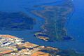
Greater Los Angeles Area Islands
The Greater Los Angeles Area is a large urban area on the Pacific coast of southern California.
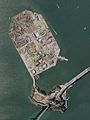
- Island Chaffee: This is an artificial island (man-made island) that also serves as an oil platform. It's named after astronaut Roger B. Chaffee and is in San Pedro Bay.
- Deadman's Island: This island with a landmark mound was at the mouth of Los Angeles Harbor. It was flattened in 1928 to build a federal prison and Coast Guard Base. It's now connected to Terminal Island.
- Freeman Island: Another artificial island and oil platform, named after astronaut Theodore Freeman. It's in San Pedro Bay.
- Island Grissom: An artificial island and oil platform named after astronaut Gus Grissom. It's in San Pedro Bay.
- Naples Islands: This is a neighborhood in Long Beach made up of three islands separated by canals that lead to Alamitos Bay.
- Terminal Island: This island was created by expanding the natural Rattlesnake Island using earth dug from San Pedro Bay. It's 3.5 miles (5.6 km) long and covers 4.46 square miles (11.6 km2).
- Island White: An artificial island and oil platform named after astronaut Ed White. It's in San Pedro Bay.
Newport Bay Islands
These islands are found in the bay connected to Newport Harbor and the city of Newport Beach, California.
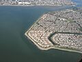
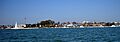
- Balboa Island: A 50-hectare (120-acre), very populated island with many expensive homes. It was partly formed by a flood in 1824 and then made bigger by people.
- Bay Island: Located west of Balboa Island.
- Collins Island: A small island at the end of Balboa Island.
- Harbor Island
- Lido Isle: Located northwest of Balboa Island.
- Linda Isle
- Newport Island: Located at the far west end of the bay.
Lake Islands
California also has islands in its lakes!
- Beaver Island: An island in the Pit River Arm of Shasta Lake, near the Pit River Bridge.
- Fannette Island: The only major island in Lake Tahoe, located inside Emerald Bay.
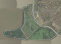
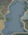
- Main Island: A 1.5-mile (2.4 km) long island in Lake Casitas, rising 512 feet (156 meters) above the lake.
- Mullet Island: A small volcanic island near the southern end of the Salton Sea.
- Negit Island: A young volcanic island in Mono Lake. It's connected to the mainland when the water is low. It's an important place for nesting birds, so it's closed to visitors in April.
- Paoha Island: This island in Mono Lake is 2.5 miles (4.0 km) long and 2 miles (3.2 km) wide. It's the largest island in Mono Lake.
- Rattlesnake Island: A 53-acre (21-hectare) island in Clear Lake.
- Red Island: A volcanic island near the southern end of the Salton Sea, located on the San Andreas Fault.
- Ridgeville Islands: A group of forested islands in the Stewart Fork arm of Trinity Lake.
- Ski Island: An island in the Pit River arm of Shasta Lake.
- Slaughterhouse Island: An island in the Sacramento River Arm of Shasta Lake.
River Islands
Many islands are also found within California's rivers.
- Cannibal Island: An island in the estuary of the Eel River.
- Circle Island: An island formed by side channels of the San Joaquin River in the San Luis National Wildlife Refuge.
- Cobbs Island: An island in the San Joaquin River north of Fresno.
- Cock Robin Island: An island in the estuary of the Eel River.
- Deer Island: An island in the Colorado River on the California–Arizona border.
- Foster Island: An island in the Sacramento River.
- Golden State Island: An island in the Sacramento River.
- Hall Island: An island in the Colorado River.
- Hanson Island: An island in the Sacramento River.
- Happy Isles: A group of small islands in the Merced River in Yosemite National Park.
- Hartley Island: An island in the Sacramento River.
- Horse Island: An island in the Colorado River.
- Ledger Island: An island in the San Joaquin River north of Fresno.
- Lower Foster Island: An island in the Sacramento River, just south of Foster Island.
- Mooney Island: An island in the Sacramento River.
- Mosley Island: The westernmost and smallest named island in the Eel River estuary.
- Packer Island: An island in the Sacramento River.
- Phelan Island: An island in the Sacramento River.
- Ryan Island: An island in the Sacramento River.
- Scout Island: A seasonal island in the San Joaquin River in north Fresno.
- Snaden Island: An island in the Sacramento River.
- Todd Island: An island in the Sacramento River.
- Turner Island: A large island along the San Joaquin River in Merced National Wildlife Refuge.
Other Interesting Islands
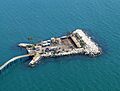
- Rincon Island: This is a 1-acre (0.40-hectare) artificial island off the coast of Ventura County. It's used for oil and gas production.
- San Mateo Rocks: These rocks are a place where sea lions rest and are a popular spot for scuba diving near San Clemente.
- Smith Island: A rocky island in San Luis Bay, near Avila Beach, California.
Images for kids
-
Sugar Loaf Island, off Cape Mendocino.
-
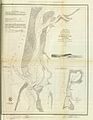
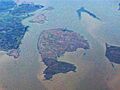
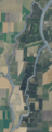
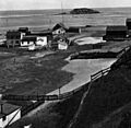
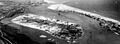
An old map showing Daby Island and Woodley Island in Humboldt Bay.
-
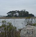
Tuluwat Island, an important place for the Wiyot people.
-
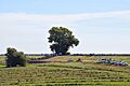
Bird Rock in Marin County.
-
Hog Island in Tomales Bay.
-
Año Nuevo Island, a protected habitat for seabirds.
-
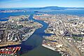
An aerial view of Alameda Island.
-
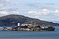
Alcatraz Island, once a famous prison.
-
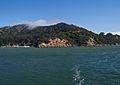
Angel Island, where many immigrants arrived.
-
Bair Island from above.
-
Bay Farm Island, now connected to the mainland.
-
Belvedere Island, now connected to the mainland.
-
Bird Island in Marin County.
-
Brooks Island from the water.
-
East and West Brother Islands.
-
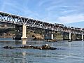
Castro Rocks under the Richmond–San Rafael Bridge.
-
Coast Guard Island in the Oakland Estuary.
-
East and West Marin Islands.
-
Greco Island in San Francisco Bay.
-
Rat Rock.
-
Red Rock Island, a privately owned island.
-
San Pedro Rock.
-
Seal Rocks, home to a sea lion colony.
-
The Sisters, two small islands in San Pablo Bay.
-
Treasure Island (left) and Yerba Buena Island (right).
-
Ogilvie Island.
-
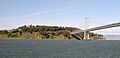
Yerba Buena Island, with the Bay Bridge tunnel.
-
Aulone Island and Great Arch Rock in the Farallons.
-
Maintop Island, part of the Farallon Islands.
-
Southeast Farallon Island, the largest of the Farallons.
-
Chipps Island in Suisun Bay.
-
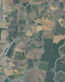
Dutton Island.
-
Freeman Island (second from top on left).
-
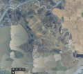
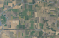
Grizzly Island.
-

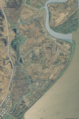
Joice Island.
-
Morrow Island.
-
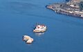
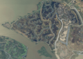
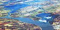
Roe Island (far right) and Ryer Island (largest in photo).
-
Simmons Island.
-
Snag Island (top center).
-
Van Sickle Island.
-
Wheeler Island.
-
Andrus Island in the Sacramento–San Joaquin River Delta.
-
Bacon Island.
-
Bethel Island.
-
Bouldin Island.
-
Bradford Island.
-
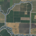
Browns Island (left) and Winter Island (right).
-
Coney Island.
-
Dead Horse Island.
-
Decker Island (top-left).
-
Fay Island.
-
Grand Island.
-
Jersey Island.
-
Jones Tract.
-
King Island.
-
Kings Island.
-
Little Mandeville Island.
-
Mandeville Island.
-
McDonald Island.
-
Medford Island.
-
Mildred Island.
-
Prospect Island.
-
Quimby Island.
-
Roberts Island.
-
Ryer Island.
-
Sherman Island (left) and West Island (right).
-
Staten Island.
-
Sutter Island.
-
Twitchell Island.
-
Tyler Island.
-
Union Island.
-
Venice Island.
-
Victoria Island.
-
Woodward Island.
-
Anacapa Island.
-
San Clemente Island.
-
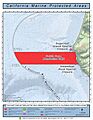
San Juan Island (Cortes Bank).
-
San Miguel Island.
-
Santa Barbara Island.
-
Santa Catalina Island.
-
Santa Cruz Island.
-
Santa Rosa Island.
-
Deadman's Island in San Pedro.
-
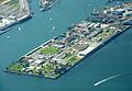
Terminal Island.
-
Balboa Island in Newport Beach.
-

Bay Island.
-
Harbor Island.
-
Lido Isle.
-
Linda Isle.
-
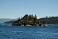
Fannette Island in Lake Tahoe.
-
Main Island in Lake Casitas.
-
Negit Island in Mono Lake.
-
Paoha Island in Mono Lake.
-
Happy Isles in Yosemite National Park.
-
Rincon Island, an artificial oil island.


.jpg)


.png)


_Highlighted.png)
.png)

.png)


.png)


.png)
.png)
.png)
.png)
.png)


.png)

.png)
.png)
.jpg)
.png)
.jpg)
.png)
.png)

.png)
.png)


See also
- Geography of California
- List of islands of the United States
- Outline of California
- Peninsulas of California
