Minneapolis–Saint Paul facts for kids
Quick facts for kids
Minneapolis–Saint Paul
|
|
|---|---|
|
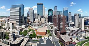
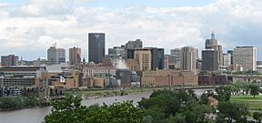
Minneapolis (top) and Saint Paul (bottom)
|
|
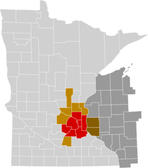
Minneapolis-St. Paul metropolitan statistical area (Met Council counties in red)
|
|
| Country | United States |
| States | Minnesota and Wisconsin |
| Principal cities | Minneapolis, Saint Paul |
| Area | |
| • Urban | 1,021.8 sq mi (2,646 km2) |
| • Metro | 8,120 sq mi (21,000 km2) |
| Highest elevation | 1,376 ft (419 m) |
| Lowest elevation | 660 ft (200 m) |
| Population
(2020)
|
|
| • Urban | 2,650,890 (16th) |
| • Urban density | 2,594.3/sq mi (1,001.7/km2) |
| • MSA | 3,690,261 (16th) |
| • CSA | 4,078,788 (16th) |
|
|
| GDP | |
| • MSA | $323.973 billion (2022) |
| Time zone | UTC−6 (CST) |
| • Summer (DST) | UTC−5 (CDT) |
| Area code(s) | 320, 507, 612, 651, 715/534, 763, 952 |
Minneapolis–Saint Paul is a large area in the Upper Midwestern United States. It's often called the Twin Cities because it includes two big cities: Minneapolis and Saint Paul. These cities are located where the Mississippi, Minnesota, and St. Croix rivers meet in Minnesota. People in Minnesota often just call the area "The Cities." It's a very important place for Minnesota's economy, culture, and government.
Minneapolis and Saint Paul are separate cities with their own boundaries. Minneapolis is mostly on the west side of the Mississippi River. It has many lakes and a busy downtown area with businesses. Saint Paul is mostly on the east side of the river. It has a smaller business area and many neighborhoods with lots of trees and old buildings. Both cities, and the smaller towns around them, have lakes, hills, and creeks.
Long ago, the Ojibwe and Dakota people lived here. Later, people from Europe settled in the area. Many early settlers in Minneapolis were from Scandinavia and were Lutheran. Saint Paul was mostly settled by French, Irish, and German Catholics. Today, both cities are home to many new immigrant groups. These include people from Mexico, Somalia, Hmong, India, Ethiopia, Vietnam, Cameroon, and Liberia.
The term "Twin Cities" can also refer to a larger area. This area includes seven counties managed by the Metropolitan Council. The U.S. government officially calls 15 counties the "Minneapolis–St. Paul–Bloomington MN–WI Metropolitan Statistical Area." It is the 16th-largest metropolitan area in the U.S. and the third-largest in the Midwest. In 2020, about 3.7 million people lived here. A even larger area, the 21-county Minneapolis–St. Paul MN–WI Combined Statistical Area, had over 4 million people in 2020.
Contents
History of the Twin Cities
Early European Settlements
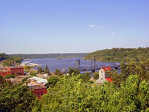
The first European settlement in this region was near Stillwater, Minnesota. This town is about 20 miles (32 km) from downtown Saint Paul. It is on the western bank of the St. Croix River, which is the border between Minnesota and Wisconsin. Another important early settlement was Fort Snelling. This fort was built from 1820 to 1825. It was located where the Minnesota River and the Mississippi River meet.
The land around Fort Snelling covered both sides of the river, up to Saint Anthony Falls. The town of Saint Anthony grew on the east side of the river, just outside the fort's land. For a few years, Colonel John H. Stevens was the only European living on the west bank. He ran a ferry service across the river. When the military land was made smaller, settlers quickly moved in. This led to the creation of the new village of Minneapolis. Minneapolis and Saint Anthony later joined together. On the east side of the Mississippi, small villages like Pig's Eye and Lambert's Landing grew into Saint Paul.
How Geography Shaped the Cities
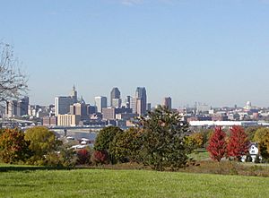
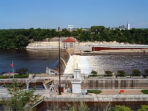
The natural landscape helped decide where the two cities grew. The Mississippi River Valley here has tall stone cliffs along the river. Saint Paul grew around Lambert's Landing. This was the last easy place to unload boats coming upriver. It was seven miles (11 km) downstream from Saint Anthony Falls. The falls were very important for Minneapolis. Their strong water power helped industries grow, making Minneapolis known as the "Mill City." You can see the falls from the Mill City Museum. This museum is in the old Washburn "A" Mill, which was once one of the world's largest mills. People used to say, "St. Paul is the last city of the East, Minneapolis the first city of the West." This showed how different their histories were.
Early Farming in the Region
The oldest farms in Minnesota are in Washington County. This county is on the eastern side of the metropolitan area. It borders the St. Croix River and Wisconsin. Joseph Haskell was the first white farmer in Minnesota. He harvested the first crops in 1840. This was on land that is now part of Afton Township.
The Grand Excursion and Tourism
The Grand Excursion was a special trip in 1854. Over a thousand curious travelers came to the Upper Midwest by train and steamboat. In 1855, Henry Wadsworth Longfellow wrote The Song of Hiawatha. This long poem was based on Ojibwe legends. It mentioned local places like Lake Minnetonka and Minnehaha Falls. Tourists were inspired by newspaper stories about the Grand Excursion and by The Song of Hiawatha. Many people visited the area in the years that followed.
Railroad History
Long ago, the Twin Cities had many passenger trains. This included streetcar systems within the cities and trains between states. Because the river was wide further south, the Minneapolis–Saint Paul area was one of the few places where trains could cross the Mississippi. A lot of commercial trains also passed through. They carried grain to be processed at Minneapolis mills. They also brought goods to Saint Paul to be shipped along the Mississippi. Saint Paul was the main point for river shipping for a long time. Later, a lock and dam was built upriver in Minneapolis.
Train travel was busiest in 1888. Nearly eight million people traveled to and from Saint Paul Union Depot. This meant about 150 trains every day. Soon, other train crossings were built further south. Travel through the region started to slow down. To compete with cars, some of the first fast "streamliner" trains ran from Chicago to Minneapolis/Saint Paul. Today, only one long-distance train service remains. It is Amtrak's Empire Builder route, which runs once a day in each direction. It goes from Seattle/Portland to Chicago. This train is named after James J. Hill, a railroad leader who lived in Saint Paul.
Economic and Social Changes
Like many older cities, Minneapolis and St. Paul changed as heavy industries became less important. This happened especially in the 1960s and 1970s. As the economy changed, fewer people lived in the city centers. Many white families moved to the suburbs. In 1967, there were race riots in Minneapolis. But by the 1980s and 1990s, Minneapolis and Saint Paul had successfully changed their economies. They focused more on services, technology, finance, and information.
In 2020, the Minneapolis–Saint Paul area gained international attention. This happened after a police officer caused the death of George Floyd. This event led to protests against racism and police actions. These protests caused a lot of damage to businesses in the area.
City Rivalry
Minneapolis and Saint Paul have always competed with each other. This sometimes led to both cities doing the same things. For example, after Saint Paul finished its beautiful cathedral in 1915, Minneapolis built the equally grand Basilica of St. Mary in 1926. In the late 1800s and early 1900s, the competition was so strong that architects working in one city often couldn't get jobs in the other. In 1890, the two cities even tried to stop each other's census takers. They wanted to make sure their city didn't seem smaller than the other.
Sometimes, the rivalry even led to fights. This happened at a 1929 baseball game between the Minneapolis Millers and the St. Paul Saints. In the 1950s, both cities wanted a major league baseball team. This led to two rival stadiums being built. For a short time in the mid-1960s, the cities couldn't agree on daylight saving time. So, people in Minneapolis were an hour "behind" those in Saint Paul for a few weeks.
By the end of the 1960s, the cities started to get along better. This was helped by new sports teams that arrived in 1961. The Minnesota Twins (baseball) and the Minnesota Vikings (football) represented the whole state. The Twins were even named for both Twin Cities. Since 1961, most major sports teams here are named for Minnesota, not just one city. In terms of building, Minneapolis often has new and modern buildings. Saint Paul tries to make new buildings fit with its older, classic styles.
Geography and Climate
Geology of the Twin Cities
Like much of Minnesota, the Twin Cities area was shaped by water and ice over millions of years. The land here has thick layers of sandstone and limestone. These layers formed when seas covered the region and then moved away. Over time, erosion created natural caves. When settlers arrived, these caves were made larger for mining. During Prohibition, some secret bars were even built in these hidden spaces. These are now known as Saint Paul's Wabasha Street Caves.
Glaciers also moved across the area, forming and changing many lakes. This left many lakes with unusual shapes. For example, Lake Minnetonka, west of the Twin Cities, has many channels and large bays. The land's height in the area ranges from 1,376 feet (419 m) above sea level in the northwest to 666 feet (203 m) by the Mississippi River in the southeast.
Twin Cities Climate
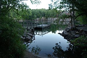
Because they are far north and inland, the Twin Cities have the coldest climate of any big city area in the U.S. However, they are in the southern part of Minnesota. Also, the cities themselves create a "heat island" effect. This makes them among the warmest places in the state. The average yearly temperature at the Minneapolis–Saint Paul International Airport is 45.4°F (7.4°C). This is warmer than many other parts of Minnesota.
Monthly average high temperatures range from 21.9°F (-5.6°C) in January to 83.3°F (28.5°C) in July. Average low temperatures for those months are 4.3°F (-15.4°C) and 63.0°F (17.2°C). Temperatures of 0°F (-18°C) or lower happen about 30 days a year. Temperatures above 90°F (32°C) happen about 15 times a year. Very hot temperatures, 100°F (38°C) or higher, are recorded about once every 4-5 years. The coldest temperature ever at the airport was -34°F (-37°C) in 1936. The hottest was 108°F (42°C) in the same year.
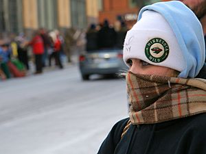
The area gets about 29.41 inches (74.7 cm) of precipitation each year. June is the wettest month, and February is the driest. Snowfall is usually plentiful, averaging 56.3 inches (143 cm) per year.
The Twin Cities often experience extreme weather. This includes strong winds, tornadoes, flash floods, droughts, heat waves, bitter cold, and blizzards. A very costly weather event was a storm in 1998. It caused over $950 million in damage from hail and wind. Other big weather events include a series of tornadoes in 1965 and major blizzards in 1940 and 1991. In January 2019, Minnesota had its coldest temperatures since 1996. A polar vortex made temperatures drop very low, even colder than on Mars in some parts of the state.
The growing season for plants in the metro area is usually from late April or early May through October.
Communities in the Twin Cities
Metropolitan Statistical Area (MSA)
The Minneapolis–St. Paul–Bloomington MN–WI Metropolitan Statistical Area includes 15 counties. Thirteen of these are in Minnesota, and two are in Wisconsin. The Minnesota part of this area has almost two-thirds of Minnesota's total population.

| County | Seat | 2021 estimate | 2020 census | Change | Area | Density |
|---|---|---|---|---|---|---|
| Hennepin | Minneapolis | 1,267,416 | 1,281,565 | −1.10% | 607 sq mi (1,570 km2) | 2,088/sq mi (806/km2) |
| Ramsey | Saint Paul | 543,257 | 552,352 | −1.65% | 170 sq mi (440 km2) | 3,196/sq mi (1,234/km2) |
| Dakota | Hastings | 442,038 | 439,882 | +0.49% | 587 sq mi (1,520 km2) | 753/sq mi (291/km2) |
| Anoka | Anoka | 367,018 | 363,887 | +0.86% | 446 sq mi (1,160 km2) | 823/sq mi (318/km2) |
| Washington | Stillwater | 272,256 | 267,568 | +1.75% | 423 sq mi (1,100 km2) | 644/sq mi (249/km2) |
| Scott | Shakopee | 153,268 | 150,928 | +1.55% | 365 sq mi (950 km2) | 420/sq mi (160/km2) |
| Wright | Buffalo | 144,845 | 141,337 | +2.48% | 714 sq mi (1,850 km2) | 203/sq mi (78/km2) |
| Carver | Chaska | 108,626 | 106,922 | +1.59% | 376 sq mi (970 km2) | 289/sq mi (112/km2) |
| Sherburne | Elk River | 99,074 | 97,183 | +1.95% | 451 sq mi (1,170 km2) | 220/sq mi (85/km2) |
| St. Croix, WI | Hudson | 95,044 | 93,536 | +1.61% | 736 sq mi (1,910 km2) | 129/sq mi (50/km2) |
| Chisago | Center City | 57,469 | 56,621 | +1.50% | 442 sq mi (1,140 km2) | 130/sq mi (50/km2) |
| Pierce, WI | Ellsworth | 42,587 | 42,212 | +0.89% | 592 sq mi (1,530 km2) | 72/sq mi (28/km2) |
| Isanti | Cambridge | 41,906 | 41,135 | +1.87% | 452 sq mi (1,170 km2) | 93/sq mi (36/km2) |
| Le Sueur | Le Center | 28,841 | 28,674 | +0.58% | 449 sq mi (1,160 km2) | 64/sq mi (25/km2) |
| Mille Lacs | Milaca | 26,867 | 26,459 | +1.54% | 682 sq mi (1,770 km2) | 39/sq mi (15/km2) |
| Total | 3,690,512 | 3,690,261 | +0.01% | 8,093 sq mi (20,960 km2) | 456/sq mi (176/km2) |
Combined Statistical Area (CSA)
The Minneapolis–St. Paul, MN–WI Combined Statistical Area is even larger. It includes 19 counties in Minnesota and two in Wisconsin. This area has two metropolitan areas and four smaller "micropolitan" areas. In 2020, the CSA had a population of about 4.08 million people.
| Statistical Area | 2021 Estimate | 2020 Census | Change | Area | Density |
|---|---|---|---|---|---|
| Minneapolis–St. Paul–Bloomington MN–WI Metropolitan Statistical Area | 3,690,512 | 3,690,261 | +0.01% | 8,093 sq mi (20,960 km2) | 456/sq mi (176/km2) |
| St. Cloud, MN Metropolitan Statistical Area (Stearns and Benton counties) | 200,406 | 199,801 | +0.30% | 1,803 sq mi (4,670 km2) | 111/sq mi (43/km2) |
| Faribault-Northfield, MN Micropolitan Statistical Area (Rice County) | 67,262 | 67,097 | +0.25% | 516 sq mi (1,340 km2) | 130/sq mi (50/km2) |
| Red Wing, MN Micropolitan Statistical Area (Goodhue County) | 47,968 | 47,582 | +0.81% | 780 sq mi (2,000 km2) | 61/sq mi (24/km2) |
| Owatonna, MN Micropolitan Statistical Area (Steele County) | 37,349 | 37,406 | −0.15% | 432 sq mi (1,120 km2) | 86/sq mi (33/km2) |
| Hutchinson, MN Micropolitan Statistical Area (McLeod County) | 36,735 | 36,771 | −0.10% | 506 sq mi (1,310 km2) | 73/sq mi (28/km2) |
| Total | 4,080,232 | 4,078,788 | +0.04% | 12,130 sq mi (31,400 km2) | 336/sq mi (130/km2) |
Cities and Towns in the Area
There are about 218 towns and cities in the Twin Cities area. This includes cities and villages in Wisconsin. Here are some of the main ones, with their populations from the 2020 census:
Main Cities
- Minneapolis (429,954 people)
- Saint Paul (311,527 people)
Cities with 50,000 to 99,999 People
- Bloomington (89,987)
- Brooklyn Park (86,478)
- Plymouth (81,026)
- Woodbury (75,102)
- Maple Grove (70,253)
- Blaine (70,222)
- Lakeville (69,490)
- Eagan (68,855)
- Burnsville (64,317)
- Eden Prairie (64,198)
- Coon Rapids (63,599)
- Apple Valley (56,374)
- Minnetonka (53,781)
- Edina (53,494)
- St. Louis Park (50,010)
Cities with 25,000 to 49,999 People
- Shakopee (43,698)
- Maplewood (42,088)
- Cottage Grove (38,839)
- Richfield (36,994)
- Roseville (36,254)
- Inver Grove Heights (35,801)
- Brooklyn Center (33,782)
- Andover (32,601)
- Savage (32,465)
- Fridley (29,590)
- Oakdale (28,303)
- Chaska (27,810)
- Ramsey (27,646)
- Prior Lake (27,617)
- Shoreview (26,921)
- Chanhassen (25,947)
- Elk River (25,835)
- Rosemount (25,650)
Cities with 10,000 to 24,999 People
- White Bear Lake (24,883)
- Champlin (23,919)
- Farmington (23,632)
- New Brighton (23,454)
- Crystal (23,330)
- Golden Valley (22,552)
- Hastings (22,154)
- New Hope (21,986)
- Columbia Heights (21,973)
- Lino Lakes (21,399)
- South St. Paul (20,759)
- West St. Paul (20,615)
- Forest Lake (20,611)
- Otsego (19,956)
- Stillwater (19,394)
- Hopkins (19,079)
- St. Michael (18,235)
- Anoka (17,921)
- Ham Lake (16,464)
- River Falls, Wisconsin (16,182)
- Buffalo (16,168)
- Hugo (15,766)
- Hudson, Wisconsin (14,755)
- Robbinsdale (14,646)
- Monticello (14,455)
- Rogers (13,295)
- Mounds View (13,249)
- Waconia (13,033)
- Vadnais Heights (12,912)
- North St. Paul (12,364)
- East Bethel (11,786)
- Mendota Heights (11,744)
- Big Lake (11,686)
- Lake Elmo (11,335)
- Little Canada (10,819)
- North Branch (10,787)
- Victoria (10,546)
Culture and Fun
Arts and Entertainment
The Twin Cities area has many great places for fine art and performances. Art museums include the Minneapolis Institute of Art and the Walker Art Center. Other museums focus on science, natural history, and technology. The Minnesota Orchestra and the Saint Paul Chamber Orchestra are professional music groups. The Guthrie Theater is a famous theater by the Mississippi River. The Minnesota Fringe Festival is a yearly event that celebrates theater, dance, and more.
The Twin Cities is also home to Minnesota Public Radio (MPR). This is the second-largest public radio station in the U.S. It has stations for classical music and modern music. The show A Prairie Home Companion used to be broadcast live from the Fitzgerald Theater in Saint Paul. This radio show was even made into a movie.
The Brave New Workshop Comedy Theater in Minneapolis is the oldest comedy theater in the country. It features sketch comedy and improvisation.
The Current radio station and the Walker Art Center host a yearly music festival called Rock the Garden. It features both famous and local artists. The festival has been held since 2008.
The Basilica of Saint Mary in Minneapolis also hosts a yearly music festival. It's called the Basilica Block Party. This festival helps raise money to restore the basilica. It brings about 25,000 people to downtown Minneapolis.
The Twin Cities area has many places where artists perform. First Avenue in Minneapolis is famous. Many well-known artists and bands from the area started there, like Prince. It became even more famous after Prince's movie Purple Rain featured it.
Outdoor Activities
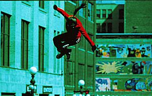
There are many lakes in the region. Some cities have large park systems for fun. People enjoy events like the Great River Energy bicycle festival and the Twin Cities Marathon. Some studies show that people here are very active and fit.
Many people in the Twin Cities own or share cabins by lakes in northern Minnesota. They often take weekend trips "up North" in warmer months. Ice fishing is a popular winter activity. Hunting, snowmobiling, and ATV riding are also common outdoor hobbies. This love for the outdoors also means many Minnesotans care about the environment.
In 2011 and 2012, Minneapolis–Saint Paul was named the healthiest big city area in the U.S. by the American College of Sports Medicine.
Sports in the Twin Cities
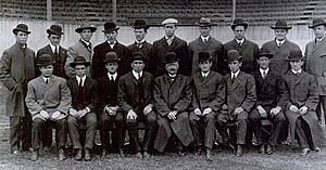
The Twin Cities is one of only 12 U.S. cities with teams in all four major professional sports. These are baseball (MLB), football (NFL), basketball (NBA), and ice hockey (NHL). If you include Major League Soccer (MLS), it's one of 11 metro areas with five major professional sports teams. To be fair to both cities, most teams use "Minnesota" in their names instead of "Minneapolis" or "St. Paul."
Minneapolis has hosted two Super Bowls, in 1992 and 2018. This is the farthest north a Super Bowl has ever been played. The Minnesota Vikings have played in four Super Bowls.
The World Series has been played in the Twin Cities three times. Three Major League Baseball All-Star Games have also been held here. Other big sports events include NHL All-Star games, NBA All-Star games, and MLS All-Star games.
The Stanley Cup Finals (ice hockey) have been played here twice. The NCAA (college) basketball tournament's Final Four has been hosted by Minneapolis four times for men and twice for women. The NCAA men's hockey tournament, called the Frozen Four, has been hosted nine times.
Major golf tournaments like the U.S. Open and PGA Championship have also been held in the Twin Cities. The Ryder Cup golf event is scheduled to return in 2028.
The World Figure Skating Championships were held in Minneapolis in 1998. The X Games were also held in Minneapolis in 2017, 2018, and 2019.
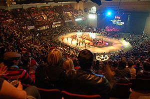
The Twin Cities has three Roller Derby leagues that compete nationally. The yearly Twin Cities Marathon takes place in the fall, running through Minneapolis and Saint Paul. Minneapolis is where Rollerblades were invented. It's also a big center for inline skating. More people play golf here per person than in any other U.S. city. Also, water skiing started on Lake Pepin, a lake southeast of the metro area.
Some sports teams got their names from being in Minnesota before they moved. The Los Angeles Lakers basketball team is named after Minneapolis, the "City of Lakes." The Dallas Stars hockey team got its name from when it was the Minnesota North Stars.
Professional Sports Teams
| Club | Sport | League | Venue | City | Since | Titles |
|---|---|---|---|---|---|---|
| Minnesota Twins | Baseball | American League, Major League Baseball | Target Field | Minneapolis | 1961 | 1987, 1991 |
| St. Paul Saints | Baseball | International League, Minor League Baseball | CHS Field | St. Paul | 1993 | 2019 (AA) 1993, 1995, 1996, and 2004 (NL) |
| Minnesota Vikings | American football | National Football League | U.S. Bank Stadium | Minneapolis | 1961 | 1969 (Not Super Bowl) |
| Minnesota Vixen | American football | Women's Football Alliance | Sea Foam Stadium | St. Paul | 1999 | |
| Minnesota Timberwolves | Basketball | National Basketball Association | Target Center | Minneapolis | 1989 | |
| Minnesota Lynx | Basketball | Women's National Basketball Association | Target Center | Minneapolis | 1999 | 2011, 2013, 2015, 2017 |
| Minnesota Wild | Ice hockey | National Hockey League | Xcel Energy Center | St. Paul | 2000 | |
| Minnesota Frost | Ice hockey | Professional Women's Hockey League | Xcel Energy Center | St. Paul | 2023 | 2024 |
| Minnesota United FC | Soccer | Major League Soccer | Allianz Field | St. Paul | 2015 | 2011 (NASL) |
The Twin Cities are also home to the University of Minnesota Golden Gophers. They play in the Big Ten Conference for college sports.
Media and News
Newspapers
The Twin Cities have two main daily newspapers: the Star Tribune and the Saint Paul Pioneer Press. The Minnesota Daily is a newspaper for the University of Minnesota's Twin Cities campus. There is also a weekly newspaper called East Side Review for St. Paul's eastern part.
Television Stations
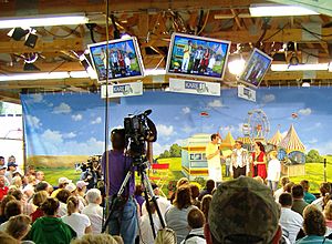
The Twin Cities is the 15th-largest television market in the U.S. This means many people watch TV here. Several TV stations operate in the area. For example, Twin Cities PBS has two channels, KTCA and KTCI. Hubbard Broadcasting owns ABC affiliate KSTP-TV and independent station KSTC-TV. Fox Television Stations owns Fox station KMSP-TV and MyNetworkTV station WFTC.
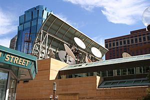
CBS station WCCO-TV is the only main local TV station with its studio in Minneapolis. Other major stations are in Saint Paul or nearby suburbs. For many years, WCCO and KARE have had the most popular evening news shows.
Some TV shows that started in the Twin Cities have been shown across the country. KTCA created the science show Newton's Apple. Other funny shows also started here. In the 1980s, KTMA created Mystery Science Theater 3000. This show made fun of old movies and became very popular.
Radio Stations
The Twin Cities radio market is also very large. In 2018, it was ranked 15th in the U.S. Most of the top morning radio shows are on FM stations. Many stations are owned by iHeartMedia. Most stations broadcast both on air and online.
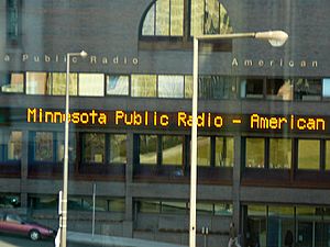
The Twin Cities has both commercial and non-commercial radio stations. Minnesota Public Radio (MPR) is a big public radio network. It broadcasts on three stations in the area. One station, KNOW, has news and talk shows. Another, KSJN, plays classical music. The third, KCMP, plays alternative music. MPR was known for the show A Prairie Home Companion for many years. MPR is the second-largest producer of content for National Public Radio (NPR).
Economy and Jobs
The Minneapolis–Saint Paul area is a major economic center. It is home to 24 companies listed in the Fortune 1000. These are some of the largest companies in the U.S.
| MSP Rank |
Company | City | Sector | Fortune Rank |
|---|---|---|---|---|
| 1 | United Health Group | Minnetonka | Healthcare | 5 |
| 2 | Target | Minneapolis | Retailing | 32 |
| 3 | Best Buy | Richfield | Retailing | 68 |
| 4 | CHS | Inver Grove Heights | Agricultural coop | 95 |
| 5 | 3M | Maplewood | Industrial | 102 |
| 6 | U S Bancorp | Minneapolis | Banking | 150 |
| 7 | C H Robinson | Eden Prairie | Logistics | 154 |
| 8 | General Mills | Golden Valley | Food | 201 |
| 9 | Land O'Lakes | Arden Hills | Agricultural coop | 232 |
| 10 | Ameriprise Financial | Minneapolis | Financial | 277 |
| 11 | Xcel Energy | Minneapolis | Energy | 278 |
| 12 | Ecolab | St. Paul | Industrial | 293 |
| 13 | Thrivent Financial | Minneapolis | Financial | 351 |
| 14 | Polaris | Medina | Recreational equipment | 419 |
| 15 | Securian Financial Group | St. Paul | Financial | 464 |
| 16 | Patterson Companies | Mendota Heights | Dental / Veterinary products | 429 |
| 17 | Bright Health Group | Minneapolis | Healthcare | 688 |
| 18 | Toro | Bloomington | Lawn care equipment | 697 |
| 19 | APi Group | New Brighton | Construction | 701 |
| 20 | Winnebago Industries | Eden Prairie | Recreational vehicles | 737 |
| 21 | H.B. Fuller | Vadnais Heights | Adhesives | 787 |
| 22 | Donaldson Company | Bloomington | Filtration | 861 |
| 23 | Vista Outdoor | Anoka | Recreational equipment | 975 |
| 24 | Sleep Number | Minneapolis | Bedding | 982 |
Other big companies headquartered here include Cargill, which is the largest private company in the U.S. Many foreign companies also have their U.S. headquarters in the Twin Cities.
The Twin Cities' economy is the 13th-largest in the nation. It is the second-largest in the Midwest after Chicago. The area is also a major center for making medical devices. It is the second-largest in North America for this industry. It is also the fourth-largest U.S. banking center.
The Federal Reserve Bank of Minneapolis covers a large area. This includes Minnesota, Montana, North and South Dakota, parts of Wisconsin, and Michigan.
Education
Colleges and Universities
- Adler Graduate School – Minnetonka
- Anoka-Ramsey Community College – Coon Rapids and Cambridge
- Anoka Technical College – Anoka
- Augsburg University – Minneapolis
- Bethany Global University - Bloomington
- Bethel University – Arden Hills
- Capella University – Minneapolis
- Century College – White Bear Lake
- Concordia University – Saint Paul
- Crown College – St. Bonifacius
- Dakota County Technical College – Rosemount
- Dunwoody College of Technology – Minneapolis
- Hamline University – Saint Paul
- Hennepin Technical College – Eden Prairie and Brooklyn Park
- Inver Hills Community College – Inver Grove Heights
- Luther Seminary – Saint Paul
- Macalester College – Saint Paul
- Metropolitan State University – Saint Paul and Minneapolis
- Minneapolis College of Art and Design – Minneapolis
- Minneapolis College – Minneapolis
- Minnesota State University – Edina
- Mitchell Hamline School of Law – Saint Paul
- Normandale Community College – Bloomington
- North Central University – Minneapolis
- North Hennepin Community College – Brooklyn Park
- Northwestern Health Sciences University – Bloomington
- Rasmussen University – Bloomington, Blaine, Brooklyn Park, Eagan and Lake Elmo
- St. Catherine University – Saint Paul and Minneapolis
- St. Cloud State University – St. Cloud and Maple Grove
- St. Mary's University of Minnesota – Minneapolis
- Saint Paul College – Saint Paul
- United Theological Seminary – Saint Paul
- University of Minnesota – Minneapolis and Saint Paul (Falcon Heights)
- University of Northwestern – St. Paul – Roseville
- University of St. Thomas – Saint Paul and Minneapolis
- University of Wisconsin – River Falls and Hudson
- Walden University – Minneapolis
Libraries in the Area
- Anoka County Library - 9 branches
- Bayport Public Library - 1 branch
- Carver County Library - 6 branches
- Dakota County Library - 10 branches
- East Central Regional Library - 8 branches
- Hennepin County Library - 41 branches
- Ramsey County Library - 7 branches
- St. Paul Public Library - 13 branches
- Scott County Library - 7 branches
- Stillwater Public Library - 1 branch
- Washington County Library - 7 branches
Infrastructure and Transportation
Buildings and Architecture
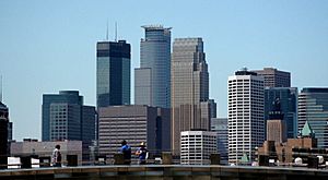
Most of the tallest buildings in the Twin Cities are in downtown Minneapolis. There is some debate about which building is the very tallest. Many people think it's the IDS Center. But some sources say Capella Tower is slightly taller. The IDS Center is taller because of a small structure on its roof. The tallest building in Saint Paul is Wells Fargo Place.
Buildings have been built and torn down quickly in the area. Some city blocks have been rebuilt many times since the mid-1800s. There isn't one main building style here. The cities have a mix of different designs. However, some older styles stand out. There used to be many stone buildings in the Romanesque style. Minneapolis City Hall is a good example. Later, the Art Deco style brought buildings like St. Paul City Hall and the Foshay Tower. Minneapolis tends to have modern glass buildings. Saint Paul tries to make new buildings fit with its older, classic styles.
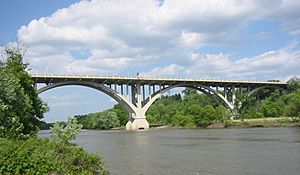
After World War II, both Saint Paul and Minneapolis changed a lot. Many old buildings were lost. But some large, strong buildings survived. The area is also known for its many bridges. Several strong concrete arch bridges were built over the Mississippi River in the 1920s and 1930s. They are still used today. Many of these bridges are listed on the National Register of Historic Places. The area also had the first known permanent crossing of the Mississippi River. Both downtown areas have many enclosed walkways called skyways.
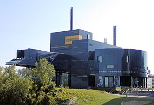
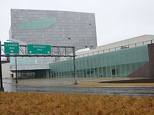
Several important buildings in Minneapolis have helped make the city modern. These include the Walker Art Center, the Central Public Library, the Weisman Art Museum, and the Guthrie Theater. The new Walker Art Center opened in 2005. It is known for its art and for getting people involved. The Guthrie Theater opened in 2006. It was designed by Jean Nouvel and has three theaters.
Healthcare and Hospitals
Hospitals with Number of Beds
Trauma Centers - Level I *; Level II **
Allina Health
- Abbott Northwestern Hospital - Minneapolis - 686
- Mercy Hospital - Coon Rapids - 271 **
- Mercy Hospital (Unity Campus) - Fridley - 164
- Phillips Eye Institute - Minneapolis - 8
- Regina Hospital - Hastings - 43
- St.Francis Regional Medical Center - Shakopee - 89
- United Hospital - St. Paul - 556
Children's Minnesota - 381
- Children's Minnesota Hospital - Minneapolis
- Children's Minnesota Hospital - St. Paul
Gillette Children's Specialty Healthcare
- Gillette Children's Hospital - St. Paul - 60
HealthPartners Park Nicollet
- Lakeview Hospital - Stillwater - 90
- Methodist Hospital - St. Louis Park - 361
- Regions Hospital - St. Paul - 552 *
- St. Francis Regional Medical Center - Shakopee - 89
Hennepin Healthcare
- Hennepin County Medical Center - Minneapolis - 484 *
M Health Fairview
- M Health Fairview Lakes Medical Center - Wyoming - 61
- M Health Fairview Ridges Hospital - Burnsville - 171
- M Health Fairview Southdale Hospital - Edina - 334
- M Health Fairview University of Minnesota Medical Center - Minneapolis - 828 **
- M Health Fairview University of Minnesota Masonic Children's Hospital - Minneapolis - 212
- St. John's Hospital - Maplewood - 184
- M Health Fairview Woodwinds Hospital - Woodbury - 86
North Memorial Health
- Maple Grove Hospital - Maple Grove - 130
- North Memorial Health Hospital - Robbinsdale - 353 *
Ridgeview Health
- Ridgeview Medical Center - Waconia - 124
Veterans Administration Health Care
- Veterans Administration Medical Center - Minneapolis - 845
Transportation Options
Roads and Highways
In the 1900s, the Twin Cities area grew a lot. Cars made it easy for suburbs to expand. Now, the area has many freeways. There are also traffic cameras and ramp meters to help manage traffic. Some lanes are for HOVs, meaning cars with more than one person. You can also pay to use these lanes with a MnPASS transponder.
I-94 enters the area from the east and goes northwest from Minneapolis. Two loop highways, I-494 and I-694, go around the cities. I-35 splits in the south. I-35E goes to Saint Paul, and I-35W goes to Minneapolis. They join again in the north. This is one of only two places in the U.S. where an interstate highway splits and then rejoins.
On August 1, 2007, a part of the I-35W Mississippi River bridge collapsed. A new bridge opened in September 2008.
 US 10
US 10 US 12
US 12 US 52 (Lafayette Freeway)
 US 61 (Blues Highway)
 US 169 (Johnson Memorial Highway)
 US 212 (Minnesota Veterans Memorial Highway)
 MN 3
MN 3 MN 5
MN 5 MN 7
MN 7 MN 13
MN 13 MN 36
MN 36 MN 47
MN 47 MN 51 (Snelling Avenue North)
 MN 55 (Olson Memorial Highway)
 MN 62 (Crosstown Highway)
 MN 65
MN 65 MN 77 (Cedar Avenue)
 MN 100
 MN 101
 MN 120
 MN 149
 MN 252
 MN 156
 MN 280
 MN 610
Airports and Air Travel
The main airport in the region is Minneapolis–Saint Paul International Airport (MSP). It is a major hub for Delta Air Lines and the main base for Sun Country Airlines. There are also six smaller airports in the area. Some people even fly to the Twin Cities from northern Minnesota for work.
Relief airports in the metropolitan area are:
Public Transportation
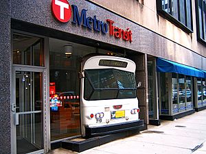
Metro Transit is the biggest bus service in the area. It grew from the old streetcar lines. Metro Transit provides most of the public transit rides. It has over 900 buses. The University of Minnesota, Twin Cities has a free bus system between its campuses.
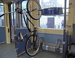
The METRO Blue Line LRT (light rail) started in 2004. It connects downtown Minneapolis, the airport, and the Mall of America. The METRO Red Line BRT (bus rapid transit) started in 2013. It connects the Mall of America to southern suburbs. The METRO Green Line LRT opened in 2014. It connects downtown Minneapolis, the University, and downtown Saint Paul. Metro Transit runs all three lines. The Northstar Line commuter train connecting Minneapolis with Big Lake opened in 2009.
The METRO system has six different projects. There are two light rail lines: the Blue Line and the Green Line. There are also three BRT lines: the Red Line, Orange Line, A Line, C Line, and D Line.
- Blue Line LRT: Target Field Station – Minneapolis-St Paul International Airport – Mall of America
- Green Line LRT: Target Field Station – University of Minnesota – Union Depot
- Orange Line BRT: Downtown Minneapolis – Burnsville Heart of the City
- Red Line BRT: Mall of America – Apple Valley Transit Station
- A Line BRT: 46th Street station – Rosedale Transit Center
- C Line BRT: Downtown Minneapolis – Brooklyn Center Transit Center
- D Line BRT: Mall of America – Brooklyn Center Transit Center
State and local governments are thinking about more rail services. This includes streetcar systems and more light rail. Minnesota is also looking into high-speed rail service to Chicago.
Some people say the Twin Cities need better public transportation. The system is not as strong as in some other cities of its size. Roads are getting wider, but traffic is growing even faster. Public transportation hasn't grown as much as the population. New lines are being built to improve public transportation. This includes an extension of the Green Line and a Blue Line extension. The METRO Gold Line BRT is also planned to connect downtown Saint Paul to eastern suburbs.
See also
 In Spanish: Área metropolitana de Minneapolis-Saint Paul para niños
 | William M. Jackson |
 | Juan E. Gilbert |
 | Neil deGrasse Tyson |


