
Alberta facts for kids
Quick facts for kids
Alberta
|
|||
|---|---|---|---|
|
|||
| Motto(s): | |||
| Country | Canada | ||
| Confederation | September 1, 1905 (split from NWT) (10th, with Saskatchewan) | ||
| Capital | Edmonton | ||
| Largest city | Calgary | ||
| Largest metro | Calgary Region | ||
| Government | |||
| • Type | Parliamentary constitutional monarchy | ||
| Area | |||
| • Total | 661,849 km2 (255,541 sq mi) | ||
| • Land | 640,082 km2 (247,137 sq mi) | ||
| • Water | 19,532 km2 (7,541 sq mi) 3% | ||
| Area rank | Ranked 6th | ||
| 6.6% of Canada | |||
| Population
(2021)
|
|||
| • Total | 4,368,370 | ||
| • Estimate
(Q2 2024)
|
4,849,906 | ||
| • Rank | Ranked 4th | ||
| • Density | 6.82/km2 (17.7/sq mi) | ||
| Demonym(s) | Albertan | ||
| Official languages | English | ||
| GDP | |||
| • Rank | 3rd | ||
| • Total (2022) | CA$459.288 billion | ||
| • Per capita | CA$101,818 (3rd) | ||
| HDI | |||
| • HDI (2021) | 0.955—Very high ([[List of Canadian provinces and territories by Human Development Index|1st]]) | ||
| Time zone | UTC−07:00 (Mountain) | ||
| • Summer (DST) | UTC−06:00 (Mountain DST) | ||
| Postal abbr. |
AB
|
||
| Postal code prefix |
T
|
||
| ISO 3166 code | CA-AB | ||
| Flower | Wild rose | ||
| Tree | Lodgepole pine | ||
| Bird | Great horned owl | ||
| Rankings include all provinces and territories | |||


Alberta is one of Canada's thirteen provinces and territories. It is located in Western Canada. Alberta is one of the three prairie provinces.
It shares borders with British Columbia to the west and Saskatchewan to the east. To the north is the Northwest Territories, and to the south is the U.S. state of Montana. Alberta is one of only two provinces in Canada that are landlocked, meaning they don't touch an ocean. The other is Saskatchewan.
The eastern part of Alberta has flat lands called the Great Plains. The western part borders the Rocky Mountains. The province mostly has a continental climate, which means it has warm summers and cold winters. Temperatures can change quickly here. However, in western Alberta, special winds called Chinook winds can make winter temperatures milder.
Alberta is the fourth largest province in Canada by land area, covering about 661,848 square kilometres (255,541 square miles). It is also the fourth most populated, with over 4.2 million people. Edmonton is Alberta's capital city. Calgary is its largest city. More than half of all Albertans live in either Edmonton or Calgary. This often leads to a friendly rivalry between the two cities. English is the official language of Alberta.
Alberta's economy is strong. It is based on hydrocarbons (like oil and gas), petrochemicals, and farming. The oil and gas industry has been very important since 1947. That's when a lot of oil was found at the Leduc No. 1 well. Alberta has the most hydrocarbons in Canada. It produces 70% of Canada's oil and natural gas. In 2018, Alberta's economy was worth CA$338.2 billion. This was about 15% of Canada's total economy.
For a long time, Alberta was seen as a conservative province in terms of politics. The Progressive Conservatives held power for a very long time, from 1971 to 2015. This was the longest time any party has continuously governed at the provincial or federal level in Canadian history.
Before Alberta became part of Canada, it was home to several First Nations groups. These included the Plains Indians and Woodland Cree. It was also a place where fur traders from different companies like the Hudson's Bay Company and North West Company did business. Canada bought these lands in 1870. Many immigrants came in the late 1800s and early 1900s. They helped grow wheat and raise cattle, which became very profitable. In 1905, the Alberta Act was passed, and Alberta officially became a province. Large oil reserves were found in 1947. The process of getting oil from oil sands started in 1967.
Alberta is known for its beautiful nature. It has many fossils and important nature reserves. Six UNESCO World Heritage Sites are in Alberta. These include the Canadian Rocky Mountain Parks, Dinosaur Provincial Park, and Wood Buffalo National Park. Other popular places are Banff National Park and Jasper National Park.
Contents
What Does the Name Alberta Mean?
Alberta was named after Princess Louise Caroline Alberta. She lived from 1848 to 1939. Princess Louise was the fourth daughter of Queen Victoria. She was also the wife of John Campbell, who was the Governor General of Canada from 1878 to 1883. Other places like Lake Louise and Mount Alberta are also named after her.
The name "Alberta" comes from "Albert," which was Princess Louise's father's name. He was Prince Consort. The name "Albert" means "noble" and "bright" or "famous."
Exploring Alberta's Geography

Alberta covers an area of about 661,848 square kilometres (255,541 square miles). This makes it the fourth-largest province in Canada. It is smaller than Quebec, Ontario, and British Columbia.
Alberta's southern border is at the 49th parallel north. This line separates it from the U.S. state of Montana. The 60th parallel north divides Alberta from the Northwest Territories. To the east, the 110th meridian west separates Alberta from Saskatchewan. To the west, its border with British Columbia follows the 120th meridian west until it reaches the Continental Divide in the Rocky Mountains. From there, the border follows the mountain peaks south to Montana.
The province stretches 1,223 kilometres (760 miles) from north to south. It is 660 kilometres (410 miles) wide at its widest point. The highest spot in Alberta is Mount Columbia in the Rocky Mountains, at 3,747 metres (12,293 feet). The lowest point is 152 metres (499 feet) on the Slave River in Wood Buffalo National Park.
Alberta has many rivers and lakes. People use them for swimming, fishing, and other water sports. There are three large lakes: Lake Claire (1,436 km2 [554 sq mi]), Lesser Slave Lake (1,168 km2 [451 sq mi]), and Lake Athabasca (7,898 km2 [3,049 sq mi]). Lake Athabasca is partly in Saskatchewan. The longest river is the Athabasca River, which flows 1,538 km (956 mi) from the Rocky Mountains to Lake Athabasca. The largest river is the Peace River.
Edmonton, Alberta's capital, is near the center of the province. It is the most northern major city in Canada. It is a key place for developing resources in northern Canada. Calgary is about 280 km (170 mi) south of Edmonton. It is surrounded by large ranching areas. Almost 75% of Alberta's population lives in the Calgary–Edmonton Corridor. This is the area between Calgary and Edmonton.

Most of northern Alberta is covered by boreal forest. The Rocky Mountains in the southwest have temperate coniferous forests. The southern part of the province is prairie. This includes shortgrass prairie and mixed grass prairie. The central area, called aspen parkland, has very fertile soil. Most of Alberta's population lives here. Much of the open land is used for grain farming or cattle ranching.
The Alberta badlands are in southeastern Alberta. Here, the Red Deer River has carved deep canyons. Dinosaur Provincial Park is in the badlands. It shows off the unique landscape and fossils from when dinosaurs lived here.
Alberta's Weather and Climate

Alberta is very long from north to south, so its weather changes a lot. In January, average high temperatures can be 0 °C (32 °F) in the southwest. But they can drop to −24 °C (−11 °F) in the far north. The Rocky Mountains also affect the climate. They block winds from the west, causing less rain in much of Alberta. This is called a rain shadow.
Northern Alberta has a subarctic climate and is mostly boreal forest. Southern Alberta's farming areas have a semi-arid climate because not enough rain falls. The southeastern part of Alberta can get very hot in summer and has low rainfall. This often causes problems for crops. Western Alberta gets milder temperatures in winter because of warm, dry Chinook winds from the mountains.

Alberta has a humid continental climate with warm summers and cold winters. Cold air from the Arctic can bring very cold winter conditions. Temperatures can change very quickly. In winter, extreme cold can reach −54 °C (−65 °F) in the north. In summer, temperatures can go over 40 °C (104 °F) in the southeast.
Alberta is a sunny province. It gets between 1,900 and 2,600 hours of sunshine each year. Northern Alberta has about 18 hours of daylight in summer. Average daytime temperatures in summer range from 21 °C (70 °F) in the mountains to 28 °C (82 °F) in the dry prairie.
In winter, a type of fast-moving storm called the "Alberta clipper" often forms here. These storms move quickly across Canada and the northern United States. In southwestern Alberta, warm Chinook winds often break up the cold winters. Temperatures can rise quickly, sometimes from −19 to 22 °C (−2 to 72 °F) in just one hour! The area around Lethbridge gets the most Chinooks.
Alberta has about 15 tornadoes each year, which is the second most in Canada after Saskatchewan. Thunderstorms are common in summer, especially in central and southern Alberta. The area around Calgary and Edmonton gets a lot of hail. This is because of the nearby Rocky Mountains.
| Community | Region | July daily maximum |
January daily maximum |
Annual precipitation |
Plant hardiness zone |
|---|---|---|---|---|---|
| Medicine Hat | Southern Alberta | 28 °C (82 °F) | −3 °C (27 °F) | 323 mm (12.7 in) | 4b |
| Brooks | Southern Alberta | 28 °C (82 °F) | −4 °C (25 °F) | 301 mm (11.9 in) | 4a |
| Lethbridge | Southern Alberta | 26 °C (79 °F) | 0 °C (32 °F) | 380 mm (15 in) | 4b |
| Fort McMurray | Northern Alberta | 24 °C (75 °F) | −12 °C (10 °F) | 419 mm (16.5 in) | 3a |
| Wetaskiwin | Central Alberta | 24 °C (75 °F) | −5 °C (23 °F) | 497 mm (19.6 in) | 3b |
| Edmonton | Edmonton Metropolitan Region | 23 °C (73 °F) | −6 °C (21 °F) | 456 mm (18.0 in) | 4a |
| Cold Lake | Northern Alberta | 23 °C (73 °F) | −10 °C (14 °F) | 421 mm (16.6 in) | 3a |
| Camrose | Central Alberta | 23 °C (73 °F) | −6 °C (21 °F) | 438 mm (17.2 in) | 3b |
| Fort Saskatchewan | Edmonton Metropolitan Region | 23 °C (73 °F) | −7 °C (19 °F) | 455 mm (17.9 in) | 3b |
| Lloydminster | Central Alberta | 23 °C (73 °F) | −10 °C (14 °F) | 409 mm (16.1 in) | 3a |
| Red Deer | Central Alberta | 23 °C (73 °F) | −5 °C (23 °F) | 486 mm (19.1 in) | 4a |
| Grande Prairie | Northern Alberta | 23 °C (73 °F) | −8 °C (18 °F) | 445 mm (17.5 in) | 3b |
| Leduc | Edmonton Metropolitan Region | 23 °C (73 °F) | −6 °C (21 °F) | 446 mm (17.6 in) | 3b |
| Calgary | Calgary Metropolitan Region | 23 °C (73 °F) | −1 °C (30 °F) | 419 mm (16.5 in) | 4a |
| Chestermere | Calgary Metropolitan Region | 23 °C (73 °F) | −3 °C (27 °F) | 412 mm (16.2 in) | 3b |
| St. Albert | Edmonton Metropolitan Region | 22 °C (72 °F) | −6 °C (21 °F) | 466 mm (18.3 in) | 4a |
| Lacombe | Central Alberta | 22 °C (72 °F) | −5 °C (23 °F) | 446 mm (17.6 in) | 3b |
Plants and Animals in Alberta
Alberta's Flora (Plants)

In central and northern Alberta, spring begins with the early blooming of the prairie crocus. This flower can appear as early as March. Other early flowers include the golden bean and the wild rose. In summer, many types of sunflowers bloom on the prairie. As summer goes on, hardy plants like the prairie coneflower and sage take over. You can also find yellow and white sweet clover across the province.
In the parkland region, trees grow in groups on hillsides. These are mostly deciduous trees like aspen, poplar, and willow. North of the North Saskatchewan River, you'll find evergreen forests. Common trees include aspen, balsam poplar, and paper birch. Conifers like jack pine, lodgepole pine, and spruce are also common.
Alberta's Fauna (Animals)

Alberta's different climate regions are home to many animals. The southern and central prairies were once home to millions of American bison, also known as buffalo. Their numbers dropped, but buffalo now live on farms and in parks.
Many plant-eating animals live throughout Alberta. Moose, mule deer, elk, and white-tailed deer live in wooded areas. Pronghorn can be found in the southern prairies. Bighorn sheep and mountain goats live in the Rocky Mountains. Smaller animals like rabbits, porcupines, and squirrels are found everywhere. Alberta has only one venomous snake, the prairie rattlesnake.
Alberta is also home to large meat-eating animals. These include wolves, grizzly bears, black bears, and mountain lions. They live in the mountains and forests. Smaller meat-eaters like coyotes, red foxes, Canada lynx, and bobcats are also found. Wolverines live in the northwestern parts of the province.
.jpg)
Central and northern Alberta are nesting grounds for many migratory birds. Large numbers of ducks, geese, swans, and pelicans arrive each spring. They nest on or near the many small lakes in northern Alberta. Eagles, hawks, and owls are common. Rivers and lakes have fish like pike, walleye, and rainbow trout. The bull trout is Alberta's provincial fish. Frogs and salamanders are also found here.
Alberta is the only province in Canada that is free from Norwegian rats. Since the 1950s, the government has had a rat-control program. It has been very successful. Only a few wild rat sightings happen, usually rats arriving by truck or train. It is against the law for people in Alberta to own Norwegian rats. Only zoos, universities, and research places can keep them.
Discovering Alberta's Dinosaurs

Alberta has one of the best collections of Late Cretaceous dinosaur fossils in the world. You can find complete skeletons, single bones, tiny fossil pieces, and even mass graves. At least 38 different types of dinosaurs have been found here. The Foremost, Oldman, and Dinosaur Park Formations are the most studied areas for dinosaurs in Alberta.
Dinosaur fossils are found all over Alberta. The Dinosaur Provincial Park area has fossils from the Dinosaur Park and Oldman Formations. In central and southern Alberta, you can find fossils from the Scollard Formation. The Drumheller Valley and Edmonton areas have fossils from the Horseshoe Canyon Formation. Other formations like the Milk River and Foremost Formations also have dinosaurs.
A Look at Alberta's History
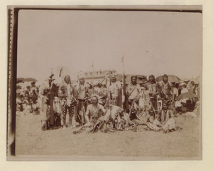
Paleo-Indians arrived in Alberta at least 10,000 years ago. This was near the end of the last ice age. They likely came from Siberia to Alaska over a land bridge. Then, they may have traveled down the east side of the Rocky Mountains through Alberta. Over time, they became different First Nations peoples. These included the Plains Indians (like the Blackfoot Confederacy) and the Plains Cree in southern Alberta. They mostly hunted buffalo. Northern tribes like the Woodland Cree hunted, trapped, and fished.
The first Europeans in Alberta were French Canadian fur traders in the late 1700s. French was spoken in early fur trading forts. After the British came to Canada, about half of Alberta became part of Rupert's Land. This land was given to the Hudson's Bay Company (HBC) in 1670.
The Athabasca River and rivers to its north were not in HBC territory. They were good for fur-bearing animals. Other fur traders formed the North West Company (NWC) in 1779 to compete with the HBC. Peter Pond built Fort Athabasca in 1778. Roderick Mackenzie built Fort Chipewyan in 1788. His cousin, Sir Alexander Mackenzie, explored the Athabasca River. He followed the Mackenzie River to the Arctic Ocean. He later followed the Peace River to the Pacific Ocean. He was the first European to cross North America north of Mexico.
The very southern part of Alberta was once French territory. It was sold to the United States in 1803. In 1818, this part of the land north of the Forty-Ninth Parallel was given to Great Britain.

The fur trade grew in the north. But there were fights between the HBC and NWC. In 1821, the British government made them join together. The new Hudson's Bay Company controlled trade in Alberta until 1870. That's when the Canadian Government bought Rupert's Land. Northern Alberta became part of the North-West Territories.
First Nations groups signed Numbered Treaties with the Crown. In these treaties, the Crown gained land. In return, the Crown promised to support the First Nations and protect their hunting and fishing rights. Important treaties for Alberta include Treaty 6 (1876), Treaty 7 (1877), and Treaty 8 (1899).
The District of Alberta was created in 1882 as part of the North-West Territories. As more people settled, local representatives were added. After a long effort to become a province, the Alberta Act was passed in 1905. This created the province of Alberta. Alexander Cameron Rutherford became the first premier.

In 2013, Alberta had very heavy rainfall. This caused major flooding in the southern part of the province. Rivers like the Bow and Elbow overflowed. Many communities had to be evacuated.
In 2016, the Fort McMurray wildfire caused the largest evacuation in Alberta's history. More than 80,000 people had to leave their homes. From 2020 to 2022, Alberta was also affected by the COVID-19 pandemic.
Alberta's Population and People

The 2021 Canadian census showed that Alberta had 4,262,635 people. This was a 4.8% increase from 2016. Alberta has a land area of about 634,658.27 km2 (245,042.93 sq mi). This means there were about 6.7/km2 people per square kilometer in 2021.
Since 2000, Alberta's population has grown quickly. This is mainly because of its strong economy. Alberta has high birth rates and many people moving in from other provinces and countries.
In 2016, Alberta had the youngest population among the provinces. The average age was 36.7 years. This is younger than the national average of 41.2 years. Alberta also had the smallest percentage of seniors (12.3%) and one of the highest percentages of children (19.2%). This helps Alberta's population stay young and growing.
About 81% of Albertans live in cities. Only about 19% live in rural areas. The Calgary–Edmonton Corridor is the most urbanized area. It is also one of the most crowded areas in Canada. Many cities and towns in Alberta have grown very quickly. Alberta's population grew from 73,022 in 1901 to 3,290,350 in 2006.
Major Cities and Towns
| Census metropolitan areas: | 2016 | 2011 | 2006 | 2001 | 1996 |
|---|---|---|---|---|---|
| Calgary CMA | 1,392,609 | 1,214,839 | 1,079,310 | 951,395 | 821,628 |
| Edmonton CMA | 1,321,426 | 1,159,869 | 1,034,945 | 937,845 | 862,597 |
| Lethbridge CMA | 117,394 | 105,999 | 95,196 | 87,388 | 82,025 |
| Urban municipalities (10 largest): | 2016 | 2011 | 2006 | 2001 | 1996 |
| Calgary | 1,239,220 | 1,096,833 | 988,193 | 878,866 | 768,082 |
| Edmonton | 932,546 | 812,201 | 730,372 | 666,104 | 616,306 |
| Red Deer | 100,418 | 90,564 | 82,772 | 67,707 | 60,080 |
| Lethbridge | 92,729 | 83,517 | 78,713 | 68,712 | 64,938 |
| St. Albert (included in Edmonton CMA) | 65,589 | 61,466 | 57,719 | 53,081 | 46,888 |
| Medicine Hat | 63,260 | 60,005 | 56,997 | 51,249 | 46,783 |
| Grande Prairie | 63,166 | 55,032 | 47,076 | 36,983 | 31,353 |
| Airdrie (included in Calgary CMA) | 61,581 | 42,564 | 28,927 | 20,382 | 15,946 |
| Spruce Grove (included in Edmonton CMA) | 34,066 | 26,171 | 19,496 | 15,983 | 14,271 |
| Leduc (included in Edmonton CMA) | 29,993 | 24,304 | 16,967 | 15,032 | 14,346 |
| Specialized/rural municipalities (5 largest): | 2016 | 2011 | 2006 | 2001 | 1996 |
| Strathcona County (included in Edmonton CMA) | 98,044 | 92,490 | 82,511 | 71,986 | 64,176 |
| Regional Municipality of Wood Buffalo (includes Fort McMurray) | 71,589 | 65,565 | 51,496 | 42,581 | 35,213 |
| Rocky View County (included in Calgary CMA) | 39,407 | 36,461 | 34,171 | 29,925 | 23,326 |
| Parkland County (included in Edmonton CMA) | 32,097 | 30,568 | 29,265 | 27,252 | 24,769 |
| Municipal District of Foothills No. 31 | 22,766 | 21,258 | 19,736 | 16,764 | 13,714 |
Languages Spoken in Alberta
In 2021, the most spoken language in Alberta was English. About 98% of people spoke English. Other common languages included French, Tagalog, Punjabi, Spanish, and Hindi. Many people in Alberta speak more than one language.
In 2016, English was the first language for most people (their mother tongue). Tagalog, German, French, and Punjabi were also common first languages.
Alberta has the second-highest number of French speakers in western Canada. Many French-speaking Albertans live in central and northwestern parts of the province. They may have moved from other parts of Canada or be descendants of Métis people.
Alberta's Diverse Ethnic Backgrounds
Alberta has many different ethnic groups. Many people are descended from immigrants from Western European countries. These include England, Scotland, Ireland, Wales, and France. Large numbers also came from Germany, Ukraine, and Scandinavia.
In 2006, the most common ethnic backgrounds reported were English, German, Canadian, Scottish, and Irish. Many places in Alberta have Scottish names, like Calgary, Airdrie, Canmore, and Banff.
Both Edmonton and Calgary have historic Chinatowns. Calgary has Canada's third-largest Chinese community. Chinese workers first came to Alberta to help build the Canadian Pacific Railway in the 1880s.
In 2021, about 27.8% of the population were visible minorities. About 6.8% were Indigenous, mostly First Nations and Métis. The Indigenous population is growing faster than Alberta's overall population.
Religions in Alberta

According to the 2021 census, about 48% of Albertans are Christian. About 40% said they had no religion. Other religions include Islam (4.8%), Sikhism (2.5%), and Hinduism (1.9%).
In 2011, the largest religious group was Roman Catholic. Alberta also had the second-highest percentage of people with no religion. Many people are part of the United Church of Canada or are Anglican. Lutherans and Baptists are also present.
Members of LDS Church mostly live in southern Alberta. Alberta has a group called Hutterites. They are a communal Anabaptist group. Alberta also has many Byzantine Rite Churches due to immigration from Eastern Europe.
Canada's oldest mosque, the Al-Rashid Mosque, is in Edmonton. Calgary has Canada's largest mosque, the Baitun Nur Mosque. Alberta also has a growing Jewish population. Most Jewish people live in Calgary and Edmonton.
Alberta's Economy

Alberta's economy is one of the strongest in the world. It is mainly supported by the oil and gas industry. Agriculture and technology also play a role. In 2013, Alberta's economy per person was higher than that of the United States, Norway, or Switzerland. It was the highest of any province in Canada.
The Calgary-Edmonton Corridor is the most urbanized area in Alberta. It is also one of the most crowded in Canada. This region is about 400 km (250 mi) long. In 2001, 2.15 million people lived there. This was 72% of Alberta's population. It is also one of the fastest-growing regions in Canada. A study in 2003 found that this corridor had a similar level of wealth to major U.S. cities. But it still kept a Canadian quality of life, including universal health care.
Alberta is known for having a lot of economic freedom. It is rated as the freest economy in Canada.
In 2014, Alberta exported goods worth US$121.4 billion. Energy exports were $90.8 billion. Farming products brought in $12.9 billion. Forest products were worth $5.4 billion. Manufacturing sales were $79.4 billion. Alberta's technology industries made over $13 billion.
Farming and Forests

Farming is very important to Alberta's economy. The province has over three million cattle. Alberta beef is sold all over the world. Forty percent of all Canadian beef comes from Alberta. The province also produces the most bison meat in Canada. Sheep are raised for wool and meat.
Wheat and canola are the main crops. Alberta grows the most spring wheat in Canada. Other grains are also important. Many farms use dryland farming, where fields are left empty some seasons. But continuous cropping, where there is no empty season, is becoming more common. This helps reduce soil erosion.
Alberta is also the top province for beekeeping in Canada. Some beekeepers keep their beehives indoors in winter. Then they move them north in summer to the Peace River valley. Here, honeybees make honey from clover and fireweed.

Forestry is a big part of Alberta's economy. It provides over 15,000 jobs. It brings in billions of dollars each year. Wood from harvested trees is used for pulpwood, hardwood, and engineered wood. It is also used to make bioproducts like chemicals and biofuels.
Key Industries
Alberta is the largest producer of conventional crude oil, synthetic crude, natural gas, and gas products in Canada. It is the world's second-largest exporter of natural gas. It is also the fourth-largest producer. Two of North America's biggest petrochemical companies are in central and north-central Alberta. They make products like polyethylene and vinyl that are shipped worldwide. Edmonton's oil refineries provide materials for a large petrochemical industry.
The Athabasca oil sands near Fort McMurray have huge amounts of unconventional oil. These reserves are thought to be as large as all the conventional oil reserves in the rest of the world. Many companies use different methods to get the bitumen (a thick, sticky form of oil) from the oil sands. In late 2006, over $100 billion worth of oil sands projects were being built or planned.
The price of oil affects how profitable it is to get oil from the oil sands. When oil prices are high, it is more profitable. But rising costs can make some projects less viable.
With help from the provincial government, Alberta has also developed high-tech industries. This includes patents for interactive liquid-crystal display systems. Alberta's growing economy also supports many financial institutions.
Tourism in Alberta
.jpg)
Alberta has been a popular place for tourists since the early 1900s. People come for skiing, hiking, and camping. They also visit shopping places like West Edmonton Mall. Other attractions include the Calgary Stampede, outdoor festivals, and sports events. Calgary and Edmonton each host over four million visitors every year. Banff, Jasper, and the Rocky Mountains get about three million visitors annually. Tourists come from other parts of Canada, the United States, and many other countries.
Natural attractions include Elk Island National Park, Wood Buffalo National Park, and the Columbia Icefield. Alberta's Rockies have famous places like Banff National Park and Jasper National Park. These two parks are connected by the beautiful Icefields Parkway. Five of Canada's fourteen UNESCO World Heritage Sites are in Alberta. These include the Canadian Rocky Mountain Parks and Dinosaur Provincial Park. Many of these areas have ski resorts.

About 1.2 million people visit the Calgary Stampede. This event celebrates Canada's Wild West and the cattle ranching industry. About 700,000 people enjoy Edmonton's K-Days festival. Edmonton was once the starting point for gold seekers going to the Yukon.
Another popular place is the Drumheller Valley, northeast of Calgary. Drumheller is known as the "Dinosaur Capital of The World." It has the Royal Tyrrell Museum of Palaeontology. Drumheller also has a rich history of coal mining. The Alberta Prairie Railway Excursions in Stettler is another popular attraction. It offers train rides into the prairie.
Alberta's Culture

Calgary is famous for its Calgary Stampede. It is called "The Greatest Outdoor Show on Earth." The Stampede is Canada's biggest rodeo festival. It has races and competitions like calf roping and bull riding.
Summer brings many festivals to Alberta, especially in Edmonton. The Edmonton International Fringe Festival is the second largest in the world. Both Calgary and Edmonton host many annual festivals. These include folk music festivals. Edmonton's "heritage days" festival involves over 70 ethnic groups. Churchill Square in Edmonton hosts many festivals during the summer.
In 2019, Alberta started an "Artist in Residence" program. This program celebrates the arts and their value to the province. An artist is chosen each year to promote the arts across Alberta. Alberta was the first province in Canada to start such a program.
Sports in Alberta
| Team | City | League | Stadium/arena | Capacity |
|---|---|---|---|---|
| Edmonton Oilers | Edmonton | National Hockey League | Rogers Place | 18 347 |
| Calgary Flames | Calgary | National Hockey League | Scotiabank Saddledome | 19 289 |
| Edmonton Elks | Edmonton | Canadian Football League | Commonwealth Stadium | 60 081 |
| Calgary Stampeders | Calgary | Canadian Football League | McMahon Stadium | 40 000 |
| Calgary Wranglers | Calgary | American Hockey League | Scotiabank Saddledome | 19 289 |
| Calgary Hitmen | Calgary | Canadian Hockey League | Scotiabank Saddledome | 19 289 |
| Edmonton Oil Kings | Edmonton | Canadian Hockey League | Rogers Place | 18 347 |
| Lethbridge Hurricanes | Lethbridge | Canadian Hockey League | Enmax Centre | 5 479 |
| Medicine Hat Tigers | Medicine Hat | Canadian Hockey League | Canalta Centre | 7 100 |
| Red Deer Rebels | Red Deer | Canadian Hockey League | Peavey Mart Centrium | 7 111 |
| Cavalry FC | Calgary | Canadian Premier League | ATCO Field | 6 000 |
| Calgary Surge | Calgary | Canadian Elite Basketball League | Winsport Event Centre | 2 900 |
| Edmonton Stingers | Edmonton | Canadian Elite Basketball League | Edmonton Expo Centre | 4 000 |
| Calgary Roughnecks | Calgary | National Lacrosse League | Scotiabank Saddledome | 19 289 |
| Edmonton Storm | Edmonton | Western Women's Canadian Football League | Clarke Stadium | 5 100 |
| Calgary Rage | Calgary | Western Women's Canadian Football League | Shouldice Athletic Park | 1 000 |
| Lethbridge Steel | Lethbridge | Western Women's Canadian Football League | University of Lethbridge Community Stadium | 2 000 |
| Edmonton Riverhawks | Edmonton | West Coast League | RE/MAX Field | 9 200 |
Education in Alberta
In Canada, each province makes its own laws about education. Since 1905, Alberta has had local school boards. These boards are elected by the public. The province also creates and regulates universities, colleges, and other schools.
Schools for Kids (K-12)
Alberta has 42 public school systems and 17 separate school systems. Most separate schools are Catholic. One is Protestant. The provincial government pays most of the cost for K-12 education. Before 1994, school boards could collect a local tax for education. Now, the provincial government sets the tax rate. Local cities collect the money and send it to the province. This money must be used for K-12 education.
Public schools, separate schools, charter schools, and private schools all follow the same learning plan. This plan is approved by Alberta Education. Homeschooling families can follow this plan or create their own. Teachers in these schools must be certified by Alberta Education. Students take provincial tests, and high school graduates get certificates from Alberta Education.
Learning After High School

Alberta has several publicly funded colleges and universities. These include four large research universities: Athabasca University, the University of Alberta, the University of Calgary, and the University of Lethbridge. These offer both undergraduate and graduate degrees. There are also three undergraduate universities that mainly offer bachelor's degrees.
Nine community colleges offer diploma and certificate programs. These include Bow Valley College and Lethbridge College. There are also four polytechnic institutes. These provide specific career training, apprenticeships, and diplomas. The Banff Centre for Arts and Creativity is a special arts school.
Alberta also has five private post-secondary schools. These include Ambrose University and Concordia University of Edmonton. They offer approved diplomas and degrees. There are also 190 private career colleges in Alberta.
In 2005, there was some discussion about the rising cost of college for students. Premier Ralph Klein promised to freeze tuition fees. He also said he would look for ways to lower schooling costs.
Getting Around Alberta
By Air

Alberta has good air connections. There are international airports in Calgary and Edmonton. Calgary International Airport is the fourth busiest in Canada. Edmonton International Airport is the fifth busiest. Calgary's airport is a main hub for WestJet Airlines. It also serves as a regional hub for Air Canada. Edmonton's airport is a hub for northern Canada. It connects to major Canadian cities, the United States, Europe, Mexico, and the Caribbean.
Public Transportation
Calgary, Edmonton, Red Deer, Medicine Hat, and Lethbridge have good public transit systems. Calgary and Edmonton also have light rail transit (LRT) systems. Edmonton's LRT was one of the first modern light rail systems in North America. Calgary's C Train has many daily riders.
By Train

Alberta has over 9,000 km (5,600 mi) of railway tracks. Most of these are owned by Canadian Pacific Kansas City (CPKC) and Canadian National Railway (CN). They carry freight across the province.
Passenger trains include Via Rail's Canadian (Toronto–Vancouver route). This train goes through Jasper National Park. The Rocky Mountaineer also operates two routes. One goes from Vancouver to Banff. The other goes to Jasper.
Alberta's Premier, Danielle Smith, has announced a plan to expand passenger rail. This plan aims to bring train services to Lethbridge, Medicine Hat, Banff, Grande Prairie, and Fort McMurray. It will also create a train service between Edmonton and Calgary. Commuter rail systems are also planned for these cities. Construction is set to begin in 2027.
By Road

Alberta has over 473,000 km (294,000 mi) of highways and roads. The main north-south highway is Highway 2. It starts at the U.S. border near Cardston. This highway is part of the CANAMEX Corridor. Highway 4 connects the U.S. border at Coutts to Lethbridge. It is the busiest way to enter Alberta from the United States. Highway 2 goes north through Fort Macleod, Calgary, Red Deer, and Edmonton. North of Edmonton, it continues to Athabasca and then to Grande Prairie. The section of Highway 2 between Calgary and Edmonton is called the Queen Elizabeth II Highway.
Alberta has two main east-west highways. The southern one is part of the Trans-Canada Highway. It enters Alberta near Medicine Hat, goes through Calgary, and leaves through Banff National Park. The northern one is also part of the Trans-Canada network. It is called the Yellowhead Highway (Highway 16). It runs from Lloydminster through Edmonton and Jasper National Park.
One of the most beautiful drives is along the Icefields Parkway. It is 228 km (142 mi) long and connects Jasper and Lake Louise. It has mountains and glaciers on both sides. Another major highway is Highway 11 (the David Thompson Highway). It runs from the Rocky Mountains through Rocky Mountain House and Red Deer.
In cities, major highways are often called "trails." For example, Highway 2 is called Deerfoot Trail in Calgary. It becomes Calgary Trail and Gateway Boulevard in Edmonton. Calgary often names its large city expressways "trails." Many are named after important First Nations people and tribes. Examples include Crowchild Trail and Stoney Trail.
Alberta's Friendship Partners
Alberta has special relationships with many provinces, states, and other places around the world.
- Gangwon-do, South Korea (1974)
- Hokkaido, Japan (1980)
- Heilongjiang, China (1981)
- Montana, United States (1985)
- Tyumen, Russia (1992)
- Khanty–Mansi, Russia (1995)
- Yamalo-Nenets, Russia (1997)
- Jalisco, Mexico (1999)
- Alaska, United States (2002)
- Saxony, Germany (2002)
- Ivano-Frankivsk, Ukraine (2004)
- Lviv, Ukraine (2005)
- California, United States (1997)
- Guangdong, China (2017)
See also
 In Spanish: Alberta para niños
