Netherlands facts for kids
Quick facts for kids
Netherlands
Nederland (Dutch)
|
|||
|---|---|---|---|
|
|||
| Motto: | |||
| Anthem: Wilhelmus (Dutch) ("William of Nassau") |
|||
|
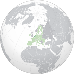
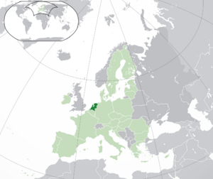
Location of Netherlands (dark green)
– on the European continent (light green & dark grey) |
|||
| Sovereign state | Kingdom of the Netherlands | ||
| Before independence | Spanish Netherlands | ||
| Act of Abjuration | 26 July 1581 | ||
| Peace of Münster | 30 January 1648 | ||
| Kingdom established | 16 March 1815 | ||
| Liberation Day | 5 May 1945 | ||
| Kingdom Charter | 15 December 1954 | ||
| Caribbean reorganisation | 10 October 2010 | ||
| Capital
and largest city
|
Amsterdam 52°22′N 4°53′E / 52.367°N 4.883°E |
||
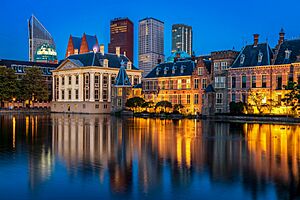
| Government seat | The Hague | ||
| Official languages | Dutch | ||
|
|||
|
Recognised languages
|
|
||
| Ethnic groups
(2022)
|
|
||
| Religion
(2023)
|
|
||
| Demonym(s) | Dutch | ||
| Government | Unitary parliamentary constitutional monarchy | ||
|
• Monarch
|
Willem-Alexander | ||
| Dick Schoof | |||
| Legislature | States General | ||
| Senate | |||
| House of Representatives | |||
| European Parliament | |||
|
• Netherlands constituency
|
26 seats | ||
| Area | |||
|
• Total
|
41,865 km2 (16,164 sq mi) (134th) | ||
|
• Water (%)
|
18.41 | ||
| Highest elevation
(Vaalserberg)
|
322.4 m (1,057.7 ft) | ||
| Population | |||
|
• 5 June 2025 estimate
|
|||
|
• 2011 census
|
16,655,799 | ||
|
• Density
|
520/km2 (1,346.8/sq mi) (33rd) | ||
| GDP (PPP) | 2024 estimate | ||
|
• Total
|
|||
|
• Per capita
|
|||
| GDP (nominal) | 2024 estimate | ||
|
• Total
|
|||
|
• Per capita
|
|||
| Gini (2021) | ▼ 26.4 low |
||
| HDI (2022) | very high · 10th |
||
| Currency | |||
| Time zone | |||
|
• Summer (DST)
|
|||
| Driving side | right | ||
| Calling code | +31, +599 | ||
| Internet TLD | .nl, .bq | ||
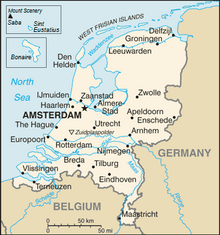
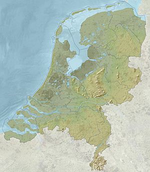
The Netherlands is a country that is part of (a constituent country) of the Kingdom of the Netherlands. Most of it is in Western Europe, but there are also some parts in the Caribbean. More than 17 million people live there. To the north and west of the European part of the Netherlands is the North Sea, and to the east is Germany and to the south is Belgium. The Netherlands is one of the countries that started the European Union. People who live in the Netherlands are called "Dutch". The language of the Netherlands is also called Dutch. The official capital of the Netherlands is Amsterdam. This however, is not the place where the government is seated, which is in The Hague.
Contents
Name
"The Netherlands" means "the low lands". The land only rises, on average, 1 meter above the sea level. One third of the land is below sea level. The Netherlands is also - incorrectly - referred to as Holland. Holland was a very rich area (two provinces) in the western part of the Netherlands, thus causing people to be mistaken. Some people who do not live in the western part of the Netherlands do not like it when people call the country Holland. The name "Holland" originates from the old Dutch words "Holt land" which means "wood lands".
History
At the end of the Middle Ages the dukes of Burgundy, a country that is now part of France, united seventeen areas. Those areas were called the Netherlands. When the daughter of a duke married Maximilian I, Holy Roman Emperor, the Netherlands became part of Spain. In the 16th century many Dutch people became Protestant. The king of Spain did not like it, he wanted all Dutch to be Roman Catholic. He decided that all Protestants should be killed. Of course the Dutch people did not like this, and in 1568 they started a war against Spain. The war lasted until 1648, therefore it is called the Eighty Years' War. An important leader of the Dutch in this war was Willem van Oranje (Willem of orange) also called William the Silent.
In 1648 the Netherlands and Spain signed peace. The Dutch people were allowed to keep all the areas they conquered. The part of the Netherlands that was not conquered by the Dutch stayed part of Spain. Later this part became the country Belgium.
When the Netherlands became independent, it was a very special country. That time almost all countries in Europe were ruled by a king, but the Netherlands was a republic. The Netherlands was made up of seven provinces, that were ruled by the big cities. The cities where ruled by the municipality which consisted from rich civilians. Together those provinces were ruled by a stadtholder, a very powerful man, but compared to the kings of other European countries he had much less power.
In the 17th century the Netherlands was the richest and one of the most powerful countries in the world. Therefore, the Dutch call the 17th century the Golden Age. Their Dutch Empire had possessions around the world. The most important possession were the East Indies, a country that is now called Indonesia. The Dutch also founded New Netherland, which is now called New York. The Netherlands often fought wars against other European countries, especially the Anglo-Dutch Wars against England. Michiel de Ruyter, a Dutch admiral, became a Dutch hero when he defeated the English navy close to London.
In the 18th century the Netherlands became poorer. Many people blamed this on the government leaders, the stadtholders. Many thought they had too much power and wanted them to get away. In 1789 the French people deposed (got rid of) their king. French armies attacked other countries to depose their leaders too. In 1795 they attacked the Netherlands. Stadtholder William V had to flee to England. The Netherlands were renamed to Batavian Republic and became a democracy. But the French were not content (satisfied) with the Dutch ruler, so in 1806 the French emperor Napoleon made his brother Louis Bonaparte king of the Netherlands. Louis became popular in the Netherlands, but the emperor was again not content with him, so in 1810 the Netherlands became a part of France.
In 1815 Napoleon was defeated, and the Netherlands became independent again. The rulers of European countries thought it was a good idea to make the Netherlands stronger, to make them able to resist another French invasion. Therefore, Belgium and Luxembourg were added to the Netherlands. William I, the son of stadtholder William V, became king. The Belgians disliked their Dutch king. In 1830 they revolted. William sent an army. He was much more powerful than the Belgians but after ten days the French sent an army to support them. In 1831 the Belgians chose their own king and Belgium became an independent country.
Some people again thought the Dutch king had too much power. They wanted to give him less power and vote for the government themselves. In 1848 there were violent revolts against the kings of many European countries. The Dutch king was afraid the same would happen in the Netherlands. Therefore, he allowed Johan Rudolf Thorbecke to write a constitution. From then on people were allowed to vote. At first only rich men were allowed to vote. From 1919 on everyone was allowed to vote.
In World War I, the Netherlands did not fight. The Dutch wanted to stay neutral in World War II as well, but in 1940 the country was invaded and occupied by Germany. Like in other countries they had occupied, the National Socialist Party started to kill Jews. Anne Frank was a Jewish girl who lived in the Netherlands. Her family hid from the Nazis and she wrote a diary. She died in a Nazi concentration camp and her diary became famous.
In 1944 the American, Canadian, Polish and British armies liberated the south of the Netherlands from Nazi Occupation. They wanted to cross the Rhine river in Operation Market Garden to liberate the rest of the country, but they were defeated. It took until May 1945 before the entire country was liberated. During the five years of Nazi occupation, 250,000 people had died in the Netherlands.
Shortly after the war, Indonesia declared its independence. The Dutch sent soldiers to fight in Indonesia. During the war the Dutch realized how it is to be occupied by another country, so some thought they should not do the same to the Indonesians. After other countries, including the United States, told the Dutch to leave Indonesia, they finally did so in 1949.
After the war the Netherlands became one of the richest countries in the world. In 2004 the United Nations said that the Netherlands was the 5th best country to live in.
Government and politics
The Netherlands has been a constitutional monarchy since 1815 and a parliamentary democracy since 1848. The Netherlands is described as a consociational state. Dutch politics and governance are characterised by an effort to achieve broad consensus on important issues. The Netherlands was ranked as the 17th best electoral democracy in the world by V-Dem Democracy indices in 2023 and 9th most democratic country in the world by the Democracy Index (The Economist) in 2022.
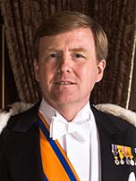
The monarch is the head of state, at present King Willem-Alexander of the Netherlands. Constitutionally, the position is equipped with limited powers. By law, the King has the right to be periodically briefed and consulted on government affairs.
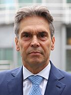
The executive power is formed by the Council of Ministers, the deliberative organ of the Dutch cabinet. The cabinet usually consists of 13 to 16 ministers and a varying number of state secretaries. One to three ministers are ministers without portfolio. The head of government is the Prime Minister of the Netherlands, who often is the leader of the largest party of the coalition. The Prime Minister is a primus inter pares, with no explicit powers beyond those of the other ministers. Dick Schoof has been Prime Minister since July 2024, succeeding the longest-serving Prime Minister Mark Rutte.
The cabinet is responsible to the bicameral parliament, the States General, which also has legislative powers. The 150 members of the House of Representatives, the lower house, are elected in direct elections on the basis of party-list proportional representation. These are held every four years, or sooner in case the cabinet falls. The provincial assemblies, the States Provincial, are directly elected every four years as well. The members of the provincial assemblies elect the 75 members of the Senate, the upper house, which has the power to reject laws, but not amend them.
Provinces
In the Netherlands there are 12 provinces:
|
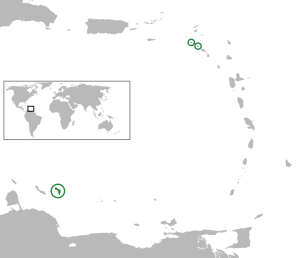
These provinces are all located in the part of the Netherlands that is in Europe. The country also includes three special municipalities in the Caribbean: Bonaire, Saba and Sint Eustatius. They are not part of any province, but together are known as the Caribbean Netherlands. The Netherlands (both the European part and the Caribbean Netherlands), together with Aruba, Curaçao and Sint Maarten, also in the Caribbean, form a sovereign state called the Kingdom of the Netherlands.
When the Kingdom was formed in 1954, the territories in the Caribbean became part of the Netherlands Antilles. At that time it also included Suriname in South America, which became an independent country in 1975. Aruba left the Antilles in 1986, and Curaçao and Sint Maarten did the same in 2010. The rest of the islands then became the Caribbean Netherlands which is part of the Netherlands proper.
Cities
This is a list of the cities with over 100,000 people.
| Rank | City | Population | Province |
|---|---|---|---|
| 1 | Amsterdam | 780,000 | |
| 2 | Rotterdam | 611,000 | |
| 3 | The Hague | 500,000 | |
| 4 | Utrecht | 312,634 | |
| 5 | Eindhoven | 213,809 | |
| 6 | Tilburg | 203,492 | |
| 7 | Almere | 193,303 | |
| 8 | Groningen | 187,298 | |
| 9 | Breda | 173,299 | |
| 10 | Nijmegen | 164,165 | |
| 11 | Apeldoorn | 155,726 | |
| 12 | Enschede | 154,017 | |
| 13 | Haarlem | 151,853 | |
| 14 | Arnhem | 147,018 | |
| 15 | Amersfoort | 126,750 | |
| 16 | Dordrecht | 118,540 | |
| 17 | Zoetermeer | 118,020 | |
| 18 | Zwolle | 118,000 | |
| 19 | Leiden | 117,480 | |
| 20 | Maastricht | 116,200 | |
| 21 | Ede | 107,476 | |
| 22 | 's-Hertogenbosch | 102,220 | |
| 23 | Venlo | 100,271 |
Geography
The European Netherlands has a total area of 41,543 km2 (16,040 sq mi), including water bodies, and a land area of 33,481 km2 (12,927 sq mi). The Caribbean Netherlands has a total area of 328 km2 (127 sq mi) It lies between latitudes 50° and 54° N, and longitudes 3° and 8° E.
The Netherlands is geographically very low relative to sea level and is considered a flat country, with about 26% of its area and 21% of its population below sea level. The European part of the country is for the most part flat, with the exception of foothills in the far southeast, up to a height of no more than 321 metres, and some low hill ranges in the central parts. Most of the areas below sea level are caused by peat extraction or achieved through land reclamation. Since the late 16th century, large polder areas are preserved through elaborate drainage systems that include dikes, canals and pumping stations.
Much of the country was originally formed by the estuaries of three large European rivers: the Rhine (Rijn), the Meuse (Maas) and the Scheldt (Schelde), as well as their tributaries. The south-western part of the Netherlands is a river delta of these rivers, the Rhine–Meuse–Scheldt delta.
The European Netherlands is divided into north and south parts by the Rhine, the Waal, its main tributary branch, and the Meuse. These rivers functioned as a natural barrier between fiefdoms and hence historically created a cultural divide, as is evident in some phonetic traits that are recognisable on either side of what the Dutch call their "Great Rivers" (de Grote Rivieren). Another significant branch of the Rhine, the IJssel river, discharges into Lake IJssel, the former Zuiderzee ('southern sea'). Just like the previous, this river forms a linguistic divide: people to the northeast of this river speak Dutch Low Saxon dialects (except for the province of Friesland, which has its own language).
Geology
The Netherlands is mostly composed of deltaic, coastal and aeolian derived sediments during the Pleistocene glacial and interglacial periods.
Almost the entire west Netherlands is composed of the Rhine-Meuse river estuary. In the east of the Netherlands, remains are found of the last ice age, which ended approximately ten thousand years ago. As the continental ice sheet moved in from the north, it pushed moraine forward. The ice sheet halted as it covered the eastern half of the Netherlands. After the ice age ended, the moraine remained in the form of a long hill-line. The cities of Arnhem and Nijmegen are built on these hills.
Floods
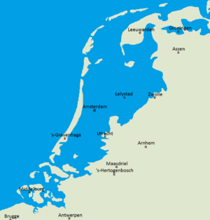
Over the centuries, the Dutch coastline has changed considerably as a result of natural disasters and human intervention.
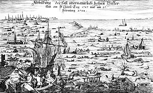
On 14 December 1287, St. Lucia's flood affected the Netherlands and Germany, killing more than 50,000 people in one of the most destructive floods in recorded history. The St. Elizabeth flood of 1421 and the mismanagement in its aftermath destroyed a newly reclaimed polder, replacing it with the 72 km2 (28 sq mi) Biesbosch tidal floodplains. The huge North Sea flood of February 1953 caused the collapse of several dikes in the southwest Netherlands; more than 1,800 people drowned. The Dutch government subsequently instituted a large-scale programme, the "Delta Works", to protect the country against future flooding, which was completed over a period of more than 40 years.
The impact of disasters was, to an extent, increased through human activity. Relatively high-lying swampland was drained to be used as farmland. The drainage caused the fertile peat to contract and ground levels to drop; groundwater levels were lowered to compensate, causing the underlying peat to contract further. Additionally, until the 19th century peat was mined, dried, and used for fuel, further exacerbating the problem. Even in flooded areas, peat extraction continued through turf dredging.
To guard against floods, a series of defences against the water were contrived. In the first millennium AD, villages and farmhouses were built on hills called terps. Later, these terps were connected by dikes. In the 12th century, local government agencies called "waterschappen" ("water boards") or "hoogheemraadschappen" ("high home councils") started to appear, whose job it was to maintain the water level and to protect a region from floods; these agencies continue to exist. As the ground level dropped, the dikes by necessity grew and merged into an integrated system. By the 13th century windmills had come into use to pump water. The windmills were later used to drain lakes, creating the famous polders. In 1932 the Afsluitdijk ("Closure Dike") was completed, blocking the former Zuiderzee (Southern Sea) from the North Sea and thus creating the IJsselmeer (IJssel Lake). It became part of the larger Zuiderzee Works in which four polders totalling 2,500 square kilometres (965 sq mi) were reclaimed from the sea.
The Netherlands is one of the countries that may suffer most from climate change. Not only is the rising sea a problem, but erratic weather patterns may cause the rivers to overflow.
Delta Works
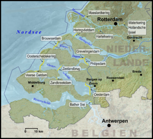
After the 1953 disaster, the Delta Works was constructed, which is a comprehensive set of civil works throughout the Dutch coast. The project started in 1958 and was largely completed in 1997 with the completion of the Maeslantkering. Since then, new projects have been periodically started to renovate and renew the Delta Works. The main goal of the Delta project was to reduce the risk of flooding in South Holland and Zeeland. This was achieved by raising 3,000 km (1,900 mi) of outer sea-dikes and 10,000 km (6,200 mi) of the inner, canal, and river dikes, and by closing off the sea estuaries of Zeeland. New risk assessments occasionally show problems requiring additional Delta project dike reinforcements. The Delta project is considered by the American Society of Civil Engineers as one of the seven wonders of the modern world.
It is anticipated that global warming will result in a rise in sea level. The Netherlands is actively preparing for a sea-level rise. A politically neutral Delta Commission has formulated an action plan to cope with a sea-level rise of 1.10 m (4 ft) and a simultaneous land height decline of 10 cm (4 in). The plan encompasses the reinforcement of existing coastal defences like dikes and dunes with 1.30 m (4.3 ft) of additional flood protection. Climate change will not only threaten the Netherlands from the coast, but could also alter rainfall patterns and river run-off. To protect the country from river flooding, another programme is already being executed. The Room for the River plan grants more flow space to rivers, protects the major populated areas and allows for periodic flooding of indefensible lands. The few residents who lived in these so-called "overflow areas" have been moved to higher ground, with some of that ground having been raised above anticipated flood levels.
Climate change
The Netherlands is already affected by climate change. The average temperature in the Netherlands rose by more than 2 °C from 1901 to 2020. Climate change has resulted in increased frequency of droughts and heatwaves. Because significant portions of the Netherlands have been reclaimed from the sea or otherwise are very near sea level, the Netherlands is very vulnerable to sea level rise.
The Netherlands has the fourth largest greenhouse gas emissions per capita of the European Union, in part due to the large number of cows. The Dutch government has set goals to lower emissions in the next few decades. The Dutch response to climate change is driven by a number of unique factors, including larger green recovery plans by the European Union in the face of the COVID-19 and a climate change litigation case, State of the Netherlands v. Urgenda Foundation, which created mandatory climate change mitigation through emissions reductions 25% below 1990 levels. In 2021 CO2 emissions were down 14% compared to 1990 levels. The goal of the Dutch government is to reduce emissions in 2030 by 49%.
Nature
The Netherlands has 21 national parks and hundreds of other nature reserves. Most of these are owned by Staatsbosbeheer, the national department for forestry and nature conservation and Natuurmonumenten, a private organisation that buys, protects and manages nature reserves. The Wadden Sea in the north, with its tidal flats and wetlands, is rich in biological diversity, and is a UNESCO World Heritage Nature Site. The Eastern Scheldt, formerly the northeast estuary of the river Scheldt was designated a national park in 2002, making it the largest national park in the Netherlands at an area of 370 km2 (140 sq mi).
Phytogeographically, the European Netherlands is shared between the Atlantic European and Central European provinces of the Circumboreal Region within the Boreal Kingdom. According to the World Wide Fund for Nature, the European territory of the Netherlands belongs to the ecoregion of Atlantic mixed forests. In 1871, the last old original natural woods were cut down. These woods were planted on anthropogenic heaths and sand-drifts (overgrazed heaths) (Veluwe). The Netherlands had a 2019 Forest Landscape Integrity Index mean score of 0.6/10, ranking it 169th globally out of 172 countries.
Nitrogen pollution is a problem. The number of flying insects in the Netherlands has dropped by 75% since the 1990s.
Caribbean islands
In the Lesser Antilles islands of the Caribbean, the territories of Curaçao, Aruba and Sint Maarten have a constituent country status within the wider Kingdom of the Netherlands. Another three territories which make up the Caribbean Netherlands are designated as special municipalities. The Caribbean Netherlands have maritime borders with Anguilla, Curaçao, France (Saint Barthélemy), Saint Kitts and Nevis, Sint Maarten, the U.S. Virgin Islands and Venezuela. The islands of the Caribbean Netherlands enjoy a tropical climate with warm weather all year round.
Within this island group:
- Bonaire is part of the ABC islands within the Leeward Antilles island chain off the Venezuelan coast. The Leeward Antilles have a mixed volcanic and coral origin.
- Saba and Sint Eustatius are part of the SSS islands. They are located east of Puerto Rico and the Virgin Islands. Although in the English language they are considered part of the Leeward Islands, French, Spanish, Dutch and the English spoken locally consider them part of the Windward Islands. The Windward Islands are all of volcanic origin and hilly, leaving little ground suitable for agriculture. The highest point is Mount Scenery, 887 m (2,910 ft), on Saba. This is the highest point in the country and in the entire Kingdom of the Netherlands.
People
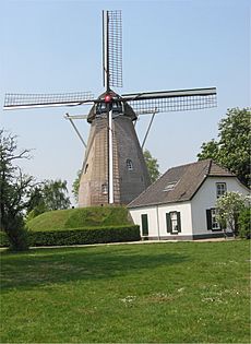
The Netherlands is a small country, but many people live there. It is one of the most densely populated countries of the world.
Most people in the Netherlands speak Dutch. In Friesland, about 200,000 people speak Frisian. Frisian is the language with the most similarities to English. Some Dutch people speak dialects. The Saxon dialects spoken in the northeastern part of the Netherlands are somewhat similar to Low German.
According to a survey done in 2006, 25% of the Dutch people are Christian and 3% believe in another organised religion, like Judaism, Islam or Hinduism. Twenty-six percent are 'unbounded spiritual' (have their own beliefs and are not tied to a religion). The other 44% are not religious.
Cuisine
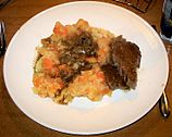
Originally, the country's cuisine was shaped by the practices of fishing and farming, including the cultivation of the soil for growing crops and raising domesticated animals. Dutch cuisine is simple and straightforward, and contains many dairy products. Breakfast and lunch are typically bread with toppings, with cereal for breakfast as an alternative. Traditionally, dinner consists of potatoes, a portion of meat, and (seasonal) vegetables. The Dutch diet was relatively high in carbohydrates and fat, reflecting the dietary needs of the labourers whose culture moulded the country. Without many refinements, it is best described as rustic, though many holidays are still celebrated with special foods. In the course of the twentieth century this diet changed and became much more cosmopolitan, with most global cuisines being represented in the major cities.
Modern culinary writers distinguish between three general regional forms of Dutch cuisine. The regions in the northeast of the Netherlands, roughly the provinces of Groningen, Friesland, Drenthe, Overijssel and Gelderland north of the great rivers are the least populated area of the Netherlands. The late (18th century) introduction of large scale agriculture means that the cuisine is generally known for its many kinds of meats. The relative lack of farms allowed for an abundance of game and husbandry, though dishes near the coastal regions of Friesland, Groningen and the parts of Overijssel bordering the IJsselmeer also include a large amount of fish. The various dried sausages, belonging to the metworst-family of Dutch sausages are found throughout this region and are highly prized for their often very strong taste. Also smoked sausages are common, of which (Gelderse) rookworst is the most renowned. The sausage contains a lot of fat and is very juicy. Larger sausages are often eaten alongside stamppot, hutspot or zuurkool (sauerkraut); whereas smaller ones are often eaten as a street food. The provinces are also home to hard textured rye bread, pastries and cookies, the latter heavily spiced with ginger or succade or contain small bits of meat. Various kinds of Kruidkoek (such as Groninger koek), Fryske dúmkes and spekdikken (small savory pancakes cooked in a waffle iron) are considered typical. Notable characteristics of Fries roggebrood (Frisian rye bread) is its long baking time (up to 20 hours), resulting in a sweet taste and a deep dark colour.
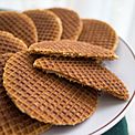
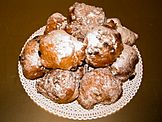
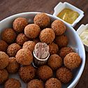
The provinces of North Holland, South Holland, Zeeland, Utrecht and the Gelderlandic region of Betuwe are the parts of the Netherlands which make up the region in which western Dutch cuisine is found. Because of the abundance of water and flat grass lands that are found here, the area is known for its many dairy products, which includes prominent cheeses such as Gouda, Leyden (spiced cheese with cumin), Edam (traditionally in small spheres) as well as Leerdammer and Beemster, while the adjacent Zaanstreek in North Holland is since the 16th century known for its mayonnaise, typical whole-grain mustards and chocolate industry. Zeeland and South Holland produce a lot of butter, which contains a larger amount of milkfat than most other European butter varieties. A by-product of the butter-making process, karnemelk (buttermilk), is also considered typical for this region. Seafood such as soused herring, mussels (called Zeeuwse Mossels, since all Dutch mussels for consumption are cleaned in Zeeland's Oosterschelde), eels, oysters and shrimps are widely available and typical for the region. Kibbeling, once a local delicacy consisting of small chunks of battered white fish, has become a national fast food, just as lekkerbek. Pastries in this area tend to be quite doughy, and often contain large amounts of sugar; either caramelised, powdered or crystallised. The oliebol (in its modern form) and Zeeuwse bolus are good examples. Cookies are also produced in great number and tend to contain a lot of butter and sugar, like stroopwafel, as well as a filling of some kind, mostly almond, like gevulde koek.
The Southern Dutch cuisine consists of the cuisines of the Dutch provinces of North Brabant and Limburg and the Flemish Region in Belgium. It is renowned for its many rich pastries, soups, stews and vegetable dishes and is often called Burgundian which is a Dutch idiom invoking the rich Burgundian court which ruled the Low Countries in the Middle Ages, renowned for its splendor and great feasts. It is the only Dutch culinary region that developed an haute cuisine. Pastries are abundant, often with rich fillings of cream, custard or fruits. Cakes, such as the Vlaai from Limburg and the Moorkop and Bossche Bol from Brabant, are typical pastries. Savoury pastries also occur, with the worstenbroodje (a roll with a sausage of ground beef, literally translates into sausage bread) being the most popular.
Transport
Cycling
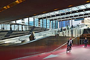
Cycling is a mode of transport used a lot in the Netherlands. Almost as many kilometres are covered by bicycle as by train.
The Dutch are estimated to have at least 18 million bicycles, which makes more than one per capita, and twice as many as the circa 9 million motor vehicles on the road.
In 2013, the European Cyclists' Federation ranked both the Netherlands and Denmark as the most bike-friendly countries in Europe, but more of the Dutch (36%) than of the Danes (23%) list the bike as their most frequent mode of transport on a typical day.
Cycling infrastructure is very good. Busy roads have received some 35,000 km of dedicated cycle tracks, physically segregated from motorised traffic. Busy junctions are often equipped with bicycle-specific traffic lights. There are large bicycle parking facilities, particularly in city centres and at train stations.
Trains
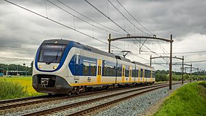
Nederlandse Spoorwegen (English: Dutch Railways) or NS is the main passenger railway operator in the Netherlands. The rail infrastructure is maintained by network manager ProRail, which was split off from NS in 2003. Freight services, formerly operated by NS Cargo, merged with the DB Schenker group in 2000.
NS runs 4,800 scheduled trains daily trains. In addition, NS provides international rail services from the Netherlands to other European destinations and carries out concessions on a number of foreign rail markets through its subsidiary Abellio such as Abellio Greater Anglia, Merseyrail and ScotRail.
Related pages
Images for kids
-
Map of the Habsburg dominions. From 1556 the dynasty's lands in the Low Countries were retained by the Spanish Habsburgs.
-
The Spanish Fury at Maastricht, 1579
-
Dutch East India Company factory in Hugli-Chuchura, Mughal Bengal by Hendrik van Schuylenburgh, 1665
-
Winter landscape with skaters near the city of Kampen by Hendrick Avercamp (1620s)
-
Amsterdam's Dam Square in 1656
-
Map of the Dutch colonial empire. Light green: territories administered by or originating from territories administered by the Dutch East India Company; dark green: the Dutch West India Company. In yellow are the territories occupied later, during the 19th century.
-
The submission of Diponegoro to General De Kock at the end of the Java War in 1830. Painting by Nicolaas Pieneman
-
Rotterdam after German air raids in 1940
-
Former Prime Ministers Wim Kok, Dries van Agt, Piet de Jong, Ruud Lubbers and Jan Peter Balkenende with Prime Minister Mark Rutte, in 2011
-
Cows near the city of Arnhem
-
In Rotterdam almost half the population has an immigrant background.
-
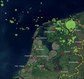
Population density in the Netherlands by municipality. The largest urban area, the Randstad is clearly visible along the west coast.
-
View on the Utrecht Science Park of Utrecht University. The building in the centre is the library.
-
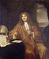
Portrait of Antonie van Leeuwenhoek (1632–1723), known as "the father of microbiology"
-
A public hospital in Amersfoort
-
A1 motorway, in Gelderland
-
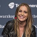
Pop singer Anouk in 2013
-
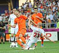
Dutch star football players Arjen Robben and Robin van Persie during a game with the Netherlands against Denmark at Euro 2012
See also
 In Spanish: Países Bajos para niños


