Conurbation facts for kids
A conurbation is a huge urban area where several cities, towns, and other developed places have grown so much that they've joined together. Imagine a bunch of cities expanding and eventually touching each other, forming one giant connected area!
These big urban areas often have great transportation systems that link everything together. This means people can easily travel between the different parts for work or other activities.
The word "conurbation" was first used by a man named Patrick Geddes in his 1915 book Cities In Evolution. He noticed how new technologies like electric power and cars were helping cities spread out and connect. He gave examples like the "Midlandton" in England and the Ruhr in Germany.
It's important to know that a conurbation is different from a megalopolis. In a megalopolis, cities are close but not fully joined, and their job markets aren't completely connected yet. A conurbation is also different from a megacity. A megacity usually has one main, super-dominant city, while a conurbation has several important centers, with no single one being the boss over all the others.
Contents
- Conurbations Around the World
- Africa
- Oceania
- North America
- Canada
- Mexico
- United States
- Puerto Rico
- New York Tri-state area
- Greater Boston Area
- San Francisco Bay Area
- Greater Los Angeles Area
- Greater Houston area
- Baltimore–Washington Area
- San Diego–Tijuana
- Dallas–Fort Worth
- Detroit–Windsor
- South Florida
- Minneapolis–St. Paul
- Quad Cities
- Stamford-Hartford
- The Valley of the Sun
- The Front Range Urban Corridor
- South America
- Asia
- Europe
- See also
Conurbations Around the World
Africa
Mauritius
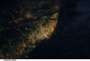
On the island of Mauritius, a large conurbation has formed in the central part. It includes cities and towns like Port Louis, Beau Bassin-Rose Hill, Curepipe, Quatre Bornes, and Vacoas-Phoenix. This connected area had about 606,650 people in 2011, which was almost half of the island's population!
Nigeria
Lagos in Nigeria is a conurbation that grew as the original city merged with other towns like Ikeja and Ojo. Many suburban areas also became part of this large urban space.
South Africa
In South Africa, the cities of Johannesburg, Ekurhuleni (also known as East Rand), and Tshwane (which includes Pretoria) have merged. This huge region is home to about 14.6 million people.
Oceania
Australia
Albury-Wodonga
Albury and Wodonga are two cities separated by the Murray River, which forms a border between the states of New South Wales and Victoria. In the 1970s, the government wanted to encourage people to move away from big cities like Sydney and Melbourne. These two cities were chosen to grow together, and now they form an urban area with an estimated population of 93,603.
Canberra-Queanbeyan
This is another cross-border urban area. It includes Australia's capital city, Canberra, in the Australian Capital Territory, and the city of Queanbeyan in New South Wales. The Australian Bureau of Statistics sees them as having a single job market, meaning many people travel between them for work.
Newcastle, Sydney, Wollongong
This massive conurbation in New South Wales stretches for about 270 kilometers (168 miles). It goes from Newcastle in the north, through the Central Coast, and down to the greater Sydney area and Wollongong in the south. Over 6 million people live here!
Major highways and a large public transport system, including trains, connect these areas. This makes it easy for people to commute for work or services across different centers that are joined together. There have even been talks since the 1960s about making Wollongong, Sydney, and Newcastle into one single "mega-region."
Greater Perth
The Perth Metropolitan Region in Western Australia is a continuous urban area over 130 kilometers (80 miles) long. It includes Perth, City of Fremantle, City of Mandurah, and Pinjarra. This area, sometimes called Greater Perth, had a population of over 2.05 million in 2015. A railway line built in 2007 made it possible to travel from Mandurah to Perth in just 51 minutes.
South East Queensland
This built-up area is 200 kilometers (124 miles) long and is centered around Brisbane. It includes places like Gold Coast, Ipswich, and Sunshine Coast. A single public transport network called Translink serves this entire region. The wider definition of South East Queensland has over 3.4 million people.
Greater Darwin
The Greater Darwin metropolitan area is an urban area in the Northern Territory. It covers two cities: Darwin (the capital) and Palmerston (Darwin's nearby city).
New Zealand
In 2010, Auckland became a single authority, combining seven former city and district councils. This included Auckland City, Manukau City, and North Shore City. The region now has a population of 1,529,300, which is almost 33% of New Zealand's total population!
The Wellington Metropolitan Area is New Zealand's second-largest urban area. It includes Wellington City, Porirua, and the cities of Lower Hutt and Upper Hutt. Its population is 409,200.
North America
Canada
Golden Horseshoe (Ontario)
The "Golden Horseshoe" is a very populated and industrial area in Southern Ontario, Canada. It's located around the west end of Lake Ontario. The biggest cities here are Toronto, Mississauga, Oakville, and Hamilton. If you include nearby metropolitan areas, the total population is 8.8 million people. This is more than a quarter of Canada's population!
Greater Montreal (Quebec)
Greater Montreal is Canada's second-largest conurbation. In 2011, it had a population of 3,824,221, which is almost half of the population of the province of Quebec. Many municipalities in this area work together to plan land use, transportation, and economic growth.
Lower Mainland (British Columbia)
British Columbia's Lower Mainland is the most populated area in Western Canada. It has many connected urban areas, including Vancouver, Burnaby, Richmond, and Surrey. The population of the Lower Mainland is around 2.5 million (as of 2011) and is growing quickly.
Ottawa-Gatineau / National Capital Region
The National Capital Region (NCR) is unique because it crosses two provinces! It includes Canada's capital, Ottawa (in Ontario), and nearby Gatineau (in Quebec), which is just across the Ottawa River. Many government buildings are in both cities, and people often live in one city and work in the other. The total population of this area is about 1,500,000.
Mexico
Mexico City (CDMX)
Greater Mexico City is the most densely populated area in North America. It includes Mexico City itself and 41 nearby municipalities in the states of Mexico and Hidalgo. As of 2019, an estimated 27,782,000 people lived in Greater Mexico City, making it the largest metropolitan area on the continent.
Guadalajara Metropolitan Area
The Guadalajara conurbation in the state of Jalisco includes seven municipalities like Guadalajara, Zapopan, and Tlaquepaque. In 2010, this area had an estimated population of 4,500,000 people.
United States
Puerto Rico
In Puerto Rico, a conurbation exists around San Juan. It includes cities like Bayamón, Guaynabo, and Carolina. This area, known as the "Área Metropolitana," has about 1.4 million people and is the largest city in the Caribbean by area.
New York Tri-state area
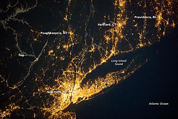
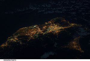
The New York metropolitan area, also called the Tri-state area, is a huge conurbation centered on New York City. It covers 30 counties across New York State, New Jersey, Connecticut, and Pennsylvania. In 2007, it had an estimated population of almost 22 million people. About one-fifteenth of all U.S. residents live in this Greater New York City area, which is the world's most brightly lit urban conurbation.
Greater Boston Area
The Greater Boston area, with a population of over 7.4 million in 2005, includes Boston and other connected cities like Providence, Rhode Island, Worcester, Massachusetts, and Manchester, New Hampshire. These cities are linked by public transportation, continuous urban areas, and shared commuting patterns.
San Francisco Bay Area
Another conurbation is the combination of the metropolitan areas of San Francisco, Oakland, and San Jose. Along with several smaller urban centers, this area is known as the San Francisco Bay Area and has a combined population of almost 8 million people.
Greater Los Angeles Area
The Greater Los Angeles Area is formed by the merging of several distinct cities and counties, including Los Angeles, Orange County, and Riverside. This area is often called Southern California and had a population of 23.8 million in 2016.
Greater Houston area
In Greater Houston, the urban area is continuously developed from the coastal parts of Galveston through the northern side, including The Woodlands and Conroe. It has a population of over 7.1 million.
Baltimore–Washington Area
The metropolitan areas of Baltimore and Washington, D.C. were traditionally separate. However, they now share suburbs and have continuous urban development between the two main cities, forming the Baltimore–Washington metropolitan area.
San Diego–Tijuana
The largest conurbation that crosses the border between the United States and Mexico is San Diego–Tijuana. It has the busiest border crossing between the two countries and a shared economy.
Dallas–Fort Worth
This area is made up of three large cities: Dallas, Fort Worth, and Arlington. They are linked by bordering city limits or suburbs. This area is often called the Dallas–Fort Worth "metroplex" because it has more than one main city of similar size or importance.
Detroit–Windsor
The major U.S. city of Detroit is right across the Detroit River from Windsor, Ontario in Canada. These two cities and their suburbs are often called the Detroit–Windsor area. The border crossing here is the busiest for trade between the two countries.
South Florida
The entire tri-county area, also known as the Miami-Fort Lauderdale-West Palm Beach metropolitan area, is continuously urbanized along about 100 miles (160 km) of the Florida east coast. It also extends inland and south of Miami.
Minneapolis–St. Paul
Minneapolis–Saint Paul is the most populated urban area in Minnesota. It's made up of 182 cities and townships built around three rivers. This area is nicknamed the Twin Cities because of its two largest cities: Minneapolis (the biggest) and Saint Paul (the state capital).
Quad Cities
The Quad Cities is a metropolitan area on the border of Illinois and Iowa. It's located along the Mississippi River. The largest cities here include Rock Island, Moline, and East Moline in Illinois, as well as Davenport and Bettendorf in Iowa.
Stamford-Hartford
Hartford is the capital city of Connecticut. Along with Waterbury, New Haven, Bridgeport, and Stamford, these five cities form a conurbation. As people move into the suburbs of these cities, the urban areas connect. Their combined population is over 1 million.
The Valley of the Sun
Phoenix is the capital and most populated city in Arizona. It's the center of The Valley of the Sun, which includes Chandler, Mesa, and Phoenix. Other communities like Scottsdale and Glendale are also part of this metropolitan area.
The Front Range Urban Corridor
Denver is the capital and most populated city in Colorado. This conurbation covers 18 counties in Colorado and Wyoming. In 2018, it had an estimated population of almost 5 million people.
South America
Argentina
- Greater Buenos Aires is a huge urban area with over 12 million people. It also connects with Greater La Plata and other towns like Zárate and Campana.
Brazil
The CME São Paulo is a massive conurbation with over 27 million people (2009). It includes the São Paulo Metro region and its connected areas. RM Rio de Janeiro is another large metropolitan region with over 12 million people (2016). RM Belo Horizonte is usually called Greater Belo Horizonte. It includes 34 municipalities and about 16 other surrounding cities, with a population of over 5.9 million (2018).
Colombia
- The Metropolitan Area of Bogotá is a conurbation between Bogota and Soacha, with over 10.7 million people (2014).
- The Metropolitan Area of the Aburrá Valley around Medellín is a metropolitan region with over 3.8 million people (2014).
Peru
The Lima Metropolitan Area in Peru had about 9.5 million people in 2017. This conurbation is expected to grow even more and become a megacity soon.
Asia
China
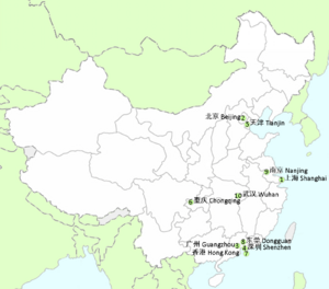
China has three very well-known conurbations:
- The Yangtze River Delta: This area includes Shanghai, Nanjing, Hangzhou, and Ningbo. It's home to 150 million people and produces a huge amount of China's economy.
- The Jingjinji: This conurbation includes Tianjin, Beijing, Tangshan, and Qinhuangdao. It has an estimated 130 million people.
- The Pearl River Delta: This region includes Guangzhou, Shenzhen, Dongguan, Hong Kong, and Macau. It's home to 60 million people and is a major economic hub.
India
The Mumbai Metropolitan Region (MMR) includes Mumbai and its surrounding towns. It covers an area of 4,355 km2 and has a population of 20.5 million, making it one of the most populated urban areas in the world. It's connected by a large railway system and roads.
The National Capital Region (NCR) is a planning region that includes Delhi and nearby districts. However, the actual conurbation of Delhi is limited to Delhi itself and the connected urban areas like Gurgaon, Faridabad, and Noida. This conurbation had an estimated population of 21.7 million in 2011, making it the world's third most populous urban area.
The Amaravati Metropolitan Region (AMR) is a conurbation of three cities: Vijayawada, Eluru, and Guntur, along with 11 other towns. The new capital city of Amaravati is being built in the center of this conurbation.
Bangladesh
The city of Dhaka is connected with Narayanganj and Gazipur city, with no gaps between them. This conurbation, known as Greater Dhaka City, includes Dhaka (the core city with about 10 million people) and satellite cities like Tongi and Fatullah.
Indonesia
Greater Jakarta (also called Jabodetabek) is the largest urban area in Indonesia and the second-largest in the world, with about 30 million people. Its center, Jakarta, has a population of 10.3 million.
Surabaya, Indonesia's second-most populated city, also forms a conurbation called Gerbangkertosusila with a metropolitan population of about 10 million.
Israel
Japan
The Taiheiyō Belt is the largest conurbation in Japan, stretching almost 1,200 km (746 miles) and having a total population of 82.9 million. However, people in Japan usually refer to its different parts separately. The Greater Tokyo Area, also called Shutoken, is often considered the most populous and economically largest metropolitan area in the world, with an estimated population of 35,676,000 in 2007.
Jordan
More than half of Jordan’s population lives in the conurbation of Amman-Russeifa-Zarqa.
Malaysia
The Klang Valley conurbation in Selangor includes cities like Kuala Lumpur (the capital), Petaling Jaya, Subang Jaya, and Shah Alam.
The second largest conurbation in Malaysia is Greater Penang. It's centered in George Town and includes towns in Penang and nearby states like Kedah and Perak.
The third largest is Johor Bahru Conurbation, centered in Johor Bahru. It includes towns like Tebrau, Pasir Gudang, and Skudai.
Pakistan
- Karachi–Hyderabad, Sindh is one of the largest metropolitan areas globally, with over 20 million people (2017).
- Rawalpindi–Islamabad, known as the twin cities, were built about 8 miles apart. They have now completely merged due to population growth.
- Lahore–Raiwind–Kala Shah Kaku includes Pakistan's second-largest city, Lahore, and its connected towns.
Palestine
The Gaza Strip conurbation has a population of 2.1 million.
Philippines
Metro Manila, also known as the National Capital Region, is a conurbation of the capital Manila, fifteen nearby cities, and a small town. It forms the largest urban center in the Philippines.
Taiwan
Taiwan has three major conurbations:
- The Taipei-Taoyuan-Keelung Metropolitan Area (Northern Taiwan Conurbation) is in northern Taiwan. It includes Taipei, New Taipei, Keelung, and Taoyuan. It's home to 9.3 million people, about one-third of Taiwan's population. This region is the main center for Taiwanese culture, economy, education, and government.
- The Taichung–Changhua–Nantou metropolitan area (Central Taiwan Conurbation) is in central Taiwan. It includes Taichung, Changhua, and Nantou, with an estimated 4.6 million people.
- The Kaohsiung–Pingtung–Tainan metropolitan area (Southern Taiwan Conurbation) is in southern Taiwan. It includes Kaohsiung, Tainan, and Pingtung, with about 5.4 million people.
Turkey
The Asian part of Istanbul forms a conurbation with districts of Kocaeli Province (like Gebze) and the town of Yalova. Even though they have separate governments, they work closely together on transport. This three-province region has 17.5 million people, which is 20% of Turkey's population.
İzmir and Manisa also form a conurbation. Many people travel daily between these cities for work and school. Their combined metropolitan areas have a population of 3.3 million.
Thailand
The Bangkok Metropolitan Region is an urban area that includes the Bangkok metropolis and five nearby provinces.
United Arab Emirates
The Dubai-Sharjah-Ajman metropolitan area is a significant conurbation in the United Arab Emirates. It includes the urban areas of Dubai, Sharjah, and Ajman, which belong to three different Emirates. This area had about 5.64 million people in 2015, making up over 70% of the UAE's population.
Vietnam
- The Ho Chi Minh City Metropolitan Region includes Ho Chi Minh City and many surrounding districts and towns in different provinces.
- The Hanoi Metropolitan Region includes Hanoi and several nearby provinces and towns, forming a large urban area.
Europe
Belgium
The Flemish Diamond is a network of four metropolitan areas in Belgium: Brussels, Ghent, Antwerp, and Leuven. These cities form the corners of a diamond shape. Over five million people live in this conurbation, with a very high population density. Because so many people commute to and from Brussels, some argue that the whole of Belgium and Luxembourg is becoming one large conurbation.
France
The most notable conurbation in France is Lille-Roubaix-Tourcoing-Villeneuve-d'Ascq in the north, with over 1.2 million people. This conurbation even extends internationally, as Belgian cities like Tournai are becoming commuter towns for Lille.
Germany
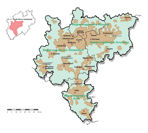
Germany has three conurbations along the Rhine River: Rhine-Main, Rhine-Neckar, and Rhine-Ruhr. The Rhine-Ruhr is the largest conurbation in continental Europe. It's a densely populated region that includes the Ruhr Metropolitan Region, Düsseldorf-Mönchengladbach-Wuppertal Region, and Cologne/Bonn Metropolitan Region. These areas are all connected by continuous urban development, even though they have cultural and economic differences.
Italy
In Italy, a conurbation usually has four main features:
- Cities must be in the same province or close to the main province.
- The total population must be more than 250,000 people.
- Cities must be connected to a main city of over 200,000 people, creating a continuous urban area.
- Cities must meet certain standards for basic services, transportation, and development.
Italian conurbations don't have official borders because there isn't a government organization for metropolitan areas.
| Map | Name | Region | Population | Year | Notes |
|---|---|---|---|---|---|
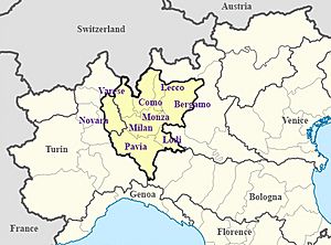
| Milan metropolitan area (Greater Milan) | Lombardy and Piedmont | 8,220,170 | 2019 | This is the largest conurbation in Italy. It includes the provinces of Milan, Bergamo, Como, Lecco, Lodi, Monza and Brianza, Pavia, Varese, and Novara. | |
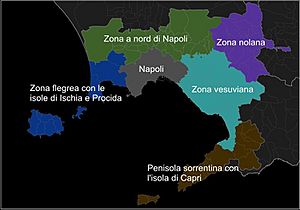
| Naples metropolitan area (Greater Naples) | Campania | 4,996,084 | 2019 | This conurbation covers many cities in the provinces of Naples, Caserta, Salerno, and Avellino. | |
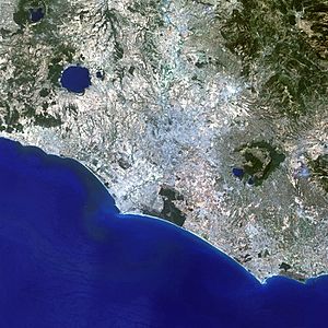
| Rome metropolitan area (Greater Rome) | Lazio | 4,353,738 | 2017 | This conurbation includes many cities within the Metropolitan City of Rome Capital and Aprilia. | |
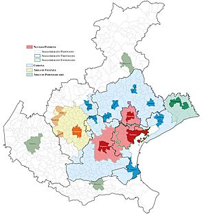
| PaTreVe (Eastern Veneto conurbation) | Veneto | 2,748,420 | 2020 | This conurbation includes 240 cities in eastern Veneto, in the provinces of Venice, Padua, and Treviso. | |
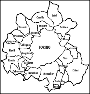
| Turin metropolitan area (Greater Turin) | Piedmont | 1,646,064 | 2014 | This includes cities in the province of Turin. | |
| Higher Adriatic conurbation | Emilia-Romagna and Marche | 1,280,666 | 2015 | This conurbation stretches from Forlì to Ancona, forming a 140 km (87 miles) urban belt. | |
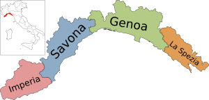
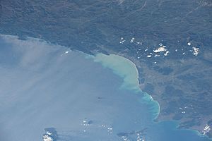
| Genoa metropolitan area (Greater Genoa) | Liguria | 1,127,173 | 2019 | This conurbation is a 180 km (112 miles) belt from Mele Cape to Palmaria Island. It includes cities from the provinces of Genoa, La Spezia, and Savona. | |
| Northwest Tuscany conurbation | Liguria and Tuscany | 1,106,128 | 2015 | This conurbation stretches from La Spezia to Livorno, including Pisa and Lucca, forming a 90 km (56 miles) urban belt. | |
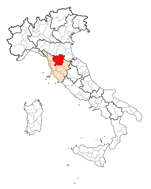
| Florence Plan conurbation | Tuscany | 1,098,230 | 2015 | This conurbation includes 21 cities from the provinces of Florence, Prato, and Pistoia, forming a 37 km (23 miles) urban belt. | |
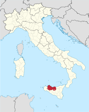
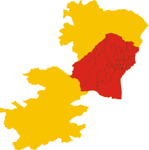
| Palermo metropolitan area (Greater Palermo) | Sicily | 1,069,754 | 2011 | This conurbation includes 26 cities in the province of Palermo. | |
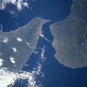
| Messina Strait conurbation | Calabria and Sicily | 1,029,729 | 2019 | This conurbation is the union of the Messina and Reggio Calabria metropolitan areas, both facing the Messina Strait. | |
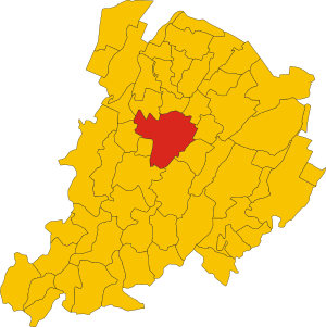
| Bologna metropolitan area (Greater Bologna) | Emilia-Romagna | 1,017,806 | 2019 | This includes 50 cities in the province of Bologna. | |
| Catania metropolitan area (Greater Catania) | Sicily | 777,745 | 2017 | This conurbation includes 27 cities in the province of Catania. | |
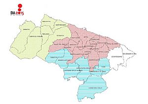
| Bari metropolitan area (Greater Bari) | Apulia | 750,450 | 2017 | This conurbation includes 21 cities in the province of Bari. | |
| Brescia conurbation | Lombardy | 706,399 | 2015 | This conurbation includes cities in the province of Brescia. | |
| Verona conurbation | Veneto | 567,329 | 2015 | This conurbation includes cities in the province of Verona. | |
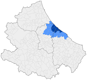
| Pescara metropolitan area (Greater Pescara) | Abruzzo | 390,154 | 2023 | This conurbation includes cities from the provinces of Pescara, Chieti, and Teramo. | |
| Cagliari conurbation | Sardinia | 375,689 | 2015 | This conurbation includes cities in the province of Cagliari. |
Malta
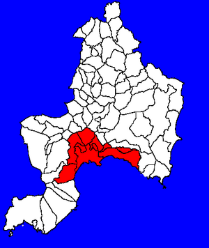
The Valletta Urban Area, around the Grand Harbour, is the main conurbation in Malta. It includes 27 of Malta's 68 local councils, including the capital Valletta. This urban area has a population of about 300,000, which is about 75% of Malta's total population.
Netherlands
The Randstad is a very populated area in the Netherlands with over 7 million people. It's a group of the country's four most populated cities (Amsterdam, Rotterdam, The Hague, and Utrecht) along with many smaller cities and towns.
Poland
The Katowice Urban Area is the largest conurbation in Poland. It's located in Upper Silesia and has about 5,294,000 people, which is over 5% of Poland's population.
Spain
United Kingdom
Many conurbations formed in the United Kingdom during the 19th and early 20th centuries due to industrial and housing growth. Greater London is the largest urban area. In the mid-1950s, the Green Belt was created to stop cities from spreading too much into the countryside in South East England.
One example is the Liverpool–Manchester conurbation, which has a population of 5.68 million.
See also
 In Spanish: Conurbación para niños
- Ecumenopolis
- Ekistics
- Megalopolis
- Transborder agglomeration
- Urban sprawl
 | Delilah Pierce |
 | Gordon Parks |
 | Augusta Savage |
 | Charles Ethan Porter |


