List of rivers of California facts for kids
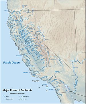
California is a huge state with many important rivers. These rivers flow into the Pacific Ocean, San Francisco Bay, or into large inland lakes and dry lakebeds. Rivers are like the veins of the land, carrying water from mountains and hills all the way to the sea or to other bodies of water. This list helps you explore some of California's most important rivers, grouped by where they end up.
Contents
- North Coast Rivers (North of Humboldt Bay)
- Humboldt Bay Streams
- North Coast Rivers (South of Humboldt Bay)
- San Francisco Bay Area Rivers
- Sacramento–San Joaquin River Delta
- Tulare Basin: An Inland Lake System
- Central Coast Rivers
- South Coast Rivers
- Gulf of California Rivers
- Carrizo Plain: A Closed Valley
- Salton Sea Rivers
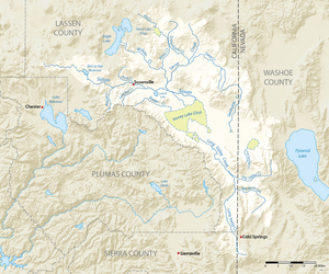
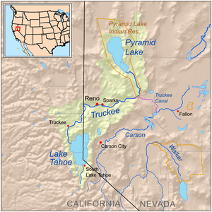
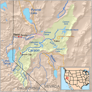
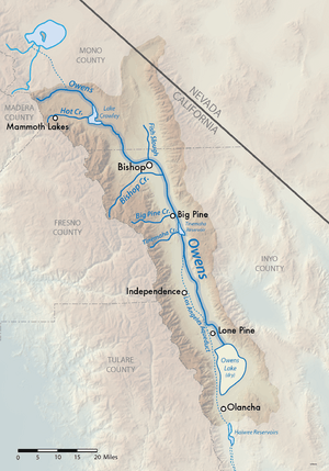
- Great Basin Rivers
- See also
North Coast Rivers (North of Humboldt Bay)
These rivers are found in the northern part of California, flowing into the Pacific Ocean between the Oregon border and Humboldt Bay. They are listed from north to south.
- Smith River - A beautiful river known for its clear waters.
- Klamath River - One of the biggest rivers in the region.
- Redwood Creek - Flows through famous redwood forests.
- Little River
- Mad River
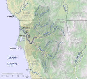
Smith River and Its Branches
The Smith River has several branches that join it:
- South Fork Smith River
- Middle Fork Smith River
- North Fork Smith River
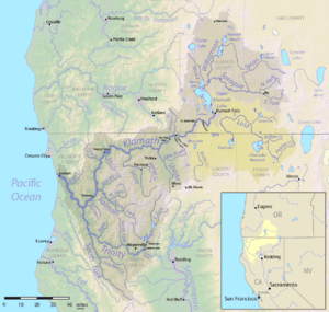
Klamath River and Its Branches
The Klamath River is a very long river with many smaller streams joining it. Some of its main branches include:
- Blue Creek
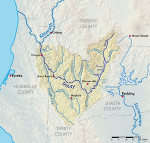
- Trinity River - A major branch of the Klamath.
- Bluff Creek
- Salmon River - Another important branch.
- Scott River
- Shasta River
- Lost River (joins the Klamath in Oregon)
Trinity River: A Major Branch
The Trinity River is a large tributary to the Klamath River. Key branches are:
- South Fork Trinity River
- New River
- North Fork Trinity River
- Weaver Creek
- Stuart Fork
- East Fork Trinity River
- Coffee Creek
Salmon River: Wild and Scenic
The Salmon River is known for its wild beauty. Its main branches are:
- Wooley Creek
- North Fork Salmon River
- South Fork Salmon River
Redwood Creek: Through Giant Trees
Redwood Creek (Humboldt County) flows through areas with giant redwood trees. Some of its streams are:
- Prairie Creek (California)
- Minor Creek
Mad River: Flowing to the Pacific
The Mad River also flows into the Pacific Ocean. Its main branches include:
- North Fork Mad River
- Boulder Creek
Humboldt Bay Streams
These streams flow into Humboldt Bay, a large natural harbor. They are listed clockwise around the bay.
- Jacoby Creek
- Eureka Slough (with Freshwater Creek)
- Elk River (California)
- Salmon Creek (Northern Humboldt County)
North Coast Rivers (South of Humboldt Bay)
These rivers flow into the Pacific Ocean between Humboldt Bay and the Golden Gate in San Francisco.
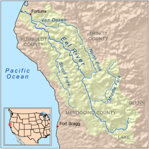
- Eel River - A very large river in this region.
- Bear River
- Mattole River
- Ten Mile River
- Noyo River
- Big River
- Navarro River
- Garcia River
- Gualala River
- Russian River - A well-known river in Sonoma County.
Eel River: A Major Waterway
The Eel River has many important branches:
Russian River: Popular for Recreation
The Russian River is a popular spot for outdoor activities. Its main branches include:
- East Fork Russian River
- Ackerman Creek
San Francisco Bay Area Rivers
These rivers and streams flow into San Francisco Bay. The large Sacramento–San Joaquin River Delta is covered in the next section.
San Pablo Bay (North of Carquinez Strait)
Streams flowing into the northern part of San Francisco Bay:
- Corte Madera Creek
- Novato Creek
- Petaluma River
- Sonoma Creek
- Napa River
Suisun Bay Streams
These streams flow into Suisun Bay, which is part of the larger San Francisco Bay system.
- Suisun Slough (with Suisun Creek)
- Montezuma Slough
- Sacramento River - A very important river, covered in more detail below.
- San Joaquin River - Another major river, also covered below.
- Kirker Creek
- Pacheco Creek
- Alhambra Creek
San Pablo Bay (South of Carquinez Strait) and San Francisco Bay
Streams flowing into the central and southern parts of San Francisco Bay:
- San Pablo Creek
- Pinole Creek
- San Leandro Creek
- San Lorenzo Creek
- Alameda Creek
- Coyote Creek
- Guadalupe River
- Stevens Creek
- San Francisquito Creek
- Redwood Creek (San Mateo County)
- San Mateo Creek
Sacramento–San Joaquin River Delta
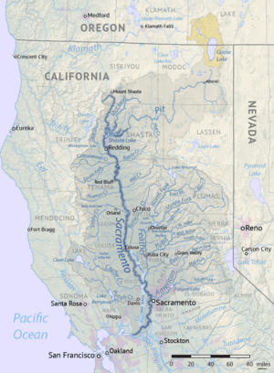
The Sacramento River and San Joaquin River systems are the biggest river systems in California. They drain water from the Sierra Nevada mountains and most of the Central Valley, forming a large delta before reaching San Francisco Bay.
Sacramento River: The Heart of the Valley
The Sacramento River is California's longest river. It has many branches:
- Sacramento Deep Water Ship Channel
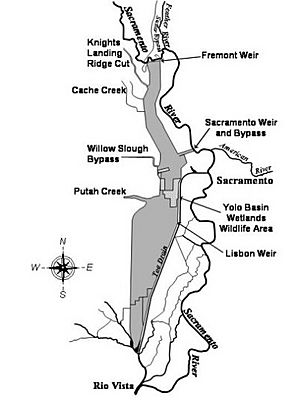
- Yolo Bypass - A special floodway built by people.
- American River - A major tributary.
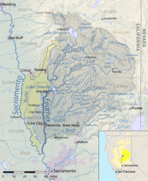
- Feather River - Another very important tributary.
- Butte Creek
- Stony Creek (with Black Butte Lake)
- Big Chico Creek
- Deer Creek
- Mill Creek
- Battle Creek
- Cottonwood Creek
- Cow Creek
- Clear Creek (with Whiskeytown Lake)
- Shasta Dam, Shasta Lake - A huge dam and lake on the Sacramento River.
- Pit River - A very long tributary that joins the Sacramento River.
Yolo Bypass: A Floodway
The Yolo Bypass helps control floods. It receives water from:
- Putah Creek (with Lake Berryessa)
- Cache Creek (with Clear Lake)
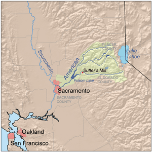
American River: Gold Rush History
The American River is famous for the California Gold Rush. It flows through Folsom Lake. Its main branches are:
Feather River: Power and Water
The Feather River is important for water and power. It has Oroville Dam and Lake Oroville. Key branches include:
- Bear River
- Yuba River - A major tributary.
- North Fork Feather River
- Middle Fork Feather River
- South Fork Feather River
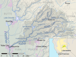
Yuba River: A Gold Rush River
The Yuba River also played a role in the Gold Rush. It flows through Englebright Lake. Its main branches are:
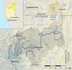
Pit River: Long and Winding
The Pit River is one of the longest rivers in California. It flows into the Sacramento River. Key branches are:
- McCloud River
- Hat Creek
- Fall River
- Ash Creek
- North Fork Pit River
- South Fork Pit River
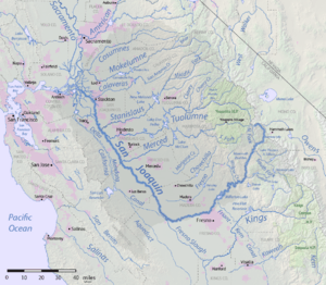
San Joaquin River: Southern Central Valley
The San Joaquin River drains the southern part of the Central Valley. It flows through Millerton Lake. Important branches include:
- Mokelumne River
- Calaveras River
- Stanislaus River
- Tuolumne River
- Merced River
- Chowchilla River
- Fresno River
- South Fork San Joaquin River
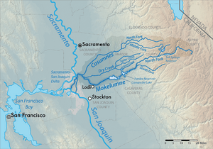
Mokelumne River: Water for Cities
The Mokelumne River provides water for many communities. It flows through Camanche Lake and Pardee Reservoir. Its main branches are:
- Cosumnes River
- Dry Creek
- North Fork Mokelumne River
- Middle Fork Mokelumne River
Calaveras River: Through the Foothills
The Calaveras River flows through the foothills of the Sierra Nevada. It has New Hogan Lake. Its main branches are:
- North Fork Calaveras River
- South Fork Calaveras River
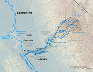
Stanislaus River: Scenic Beauty
The Stanislaus River is known for its beautiful canyons. It flows through Tulloch Reservoir and New Melones Lake. Key branches include:
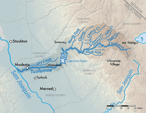
Tuolumne River: Yosemite's Water
The Tuolumne River flows from Yosemite National Park. It has Lake Don Pedro and Hetch Hetchy Reservoir. Main branches are:
- Clavey River
- South Fork Tuolumne River
- Cherry Creek (with Cherry Lake)
- Dana Fork Tuolumne River
- Lyell Fork Tuolumne River
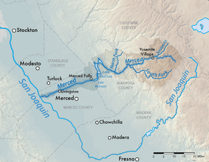
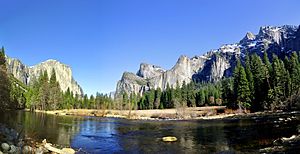
Merced River: Through Yosemite Valley
The Merced River flows right through Yosemite National Park's famous valley. It has Lake McClure. Its main branches are:
- North Fork Merced River
- South Fork Merced River
- Yosemite Creek
- Tenaya Creek
- Illilouette Creek
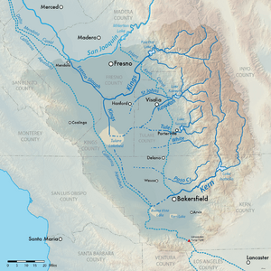
Tulare Basin: An Inland Lake System
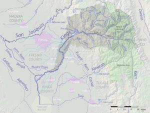
The Tulare Basin is a special area where rivers usually flow into Tulare Lake instead of the ocean. In very wet years, Tulare Lake can overflow into the San Joaquin River. Rivers here are listed clockwise.
Kings River: A Powerful River
The Kings River is a powerful river that flows through Pine Flat Lake. It has several forks:
- North Fork Kings River
- Middle Fork Kings River
- South Fork Kings River (This is the river that flows through Kings Canyon.)
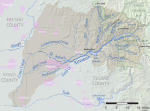
Kaweah River: Sierra Foothills
The Kaweah River flows from the Sierra Nevada foothills. It has Lake Kaweah. Its main forks are:
- South Fork Kaweah River
- North Fork Kaweah River
- East Fork Kaweah River
- Marble Fork Kaweah River
- Middle Fork Kaweah River
Tule River: Through Farmland
The Tule River flows through agricultural areas. It has Lake Success. Its main forks are:
- South Fork Tule River
- North Fork Tule River
- Middle Fork Tule River
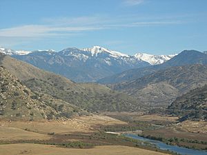
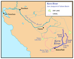
Kern River: From Mountains to Valley
The Kern River starts high in the Sierra Nevada mountains and flows into the valley. It has Lake Isabella. Its main forks are:
- North Fork Kern River
- South Fork Kern River
Central Coast Rivers
These rivers flow into the Pacific Ocean between the Golden Gate and Point Arguello.
- San Gregorio Creek
- Pescadero Creek
- San Lorenzo River
- Pajaro River
- Elkhorn Slough
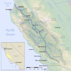
- Salinas River
- Carmel River
- Big Sur River
- San Luis Obispo Creek
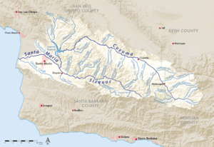
- Santa Maria River
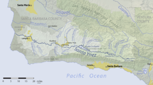
- Santa Ynez River
Pajaro River: Bordering Counties
The Pajaro River forms a border between several counties. Its main branches are:
- Pacheco Creek
- San Benito River
- Salsipuedes Creek
Salinas River: Longest Coastal River
The Salinas River is the longest river on California's Central Coast. It has San Antonio Lake and Lake Nacimiento. Key branches include:
Santa Maria River: Southern Central Coast
The Santa Maria River flows into the Pacific Ocean. It has Twitchell Reservoir. Its main branches are:
Santa Ynez River: Important for Water Supply
The Santa Ynez River is a key source of water for the area. It flows through Lake Cachuma. Its main branches are:
- Salsipuedes Creek
- Mono Creek
- Agua Caliente Creek
South Coast Rivers
These rivers flow into the Pacific Ocean southeast of Point Arguello.
Point Arguello to Santa Monica
- Goleta Slough
- Montecito Creek
- San Ysidro Creek
- Carpinteria Creek
- Ventura River
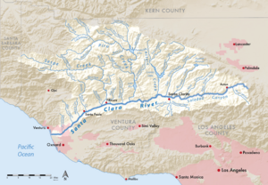
- Santa Clara River
- Calleguas Creek
- Malibu Creek
- Topanga Creek
Santa Clara River: A Long Southern California River
The Santa Clara River is one of the longest rivers in Southern California. It has Lake Piru and Castaic Lake. Key branches are:
- Santa Paula Creek
- Sespe Creek
- Piru Creek
- Castaic Creek
- South Fork Santa Clara River
Ventura River: Coastal Flow
The Ventura River flows to the coast. It includes Lake Casitas. Its main branches are:
- Coyote Creek
- Matilija Creek
- North Fork Matilija Creek
Santa Monica to San Clemente
- Ballona Creek
- Dominguez Channel
- Los Angeles River
- San Gabriel River
- Santa Ana River
- Newport Bay (with San Diego Creek)
- Aliso Creek
- Salt Creek
- San Juan Creek
Los Angeles River: Through the City
The Los Angeles River flows through the city of Los Angeles. Many parts of it are now lined with concrete to control floods. Key branches include:
- Compton Creek
- Rio Hondo
- Arroyo Seco
- Tujunga Wash (with Big Tujunga Creek and Little Tujunga Creek)
- Aliso Creek
- Bell Creek
San Gabriel River: Flood Control and Recreation
The San Gabriel River is important for flood control and recreation. Its main branches are:
Santa Ana River: Southern California's Largest
The Santa Ana River is the largest river in Southern California. It has Lake Mathews and Lake Elsinore. Key branches include:
- Santiago Creek
- Chino Creek
- Temescal Creek (with San Jacinto River)
- Lytle Creek
- Mill Creek
- Deep Creek
- Bear Creek (with Big Bear Lake)
- South Fork Santa Ana River
San Clemente to Mexican Border
- San Mateo Creek
- San Onofre Creek
- Santa Margarita River
- San Luis Rey River
- Buena Vista Lagoon (with Buena Vista Creek)
- Agua Hedionda Lagoon (with Agua Hedionda Creek)
- San Dieguito River
- San Diego River
- San Diego Bay outlet
- Tijuana River
Santa Margarita River: Coastal Flow
The Santa Margarita River flows to the coast. Its main branches are:
- DeLuz Creek
- Temecula Creek (with Vail Lake)
- Murrieta Creek
San Luis Rey River: From Mountains to Sea
The San Luis Rey River flows from the mountains to the Pacific Ocean. Its main branch is:
- West Fork San Luis Rey River
San Dieguito River: Near San Diego
The San Dieguito River is located north of San Diego. Its main branches are:
- Santa Maria Creek (San Diego)
- Santa Ysabel Creek
San Diego River: Through the City
The San Diego River flows through the city of San Diego. Key branches include:
- Oak Canyon Creek
- Forester Creek
- San Vicente Creek
- Wildcat Canyon Creek
- Boulder Creek
- Cedar Creek
San Diego Bay: A Natural Harbor
Streams flowing into San Diego Bay:
- Chollas Creek
- Paradise Creek
- Sweetwater River
- Otay River
Gulf of California Rivers
These rivers flow into the Gulf of California, which is part of the Pacific Ocean.
- Colorado River - A huge river that forms California's eastern border.
Carrizo Plain: A Closed Valley
The Carrizo Plain is a large valley where water collects in Soda Lake and doesn't flow to the ocean.
- Wallace Creek
Salton Sea Rivers
These rivers flow into the Salton Sea, a large, salty inland lake.
- Salt Creek
- Whitewater River (with San Gorgonio River and Mission Creek)
- Palm Canyon Wash (with Tahquitz Creek)
- Deep Canyon Stormwater Channel
- San Felipe Creek
- New River
- Alamo River
Great Basin Rivers
The Great Basin is a region where rivers don't flow to the ocean. Instead, they flow into inland lakes or dry up.
Tule Lake Basin
- Lost River (with Clear Lake Reservoir)
Honey Lake Basin
- Susan River
- Long Valley Creek
Pyramid Lake Basin (Nevada)
- Truckee River (flows into Pyramid Lake in Nevada)
- Lake Tahoe (many small streams flow into this famous lake, which then drains into the Truckee River)
Carson Sink Basin (Nevada)
- Carson River (flows into Carson Sink in Nevada)
Walker Lake Basin (Nevada)
- Walker River (flows into Walker Lake in Nevada)
Mono Lake Basin
Rivers draining into salty Mono Lake in eastern California:
- Cottonwood Creek
- Wilson Creek
- Mill Creek
- Lee Vining Creek
- Rush Creek
Owens Lake Basin
- Owens River (historically flowed into Owens Lake, now mostly diverted)
- Lone Pine Creek
- Big Pine Creek
- Bishop Creek
- Rock Creek
- Hot Creek
Death Valley Basin
Streams that end in the very dry Badwater Basin in Death Valley National Park.
- Salt Creek
- Amargosa River (often dry)
Antelope Valley-Fremont Valley Watersheds
Streams that flow into dry lakes in the Antelope Valley, like Rogers Dry Lake.
- Cottonwood Creek
- Cache Creek
- Oak Creek
- Little Rock Creek
- Big Rock Creek
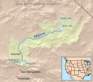
Soda Lake Basin (Mojave River drainage)
- Mojave River (often flows underground or is dry on the surface)
- West Fork Mojave River
- Deep Creek
See also
 In Spanish: Anexo:Ríos de California para niños
- Geography of California
- List of lakes in California
- Water in California


