British Columbia facts for kids
Quick facts for kids
British Columbia
Colombie-Britannique (French)
|
|||
|---|---|---|---|
|
Province
|
|||
|
|||
| Motto(s):
Splendor sine occasu (Latin for 'splendour without diminishment')
|
|||
| Country | Canada | ||
| Confederation | July 20, 1871 (7th) | ||
| Capital | Victoria | ||
| Largest city | Vancouver | ||
| Largest metro | Greater Vancouver | ||
| Government | |||
| • Type | Parliamentary constitutional monarchy | ||
| Area | |||
| • Total | 944,735 km2 (364,764 sq mi) | ||
| • Land | 925,186 km2 (357,216 sq mi) | ||
| • Water | 19,548.9 km2 (7,547.9 sq mi) 2.1% | ||
| Area rank | Ranked 5th | ||
| 9.5% of Canada | |||
| Population
(2021)
|
|||
| • Total | 5,000,879 | ||
| • Estimate
(Q1 2024)
|
5,609,870 | ||
| • Rank | Ranked 3rd | ||
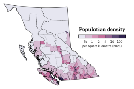
| • Density | 5.41/km2 (14.0/sq mi) | ||
| Demonym(s) | British Columbian | ||
| Official languages | English (de facto) | ||
| GDP | |||
| • Rank | 4th | ||
| • Total (2015) | CA$249.981 billion | ||
| • Per capita | CA$53,267 (8th) | ||
| HDI | |||
| • HDI (2021) | 0.944 — Very high ([[List of Canadian provinces and territories by Human Development Index|2nd]]) | ||
| Time zones | |||
| Most of province | UTC−08:00 (Pacific) | ||
| • Summer (DST) | UTC−07:00 (Pacific DST) | ||
| Southeastern | UTC−07:00 (Mountain) | ||
| • Summer (DST) | UTC−06:00 (Mountain DST) | ||
| Eastern | UTC−07:00 (Mountain [no DST]) | ||
| Postal abbr. |
BC
|
||
| Postal code prefix |
V
|
||
| ISO 3166 code | CA-BC | ||
| Flower | Pacific dogwood | ||
| Tree | Western red cedar | ||
| Bird | Steller's jay | ||
| Rankings include all provinces and territories | |||
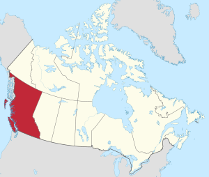
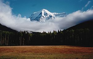
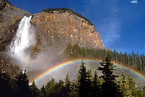
British Columbia (often called BC) is Canada's most western province. It sits between the Pacific Ocean and the Rocky Mountains. BC has many different landscapes, like rocky coasts, sandy beaches, thick forests, lakes, mountains, and even some dry plains. It shares borders with Alberta, Yukon, Northwest Territories, and the US states of Washington, Idaho, Montana, and Alaska.
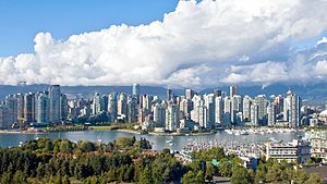
With over 5.6 million people in 2024, British Columbia is the third-most populated province in Canada. Its capital city is Victoria, but the biggest city is Vancouver. Vancouver and its nearby areas, called Metro Vancouver, form the third-largest city area in Canada. In 2021, about 2.6 million people lived there. British Columbia is also the third-largest province in Canada by land size, after Quebec and Ontario.
People have lived in this area for at least 10,000 years. These were the First Nations groups, like the Coast Salish, Tsilhqotʼin, and Haida. One of the first British settlements was Fort Victoria, built in 1843. This fort grew into the city of Victoria, which became the capital of the Colony of Vancouver Island. Later, the Colony of British Columbia (1858–1866) was created because of the Fraser Canyon Gold Rush. In 1866, the two colonies joined together. In 1871, British Columbia officially joined Canada, becoming its sixth province.
British Columbia is a very diverse place with many cultures. People here come from British, European, and Asian backgrounds, as well as the Indigenous population. Most people have ancestors from the British Isles, but many also come from Europe, East Asia, and South Asia. About 6% of the population are Indigenous Canadians. While Christianity is the largest religion, many people do not follow any religion. English is the main language. However, Punjabi, Mandarin Chinese, and Cantonese are also widely spoken in the Vancouver area. British Columbia is home to at least 34 different Indigenous languages.
The main parts of British Columbia's economy include forestry, mining, making movies and TV shows, tourism, real estate, construction, and shopping. It exports things like lumber, pulp and paper, copper, coal, and natural gas. Property values are high, and the Port of Vancouver is Canada's largest port. Even though only a small part of the province's land can be farmed, there is a lot of farming in the Fraser Valley and Okanagan areas because of the warmer weather.
Contents
- Why is it Called British Columbia?
- Exploring British Columbia's Geography
- British Columbia's History
- British Columbia's Population and Cities
- British Columbia's Economy
- Getting Around British Columbia
- Arts and Culture in British Columbia
- Outdoor Activities and Sports
- Education in British Columbia
- See also
Why is it Called British Columbia?
The name "British Columbia" was chosen by Queen Victoria in 1858. This was when the mainland area became a British colony. The name refers to the Columbia District, which was the British name for the land around the Columbia River. Queen Victoria added "British" to the name. This was to show it was the British part of the Columbia District. It helped tell it apart from the American part, which became the Oregon Territory.
The word "Columbia" comes from an American ship called the Columbia Rediviva. This ship gave its name to the Columbia River and then to the whole region. The ship's name "Columbia" was a reference to Christopher Columbus and the "New World".
The official French name for the province is Colombie-Britannique. Both the Canadian and British Columbia governments recognize this name.
Exploring British Columbia's Geography
British Columbia is on the west coast of Canada, next to the Pacific Ocean. To the northwest, it borders Alaska. To the north, it borders Yukon and the Northwest Territories. To the east, it borders Alberta. To the south, it borders the US states of Washington, Idaho, and Montana. The southern border was set by the 1846 Oregon Treaty.
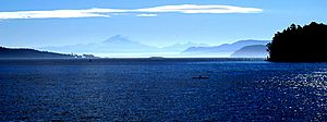
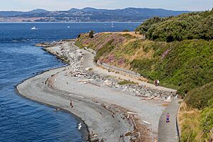
British Columbia covers about 944,735 square kilometers (364,764 square miles). Its rugged coastline is over 27,000 kilometers (16,777 miles long). It has deep, mountainous fjords and about 6,000 islands. Most of these islands are not inhabited. British Columbia is the only Canadian province that touches the Pacific Ocean.
The capital city, Victoria, is at the southern tip of Vancouver Island. Only a small part of the island, from Campbell River to Victoria, has many people. Much of western Vancouver Island and the coast are covered by thick, tall temperate rainforests.
The province's largest city, Vancouver, is in the southwest corner of the mainland. This area is often called the Lower Mainland. It sits where the Fraser River meets the Strait of Georgia. By land area, Abbotsford is the largest city. Vanderhoof is close to the geographic center of the province.
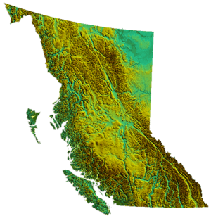
The Coast Mountains and the many inlets of the Inside Passage offer beautiful scenery. This makes British Columbia a great place for outdoor adventures and ecotourism. About 75% of the province is mountainous, meaning it's over 1,000 meters (3,280 feet) above sea level. About 60% is covered in forests, but only about 5% can be farmed.
Away from the coast, the climate is influenced by the Pacific Ocean. The land changes from dry inland forests and semi-arid valleys to northern forests and subarctic plains.
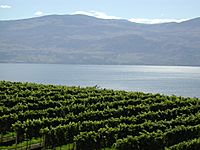
The Okanagan region, stretching from near Vernon to Osoyoos at the US border, is famous for making wine and cider. Other wine areas include the Cowichan Valley on Vancouver Island and the Fraser Valley.
Cities in the Southern Interior, like Kamloops and Penticton, have some of Canada's warmest and longest summers. Temperatures can get even hotter north of the Fraser Canyon. Large areas of the Interior Plateau have semi-desert grasslands. Here, people raise cattle at lower elevations and do forestry at higher ones.
The northern two-thirds of the province are mostly mountains, with few people or developments. The exception is the Peace River Country in the northeast. This area, east of the Rockies, is British Columbia's part of the Canadian Prairies. Its center is Dawson Creek.
British Columbia's Climate
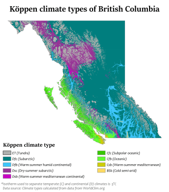
British Columbia's coastal areas have a mild, rainy climate. This is thanks to the Kuroshio Current from the Pacific Ocean. Some southern coastal parts even have warm-summer Mediterranean weather. Because of the mountains, the interior of the province is semi-dry. Some places get less than 250 mm (10 inches) of rain each year. The average yearly temperature in the most populated areas is up to 12°C (54°F). This is the mildest in Canada.
The valleys in the Southern Interior have short winters. They get only brief cold spells or light snow. The Cariboo region in the Central Interior is colder because it's higher up and further north. But it doesn't get the extreme cold seen in other parts of Canada at similar latitudes. For example, the average low in Prince George in January is -12°C (10°F). Heavy snow falls in all mountainous areas, making them great for skiers.
Winters in the Northern Interior are usually harsh. But even there, warmer air can sometimes move far inland. The coldest temperature ever recorded in British Columbia was -58.9°C (-74°F) in Smith River. This is one of the coldest readings in North America. Atlin, in the far northwest, sometimes gets mid-winter thaws. These are caused by the Chinook effect, which is also common in the southern Interior.
During winter, the coast gets a lot of rain from storms coming off the North Pacific. The average snowfall on the coast is between 25 to 50 cm (10 to 20 inches). Sometimes, heavy snow with more than 20 cm (8 inches) falls. This happens when cold arctic air reaches the coast, usually for short times. Temperatures can drop below -10°C (14°F) even at sea level. Arctic winds can make it feel like -17.8°C (0°F) or colder in the mornings. While winters are very wet, coastal areas are usually milder and dry in summer. This is due to stable high-pressure systems.
Southern Interior valleys are hot in summer. For example, in Osoyoos, the average high in July is 31.7°C (89°F). This is the hottest month for any place in Canada. Temperatures often go over 40°C (104°F) in the lower valleys of the Interior in mid-summer. The record high was 44.4°C (112°F) in Lytton on July 16, 1941.
The long, dry summers often cause forest fires. These can start from dry lightning or human activity. Many areas of the province are often covered by thick clouds and fog in winter. This is very different from the sunny summers. Annual sunshine hours range from 2200 near Cranbrook and Victoria to less than 1300 in Prince Rupert on the North Coast.
During El Niño years, winters are milder and drier than usual. This is because the jet stream moves further south. During La Niña years, winters are much wetter and cooler.
| Municipality | January | April | July | October |
|---|---|---|---|---|
| Prince Rupert | 5.6°C (42°F)/ -0.8°C (30°F) | 10.2°C (50°F)/ 2.5°C (37°F) | 16.2°C (61°F)/ 10.5°C (51°F) | 11.1°C (52°F)/ 4.9°C (41°F) |
| Tofino | 8.3°C (47°F)/ 2.3°C (36°F) | 11.9°C (53°F)/ 4.0°C (39°F) | 18.9°C (66°F)/ 10.5°C (51°F) | 13.6°C (56°F)/ 6.3°C (43°F) |
| Nanaimo | 6.9°C (44°F)/ 0.1°C (32°F) | 14.1°C (57°F)/ 3.9°C (39°F) | 23.9°C (75°F)/ 12.3°C (54°F) | 14.6°C (58°F)/ 5.2°C (41°F) |
| Victoria | 7.6°C (46°F)/ 1.5°C (35°F) | 13.6°C (56°F)/ 4.3°C (40°F) | 22.4°C (72°F)/ 11.3°C (52°F) | 14.2°C (58°F)/ 5.7°C (42°F) |
| Vancouver | 6.9°C (44°F)/ 1.4°C (35°F) | 13.2°C (56°F)/ 5.6°C (42°F) | 22.2°C (72°F)/ 13.7°C (57°F) | 13.5°C (56°F)/ 7.0°C (45°F) |
| Chilliwack | 6.1°C (43°F)/ 0.4°C (33°F) | 15.8°C (60°F)/ 5.2°C (41°F) | 25.0°C (77°F)/ 12.5°C (55°F) | 15.3°C (59°F)/ 6.4°C (44°F) |
| Penticton | 1.8°C (35°F)/ -3.0°C (27°F) | 15.7°C (60°F)/ 2.5°C (37°F) | 28.7°C (84°F)/ 13.3°C (56°F) | 14.3°C (58°F)/ 3.2°C (38°F) |
| Kamloops | 0.4°C (33°F)/ -5.9°C (21°F) | 16.6°C (62°F)/ 3.2°C (38°F) | 28.9°C (84°F)/ 14.2°C (58°F) | 13.7°C (57°F)/ 3.3°C (38°F) |
| Osoyoos | 2.0°C (36°F)/ -3.8°C (25°F) | 18.1°C (65°F)/ 3.6°C (38°F) | 31.5°C (89°F)/ 14.3°C (58°F) | 16.4°C (62°F)/ 3.5°C (38°F) |
| Cranbrook | -1.9°C (29°F)/ -10.2°C (14°F) | 12.9°C (55°F)/ 0.3°C (33°F) | 26.2°C (79°F)/ 11.2°C (52°F) | 11.7°C (53°F)/ -0.3°C (31°F) |
| Prince George | -4.0°C (25°F)/ -11.7°C (11°F) | 11.2°C (52°F)/ -1.1°C (30°F) | 22.4°C (72°F)/ 9.1°C (48°F) | 9.4°C (49°F)/ -0.5°C (31°F) |
| Fort Nelson | -16.1°C (3°F)/ -24.6°C (-12°F) | 9.6°C (49°F)/ -3.6°C (26°F) | 23.2°C (74°F)/ 10.9°C (52°F) | 5.2°C (41°F)/ -4.2°C (24°F) |
Parks and Protected Areas in BC
British Columbia has 14 different types of parks and protected areas. These include 141 ecological reserves, 35 provincial marine parks, 7 Provincial Heritage Sites, 6 National Historic Sites of Canada, 4 National Parks, and 3 National Park Reserves. About 12.5% of British Columbia's land (114,000 square kilometers or 44,015 square miles) is protected. This includes over 800 separate areas.
British Columbia has seven of Canada's national parks:
- Glacier National Park
- Gulf Islands National Park Reserve
- Gwaii Haanas National Park Reserve and Haida Heritage Site
- Kootenay National Park
- Mount Revelstoke National Park
- Pacific Rim National Park Reserve
- Yoho National Park
The province also has many provincial parks, managed by BC Parks. This system is the second largest in Canada, after the National Parks system. There are also regional parks, which are run by local governments.
In addition, over 47,000 square kilometers (18,147 square miles) of arable land (farmable land) are protected by the Agricultural Land Reserve.
Animals and Plants of British Columbia
Much of British Columbia is wild. This means many animal species that are rare elsewhere in North America still thrive here. People enjoy watching many kinds of animals, especially birds. Bears (grizzly, black, and the Kermode bear or spirit bear, found only in BC) live here. You can also find deer, elk, moose, caribou, bighorn sheep, mountain goats, marmots, beavers, muskrats, coyotes, wolves, and cougars. Many birds like eagles, ospreys, herons, Canada geese, swans, and owls are also common.
Many types of fish live in the waters, including different kinds of salmon, trout, and char. Sport fishers also catch halibut, steelhead, bass, and sturgeon. Along the coast, harbour seals and river otters are common. Whales and dolphins like orcas, grey whales, and minke whales live off the coast.
Some animals and plants have been brought to British Columbia from other places. These include dandelions, ring-necked pheasants, brown trout, European starlings, and Himalayan blackberries.
Some species in British Columbia are endangered, meaning they are at risk of disappearing. These include the Vancouver Island marmot, spotted owl, and American white pelican.
| Type of organism | Red-listed species in BC | Total number of species in BC |
|---|---|---|
| Freshwater fish | 24 | 80 |
| Amphibians | 5 | 19 |
| Reptiles | 6 | 16 |
| Birds | 34 | 465 |
| Terrestrial mammals | Requires new data | Requires new data |
| Marine mammals | 3 | 29 |
| Plants | 257 | 2333 |
| Butterflies | 19 | 187 |
| Dragonflies | 9 | 87 |
(Data as of 2001)
Forests in British Columbia
Some common trees that grow wild in BC's forests are different kinds of pine, fir, cedar, birch, hemlock, maple, and spruce.
Traditional Plant Foods
Plant foods were only a part of what coastal First Nations people in British Columbia ate. But they were very important for making many useful things. Berries, some roots (like the Camas Lily), inner bark of hemlock, and seaweeds were important foods. Animal products were eaten more, but native plants gave a lot of different nutrients. Before Europeans arrived, British Columbia had the most Indigenous people of any region in Canada.
British Columbia's Ecozones
Environment Canada divides British Columbia into six ecozones:
- Pacific Marine
- Pacific Maritime
- Boreal Cordillera
- Montane Cordillera
- Taiga Plains
- Boreal Plains Ecozones.
British Columbia's History
First Nations History
The land now called British Columbia has a long history with many First Nations groups. There are over 200 First Nations in BC. We know about their history from old digs, their spoken stories, and early explorer records.
The first people, called Paleoindians, arrived between 20,000 and 12,000 years ago. For a long time, families of hunter-gatherers lived here. They moved around, finding nuts, berries, roots, and hunting animals. About 5,000 years ago, groups started to stay in one place more often. Over time, these groups developed into many different cultures with shared traditions.
In the northwest, the Na-Dene languages groups lived. These included the Athapaskan-speaking peoples and the Tlingit. They lived on islands in southern Alaska and northern British Columbia. The Interior of British Columbia was home to Salishan language groups like the Shuswap and Okanagan. It also had Athabaskan groups like the Dakelh and Tsilhqot'in. Along the British Columbia Coast, large groups like the Haida, Kwakwaka'wakw, and Nuu-chah-nulth lived. They had plenty of salmon and shellfish. These people built amazing cultures using western red cedar. They made wooden houses, large canoes, and carved totem poles.
When Europeans arrived, they brought diseases like smallpox. First Nations people had no protection against these illnesses. This caused a huge drop in their population. The 1862 Smallpox outbreak in Victoria spread widely and killed many people. European settlement also changed life for First Nations. Colonial officials believed settlers could use the land better. So, First Nations people were moved to reserves. These reserves were often too small to support their traditional ways of life. By the 1930s, there were over 1,500 reserves in British Columbia.
Fur Trade and Early Colonies
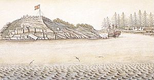
In the 1770s, smallpox killed at least 30% of the Pacific Northwest First Nations. The Great Smallpox Epidemic of 1862 later killed 50% of the native population.
Europeans started arriving in the mid-1700s. Fur traders came to hunt sea otters. While some think Sir Francis Drake explored the coast in 1579, Juan Pérez made the first recorded voyage in 1774. Juan Francisco de la Bodega y Quadra explored in 1775. They claimed the Pacific coast for Spain.
James Cook in 1778 and George Vancouver in 1792–93 explored the coast. They helped establish British control over the area north and west of the Columbia River. In 1793, Sir Alexander Mackenzie was the first European to cross North America by land to the Pacific Ocean. He marked his achievement near Bella Coola. Other explorers like Simon Fraser and David Thompson also mapped the region. They were mainly interested in expanding the fur trade. In 1794, Spain gave up its exclusive claims in the Pacific. This allowed other countries, like Britain, to claim land.
Trading posts set up by the North West Company and the Hudson's Bay Company (HBC) created a lasting British presence. The Columbia District was the area south of 54°40 north latitude (Russian America's southern border), north of Mexican California, and west of the Rocky Mountains. By the Anglo-American Convention of 1818, both American and British citizens could use this area. This shared use ended with the Oregon Treaty of 1846.
Many early trading posts grew into towns and cities. Some British Columbia places that started as fur trading posts include Fort St. John (1794), Fort St. James (1806), Prince George (1807), Fort Langley (1827), and Fort Victoria (1843).
In 1821, the two fur trading companies merged. The region of British Columbia was then divided into three fur trading areas. The central and northern interior was called New Caledonia. The southern interior was the Columbia District. The northeast corner, east of the Rockies, was part of the Athabasca District.
Until 1849, these areas were not formally organized by Britain. The HBC managed them. But as Americans explored westward, claims to the land overlapped. In 1846, the Oregon Treaty divided the territory along the 49th parallel. The area south of this line went to the United States. The Colony of Vancouver Island was created in 1849, with Victoria as its capital. The mainland, now called New Caledonia, remained unorganized.
Colony of British Columbia (1858–1866)
The Fraser Canyon Gold Rush in 1858 brought many Americans to New Caledonia. This made the British government create the Colony of British Columbia on the mainland. Richard Clement Moody was chosen to establish British order. He was to build a "second England" on the Pacific coast.
Moody arrived in December 1858 with the Royal Engineers, Columbia Detachment. He became the first Chief Commissioner of Lands and Works. Moody wanted to build a beautiful city in the wilderness. He chose New Westminster as the new capital. He liked its strong position and good port. He also found the area very beautiful.
Moody and the Royal Engineers built many roads. These included Kingsway, the North Road, and the Cariboo Road. He named Burnaby Lake after his secretary, Robert Burnaby. Port Moody is named after him. It was set up to protect New Westminster from possible attacks.
By 1862, the Cariboo Gold Rush was in full swing, bringing 5,000 more miners. Governor Douglas sped up building the Great North Road (now the Cariboo Wagon Road). This road went up the Fraser Canyon to the gold areas around Barkerville. As more British colonists settled, the colony changed. They started businesses, sawmills, fishing, and farming. People began to complain about the governor and the lack of local government. This led to Douglas leaving office in 1864. Finally, the colony got an assembly and a resident governor.
Joining Canada and Rapid Growth
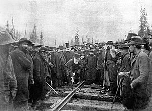
After the gold rushes, the colony was in debt. People worried about being taken over by the United States. Groups like the Confederation League wanted British Columbia to join Canada. Canada had been formed in 1867.
Canada agreed to build the Canadian Pacific Railway to British Columbia. It also agreed to take on the colony's debt. So, on July 20, 1871, British Columbia became the sixth province to join Canada. The province's borders were not fully set. Disputes like the Pig War and the Alaska boundary dispute changed the borders later.
British Columbia's population grew as mining, forestry, farming, and fishing developed. Mining was very important, especially in the Interior. Farming attracted settlers to the fertile Fraser Valley. Ranchers and fruit growers came to the drier areas like the Okanagan. Forestry brought workers to the coastal rainforests, where fishing also grew.
The railway's completion in 1885 greatly boosted the economy. It made it easier to transport resources to the east. Granville, a mill town near the Burrard Inlet, became the railway's end point. It was renamed Vancouver in 1886. Vancouver grew quickly and became the largest city in Western Canada.
Early on, there were challenges in finding enough workers. Many immigrants came from Europe, China, and Japan. However, some people were not happy about the arrival of Asian immigrants. This led to efforts to limit Asian immigration, like a head tax. There were even attacks against Chinese and Japanese immigrants in Vancouver in 1887 and 1907. By 1923, most Chinese immigration was stopped.
The province continued to grow. In 1914, another railway, the Grand Trunk Pacific Railway, was finished. It connected north-central British Columbia to Prince Rupert. This opened up new economic chances for the North Coast and Bulkley Valley. These areas, once focused on fur trade, now saw growth in forestry, farming, and mining.
In World War I, British Columbia strongly supported the British Empire. About 55,570 of the 400,000 residents joined the military. This was the highest rate per person in Canada. About 6,225 men from the province died in the war.
The 1920s to 1940s
When soldiers returned from World War I, many found their jobs taken by European immigrants. Veterans formed "soldier parties" to speak for their interests. These groups led to the creation of other political parties later on.
The Prohibition in the United States created new opportunities. Many people made money by smuggling alcohol across the border. Vancouver's wealth in the 1920s partly came from this "pirate economy." But forestry, fishing, and mining also continued to grow.
When US Prohibition ended and the Great Depression began, British Columbia faced hard times. Thousands of unemployed men came to Vancouver. They created large camps around False Creek. This led to protests, including one at the main Post Office that was put down by police. A group from Vancouver tried to join the On-to-Ottawa Trek by train. But they were stopped and sent to work camps.
The economy slowly started to recover in the late 1930s. But it was World War II that truly ended the Depression. The war effort boosted the economy, and more women joined the workforce.
British Columbia has always had strong ties with East Asia. However, this sometimes caused problems and unfair treatment towards Asian immigrants. During World War II, many people of Japanese descent were moved to camps in the Interior of the province.
After World War II: Growth and Change
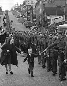
During World War II, the BC Liberal and BC Conservative Parties formed a coalition government. This was led by Liberal leader John Hart. The main reason for this coalition was to prevent the socialist Co-operative Commonwealth Federation (CCF) from gaining power. After the war, the government started big projects. These included building Highway 97 and public hospital insurance.
In 1947, Byron Ingemar Johnson took over the coalition. His government won a huge victory in the 1949 election. This was because of popular spending programs, despite some concerns about corruption. During his time, major projects continued, like the agreement with Alcan Aluminum to build the town of Kitimat and the Kemano Hydro Project. Johnson also gained popularity for helping with the 1948 Fraser Valley flood.
Tensions grew between the Liberal and Conservative partners. Johnson ended the coalition, leading to the 1952 election. A new voting system was used, allowing voters to pick second and third choices. This plan backfired for the Liberals and Conservatives. Many voters chose the Social Credit Party (Socreds). The Socreds, led by W. A. C. Bennett, won the most seats.
The W.A.C. Bennett Era (1952–1972)
With the Social Credit Party in power, British Columbia began a period of fast economic development. Premier Bennett and his party governed for 20 years. They started many large infrastructure projects. This was possible because of a strong economy in forestry, mining, and energy.
During these two decades, the government took control of private electric companies. They combined them into BC Hydro. By the end of the 1960s, several large dams were built. These included dams on the Peace, Columbia, and Nechako River. Major deals were made, like the Columbia River Treaty with the United States. The province's economy also grew with the forest industry and oil and gas development.
The 1950s and 1960s also saw improvements in transportation. In 1960, the government created BC Ferries. This was a government-owned company to provide ferry service. The highway system was also improved with new roads and bridges.
Vancouver and Victoria became important cultural centers. Artists, musicians, and chefs moved there for the scenery and mild weather. Tourism also became a big part of the economy. The rise of Asian economies boosted BC's economy, especially with exports of lumber and coal.
Politically, the 1960s were a time of big social changes. The gap between the political left and right grew wider. The Social Credit Party represented free enterprise. The New Democratic Party (NDP), which was more social democratic, was their main opponent. As the economy boomed, there were more conflicts between workers and businesses. By the end of the decade, people were less happy with the Bennett government.
The 1970s and 1980s
In August 1972, the Social Credit Party lost power. The New Democratic Party (NDP), led by Dave Barrett, took over. Under Barrett, the province's money situation changed. The NDP made some lasting changes. They created the Agricultural Land Reserve to protect farmland. They also created the Insurance Corporation of British Columbia, which provides car insurance.
People felt the NDP government made too many changes too quickly. This, along with worker strikes, led to the NDP losing the 1975 election. Social Credit, now led by W.A.C. Bennett's son, Bill Bennett, returned to power. His government changed some of the NDP's social programs. They also sold off some government-owned businesses.
During Bill Bennett's time, several large projects were completed. These were meant to help the economy and win votes. The most famous was Expo 86, a world's fair in Vancouver. Along with Expo, the Coquihalla Highway and Vancouver's SkyTrain system were built. The Coquihalla Highway project faced some controversy.
As the province entered a recession, Bennett's popularity dropped. In 1983, his government faced a constitutional crisis. An election was called, and Bennett won a surprising majority. After the election, his government announced a program of spending cuts called "restraint." These cuts affected many social programs. This led to huge protests, with tens of thousands of people demonstrating. This period was known as the 1983 Solidarity Crisis. The protests eventually ended after a deal was made between union leaders and Premier Bennett.
Bennett retired in 1986. Bill Vander Zalm became the new Social Credit leader and won the election that year. Vander Zalm later faced a conflict of interest scandal. This led to his resignation. Rita Johnston became premier, but her party lost the next election. The British Columbia Liberal Party then became the main opposition party. In 1988, David Lam became British Columbia’s Lieutenant-Governor. He was the first of Chinese origin.
From the 1990s to Today
In the 1991 election, Rita Johnston lost to the NDP, led by Mike Harcourt. The NDP created many new parks and protected areas. This was popular and helped the growing tourism industry. However, the economy still struggled. Harcourt resigned due to a political scandal, though he was not directly involved. Glen Clark became the new NDP leader. His government won a second term in 1996. More scandals followed, like the Fast Ferry Scandal. An unproven allegation against Clark led to his resignation. He was followed by Dan Miller and then Ujjal Dosanjh.
In the 2001 election, Gordon Campbell's BC Liberals won a huge victory. They took 77 out of 79 seats. Campbell made many changes, including ending the "fast ferries" project, lowering taxes, and selling BC Rail. Campbell won again in 2005 and 2009. This was the first time in 23 years a premier won a third term.
The province won the bid to host the 2010 Winter Olympics in Vancouver and Whistler. Vancouver residents voted to support hosting the games in 2003.
After the Olympics, Campbell's popularity dropped. His leadership style, the new Harmonized Sales Tax (HST), and the end of a corruption trial led to low approval. He resigned in November 2010.
In early 2011, Christy Clark became the new Liberal leader and Premier. She worked to create her own image. She raised the minimum wage and created the new holiday of Family Day. She also pushed for the development of BC's liquified natural gas. In the 2013 election, the Liberals won a surprising majority. Clark became the first elected female premier in BC history. Her government has since balanced the budget and changed liquor laws.
British Columbia has also been greatly affected by people moving to the province. Vancouver became a major destination for immigrants from Hong Kong before it was returned to China. Many Canadians from other provinces also moved to BC. This is because of its natural beauty, mild climate, and relaxed lifestyle. As a result, British Columbia's population has grown a lot compared to the rest of Canada. The Greater Vancouver area now holds 51% of the province's population. Greater Victoria is second with 8%.
More people have been moving to BC from other provinces. In early 2016, BC received the most people from other parts of Canada. Half of these 5,000 people came from Alberta.
British Columbia's Population and Cities
According to the 2021 Canadian census, British Columbia had a population of 5,000,879 people. This makes it Canada's third-most populated province.
Major Cities in British Columbia
Half of all people in British Columbia live in the Metro Vancouver Regional District. This area includes Vancouver, Surrey, Burnaby, Richmond, Coquitlam, and many other cities and towns. It also has 17 Indian reserves, which are outside the regional district's control.
The second largest group of people lives at the southern tip of Vancouver Island. This area is called Greater Victoria. It includes Victoria, Saanich, Esquimalt, and 10 other municipalities. These are part of the Capital Regional District. Almost half of Vancouver Island's population lives in Greater Victoria.
|
|
Cultural Backgrounds in BC
British Columbia is Canada's most diverse province. In 2021, it had the highest percentage of visible minorities. The five largest groups are Europeans (60%), East Asians (14%), South Asians (10%), Indigenous (6%), and Southeast Asians (5%).
| # | Ethnic origin | Population | Percent |
|---|---|---|---|
| 1 | English | 1,203,540 | 26.39% |
| 2 | Canadian | 866,530 | 19% |
| 3 | Scottish | 860,775 | 18.88% |
| 4 | Irish | 675,135 | 14.80% |
| 5 | German | 603,265 | 13.23% |
| 6 | Chinese | 540,155 | 11.84% |
| 7 | French | 388,815 | 8.53% |
| 8 | Indian | 309,315 | 6.78% |
| 9 | Ukrainian | 229,205 | 5.03% |
| 10 | Indigenous Canadian | 220,245 | 4.83% |
Visible Minorities and Indigenous Peoples
In 2021, 34.4% of the population were visible minorities. Also, 5.9% were Indigenous, mostly First Nations and Métis.
| Visible Minority and Indigenous Population (2021 Canadian census) | |||
|---|---|---|---|
| Population group | Population | % | |
| European | 2,936,245 | 59.7% | |
| Visible minority group |
South Asian | 473,965 | 9.6% |
| Chinese | 550,590 | 11.2% | |
| Black | 61,760 | 1.3% | |
| Filipino | 174,280 | 3.5% | |
| Arab | 28,010 | 0.6% | |
| Latin American | 65,970 | 1.3% | |
| Southeast Asian | 71,785 | 1.5% | |
| West Asian | 69,270 | 1.4% | |
| Korean | 72,815 | 1.5% | |
| Japanese | 44,120 | 0.9% | |
| Visible minority, n.i.e. | 18,080 | 0.4% | |
| Multiple visible minorities | 58,840 | 1.2% | |
| Total visible minority population | 1,689,490 | 34.4% | |
| Indigenous group |
First Nations (North American Indian) | 180,085 | 3.7% |
| Métis | 97,860 | 2.0% | |
| Inuk (Inuit) | 1,720 | 0.0% | |
| Multiple Indigenous responses | 5,980 | 0.1% | |
| Indigenous responses n.i.e. | 4,560 | 0.1% | |
| Total Indigenous population | 290,210 | 5.9% | |
| Total population | 4,915,945 | 100.0% | |
Religion in British Columbia
| % (1991) | % (2001) | % (2011) | Number (2011) | |
|---|---|---|---|---|
| Christian | 64.5% | 55.7% | 44.6% | 1,930,415 |
| No religious affiliation | 30.0% | 35.1% | 44.1% | 1,908,285 |
| Sikh | 2.3% | 3.5% | 4.7% | 201,110 |
| Buddhist | 1.1% | 2.2% | 2.1% | 90,620 |
| Muslim | 0.8% | 1.5% | 1.8% | 79,310 |
| Hindu | 0.6% | 0.8% | 1.1% | 45,795 |
| Jewish | 0.5% | 0.5% | 0.5% | 23,130 |
| Other religions | 0.8% | 35,500 | ||
| Aboriginal religions | 0.2% | 10,295 | ||
| Total | 100% | 100% | 100% | 4,324,455 |
The largest religious groups in British Columbia are Christianity (44.6%) and those with no religious affiliation (44.1%). Other religions include Sikhism (4.7%), Buddhism (2.1%), Islam (1.8%), and Hinduism (1.1%).
Languages Spoken in British Columbia
Of the 4,648,055 people counted in the 2016 census, most spoke English as their first language.
| # | Language | Population | Percent |
|---|---|---|---|
| 1 | English | 3,170,110 | 70.52% |
| 2 | Punjabi | 198,805 | 4.42% |
| 3 | Cantonese | 193,530 | 4.31% |
| 4 | Mandarin | 186,325 | 4.15% |
| 5 | Tagalog (Filipino) | 78,770 | 1.75% |
| 6 | German | 66,885 | 1.49% |
| 7 | French | 55,325 | 1.23% |
| 8 | Korean | 52,160 | 1.17% |
| 9 | Spanish | 47,010 | 1.05% |
| 10 | Persian | 43,470 | 0.97% |
British Columbia is also home to 34 Indigenous languages. About 6,000 people speak these languages, with 4,000 being fluent. These are the languages of the province's First Nations. One important Indigenous language in BC is Kwakʼwala, spoken by the Kwakwakaʼwakw First Nations.
British Columbia's Economy
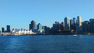
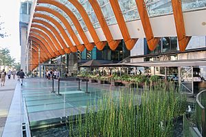
British Columbia has a varied economy. Most of its money comes from service industries. It is also a major transportation hub with two transcontinental railways and 27 large ports. Even though less than 5% of its huge land area can be farmed, the province is rich in agriculture. This is especially true in the Fraser and Okanagan valleys, thanks to milder weather.
The climate also encourages outdoor recreation and tourism. However, the economy has long relied on getting resources from the land. This includes logging, farming, and mining. Vancouver, the largest city, is home to many natural resource companies. It also has a strong housing market and high incomes. While coastal BC and some southern valleys have mild winters, most of the province has cold winters like the rest of Canada. The Northern Interior has a very cold, subarctic climate. Vancouver has the mildest winter climate of major Canadian cities.
Historically, British Columbia's economy depended on resources, especially forestry and mining. But now, fewer people work in the resource sector. New jobs are mostly in construction, retail, and services. BC now has the highest percentage of service jobs in Western Canada (72%). The biggest part of this is in finance, insurance, real estate, and company management. However, many areas outside big cities still rely heavily on resource extraction. Vancouver is also a major film production center, known as Hollywood North. It's the third-largest film location in North America.
British Columbia's economic history has seen many ups and downs. This "boom and bust" pattern has shaped its politics and culture. Mining, in particular, has changed a lot with commodity prices.
In 2020, British Columbia had the third-largest economy in Canada. Its total economic output was $309 billion. The economy grew by 9.6% from 2017 to 2021, which was the second-highest growth rate in the country.
Getting Around British Columbia
Transportation has been very important in British Columbia's history. The Rocky Mountains made it hard to travel by land until the transcontinental railway was finished in 1885. Before then, people mostly traveled by sea through the Pacific Ocean. The ports of Victoria and New Westminster were very busy.
Until the 1930s, trains were the only way to travel by land to and from the rest of Canada. If you had a car, you had to drive through the United States. But after the Inter-Provincial Highway (now the Crowsnest Pass Highway) was built in 1932, and later the Trans-Canada Highway, roads became the main way to travel.
As of 2021, British Columbia sells more electric vehicles (as a percentage of total car sales) than any other Canadian province or US state.
Roads and Highways in BC
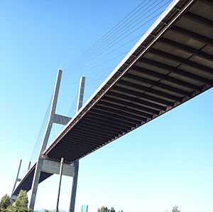
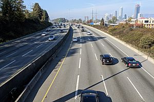
British Columbia is a large province with rugged land. This means it needs thousands of kilometers of highways to connect its communities. In the past, BC's roads were not well maintained. But in the 1950s and 1960s, a big improvement program started. Now, there are freeways in Greater Victoria, the Lower Mainland, and the Central Interior. Most other areas have well-maintained two-lane highways. These often have extra passing lanes in mountains.
Some busy roads outside Greater Vancouver have more traffic lights. These are mostly four-lane highways. Highway 1 on Vancouver Island and Highway 97 through the Okanagan Valley are examples. They have varying speed limits. Many traffic lights are used instead of interchanges to save money. The British Columbia Ministry of Transportation and Infrastructure is in charge of building and maintaining provincial highways.
There are only five main routes to the rest of Canada. From south to north, they are: BC Highway 3 (Crowsnest Pass), Highway 93 (Vermilion Pass), the Trans-Canada Highway (Kicking Horse Pass), the Yellowhead Highway (16) through Jasper National Park, and Highway 2 through Dawson Creek. There are also several highway crossings to the US states of Washington, Idaho, and Montana. The longest highway is Highway 97. It runs 2,081 kilometers (1,293 miles) from the US border at Osoyoos north to Watson Lake, Yukon. This includes the BC part of the Alaska Highway.
Public Transportation in BC
Before 1979, public transit in Vancouver and Victoria was run by BC Hydro. Then, the province created BC Transit to manage all city transportation. In 1998, TransLink was created for the Greater Vancouver area. Some smaller island communities have their own transit. BC Transit has also started intercity routes, especially in northern BC.
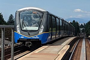
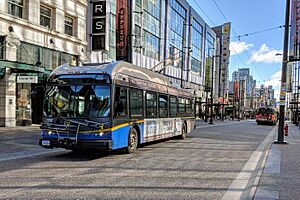
Public transit in British Columbia mostly uses diesel buses. Vancouver also has trolley buses. Some new buses are being tested, like hybrid buses and CNG-fueled buses. British Columbia also tested Hydrogen-fueled buses for the 2010 Vancouver-Whistler Winter Olympics. TransLink operates SkyTrain, an automated metro system. It serves Vancouver, Burnaby, New Westminster, Surrey, Richmond, Coquitlam, and Port Moody. The Canada Line SkyTrain, connecting Vancouver International Airport to downtown, was finished in 2009. A new extension to Coquitlam and Port Moody was completed in 2016. An extension through Vancouver to the University of British Columbia is also planned.
Rail Travel in BC
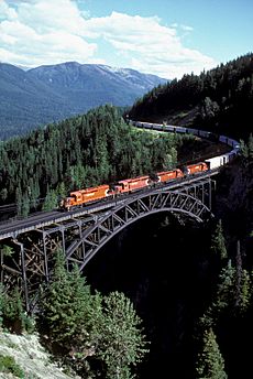
Railways grew a lot after the Canadian Pacific Railway was finished in 1885. They were the main way to travel long distances until highways improved in the 1950s. Two other major routes, the Grand Trunk Pacific Railway and the Canadian Northern Railway, also connected BC.
The Pacific Great Eastern line (now owned by Canadian National Railway) connects northern resource communities to North Vancouver. The E&N Railway, now called the Island Rail Corridor, used to serve Vancouver Island.
Today, passenger train services in British Columbia are limited. Via Rail runs long-distance trains. Local services are available in the Lower Mainland through TransLink. The Seton Lake Indian Band also runs the Kaoham Shuttle south of Lillooet. Amtrak offers international passenger service between Vancouver and Seattle.
Several heritage railways operate in the province, including the White Pass and Yukon Route.
Water Travel in BC
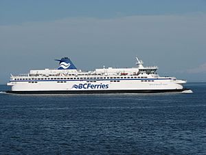
BC Ferries was started in 1960 by the province. It provides ferry service for people and vehicles between Vancouver Island and the mainland. It now runs 25 routes among the islands of British Columbia and to the mainland. Ferries to Washington State are offered by Washington State Ferries and Black Ball Transport. The Ministry of Transportation and Infrastructure also provides ferry service on inland lakes and rivers. Other coastal ferries are privately run.
Commercial ocean shipping is very important. Major ports are in Vancouver, Roberts Bank, Prince Rupert, and Victoria. Vancouver, Victoria, and Prince Rupert are also popular stops for cruise ships. In 2007, a large container port opened in Prince Rupert.
Air Travel in BC
British Columbia has over 200 airports. The main ones are Vancouver International Airport, Victoria International Airport, Kelowna International Airport, and Abbotsford International Airport. These airports serve millions of passengers each year. As of 2017, Vancouver International Airport is the second busiest airport in Canada. It is also the second largest international gateway on the west coast, after Los Angeles. In 2019, about 26.4 million travelers passed through it.
Arts and Culture in British Columbia
Visual Arts in BC
The earliest known visual art in the Pacific Northwest was made by First Nations groups. These include the Coast Salish, Haida, Heiltsuk, and Tsimshian. Their art often involves woodcarving, seen in totem poles, masks, and canoes. They also made textile arts like Chilkat weaving and button blankets. Traditional Indigenous art is known for its "formline style." This uses continuous, flowing lines for outlines and designs.
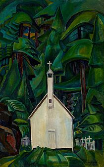
Western styles came to the region when British settlements were established in the late 1700s. Famous English-Canadian artists from early BC include architect Francis Rattenbury and painter Emily Carr.
In the mid-1900s, Vancouver's art scene was known for abstract and surreal landscape paintings. Later, the city saw more types of art, like conceptual art, video art, and performance art.
The Vancouver School of conceptual photography includes artists like Jeff Wall and Ian Wallace. They became well-known in the 1980s.
Vancouver has about 350 public art pieces outdoors. Some famous ones are A-maze-ing Laughter, Digital Orca, and the Brockton Point totem poles.
Performing Arts in BC
British Columbia is home to the Vancouver Opera and Ballet BC. It also has many independent theatre companies. Popular venues include the Queen Elizabeth Theatre and the Orpheum Theatre.
Music in British Columbia
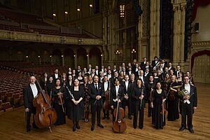
British Columbia is the third-largest music-producing province in Canada. The local music industry makes about $265 million each year. The province has the Vancouver Symphony Orchestra and the Victoria Symphony. Music festivals in BC have included the Squamish Valley Music Festival and Shambhala Music Festival.
Food and Cuisine in British Columbia
British Columbian food is often linked to healthy eating, fusion, fresh local ingredients, and new ideas. It has two main styles. One is west coast cuisine, which uses a lot of seafood. The other is interior cuisine, which uses local game meat and fresh farm produce. Seafood is very important because of the Pacific Ocean and many rivers and lakes. BC is known for unique dishes and produces fruit, wine, and cheese.
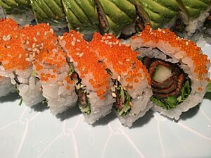
Seafood dishes include sushi (like the BC roll and dynamite roll), dungeness crab, spot prawns, and wild pacific salmon. You can also find delicacies like white sturgeon caviar and geoduck.
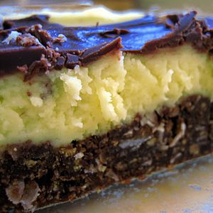
British Columbia also has unique non-seafood foods. Some dishes are Doukhobour borscht, Salt Spring Island lamb, and Japadog street food. Famous pastries include apple cranberry cinnamon buns and Nanaimo bars. The London Fog tea latte was invented in Vancouver.
The Okanagan region grows many unique fruits. These include Ambrosia and Spartan apples, and Stella and Skeena cherries. Other fruits grown in the province are peaches, pears, plums, apricots, and different kinds of berries.
British Columbia is famous for its wine. The main wine-producing areas are the Okanagan, Similkameen Valley, Vancouver Island, the Gulf Islands, and the Fraser Valley. As of 2014, there were 280 licensed wineries.
Outdoor Activities and Sports
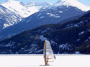
British Columbia's mountains, coasts, lakes, rivers, and forests make it a great place for outdoor activities. People enjoy hiking, camping, rock climbing, hunting, and fishing.
Many water sports are popular. Sea kayaking is great along the coast with its fjords. Whitewater rafting and kayaking are popular on inland rivers. Sailing and sailboarding are also widely enjoyed.
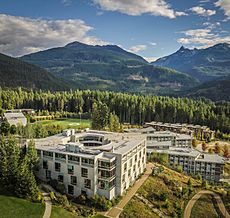
In winter, cross-country and telemark skiing are popular. High-quality downhill skiing has developed in the Coast Mountains and Rockies. Snowboarding has also become very popular. The 2010 Winter Olympics downhill events were held in Whistler Blackcomb.
In Vancouver and Victoria, there are many places for joggers and bicyclists. Cross-country bike touring is popular. With mountain bikes, trails in wilder places have been created. A 2016 poll rated BC as the top place mountain bikers want to ride. Some old railway lines have been turned into trails for hiking, biking, and cross-country skiing. Longboarding is also popular because of the hilly land.
Horseback riding is enjoyed by many. There are many places for tourists to go trail riding in scenic areas.
British Columbia also has many other popular sports. These include golf, tennis, soccer, hockey, Canadian football, rugby union, lacrosse, baseball, softball, basketball, curling, and figure skating. British Columbia has produced many great athletes, especially in water and winter sports.
More lodges, chalets, hotels, and camping facilities have been built. This is because of more tourism and more people enjoying outdoor activities. Some businesses and groups promote ecotourism. Some farmers in BC even let visitors combine tourism with farm work.
Sports Teams in British Columbia
| Team | City | League | Stadium/arena |
|---|---|---|---|
| Abbotsford Canucks | Abbotsford | American Hockey League | Abbotsford Centre |
| BC Lions | Vancouver | Canadian Football League | BC Place |
| BC Thunder | Richmond | National Ringette League | Richmond Ice Centre |
| Kamloops Blazers | Kamloops | Canadian Hockey League | Sandman Centre |
| Kelowna Rockets | Kelowna | Canadian Hockey League | Prospera Place |
| Pacific FC | Langford | Canadian Premier League | Starlight Stadium |
| Prince George Cougars | Prince George | Canadian Hockey League | CN Centre |
| Vancouver Bandits | Langley | Canadian Elite Basketball League | Langley Events Centre |
| Vancouver Canucks | Vancouver | National Hockey League | Rogers Arena |
| Vancouver FC | Langley | Canadian Premier League | Willoughby Community Park Stadium |
| Vancouver Giants | Langley | Canadian Hockey League | Langley Events Centre |
| Vancouver Warriors | Vancouver | National Lacrosse League | Rogers Arena |
| Vancouver Whitecaps | Vancouver | Major League Soccer | BC Place |
| Victoria Royals | Victoria | Canadian Hockey League | Save-On-Foods Memorial Centre |
Education in British Columbia
K-12 Schools in BC
British Columbia has a complete education system with public and independent schools. The provincial Ministry of Education oversees it. The public school system has 59 English-speaking school districts. There is also one French-speaking school district, the Conseil scolaire francophone de la Colombie-Britannique. School board trustees, elected by local residents, govern the English-speaking districts.
While 86% of students are in public schools, British Columbia has many independent schools. About 14% of students attend them. This is because these schools receive good funding from the government. A very small number of students (less than 1%) are home-schooled.
Education is required from ages 6 to 16 (grades 1–10). However, most students stay in school until they graduate from high school (grade 12) at age 18. To get a graduation certificate, called a Dogwood Diploma, students must earn at least 80 course credits in grades 10 to 12. These credits include required courses like language arts, social studies, math, and science, plus elective courses.
Students in British Columbia generally do well in school. In 2020, 86% of students graduated from high school within six years of starting grade 8. In 2018, British Columbia students scored high in reading, math, and science on an international test (PISA).
International Students in K-12
In September 2014, there were 11,000 international students in BC public K-12 schools. About 3,000 more were in other K-12 schools in BC.
Higher Education in BC
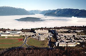
British Columbia has many different places for higher education. These include public universities, colleges, and institutes. There are also private universities, colleges, and career institutes. Public institutions get about half their money from the provincial government. The rest comes from tuition fees and donations. Each school sets its own admission rules, but usually, you need to finish high school.
Public universities and colleges include:
- University of British Columbia
- Simon Fraser University
- University of Victoria
- University of Northern British Columbia
- Vancouver Island University
- British Columbia Institute of Technology
- Kwantlen Polytechnic University
- Thompson Rivers University
- Emily Carr University of Art and Design
- Royal Roads University
- Capilano University
- University of the Fraser Valley
- Douglas College
- Camosun College
- Langara College
- Selkirk College
- College of New Caledonia
- College of the Rockies
- Okanagan College
- Coast Mountain College
- Justice Institute of BC
British Columbia also has 11 private colleges and universities. These include:
- Quest University
- Trinity Western University
- Alexander College
- University Canada West
- Columbia College
- Coquitlam College
- Tamwood International College
- Ashton College
- Blanche Macdonald
- Vanwest College
Two American universities, Fairleigh Dickinson University and Northeastern University, also have campuses in Vancouver.
See also
 In Spanish: Columbia Británica para niños
 | James Van Der Zee |
 | Alma Thomas |
 | Ellis Wilson |
 | Margaret Taylor-Burroughs |


