
List of municipalities in Massachusetts facts for kids
Quick facts for kids Municipalities of Massachusetts |
|
|---|---|
 |
|
| Category | Municipality |
| Location | Commonwealth of Massachusetts |
| Found in | County |
| Created | 1620 (Plymouth) |
| Number | 351 |
| Possible types | City Town |
| Populations | 70 (Gosnold) – 675,647 (Boston) |
| Areas | 1.0 square mile (2.6 km2) (Nahant) – 96.5 square miles (250 km2) (Plymouth) |
| Government | Council–manager Town meeting Mayor–council Select Board |
| Subdivisions | Village Neighborhood |
In Massachusetts, local areas are called municipalities. These are either known as towns or cities. The main difference between them is how they are governed. Towns usually have a "town meeting" style of government. Cities, on the other hand, are run by a mayor and a council, or a manager and a council.
There are 292 towns and 59 cities in Massachusetts. Some places still call themselves "towns" even if they use a city-style government. The good news is that all the land in Massachusetts is part of one of these 351 municipalities. There are no areas that don't belong to a town or city.
Contents
Massachusetts' Biggest Cities
These are the largest cities in Massachusetts based on their population.
| Rank | Name | Pop. |
|---|---|---|
| 1 | Boston | 675,647 |
| 2 | Worcester | 206,518 |
| 3 | Springfield | 155,929 |
| 4 | Cambridge | 118,403 |
| 5 | Lowell | 115,554 |
| 6 | Brockton | 105,643 |
| 7 | Quincy | 101,636 |
| 8 | Lynn | 101,253 |
| 9 | New Bedford | 101,079 |
| 10 | Fall River | 94,000 |
Understanding Massachusetts Municipalities
.png)
Massachusetts has 351 different municipalities. These include both cities and towns. The table below shows some of the largest and oldest ones. It lists their type, the county they are in, how they are governed, their population, size, and when they were first established.
| Municipality | Type | County | Form of government | Population (2020) |
Total area | Land area | Year established |
|---|---|---|---|---|---|---|---|
| Boston | City (capital) | Suffolk (seat) | Mayor-Council | 675,647 | 89.6 sq mi (232.06 km2) | 48.3 sq mi (125.10 km2) | 1630 |
| Worcester | City | Worcester (seat) | Mayor-Manager-Council | 206,518 | 38.5 sq mi (99.71 km2) | 37.4 sq mi (96.87 km2) | 1684 |
| Springfield | City | Hampden (seat) | Mayor-Council | 155,929 | 33.1 sq mi (85.73 km2) | 31.9 sq mi (82.62 km2) | 1636 |
| Cambridge | City | Middlesex (seat) | Mayor-Manager-Council | 118,403 | 7.1 sq mi (18.39 km2) | 6.4 sq mi (16.58 km2) | 1636 |
| Lowell | City | Middlesex (seat) | Mayor-Manager-Council | 115,554 | 14.5 sq mi (37.55 km2) | 13.6 sq mi (35.22 km2) | 1826 |
| Brockton | City | Plymouth (seat) | Mayor-Council | 105,643 | 21.5 sq mi (55.68 km2) | 21.3 sq mi (55.17 km2) | 1821 |
| Quincy | City | Norfolk | Mayor-Council | 101,636 | 26.9 sq mi (69.67 km2) | 16.6 sq mi (42.99 km2) | 1792 |
| Lynn | City | Essex | Mayor-Council | 101,253 | 13.5 sq mi (34.96 km2) | 10.7 sq mi (27.71 km2) | 1629 |
| New Bedford | City | Bristol | Mayor-Council | 101,079 | 24.1 sq mi (62.42 km2) | 20.0 sq mi (51.80 km2) | 1787 |
| Fall River | City | Bristol | Mayor-Council | 94,000 | 40.2 sq mi (104.12 km2) | 33.1 sq mi (85.73 km2) | 1803 |
| Lawrence | City | Essex (seat) | Mayor-Council | 89,143 | 7.4 sq mi (19.17 km2) | 6.9 sq mi (17.87 km2) | 1847 |
| Newton | City | Middlesex | Mayor-Council | 88,923 | 18.2 sq mi (47.14 km2) | 17.8 sq mi (46.10 km2) | 1688 |
| Somerville | City | Middlesex | Mayor-Council | 81,045 | 4.2 sq mi (10.88 km2) | 4.1 sq mi (10.62 km2) | 1842 |
| Framingham | City | Middlesex | Mayor-Council | 72,362 | 26.5 sq mi (68.63 km2) | 25.0 sq mi (64.75 km2) | 1700 |
| Haverhill | City | Essex | Mayor-Council | 67,787 | 35.7 sq mi (92.46 km2) | 33.0 sq mi (85.47 km2) | 1641 |
| Malden | City | Middlesex | Mayor-Council | 66,263 | 5.1 sq mi (13.21 km2) | 5.0 sq mi (12.95 km2) | 1649 |
| Waltham | City | Middlesex | Mayor-Council | 65,218 | 13.8 sq mi (35.74 km2) | 12.7 sq mi (32.89 km2) | 1738 |
| Brookline | Town | Norfolk | Representative town meeting | 63,191 | 6.8 sq mi (17.61 km2) | 6.8 sq mi (17.61 km2) | 1705 |
| Revere | City | Suffolk | Mayor-Council | 62,186 | 10.1 sq mi (26.16 km2) | 5.7 sq mi (14.76 km2) | 1846 |
| Plymouth | Town | Plymouth (seat) | Representative town meeting | 61,217 | 134.0 sq mi (347.06 km2) | 96.5 sq mi (249.93 km2) | 1620 |
How Towns Were Formed
This map shows when towns were first created in Massachusetts. This started with the founding of Plimoth Plantation in 1620. Many of these early towns were very large. Over time, they were often divided into two, three, or even more smaller towns or cities.
For example, Dorchester was first established in 1630. It used to include all of what is now Dorchester, plus the Boston neighborhood of Mattapan. It also included all of present-day Quincy, Milton, Braintree, Randolph, Holbrook, Canton, Sharon, Stoughton, Avon, and part of Foxboro!
By 1815, almost all of Massachusetts was divided into towns. The last three areas to become towns were Erving (in 1838), Gay Head (now Aquinnah), and Mashpee (both in 1870). These last areas were previously Native American land.
Here are some examples of how towns were formed or changed over time:
| Community | Year incorporated as a town | Notes |
| Medfield | 1651 | This was the first town to separate from Dedham. |
| Natick | 1659 | This community was created for Christian Native Americans. |
| Wrentham | 1673 | The southeast part of this town was once part of the Dorchester New Grant from 1637. |
| Deerfield | 1673 | This land was given to Dedham in exchange for giving up Natick. |
| Needham | 1711 | |
| Medway | 1713 | This town separated from Medfield. The land was originally granted to Dedham in 1649. |
| Bellingham | 1719 | |
| Walpole | 1724 | |
| Stoughton | 1726 | This town was part of the Dorchester New Grant of 1637 and separated from Dorchester. |
| Sharon | 1775 | Also part of the Dorchester New Grant of 1637, it separated from Stoughton. |
| Foxborough | 1778 | This area was part of the Dorchester New Grant of 1637. |
| Franklin | 1778 | This town separated from Wrentham. |
| Canton | 1797 | Part of the Dorchester New Grant of 1637, it separated from Stoughton. |
| Dover | 1836 | This area was once known as Springfield. It became a part of Dedham in 1729 and later its own parish. |
| Hyde Park | 1868 | 800 acres were taken from Dedham, along with land from Dorchester and Milton, to form this town. |
| Norfolk | 1870 | This town separated from Wrentham. |
| Norwood | 1872 | This area became its own precinct in 1734. |
| Wellesley | 1881 | This town separated from Needham. |
| Millis | 1885 | This town separated from Medfield. |
| Avon | 1888 | Part of the Dorchester New Grant of 1637, it separated from Stoughton. |
| Westwood | 1897 | This was the last community to directly break away from Dedham. |
| Plainville | 1905 | The eastern part of this town was part of the Dorchester New Grant of 1637. It separated from Wrentham. |
Former Municipalities
Some towns and cities in Massachusetts no longer exist as separate places. They were either joined with other towns, stopped being towns, or became part of another state. This list does not include small changes to town borders.
Joined with Other Places
The following places used to be independent towns but later became part of Boston:
- Brighton (in 1873)
- Charlestown (in 1873)
- Dorchester (in 1869)
- Hyde Park (in 1912)
- Roxbury (in 1867)
- West Roxbury (in 1873)
The town of Bradford also joined with Haverhill, Massachusetts in 1897.
No Longer Towns
These towns were closed down in 1938 because the Quabbin Reservoir was being built. Their land was then added to nearby towns:
Given to Other States
Sometimes, towns were given to other states due to border changes or political decisions.
Given to New Hampshire
In 1641, four towns in colonial New Hampshire decided to join the Massachusetts Bay Colony. But in 1680, they were given back to the newly formed Province of New Hampshire. These towns were:
Many other towns were given to New Hampshire after the border was officially set in 1741.
Given to Rhode Island
In 1747, some towns were given to the Rhode Island colony because of a border disagreement:
- Barrington
- Bristol
- Little Compton
- Sowams (now Warren)
- Tiverton
Given to Connecticut
Because of a surveying mistake and ongoing arguments, these Massachusetts towns joined the Connecticut Colony in 1749:
Given to Maine
When the State of Maine became independent from Massachusetts in 1820 (as part of the Missouri Compromise), all the towns in the District of Maine were given to the new state. This included many towns, such as:
- Addison
- Alfred
- Alna
- Anson
- Arundel (now Kennebunkport)
- Athens
- Augusta
- Avon
- Baldwin
- Bath
- Belfast
- Belgrade
- Belmont
- Berwick
- Bethel
- Biddeford
- Bingham
- Blue Hill
- Boothbay
- Bowdoin
- Bowdoinham
- Bradford
- Brewer
- Bridgton
- Bristol
- Brooks
- Brooksville
- Brownfield
- Brunswick
- Buckfield
- Bucksport
- Buxton
- Calais
- Camden
- Canaan
- Cape Elizabeth
- Carmel
- Castine
- Cherryfield
- Chesterville
- China
- Clinton
- Columbia
- Corinna
- Corinth
- Cornish
- Cornville
- Cushing
- Deer Isle
- Denmark
- Dennysville
- Dexter
- Dixfield
- Dixmont
- Dresden
- Durham
- East Andover (Andover)
- Eastport
- Eddington
- Eden (Bar Harbor)
- Edgecomb
- Eliot
- Ellsworth
- Embden
- Etna
- Exeter
- Fairfax (Albion)
- Fairfield
- Falmouth
- Farmington
- Fayette
- Frankfort
- Freedom
- Freeport
- Friendship
- Fryeburg
- Gardiner
- Garland
- Georgetown
- Gilead
- Gorham
- Gouldsboro
- Gray
- Greene
- Greenwood
- Guilford
- Hallowell
- Hampden
- Harlem (annexed by China)
- Harmony
- Harpswell
- Harrington
- Harrison
- Hartford
- Hartland
- Hebron
- Hermon
- Hiram
- Hollis
- Hope
- Industry
- Islesboro
- Jackson
- Jay
- Jefferson
- Jonesboro
- Kenduskeag Plantation (Bangor)
- Kingfield
- Kittery
- Knox
- Lebanon
- Leeds
- Levant
- Lewistown (Lewiston)
- Limerick
- Limington
- Lincolnville
- Lisbon
- Litchfield
- Livermore
- Lovell
- Lubec
- Lyman
- Machias
- Madison
- Malta (Windsor)
- Mercer
- Mexico
- Minot
- Monmouth
- Monroe
- Montville
- Moscow
- Mount Desert
- Mount Vernon
- New Charleston (Charleston)
- New Gloucester
- New Portland
- New Sharon
- New Vineyard
- Newburgh
- Newcastle
- Newfield
- Newport
- Newry
- Nobleboro
- Norridgewock
- North Hill (Brighton Plantation)
- North Yarmouth
- Northport
- Norway
- Orland
- Orono
- Orrington
- Otisfield
- Palermo
- Palmyra
- Paris
- Parsonsfield
- Penobscot
- Perry
- Phillips
- Phippsburg
- Pittston
- Poland
- Porter
- Portland
- Pownal
- Prospect
- Raymond
- Readfield
- Ripley
- Robbinston
- Rome
- Rumford
- Saco
- Sanford
- Sangerville
- Scarborough
- Searsmont
- Sebec
- Sedgwick
- Shapleigh
- Sidney
- Solon
- South Berwick
- St. Albans
- St. George
- Standish
- Starks
- Steuben
- Strong
- Sullivan
- Sumner
- Surry
- Swanville
- Sweden
- Temple
- Thomaston
- Thorndike
- Topsham
- Trenton
- Troy
- Turner
- Union
- Unity
- Vassalboro
- Vienna
- Vinalhaven
- Waldoboro
- Wales
- Warren
- Warsaw (Pittsfield)
- Washington
- Waterboro
- Waterford
- Waterville
- Wayne
- Weld
- Wells
- Westbrook
- Whitefield
- Wilton
- Windham
- Winslow
- Winthrop
- Wiscasset
- Woodstock
- Woolwich
- York
Images for kids
-
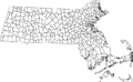
Map of Massachusetts showing its towns and cities.
See also
 In Spanish: Anexo:Localidades de Massachusetts para niños
- Administrative divisions of Massachusetts
- Equivalent Lands
- Lists of cities in the United States
- List of villages in Massachusetts
- Massachusetts gateway cities
