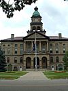
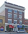
National Register of Historic Places listings in Michigan facts for kids
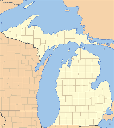
The National Register of Historic Places is a special list of buildings, places, and objects in the U.S. state of Michigan that are important to history. These places are recognized by the United States government for their historical, architectural, or archaeological value. When a place is added to this list, it helps protect it and makes sure future generations can learn from it. Michigan has many amazing historic sites, from old lighthouses and courthouses to unique homes and bridges.
| Legend |
|---|
| Italic link – Links to a separate articles |
| Regular link – Redirects further down in this article |
| Black text – Listed county has no designated NRHP listings |
Alcona • Alger • Allegan • Alpena • Antrim • Arenac • Baraga • Barry • Bay • Benzie • Berrien • Branch • Calhoun • Cass • Charlevoix • Cheboygan • Chippewa • Clare • Clinton • Crawford • Delta • Dickinson • Eaton • Emmet • Genesee • Gladwin • Gogebic • Grand Traverse • Gratiot • Hillsdale • Houghton • Huron • Ingham • Ionia • Iosco • Iron • Isabella • Jackson • Kalamazoo • Kalkaska • Kent • Keweenaw • Lake • Lapeer • Leelanau • Lenawee • Livingston • Luce • Mackinac • Macomb • Manistee • Marquette • Mason • Mecosta • Menominee • Midland • Missaukee • Monroe • Montcalm • Montmorency • Muskegon • Newaygo • Oakland • Oceana • Ogemaw • Ontonagon • Osceola • Oscoda • Otsego • Ottawa • Presque Isle • Roscommon • Saginaw • Sanilac • Schoolcraft • Shiawassee • St. Clair • St. Joseph • Tuscola • Van Buren • Washtenaw • Wayne (excluding Detroit) • Wayne (only Detroit) • Wexford
|
|}
Contents
- Historic Places by County in Michigan
- Alcona County Historic Sites
- Alpena County Historic Sites
- Antrim County Historic Sites
- Arenac County Historic Sites
- Baraga County Historic Sites
- Barry County Historic Sites
- Benzie County Historic Sites
- Cass County Historic Sites
- Clare County Historic Sites
- Clinton County Historic Sites
- Crawford County Historic Sites
- Dickinson County Historic Sites
- Gladwin County Historic Sites
- Hillsdale County Historic Sites
- Iosco County Historic Sites
- Isabella County Historic Sites
- Kalkaska County Historic Sites
- Lake County Historic Sites
- Luce County Historic Sites
- Mason County Historic Sites
- Mecosta County Historic Sites
- Missaukee County Historic Sites
- Montcalm County Historic Sites
- Montmorency County Historic Sites
- Newaygo County Historic Sites
- Oceana County Historic Sites
- Ogemaw County Historic Sites
- Ontonagon County Historic Sites
- Osceola County Historic Sites
- Oscoda County Historic Sites
- Otsego County Historic Sites
- Roscommon County Historic Sites
- Schoolcraft County Historic Sites
- Van Buren County Historic Sites
- Wexford County Historic Sites
Historic Places by County in Michigan
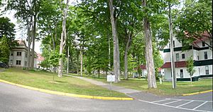
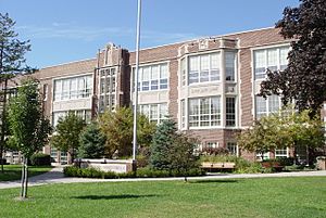
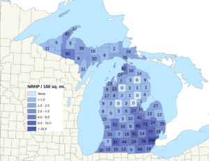
Michigan is home to many important historic sites, spread across its counties. Some counties have many listed places, while others have fewer. This list helps us see where these special places are located.
Alcona County Historic Sites
| Name on the Register | Image | Date listed | Location | City or town | Description | |
|---|---|---|---|---|---|---|
| 1 | Sturgeon Point Light Station |
(#84001370) |
Point Road 44°42′36″N 83°16′20″W / 44.71°N 83.272222°W |
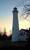
Haynes Township | Built in 1869, this lighthouse on Lake Huron helped guide ships away from a dangerous underwater reef. It's located near Harrisville in northeastern Michigan. |
Alpena County Historic Sites
| Name on the Register | Image | Date listed | Location | City or town | Description | |
|---|---|---|---|---|---|---|
| 1 | Alpena County Courthouse |
(#83003643) |
720 Chisholm Avenue 45°04′05″N 83°26′30″W / 45.068056°N 83.441667°W |
Alpena | This courthouse was built in 1934 in the city of Alpena. It still serves the county today and has a cool Art Deco design. | |
| 2 | Alpena Light |
(#06000197) |
Thunder Bay River mouth, 150 feet (46 m) from shore 45°03′37″N 83°25′23″W / 45.060278°N 83.423056°W |
Alpena | The Alpena Light was built in 1914 to mark the entrance of Thunder Bay River. This lighthouse is still active and helps boats navigate the waters. | |
| 3 | Fishing Tug Katherine V |
(#03000622) |
491 Johnson Street 45°04′53″N 83°26′57″W / 45.081389°N 83.449167°W |
Alpena | The Katherine V is an old fishing tugboat that you can now see at the Besser Museum in Alpena. It's special because it's thought to be the last wooden fishing tug still in one piece. | |
| 4 | IOOF Centennial Building |
(#15000944) |
150 E. Chisholm St. 45°03′40″N 83°25′57″W / 45.061238°N 83.432638°W |
Alpena | This building was built in 1876 for Samuel and Samantha Hitchcock, who were important early settlers of Alpena. Later, a local club called the Independent Order of Odd Fellows bought it in 1901. | |
| 5 | Middle Island Light |
(#06000133) |
Middle Island 45°11′35″N 83°19′16″W / 45.193056°N 83.321111°W |
Alpena Township | This lighthouse is on Middle Island, about 10 miles (16 km) north of Alpena. It's located between two other important lights, Presque Isle and Thunder Bay Island. | |
| 6 | Norwegian Lutheran Church Complex |
(#13000478) |
10430 S. Leer Rd. (Long Rapids Township) 45°11′50″N 83°43′11″W / 45.197314°N 83.719847°W |
Leer | The Norwegian Lutheran Church Complex includes a church, a parish house, a cemetery, and a pavilion. The church looks much like it did when it was built in 1899. It has a special altar painting and a unique metal interior in the parish house. | |
| 7 | PEWABIC (propeller) Shipwreck Site |
(#14001096) |
Lake Huron 44°57′53″N 83°06′14″W / 44.964833°N 83.103933°W |
Alpena Township | The SS Pewabic was a cargo ship that worked on the Great Lakes. It sank in Lake Huron on August 9, 1865, after crashing into another ship. | |
| 8 | Thunder Bay Island Light Station |
(#84001371) |
Thunder Bay Island 45°02′14″N 83°11′40″W / 45.037222°N 83.194444°W |
Alpena Township | This lighthouse was built in 1832 and is one of the oldest working lighthouses on Lake Huron. It has been updated many times over the years. |
Antrim County Historic Sites
| Name on the Register | Image | Date listed | Location | City or town | Description | |
|---|---|---|---|---|---|---|
| 1 | Antrim County Courthouse |
(#80001846) |
S. Cayuga St. 44°58′33″N 85°12′29″W / 44.975833°N 85.208056°W |
Bellaire | The Antrim County Courthouse was designed in 1879. It was empty for a while but was restored in the 1990s. Today, it holds the county courts and prosecutor's office. | |
| 2 | Elk Rapids First Methodist Episcopal Church |
(#15000945) |
301 Traverse St. 44°53′48″N 85°24′56″W / 44.896602°N 85.415634°W |
Elk Rapids | This church was built in 1901 and used by its congregation until 2011. It's known for its beautiful Gothic stained glass windows. Now, it's the Elk Rapids Area Historical Museum. | |
| 3 | Elk Rapids Township Hall |
(#77000709) |
River St. 44°53′51″N 85°24′57″W / 44.8975°N 85.415833°W |
Elk Rapids | The Elk Rapids Township Hall was built in 1883. It was used as a theater and a place for community events like plays, concerts, and dances. | |
| 4 | Holtz Site |
(#73002151) |
Address Restricted |
Bellaire | The Holtz Site is an archaeological site from the Middle Woodland period, around 200-400 AD. It was likely a short-term camp for people traveling north from southern Michigan. | |
| 5 | Hughes House |
(#76001024) |
109 Elm St. 44°53′49″N 85°25′04″W / 44.896944°N 85.417778°W |
Elk Rapids | The Hughes House was built around 1868 as a guest house. It was located on the main road between Traverse City and Petoskey. | |
| 6 | M-88–Intermediate River Bridge |
(#99001574) |
M-88 over the Intermediate River 44°58′43″N 85°12′36″W / 44.978611°N 85.21°W |
Bellaire | This steel bridge was built in 1931–32. Many workers for its construction came from a special committee that helped people find jobs during the Great Depression. | |
| 7 | Henry Richardi House |
(#78001491) |
402 N. Bridge St. 44°58′49″N 85°12′37″W / 44.980278°N 85.210278°W |
Bellaire | The Henry Richardi House was built for Henry Richardi, a rich lumber businessman from the late 1800s. It is now a bed and breakfast called the "Grand Victorian Bed and Breakfast." |
Arenac County Historic Sites
| Name on the Register | Image | Date listed | Location | City or town | Description | |
|---|---|---|---|---|---|---|
| 1 | Michigan Central Railroad Standish Depot |
(#91000215) |
107 N. Main St. 43°59′00″N 83°57′37″W / 43.983333°N 83.960278°W |
Standish | This train station was built using fieldstones collected by local farmers. It was a passenger station until 1955 and is now a welcome center. | |
| 2 | Second Arenac County Courthouse |
(#82002823) |
Central Ave. 44°02′50″N 83°51′14″W / 44.047222°N 83.853889°W |
Omer | The first courthouse burned down in 1889, so this second one was built in 1890. However, the county seat moved to Standish in 1892. This building then became a Masonic Hall and is now owned by the Arenac County Historical Society. |
Baraga County Historic Sites
| Name on the Register | Image | Date listed | Location | City or town | Description | |
|---|---|---|---|---|---|---|
| 1 | Assinins |
(#72000591) |
US 41 46°48′43″N 88°28′33″W / 46.811944°N 88.475833°W |
Assinins | Assinins was started in 1843 by Bishop Frederic Baraga. It was one of the first Catholic missions in the Upper Peninsula. It helped build good relationships between local Ottawa and Chippewa tribes and new settlers. | |
| 2 | Arvon Township Hall |
(#81000302) |
Park Rd. 46°52′37″N 88°13′10″W / 46.876944°N 88.219444°W |
Skanee | When this hall was built in 1915, the area was still very wild. The hall was an important community center for public meetings, plays, music festivals, and other fun activities. It is still used for these events today. | |
| 3 | Canyon Falls Bridge |
(#99001464) |
US 41 over the Sturgeon River 46°37′31″N 88°28′13″W / 46.625278°N 88.470278°W |
L'Anse Township | The Canyon Falls Bridge has a unique design with decorative steel rails and concrete pillars. Its look gives it an Art Moderne style. | |
| 4 | Herman and Anna Hanka Farm |
(#84001372) |
Northeast of Pelkie 46°53′37″N 88°32′17″W / 46.893611°N 88.538056°W |
Pelkie | The Hanka Farm was home to the Hanka family, who were Finnish immigrants, from 1896 to 1966. The farm looks much like it did in the 1920s and shows how people lived during a time of big immigration from Finland. | |
| 5 | Hebard – Ford Summer House |
(#82002824) |
Northeast of L'Anse 46°51′33″N 88°23′50″W / 46.859167°N 88.397222°W |
Pequaming | This lodge was built in 1915 by Daniel Hebard. In 1923, Henry Ford bought the town and used this lodge as his summer home until 1941. | |
| 6 | Kewawenon Mission |
(#80001847) |
227 Front Street (Zeba Road), between Whirl-I-Gig Road and Peter Marksman Rd. 46°47′59″N 88°25′25″W / 46.799722°N 88.423611°W |
Zeba | Now called the Zeba United Indian Methodist Church, this mission was started by Methodist missionaries in 1832. The current church building is covered with handmade shingles and has a unique design. | |
| 7 | Sand Point Site |
(#73002152) |
Sand Point, NW of Baraga 46°47′00″N 88°28′00″W / 46.783333°N 88.466667°W |
Baraga | Sand Point is an archaeological site from the Late Woodland period. It contains the remains of an old village and 12 burial mounds. | |
| 8 | US-41 (old)-Backwater Creek Bridge |
(#99001508) |
Abandoned US 41 over Backwater Creek 46°45′16″N 88°29′41″W / 46.754444°N 88.494722°W |
Baraga Township | This bridge was built in 1918 and is one of the earliest examples of a standard bridge design used by the Michigan State Highway Department. |
Barry County Historic Sites
| Name on the Register | Image | Date listed | Location | City or town | Description | |
|---|---|---|---|---|---|---|
| 1 | Barry County Courthouse Complex |
(#81000303) |
220 W. State St. 42°38′53″N 85°17′24″W / 42.648056°N 85.29°W |
Hastings | The Barry County Courthouse was built between 1892 and 1894. It has a mix of different architectural styles, including Victorian and Queen Anne elements. | |
| 2 | John Carveth House |
(#92001076) |
614 W. Main St. 42°42′40″N 85°28′27″W / 42.711111°N 85.474167°W |
Middleville | The John Carveth House, also called the Aaron Clark House, is a large, two-story Queen Anne style house. It was built in 1886 by John Carveth, who was a lawyer and a state senator. | |
| 3 | Chief Noonday Group Camp Historic District |
(#96001481) |
Chief Noonday Road (County Road 434) east of Briggs Rd. 42°38′24″N 85°30′07″W / 42.64°N 85.501944°W |
Yankee Springs Township | In the late 1930s, two group camps were built in the Yankee Springs Recreation Area by a program called the Recreation Development Area. The Chief Noonday Outdoor Center is one of them. | |
| 4 | Austin H. and Frankie A. Dwight Summer House |
(#85000656) |
11456 Marsh Rd. 42°34′56″N 85°30′51″W / 42.582222°N 85.514167°W |
Shelbyville | This house was built between 1901 and 1902 by Austin H. and Frankie Dwight. It was known for its unique architecture and advanced building techniques. The house was later taken down in 2004. | |
| 5 | Long Lake Group Camp Historic District |
(#96001482) |
10370 Gun Lake Rd. 42°37′00″N 85°29′41″W / 42.616667°N 85.494722°W |
Yankee Springs Township | The Long Lake Outdoor Center was built in the late 1930s as a group camp in the Yankee Springs Recreation Area. It was part of a program to develop recreation areas. | |
| 6 | Shriner-Ketcham House |
(#87000186) |
327 Shriner St. 42°38′11″N 85°17′05″W / 42.636389°N 85.284722°W |
Hastings | The Shriner-Ketcham House was built in 1868 by William Shriner, a local dairy farmer. Later, John C. Ketcham, who served many terms as a U.S. Representative, bought the house and lived there until he passed away in 1941. | |
| 7 | Daniel Striker House |
(#72000592) |
321 S. Jefferson St. 42°38′46″N 85°17′12″W / 42.646111°N 85.286667°W |
Hastings | Daniel Striker was an important banker and politician. He was elected as Michigan Secretary of State in 1870. He built this beautiful house in the 1880s, and it was known as one of the nicest homes in Hastings at the time. |
Benzie County Historic Sites
| Name on the Register | Image | Date listed | Location | City or town | Description | |
|---|---|---|---|---|---|---|
| 1 | Benzie County Courthouse |
(#96000611) |
7157 Crystal Ave. 44°37′39″N 86°05′46″W / 44.6275°N 86.096111°W |
Beulah | The Benzie County Courthouse was built in 1912 as a recreation center and hotel called The Grand. In 1916, Beulah became the county seat, and the hotel was turned into the courthouse. | |
| 2 | Frankfort Land Company House |
(#95000452) |
428 Leelanau St. 44°38′04″N 86°14′16″W / 44.634444°N 86.237778°W |
Frankfort | This house was built in the 1860s by the Frankfort Land Company for its officials. It was the first fancy building in town and showed how much the company believed in Frankfort's future. It's now a bed and breakfast called the Stonewall Inn B & B. | |
| 3 | Frankfort North Breakwater Light |
(#05000983) |
Offshore end of the north breakwater, 0.4 miles southwest of the junction of Main St. and Michigan Ave. 44°37′52″N 86°15′07″W / 44.631111°N 86.251944°W |
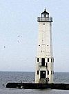
Frankfort | The original Frankfort North Breakwater lighthouse was built in 1873. The current light was built in 1932 at the end of the northern concrete pier. It is still used today. | |
| 4 | Mills Community House |
(#72000593) |
891 Michigan Ave. 44°37′08″N 86°06′05″W / 44.618889°N 86.101389°W |
Benzonia | Mills Community House was built in 1909 as a girls' dormitory and president's home for Benzonia Academy. It's famous because Bruce Catton, a Pulitzer Prize-winning historian, lived there. After the Academy closed, it became a community center and library. | |
| 5 | Navigation Structures at Frankfort Harbor |
(#97000973) |
2nd St. 44°37′49″N 86°14′52″W / 44.630278°N 86.247778°W |
Frankfort | The Frankfort Harbor has two piers and two breakwaters. The piers were built between 1867 and 1873 and have been changed over time. | |
| 6 | Platte River Campground |
(#90000605) |
along the Platte River 44°43′00″N 86°07′00″W / 44.716667°N 86.116667°W |
Sleeping Bear Dunes | The Platte River Campground Site is an archaeological site that shows how people lived during the Middle and Late Woodland period over a long time. | |
| 7 | Point Betsie Light Station |
(#84001375) |
Point Betsie 44°41′08″N 86°15′20″W / 44.685556°N 86.255556°W |
Frankfort | Construction on this lighthouse began in 1854. It was one of the first places to have a Life Saving Station, built in 1875. Point Betsie Light was the last lighthouse on Lake Michigan to have a human keeper. | |
| 8 | Watervale Historic District |
(#03000624) |
975-1422 Watervale Rd. 44°33′14″N 86°13′04″W / 44.553889°N 86.217778°W |
Blaine Township | Watervale was first planned and built in the 1890s for logging operations. Later, in 1917, Dr. Oscar H. Kraft bought the town to use as a resort. His family has run Watervale as a resort ever since. |
Cass County Historic Sites
| Name on the Register | Image | Date listed | Location | City or town | Description | |
|---|---|---|---|---|---|---|
| 1 | Criffield-Whiteley House |
(#16000818) |
601 Main St. 41°59′06″N 86°07′01″W / 41.984991°N 86.116966°W |
Dowagiac | The Criffield–Whiteley House, built in 1897, is a 2-1/2-story Queen Anne style house. It sits on a strong foundation made of large, carefully placed fieldstones. | |
| 2 | First Methodist Episcopal Church of Pokagon |
(#02000295) |
60041 Vermont St. 41°54′43″N 86°10′26″W / 41.911944°N 86.173889°W |
Pokagon Township | In 1876, this building was changed from a barn into a church. It's famous because the hymn "The Old Rugged Cross" was first performed here in 1903. It was later sold and used for storage again, but restoration started in 1998. | |
| 3 | Carroll and Bessie E. (Caul) Jones House |
(#97001482) |
170 W. Main St. 42°01′38″N 85°49′00″W / 42.027222°N 85.816667°W |
Marcellus | This two-story house has both Dutch Colonial Revival and Romanesque Revival styles. It was built between 1898 and 1900 for Carroll Sherman Jones, the son of Marcellus's founder. | |
| 4 | G. W. Jones House |
(#94001427) |
180 W. Main St. 42°01′38″N 85°49′02″W / 42.027222°N 85.817222°W |
Marcellus | This house was built in 1888 for George Washington Jones, who founded the town of Marcellus. He lived here until he passed away in 1896. | |
| 5 | Mason District Number 5 Schoolhouse |
(#85002153) |
17049 US 12 41°46′34″N 85°53′52″W / 41.776111°N 85.897778°W |
Edwardsburg | The Mason District Number 5 Schoolhouse was a two-room country school built in 1874. It could hold up to 110 students. The school closed in 1959, and the building became the Mason Township Hall in 1964. | |
| 6 | Michigan Central Railroad Dowagiac Depot |
(#93001349) |
200 Depot Dr. 41°58′51″N 86°06′33″W / 41.980833°N 86.109167°W |
Dowagiac | The Dowagiac Depot was built by the Michigan Central Railroad in 1903. It was restored in 1995. | |
| 7 | George Newton House |
(#82002830) |
20689 Marcellus Highway 42°00′44″N 85°58′05″W / 42.012222°N 85.968056°W |
Marcellus | The George Newton House was the home of George Newton, an important community leader. It is now a museum. | |
| 8 | Smith's Chapel |
(#87002224) |
29858 Redfield Rd. 41°46′07″N 86°08′44″W / 41.768611°N 86.145556°W |
Milton Township | Smith's Chapel was built in 1840 by a local Methodist group. It is the oldest known church building in Cass County. The church was used regularly until 1967. | |
| 9 | Thomson Road–Air Line Railroad Bridge |
(#99001612) |
Thompson Rd. over an abandoned railroad right-of-way 41°53′35″N 86°11′41″W / 41.893056°N 86.194722°W |
Howard Township | This bridge, built in 1919, is one of the oldest examples of a concrete T-beam bridge in Michigan. It's special because it has multiple spans and a rare brick deck. |
Clare County Historic Sites
| Name on the Register | Image | Date listed | Location | City or town | Description | |
|---|---|---|---|---|---|---|
| 1 | Clare Congregational Church |
(#94001424) |
110 W. Fifth St. 43°49′11″N 84°46′10″W / 43.819722°N 84.769444°W |
Clare | The Clare Congregational Church was built in 1908–09. It's one of the few churches in Michigan that shows how Protestants in the early 1900s adopted older church designs. | |
| 2 | Clare Downtown Historic District |
(#16000178) |
114-120 E. Fifth St., 102-202 W. Fifth St., 112-115 E. Fourth St., 112-124 W. Fourth St., 307, 321-622 N. McEwan 43°49′09″N 84°46′06″W / 43.819236°N 84.768343°W |
Clare | The Clare Downtown Historic District is the main business area of the city. It has 51 buildings built from 1873 to 2000, showing different architectural styles like Neoclassical and Commercial Brick. | |
| 3 | George and Martha Hitchcock House |
(#82002832) |
205 E. Michigan St. 43°50′11″N 84°51′53″W / 43.836389°N 84.864722°W |
Farwell | George Hitchcock and his wife Martha hired a famous Detroit firm to design this house. Construction was finished in 1885. George was involved in the logging business and helped found the village of Farwell. |
Clinton County Historic Sites
| Name on the Register | Image | Date listed | Location | City or town | Description | |
|---|---|---|---|---|---|---|
| 1 | East Ward School |
(#80001850) |
106 N. Traver St. 43°00′06″N 84°32′56″W / 43.001667°N 84.548889°W |
St. Johns | The East Ward School was built in 1876. It was known for its large size and fancy brickwork. The school building has since been replaced by homes and a preschool. | |
| 2 | Giles J. Gibbs Building-Sugar Bowl |
(#00000223) |
12 N. Clinton Ave. 43°00′07″N 84°33′30″W / 43.001944°N 84.558333°W |
St. Johns | This building was first a grocery store owned by Giles J. Gibbs. In 1916, The Sugar Bowl, a popular spot, opened here and was run by the Pappas family until 1970. | |
| 3 | Grist Mill Bridge, Dam and Mill Site |
(#15000295) |
Upton Rd. from Island Rd. to Maple R. 43°05′24″N 84°24′21″W / 43.0899°N 84.4058°W |
Duplain Township | This site has three important parts: the Upton Road Bridge, which is a rare type of bridge in Michigan, the Elsie Mill Pond Dam, and the remains of the 1865 Kellogg Bros. & Johnson grist mill. | |
| 4 | Main Street Building, United Church of Ovid |
(#72000607) |
222 Main St. 43°00′25″N 84°22′16″W / 43.006944°N 84.371111°W |
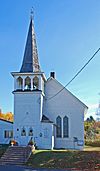
Ovid | This building was constructed in 1872 as the First Congregational Church of Ovid. It has a tall, three-story tower with unique decorations. | |
| 5 | Stony Creek Bridge |
(#99001467) |
Private road over Stony Creek 42°54′54″N 84°34′48″W / 42.915°N 84.58°W |
Olive Township | The Stony Creek Bridge, built in 1880, is made of wrought iron. It is the last example of this type of bridge still standing in Michigan. | |
| 6 | Union School |
(#80001851) |
205 W. Baldwin St. 42°59′52″N 84°33′39″W / 42.997778°N 84.560833°W |
St. Johns | The Union School was a very modern school when it was built in 1885. It served the St. Johns district until 1986. The building has since been replaced by homes. |
Crawford County Historic Sites
| Name on the Register | Image | Date listed | Location | City or town | Description | |
|---|---|---|---|---|---|---|
| 1 | Douglas House |
(#01001017) |
6122 E. County Road 612 44°48′08″N 84°28′57″W / 44.802222°N 84.4825°W |
Lovells Township | The Douglas House, also known as North Branch Outing Club, was built in 1916 to attract rich tourists. Famous early members included Henry Ford and his son Edsel. | |
| 2 | Edward E. Hartwick Memorial Building |
(#98001216) |
Hartwick Pines Rd. 44°44′25″N 84°39′14″W / 44.740278°N 84.653889°W |
Grayling Township | The Edward E. Hartwick Memorial Building is a rustic log structure made entirely of Michigan pine. It's one of the few remaining examples of this type of architecture from the 1920s and 1930s in Michigan State Parks. | |
| 3 | M-72–Au Sable River Bridge |
(#99001510) |
M-72 over the Au Sable River 44°39′35″N 84°42′44″W / 44.659722°N 84.712222°W |
Grayling | This bridge is important because it might be the earliest steel rigid-frame bridge built by the Michigan State Highway Department. It's the only one of its kind in Michigan. |
Dickinson County Historic Sites
| Name on the Register | Image | Date listed | Location | City or town | Description | |
|---|---|---|---|---|---|---|
| 1 | Ardis Furnace |
(#72000608) |
Aragon and Antoine Sts. 45°50′13″N 88°03′10″W / 45.836944°N 88.052778°W |
Iron Mountain | In 1908, John T. Jones built this experimental furnace to test a new way to get iron. It was a huge rotating metal tube. While it worked at first, it had problems and was abandoned. Only the concrete supports remain today. | |
| 2 | Chapin Mine Steam Pump Engine |
(#81000305) |
Kent St. 45°49′30″N 88°04′12″W / 45.825°N 88.07°W |
Iron Mountain | This steam pump, also known as The Cornish Pump, was built in 1890–91. It's the largest steam-driven engine ever built in the United States. It was used to pump water out of mines. Since 1934, it has been a popular tourist attraction. | |
| 3 | Dickinson County Courthouse and Jail |
(#80001852) |
700 S. Stephenson Ave. 45°49′02″N 88°03′45″W / 45.817222°N 88.0625°W |
Iron Mountain | The Dickinson County Courthouse and Jail was built in 1896. It's a red brick building designed in a Romanesque Revival style. A fire in 1896 destroyed much of the city, including this courthouse, but its walls were saved and the inside was rebuilt. | |
| 4 | Graved Rock Site |
(#95001389) |
Address Restricted |
Kingsford | The Graved Rock Site is an archaeological site with rock carvings. It's believed to have been a special place for prehistoric Native Americans. | |
| 5 | Immaculate Conception Church |
(#90000562) |
500 E. Blaine St. 45°49′59″N 88°03′20″W / 45.833056°N 88.055556°W |
Iron Mountain | The Immaculate Conception Church is an Italian Renaissance Revival style church. It was built in 1902 by Italian Catholics living in Iron Mountain. The parish priest designed and oversaw its construction. | |
| 6 | Iron Mountain Central Historic District |
(#13000763) |
Broadly Fleshiem to C St. & Iron Mountain to Stockbridge Ave. 45°49′10″N 88°04′01″W / 45.819439°N 88.066946°W |
Iron Mountain | This district covers the main business area of Iron Mountain. It has many commercial buildings, as well as the historic county courthouse, a school, a library, and churches. | |
| 7 | Menominee River Park Archeological District |
(#95001388) |
Address Restricted 45°47′00″N 88°05′30″W / 45.783333°N 88.091667°W |
Kingsford | The Menominee River Park Archeological District is an archaeological site. It was once a campsite during the Woodland period and is now a park. | |
| 8 | Up Stream Put-In Site |
(#95001390) |
Address Restricted |
Kingsford | The Up Stream Put-In Site is an archaeological site. It was a campsite and a place to access water during the Woodland period and also used by early European-American settlers. | |
| 9 | Upper Twin Falls Bridge |
(#12001028) |
Over the Menominee River 45°52′39″N 88°04′43″W / 45.8775°N 88.0785°W |
Breitung Township | This highway bridge was built in 1910–11 because a dam would flood the old bridge. It's one of only two camelback through-truss bridges left in Wisconsin. It was also a place where liquor was inspected from 1914 to 1920 when Michigan was dry and Wisconsin was not. |
Gladwin County Historic Sites
There are no sites listed on the National Register of Historic Places in Gladwin County.
Hillsdale County Historic Sites
| Name on the Register | Image | Date listed | Location | City or town | Description | |
|---|---|---|---|---|---|---|
| 1 | J.J. Deal and Son Carriage Factory |
(#12000456) |
117 West St. 41°58′59″N 84°39′48″W / 41.982958°N 84.663264°W |
Jonesville | The J.J. Deal and Son Carriage Factory was built in parts between 1893 and 1909. The company made cars here from 1908 to 1911. Today, it houses apartments. | |
| 2 | Grace Episcopal Church |
(#71000391) |
360 E. Chicago St. 41°59′03″N 84°39′37″W / 41.984167°N 84.660278°W |
Jonesville | Grace Episcopal Church was built between 1844 and 1848. It's one of the first church buildings constructed in Michigan west of Detroit. It's a rare example of early church architecture in the state. | |
| 3 | E.O. Grosvenor House |
(#77000713) |
211 Maumee St. 41°58′55″N 84°39′35″W / 41.981944°N 84.659722°W |
Jonesville | This house was designed in 1874 for Ebenezer O. Grosvenor, a politician who served as Lieutenant Governor of Michigan. It now operates as the Grosvenor House Museum. | |
| 4 | Hillsdale County Courthouse |
(#82002835) |
Howell St. 41°55′14″N 84°37′54″W / 41.920556°N 84.631667°W |
Hillsdale | The Hillsdale County Courthouse was built in 1898–99. It's made of yellow sandstone and was designed by architect Claire Allen. | |
| 5 | Hillsdale Downtown Historic District |
(#95000075) |
Roughly bounded by Ferriss, Cook, E. Bacon, S. Howell, Waldron, N. Manning, Monroe and Hillsdale Sts. and Carlton Rd. 41°55′18″N 84°37′57″W / 41.921667°N 84.6325°W |
Hillsdale | The Hillsdale Downtown Historic District is a commercial area with 95 buildings built from the 1860s to the 1930s. These buildings show many different American architectural styles from Hillsdale's history. | |
| 6 | William R. Kirby Sr. House |
(#82002836) |
377 State Rd. 41°55′36″N 84°34′41″W / 41.926667°N 84.578056°W |
Hillsdale | The William R. Kirby Sr. House, built in the 1840s, is one of the few old cobblestone houses still standing in Michigan. | |
| 7 | W.H.L. McCourtie Estate |
(#91001984) |
Junction of US 12 and Jackson Rd. 42°03′08″N 84°24′30″W / 42.052222°N 84.408333°W |
Somerset Center | This estate was the birthplace of W.H.L. McCourtie, who became rich in the Texas oil boom. He returned to Somerset Center in 1922 and built this estate as a social hub. Around 1930, he hired two Mexican artists to build 17 concrete bridges that look like wood. The estate is now McCourtie Park. | |
| 8 | William Treadwell House |
(#74000984) |
446 N. Meridian Rd. 41°51′47″N 84°21′53″W / 41.863056°N 84.364722°W |
Hudson | This two-story brick house was built for William Treadwell in the early 1860s. It has an Italian Villa style. | |
| 9 | Trunk Line Bridge No. 237 |
(#99001672) |
Burt Rd. over Silver Creek 41°46′11″N 84°34′24″W / 41.769722°N 84.573333°W |
Ransom Township | Trunk Line Bridge No. 237 was built in 1918. It's a concrete arch bridge with a single arch spanning 31 feet (9.4 m) over Silver Creek. The bridge still carries Burt Road today. |
Iosco County Historic Sites
| Name on the Register | Image | Date listed | Location | City or town | Description | |
|---|---|---|---|---|---|---|
| 1 | Alabaster Historic District |
(#77000715) |
Bounded by Lake Huron, Gypsum, Keystone, and Rempert Rds. 44°11′12″N 83°34′04″W / 44.186667°N 83.567778°W |
Alabaster | The Alabaster Historic District includes an old open-pit gypsum mine, its buildings, and the company town. The mine started in 1862, but most buildings were built after a fire in 1891. | |
| 2 | Cooke Hydroelectric Plant |
(#96000803) |
Cook Dam Rd. at the Cook Dam on the Au Sable River 44°28′21″N 83°34′18″W / 44.4725°N 83.571667°W |
Oscoda | The Cook Dam started making electricity in December 1911. It set a world record by sending electricity 125 miles (201 km) to Flint at a very high voltage. | |
| 3 | Five Channels Dam Archeological District |
(#01001016) |
Near Five Channels Dam 44°27′19″N 83°40′36″W / 44.45526°N 83.6766°W |
Oscoda | The Five Channels Dam Archeological District includes the site of a former worker's camp. This camp was used when the dam was being built in 1911–1912. | |
| 4 | Tawas Point Light Station |
(#84001453) |
Tawas Point Rd. 44°15′13″N 83°26′58″W / 44.253611°N 83.449444°W |
East Tawas | The Tawas Point Light was first built in 1852–53, but a new lighthouse was constructed in 1876. The tower is 70 feet (21 m) tall and made of brick. |
Isabella County Historic Sites
| Name on the Register | Image | Date listed | Location | City or town | Description | |
|---|---|---|---|---|---|---|
| 1 | Doughty House |
(#74000989) |
301 Chippewa St. 43°36′21″N 84°46′27″W / 43.605833°N 84.774167°W |
Mount Pleasant | The Doughty House was built around 1865 and bought by Wilkinson Doughty in 1869. He was an early leader in Mt. Pleasant and helped start Central Michigan Normal School (now Central Michigan University). | |
| 2 | Michigan Condensed Milk Factory |
(#83000853) |
320 W. Broadway St. 43°36′17″N 84°46′54″W / 43.604722°N 84.781667°W |
Mount Pleasant | The Michigan Condensed Milk Factory was built in 1908 and used as a creamery until 1960. After being empty for 40 years, it was fixed up and now holds the offices for the City of Mount Pleasant. | |
| 3 | Mount Pleasant Downtown Historic District |
(#14001043) |
Roughly bounded by Mosher, Franklin, Illinois & Washington Sts. 43°36′16″N 84°46′34″W / 43.6045°N 84.7761°W |
Mount Pleasant | The Mount Pleasant Downtown Historic District is the main business area of Mount Pleasant. It has 70 buildings from the 1870s to the 1950s, showing different architectural styles like Italianate and Art Deco. | |
| 4 | Sherman City Union Church |
(#04000645) |
11429 W. Vernon Rd. 43°43′35″N 85°04′34″W / 43.726389°N 85.076111°W |
Sherman City | The Sherman City Union Church was built in 1871 as a hall. In 1898, it became a church for all faiths. It was abandoned around 1960 but was saved and restored by local people in the late 1970s. | |
| 5 | St. John's Episcopal Church |
(#82002842) |
206 W. Maple St. 43°35′59″N 84°46′40″W / 43.599722°N 84.777778°W |
Mount Pleasant | St. John's Episcopal Church was started as a mission church in 1876. The current church, built in 1882, has beautiful stained-glass windows. The building was extensively restored in 1996. |
Kalkaska County Historic Sites
There are no sites listed on the National Register of Historic Places in Kalkaska County.
Lake County Historic Sites
| Name on the Register | Image | Date listed | Location | City or town | Description | |
|---|---|---|---|---|---|---|
| 1 | Idlewild Historic District |
(#79001160) |
U.S. Route 10; also bounded generally by U.S. Route 10 on the north, 72nd St. on the south, Nelson Rd. on the east, and extending west of Forman Rd. on the west 43°53′29″N 85°46′58″W / 43.891389°N 85.782778°W |
Cherry Valley, Pleasant Plains, and Yates Townships, and Idlewild | Idlewild was a vacation and retirement community started in 1912 for African-American residents. It was one of the few places where African Americans could vacation and buy property before discrimination became illegal in 1964. At its busiest, up to 25,000 people would visit for camping, swimming, and entertainment. | |
| 2 | Marlborough Historic District |
(#72000630) |
James Rd. 43°51′40″N 85°50′17″W / 43.861111°N 85.838056°W |
Pleasant Plains Township, Michigan | In the 1890s, the Great Northern Portland Cement Company built a cement plant here. In 1902, they built a nearby village called Marlborough for the workers. By 1910, only ruins remained after the company faced problems. | |
| 3 | John and Katharine Tunkun Podjun Farm |
(#02000160) |
9581 E. One Mile Rd. 44°00′19″N 85°36′28″W / 44.005278°N 85.607778°W |
Ellsworth | John and Katharine Podjun bought this land in 1914 and slowly built a group of farm buildings between 1914 and 1930. The farm is still owned by the Podjun family today. |
Luce County Historic Sites
| Name on the Register | Image | Date listed | Location | City or town | Description | |
|---|---|---|---|---|---|---|
| 1 | Luce County Sheriff's House and Jail |
(#82002848) |
411 W. Harrie St. 46°21′09″N 85°30′55″W / 46.3525°N 85.515278°W |
Newberry | The Luce County Sheriff's House and Jail was built in 1894. This grand building showed how well the community was doing at the time. It was used as the jail and sheriff's home for over 70 years. In 1976, it became the Luce County Historical Museum. |
Mason County Historic Sites
| Name on the Register | Image | Date listed | Location | City or town | Description | |
|---|---|---|---|---|---|---|
| 1 | S.S. Badger (carferry) |
(#09000679) |
700 S. William Street 43°56′57″N 86°27′05″W / 43.949211°N 86.451342°W |
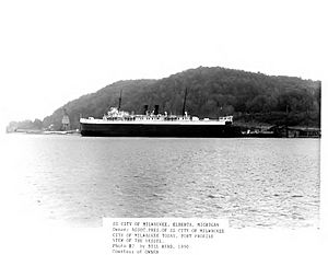
Ludington | The SS Badger is a coal-powered ferry that carries both people and cars. It has been operating on Lake Michigan since 1953 and is the only coal-fired passenger ship still running on the Great Lakes. It was named a National Historic Landmark in 2016. | |
| 2 | Big Sable Point Light Station |
(#83004296) |
Big Sable Point 44°03′26″N 86°30′54″W / 44.057222°N 86.515°W |
Ludington | The Big Sable Point Light was built in 1867. At 112 feet (34 m) tall, it's one of Michigan's tallest lighthouses. It was the last light on the Great Lakes to get electricity in 1949. It still helps guide ships today. | |
| 3 | Warren A. and Catherine Cartier House |
(#14001007) |
409 E. Ludington Ave. 43°57′21″N 86°26′33″W / 43.955926°N 86.442523°W |
Ludington | This house was built in 1905 for Warren Antoine Cartier, a local businessman and politician. | |
| 4 | Lake Michigan Beach House, Ludington State Park |
(#13000798) |
8800 W. M-116 44°01′56″N 86°30′29″W / 44.032155°N 86.507948°W |
Hamlin Township | This beach house at Ludington State Park was designed in 1933 and built in 1935 by the Civilian Conservation Corps, a program that provided jobs during the Great Depression. | |
| 5 | Ludington North Breakwater Light |
(#05000982) |
North Breakwater offshore end, 0.5 miles west of Ludington Ave. at M-116 43°57′13″N 86°28′10″W / 43.953611°N 86.469444°W |
Ludington | The Ludington Light Station was built in 1871, but the light itself wasn't lit until 1924. The light was automated in 1972 and is still used today. | |
| 6 | Ludington United States Coast Guard Station |
(#10000264) |
101 S Lakeshore Dr. 43°57′12″N 86°27′34″W / 43.953333°N 86.459444°W |
Ludington | The first life-saving station in Ludington was built in 1883. The current buildings were constructed in 1933. The Coast Guard moved into a new station nearby in 2004. | |
| 7 | Mason County Courthouse |
(#88000602) |
300 E. Ludington Ave. 43°57′17″N 86°26′40″W / 43.954722°N 86.444444°W |
Ludington | The Mason County Courthouse was built in 1893–94. It's the fourth building to serve as a courthouse for Mason County. It's made of Jacobsville sandstone from Houghton County. | |
| 8 | Not-A-Pe-Ka-Gon Site |
(#73002155) |
Address Restricted |
Mason County | According to the stories of the Odawa people, the Not-A-Pe-Ka-Gon Site was where a big battle happened in the 1600s. Many people died, and their skulls were placed on sticks along the river, which is how the site got its name, meaning "heads on sticks." | |
| 9 | Scottville School |
(#01000571) |
209 N. Main St. 43°57′25″N 86°16′48″W / 43.956944°N 86.28°W |
Scottville | The Scottville School was built in 1888 and was the only school in Scottville until the 1950s. It was used as a high school and middle school until 1976. |
Mecosta County Historic Sites
| Name on the Register | Image | Date listed | Location | City or town | Description | |
|---|---|---|---|---|---|---|
| 1 | Fairman Building |
(#87000072) |
102-106 S. Michigan Ave. 43°41′53″N 85°28′54″W / 43.698056°N 85.481667°W |
Big Rapids | The Fairman Building was built in 1880 for Ferdinand Fairman, a businessman. In 2003, it was renovated into housing for senior citizens and is now called the Nisbett-Fairman Residences. | |
| 2 | Morgan West Wheatland Cemetery |
(#14001044) |
55th Ave. between 10 & 11 Mile Rds. 43°36′55″N 85°11′34″W / 43.6153°N 85.1929°W |
Wheatland Township | The Morgan West Wheatland Cemetery was started in 1864 as African American settlers moved to the area. It has over 50 burial plots from the 1800s and is still used today. | |
| 3 | Nisbett Building |
(#86003452) |
101 S. Michigan Ave. 43°41′53″N 85°28′54″W / 43.698056°N 85.481667°W |
Big Rapids | Construction on the Nisbett Building began in 1885. It was finished in 1900 by William Nisbett. In 2003, it was renovated into senior citizen housing, along with the Fairman Building, and is now part of the Nisbett-Fairman Residences. |
Missaukee County Historic Sites
| Name on the Register | Image | Date listed | Location | City or town | Description | |
|---|---|---|---|---|---|---|
| 1 | Aetna Earthworks |
(#73002157) |
Address Restricted |
Aetna Township | The Aetna Earthworks are two circular ditch-and-bank structures, about 50 meters (164 feet) wide. They are thought to represent a traditional story of Bear's Journey. | |
| 2 | Boven Earthwork |
(#73002293) |
Address Restricted |
Lake City | The Boven Earthworks include four enclosed areas and a burial mound. |
Montcalm County Historic Sites
| Name on the Register | Image | Date listed | Location | City or town | Description | |
|---|---|---|---|---|---|---|
| 1 | Giles Gilbert House |
(#87000137) |
306 N. Camburn St. 43°17′40″N 85°04′48″W / 43.294444°N 85.08°W |
Stanton | Giles Gilbert was an important person in the lumber business in Stanton. He built this house in 1877 and lived there for a few years. Later, another famous lumberman, James Willet, owned the house. | |
| 2 | Greenville Downtown Historic District |
(#08001104) |
Lafayette between Montcalm and Benton and adjacent block of Montcalm, Grove, Cass, and Washington on either side 43°10′48″N 85°15′09″W / 43.18°N 85.2525°W |
Greenville | The Greenville Downtown Historic District is a commercial area with 60 historic buildings. The oldest one dates back to 1869. | |
| 3 | Winter Inn |
(#80001883) |
100 N. Lafayette St. 43°10′52″N 85°15′09″W / 43.181111°N 85.2525°W |
Greenville | The Winter Inn, built in 1902, is a good example of a small, local hotel that was common in towns like Greenville a long time ago. It's still operating today. |
Montmorency County Historic Sites
There are no sites listed on the National Register of Historic Places in Montmorency County.
Newaygo County Historic Sites
| Name on the Register | Image | Date listed | Location | City or town | Description | |
|---|---|---|---|---|---|---|
| 1 | Croton Dam Mound Group |
(#08000846) |
Address Restricted 43°26′15″N 85°39′45″W / 43.4375°N 85.6625°W |
Croton | The Croton Dam Mound Group has three mounds. The largest one is about 35 feet (10.7 m) wide and contained animal bones and weapon points. The two smaller mounds had red ochre and human remains. | |
| 2 | Croton Hydroelectric Plant |
(#79001165) |
Croton Dam Road 43°26′13″N 85°39′55″W / 43.436944°N 85.665278°W |
Croton | Croton Dam was built in 1907. It's one of the earliest examples of using water pressure to build dams east of the Mississippi River. The dam is 40 feet (12 m) high and can hold 7.2 billion U.S. gallons (27 billion L) of water. | |
| 3 | Fremont High School |
(#13000669) |
204 E. Main 43°28′00″N 85°56′27″W / 43.466719°N 85.940766°W |
Fremont | The former Fremont High School has three parts: the original 1926 school building, a 1961 gymnasium, and a connector built in 1988. The building was no longer used as a school after 2012. | |
| 4 | Hardy Hydroelectric Plant |
(#97001479) |
6928 East 36th Street 43°29′13″N 85°38′02″W / 43.486944°N 85.633889°W |
Newaygo | When it was finished in 1931, the Hardy Dam was the largest earthen dam in North America east of the Mississippi River. It is still the third largest earthen dam in the world and the largest east of the Mississippi. | |
| 5 | Toft Lake Village Site |
(#72001476) |
near Toft Lake 43°29′16″N 85°44′22″W / 43.487778°N 85.739444°W |
Everett Township, Michigan | The Toft Lake Village Site is an archaeological site. It was once a Middle Woodland period village located on 10 acres (4 ha) by Toft Lake. |
Oceana County Historic Sites
| Name on the Register | Image | Date listed | Location | City or town | Description | |
|---|---|---|---|---|---|---|
| 1 | Dumaw Creek Site |
(#72001477) |
Dumaw Crk, NE of Pentwater, Michigan 43°48′30″N 86°22′30″W / 43.808333°N 86.375°W |
Pentwater | The Dumaw Creek site was once a village and cemetery from the 1600s. Archaeological items and human remains were found here in 1915. | |
| 2 | Jared H. Gay House |
(#88003235) |
Rt. 2, 128th Ave. 43°46′33″N 86°14′16″W / 43.775833°N 86.237778°W |
Crystal Valley | The Jared H. Gay House is a log house built in 1861 by Jared Gay and his wife Catherine. The Gays were the first European settlers in the area and helped develop Crystal Valley. | |
| 3 | Green Quarry Site |
(#72001478) |
Address Restricted |
Mears | The Green Quarry Site, covering 40 acres (16 ha), is the only known source of a special type of stone called Lambrix chert. This stone was used to make many prehistoric tools. | |
| 4 | Hart Downtown Historic District |
(#15000814) |
Along S. State St., roughly bounded by Main, Dryden, Water, and Lincoln Sts. 43°42′07″N 86°21′51″W / 43.701880°N 86.364233°W |
Hart | The Hart Downtown Historic District is the main business area of the city. The buildings are mostly one or two stories and show different architectural styles like Italianate and Art Deco. | |
| 5 | Little Sable Point Light Station |
(#84001827) |
Little Sable Point 43°39′04″N 86°32′21″W / 43.651111°N 86.539167°W |
Golden Township | The Little Sable Point Light was built in 1874. The lighthouse tower is made of brick. In 1900, it was painted white because sailors said the brick was hard to see. It was sandblasted in 1975 to return to its natural brick color. | |
| 6 | Charles Mears Silver Lake Boardinghouse |
(#86002115) |
Corner of Lighthouse and Silver Lake Channel Rds. 43°39′20″N 86°32′15″W / 43.655556°N 86.5375°W |
Mears | Charles Mears was a lumberman from Chicago who owned timberland and mills in Michigan. He built many boardinghouses for his workers, and this one was constructed in 1866. | |
| 7 | Navigation Structures at Pentwater Harbor |
(#00001638) |
Western end of Lowell St. 43°46′51″N 86°26′25″W / 43.780833°N 86.440278°W |
Pentwater | The Pentwater Harbor has two concrete piers and lights at the end of each pier. The channel was first dug in 1855 for Charles Mears' lumber business. | |
| 8 | US 31-Pentwater River Bridge |
(#99001534) |
US 31 over the Pentwater River 43°44′29″N 86°23′22″W / 43.741389°N 86.389444°W |
Weare Township | The US 31–Pentwater River Bridge is a three-span steel bridge that is 270 feet (82 m) long. It has two anchor spans and a center span that is 102 feet (31 m) long. |
Ogemaw County Historic Sites
There are no sites listed on the National Register of Historic Places in Ogemaw County.
Ontonagon County Historic Sites
| Name on the Register | Image | Date listed | Location | City or town | Description | |
|---|---|---|---|---|---|---|
| 1 | Bergland Administrative Site |
(#05000103) |
M-28 46°35′30″N 89°34′38″W / 46.591667°N 89.577222°W |
Bergland | The Bergland Administrative Site, also known as the Bergland Ranger Station, is a group of six government buildings. They were built in 1936 by the Civilian Conservation Corps. It now houses a cultural and heritage center and a historical society museum. | |
| 2 | Ontonagon County Courthouse |
(#80001888) |
601 Trap St. 46°52′27″N 89°18′40″W / 46.874167°N 89.311111°W |
Ontonagon | The Ontonagon County Courthouse is a two-story Romanesque Revival style building. It was finished in 1886. A big fire in 1896 destroyed most of the city, including this courthouse, but its walls were saved and the inside was rebuilt. | |
| 3 | Ontonagon Harbor Piers Historic District |
(#01001313) |
Ontonagon River at Lake Superior 46°52′36″N 89°19′39″W / 46.876667°N 89.3275°W |
Ontonagon | In 1860, the Army Corps of Engineers started designing pier structures in Ontonagon. The piers were first built between 1868 and 1872, with more additions over the years. The east and west piers are now very long, helping to protect the harbor. | |
| 4 | Ontonagon Lighthouse |
(#75000960) |
Off M-64 46°52′25″N 89°19′07″W / 46.873611°N 89.318611°W |
Ontonagon | The first Ontonagon Lighthouse was made of wood in 1852/53. The current brick lighthouse was built in 1866. It was stopped from being used in 1964. Now, the Ontonagon County Historical Society owns it and offers tours. | |
| 5 | Ontonagon School |
(#11000308) |
301 Greenland Rd. 46°52′08″N 89°18′36″W / 46.868889°N 89.31°W |
Ontonagon | The Ontonagon School was first built as a high school in 1912. The elementary school addition from 1938 is special because it was designed to be kid-friendly. It has stained-glass art, floor tiles with fairytale characters, and child-sized benches. |
Osceola County Historic Sites
There are no sites listed on the National Register of Historic Places in Osceola County.
Oscoda County Historic Sites
| Name on the Register | Image | Date listed | Location | City or town | Description | |
|---|---|---|---|---|---|---|
| 1 | Oscoda County Courthouse |
(#72000651) |
311 Morenci Ave (M-33) between 10th and 11th 44°38′57″N 84°07′45″W / 44.6493°N 84.1292°W |
Mio | The Oscoda County Courthouse was built in 1888–89. Unlike many stone and brick courthouses of its time, this one is a simple wooden building. It has a projected bay with a steeple and one-story wings on both sides. |
Otsego County Historic Sites
| Name on the Register | Image | Date listed | Location | City or town | Description | |
|---|---|---|---|---|---|---|
| 1 | Frank A. and Rae E. Harris Kramer House |
(#02001507) |
221 N. Center Ave. 45°01′47″N 84°40′27″W / 45.029722°N 84.674167°W |
Gaylord | Frank Kramer, an immigrant from Russia, settled in Gaylord and started a clothing business. He and his wife Rae built this house in 1896. | |
| 2 | Johannesburg Manufacturing Company Store |
(#09000475) |
10816 M-32, E., Johannesburg 44°59′09″N 84°27′22″W / 44.9859°N 84.4560°W |
Charlton Township | The Johannesburg Manufacturing Company was started in 1901 by lumbermen. They built Johannesburg as a lumber mill and company town. This company store was the first building constructed in the new town. | |
| 3 | James A. and Lottie J. (Congdon) Quick House |
(#16000509) |
120 N. Center Ave. 45°01′41″N 84°40′25″W / 45.028112°N 84.673486°W |
Gaylord | James Quick was an important citizen of Gaylord. He built this house in 1900. Later, a dentist bought it and practiced there for a while. |
Roscommon County Historic Sites
| Name on the Register | Image | Date listed | Location | City or town | Description | |
|---|---|---|---|---|---|---|
| 1 | Eggleston School |
(#96000368) |
10539 Nolan Road 44°11′46″N 84°28′41″W / 44.196111°N 84.478056°W |
Nester Township | Built in 1934, the Eggleston School is a well-preserved former public school. It had two classrooms and a gymnasium. It is now a private home. |
Schoolcraft County Historic Sites
| Name on the Register | Image | Date listed | Location | City or town | Description | |
|---|---|---|---|---|---|---|
| 1 | Ekdahl-Goudreau Site |
(#78003099) |
Just west of Seul Choix Point 45°55′00″N 85°55′00″W / 45.916667°N 85.916667°W |
Restricted | The Ekdahl-Goudreau Site, also known as the Seul Choix site, is an archaeological site near a natural harbor on Lake Michigan. Pottery found here shows it dates back to the Late Woodland period. | |
| 2 | Manistique East Breakwater Light |
(#05000980) |
at offshore end of east breakwater, approx. 1,800 ft. from shore 45°56′41″N 86°14′52″W / 45.944722°N 86.247778°W |
Manistique | In the 1910s, a new breakwater was built to protect the Manistique harbor. This light was put into service in 1916. As the port became less busy, the light was automated in 1969. | |
| 3 | Manistique Pumping Station |
(#81000316) |
Deer St. 45°57′47″N 86°15′06″W / 45.963056°N 86.251667°W |
Manistique | The Manistique Pumping Station was built in 1921/22 and used for waterworks until 1954. The tower is special for its design, which made a useful building look attractive. | |
| 4 | Seul Choix Pointe Light Station |
(#84001846) |
County Road 431 45°55′17″N 85°54′43″W / 45.921389°N 85.911944°W |
Manistique | This lighthouse marks the only safe harbor along a long, dangerous stretch of Lake Michigan shore. It was built in 1895 and designed by Orlando Metcalfe Poe, who designed many other lighthouses in the area. | |
| 5 | Ten Curves Road – Manistique River Bridge |
(#99001538) |
Ten Curves Rd. over the Manistique River 46°14′49″N 85°55′28″W / 46.246944°N 85.924444°W |
Germfask Township | The Michigan State Highway Department created standard plans for long concrete bridges in 1921–22. This bridge, built in 1923, was an early version of this type. | |
| 6 | Thunder Lake II Site |
(#14000372) |
near Thunder Lake 46°06′00″N 86°28′30″W / 46.1°N 86.475°W |
Escanaba vicinity | This is an archaeological site that is part of a larger group of Woodland Period sites in the area. |
Van Buren County Historic Sites
| Name on the Register | Image | Date listed | Location | City or town | Description | |
|---|---|---|---|---|---|---|
| 1 | Bangor Elevator |
(#09000523) |
142 W. Monroe St. 42°18′46″N 86°06′37″W / 42.312756°N 86.110306°W |
Bangor | This grain elevator was built in 1873 next to the railroad tracks. It has had many owners over the years. In 2002, the city of Bangor bought and restored it. It is now a reception hall for rent. | |
| 2 | Liberty Hyde Bailey Birthplace |
(#83000892) |
903 Bailey Ave. 42°23′31″N 86°15′50″W / 42.391944°N 86.263889°W |
South Haven | This Greek Revival farmhouse was built between 1853 and 1858. Liberty Hyde Bailey, a famous plant scientist and co-founder of the American Society for Horticultural Science, was born here in 1858. He spent 19 years learning about nature on this farm. | |
| 3 | Houppert Winery Complex |
(#00000222) |
646 N. Nursery 42°10′28″N 85°50′26″W / 42.174444°N 85.840556°W |
Lawton | The main stone building in this complex was built in 1940 after a fire destroyed the earlier one. It was used as a winery until the mid-1970s. It has been restored and now serves as the Lawton Heritage Community Center. | |
| 4 | Marshall's Store |
(#02000205) |
102 E. St. Joseph St. 42°13′08″N 86°03′04″W / 42.218889°N 86.051111°W |
Lawrence | Marshall's Store, also known as DeHaven's Store, was built in 1874. It was the main grocery and dry goods store in Lawrence for almost 90 years. It's one of the best-preserved Italianate commercial buildings in the region. | |
| 5 | Navigation Structures at South Haven Harbor, Michigan |
(#95001160) |
Mouth of the Black River at Lake Michigan 42°24′07″N 86°17′17″W / 42.401944°N 86.288056°W |
South Haven | The light station at South Haven was established in 1872. It includes piers, the original 1872 keeper's house, and a cast iron light tower from 1903. | |
| 6 | Paw Paw City Hall |
(#72000657) |
111 E. Michigan Ave. 42°13′05″N 85°53′29″W / 42.218056°N 85.891389°W |
Paw Paw | This Greek Revival building was built between 1842 and 1845 as the first Van Buren County Courthouse. It served as a courthouse for over 50 years. In 1900, it was moved and now serves as the Paw Paw City Hall. | |
| 7 | Van Buren County Courthouse Complex |
(#79001169) |
212 E. Paw Paw St. 42°12′58″N 85°53′27″W / 42.216111°N 85.890833°W |
Paw Paw | This Classical Revival building, designed in 1901, has been the Van Buren County Courthouse for over 100 years. |
Wexford County Historic Sites
| Name on the Register | Image | Date listed | Location | City or town | Description | |
|---|---|---|---|---|---|---|
| 1 | Cadillac Public Library |
(#07001020) |
127 Beech St. 44°15′07″N 85°23′55″W / 44.251944°N 85.398611°W |
Cadillac | The Cadillac Public Library, now the Wexford County Historical Society Museum, was built as a Carnegie Library in 1906. | |
| 2 | Frank J. Cobbs House |
(#88000376) |
407 E. Chapin St. 44°15′01″N 85°23′38″W / 44.250278°N 85.393889°W |
Cadillac | Frank J. Cobbs was the son of Jonathan W. Cobbs, who started a large lumber company called Cobbs & Mitchell. Frank built this house in 1898. | |
| 3 | Cobbs and Mitchell Building |
(#10000479) |
100 East Chapin St. 44°14′54″N 85°23′52″W / 44.248333°N 85.397778°W |
Cadillac | Cobbs & Mitchell was one of Michigan's biggest lumber companies. In 1905, they hired an architect to design this building to show off their wood products. The building is finished with nine different types of wood native to Michigan. | |
| 4 | Elks Temple Building |
(#88001835) |
122 S. Mitchell St. 44°14′58″N 85°23′57″W / 44.249444°N 85.399167°W |
Cadillac | The Cadillac Elks Temple, built in 1910, was designed by a firm that specialized in buildings for fraternal organizations. | |
| 5 | Masonic Temple Building |
(#94000747) |
122-126 N. Mitchell St. 44°15′05″N 85°24′00″W / 44.251389°N 85.4°W |
Cadillac | The Cadillac Masonic Temple, built in 1899, is a three-story Romanesque brick and stone building. It measures 75 feet (23 m) by 100 feet (30 m). | |
| 6 | Charles T. Mitchell House |
(#86003369) |
118 N. Shelby St. 44°15′06″N 85°23′53″W / 44.251667°N 85.398056°W |
Cadillac | In 1874, Cadillac's founder, George Mitchell, built this house. He lived there until 1878. In 1922, his great-nephew Charles T. Mitchell bought the house and completely updated it in 1926 to a more modern style. | |
| 7 | Old Cadillac City Hall |
(#86001380) |
201 Mitchell St. 44°15′05″N 85°24′02″W / 44.251389°N 85.400556°W |
Cadillac | The Cadillac City Hall was built in 1901 and used for city offices until 1977. | |
| 8 | Shay Locomotive |
(#81000321) |
Cass St. 44°14′56″N 85°24′00″W / 44.248889°N 85.4°W |
Cadillac | This engine is a Shay locomotive designed by a local logger named Ephraim Shay. It was small and powerful, built to run on temporary tracks to haul logs. It could handle steep hills and sharp turns. |


