Timeline of European exploration facts for kids
This is a timeline of important journeys and discoveries made by Europeans between 1418 and 1957. These journeys happened during a time called the Age of Discovery and the years that followed.
Before the 15th century, Europeans didn't know much about the world outside Europe. But then, new technologies, especially for sea travel, made it possible to explore far-off places. Countries also wanted to find new trade routes and lands.
The Age of Discovery started in the early 1400s. Portuguese explorers sailed down the west coast of Africa. They bravely went past Cape Bojador, which many sailors feared. Later in the 1400s, Spanish ships sailed across the Atlantic Ocean. They reached the Americas, a "New World" to them. The Portuguese also found a sea route to India.
In the 1500s, different European countries explored the insides of North and South America. They went as far north as California and Labrador and as far south as Chile. In the 1600s, Russian explorers moved into Siberia. The Dutch helped map out Australia. The 1700s saw big explorations of the South Pacific and Oceania, and also Alaska. The 1800s were about exploring the polar regions and the heart of Africa. By the early 1900s, explorers had even reached the North and South Poles.
Contents
Exciting Journeys of the 1400s
The 15th century was a time of big changes. Explorers from Portugal and Spain led the way. They sailed to new islands and coasts, slowly mapping more of the world.
Portuguese Explorers Sail South
- 1418 – João Gonçalves Zarco and Tristão Vaz Teixeira from Portugal found Porto Santo Island in the Madeira archipelago.
- 1419 – Gonçalves and Vaz discovered the main island of Madeira.
- 1431 – Diogo de Silves found the Azores islands.
- 1434 – Gil Eanes sailed past Cape Bojador. This was a big deal because many sailors thought it was impossible to pass.
- 1444 – Dinis Dias reached the Senegal River.
- 1446 – The Portuguese reached the Cape Verde peninsula and the Gambia River.
- 1456 – Alvise Cadamosto and Diogo Gomes discovered the Cape Verde Islands.
- 1460 – Pêro de Sintra reached Sierra Leone.
- 1470 – Sailors passed Cape Palmas.
- 1472 – Fernão do Pó landed on the island of Bioko.
- 1473 – Lopo Gonçalves was the first European sailor to cross the Equator.
- 1474–75 – Ruy de Sequeira discovered São Tomé and Príncipe.
- 1482 – Diogo Cão reached the Congo River. He set up a stone pillar there.
- 1485–86 – Cão reached Cape Cross, setting up his last stone pillar.
- 1488 – Bartolomeu Dias sailed around the "Cape of Storms." This cape is now known as the Cape of Good Hope. It's at the very bottom of Africa.
Columbus Reaches the Americas
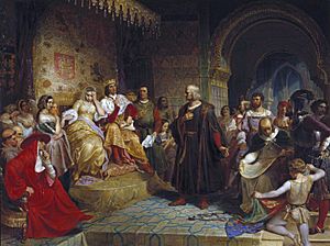
- 1492 – Christopher Columbus, an Italian explorer, sailed for Spain. He explored the Bahamas, Cuba, and "Española" (Hispaniola). People later realized these were part of a "New World."
- 1493–94 – On his second trip, Columbus reached Dominica, Guadeloupe, Puerto Rico, and Jamaica.
- 1497 – John Cabot, an Italian explorer working for England, explored Newfoundland. He was the first European to explore mainland North America since the Norse explorers centuries before.
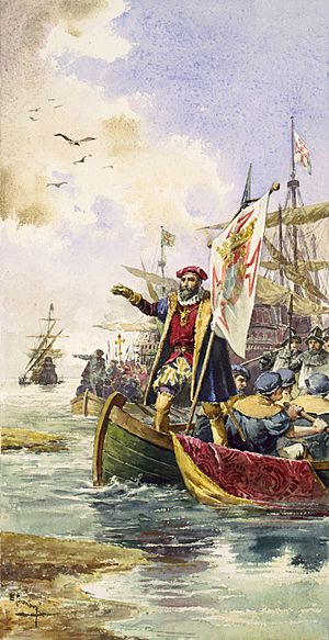
- 1497–98 – Vasco da Gama sailed all the way to India and back for Portugal. This was a major sea route discovery.
- 1498 – On his third trip, Christopher Columbus reached mainland South America.
- 1499 – Spanish explorer Alonso de Ojeda explored the South American coast. He went from Cayenne to Cabo de la Vela. He also reached the Orinoco River and Lake Maracaibo.
- 1499 – Italian explorer Amerigo Vespucci explored the mouth of the Amazon River. He reached far south into what is now northern Brazil.
- 1499 – João Fernandes Lavrador and Pêro de Barcelos sighted Labrador.
- 1499 – Gaspar and Miguel Corte-Real reached and mapped Greenland.
Big Discoveries of the 1500s
The 16th century saw Europeans explore more of the Americas and Asia. They found new sea routes and explored vast lands.
Exploring Brazil and Beyond
- 1500 – Vicente Yáñez Pinzón reached the northeast coast of Brazil. He sailed up a river he called the "Marañón" (Amazon).
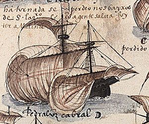
- 1500 – Pedro Álvares Cabral made the "official" discovery of Brazil. His trip connected Europe, America, Africa, and Asia.
- 1500 – João Fernandes reached Cape Farewell in Greenland.
- 1500–02 – Gaspar and Miguel Corte Real explored and named the coasts of "Terra Verde" (likely Newfoundland) and Labrador.
- 1500–01 – Diogo Dias reached Madagascar and the Bab-el-Mandeb Strait, which is the gate to the Red Sea.
- 1500 – Rodrigo de Bastidas explored the coast of Colombia.
- 1501–02 – Gonçalo Coelho reached "Rio de Janeiro" (Guanabara Bay).
- 1502–03 – On his fourth trip, Christopher Columbus explored the North American mainland. He went from Honduras to the border of Panama and Colombia.
- 1505 – Juan de Bermúdez discovered Bermuda.
- 1506 – Lourenço de Almeida reached the Maldives and Sri Lanka.
- 1506 – Tristão da Cunha discovered the remote island of Tristan da Cunha in the South Atlantic.
- 1509 – Diogo Lopes de Sequeira reached Sumatra and Malacca.
- 1511 – Duarte Fernandes led a diplomatic mission to Ayutthaya Kingdom (Thailand).
- 1511 – Rui Nunes da Cunha led a diplomatic mission to Pegu (Myanmar).
- 1511–12 – João de Lisboa and Estevão de Fróis explored the River Plate estuary. They traveled as far south as the Gulf of San Matias in Uruguay and Argentina.
- 1511–12 – António de Abreu sailed through the Strait of Malacca to the "Spice Islands" (Maluku).
- 1513 – Jorge Álvares was the first European to reach China by sea.
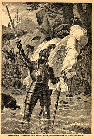
- 1513 – Vasco Núñez de Balboa crossed the Isthmus of Panama. He reached the "Mar del Sur" (Pacific Ocean).
- 1513 – Juan Ponce de León explored "La Florida" (Florida) and the Yucatán.
- 1514–15 – António Fernandes reached present-day Zimbabwe.
- 1515 – Gonzalo de Badajoz crossed the Isthmus of Panama.
- 1516 – Juan Díaz de Solís explored the River Plate estuary, calling it "The Fresh-Water Sea."
- 1516 – Portuguese traders landed in Da Nang, Vietnam.
- 1518 – Lourenço Gomes reached Borneo.
- 1518 – Juan de Grijalva explored the Mexican coast.
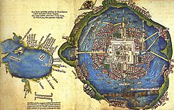
- 1519 – Hernán Cortés traveled from Villa Rica de la Vera Cruz to the Aztec capital of Tenochtitlan.
- 1519 – Alonzo Alvarez de Pineda sailed around the Gulf of Mexico. He also reached the "Father of Waters" (the Mississippi).
- 1519 – Gaspar de Espinosa sailed along the west coasts of modern Panama and Costa Rica.
- 1519–22 – Ferdinand Magellan's expedition reached the Maluku Islands by sailing west. They discovered the Strait of Magellan. After Magellan's death, Juan Sebastian Elcano completed the first trip around the globe.
Further Explorations in the Americas and Asia
- 1520–21 – João Alvares Fagundes explored Newfoundland and Nova Scotia.
- 1521 – Francisco Gordillo and Pedro de Quexos found the mouth of a river in modern South Carolina.
- 1521 – Cristóvão Jacques explored the Plate River and the Parana River.
- 1522 – Gil González Dávila explored inland from the Gulf of Nicoya, reaching Lake Nicaragua.
- 1524 – Giovanni da Verrazzano, an Italian explorer for France, explored the eastern coast of the United States. He went from Cape Fear to Maine. He also explored the mouth of the Hudson River.
- c. 1524 – Aleixo Garcia traveled from Santa Catarina to the Inca frontier in modern Bolivia.
- 1524–25 – Francisco Pizarro and Diego de Almagro explored the southern coast of Panama and the west coast of Colombia.
- 1525 – Estêvão Gomes explored Penobscot Bay, Maine.
- 1525 – The Portuguese reached "Celebes" (Sulawesi).
- 1525 – Diogo da Rocha and Gomes de Sequeira explored the Caroline Islands.
- 1526 – Alonso de Salazar reached the Marshall Islands.
- 1526–28 – Pizarro and Bartolomé Ruiz explored the west coast of South America. They were the first Europeans to see the coasts of Ecuador and Peru.
- 1526–27 – Jorge de Menezes reached New Guinea.
- 1527–28 – Sebastian Cabot explored several hundred miles up the Paraná River.
- 1528 – Diogo Rodrigues explored the Mascarene Islands. He named Réunion, Mauritius, and Rodrigues.
- 1528–36 – Álvar Núñez Cabeza de Vaca and three others survived a journey from Florida to northern Mexico.
- 1531 – Diego de Ordaz went up the Orinoco River.
- 1532–33 – Pizarro explored and conquered inland to Cajamarca and Cuzco.
- 1533 – Fortún Ximénez found the tip of Baja California.
- 1534 – Jacques Cartier explored the Gulf of St. Lawrence. He discovered Anticosti Island and Prince Edward Island.
- 1535 – Fray Tomás de Berlanga explored the Galapagos Islands.
- 1535 – Cartier sailed up the St. Lawrence River to the village of Hochelaga (present-day Montreal).
- 1535–37 – Diego de Almagro led an expedition south from Cuzco into Chile.
- 1539 – Francisco de Ulloa sailed around Baja California, proving it was a peninsula.
- 1539–43 – An expedition led by Hernando de Soto explored much of the Southern United States. They were the first to cross the Appalachians and the Mississippi River.
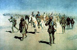
- 1540–42 – Francisco Vásquez de Coronado traveled from Mexico looking for the mythical Seven Cities of Cibola. He found villages of mud and thatch. One of his groups explored the Grand Canyon.
- 1540 – Hernando de Alarcón went up the Colorado River.
- 1541–42 – Francisco de Orellana sailed down the entire Amazon River.
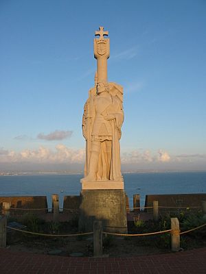
- 1542–43 – Juan Rodriguez Cabrillo explored the coasts of modern Baja and California.
- 1542 or 1543 – Fernão Mendes Pinto, António Mota and Francisco Zeimoto reached Tanegashima, Japan.
- 1543 – Ruy López de Villalobos discovered islands in the Carolines and Marshall Islands.
- 1543 – Jean Alfonce explored up the Saguenay River.
- 1553 – Hugh Willoughby tried to find a Northeast Passage over Russia.
- 1556 – Steven Borough reached Kara Strait.
- 1557–59 – Juan Fernández Ladrillero and Cortés Hojea explored the Chilean coast.
- 1565 – Miguel López de Legazpi discovered islands in the Marshall and Caroline Islands.
- 1568 – Álvaro de Mendaña reached the Solomon Islands.
- 1576 – Martin Frobisher discovered "Meta Incognita" (Baffin Island).
- 1577–80 – Sir Francis Drake completed the second trip around the globe.
- 1578 – Frobisher sailed part way up the "Mistaken Straites" (Hudson Strait).
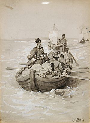
- 1581–82 – Yermak Timofeyevich and his men crossed the Ural Mountains into Siberia.
- 1585 – John Davis explored Davis Strait.
- 1587 – Davis sailed up the west coast of Greenland.
- 1589 – João da Gama reached "Yezo" (Hokkaido).
- 1592 – Davis discovered the Falkland Islands.
- 1595 – Mendaña discovered the Marquesas.
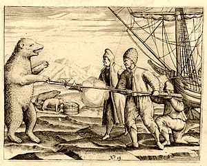
- 1596 – Willem Barentsz discovered Spitsbergen.
Adventures of the 1600s
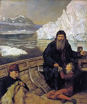
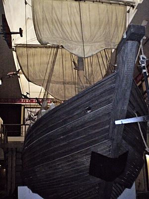
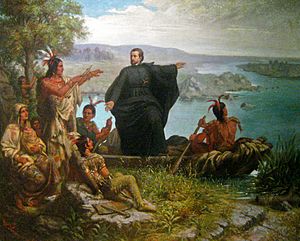
The 17th century saw more exploration in North America, Siberia, and the Pacific. Many explorers faced harsh conditions and unknown dangers.
Siberian and Arctic Journeys
- 1600–01 – Prince Miron Shakhovskoi and D. Khripunov explored the Ob and Taz River.
- 1602–06 – Portuguese missionary Bento de Góis traveled overland from India to China.
- 1605 – Ketsk serving men reached the Yenisei River.
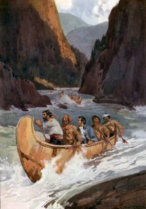
- 1607 – Henry Hudson explored the east coast of Greenland.
- 1609 – Hudson sailed the Halve Maen up the Hudson River to present-day Albany, New York.
- 1610 – Étienne Brûlé explored the Ottawa River and reached Lake Huron.
- 1610–11 – Hudson sailed into Hudson Bay, where he spent the winter.
- 1612–13 – Thomas Button explored the western shores of Hudson Bay. He discovered Coats and Southampton Islands.
- 1614 – Whalers discovered Jan Mayen island.
- 1615–16 – Étienne Brûlé explored parts of modern New York and Pennsylvania. He also went down the Susquehanna River to Chesapeake Bay.
- 1616 – Jacob Le Maire and Willem Schouten discovered and named Le Maire Strait and Cape Horn. They also found islands in Tonga, Wallis and Futuna, and other Pacific groups.
- 1616 – Robert Bylot and William Baffin reached 77°30′ N, entering Baffin Bay. They discovered Smith, Jones, and Lancaster Sounds.
- 1616 – Dirk Hartog explored the coast of Western Australia.
- 1618 – Pedro Páez was likely the first European to see the source of the Blue Nile in Ethiopia.
- 1619 – Frederick de Houtman sighted the coast of Western Australia near Fremantle.
- 1621–23 – Étienne Brûlé and Grenolle traveled to "Grand Lac" (Lake Superior).
- 1622 – The Dutch ship Leeuwin discovered land near present-day Cape Leeuwin.
- 1623 – Jan Carstenszoon discovered the western coast of Cape York Peninsula in Australia.
- 1624 – António de Andrade was the first known European to cross the Himalayas into Tibet.
- 1627 – Jesuit missionaries Estêvão Cacella and João Cabral were the first to enter Bhutan.
- 1627 – François Thijssen and Pieter Nuyts discovered over 1609 km of coastline in Australia.
- 1628 – Cabral was the first to enter Nepal.
- 1628 – Gerrit Frederikszoon de Witt discovered "Witsland" in Australia.
- 1631–32 – Luke Foxe and Thomas James explored Hudson Bay looking for a Northwest Passage.
- 1632–33 – Pyotr Beketov established the fort of Yakutsk on the Lena.
- 1633–34 – French trader Jean Nicolet discovered Lake Michigan.
- 1633–38 – Ilya Perfilyev and Ivan Rebrov sailed down the Lena River and along the coast.
- 1638–40 – Poznik Ivanov crossed the Verkhoyansk Range into the Indigirka system.
- 1639–40 – Maksim Perfilyev explored the Vitim River in Transbaikal.
- 1639–41 – Ivan Moskvitin reached the Sea of Okhotsk.
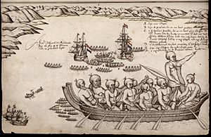
- 1642–43 – Dutch explorer Abel Tasman discovered "Anthony van Diemenslandt" (Tasmania) and "Staten Landt" (New Zealand). He later found Tongatapu, Fiji, and New Britain.
- 1643 – Kurbat Ivanov reached the western shores of Lake Baikal.
- 1643 – Maarten Gerritsz Vries sailed along the eastern coast of "Yezo" (Hokkaido).
- 1643–45 – Vassili Poyarkov crossed the Stanovoy Range and went down the Amur to its mouth.
- 1644 – Tasman mapped the northern coast of Australia.
- 1644 – Mikhail Stadukhin reached the Kolyma.
- 1644–47 – Ivan Pokhabov was the first to go up the Angara to Lake Baikal. He later reached Urga in Mongolia.
- 1648–49 – Semyon Dezhnyov sailed from the Kolyma, rounded Cape Dezhnev. This proved that Asia and America are separate. He reached the Anadyr River.
- 1649–51 – Yerofey Khabarov explored the Amur River.
- 1653–54 – Beketov explored the Khilok and Shilka rivers.
- 1654 – Médard Chouart des Groseilliers explored the western shore of Lake Michigan.
- 1659 – Groseilliers and Pierre-Esprit Radisson explored the southern shore of Lake Superior.
- 1661 – Jesuit missionaries Johann Grueber and Albert Dorville were the first to visit Lhasa.
- 1669 – René-Robert Cavelier, Sieur de La Salle discovered the Ohio River.
- 1673 – French-Canadian explorer Louis Jolliet and Jesuit missionary Jacques Marquette reached the upper Mississippi River. They were the first Europeans to map this river valley. They also discovered the Missouri River.
- 1675 – Anthony de la Roché accidentally discovered South Georgia Island. This was the first land ever found south of the Antarctic Convergence.
- 1682 – Robert de La Salle went down the Mississippi to its mouth.
- 1688–89 – Jacques de Noyon discovered Rainy Lake and Lake of the Woods.
- 1690–92 – Henry Kelsey traveled southwest from York Factory. He was the first European to see the Canadian Prairies.
- 1697–99 – Vladimir Atlasov explored the Kamchatka.
New Horizons in the 1700s
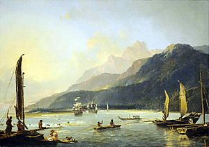
The 18th century was a time of major mapping and charting. Explorers filled in many blanks on world maps, especially in the Pacific and Arctic.
Charting the Arctic and Pacific
- 1706 – Mikhail Nasedkin reached Cape Lopatka and sighted Shumshu, the northernmost of the Kuril Islands.
- 1710 – Yakov Permyakov discovered Bolshoy Lyakhovsky Island.
- 1713 – Ivan Kozyrevsky reached Shumshu and Paramushir.
- 1714 – Étienne de Veniard, Sieur de Bourgmont went up the Missouri River. He was the first European to enter present-day Nebraska.
- 1722 – Dutch explorer Jacob Roggeveen discovered "Paasch Eiland" (Easter Island). He also found Tutuila and Upolu.
- 1728 – Vitus Bering, a Danish explorer for Russia, sailed through the strait named after him. He also discovered Saint Lawrence Island.
- 1732 – Mikhail Gvozdev discovered the "Large Country" (Alaska).
- 1734 – Jean Baptiste de La Vérendrye discovered Lake Winnipeg.
- 1739 – Jean Bouvet de Lozier discovered "Cape Circumcision" (Bouvet Island).
- 1741 – Bering sighted Mount St. Elias and the Alaska Peninsula. He also discovered several of the Aleutian Islands. His second-in-command, Aleksei Chirikov, sighted other mountains and islands.
- 1741–42 – Khariton Laptev and Semion Chelyuskin charted the Taymyr Peninsula. Chelyuskin reached Cape Chelyuskin, the northernmost point of Asia.
- 1742 – Christopher Middleton discovered Wager Bay and Repulse Bay.
- 1742–43 – Louis-Joseph Gaultier de La Vérendrye and his brother François reached the Big Horn Mountains in modern Wyoming.
- 1767 – Samuel Wallis discovered "King George's Land" (Tahiti).
- 1769 – José Ortega discovered San Francisco Bay.
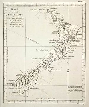
- 1769–70 – English explorer James Cook sailed around both islands of New Zealand. He proved they were not part of a larger southern continent. He also mapped the east coast of Australia.
- 1771–72 – Samuel Hearne reached the Coppermine. He was the first to see and cross Great Slave Lake.
- 1772 – Yves-Joseph de Kerguelen-Trémarec discovered the Kerguelen Islands.
- 1773–75 – Cook was the first to cross the Antarctic Circle. He reached 71° 10’ S, proving that a large southern continent did not exist where people thought. He also discovered New Caledonia and the South Sandwich Islands.
- 1774 – Juan José Pérez Hernández explored the western coast of North America. He discovered the Queen Charlotte Islands, Vancouver Island, and Dall Island.
- 1775 – Bruno de Heceta discovered the mouth of the Columbia River. His partner Juan Francisco de la Bodega y Quadra discovered Prince of Wales Island.
- 1776 – Franciscan priests Atanasio Domínguez and Silvestre Vélez de Escalante traveled west from Santa Fe. They discovered Utah Lake.
- 1777–78 – James Cook discovered Christmas Island and Hawaii. He also explored the Alaskan coast.
- 1787 – Charles William Barkley discovered the Strait of Juan de Fuca.
- 1788 – Captain Arthur Phillip arrived with the First Fleet in Botany Bay in Sydney, Australia.
- 1789 – Alexander Mackenzie went down the Mackenzie River to the Arctic Ocean.
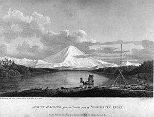
- 1791–95 – George Vancouver and his team mapped the modern states of Oregon and Washington. They also charted the coast of British Columbia and Alaska Panhandle.
- 1792 – Spanish naval officers Dionisio Alcalá Galiano and Cayetano Valdés y Flores sailed around Vancouver Island, proving it was an island.
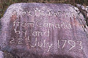
- 1792–93 – Mackenzie crossed the Canadian Rockies and the Coast Mountains. He reached the Bella Coola and then the Pacific Ocean.
- 1796 – Scottish explorer Mungo Park reached the upper Niger.
- 1797–98 – George Bass explored from Cape Howe to Western Port, discovering the Bass Strait.
- 1798 – John Fearn discovered "Pleasant Island" (Nauru).
- 1798–99 – English cartographer Matthew Flinders and George Bass sailed around Tasmania, proving it was an island.
Adventures of the 1800s
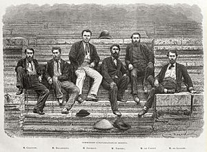
From left to right: Francis Garnier, Louis Delaporte, Clovis Thorel, Captain Ernest Doudart de Lagrée, Lucien Joubert, Louis de Carné
engraving from photo by Émile Gsell
The 19th century was a time of intense exploration, especially in the polar regions and the interior of continents like North America and Africa.
Exploring North America and Australia
- 1800 – James Grant discovered the Australian coastline from Cape Banks to Cape Otway.
- 1802 – John Murray discovered Port Phillip Bay.
- 1802 – Matthew Flinders explored the coast of South Australia. He discovered Spencer Gulf, Kangaroo Island, and Gulf St. Vincent.
- 1802 – Nicolas Baudin explored the coast from Cape Banks to Encounter Bay, where he met Flinders.
- 1802–03 – Flinders sailed all the way around Australia.
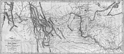
- 1805–06 – Meriwether Lewis and William Clark traveled from Fort Mandan. They went up the Missouri River, crossed the Continental Divide, and went down the Clearwater and Snake rivers to the Columbia. They then followed the Columbia to its mouth.
- 1805–06 – Mungo Park went down the Niger River.
- 1806 – Yakov Sannikov discovered New Siberia Island.
- 1806 – Abraham Bristow discovered the Auckland Islands.
- 1808 – Simon Fraser went down the Fraser River to its mouth.
- 1810 – Frederick Hasselborough discovered Campbell and Macquarie Islands.
- 1811–12 – Wilson Price Hunt discovered Union Pass. Robert Stuart discovered South Pass, which later became part of the Oregon Trail.
- 1816 – Otto von Kotzebue discovered Kotzebue Sound.
- 1819 – William Smith discovered the South Shetland Islands.
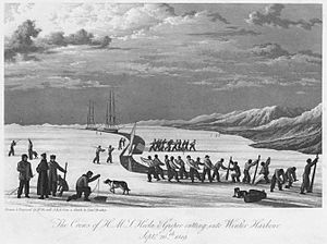
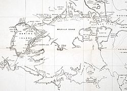
- 1819–20 – William Edward Parry entered Lancaster Sound and reached Melville Island. He discovered and named Cornwallis, Bathurst, and Somerset Islands.
- 1820 – Edward Bransfield sighted the Antarctic Peninsula. He also discovered the northernmost islands of the South Shetlands.
- 1820–21 – Fabian Gottlieb von Bellingshausen discovered the northernmost islands of the South Sandwich group. The next year he discovered Peter I and Alexander Islands.
- 1821 – English naval officer John Franklin explored over 800 km of coastline from the mouth of the Coppermine River.
- 1821 – Sealers Nathaniel Palmer and George Powell discovered the South Orkney Islands.
- 1821–23 – Parry explored the eastern side of the Melville Peninsula.
- 1823 – Dixon Denham, Walter Oudney, and Hugh Clapperton were the first Europeans to see Lake Chad.
- 1823 – Sealer James Weddell sailed to 74°15′S into the Weddell Sea.
- 1824 – Samuel Black went up the Finlay to Thutade Lake.
- 1824–25 – Étienne Provost, Jim Bridger, and Peter Skene Ogden independently reached the Great Salt Lake.
- 1825–26 – Franklin explored the Arctic coastline from the mouth of the Mackenzie River. His partner John Richardson explored east to the Coppermine River.
- 1826 – Frederick William Beechey charted the Alaskan coastline from Icy Cape to Point Barrow.
- 1826 – Scottish explorer Alexander Gordon Laing was the first European to reach the famous city of Timbuktu, but he was killed when leaving.
- 1827 – Jedediah Smith crossed the Sierra Nevada and the Great Basin.
- 1828 – French explorer René Caillié was the first European to return alive from Timbuktu.
- 1829–30 – John Ross discovered the Boothia Peninsula. His nephew James Clark Ross reached King William Island.
- 1830 – English explorer Richard Lander and his brother John went down the Niger for more than 643 km to its mouth.
- 1831–32 – John Biscoe discovered Enderby Land. The next year he found Adelaide, Anvers, and Biscoe Islands.
- 1833 – Andrei Glazunov and Semyon Lukin discovered the mouth of the Yukon River.
- 1834 – George Back went down the Back River.
- 1837–39 – Peter Warren Dease and Thomas Simpson reached Point Barrow from the east. They mapped the region from Point Turnagain to the Boothia Peninsula.
- 1838–40 – Jules Dumont d'Urville discovered the Joinville Island group and Adélie Land.
- 1839 – John Balleny discovered the Balleny Islands.
- 1840 – An expedition led by Charles Wilkes of the United States Navy discovered Wilkes Land. They mapped 2414 km of the Antarctic coast, proving that Antarctica is a continent.
- 1841–43 – James Clark Ross discovered the Ross Sea. He reached 78°09′30″S and discovered the active volcano Mount Erebus on Ross Island. He also found the Ross Ice Shelf and Victoria Land.
- 1845 – John Bell discovered the Porcupine River.
- 1846 – Candido José da Costa Cardoso discovered Lake Malawi.
- 1848 – German missionary Johannes Rebmann was the first European to see Mount Kilimanjaro.
- 1849 – David Livingstone and William Cotton Oswell crossed the Kalahari Desert to Lake Ngami.
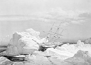
- 1850–54 – Robert McClure traveled through the Northwest Passage (by boat and sledge). He and his men charted about 2736 km of new coastline.
- 1851 – Rae charted over 965 km of the southern coastline of Victoria Island.
- 1851 – Robert Campbell went down the Pelly to the Yukon.
- 1853–56 – Livingstone was the first to cross Africa from west to east. He traveled from Luanda in Angola to Quelimane in Mozambique. He also explored the upper Zambezi and discovered Victoria Falls.
- 1854 – Rae charted the Boothia Peninsula. He discovered Rae Strait and proved that King William Island was an island.
- 1858 – Richard Francis Burton and John Hanning Speke discovered Lake Tanganyika and Lake Victoria.
- 1859 – McClintock charted the remaining 193 km of the continental coastline of America.
- 1860–61 – Robert O'Hara Burke and William Wills were the first to cross Australia from south to north.
- 1862 – Speke discovered the Nile River flowing from the northern end of Lake Victoria.
- 1864 – Samuel Baker discovered "Luta Nzige" (Lake Albert). He also sighted the Rwenzori.
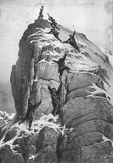
- 1865 – Edward Whymper was the first to climb the Matterhorn.
- 1866–68 – A group of French colonial officers led by Ernest Doudard de Lagrée explored the Mekong River.
- 1869 – American naturalist John Wesley Powell led the first expedition to travel the entire length of the Colorado River through the Grand Canyon.
- 1871 – Charles Francis Hall reached Robeson Channel.
- 1873–74 – Karl Weyprecht and Julius von Payer discovered and named Franz Josef Land.
- 1875–77 – Henry Morton Stanley sailed around Lakes Tanganyika and Victoria. He also went down the Lualaba and Congo to the sea.
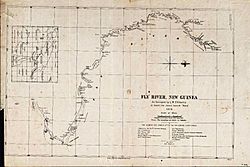
- 1876 – Luigi D'Albertis went up the Fly River in New Guinea.
- 1878–79 – Adolf Erik Nordenskiöld was the first to travel through the Northeast Passage.
- 1881–83 – Adolphus Greely explored the interior of Ellesmere Island. He discovered Lake Hazen.
- 1887–89 – Stanley traveled through the Ituri Rainforest and explored the Rwenzori. He also followed the Semliki to its source, which he named Lake Edward.
- 1892 – Robert Peary discovered and named Independence Bay and Peary Land.
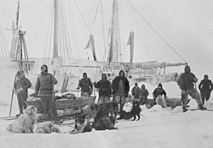
- 1893–96 – Fridtjof Nansen and Hjalmar Johansen traveled by sledge to 86°13'06" N, a new record for how far north explorers had gone.
- 1898–1902 – Otto Sverdrup and Gunnar Isachsen charted the western coast of Ellesmere Island. They discovered and named Axel Heiberg, Ellef Ringnes, Amund Ringnes, and King Christian Islands.
The 20th Century: Reaching the Poles
The early 20th century marked the final frontier of exploration: the Earth's poles. It also saw the first ascents of the world's highest mountains.
Polar Expeditions and Mountain Climbs
- 1900 – Peary explored the north coast of Greenland. He reached Cape Morris Jesup, the northernmost point of mainland Greenland.
- 1902–04 – Robert Falcon Scott explored the Ross Ice Shelf in Antarctica. He discovered the Edward VII Peninsula and the Antarctic Plateau. He was also the first to see the dry valleys of the Antarctic.
- 1903–06 – Norwegian polar explorer Roald Amundsen led the first expedition to travel through the entire Northwest Passage.
- 1906–07 – Ludvig Mylius-Erichsen and Johan Peter Koch charted the northeast coast of Greenland.
- 1908–09 – Frederick Cook and Peary both claimed to have reached the North Pole. Cook's claim was later found to be false, and Peary's is widely doubted.
- 1910–11 – Bernhard Hantzsch crossed Baffin Island.
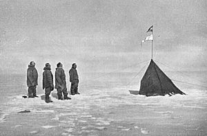
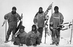
- 1911–12 – Amundsen became the first person to reach the South Pole. Scott and his team reached the Pole over a month later, but they all died on the way back.
- 1913 – Frederick Bailey and Henry Morshead explored the Yarlung Tsangpo river's route.
- 1913–14 – Boris Vilkitsky and Per Novopashennyy discovered Severnaya Zemlya.
- 1915–17 – Vilhjalmur Stefansson discovered Brock, Mackenzie King, Borden, Meighen, and Lougheed Islands.
- 1926 – Amundsen, Lincoln Ellsworth and Umberto Nobile were the first definitely known to have seen the North Pole from their airship, the Norge.
- 1930–32 – Georgy Ushakov and Nikolay Urvantsev mapped the entire coast of Severnaya Zemlya. They showed it was made up of four main islands.
- 1932 – W. A. Poole discovered Prince Charles Island.
- 1934 – Richard E. Byrd discovered and named Roosevelt Island.
- 1940 – Byrd discovered Thurston Island.
- 1948 – E. C. Kerslake charted Prince Charles, Air Force, and Foley Islands.
- 1950 – Maurice Herzog and Louis Lachenal were the first climbers to reach the top of an 8,000-meter peak.
- 1953 – Edmund Hillary and Tenzing Norgay were the first to climb Mount Everest.
- 1954 – Lino Lacedelli and Achille Compagnoni were the first to climb K2.
- 1957 – Finn Ronne discovered Berkner Island.
See also
 In Spanish: Anexo:Cronología de la exploración europea para niños
 | Janet Taylor Pickett |
 | Synthia Saint James |
 | Howardena Pindell |
 | Faith Ringgold |


